Showing 229 items
matching grape
-
 Merbein District Historical Society
Photograph, Delivering Grapes to the Winery in a corrugated tank on truck(Display Coll.), c.1947
mildara wines -
Merbein District Historical Society
Photograph, Delivering Grapes to the Winery in a corrugated tank on truck, c.1947
-
 Merbein District Historical Society
Photograph, Delivering Grapes to the Winery in a corrugated tank on truck, c.1947
-
 Merbein District Historical Society
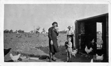
Photograph, Kimpton, Ellen, c.1932
alec bruce, bruce kimpton, ellen bruce, birdwoodton, grape block -
 Merbein District Historical Society
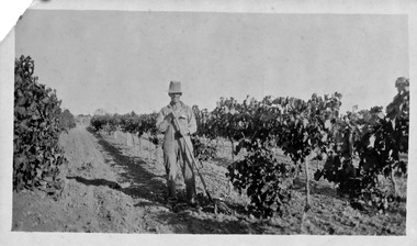
Photograph, Bruce, Alex (Block), unknown
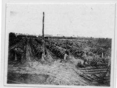
grape block -
 Merbein District Historical Society
Photograph, Kimpton, unknown
grape block -
 Merbein District Historical Society
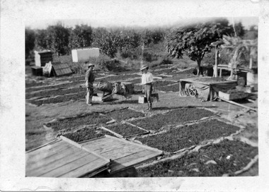
Photograph, Drying Green, unknown
grape block -
 Merbein District Historical Society
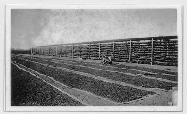
Photograph, Drying Green, unknown
grape block -
 Merbein District Historical Society
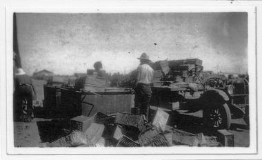
Photograph, Dipping Dried Fruit, 1921
grape block -
 Merbein District Historical Society
Photograph, Drying Sultanas, unknown
grape block -
 Merbein District Historical Society
Photograph, Drying grapes on hessians, 1937
grape harvest - dried fruit -
 Merbein District Historical Society
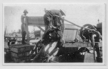
Photograph, Dipping dried fruit, 1937
grape harvest - dried fruit -
 Merbein District Historical Society
Photograph, Dipping dried fruit, 1937
grape harvest - dried fruit -
 Merbein District Historical Society
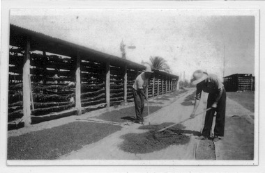
Photograph, Raking out dried fruit, 1937
grape harvest - dried fruit -
 Merbein District Historical Society
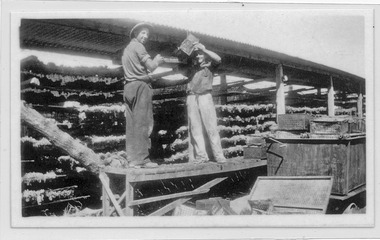
Photograph, Spreading the grapes on the rack, 1937
-
 Merbein District Historical Society
Photograph, Irrigating the Grapes, 1937
-
Merbein District Historical Society
Journal - Quarterly, Merbein Historian - Quarterly Journal of MDHS - No 34 (2 copies), Dec.2008
saltbush farms of the western channel, merbein water supply, zrna & kolaric families, david zrna, centenary, grape picking, murray rose, judy duffield, merbein's horse trough -
 Federation University Historical Collection
Map, Ballaarat Gold Field, 1861, 1861
A party of surveyors camped by Yuille's Swamp (later Lake Wendouree) and surveyed the countryside for a map to be produced by the Geological Survey of Victoria. In November 2004 the Central Highlands Regional Library presented a special edition of 200 copies of the 1861 map reproduced from a copy in their collection. Original 1861 map of Ballarat showing streets and leads. Blue dots indicate gold leads, and red lines indicate auriferous quartz reef and outcrops of quartz veins."Compiled & Drawn from the Survey of Mining Surveyors Davidson, Fitzpatrick and Cowan & the Plans in the Surveyor General's Office by J. Brahe, 21st October 1861. R. Brough Smyth, Secretary for Mines. The Honourable J.B. Humffray, M.L.A. Commr of Mines.”ballarat, map, ballarat east, lake wendouree, survey, mines, robert davidson, ballarat gold field 1861, yuille's swamp, wendouree swamp, little bendigo diggings, gold leads, old post office hill, specimen hill, bakery hill, black hill, dead horse creek, brown hill, pennyweight hill, clayton hill, soldiers hill, golden point, gum tree flat, white flat, poverty hill, chinese village, robert brough smyth, ballarat map 1861, ballaarat vineyard, dead horse gully, deadhorse creek, invermay, black hill flat, gaelic church, police reserve, magpie range, dalton's flat, caadian lead, rifle butts, powder magazine, bathing house, government camp, gold office, chinese, llanberrris, victoria theatre, charlie napier hotel, united states hotel, grape's hoel, clayton's hill, cattleyard hill, free trade hotel, esmond lead, bakery hill, black hill lead, juvenile reformatory, ballarat orphanage, lady barkly lead, triffet's slaughter yard, little bendigo, melbourne road, t. cowan, thomas cowan -
University of Melbourne, Burnley Campus Archives
Book - PhD Thesis, Andrea Watt, Environmental Factors Influencing Inflorescence Differentiation and Development and Bunch Architecture, of Vitis viniferal.cvs. Chardonnay, Shiraz and Sauvignon Blanc, 2010
phd thesis, grapes, agricultural science