Showing 319 items
matching nepean road
-
 Anglesea and District Historical Society
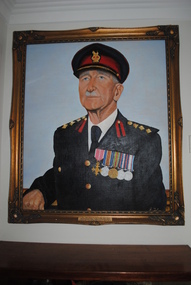
Portrait, James Foley, Col. John Purdue O.B.E
Oil portrait of Col. John Purdue O.B.E. in full army uniform with 5 campaign medals on left breast painted on canvas stretched over hardboard in ornate gilt wooden frame.Plaque affixed to bottom of frame reads: COL. JOHN PURDUE O.B.E. 24-5-1890/25-3-1980. / FIRED THE FIRST SHOT IN W.W. I FROM FORT NEPEAN ACROSS BOW OF / GERMAN STEAMER "PFALZ' MERCHANT RAIDER ON AUG 5 - 1914 AT 12.50 PM.purdue, j foley, ww1, "pfalz" -
 Whitehorse Historical Society Inc.
Document, Commonwealth of Australia, 1973
Officer Cadet School ordinary permit to use defence road and the area of the Point Nepean Defence Reserve for the purpose of sightseeing issued to Nunawading Historical Society for 16 Sep 1973.Officer Cadet School ordinary permit to use defence road and the area of the Point Nepean Defence Reserve for the purpose of sightseeing issued to Nunawading Historical Society for 16 Sep 1973.Officer Cadet School ordinary permit to use defence road and the area of the Point Nepean Defence Reserve for the purpose of sightseeing issued to Nunawading Historical Society for 16 Sep 1973.armed forces, officer cadet school, portsea, australian government -
Whitehorse Historical Society Inc.
Article, Honour for a peninsular defender, 2009
Ian Haskins, a Forest Hill environmentalist, received an Order of Australia for his work with the Point Nepean Reference Group.Ian Haskins, a Forest Hill environmentalist, received an Order of Australia for his work with the Point Nepean Reference Group.Ian Haskins, a Forest Hill environmentalist, received an Order of Australia for his work with the Point Nepean Reference Group.haskins, ian -
 Whitehorse Historical Society Inc.
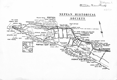
document - Map, Point Nepean, 1969
... Whitehorse Historical Society Inc. 2-10 Deep Creek Road ...Map of Point Nepean showing historical sites, issued by the Nepean Historical Society, 1969.point nepean, victoria, nepean historical society -
 Kingston Arts
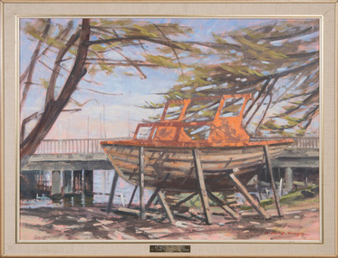
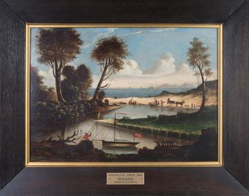
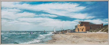
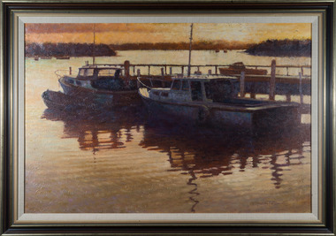
Painting, Monie Mayor, Mordialloc Creek Refit, c.1978
... Kingston Arts 979 Nepean Hwy (Cnr South Road and Nepean Hwy ... -
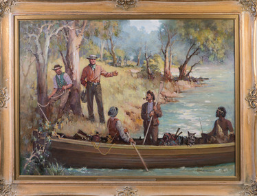
 Kingston Arts
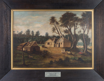
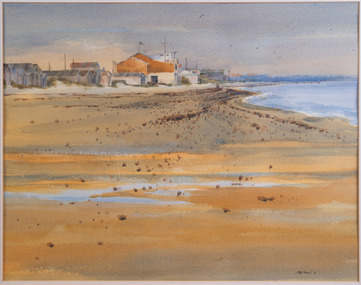
Painting, Petrie, McDonald's Homestead, 1865
... Kingston Arts 979 Nepean Hwy (Cnr South Road and Nepean Hwy ... -
 Kingston Arts
Painting, Petrie, Mordialloc Creek, 1865
... Kingston Arts 979 Nepean Hwy (Cnr South Road and Nepean Hwy ... -
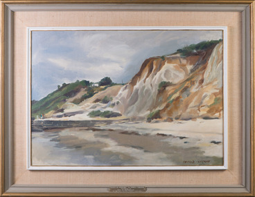
 Kingston Arts
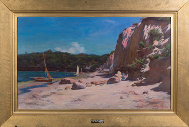
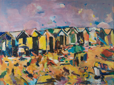
Painting, Arthur Taylor, Mentone Under Cliffs, 1990
... Kingston Arts 979 Nepean Hwy (Cnr South Road and Nepean Hwy ... -
 Kingston Arts
Painting, Edith Slaney, South Road near Bignell Road - Moorabbin, 1903
... Kingston Arts 979 Nepean Hwy (Cnr South Road and Nepean Hwy ... -
 Kingston Arts
Painting, Robyn Joy Pylypec, Chelsea Yacht Club (North View), Unknown
... Kingston Arts 979 Nepean Hwy (Cnr South Road and Nepean Hwy ... -
 Kingston Arts
Painting, Robyn Joy Pylypec, Chelsea Yacht Club (2)
... Kingston Arts 979 Nepean Hwy (Cnr South Road and Nepean Hwy ... -
 Kingston Arts
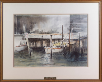
Painting, Ron Thomas, Early Morning
... Kingston Arts 979 Nepean Hwy (Cnr South Road and Nepean Hwy ... -
 Kingston Arts
Painting, Elizabeth Prior, Summer Brighton, 1982
... Kingston Arts 979 Nepean Hwy (Cnr South Road and Nepean Hwy ... -
 Kingston Arts
Painting, John Sterchele, On Mordialloc Creek, 1983
... Kingston Arts 979 Nepean Hwy (Cnr South Road and Nepean Hwy ... -
 Kingston Arts
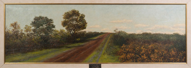
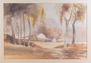
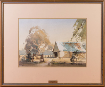
Painting, Roderick Jerard, Deserted Farmhouse, 1979
... Kingston Arts 979 Nepean Hwy (Cnr South Road and Nepean Hwy ... -
 Kingston Arts
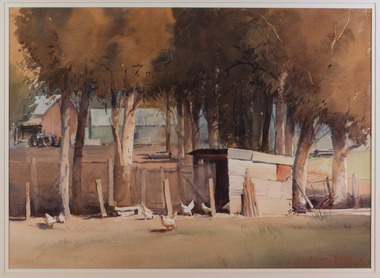
Painting, R. Russell Fletcher, Chickens, 1996
... Kingston Arts 979 Nepean Hwy (Cnr South Road and Nepean Hwy ... -
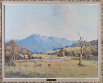
 Kingston Arts
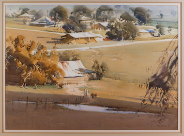
Painting, Ross Paterson, Avenel Landscape, 1995
... Kingston Arts 979 Nepean Hwy (Cnr South Road and Nepean Hwy ... -
 Kingston Arts
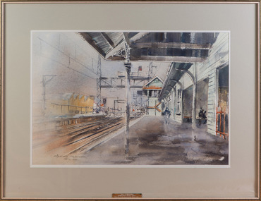
Painting, Gunther Kalbitzer, Mordialloc Station, 1985
... Kingston Arts 979 Nepean Hwy (Cnr South Road and Nepean Hwy ... -
 Kingston Arts
Painting, James Northfield, Victorian Landscape
... Kingston Arts 979 Nepean Hwy (Cnr South Road and Nepean Hwy ... -
 Kingston Arts
Painting, Donald Cameron, Cliffs at Mentone, 1970
... Kingston Arts 979 Nepean Hwy (Cnr South Road and Nepean Hwy ... -
 Kingston Arts
Painting, Ernest Buckmaster, Sunlit Yarra
... Kingston Arts 979 Nepean Hwy (Cnr South Road and Nepean Hwy ... -
 Kingston Arts
Painting, James Northfield, John Batman on the Yarra
... Kingston Arts 979 Nepean Hwy (Cnr South Road and Nepean Hwy ... -
 Kingston Arts
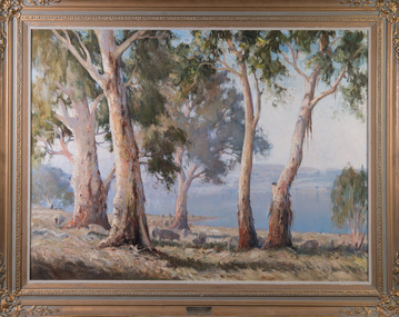
Painting, Leonard H. Long, Summer Morning - Lake George, 1963
... Kingston Arts 979 Nepean Hwy (Cnr South Road and Nepean Hwy ... -
 Kingston Arts
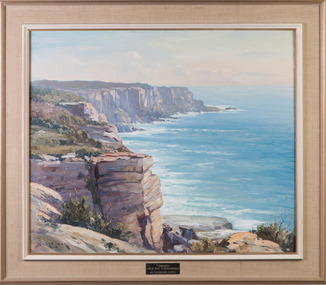
Painting, Leonard H. Long, Towards "Old Hat" Currarong
... Kingston Arts 979 Nepean Hwy (Cnr South Road and Nepean Hwy ... -
 Kingston Arts
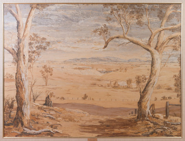
Painting, Doris Percival, A Wimmera Landscape
... Kingston Arts 979 Nepean Hwy (Cnr South Road and Nepean Hwy ... -
 Kingston Arts
Painting, Russell Fletcher, At Tooradin
... Kingston Arts 979 Nepean Hwy (Cnr South Road and Nepean Hwy ... -
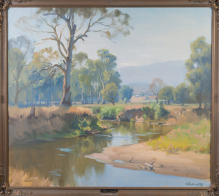
 Kingston Arts
Painting, Ross Paterson, Summer Morning - Murchison
... Kingston Arts 979 Nepean Hwy (Cnr South Road and Nepean Hwy ... -
 Kingston Arts
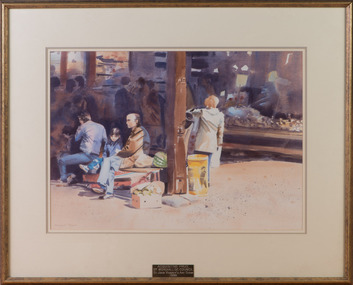
Painting, Margaret Cromb, Waiting with Dad, 1986
... Kingston Arts 979 Nepean Hwy (Cnr South Road and Nepean Hwy ... -
 Kingston Arts
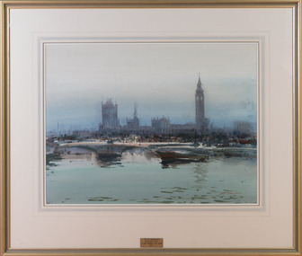
Painting, David Taylor, Across the Thames
... Kingston Arts 979 Nepean Hwy (Cnr South Road and Nepean Hwy ... -
 Kingston Arts
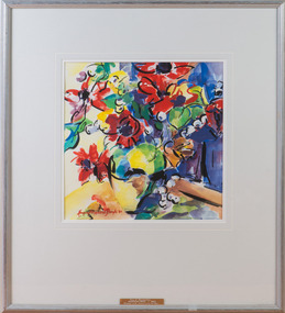
Painting, Margery Fitzgerald Boyle, Vase of Flowers, 1985
... Kingston Arts 979 Nepean Hwy (Cnr South Road and Nepean Hwy ...