Showing 841 items matching "parish plan"
-
 Bendigo Historical Society Inc.
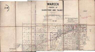
Map - JACK FLYNN COLLECTION: WAREEK, Examined 1918
... parish plan... and Talbot. Parish plan. Looks like half of the sheet is missing.... Gladstone parish plan Wareek Second Issue. Examined by S.F. Green ...Map: L.1053. Parish of Wareek, Counties of Gladstone and Talbot. Parish plan. Looks like half of the sheet is missing.Second Issue. Examined by S.F. Green. July 1918. William J. Swan, Draughtsman, August 1884. Photo-Lithographic Fac-Simile, W 36.map, gladstone, parish plan, wareek -
 Bendigo Historical Society Inc.
Map - BOROUGH OF EAGLEHAWK, 30/11/1931
... parish plan...Map: Borough of Eagle hawk, Parish of Nerring. Parish plan... Bendigo parish plan Borough of Eaglehawk Parish of Nerring Map ...Map: Borough of Eagle hawk, Parish of Nerring. Parish plan with coloured areas ( number 185 in Map Cupboard 1)map, bendigo, parish plan, borough of eaglehawk, parish of nerring -
Bendigo Historical Society Inc.
Map - TARNAGULLA (PARTS), Circa 1880's
... parish plan...Map: Compilation of 3 hand draughted parish plans showing... parish plan Tarnagulla Map: Compilation of 3 hand draughted ...Map: Compilation of 3 hand draughted parish plans showing portions of Tarnagulla (number 261 in map cupboard 1)map, parish plan, tarnagulla -
Bendigo Historical Society Inc.
Map - HUNTLY (PART) RESURVEY, Circa 1877
... parish plan... of Bendigo. Parish plan ( number 243 in Map Cupboard 1)... Bendigo parish plan Huntly Map: Huntly [part) resurvey, Parish ...Map: Huntly [part) resurvey, Parish of Huntly, County of Bendigo. Parish plan ( number 243 in Map Cupboard 1)map, bendigo, parish plan, huntly -
Bendigo Historical Society Inc.
Map - PARISH OF EPPALOCK RESURVEY, 23/05/1876
... parish plan... draughted Parish plan ( number 240 in Map Cupboard 1)... Bendigo parish plan Eppalock resurvey Map: Parish of Eppalock ...Map: Parish of Eppalock resurvey, County of Bendigo, hand draughted Parish plan ( number 240 in Map Cupboard 1)map, bendigo, parish plan, eppalock, resurvey -
Bendigo Historical Society Inc.
Map - SANDHURST (PART), Circa 1880's
... parish plan...Map: Parish plan showing the area Specimen Hill Road... Bendigo parish plan Specimen Hill Rd. Inglewood St. Map: Parish ...Map: Parish plan showing the area Specimen Hill Road and Inglewood St. ( number 222 in Map Cupboard 1)map, bendigo, parish plan, specimen hill rd. inglewood st. -
 Bendigo Historical Society Inc.
Map - EPSOM ?, Circa 1880
... parish plan...Map: Parish plan showing an area Southwards from the parish...MAP Bendigo parish plan Epsom Ascot White Hills Map: Parish ...Map: Parish plan showing an area Southwards from the parish of Huntly boundary, Covering Epsom,Ascot and White Hillsmap, bendigo, parish plan, epsom, ascot, white hills -
Bendigo Historical Society Inc.
Map - SANDHURST (PART), Circa 1880's
... parish plan...Map: Parish plan showing an area from McKenzie/View streets... Bendigo parish plan Sandhusrt McKenzie street View street Long ...Map: Parish plan showing an area from McKenzie/View streets to Long Gully ( number 232 in Map Cupboard 1)map, bendigo, parish plan, sandhusrt, mckenzie street , view street, long gully -
Bendigo Historical Society Inc.
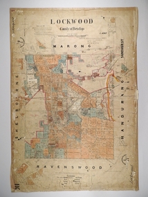
Map - LOCKWOOD, November 25th 1855
... parish plan... on the Bullock Creek. Parish plan (number 273 in map cupboard 1)... Bendigo parish plan Lockwood Garden Allotments Bullock creek Map ...Map: Garden Allotments within the Town Reserve of Lockwood on the Bullock Creek. Parish plan (number 273 in map cupboard 1)map, bendigo, parish plan, lockwood, garden allotments, bullock creek -
 Bendigo Historical Society Inc.
Map - LOCKWOOD, 13/03/1876
... parish plan...Map: Lockwood, County of Bendigo. Parish plan. Compiled Jan...MAP Bendigo parish plan Lockwood W. P. Blake Map: Lockwood ...Map: Lockwood, County of Bendigo. Parish plan. Compiled Jan. 1876. W. P. Lake Draftsman. paper on canvas backing.map, bendigo, parish plan, lockwood, w. p. blake -
 Bendigo Historical Society Inc.
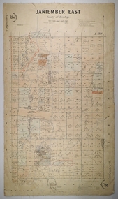
Map - JANIEMBER EAST, 26/07/1879
... parish plan...Map: Janiember East, County of Bendigo. Parish plan...MAP Bendigo parish plan Janiember East Serpentine Map ...Map: Janiember East, County of Bendigo. Parish plan Examined by T Pures 16.10.75 S M Reed August 1875map, bendigo, parish plan, janiember east, serpentine -
 Bendigo Historical Society Inc.
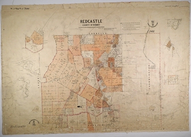
Map - REDCASTLE, 15/10/1878
... parish plan...Map: Redcastle, County of Rodney. Parish plan. Examined E...MAP Rodney parish plan Redcastle T. S. hall E. D. Downward ...Map: Redcastle, County of Rodney. Parish plan. Examined E. D. Downward 28.9.78 T, S Hall Aug 78map, rodney, parish plan, redcastle, t. s. hall, e. d. downward -
 Bendigo Historical Society Inc.
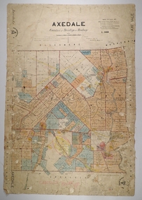
Map - AXEDALE, 26/07/1877
... parish plan...Map: Axedale, Counties of Bendigo and Rodney. Parish plan...MAP Bendigo parish plan Axedale E. Daniell Harvey Map ...Map: Axedale, Counties of Bendigo and Rodney. Parish plan Draughtsman E. Daniell Sept. 1876. Examined by Harvey 1/6/1877map, bendigo, parish plan, axedale, e. daniell, harvey -
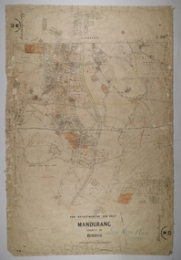
 Bendigo Historical Society Inc.
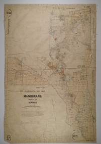
Map - MANDURANG 3, 10/11/1909
... parish plan...Map: Mandurang, County of Bendigo. Parish plan Examined...MAP Bendigo parish plan Mandurang W. S. Stephen W. E ...Map: Mandurang, County of Bendigo. Parish plan Examined by W. S. Stephen 11.12.79 W. E. Porter Draughtsman July 1879map, bendigo, parish plan, mandurang, w. s. stephen, w. e. porter -
 Bendigo Historical Society Inc.
Map - MANDURANG 2, Date unreadable
... parish plan...Map: Mandurang, County of Bendigo. Parish plan Examined...MAP Bendigo parish plan Mandurang W.S. Stephen W. E. Porter ...Map: Mandurang, County of Bendigo. Parish plan Examined by W. S. Stephen 11.12.79 W. E. Porter Draughtsman July 1879map, bendigo, parish plan, mandurang, w.s. stephen, w. e. porter -
Bendigo Historical Society Inc.
Map - HUNTLY ? (NO NAME ON PLAN), Circa 1876
... parish plan...Map: Huntly?. Hand Draughted parish plan. Originally in Map... Bendigo parish plan Huntly Map: Huntly?. Hand Draughted parish ...Map: Huntly?. Hand Draughted parish plan. Originally in Map Cupboard. Relocated to Map Drawer 5 on 22.9.22. Too long for the map cupboard.map, bendigo, parish plan, huntly -
Bendigo Historical Society Inc.
Map - CITY OF BENDIGO (PART), Circaa 1900
... parish plan...Map: parish plan showing an area North West oh Napier St... Bendigo parish plan Bendigo Napier St Weeroona Avenue Map: parish ...Map: parish plan showing an area North West oh Napier St., Weeroona Ave. intersection ( number 216 in Map Cupboard 1)map, bendigo, parish plan, bendigo, napier st, weeroona avenue -
Bendigo Historical Society Inc.
Map - SANDHURST (PART), Circa 1880's
... parish plan...Map: Parish plan showing a section of the city of Sandhurst... Bendigo parish plan Lloyd St. Sandhurst Bendigo Map: Parish plan ...Map: Parish plan showing a section of the city of Sandhurst, Northwards from Lloyd St. East bendigo. ( number 212 in Map Cupboard 1)map, bendigo, parish plan, lloyd st. sandhurst, bendigo -
Bendigo Historical Society Inc.
Map - PART OF ELLESMERE, 20/06/1875
... parish plan... draughted Parish plan Reloacated to Map Drawer 5 on 22.9.2022... Bendigo parish plan Ellesmere Map: Re-survey of part of the Parish ...Map: Re-survey of part of the Parish of Ellesmere, hand draughted Parish plan Reloacated to Map Drawer 5 on 22.9.2022. Hanging strip detached.map, bendigo, parish plan, ellesmere -
 Bendigo Historical Society Inc.
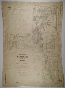
Map - MANDURANG 1, Examined 11/12/1879
... parish plan...Map: Mandurang 2, County of Bendigo. Parish plan Examined...MAP Bendigo parish plan Mandurang W. S. Stephen W. E ...Map: Mandurang 2, County of Bendigo. Parish plan Examined by W. S. Stephen 11.12.79 W. E. Porter Draughtsman July 1879map, bendigo, parish plan, mandurang, w. s. stephen, w. e. porter -
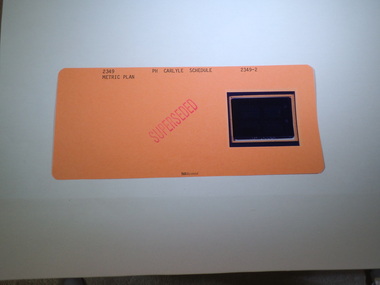
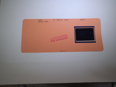 Rutherglen Historical Society
Aperture Card microfilm, Victorian Land Tiltes Office, Parish Plan Carlyle (Superseded)
... Parish Plan Carlyle (Superseded)... with a single microfilm insert Parish Plan Carlyle (Superseded) Aperture ...Town layout of Carlylecard with a single microfilm insertplan, town, boundries, lots, roads -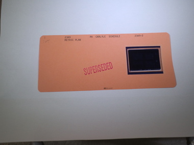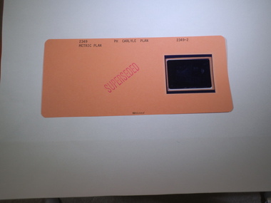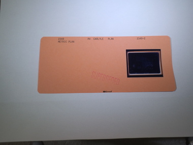
 Rutherglen Historical Society
Aperture Card microfilm, Victorian Land Tiltes Office, Parish Plan Chiltern
... Parish Plan Chiltern... card with a single microfilm insert Parish Plan Chiltern ...Town layout of Chilterncard with a single microfilm insertplan, town, boundries, lots, roads -
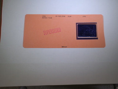 Rutherglen Historical Society
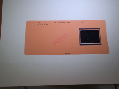
Aperture Card microfilm, Victorian Land Tiltes Office, Parish Plan Chiltern (Superseded)
... Parish Plan Chiltern (Superseded)... card with a single microfilm insert Parish Plan Chiltern ...Town layout of Chilterncard with a single microfilm insertplan, town, boundries, lots, roads -
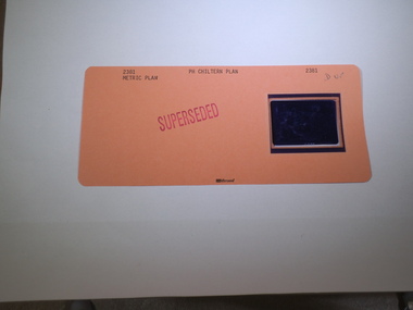
 Rutherglen Historical Society
Aperture Card microfilm, Victorian Land Tiltes Office, Parish Plan Chiltern (Superseded)
... Parish Plan Chiltern (Superseded)... card with a single microfilm insert Parish Plan Chiltern ...Town layout of Chilterncard with a single microfilm insertplan, town, boundries, lots, roads -
 Rutherglen Historical Society
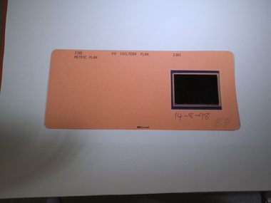
Aperture Card microfilm, Victorian Land Tiltes Office, Parish Plan Chiltern, 14/08/1998
... Parish Plan Chiltern... card with a single microfilm insert Parish Plan Chiltern ...Town layout of Chilterncard with a single microfilm insertplan, town, boundries, lots, roads