Showing 278 items
matching plenty - maps
-
 Greensborough Historical Society
Maps, Greensborough. Parish Plan 1860, 1860c
... Plenty Lower Plenty melbourne Maps Greensborough. Parish Plan ...This plan show Green's subdivision of Greensborough, north of Grimshaw Street.Enlargements of Parish plan circa 1860?One copy possibly from 1860, containing lot numbers for a government road, now Main Street, and surrounding streets.greensborough, grimshaw street greensborough, edward bernard green -
 Greensborough Historical Society
Map, Greensborough Map with Rail Line Plan, 1970s
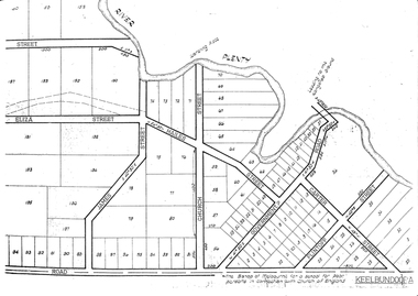
... Plenty Lower Plenty melbourne Map Greensborough Map with Rail ...Central Greensborough area, including railway line and some landowners. Basic map made c. 1902; annotations dated to circa 1970sTwo copies of planParish of Keelbundora, County of Bourke. Central Greensborough areagreensborough, greensborough railway station -
 Greensborough Historical Society
Photograph - Digital Image, Marilyn Smith, Larundel map and sign, 05/09/2017
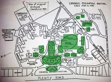
This photograph shows the signs at the old Larundel site. Some buildings on this site are heritage listed on the Victorian Heritage Database.Digital copy of colour photographlarundel hospital -
 Greensborough Historical Society
Pamphlet, Olinda Heritage Walk: official souvenir guide, by Mount Dandenong and District Historical Society Inc, 2016_
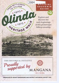
Walking guide to early Olinda buildings 1905-191524 p. pamphlet, map, photographs, with accompanying postcard from Patricia Hogan to Noel Withersolinda, mount dandenong -
 Greensborough Historical Society
Map, City of Heidelberg, Subdivision plan of Greensborough, 1965c
... Plenty Lower Plenty melbourne Map Subdivision plan ...Subdivision plan of Greensborough including Briar Hill and Greenhills. Supplied by Bill Cecil whose parents owned the Greensborough Post Office and it is assumed that these maps were used by Bill (who delivered the post on horseback) to keep up to date with the growing number of new streets and housing in Greensborough.Copies of subdivision plan for Greensboroughgreensborough, briar hill, greenhills -
 Greensborough Historical Society
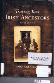
Book, Gill & Macmillan et al, Tracing your Irish ancestors, 3rd ed. John Grenham, 2006_
Hints on tracing Irish ancestors.526p., maps.family history, genealogy -
 Greensborough Historical Society
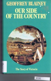
Book, Geoffrey Blainey et al, Our side of the country / Geoffrey Blainey, 1991_
A short history of Victoria.226p., maps.victoria history -
 Greensborough Historical Society
CD-ROM, Neil McPherson, Scout Pathfinder Badge 1951, 1951_
Detailed description and maps of Greensborough area, including roads and streets and natural features in 1951. Report made to satisfy requirements for award of a Scout Pathfinder badge.Very detailed description of the Greensborough area in 1951, by Neil McPherson, Troop Leader, 6th PrestonCD-ROM, containing 30 files Adobe 12.5 x 14.2 cm Photoshop 7greensborough, scouts, pathfinder badge -
 Greensborough Historical Society
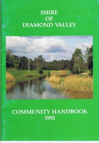
Book, Shire of Diamond Valley, Shire of Diamond Valley Community Handbook 1992, 1992_
Guide to services provided by Shire of Diamond Valley. The Shire of Diamond Valley was a Local Government Area located about 20 kilometres northeast of Melbourne. The shire covered an area of 74.38 square kilometres and existed from 1964 until 1994.Annual guide to services in Shire of Diamond Valley52 pages, col illus., maps. Cover illustration of Kalparrin Gardens Greensboroughshire of diamond valley -
 Greensborough Historical Society
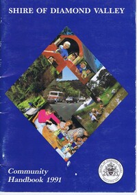
Book, Shire of Diamond Valley, Shire of Diamond Valley Community Handbook 1991, 1991_
Guide to services provided by Shire of Diamond Valley. The Shire of Diamond Valley was a Local Government Area located about 20 kilometres northeast of Melbourne. The shire covered an area of 74.38 square kilometres and existed from 1964 until 1994.Annual guide to services in Shire of Diamond Valley36 pages, col. illus., maps. Front cover is a collage of scenes from Diamond Valley, back cover illustration of a copy of "Summer Panorama, Tabletop, NSW" by Max Dimmack, from the Shire of Diamond Valley Art Collection.shire of diamond valley -
 Greensborough Historical Society
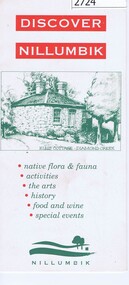
Leaflet, Nillumbik Shire Council, Discover Nillumbik, 2000c
Map and lists of attractions within the Shire of NillumbikDouble sided, folded seven times printed in red and greennillumbik -
 Greensborough Historical Society
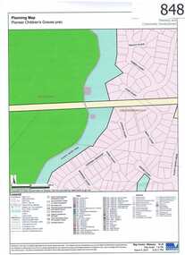
Map, Plenty River Children's Cemetery - location map, 1848-1860
... Plenty Lower Plenty melbourne Map Map Plenty River Children's ...The unmarked graves of the children of two Greensborough pioneer families lie in a private cemetery on the Plenty River. Burials occurred between 1848 and 1860.The significance lies in the association with two of the pioneer families of the Greensborough district. Descendants of both families still live in the area.One page map accompanies article item #804 -
 Greensborough Historical Society
Map, Scotprint, A Guide to World War II 'Invasion or Liberation': Western Europe Sept 1939 to March 1945, 1999_
... Plenty Lower Plenty melbourne Map A Guide to World War II ...Notes of battles, military leaders, cemeteries and other features of World War 11 Western Europe.Double sided col. maps, with notes of battles, military leaders, cemeteries and other features of World War 11 Western Europe.world war ii -
 Greensborough Historical Society
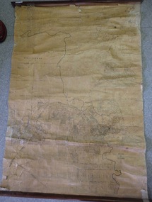
Map, Map of Greensborough - Jessop's Real Estate, 1930c
... Plenty Lower Plenty melbourne Map Map Map of Greensborough ...This map of Greensborough hung in the office of Cec Jessop's Real Estate office corner Main and Grimshaw Street. Includes a word document listing street name changes from the original map to today, according to Norm Colvin.This map was saved from the building when the business closed.Canvas roll-up map with timber rails top and bottom.greensborough - maps, cecil jessop, greensborough street names -
 Greensborough Historical Society
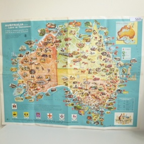
Map, International Harvester, Australia. Land of tomorrow, 1965_
... Plenty Lower Plenty melbourne Map Australia. Land of tomorrow ...This 1960s map of Australia shows areas of economic development at that time.Colour map of Australiaaustralia economic development, international harvester -
 Greensborough Historical Society
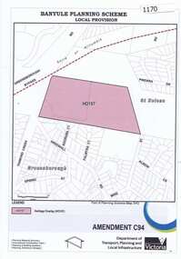
Map, Saxam Heritage Overlay, 2011_
... Plenty Lower Plenty melbourne Map Saxam Heritage Overlay Copy ..."Saxam" was the home of the Kaye family (1886-1888) then William Santon, a former councillor and Mayor of Heidelberg. Saxam Homestead is a distinctive and substantial timber homestead built in the late 1880s as one of the notable rural properties in the St Helena area. In 2014 the house still stands but is in poor condition with most interior features removed. The site had a heritage overlay as shown. The overlay was reduced in 2014 to protect the house while allowing residential development on the site.Saxam is one of the only remaining farmhouses in the Greensborough area.Copy of map and planning scheme.saxam -
 Greensborough Historical Society
Document, John Gibson et al, Thomas John Finnigan - the missing gunner, 1914-1918
Article on the World War 1 service of Thomas Finnigan and the likelihood that he abandoned his wife and future child in Ireland when he took ship to Australia in 1915.6 p., colour images and mapthomas john finnigan, world war 1 project -
![Planning Document, Plan of proposed subdivision of land in Greensborough [Map shows Scotland house], 01/04/1971](/media/collectors/4f729f5697f83e03086015b8/items/5982a68921ea6b1420e4e560/item-media/59916fb521ea681094908d7a/item-fit-380x285.jpg) Greensborough Historical Society
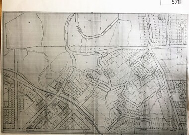
Greensborough Historical SocietyPlanning Document, Plan of proposed subdivision of land in Greensborough [Map shows Scotland house], 01/04/1971
This subdivision of Greensborough shows the home of John Scotland (died 1888) and surrounding area bounded by Hailes, William, Lorimer, and Jessop Streets.Photocopy of plan, 2 pages.Part of plan (68G) of proposed subdivision of Greensborough, part of Crown Portion 18, Parish pf Keelbundora. Scale: 132 ft. to an inchjohn scotland, hailes street greensborough, william street greensborough, lorimer street greensborough, jessop street greensborough -
 Eltham District Historical Society Inc
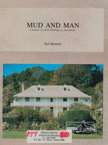
Book, Earthbuild, Mud and Man: a history of earth buildings in Australia by Ted Howard, 1992
Includes references to local sites Bear's Castle, Yan Yean (City of Whitlesea), mud brick houses in Eltham, including at Montsalvat and Eltham Community Centre, Smith's Gully, Plenty Baptist Church and Warrandyte. Includes chapter on Alistair Knox. The author's own home appears in the book on page 100. It was situated at Batman Road, Eltham next to the manse and church opposite Stanley Avenue. It was demolished for unit development June 2004 after the author's death in 2003. A significant and oft cited history of the mud brick earth construction style of architecture which includes a number of examples within the Shire of Nillumbik, known to be a site of the environmental earth building movement following WW2.198 p. : ill. (some col.), maps ISBN 0646069624earth construction, mud bricks, pise, domestic architecture -
 Eltham District Historical Society Inc
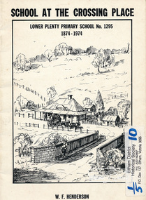
Book, School at the crossing place : Lower Plenty Primary School no. 1295, 1874-1974 / W.F. Henderson, 1974c
23 pages including information on inside covers. Text with black and white illustrations and photographs and map. Contents: Crossing Place Need for a school Residence for the teacher Closure A View of Lower Plenty 1918 Moving day at the Village The Golf Club Depression 1931 Vandals Electricity Grass Fires Cows at School Mothers' Club Women's liberation 1950's Lower Plenty after 1945 Swimming Pool - drowned dreams Long Grass - snakes - meadow hay - Fire Brigade The Royal Visit 1954 School Band Community Centre Our School Hall Trees and Gardens The Library Education 1874-1974 A Teacher's View The Second generation - children of ex-pupils (photo with names) The Third generation - Grandchildren of ex-pupils (photo with names) Head Teachers (list with dates) The Staff 1974 (photo with names) The sketch on the cover shows the Lower Plenty Bridge, toll house and the Plenty Bridge hotel, both no longer there. The bridge is listed in the Banyule Heritage Study and has recently been restored by Banyule Council as a pedestrian bridge - NL 137 March 2001 Paperback; [24] p. : ill. ; 25 cm.lower plenty, state school no. 1295, lower plenty primary school -
 Koorie Heritage Trust
Book, Alberts, Trish et al, Making a Difference / First Australians : Plenty Stories, 2010
This book shares inspiring stories aabout how individuals and organisations have made a difference in Australian society by giving a voice to the histories and viewpoints of Aboriginal and Torres Strait Islander peoples. Contents: Understanding each other; Koorie Heritage Trust; Bangarra Dance Theatre; The Aboriginal Baldja Network; Reconciliation Australia and the Stolen Generations Alliance; Working together for change; Glossary; Index.32 p. : ill., col. maps, ports. (some col.) ; 24 cm.This book shares inspiring stories aabout how individuals and organisations have made a difference in Australian society by giving a voice to the histories and viewpoints of Aboriginal and Torres Strait Islander peoples. Contents: Understanding each other; Koorie Heritage Trust; Bangarra Dance Theatre; The Aboriginal Baldja Network; Reconciliation Australia and the Stolen Generations Alliance; Working together for change; Glossary; Index.aboriginal australians. | torres strait islanders. | australian -
 Greensborough Historical Society
Document, Parliament of Victoria, Ministers & Members search - the Hon. Colin Brooks (Bundoora), 23/04/2021
Biographical details of the Hon. Colin Brooks, MLA for Bundoora, taken from Parliament of Victoria - Ministers and Members website; and, map of the electoral district of Bundoora.2 p. text and colour photograph, with colour map of Bundoora Electoral Districtbrooks family, victoria parliament, colin brooks, bundoora -
 Greensborough Historical Society
Booklet, Parks Victoria et al, Plenty Gorge Park fire recovery, 15/04/2020
Community update on rehabilitation of the section of Plenty Gorge Park affected by a bushfire in December 20196 p. text and colour photographs and mapplenty gorge park, bushfires, blue lake, yellow gum park, plenty -
 Greensborough Historical Society
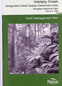
Booklet, Parks Victoria, Wallaby Creek: designated water supply catchment area. Kinglake National Park: Draft management plan 1998, 1998_02
Wallaby Creek is part of Kinglake National Park, and is a restricted access catchment area to protect quality of water supplied to Melbourne's water supply system. 26 p. black print on white paper, green cover, three folded mapskingllake national park, water supply, wallaby creek, parks victoria -
 Greensborough Historical Society
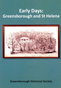
Book, Peter Van Eeken, Early days: Greensborough and St Helena, 2021
History of the Greensborough and St Helena areas 1837-1900GHS produced publication113 p. black print on white paper, illus., maps.st helena, greensborough, greensborough historical society -
 Greensborough Historical Society
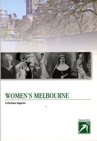
Book, Celestina Sagazio, Women's Melbourne by Celestina Sagazio, 2010
This book contains maps and walking tours of Melbourne with a focus on places that are important to the development of women's rights over the years.96 p., paperback, illus. (some col.), maps.melbourne, women, women's rights, walking tours -
 Greensborough Historical Society
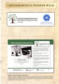
Booklet, Greensborough Historical Society Inc, Greensborough Pioneer Walk, 2021
A guide to the historic photographs which have been mounted on 12 plaques in Greensborough Town Centre. 8 p., photographs, captions and mapgreensborough, pioneer walks, greensborough historical society -
 Greensborough Historical Society
Document - Booklet and CD-ROM, Greg Neumann, The Starling and Stewart families at Janefield, Yan Yean, Greensborough, Diamond Creek, Plenty and Yarrambat, from the late 1850s onward, compiled by Greg Neumann, 2021
Story of the Starling and Stewart families over several generations as farmers in the Plenty-Yarrambat area, compiled by Greg Neumann2021 updated version: on CD Rom. 2013 version: 19 p., black and white and colour photographs and maps, stapled top left corner.starling family, stewart family, plenty river, plenty, janefield mill, janefield mill on the plenty river, yarrambat -
 Orbost & District Historical Society
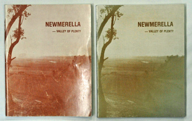
books, Snowy River Mail, Newmerella - Valley of Plenty, March 1978
This book is a useful reference tool on the history of Newmerella.Four copies of a 80 pp soft covered stapled book with a light brown cover with the title, "NEWMERELLA - VALLEY OF PLENTY' in a darker brown print at the top. Below is an illustration of the Snowy River flats. It contains an outline of the history of Newmerella from the beginning of the 19th century until 1978. There are black/white photographs, detailed information and maps.newmerella-history valley-of-plenty -
 Eltham District Historical Society Inc
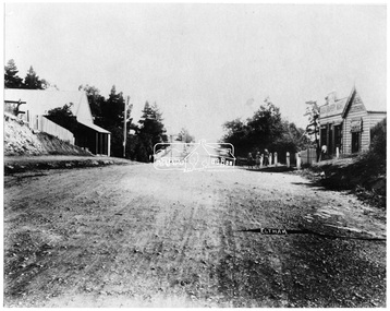
Negative - Photograph, Main Road, Eltham, looking south from Bridge Street, 1906-1907
Looking south along Main Road from the south side of the intersection of Bridge Street with Main Road. Anne Hunniford's Post Office and Burgoyne's store on left. Miss Harriet (Minnie) Williams's Cash Drapery Mart (est. 1902 and enlarged in 1906), also known as Eltham House on the right. Harriet (Minnie) Williams was born London, 1857, the daughter of George John Williams (1812-1895) and Jane Mansfield (1812-1895). In September 1885 she was operating Williams’s Drapery Establishment in premises on Main Road owned by R. Wallis who advertised them to let in September 1885. In 1902 she opened Williams’s Cash Drapery Mart at the southwest corner of Bridge Street and Main Road (opposite the Post Office), owned by W.J. Taylor. In 1906 she bought the premises and one quarter acre of land and expanded the business with a re-opening in April 1906. Harriet was also well-known and esteemed as an active worker in Methodist circles and also Superintendent of the Sunday School. Harriet fell ill in August 1907 and died 15 August. She is buried in Eltham Cemetery with her good friend Ada Ford. Evelyn Observer and Bourke East Record (Vic. : 1902 - 1917), Friday 30 March 1906, page 5 ________________________________________ ELTHAM. (FROM OUR OWN CORRESPONDENT.) For over three years Miss Williams has carried on a drapery business in very small and inconvenient premises opposite the Eltham post-office. Recently she bought the building and a quarter-acre of land from Mr. W. J. Taylor. Thus having a free hand, she at once matured plans to enlarge and improve the premises to make them suitable for her growing business. The result being that she consulted Mr Roach, contractor, of Heidelberg, put the matter in his hands, and now he has completed in a very satisfactory manner and up-to-date style extensive improvements. A large addition, of very neat and attractive design, with three large windows, has been built right along the front of the old building, and the counters and inside fittings are very neat and convenient, harmonizing well with the attractive outside appearance. Miss Williams has now got in a large now stock of goods, and is making extensive arrangements for a “reopening week," commencing 2nd April, during which time she will make 10 per cent reduction on all cash purchases in the form of gifts of that value. Miss Williams has gone to considerable expense and liability both, in the enlargement and improvement of the premises and in purchasing additional stock. We therefore trust that the public will stand by her by heartily and en masse patronizing her re-opening effort to show their appreciation of pluck in this advance movement. Google Street View Feb 2017: https://www.google.com.au/maps/@-37.7191341,145.1462046,3a,50.5y,191.91h,88.27t/data=!3m6!1e1!3m4!1sARwwqEQfMSfH9oTWWapPgQ!2e0!7i13312!8i6656This photo forms part of a collection of photographs gathered by the Shire of Eltham for their centenary project book,"Pioneers and Painters: 100 years of the Shire of Eltham" by Alan Marshall (1971). The collection of over 500 images is held in partnership between Eltham District Historical Society and Yarra Plenty Regional Library (Eltham Library) and is now formally known as the 'The Shire of Eltham Pioneers Photograph Collection.' It is significant in being the first community sourced collection representing the places and people of the Shire's first one hundred years.Digital image 4 x 5 inch B&W Negsepp, shire of eltham pioneers photograph collection, eltham, main road, anne jane hunniford, burgoyne store, christopher watson, commercial bank of australia, drapery store, eltham house, harriet (minnie) williams, post office, watson's hotel, williams's cash drapery mart