Showing 576 items matching "route map"
-
 Bendigo Historical Society Inc.
Document - DEBORAH REEF PROJECT ENVIRONMENT EFFECTS STATEMENT
Two page document. On top, first page ' Bendigo Mining N.L., Deborah Reef Project, Environment Effects Statement, Summary Brochure'. Poppet head on top LH corner of document. A map of central Bendigo is drawn on page 1 and shows the location of the proposed processing plant near the Airport. Further maps on page 2 and 3 show the North Deborah Mine Site, the pipeline route and the airfield site. The summary brochure provides an outline of the material contained in the Environment Effects Statement and proposed planning scheme amendments upon which, the Deborah Reef Project will be assessed. Page four lists the issues that impact on this submission: planning and land use; socio economic environment; traffic; discharges to air; water management; explosives storage and handling; subsidence; heritage; flora and fauna and landscape and visual assessment. The 16th March, 1989, is the date given for submissions to be lodged in regard to this project.Bendigo Mining N.Lbendigo, mining, deborah reef project -
 Bendigo Historical Society Inc.
Book - BENDIGO'S VINTAGE TALKING TRAMS, 1996
100 page soft cover booklet describing the history of the Bendigo tramways. Includes a brief history of Bendigo, illustrated descriptions of the tramways fleet, map of the talking tram route and a script for the tram tour. Edited by Keith S Kings. Published by the Bendigo Trust, December 1996 and printed by Bendigo Modern Press. Signed by Keith Kings 20/2/97 Copy originally owned by RW & M Birrell Inside front cover are 2 tickets for the inaugural tram trip of the restored tram No. 7Keith S Kings -
 Bendigo Historical Society Inc.
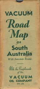
Document - BILL ASHMAN COLLECTION: VACUUM MAP OF SOUTH AUSTRALIA
Vacuum Road Map of South Australia with Interstate Routes with the Compliments of the Vacuum Oil Company Pty. Ltd. Coloured map of S.A. with car, trucks, aeroplane and petrol bowsers on the map. Map only shows the Southern half of S.A. On the back is Adelaide-Melbourne Routes, Traffic Hints, Eucla to Perth, Tours Around Adelaide, Acknowledgement to the Royal Automobile Association of South Australia, Inc., Darwin-Adelaide Routes, Outlets of Adelaide, Vacuum Products, What to See in Adelaide, Super Plume Ethyl, Making Sure of a Trouble-Free Trip, and the front cover. Also folded in the map is a small map from Hancock's Garage, Kingston with routes from Melbourne to Adelaide and distances. On the back is an advertisement for Hancock's Garage and a map of Kingston. Map folded and kept in a light green cover.map, bill ashman collection - correspondence, vacuum road map of south australia, vacuum oil company pty ltd, commissioner of crown lands for south australia, royal automobile association of south australia, inc. -
 Bendigo Historical Society Inc.
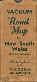
Document - BILL ASHMAN COLLECTION: VACUUM ROAD MAP OF NEW SOUTH WALES
Vacuum Road Map of New South Wales with Interstate Routes with the Compliments of the Vacuum Oil Company Pty. Ltd. Coloured map of NSW with car, trucks, aeroplane and petrol bowsers around the margin. Has a list of principal Towns and Distances from Sydney. On the back is Beauty Spots around Sydney, Traffic Hints, Sydney-Melbourne Routes, Short Tours Around Sydney, Outlets of Sydney, Canberra and Newcastle, What to See in Sydney, Vacuum Products, Making Sure of a Trouble-Free Trip, Super Plume or Plume and the front picture of the folded map which has a car with a lady, child and a man at the petrol bowser. Map folds up and has a brown card pocket to keep it in.map, bill ashman collection - correspondence, vacuum road map of new south wales, vacuum oil company pty ltd, clive barass -
 Bendigo Historical Society Inc.
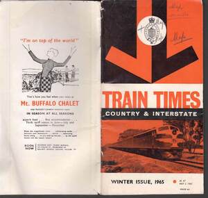
Book - RAILWAYS COLLECTION: TRAIN TIMES COUNTRY AND INTERSTATE WINTER ISSUE 1965
... a Diesel train on the front. Back page has a fold out map of rail... showing a Diesel train on the front. Back page has a fold out map ...RAILWAYS COLLECTION - Victorian Railways train times country and interstate - winter issue 1965 - as at May 3, 1965 price 6d - glossy cover in orange, black and white showing a Diesel train on the front. Back page has a fold out map of rail routes.railways, bendigo to melbourne -
Port Melbourne Historical & Preservation Society
Flyer, Suggested ring road around Port, 2018 - 2019
... Melbourne. Map of proposed route and listing key contact people... road around Port Melbourne. Map of proposed route and listing ...These items were collected by a PMHPS member during 2018-19 and they have been retained as a group of ephemeraVarious ephemera of local interest showing changes in community. . Flyer regarding proposed ring road around Port Melbourne. Map of proposed route and listing key contact people. Campaign by Social Media Realty.built environment, ring road, social media ready -
Port Melbourne Historical & Preservation Society
Map - Route of US Navy Great White Fleet, 2008
... marked in red and white tape Map Route of US Navy Great White ...Large photocopy of map of the world with the route of the Great White Fleet (US Navy) 1908 marked in red and white tapearmed services - navy, great white fleet, us navy -
 Monbulk RSL Sub Branch
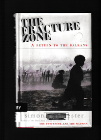
Book, Harper Collins, The fracture zone : a return to the Balkans, 1999
Winchester travels in a scimitar-shaped journey through Croatia, Bosnia, Montenegreo, Macedonia, Bulgaria and Greece to Turkey. He names his route the Fracture Zone, because this locale marks not only the meeting of two vast continental tectonic plates, perpetrators of geological chaos, but also the uneasy boundary between two great historical empires, the Hapsburg and the Ottoman." "The Fracture Zone weaves together history, travel and political perspective with the personal testaments of ordinary and extraordinary people. In this record of history, hatred and ruin, Simon Winchester details the conditions under which the area's refuges now live against a background of ancient political and spiritual struggleGlossary, maps, p.236.non-fictionWinchester travels in a scimitar-shaped journey through Croatia, Bosnia, Montenegreo, Macedonia, Bulgaria and Greece to Turkey. He names his route the Fracture Zone, because this locale marks not only the meeting of two vast continental tectonic plates, perpetrators of geological chaos, but also the uneasy boundary between two great historical empires, the Hapsburg and the Ottoman." "The Fracture Zone weaves together history, travel and political perspective with the personal testaments of ordinary and extraordinary people. In this record of history, hatred and ruin, Simon Winchester details the conditions under which the area's refuges now live against a background of ancient political and spiritual strugglebalkan peninsula - history, balkan peninsula - travel -
 Bendigo Historical Society Inc.
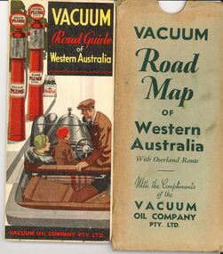
Document - BILL ASHMAN COLLECTION: VACUUM ROAD MAP WESTERN AUSTRALIA
Vacuum Road Map of Western Australia with overland route with the compliments of the Vacuum Oil Company Pty Ltd.map -
 Bendigo Historical Society Inc.
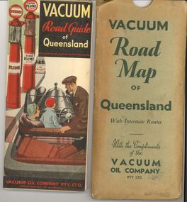
Document - BILL ASHMAN COLLECTION: VACUUM ROAD MAP QUEENSLAND
Vacuum Road Map of Queensland with Interstate routes with the compliments of the Vacuum Oil Company Pty Ltd.map -
 Bendigo Historical Society Inc.
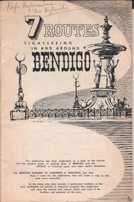
Document - BENDIGO CHAMBER OF COMMERCE & INDUSTRIES BOOKLET - 7 TOUTES SIGHTESEEING IN AND AROUND BENDIGO
Booklet produced for the Bendigo Chamber of Commerce & Industries 7 ROUTES sightseeing in and around Bendigo Black & white, 32 page booklet, plus extrended cover Two maps on inside front (Bendigo route) and rear (District routes) covers Four half-day routes * 1st Bendigo, * 2nd Eppalock etc. * 3rd Castlemaine & * 7th Whipstick Hill Three day routes * 4th Maryborough etc., * 5th Kyneton, Daylesford, etc., * 6th Wedderburn, etc.Hedges & Bell, Maryborough -
 Bendigo Historical Society Inc.
Map - GUIDE MAP OF BENDIGO & EAGLEHAWK, Late 1920's
... is compiled by E E Parker, Eaglehawk. Map shows tramways, bus routes.... Map shows tramways, bus routes and cost one shilling. Map ...Map. Guide map of Bendigo & Eaglehawk. Folded map of Bendigo & Eaglehawk with blue outer cover booklet. Map is compiled by E E Parker, Eaglehawk. Map shows tramways, bus routes and cost one shilling. Map shows Agricultural Showgrounds located between Park Street, Water Street, Barnard Street and Bridge Lane. Also shows Acclimitization Reserve located behind the Botanical Gardens at White Hills. Shows the location of Sailors Gully, Peg-Leg Gully, Jobs Gully, California Gully, Long Gully, Ironbark Gully, Golden Gully, Poverty Gully, Sheepshead Gully, Charcoal Gully, Eaglehawk Creek, Bendigo Creek and Back Creek.Contains interesting facts about Bendigo:- Area - 7,900 acres, Population - 26,000, First Council elected - 1855, Proclaimed a City - 1871. Gold Rush broke out - 1851. For first 10 years gold yield averaged 8,600 ozs. Per week. Total gold yield to 1923 - 572 tons valued at 82,000,000 pounds. Deepest mines - Victoria Quartz 4,614 ft., New Chum Railway 4,318 ft., 13 mines over 3,000ft. deep, 53 mines over 2,000 ft. deep. Sewering of City commenced 1922. All principal buildings now sewered. Map printed by Arnall & Jackson, General Printers, Stationers & Engravers, 476 Collins Street. Outer map blue cover printed in red and blue ink by J B Young, Lithographer. Map displays advertisement for Bendigo Timber Co. Outer blue cover displays advertisement for Campbell Connelly & Co. Pty. Ltd, Ironmongers, Timware Manufacturers, Plumbers, Sewerage Contractors, High and Forest Sts, Bendigo 9outside back cover) and for Hartleys ( J L Shoosmith) Bendigo, displaying Indian Motor Cycles (inside back cover).map, bendigo, township, guide map of bendigo & eaglehawk -
 Bendigo Historical Society Inc.
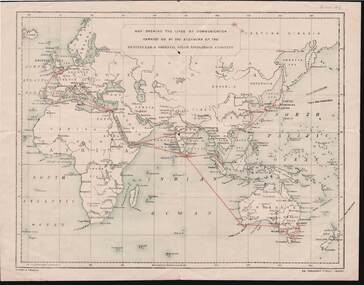
Document - KELLY AND ALLSOP COLLECTION: MAP OF P & O SHIPPING ROUTES
... map Shipping routes Nissen & Arnold. Nissen & Arnold Document ...Document. KELLY & ALLSOP COLLECTION. Map of Europe, Africa and Asia showing the shipping routes of the Peninsular & Oriental Steam Navigation Co. Routes highlighted in red. Produced by Nissen & Arnold, Fenchurch St., London. Date estimated as early 20th century.Nissen & Arnoldbusiness, stockbroker, kelly & allsop, kelly & allsop collection, p & o map, shipping routes, nissen & arnold. -
 Bendigo Historical Society Inc.
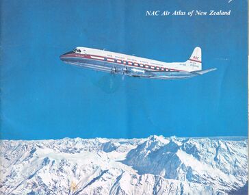
Document - MCCOLL, RANKIN AND STANISTREET COLLECTION: NAC AIR ATLAS OF NEW ZEALAND, 1955
... . Photographs, arial photographs & maps. Shows air routes. Information... & maps. Shows air routes. Information on commercial air flights ...McColl Rankin & Stanistreet, NAC Air Atlas of New Zealand. Photographs, arial photographs & maps. Shows air routes. Information on commercial air flights in New Zealand. Published by New Zealand National Airways Corp.organization, business, bendigo businesses, mccoll rankin & stanistreet, nac air atlas of new zealand -
 Dutch Australian Heritage Centre Victoria
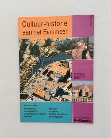
Booklet, Cultuur-historie aan het Eemmeer (Culture and History around Lake Eem), No date recorded
Although this publication has no date it is obviously from the 2nd half of the 20th century and put together by the local historic society in an effort to record certain traditions and promote the local area. It is aimed at visiting tourists and includes maps with walk and cycle routes.A colourful 32pp booklet published as extra-edition of the historic Bunschoten periodical 'Bunscote'.Names of the editing team, co-ordinator, graphic artist and printer are all recorded. -
Moorabbin Air Museum
Map (item) - Aloha Airlines - map of the islands of Hawaii, Aloha Airlines - map of the islands of Hawaii circa 1955
-
 St Kilda Historical Society
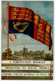
Document - Booklet, A Coronation Booklet Presented to Young People Empire Youth Sunday 3rd May 1953, 1953
... the Royal Standard and Buckingham Palace. The back cover shows a map.... The back cover shows a map of the route from Buckingham Palace ...Booklet to commemorate the coronation of Elizabeth II. Contains coloured photos of Royal regalia. The front cover shows the Royal Standard and Buckingham Palace. The back cover shows a map of the route from Buckingham Palace to Westminster Abbey.Multi-page booklet with cover printed in colour and the internal pages in black and white text and some coloured photographs. Stapled.queen elizabeth ii, queen elizabeth ii coronation -
 Tatura Irrigation & Wartime Camps Museum
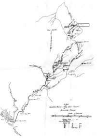
Map - Map - Photocopy, New Guinea Escape Route
... of the second group, and had drawn a detailed map of their route...Photocopy of New Guinea map showing escape route... a detailed map of their route. This might be the same route taken ...At the end of January 1942 there was only about 250 men left in Wau, as the women and children had been evacuated by air a little earlier. With no planes to take the men they had to make their own way to Port Moresby and then travel by ship to Australia. Some men went down to Salamaua and made their way along the north coast, but small groups also made their way over the Owen Stanley Ranges; rafting down the Lakekamu RIver to Yule Island and by boat to Port Moresby. Donor Vanessa Kiessling's Father was part of the second group, and had drawn a detailed map of their route. This might be the same route taken by Rev. Willi Hertle (Ref C0750)Photocopy of New Guinea map showing escape routePlan of surveyed route from Edie Creek to Bulldog Dromepapua new guinea, escape, map, wau, willi hertle, kiessling -
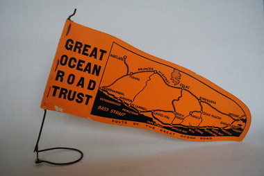 Anglesea and District Historical Society
Pennant, Unknown
... GREAT/ OCEAN/ ROAD/ TRUST. Map of Area/ Route of the Great.../ TRUST. Map of Area/ Route of the Great Ocean. (Orange - on wire ...Orange pennant flag listing towns on and near the Great Ocean Road. List of town names on pennant - (west to east) Mortlake, Warrnambool, Nirranda, Terang, Port Campbell, Lavers Hill, Colac, Beech Forest, Apollo Bay, Wye, Birregurra, Forrest, Deans Marsh, Peterborough, Princetown, Lorne, Eastern View, Airy's Inlet, Anglesea, Torquay, Geelong, Barwon Heads.GREAT/ OCEAN/ ROAD/ TRUST. Map of Area/ Route of the Great Ocean. (Orange - on wire stand. Printed on both sides.) great ocean road trust -
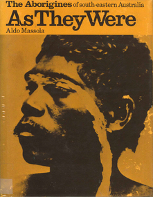 Victorian Aboriginal Corporation for Languages
Book, Aldo Massola, The Aborigines of south-eastern Australia : as they were, 1971
... , meeting places for trade (Victoria), map shows possible routes..., meeting places for trade (Victoria), map shows possible routes ...Contents: p.1-3; Origins, arrival in Australia; p.4-9; How they lived - camp sites, dating (including carbon dating); p.10-27; Physical appearance, skin colour, hair, clothing, body ornaments, cicatrization; exchange system, distribution of food, marriage &? sexual relations; the tribe - structure, relationship to land, territory, gives map showing locations of tribes, New South Wales, Victoria &? eastern South Australia, leadership, government, division of labour, status of women, estimated population at white settlement, density of population (Victoria); p.28-31; Language - names &? naming, reproduces Wembawemba vocabulary, notes use of secret languages, gives 12 rules for pronounciation; p.32-53; Religion, spirit beliefs, totemism, moieties, phratries, marriage rules; mythology, gives eaglehawk &? crow myth from Lake Victoria &? other myths illustrating origins of fire &? natural rock formations, mythical beasts (Bunyip, Mindie), stellar beliefs; magic, medicine men, powers, native remedies for sickness, describes ceremony held in Melbourne, 1847 to avert evil, sorcery, pointing bone, love magic, rain makers; messengers, appearance, etiquette, message sticks; p.54-71; Rock art, motifs, colours, decorative art, engraving of utensils, rock engravings, manufacture &? use of pigments, engraving techniques; trade system, objects bartered, meeting places for trade (Victoria), map shows possible routes (south east Australia); corroborees, purpose, body ornaments &? decorations, musical instruments; p.72-93; Ceremonial life, marriage, punishment for infidelity, birth, childhood, games &? amusements, initiation, etiquette of visiting tribes, details of ceremony, womens role, earth figures &? ground designs, bull roarers, female puberty ceremonies; p.94-133; Shelters, fire making, cooking, construction of canoes, wooden implements, use of reeds, animal skins &? sinews, shells; stone tools, cylindro conical stones, scrapers, knives &? microliths; hunting weapons, spear, other methods pits, nets; fishing methods &? spears, traps; food sharing, womens responsibilities for collecting, digging stick, cooking methods, insect foods, plant foods, water resources; manufacture &? use of spears, spear throwers, shields, clubs, boomerangs; inter- &? intratribal fighting; p.134-147; Death, disposal of body - eating of the dead, burial, cremation, platform exposure, dendroglyphs (N.S.W.), Aboriginal burial grounds (Darling &? Murray Rivers), mourning, widowhood, kopi caps (N.S.W.), causes of death, inquest ceremonies, revenge expedition, after death beliefs; p.148-157; The end of the tribes white settlement &? its impact on Aboriginal life, friction between natives &? settlers, establishment of Protectorates; copiously illustrated throughout.maps, b&w illustrations, b&w photographswemba wemba, murray river, darling river, lake victoria -
Koorie Heritage Trust
Book, Blainey, Geoffrey, Triumph of the nomads : A history of ancient Australia, 1975
General account based on secondary sources of the prehistory of Australia; origins, migration and pre-contact culture.x,285p. : maps ; 22cm.General account based on secondary sources of the prehistory of Australia; origins, migration and pre-contact culture.australian aboriginal civilization, to 1788. ecological aspects | aboriginal australians -- history. | aboriginal australians -- economic conditions -- history. | aboriginal australians. | habitation - nomadism. | demography - palaeodemography - aboriginal settlement of australia. | reproduction - infanticide. | feuds and warfare. | hunting, gathering and fishing. | food - plants. | trade and exchange - trade routes. -
Whitehorse Historical Society Inc.
Document - Report, Frank Isaac White, 01/06/1997
... on the Mitcham War Memorial. White served in Egypt and France,. Maps show... on the Mitcham War Memorial. White served in Egypt and France,. Maps show ...Photocopy of a Luther Collage assignment on visits to war memorials and an investigation of Frank Isaac White, a name on the Mitcham War Memorial. White served in Egypt and France,. Maps show the route of his journeys including a period in hospital in England. Information is given about soldiers living conditions and his role as a artillery man. He was killed in Belgium on 20th September 1917 and buried in the Menin Road South Cematery at Ypres. Photographs of the cemetary are included and of his grave.white, frank isaac, menin road south military cemetry, ww1, war memorials -
Whitehorse Historical Society Inc.
Map, Facilities provided for you, 1970
Map of the City of Nunawading showing main roads and reserves with numbers indicating location of Halls, Infant Welfare Centres, Elderly Citizens Clubrooms and other major Council facilities. Route of proposes Healesville Freeway marked.Map of the City of Nunawading showing main roads and reserves with numbers indicating location of Halls, Infant Welfare Centres, Elderly Citizens Clubrooms and other major Council facilities. Route of proposes Healesville Freeway marked.Map of the City of Nunawading showing main roads and reserves with numbers indicating location of Halls, Infant Welfare Centres, Elderly Citizens Clubrooms and other major Council facilities. Route of proposes Healesville Freeway marked.city of nunawading, maps, maternal and child health centres, senior citizens centres, healesville freeway, parks and reserves -
 Whitehorse Historical Society Inc.
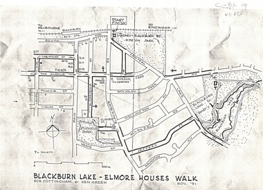
Map, Blackburn Lake - Elmore houses walk, 1/11/1991
Map of Blackburn outlining a walk through the lake.Map of Blackburn outlining a walk through the lake. The route includes four Elmore houses.Map of Blackburn outlining a walk through the lake.maps, blackburn lake sanctuary, the avenue, blackburn, laburnum street, main street, gardenia street, blackburn road, gordon crescent -
Whitehorse Historical Society Inc.
Book, The Herald Road Guide, 1930's
A Road Guide Book of Victoria and routes to Sydney, Brisbane, Canberra, Adelaide and Alice Springs.A Road Guide Book of Victoria and routes to Sydney, Brisbane, Canberra, Adelaide and Alice Springs.A Road Guide Book of Victoria and routes to Sydney, Brisbane, Canberra, Adelaide and Alice Springs.maps, tourism, australia, victoria -
Whitehorse Historical Society Inc.
Pamphlet, Getting about Nunawading, 1990's
Maps of schools, parks, bicycle and public transport routes in the City of Nunawading.Maps of schools, parks, bicycle and public transport routes in the City of Nunawading.Maps of schools, parks, bicycle and public transport routes in the City of Nunawading.public transport, city of nunawading -
Whitehorse Historical Society Inc.
Map, Survey for road from Doncaster to Ringwood, 01/03/1867
Survey in County of Bourke, Road Plan no. 390, showing early routes of Doncaster, Whitehorse and Mitcham Roads.Survey in County of Bourke, Road Plan no. 390, showing early routes of Doncaster, Whitehorse and Mitcham Roads. Measurement in chains. Surveyor: Thomas E. Rawlinson.Survey in County of Bourke, Road Plan no. 390, showing early routes of Doncaster, Whitehorse and Mitcham Roads. parish of nunawading, parish of bulleen, whitehorse road mitcham, doncaster road, doncaster east, mitcham road mitcham -
 Whitehorse Historical Society Inc.
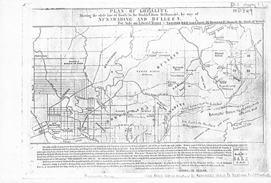
Map, Plan of locality, 1855-60?
'Plan of locality, showing the whole line of route to the district from Melbourne by way of Nunawading and Bulleen. 2,000 acres for sale... Thomas Ham, Land Agent [ 1855 - 60?]nunawading, bulleen, barkers track, land sales -
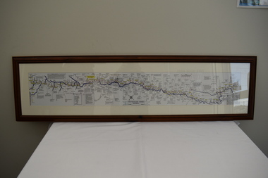 Dandenong/Cranbourne RSL Sub Branch
Map - Burma - Siam Railway
... maps to show the route and it took him over 15 months to put... railway and road maps to show the route and it took him over 15 ...Is of Historical significance. This map was put together by T.R.Beaton on the 15th February 2002. He used old railway and road maps to show the route and it took him over 15 months to put together. T.R. Beaton was Manager/Curator of Australian Government Memorial Museum built above " Hellfire Pass " or Konyu Cutting.Framed picture map of the Burma _ Siam Railway. -
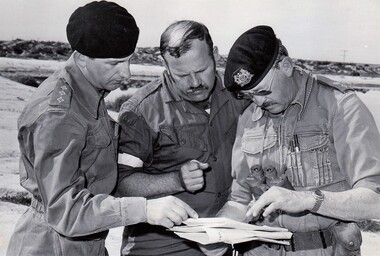 8th/13th Victorian Mounted Rifles Regimental Collection
Photograph
The reconnaissance squadron made use of the wide stock routes in the Booligal area for training.Black and white photograph of 3 soldiers studying a map while on 8/13 Victorian Mounted Rifles annual exercise at Booligal NSW in 1983. From left : Captain D. Cameron, SERGEANT e bEASLEY AND lIEUTENANT cOLONEL d. hUNTER.