Showing 652 items
matching survey department
-
 Bendigo Historical Society Inc.
Map - HEATHCOTE : COUNTY OF BENDIGO, 19-2-1942
... , Government Printer, Melbourne. Drawn and reproduced at the Department... Printer, Melbourne. Drawn and reproduced at the Department ...Map. Heathcote, County of Bendigo. County of Dalhousie, McIvor Creek,Wallan and Bendigo Railway, By authority H.E. Daw, Government Printer, Melbourne. Drawn and reproduced at the Department of Lands and Survey, Melbourne. 19-2-1942. Price 2/-. (number 90 in map cupboard 1)H.E. Daw, Government Printer, Melbourne.map, bendigo, heathcote -
Bendigo Historical Society Inc.
Map - HEATHCOTE : COUNTY OF BENDIGO, May 1952
... at the Department of Lands and Survey, Melbourne. May 1952, Price 2... Printer, Melbourne, Drawn and reproduced at the Department ...Map. Heathcote, County of Bendigo, County of Housie, Knowsley, Knowsley East, Langwornor, Tooborac, Warrowitue, Costerfield, Dargile, Township of Heathcote, Meadows Valley Creek, Wallan and Bendigo Railway, C.R.B. Main Road. By authority J.J. Gourley, Government Printer, Melbourne, Drawn and reproduced at the Department of Lands and Survey, Melbourne. May 1952, Price 2/-. (number 89 in map cupboard 1)J.J. Gourley, Government Printer, Melbourne.map, bendigo, heathcote -
Bendigo Historical Society Inc.
Map - HEATHCOTE : COUNTY OF BENDIGO, 11-4-35
... . Printer. Photo-Lithographed at the Department of Lands and Survey...-Lithographed at the Department of Lands and Survey, Melbourne. 11-4-35 ...Map. Heathcote, County of Bendigo, County of Dalhousie,Township of Heathcote, McIvor Creek, Argyle Station Ground, Wallan and Bendigo Railway, C.R.B. Main Road. By authority H.J. Green, Govt. Printer. Photo-Lithographed at the Department of Lands and Survey, Melbourne. 11-4-35. Price 2/-. (number 88 in map cupboard 1)H.J. Green, Govt.Printermap, bendigo, heathcote -
Bendigo Historical Society Inc.
Map - RAVENSWOOD : COUNTY OF BENDIGO, 28-7-14
... , Mandurang, Photo-Lithographed at the Department of Lands and Survey... at the Department of Lands and Survey by T.F. McGauran 28-7-14. (number 86 ...Map. Ravenswood, County of Bendigo, County of Talbot, Lockwood, Sutton Grange, Harcourt, Walmer, Bradford, Shelbourne, Mandurang, Photo-Lithographed at the Department of Lands and Survey by T.F. McGauran 28-7-14. (number 86 in map cupboard 1)T.F. McGauranmap, bendigo, ravenswood -
Bendigo Historical Society Inc.
Map - POMPAPIEL : COUNTY OF BENDIGO, 1-10-27
... . Photo-Lithographed at the Department of Lands and Survey by W.J... Creek, Blind Creek. Photo-Lithographed at the Department ...Map. Pompapiel, County of Bendigo, Calivil, Talambe, Yallook, Salisbury, Yarrayne, Janiember East, Waranga Mallee Channel, Judyong Creek.Pompapiel Creek, Bullock Creek, Blind Creek. Photo-Lithographed at the Department of Lands and Survey by W.J. Butson, 1-10-27. Price 1/-. (number 84 in map cupboard 1)W.J. Butson.map, bendigo, pompapiel -
Bendigo Historical Society Inc.
Map - PANNOOMILLOO : COUNTY OF BENDIGO, 1957
... and reproduced at the Department of Lands and Survey, Melbourne 1957... and reproduced at the Department of Lands and Survey, Melbourne 1957 ...Map. Pannoomilloo, County of Bendigo, Pannoobamawm, Milloo, Diggorra, Warragamba. Elmore Cohuna Railway. Waranga Mallee Channel. By authority W.M. Houston, Government Printer, Melbourne. Drawn and reproduced at the Department of Lands and Survey, Melbourne 1957. Price 2/-. (number 83 in map cupboard 1)W.M. Houston, Government Printer, Melbourne.map, bendigo, pannoomilloo -
Bendigo Historical Society Inc.
Map - PANNOOMILLOO : COUNTY OF BENDIGO, 17-12-13
... , Warragamba, Milloo, Diggorra. Photo-Lithographed at the Department...-Lithographed at the Department of Lands and Survey, Melbourne by W.J ...Map. Pannoomilloo, County of Bendigo, Pannoobamawm, Warragamba, Milloo, Diggorra. Photo-Lithographed at the Department of Lands and Survey, Melbourne by W.J. Butson 17-12-13, Price 1/-. (number 82 in map cupboard 1)W.J. Butson.map, bendigo, pannoomilloo -
Bendigo Historical Society Inc.
Map - PANNOOBAMAWM : COUNTY OF BENDIGO, 1957
... and reproduced at the Department of Lands and Survey, Melbourne 1957... and reproduced at the Department of Lands and Survey, Melbourne 1957 ...Map. Pannoobamawm, County of Bendigo, Turrumberry, Terrick Terrick East, Wanurp, Pannoomilloo, Bamawm, Elmore to Cohuna Railway, McColl Station Ground, Lockington Station Ground. By authority W.M. Houston, Government Printer, Melbourne. Drawn and reproduced at the Department of Lands and Survey, Melbourne 1957. Price 2/-. (number 80 in map cupboard 1)W.M. Houston, Government Printer, Melbourne.map, bendigo, pannoobamawm -
Bendigo Historical Society Inc.
Map - NOLAN : COUNTY OF BENDIGO, 7-5-30
... , Government Printer, Melbourne. Drawn and reproduced at the Department... Printer, Melbourne. Drawn and reproduced at the Department ...Map. Nolan, County of Bendigo, Egerton, Elmore, Goornong, Campaspe River, Northern Railway. By Authority H.J. Green, Government Printer, Melbourne. Drawn and reproduced at the Department of Lands and Survey, Melbourne, Victoria.7-5-30. Price 2/-. (number 78 in map cupboard 1)H.J. Green, Government Printer, Melbourne.map, bendigo, nolan -
Bendigo Historical Society Inc.
Map - NEILBOROUGH : COUNTY OF BENDIGO, 13-10-27
... at the Department of Lands and Survey, Melbourne by W.J. Butson 13-10-27..., Photo-Lithographed at the Department of Lands and Survey ...Map. Neilborough, County of Bendigo, Tandarra, Whirrakee, Huntly, Nerring, Yarraberb, Yallook, Photo-Lithographed at the Department of Lands and Survey, Melbourne by W.J. Butson 13-10-27, Price 1/- (number 77 in map cupboard 1)W.J. Butson.map, bendigo, neilborough -
Bendigo Historical Society Inc.
Map - NERRING : COUNTY OF BENDIGO, August 1952
... and reproduced at the Department of Lands and Survey, Melbourne, Victoria... and reproduced at the Department of Lands and Survey, Melbourne, Victoria ...Map. Nerring, County of Bendigo, Yarraberb, Leichardt, Marong, Sandhurst, Huntly, Neilborough, Bendigo and Swan Hill Railway, Bendigo and Kulwin Railway, Loddon Valley Highway. By authority J.J. Gourley, Government Printer, Melbourne. Drawn and reproduced at the Department of Lands and Survey, Melbourne, Victoria. August 1952. Price $1.00. (number 76 in map cupboard 1)J.J. Gourley, Government Printer, Melbourne.map, bendigo, nerring -
Bendigo Historical Society Inc.
Map - MARONG : COUNTY OF BENDIGO, 25-6-25
... Printer, Melbourne. Photo-Lithographed at the Department of Lands.... Photo-Lithographed at the Department of Lands and Survey ...Map. Marong, County of Bendigo, Nerring, Sandhurst, Lockwood, Shelbourne, Woodstock, Leichardt, Kangaroo Flat Rifle Range, Crusoe Aqueduct. By authority H.J. Green, Government Printer, Melbourne. Photo-Lithographed at the Department of Lands and Survey, Melbourne by W.J. Butson 25-6-25.Price 1/-. (number 75 in map cupboard 1)H.J. Green, Government Printer, Melbourne.map, bendigo, marong -
Bendigo Historical Society Inc.
Map - MARONG : COUNTY OF BENDIGO, June 1953
... at the Department of Lands and Survey, Melbourne, Victoria. June 1953. Price... Printer. Drawn and reproduced at the Department of Lands ...Map. Marong, County of Bendigo, Nerring, Sandhurst, Lockwood, Shelbourne, Woodstock, Leichardt, Fletcher Creek, Bullock Creek, Township of Marong, Marong Railway Station, Bendigo Railway Line, Spring Creek, Crusoe Aqueduct. By authority W.M. Houston, Government Printer. Drawn and reproduced at the Department of Lands and Survey, Melbourne, Victoria. June 1953. Price 2/-. (number 73 in map cupboard 1)W.M. Houston, Government Printermap, bendigo, marong -
Bendigo Historical Society Inc.
Map - MILLOO : COUNTY OF BENDIGO, 29-2-24
... -Lithographed at the Department of Lands and Survey, Melbourne, by W.J... at the Department of Lands and Survey, Melbourne, by W.J. Butson, 29-2-24 ...Map. Milloo, County of Bendigo. Wanurf, Dingee, Kamarooka, Pannoomilloo, Waranga Mallee Channel, Elmore to Kerang Road, Pannoo Estate. By authority A.J. Mullett, Govt. Printer. Photo-Lithographed at the Department of Lands and Survey, Melbourne, by W.J. Butson, 29-2-24. Price 1/-. Janiember to Rochester Road. (number 72 in map cupboard 1)A.J. Mullett, Government Printer.map, bendigo, milloo -
Bendigo Historical Society Inc.
Map - LYELL : COUNTY OF BENDIGO, 24-10-84
... School. Photo-Lithographed at the Department of Lands and Survey..., Myrtle Creek. State School. Photo-Lithographed at the Department ...Map. Lyell, County of Bendigo, Eppalock, Sedgwick, Sutton Grange, Hawkestone, Kimbolton, Coliban River, Myrtle Creek. State School. Photo-Lithographed at the Department of Lands and Survey, Melbourne by J. Noune, 24-10-84. (number 71 in map cupboard 1)J. Nounemap, bendigo, lyell -
Bendigo Historical Society Inc.
Map - LYELL : COUNTY OF BENDIGO, 24-9-07
... -Lithographed at the Department of Lands and Survey, Melbourne by T.F... Creek, Coliban River. Photo-Lithographed at the Department ...Map. Lyell, County of Bendigo, Sedgwick, Sutton Grange, Hawkestone, Kimbolton, Eppalock, Myrtle Creek, Coliban River. Photo-Lithographed at the Department of Lands and Survey, Melbourne by T.F. McGauran, 24-9-07, Price 1/-. (number 70 in map cupboard 1)T.F. McGauranmap, bendigo, lyell -
Bendigo Historical Society Inc.
Map - LEICHARDT : COUNTY OF BENDIGO, 15-6-19
... Line. Photo-Lithographed at the Department of Lands and Survey... & Inglewood Railway Line. Photo-Lithographed at the Department ...Map. Leichardt, County of Bendigo, Bridgewater, Yarraberb, Nerring, Marong, Woodstock, Derby, Sandhurst & Inglewood Railway Line. Photo-Lithographed at the Department of Lands and Survey, Melbourne, by T.F. McGauran, 15-6-09. Price 1/-. (number 68 in map cupboard 1)T.F. McGauranmap, bendigo, leichardt -
Bendigo Historical Society Inc.
Map - MANDURANG : COUNTY OF BENDIGO, 1962
... Printer, Melbourne. Drawn and Reproduced at the Department.... Drawn and Reproduced at the Department of Lands and Survey ...Map. Mandurang, County of Bendigo. Sandhurst, Strathfieldsaye, Sedgwick, Lockwood. By authority A.C. Brooks, Government Printer, Melbourne. Drawn and Reproduced at the Department of Lands and Survey, Melbourne, 1962, Price 2/-. (number 67 in map cupboard 1)A.C. Brooks, Government Printer, Melbourne.map, bendigo, mandurang -
Bendigo Historical Society Inc.
Map - JANIEMBER WEST : COUNTY OF BENDIGO, September 1955
... and reproduced at the Department of Lands and Survey, Melbourne... and reproduced at the Department of Lands and Survey, Melbourne ...Map. Janiember West, County of Bendigo. Loddon River, Janiember East, Powlett, Kinypanial, Jarklan. Welsh's Lagoon. By authority W.M. Houston, Government Printer, Melbourne. Drawn and reproduced at the Department of Lands and Survey, Melbourne, September 1955, Price 5/-. (number 66 in map cupboard 1)W.M. Houston, Government Printer, Melbourne.map, bendigo, janiember west -
Bendigo Historical Society Inc.
Map - KIMBOLTON : COUNTY OF BENDIGO, 1966
... , Government Printer, Melbourne. Drawn and reproduced at the Department..., Melbourne. Drawn and reproduced at the Department of Lands ...Map. Kimbolton, County of Bendigo. Eppalock, Lyell, Knowsley, Langwornor, Redesdale, County of Dalhouse, County of Rodney, Campaspe River, Coliban River,By authority A.C.Brooks, Government Printer, Melbourne. Drawn and reproduced at the Department of Lands and Survey, Melbourne, 1966, Price $1.00 (number 65 in map cupboard 1)A.C. Brooks, Government Printer, Melbourne.map, bendigo, kimbolton -
Bendigo Historical Society Inc.
Map - JANIEMBER WEST : COUNTY OF BENDIGO, September 1955
... at the Department of Lands and Survey, Melbourne. Price 2/-.September 1955..., Government Printer. Drawn and reproduced at the Department of Lands ...Map. Janiember West, County of Bendigo, Powlett, Janiember East, Jarklan, Kinypanial, River Loddon, Kelsh's Lagoon. By authority W.M. Houston, Government Printer. Drawn and reproduced at the Department of Lands and Survey, Melbourne. Price 2/-.September 1955. (number 64 in map cupboard 1)W.M. Houston, Government Printermap, bendigo, janiember west -
Bendigo Historical Society Inc.
Map - KAMAROOKA : COUNTY OF BENDIGO, 29-8-21
... at the Department of Lands and Survey, Melbourne by W.J. Butson 29-8-21.... Photo-Lithographed at the Department of Lands and Survey ...Map. Kamarooka, County of Bendigo, Milloo, Warragamba, Minto, Whirrakee, Tandarra, Piccaninny Creek, Dingee. By authority A.J. Mullett, Govt. Printer. Photo-Lithographed at the Department of Lands and Survey, Melbourne by W.J. Butson 29-8-21. Price 1/-. (number 63 in map cupboard 1)A.J. Mullett, Govt.Printermap, bendigo, kamarooka -
 Bendigo Historical Society Inc.
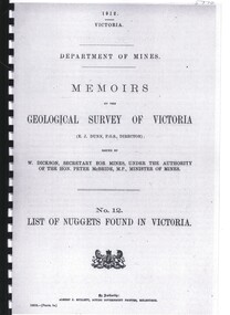
Book - LIST OF NUGGETS FOUND IN VICTORIA
Department of Mines, Memoirs of the Geological Survey Of Victoria No 12 List of Nuggets found in Victoria. 67 pages in spiral binder with clear plastic cover.victoria, history, gold mining, geology, and gold pros, victoria- gold mining-gold nuggetts -
Bendigo Historical Society Inc.
Book - MINING REPORTS - MINES DEPARTMENT CAN WE HELP YOU?
... J C M Balfour Geological Survey of Victoria Mines Department ...Small, 40 page paper booklet issued by E. Condon, Secretary of Mines, under the authority of The Hon. J. C. M. Balfour, MLA, Minister of Mines. The booklet was printed Melbourne, Victoria 1969. Topics include: Assistance to Mining, Commencing Mining Operations, Concessions to Mining Industry, Miners Rights and Claims, Mining Leases and Licences, Examination Boards, Gold Buying and Selling, Air Conditions in Mines, Cyanide Plant, State Crushing Batteries, Extractive Industries, Petroleum (On Land), Petroleum (Offshore), Pipelines, Explosives, Inflammable Liquids, Gas Meter Examination and Liquified Pertoleum Gas.book, mining reports, mines department can we help you?, e condon, the hon j c m balfour, geological survey of victoria, mines department laboratories, explosives and gas examining branch, minister for mines, depot & core laboratory -
Bendigo Historical Society Inc.
Book - DEPARTMENT OF MINES 1914 BULLETINS OF THE GEOLOGICAL SURVEY OF VICTORIA NO. 33. HUSTLER'S LINE OF REEF, BENDIGO, 1914
Department of Mines 1914 Bulletins of the Geological Survey of Victoria No. 33. Hustler's Line of Reef, Bendigo. Photos of the mines on the Hustler's Line of Reef. 59 pages plus 7 pages of photos. Inscribed A. Richardson 29 Harrison street, BendigoDepartment of Mines.bendigo, mining, hustler's line of reef, mining, and hustler's reef mines. -
Bendigo Historical Society Inc.
Book - 'BULLETINS OF THE GEOLOGICAL SURVEY OF VICTORIA NO. 30'. THE PEARL AND HERCULES AND ENERGETIC MINES, BENDIGO, 1914
Bulletins of the Geological Survey of Victoria No. 30. The Pearl and Hercules and Energetic Mines, Bendigo, with plans and sections. By W. Baraganath Underground maps of the 4 (four) mines referred to in this book. Priced six pence Inscribed on the front cover: A. Richardson, 29 Harrison Street, Bendigo.Department of Mines. By W. Baraganathbendigo, mining, early history., mining, pearl, hercules and energetic mines. -
Bendigo Historical Society Inc.
Document - STRUCTURE OF BENDIGO GOLDFIELD BULLETIN NO. 47
Booklet, 36 pages, that describes the structure of the Bendigo Goldfield. Booklet is enclosed in an envelope. On front of booklet : 1923 Victoria, Department of Mines, Bulletins of the Geological Survey of Victoria, W. Baragwanath, Director. Structure of Bendigo Goldfield, by H. Herman, late Director of Geological Survey. Maps under catalogue number 3769 accompanied the booklet and are listed as 'plates' on the contents page. Plans and Sections to accompany Bulletin No 47, Structure of Bendigo Gold-Field, by H Herman, B.C.E., M.M.E., F.G.S., late Director of Geological Survey.Geological Survey of Victoriabendigo, gold mining, structure of goldfield, bendigo, goldfield, gold mining, geology -
 Bendigo Historical Society Inc.
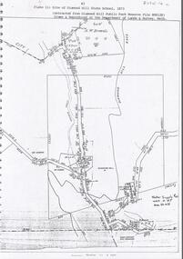
Document - DIAMOND HILL STATE SCHOOL SITE
... Reserve File RS8128, drawn and reproduced at the Department... and reproduced at the Department of Lands and Survey, Melbourne' Document ...Map (copy) showing the site of Diamond Hill State School, 1873. On top of page 'extracted from Diamond Hill Public Park Reserve File RS8128, drawn and reproduced at the Department of Lands and Survey, Melbourne'bendigo, education, diamond hill state school -
 Bendigo Historical Society Inc.
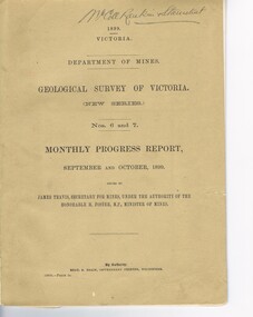
Document - MCCOLL, RANKIN AND STANISTREET COLLECTION: GEOLOGICAL SURVEY OF VICTORIA 1899, 1899
... Booklet: 1899 Victoria Department of Mines Geological... MCCOLL RANKIN & STANISTREET Booklet: 1899 Victoria Department ...Booklet: 1899 Victoria Department of Mines Geological survey of Victoria (new series Nos. 6 &7. Monthly progress report, September, October issued by James Travis secretary for mines, under the Authority of the Hon. H. Foster M.P. Minister of Mines. McColl Rankin & Stanistreet, 1899 Victoria.MCCOLL RANKIN & STANISTREETorganization, business, industrial - mining, mccoll rankin & stanistreet -
 Bendigo Historical Society Inc.
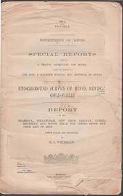
Document - STRUGNELL COLLECTION: UNDERGROUND SURVEY OF MINES: BENDIGO GOLD-FIELD, 1901
Document, Underground Survey of Mines, Bendigo Gold-Field, Department of Mines, Special Reports on the Shamrock, Shenandoah, New Chum Railway, Eureka Extended, and South Belle Vue United Mines, New Chum Line of Reef, by H.S.Whitelaw.dated 1901.Issued by J.Travis , Secretary for Minesdocument, underground survey of mines, h.s.whitelaw -herbert staney whitelaw