
Showing 56531 items matching " coat-of-arms"
-
 Mission to Seafarers Victoria
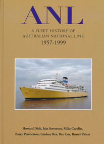
Book, Nautical Association of Australia Inc, ANL, A Fleet History of Australian National Line 1957-1999, 2020
... ANL, A Fleet History of Australian National Line 1957-1999...Nautical Association of Australia Inc. ...Australian National Line (ANL) began operations on 1 January 1957. It operated the largest fleet in coastal trade, ran passenger ships such as Princess of Tasmania and Empress of Australia that became household names, and from 1969 carried the Australian flag into international trades. ANL was at the forefront of innovation in bulkships, RoRo vessels and containerization, also in the redesign of ports and terminals. Many of its 110 ships were built in Australia. This impressive record of achievement eventually became overshadowed by financial woes, poor industrial relations and a difficult relationship with government that culminated in the sale of 1998-99. This fleet history, written and informed by the knowledge, experience and insight of those who sailed on and worked with the ships, weaves the stories of a complex forty-year transition from conventional shipping to modern bulk handling and containers, along with the nation-building role of the ANL, whose flag still flies proudly across the region as a subsidiary of the French CMA CGM. The book is lavishly illustrated with over 300 images, mostly in colour, and will become an essential source on Australia's 20th century maritime history.A4, hardcover, 349pp, 300 illustrations, index, flags, funnels, hull colours, bibliography, full ships lists. Howard Dick, Iain Steverson, Mike Carolin, Barry Pemberton, Lindsay Rex, Rex Cox, Russell Priestnon-fictionAustralian National Line (ANL) began operations on 1 January 1957. It operated the largest fleet in coastal trade, ran passenger ships such as Princess of Tasmania and Empress of Australia that became household names, and from 1969 carried the Australian flag into international trades. ANL was at the forefront of innovation in bulkships, RoRo vessels and containerization, also in the redesign of ports and terminals. Many of its 110 ships were built in Australia. This impressive record of achievement eventually became overshadowed by financial woes, poor industrial relations and a difficult relationship with government that culminated in the sale of 1998-99. This fleet history, written and informed by the knowledge, experience and insight of those who sailed on and worked with the ships, weaves the stories of a complex forty-year transition from conventional shipping to modern bulk handling and containers, along with the nation-building role of the ANL, whose flag still flies proudly across the region as a subsidiary of the French CMA CGM. The book is lavishly illustrated with over 300 images, mostly in colour, and will become an essential source on Australia's 20th century maritime history.naa, anl, australian national line, interest group, shipping companies -
 Mission to Seafarers Victoria
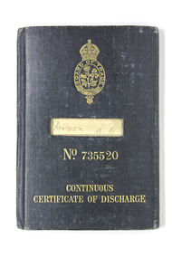
Booklet - Continuous Certificate of Discharge, Continuous Certificate of Discharge: Arthur Oswald Dixon, 1913
... Continuous Certificate of Discharge: Arthur Oswald Dixon...British Board of Trade ...This important booklet and record of service is first stamped and dated in 1913. It is unlikely to be the first booklet issued as the seafarer Arthur O. Dixon b. 1879 commenced maritime service in 1904 working for the Harrison Line between 1904 and 1914. He enlisted as an RNR officer during WW1. He is recorded as returning to Merchant vessel service with the New Zealand Shipping Co between 1916-1920. He subsequently was employed with Adelaide Steamship Co between 1920 and 1921. All documentation shows him to be regarded as an officer of good character and reliable. On leaving seafaring Mr Dixon eventually took up a smallholding in regional Victoria.Unusually for the early 20th C. era of Mr Dixon's service at sea two images of Mr Dixon survive on ID papers and were included in the gift of papers. Personal objects included an unusual small travel size New Testament (see VC record ) heavily annotated provide further insights into the experience of early 20th C. seafarers.Fabric reinforced and backed heavy card covers and service book with multiple pages pre printed for completion by either handwritten entries or ink stamps. Records service record, dates, status, vessel names, ports, master names, character assessment. A thin pink ribbon is affixed by a staple to Page 26.Various - see images licensing, registration, certificate of discharge, mariner papers, seafarer certification, identity cards, identification, arthur oswald dixon, seamanship, seamen, sailors, officers, seafarers, wwi, merchant navy, ran, rnr -
 Mission to Seafarers Victoria
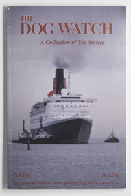
Journal (item) - Periodicals-Annual, Shiplovers' Society of Victoria, The Dog Watch - A Collection of Sea Stories - Issue 54, 1997
... The Dog Watch - A Collection of Sea Stories - Issue 54...Shiplovers' Society of Victoria ...seafaring life, shipping, transport, shiplovers' society of victoria, dog watch -
 Mission to Seafarers Victoria
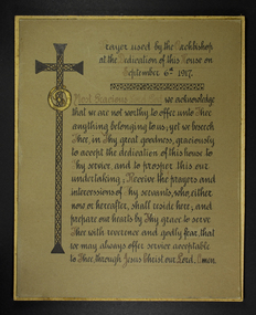
Document - Prayer, Anglican Diocese of Melbourne, Prayer used by the Archbishop at the Dedication of this House on September 6th 1917, 1917
... Prayer used by the Archbishop at the Dedication of this House on September 6th 1917...Anglican Diocese of Melbourne ...Hand-inked prayer text, as used by the Archbishop of Melbourne, at the opening of MTSV, 717 Flinders Street, 6th of September, 1917 Hand crafted piece, of significance because of the use of this prayer at the opening of the new MTSV building at 717 Flinders Street, Melbourne.Thick card with ornate/styled hand-inked text and decoration, of Archbishop's prayer. Thinner, slightly larger backing card glued to front card. -
 Greensborough Historical Society
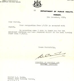
Document - Letter, Department of Public Health Hobart, Confirmation of resignation for Marjorie Jean Burke, 05/12/1950
... Confirmation of resignation for Marjorie Jean Burke...Department of Public Health Hobart ...Letter confirming the resignation of Marjorie Jean Burke, from the Bush Nursing Staff. This letter gives Miss Burke's address as Tasman Bush Nursing Centre Koonya (Tasmania).Miss Burke was a nurse, midwife and infant welfare sister. This collection covers her many qualifications throughout Australia and Great Britain, including references both professional and personal. When Miss Burke returned to Australia, she was employed at Diamond Valley Community Hospital as a nurse in 1953 and as Deputy Matron 1954-1971.Letter typed on cream letterhead.Signed by Director of Hospital and Medical Services.marjorie jean burke, nurses, diamond valley community hospital, flinders island hospital, tasman bush nursing service koonya -
 Greensborough Historical Society
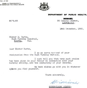
Document - Letter, Department of Public Health Hobart, Confirmation of resignation for Marjorie Jean Burke, 14/12/1950
... Confirmation of resignation for Marjorie Jean Burke...Department of Public Health Hobart ...Letter confirming the resignation of Marjorie Jean Burke, from the Bush Nursing Service. This letter gives Miss Burke's address as Tasman Bush Nursing Centre Koonya (Tasmania).Miss Burke was a nurse, midwife and infant welfare sister. This collection covers her many qualifications throughout Australia and Great Britain, including references both professional and personal. When Miss Burke returned to Australia, she was employed at Diamond Valley Community Hospital as a nurse in 1953 and as Deputy Matron 1954-1971.Letter typed on cream letterhead.Signed by Supervisory Sister.marjorie jean burke, nurses, diamond valley community hospital, flinders island hospital, tasman bush nursing service koonya -
 Greensborough Historical Society
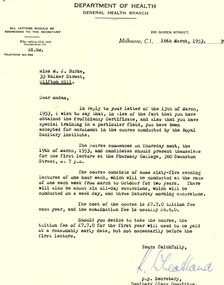
Document - Letter, Department of Health, Victoria, Letter of acceptance into a course for Marjorie Jean Burke, 16/03/1953
... Letter of acceptance into a course for Marjorie Jean Burke...Department of Health, Victoria ...Letter of acceptance into a course for Marjorie Jean Burke, from the Department of Health, Victoria, issued in 1953. The course offered is by the Royal Sanitary Institute.Miss Burke was a nurse, midwife and infant welfare sister. This collection covers her many qualifications throughout Australia and Great Britain, including references both professional and personal. When Miss Burke returned to Australia, she was employed at Diamond Valley Community Hospital as a nurse in 1953 and as Deputy Matron 1954-1971.Certificate on cream folded paper.Signed by Secretary.marjorie jean burke, nurses, diamond valley community hospital, department of health victoria, royal sanitary institute -
 Greensborough Historical Society
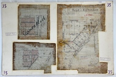
Poster - Planning Document, City of Heidelberg, Subdivision Plan # 35 - Parish of Keelbundoora, Crown Portion 16, Watsonia, 1918
... Subdivision Plan # 35 - Parish of Keelbundoora, Crown Portion 16, Watsonia...City of Heidelberg ...Subdivision Plan # 35 Parish of Keelbundoora, Crown Portion 16: 3 plans on one sheet. Plan 1: Lambourn Road, Boger Street, Kenmare Street, Greensborough Road, Devonshire Road, Watsonia (stamped "Superseded"). Plan 2: an update of plan 1. Plan 3: Also Lambourn Road, Boger Street, Kenmare Street, dated 1918, Shire of Heidelberg.An example of hard copy subdivision plans from the Greensborough area. Mainly from the Shire of Diamond Valley era (1964-1994).3 Plans (single sided) mounted on heavy card. Stamped and handwritten Council permissions, dates and other details. Plan 1 has been stamped in red "SUPERCEDED" and overwritten by hand "Cancelled".subdivision plans, city of heidelberg, greensborough, main street greensborough, shire of heidelberg, watsonia -
 Greensborough Historical Society
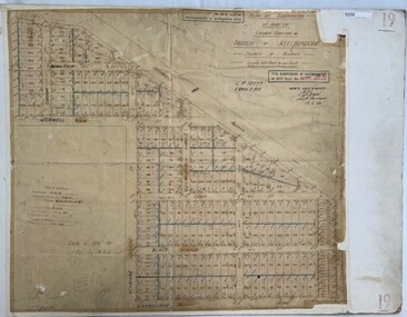
Poster - Planning Document, City of Heidelberg, Subdivision Plan # 19 - Parish of Keelbundoora, Crown Portion 16, Watsonia "Black's subdivision', 1924
... Subdivision Plan # 19 - Parish of Keelbundoora, Crown Portion 16, Watsonia "Black's subdivision'...City of Heidelberg ...Subdivision Plan # 19 - Parish of Keelbundoora, Crown Portion 16, Watsonia "Black's subdivision". This subdivision plan includes proposed street names which were later changed (e.g. Morwell Street (not Morwell Avenue) now called Greenwood Drive). Includes Lambourn Road, Black Street, Grace Street, Eden Avenue, High Street, Kenmare Street, Morwell Avenue, Greensborough Road, Mundy Street, Ladd Street.An example of hard copy subdivision plans from the Greensborough area. Mainly from the Shire of Diamond Valley era (1964-1994).Plan (single sided) mounted on heavy card. Stamped and handwritten Council permissions, dates and other details. subdivision plans, city of heidelberg, greensborough, main street greensborough, shire of heidelberg, watsonia, black family -
 Greensborough Historical Society
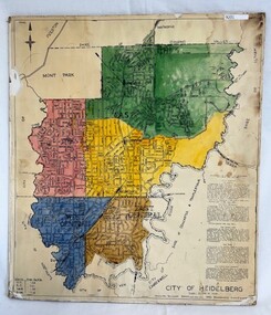
Poster - Map, City of Heidelberg, 1965c
... City of Heidelberg...City of Heidelberg ...Map of the City of Heidelberg showing municipal boundaries and Wards are coloured. Scale 20 chains to 1 inch.An example of hard copy plans from the 1960s. Mainly from the Shire of Diamond Valley era (1964-1994).Colour map, pasted on card and laminated.Stamped and handwritten Council permissions, dates and other details. city of heidelberg, heidelberg - maps, local government -
 Greensborough Historical Society
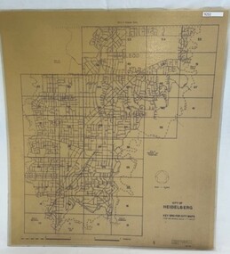
Poster - Map, City of Heidelberg, 1984
... City of Heidelberg...City of Heidelberg ...Numbered grid map of the City of Heidelberg showing municipal boundaries in 1984 . Scale 1 inch to 160 feet. Side 2: MMBW Plans Yarra 2000, note Ward boundaries not updated on this plan.An example of hard copy plans from the 1960s. Mainly from the Shire of Diamond Valley era (1964-1994).Map printed on brown paper and laminated. Double sided.city of heidelberg, mmbw -
 Greensborough Historical Society
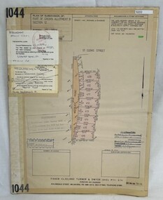
Poster - Planning Document, Shire of Diamond Valley et al, Subdivision Plan # 1044 - Parish of Nillumbik, County Bourke, Crown Allotment B Section 12, Eltham North, 1981-1987
... Subdivision Plan # 1044 - Parish of Nillumbik, County Bourke, Crown Allotment B Section 12, Eltham North....Shire of Diamond Valley ...Subdivision Plan # 1044 - Parish of Nillumbik, County Bourke, Crown Allotment B Section 12, Eltham North. This subdivision plan includes Weidlich Road and St Clems Street. The developer for this subdivision is Taunton Developments and the Surveyors are Fisher Cleeland Turner & Dwyer Vic, Surveyors and Engineers.An example of hard copy subdivision plans from the Greensborough area. Mainly from the Shire of Diamond Valley era (1964-1994).Plan (single sided) mounted on heavy card. Stamped and handwritten Council permissions, dates and other details. subdivision plans, shire of diamond valley, taunton developments -
 Greensborough Historical Society
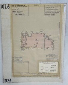
Poster - Planning Document, Shire of Diamond Valley et al, Subdivision Plan # 1026 - Parish of Nillumbik, County Bourke, Crown Allotment B Section 12, Eltham North, 1981-1984
... Subdivision Plan # 1026 - Parish of Nillumbik, County Bourke, Crown Allotment B Section 12, Eltham North....Shire of Diamond Valley ...Subdivision Plan # 1026 - Parish of Nillumbik, County Bourke, Crown Allotment B Section 12, Eltham North. This subdivision plan includes Ryans Road (also known as Government Road) and St Clems Street. The developer for this subdivision is Taunton Developments and the Surveyors are Fisher Cleeland Turner & Dwyer Vic, Surveyors and Engineers.An example of hard copy subdivision plans from the Greensborough area. Mainly from the Shire of Diamond Valley era (1964-1994).Plan (single sided) mounted on heavy card. Stamped and handwritten Council permissions, dates and other details. subdivision plans, shire of diamond valley, taunton developments -
 Greensborough Historical Society
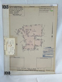
Poster - Planning Document, Shire of Diamond Valley et al, Subdivision Plan # 1018 - Parish of Nillumbik, County Bourke, Crown Allotment 4 Section 15, and Crown Allotment B Section 12, Eltham North, 1981-1982
... Subdivision Plan # 1018 - Parish of Nillumbik, County Bourke, Crown Allotment 4 Section 15, and Crown Allotment B Section 12, Eltham North....Shire of Diamond Valley ...Subdivision Plan # 1018 - Parish of Nillumbik, County Bourke, Crown Allotment 4 Section 15, and Crown Allotment B Section 12, Eltham North. This subdivision plan includes Ryans Road (also known as Government Road) and St Clems Street. The developer for this subdivision is Taunton Developments and the Surveyors are Fisher Cleeland Turner & Dwyer Vic, Surveyors and Engineers.An example of hard copy subdivision plans from the Greensborough area. Mainly from the Shire of Diamond Valley era (1964-1994).Plan (single sided) mounted on heavy card. Stamped and handwritten Council permissions, dates and other details. subdivision plans, shire of diamond valley, taunton developments -
 Greensborough Historical Society
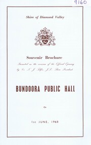
Booklet, Shire of Diamond Valley, Shire of Diamond Valley Souvenir Brochure, Bundoora Public Hall, 01/06/1968
... Shire of Diamond Valley Souvenir Brochure, Bundoora Public Hall...Shire of Diamond Valley ...Official souvenir program of the opening of the new Bundoora Public Hall on 1st June, 1968 with photos of the old and new Hall.HistoricBooklet, with sepia text and photos and diagram on card and envelopebundoora hall, shire of diamond valley -
 Greensborough Historical Society
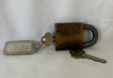
Functional object - Padlock and Keys, Lockwood, Shire of Diamond Valley padlock and key and master key, 1960s
... Shire of Diamond Valley padlock and key and master key ......Shire of Diamond Valley ...Shire of Diamond Valley Master Key and padlock and key, used by Shire staff between 1964 and 1994.Lockwood padlock and two keysshire of diamond valley, keys, padlocks -
 Greensborough Historical Society
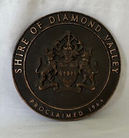
Plaque, Shire of Diamond Valley, Shire of Diamond Valley, Proclaimed 1964 Plaque, 1960s
... Shire of Diamond Valley, Proclaimed 1964 Plaque...Shire of Diamond Valley ...This Logo was from the front door of the original Diamond Valley Library under Shire of Diamond Valley offices, Civic Ave, Greensborough. This was before the current Diamond Valley branch was built.Round brass plaque with writing and logoshire of diamond valley, plaques, diamond valley library -
 Greensborough Historical Society
Sign, Shire of Diamond Valley, Shire of Diamond Valley: Park or Reserve sign, 1964-1994
... Shire of Diamond Valley: Park or Reserve sign...Shire of Diamond Valley ...Shire of Diamond Valley timber sign. This sign would have been at the entry to one of the many public parks and reserves created during the time of the Shire of Diamond Valley (1964-1994). Following the redistribution of local government areas in 1994, the previous Shire of Diamond Valley was split between City of Banyule and Shire of Nillumbik. Signage would have been replaced to reflect the new 'owners' of the property. The exact location of this sign is unknown.Brown painted Timber sign with yellow writing etched into timbershire of diamond valley, sign, parks - greensborough -
![Sign, Shire of Eltham, St Faiths Road, Shire of Eltham [street sign], 1960s](/media/collectors/4f729f5697f83e03086015b8/items/67db6caab13536720ddc4bb9/item-media/67f21a5be76666667ba86b1f/item-fit-380x285.jpg?cb=6) Greensborough Historical Society
Greensborough Historical SocietySign, Shire of Eltham, St Faiths Road, Shire of Eltham [street sign], 1960s
... St Faiths Road, Shire of Eltham [street sign]...Shire of Eltham ...Road sign pre 1994 of St Faiths Road, Montmorency, formerly in the Shire of Eltham. This early sign does not have the Shire of Eltham 'branding' of later signs. Following the redistribution of local government areas in 1994, St Faiths Road was allocated to the City of Banyule.Double Sided Metal sign, white with black writing shire of eltham, road sign, st faiths road montmorency -
![Sign, Shire of Eltham, St Faiths Road, Shire of Eltham [street sign], 1970c](/media/collectors/4f729f5697f83e03086015b8/items/67db7068b13536720ddd1c08/item-media/67f21867e76666667ba84bc9/item-fit-380x285.jpg?cb=6) Greensborough Historical Society
Greensborough Historical SocietySign, Shire of Eltham, St Faiths Road, Shire of Eltham [street sign], 1970c
... St Faiths Road, Shire of Eltham [street sign]...Shire of Eltham ...Road sign pre 1994 of St Faiths Road, Montmorency, formerly in the Shire of Eltham. Following the redistribution of local government areas in 1994, St Faiths Road was allocated to the City of Banyule.Double Sided Metal sign painted yellow with green writing and Shire of Eltham Logo and Nameshire of eltham, sign, st faiths road montmorency -
 Greensborough Historical Society
Booklet - Report, TTM Consulting Pty Ltd, Shire of Diamond Valley: Greensborough District Centre: "East-side" development application: traffic & parking impact report, 1992, 1992_04
... Shire of Diamond Valley: Greensborough District Centre: "East-side" development application: traffic & parking impact report, 1992.......Shire of Diamond Valley ...A summary of traffic ad parking impacts of the Greensborough District Centre in 1992, with plans for the development of the East side of Main Street Greensborough.14 pages text and 11 pages black and white line drawings. greensborough district centre, main street greensborough, traffic, parking -
 Greensborough Historical Society
Book - Report, Ross King et al, Youth, leisure and public policy: the case of Diamond Valley, 1977, 1977_11
... Youth, leisure and public policy: the case of Diamond Valley, 1977...Shire of Diamond Valley ...119 pages text and black and white line drawings and tables. One colour fold out map. White plastic binding. non-fictionshire of diamond valley, leisure activities, sport -
 Greensborough Historical Society
Article, Marilyn Warren, Early history of the Victorian legal system, 28/04/2011
... Early history of the Victorian legal system...Royal Historical Society of Victoria ...Early history of the Victorian legal system is a presentation by Marilyn Warren, Chief Justice of the Supreme Court of Victoria at the Royal Historical Society of Victoria. Of particular interest is the section on Plenty Valley bushrangers, pp26-28.30p. text.victoria law, legal system victoria, plenty valley bushrangers, marilyn warren, rhsv -
 Greensborough Historical Society
Booklet, Wilson Sayer Core Pty Ltd, Diamond Creek retail study: preparation of development concept options, August 1989
... Diamond Creek retail study: preparation of development concept options......Shire of Diamond Valley ...Planning options for an extended retail development in Diamond Creek 1989.12 p. text, 12p. plans, spiral bound non-fictiondiamond creek, shire of diamond valley, retail developments -
 Greensborough Historical Society
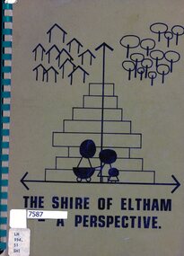
Book, Lodi Francesconi, The Shire of Eltham - a perspective, 1981_07
... The Shire of Eltham - a perspective......Shire of Eltham ...Collection of statistics and projections relating to the Shire of Eltham as at 1981123 p. typescriptnon-fictionshire of eltham, statistics, eltham -
 Federation University Historical Collection
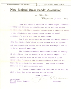
Document, John G Osborne, Secretary of New Zealand Brass Bands' Association, Frank Wright Reference from John G. Osborne of the New Zealand Brass Bands' Association, 1933, 31/7/1933
... Frank Wright Reference from John G. Osborne of the New Zealand Brass Bands' Association, 1933...John G Osborne, Secretary of New Zealand Brass Bands' Association ...Frank Wright was a renown resident of Smeaton, where he was born on 2 August 1901. He lived at Laura Villa, and attended Smeaton State School. His father William was a gold miner and his mother's name was Sarah. Their family won many singing and instrumental awards. Frank was tutored by Percy Code and was awarded a gold medal for the highest marks in the ALCM examinations in the British Colonies at the age of seventeen years. He became the Australian Open Cornet Champion by the age of eighteen. A year later, Frank conducted the City of Ballarat Band, and later the Ballarat Soldiers’ Memorial Band. He formed the Frank Wright Frisco Band and Frank Wright and his Coliseum Orchestra. These bands won many South Street awards, and Frank as conductor won many awards in the Australian Band Championship contest. In 1933 Frank Wright sailed to England to conduct the famous St Hilda’s Band and was later appointed Musical Director of the London County Council, where he organized many amazing concerts in parks, in and around the London district. He was made Professor of Brass and Military Band Scoring and conducted at the Guildhall of Music and Drama. Frank was often invited to adjudicate Brass Band Championships around Europe, in Australia, including South Street and in New Zealand. The Frank Wright Medal at the Royal South Street competition is awarded to an individual recognized as making an outstanding contribution to brass music in Australia.This single sheet of typed paper has the printed header of the New Zealand Brass Bands' Association and is a letter of reference for Frank Wright signed by John G Osborne, the Secretary. The typing is purple.Signature in penfrank wright, john g osborne, new zealand brass bands' association, reference -
 Federation University Historical Collection
Booklet, Thomas Stephen Hart, The Highlands and Main Divide of Western Victoria, 1907, 12/12/1907
... The Highlands and Main Divide of Western Victoria, 1907......Royal Society of Victoria ...Thomas S. Hart was a teacher at the Ballarat School of Mines, and a member of the Ballarat Field Naturalists ClubArticle with illustrations published by the Royal Society of Victoria by Thomas S. Hart. The following plates are included: Fig 1. The Main Divide and some of the transverse ridges Fig 2. Hills on and near the Divide at the Ercildoun and Ascot Gaps Fig. 3. Profile of the Divide at Ascot Gap. Fig. 4. Sketch of the Hills west and north-west from Mt Buninyong - - The divide in Ascot Gap from Mt Blowhard (Serra Range, Mt William, Mt Ararat, Larne Gerin, Ben Major, Mt Cole, Mt Misery, Mt Bolton) Fig. 5. Diagram to illustrate the possible courses of the leads south of the present Divide - Burrumbeet Basin (Smythesdale, Ballarat, Lal Lal , Mt Doran, egerton, Parwan Creet, Rowsley Fault, Eastern Plateau) Fig. 6. Diagramatic cross section of the grampians, south of Hall's Gap. Profile of the Pyranees, from maiden Hill - Diagramatic Section of the Grampians south of Hall's Gap. (Mt Cole, Mt Mitchell, Ben Major, Ben More, Avoca Hill, Hall's Gap.) Fig. 7. Profile of the Pyrenees as seen from Maiden Hill near Waubra.thomas hart, thomas s. hart, ballarat school of mines, ballarat field naturalists club, royal society of victoria, western victoria, ballarat, great dividing range, mt william, volcano, volcanic plains, waterways, lal lal basin, yarrowee creek, ballarat common, lava flow, wendouree, warrenheip, ballarat plateau, mt elephant, grampians, t.s. hart, mt buangor, mt beckworth, mt misery, mt bolton, lal lal iron ored, mt ararat, mt wiliam, mt cole, burrumbeet, mt warrenheip, daylesford, waubra, ercildoun gap, smythesdale, lal lal falls, parwan valley, burrumbeet creek, staffordshire reef, pyranees, bacchus marsh, rowsley fault, ben nevis, avoca hill, landsborough hill, mt blowhard, weatherboard, mclean's hill, fyan's creek, thomas stephen hart, lal lal -
 Federation University Historical Collection
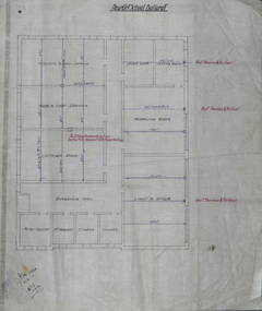
Plan, Ballarat Technical Art School Plan of Proposed Fittings, 1914, 05/03/2014
... Ballarat Technical Art School Plan of Proposed Fittings, 1914...Department of Public Works ...The Ballarat Technical Art School was a division of the Ballarat School of Mines. A custom built building was opened in 1915. A plan on linen showing the proposed fittings for the new Ballarat Technical Art School Building built in the grounds of the Ballarat School of Mines. The plan has been hand coloured and designates rooms for freehand and plant drawing, model and cast drawing, Modelling Room, Light and Shade Room, Lecture room, Head Master's Office, attendant's office, cloakroom, storeroom, Castings Room, Sheet 7 W.J.G. 5.3.14ballarat technical art school, buildings, ballarat school of mines, plan -
 Federation University Historical Collection
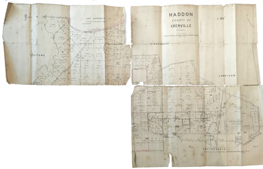
Plan, Haddon County of Grenville, 1887, 1887
... Haddon County of Grenville, 1887...Department of Lands and Survey ...Parish Plan of Haddon showing the township of Haddon, Cardigan and Haddon State Forest, Lake Burrumbeet and Nentingbook Pre-emptive Right. Names on the allotments include H. Cuthbert, B. Hepburn, T.W. Lloyd, J. Palmer, E.A. Wynne, William Collard Smith, A. Porteous, P. Russell, J. Mitchell, G. Renniehandwritten 'J. H. Cunningham Applic'haddon, cardigan, haddon state forest, lake burrumbeet, nentingbook pre-emptive right, h. cuthbert, b. hepburn, t.w. lloyd, j. palmer, e.a. wynne, william collard smith, a. porteous, p. russell, j. mitchell, g. rennie, j. noone, department of lands and survey -
 Federation University Historical Collection
Document, Trinity College of Music Diploma Examinations 1967, June-July 1967
... Trinity College of Music Diploma Examinations 1967...Trinity College of Music ...Frank Wright was a renown resident of Smeaton, where he was born in 1901. He lived at Laura Villa, and attended Smeaton State School. His father William was a gold miner and his mother's name was Sarah. Their family won many singing and instrumental awards. Frank was tutored by Percy Code and was awarded a gold medal for the highest marks in the ALCM examinations in the British Colonies at the age of seventeen years. He became the Australian Open Cornet Champion by the age of eighteen. A year later, Frank conducted the City of Ballarat Band, and later the Ballarat Soldiers’ Memorial Band. He formed the Frank Wright Frisco Band and Frank Wright and his Coliseum Orchestra. These bands won many South Street awards, and Frank as conductor won many awards in the Australian Band Championship contest. In 1933 Frank Wright sailed to England to conduct the famous St Hilda’s Band and was later appointed Musical Director of the London County Council, where he organized many amazing concerts in parks, in and around the London district. He was made Professor of Brass and Military Band Scoring and conducted at the Guildhall of Music and Drama. Frank was often invited to adjudicate Brass Band Championships around Europe, in Australia, including South Street and in New Zealand. The Frank Wright Medal at the Royal South Street competition is awarded to an individual recognized as making an outstanding contribution to brass music in Australia.1). With compliments slip from Trinity College of Music, London 2). Printed and folded 4 page examination with 'Instructions to candidates' and 'Musical knowledge' questions.1). Written in blue pen - Bill, 20.11.67frank wright, trinity college of music, diploma examination
