Showing 123957 items
matching main-road
-
 Glen Eira Historical Society
Album - Album page, Koornang Road, Circa 1972
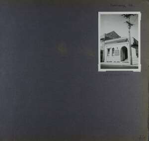
This photograph is part of the Caulfield Historical Album 1972. This album was created in approximately 1972 as part of a project by the Caulfield Historical Society to assist in identifying buildings worthy of preservation. The album is related to a Survey the Caulfield Historical Society developed in collaboration with the National Trust of Australia (Victoria) and Caulfield City Council to identify historic buildings within the City of Caulfield that warranted the protection of a National Trust Classification. Principal photographer thought to be Trevor Hart, member of Caulfield Historical Society. Most photographs were taken between 1966-1972 with a small number of photographs being older and from unknown sources. All photographs are black and white except where stated, with 386 photographs over 198 pages. 1970 Sands & McDougall Directory shows UFS Dispensary at address.Page 106 of Photograph Album with one photograph (portrait) of a pharmacy on Koornang Road.Handwritten: Koornang Rd [top right] / 162 KOORNANG RD [under photo] / 106 [bottom right]trevor hart, koornang road, carnegie, rosstown, dispensary, pharmacies, shops, commercial establishments, ufs dispensary, arches -
 Whitehorse Historical Society Inc.
Document - Article, Surrey Road, Blackburn, 1994
Copy of a photograph of 106 Surrey Road, Blackburn [previously a Slater home], 1994.surrey road, blackburn, houses, slater family -
 Hawthorn Historical Society
Drawing - Property Illustration, 766-768 Barkers Road, Hawthorn East
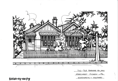
'After training as a Cartographic Draftsman within the mining industry, I worked as a property illustrator for real estate firms in the eastern suburbs of Melbourne for 23 years from 1983. I initially photographed houses with a Polaroid camera and made a 'thumbnail' sketch while there. The photos were used to scale off a sketch in pencil and then that sketch was overlaid with drafting film and the 'pen and ink' completed. The pens I used were the Rotring ‘Rapidigraph’ drafting pens. The ink was also made by Rotring (German).The film was ‘Rapidraw’, polyester drafting film, double matte. It takes a very fine line and doesn’t bleed. As well as house sketches, there were often floor plans and site plans ordered. Aerial sketches were ordered when the property needed an overall view.' (Margaret Picken, 2020)This property illustration is one of a series created by Margaret Picken for a range of real estate agents in Melbourne between c. 1983 and c. 2006. Each work is signed and dated by the artist.Gift of Margaret Picken, 2020Pen and ink property illustration on drafting film of 766-768 Barkers Road, Hawthorn East by Margaret Picken.766-768 Barkers Road, Haw, Margaret Picken '96. Woodards.artist - margaret picken 1950- -
 Surrey Hills Historical Society Collection
Photograph, Surrey Hills - Looking East from Essex Road, circa 1900, c1900
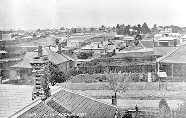
Date is approximate. Two original post cards of this image - "Surrey Hills - looking East" - were donated by Stephen Wyatt on 10 March 2012. One is blank; the other has been sent to Mrs A Wyatt, C/O Mrs E Young, 'Grand View', Warburton from daughter Nellie from 'The Quantocks', Surrey Hills - postmarked 10 Dec 1906. There is also a reproduction of this image in a framed collage of Surrey Hills photos.This is the earliest known image of the Surrey Gardens. The layout was originally designed by William Guilfoyle, who also designed Melbourne’s Royal Botanic Gardens.Black and white photo taken from an early postcard. Taken from the roof of a house in Essex Road, it shows the development of housing between Essex and Union Roads and includes the section of land fenced off for the Surrey Gardens with paths roughly laid out, one existing tree but no tree planting. The houses depicted are largely Edwardian timber buildings with corrugated rooves. There are still some vacant blocks. Kirkland on Union Road can be seen in the distance, as can some of the shops along Canterbury Road.Lower LHS within original image: " Surrey Hills - Looking East"; on the rear "No 17" in black pen in top LH corner.edwardian style, residential development, kirkland, essex road, suffolk road, norfolk road, surrey gardens, post card -
 Eltham District Historical Society Inc
Photograph, Council owned Reserve running between Arthur Street and Ruskin Court, Eltham, 4 March 2018, 4/3/2018
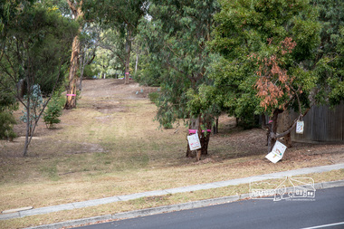
Shows protest banners and ribbons placed by members of the community opposed to Nillumbik Council's proposal to sell this land along with 16 other reserves in the Shire. One of 17 reserves which 3,000 people rallied for at the former Shire office site on March 4th, 2018 then marched down Main Road to Luck Street.Born digital imagenillumbik shire council, parks, save community reserves, arthur street, ruskin court -
 City of Greater Bendigo - Civic Collection
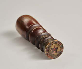
Ceremonial object - Common Seal, Campaspe District Road Board Seal
Wax seals have been used since the Middle Ages and are primarily used for legitimising and authenticating official documents. This wax seal was used by the Campaspe Road Board (later the Huntly Council). The first president of the Campaspe Road Board was Sir James Joseph Casey who was a member of the municipal council of Sandhurst prior to holding this position in 1861.Circular, brass seal with wooden handle. Remnants of red wax remain in seal. Campaspe District Road Boardhuntly shire (1866-1994), city of greater bendigo administration item -
 Greensborough Historical Society
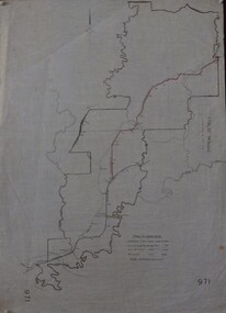
Maps, Shire of Heidelberg, 1920s
Map of main roads within Shire of Heidelberg, probably those for which the Shire was responsible for maintainingMap of main roads within Shire of Heidelberg, hand coloured, and Hurstbridge rail line. 40 chains: 1 inch971shire of heidelberg, heidelberg -
Surrey Hills Historical Society Collection
Ephemera, H Bowley, Printer, 192 Canterbury Road, Canterbury, Theatre program - The Arcadians, 10 May 1932, May 1932
There was a vibrant musical culture in Surrey Hills in the 1920s and 1930s. The donor William John Lock was a musician and lived at 9 Norfolk Road, Surrey Hills. Donation was made at time Libby Cavanagh was Secretary of the Surrey Hills Historical Society. Mrs N B Cerini was Jocelyn Hall's mother.This is one of a series of programs that documents the vibrant musical culture in Surrey Hills in the 1920s and 1930s.Faded blue-coloured bi-fold paper program with one corner cut off but with the program. [This also acted as the admission slip / ticket]. Includes a cast list and synopsis of the three acts.In faded ink "K13"; stamped in purple ink "SURREY HILLS / OPERATIC SOCIETY"; In faded ink "Price 2/- / P. Hirtsch / Hon. Sec." and "J Hall" in biro. On the cut off corner: "HALL (1932) / UNION RD" and 1/- crossed out and replaced by "2/-" in faded ink.camberwell town hall, operetta, the arcadians, wimperis and monckton, surrey hills operatic society, eye and ear hospital, j c williamson, winslow's news agency, entertainment, fundraising, musical events and activities, cr r mccamish, mrs mccamish, miss lilian horn, mr h brett, mr cocking, mr alan abery, mr o danvers, mr pearce, mr j rowse, mrs ethel cerini, mrs natole cerini, miss u blaikie, miss f callaghan, miss j gordon, mr h denny, mr h collins, mr m latimer, mrs p d clucas, miss i roderick, miss m collins, mr darby, miss p heitsch, miss pearson -
 Kew Historical Society Inc
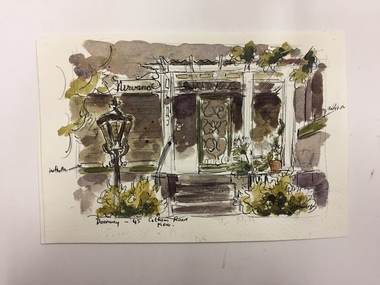
Work on paper, Joy Stewart, Doorway - 45 Cotham Road, Kew, c.1978
Sydney Joy (joy) Stewart (1925-2018) was a founding member of the Kew Historical Society, and during the 1970s its secretary. During her residence in Kew, she completed numerous property illustrations on commission. These ranged from preliminary sketches, including architectural details to finished pen & ink and wash illustrations on paper. On moving to Queensland, Joy Stewart donated the remaining property illustrations in her possession to the Kew Historical Society. In 1987-88, she fulfilled a commission by the Society of designs for a series of embroideries completed by residents during the Australian Bicentennial commemorations.Sydney Joy (Joy) Stewart was born in Melbourne 1925. She studied at Swinburne Technical College Art School from 1941-1945, then the National Gallery Art School 1946-1948. Her career included employment positions as a display artist, designer/painter, gallery assistant, and art teacher. Joy relocated to Cairns in 1981. Solo exhibitions in Melbourne and Cairns, including 'Done By Me' at Cairns Regional Gallery in 1999. Group exhibitions at Cairns Regional Gallery, 'The Fish John West Regrets, 1993' and 'Facets of Life' 1994. Joy Stewart died in Cairns in 2018.Watercolour, pen & Ink on paper by the artist and local historian Joy Stewart of 45 Cotham Road, Kew. Inscription: "Doorway -, 45 Cotham Road, Kew." Signed lower right: "JStewart".cotham road (kew), joy stewart -
 Hawthorn Historical Society
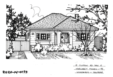
Drawing - Property Illustration, 18 Clifton Road, Hawthorn East
'After training as a Cartographic Draftsman within the mining industry, I worked as a property illustrator for real estate firms in the eastern suburbs of Melbourne for 23 years from 1983. I initially photographed houses with a Polaroid camera and made a 'thumbnail' sketch while there. The photos were used to scale off a sketch in pencil and then that sketch was overlaid with drafting film and the 'pen and ink' completed. The pens I used were the Rotring ‘Rapidigraph’ drafting pens. The ink was also made by Rotring (German).The film was ‘Rapidraw’, polyester drafting film, double matte. It takes a very fine line and doesn’t bleed. As well as house sketches, there were often floor plans and site plans ordered. Aerial sketches were ordered when the property needed an overall view.' (Margaret Picken, 2020)This property illustration is one of a series created by Margaret Picken for a range of real estate agents in Melbourne between c. 1983 and c. 2006. Each work is signed and dated by the artist.Gift of Margaret Picken, 2020Pen and ink property illustration on drafting film of 18 Clifton Road, Hawthorn East by Margaret Picken.18 Clifton Road, Haw E, Margaret Picken '95. Woodards - Hawthorn. artist - margaret picken 1950- -
 Hawthorn Historical Society
Drawing - Property Illustration, 14 Clive Road, Hawthorn East
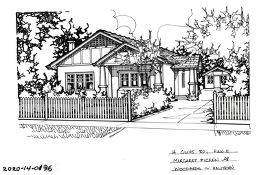
'After training as a Cartographic Draftsman within the mining industry, I worked as a property illustrator for real estate firms in the eastern suburbs of Melbourne for 23 years from 1983. I initially photographed houses with a Polaroid camera and made a 'thumbnail' sketch while there. The photos were used to scale off a sketch in pencil and then that sketch was overlaid with drafting film and the 'pen and ink' completed. The pens I used were the Rotring ‘Rapidigraph’ drafting pens. The ink was also made by Rotring (German).The film was ‘Rapidraw’, polyester drafting film, double matte. It takes a very fine line and doesn’t bleed. As well as house sketches, there were often floor plans and site plans ordered. Aerial sketches were ordered when the property needed an overall view.' (Margaret Picken, 2020)This property illustration is one of a series created by Margaret Picken for a range of real estate agents in Melbourne between c. 1983 and c. 2006. Each work is signed and dated by the artist.Gift of Margaret Picken, 2020Pen and ink property illustration on drafting film of 14 Clive Road, Hawthorn East by Margaret Picken.14 Clive Road, Haw E, Margaret Picken '98 Woodards - Hawthorn. artist - margaret picken 1950- -
 Hawthorn Historical Society
Drawing - Property Illustration, 18 Clive Road, Hawthorn East
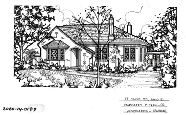
'After training as a Cartographic Draftsman within the mining industry, I worked as a property illustrator for real estate firms in the eastern suburbs of Melbourne for 23 years from 1983. I initially photographed houses with a Polaroid camera and made a 'thumbnail' sketch while there. The photos were used to scale off a sketch in pencil and then that sketch was overlaid with drafting film and the 'pen and ink' completed. The pens I used were the Rotring ‘Rapidigraph’ drafting pens. The ink was also made by Rotring (German).The film was ‘Rapidraw’, polyester drafting film, double matte. It takes a very fine line and doesn’t bleed. As well as house sketches, there were often floor plans and site plans ordered. Aerial sketches were ordered when the property needed an overall view.' (Margaret Picken, 2020)This property illustration is one of a series created by Margaret Picken for a range of real estate agents in Melbourne between c. 1983 and c. 2006. Each work is signed and dated by the artist.Gift of Margaret Picken, 2020Pen and ink property illustration on drafting film of 18 Clive Road, Hawthorn East by Margaret Picken.18 Clive Road, Haw E, Margaret Picken '96 Woodards - Hawthorn. artist - margaret picken 1950- -
 Hawthorn Historical Society
Drawing - Property Illustration, 21 Clive Road, Hawthorn East
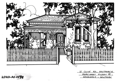
'After training as a Cartographic Draftsman within the mining industry, I worked as a property illustrator for real estate firms in the eastern suburbs of Melbourne for 23 years from 1983. I initially photographed houses with a Polaroid camera and made a 'thumbnail' sketch while there. The photos were used to scale off a sketch in pencil and then that sketch was overlaid with drafting film and the 'pen and ink' completed. The pens I used were the Rotring ‘Rapidigraph’ drafting pens. The ink was also made by Rotring (German).The film was ‘Rapidraw’, polyester drafting film, double matte. It takes a very fine line and doesn’t bleed. As well as house sketches, there were often floor plans and site plans ordered. Aerial sketches were ordered when the property needed an overall view.' (Margaret Picken, 2020)This property illustration is one of a series created by Margaret Picken for a range of real estate agents in Melbourne between c. 1983 and c. 2006. Each work is signed and dated by the artist.Gift of Margaret Picken, 2020Pen and ink property illustration on drafting film of 21 Clive Road, Hawthorn East by Margaret Picken.21 Clive Road, Hawthorn E, Margaret Picken '88 Woodards - Hawthorn. artist - margaret picken 1950- -
 Hawthorn Historical Society
Drawing - Property Illustration, 25 Clive Road, Hawthorn East
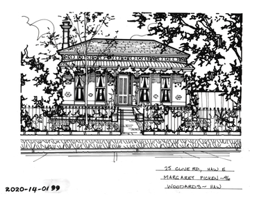
'After training as a Cartographic Draftsman within the mining industry, I worked as a property illustrator for real estate firms in the eastern suburbs of Melbourne for 23 years from 1983. I initially photographed houses with a Polaroid camera and made a 'thumbnail' sketch while there. The photos were used to scale off a sketch in pencil and then that sketch was overlaid with drafting film and the 'pen and ink' completed. The pens I used were the Rotring ‘Rapidigraph’ drafting pens. The ink was also made by Rotring (German).The film was ‘Rapidraw’, polyester drafting film, double matte. It takes a very fine line and doesn’t bleed. As well as house sketches, there were often floor plans and site plans ordered. Aerial sketches were ordered when the property needed an overall view.' (Margaret Picken, 2020)This property illustration is one of a series created by Margaret Picken for a range of real estate agents in Melbourne between c. 1983 and c. 2006. Each work is signed and dated by the artist.Gift of Margaret Picken, 2020Pen and ink property illustration on drafting film of 25 Clive Road, Hawthorn East by Margaret Picken.25 Clive Road, Haw E, Margaret Picken '96 Woodards - Haw. artist - margaret picken 1950- -
 Hawthorn Historical Society
Drawing - Property Illustration, 15 Denmark Hill Road, Hawthorn
'After training as a Cartographic Draftsman within the mining industry, I worked as a property illustrator for real estate firms in the eastern suburbs of Melbourne for 23 years from 1983. I initially photographed houses with a Polaroid camera and made a 'thumbnail' sketch while there. The photos were used to scale off a sketch in pencil and then that sketch was overlaid with drafting film and the 'pen and ink' completed. The pens I used were the Rotring ‘Rapidigraph’ drafting pens. The ink was also made by Rotring (German).The film was ‘Rapidraw’, polyester drafting film, double matte. It takes a very fine line and doesn’t bleed. As well as house sketches, there were often floor plans and site plans ordered. Aerial sketches were ordered when the property needed an overall view.' (Margaret Picken, 2020)This property illustration is one of a series created by Margaret Picken for a range of real estate agents in Melbourne between c. 1983 and c. 2006. Each work is signed and dated by the artist.Gift of Margaret Picken, 2020Pen and ink property illustration on drafting film of 15 Denmark Hill Road, Hawthorn by Margaret Picken.15 Denmark Hill Road, Hawthorn, Marg Picken '88. Woodards - C'well.artist - margaret picken 1950- -
 Hawthorn Historical Society
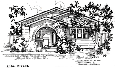
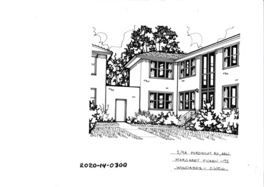
Drawing - Property Illustration, 5/ 9A Fordholm Road, Hawthorn
'After training as a Cartographic Draftsman within the mining industry, I worked as a property illustrator for real estate firms in the eastern suburbs of Melbourne for 23 years from 1983. I initially photographed houses with a Polaroid camera and made a 'thumbnail' sketch while there. The photos were used to scale off a sketch in pencil and then that sketch was overlaid with drafting film and the 'pen and ink' completed. The pens I used were the Rotring ‘Rapidigraph’ drafting pens. The ink was also made by Rotring (German).The film was ‘Rapidraw’, polyester drafting film, double matte. It takes a very fine line and doesn’t bleed. As well as house sketches, there were often floor plans and site plans ordered. Aerial sketches were ordered when the property needed an overall view.' (Margaret Picken, 2020)This property illustration is one of a series created by Margaret Picken for a range of real estate agents in Melbourne between c. 1983 and c. 2006. Each work is signed and dated by the artist.Gift of Margaret Picken, 2020Pen and ink property illustration on drafting film of 5/9A Fordholm Road, Hawthorn by Margaret Picken.5/9A Fordholm Road, Haw, Margaret Picken '95. Woodards - C'well. artist - margaret picken 1950- -
 Surrey Hills Historical Society Collection
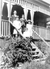
Photograph, McPhie children, of 5 Suffolk Road, Surrey Hills
5 Suffolk Road was the Mounted Police Station from 1889 - 1914.Image of a five young (school age or younger) children (three boys, two girls) standing on the exterior steps of a building identified as the Mounted Police Station, 5 Suffolk Road, Surrey Hills. The children are identified as the family of Sgt. David McPhie. The children are dressed in 'best clothes.' The main part of the building is not visible however it does have a decorative wooden verandah.people, families, family groups, children, girls, boys, police, policemen, surrey hills mounted police station, structures and establishments, police stations, david mcphie -
 Mt Dandenong & District Historical Society Inc.
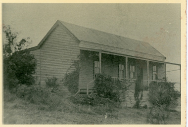
Photograph, 'Hillcrest' on Mernda Road, Olinda 1911, 1911
Front view of 'Hillcrest' the Devine family home on Mernda Road, Olinda taken in 1911. The road deviation passed to the right of where the photographer was standing. The descriptive text on the reverse of this photograph was hand written by John Lundy-Clarke.“Hillcrest” the home of the Devine family 1911 in Mernda Road now Coonara Road. The road was deviated here to regrade it and the deviation past to the right of the camera. The house fronted down over the valley of the Sassafras Creek towards Kallista. It was close to the spot where the camera stood that the girls practiced the maypole dance in 1911. Vera Devine trained 11 of her mates in the dance here.hillcrest, mernda road, olinda, vera devine, devine family -
 Whitehorse Historical Society Inc.
Photograph - Black and white photograph, Williams Road Blackburn circa 1924. Electricity poles showing and unmade road
Williams Road Blackburn. Two early photos in black and white.Two early black and white photographs of Williams Road Blackburn prior to lots being sold.blackburn, williams road, 1924 -
 Ringwood and District Historical Society
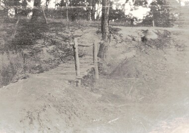
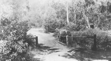
Photograph, Deep Creek bridge and road c.1935
Black and white photograph of narrow unmade road showing narrow bridge with wooded balustrades. Forested area at edge of roadway.Typed below photograph, "Deep Creek bridge and road. c.1935". -
 Surrey Hills Historical Society Collection
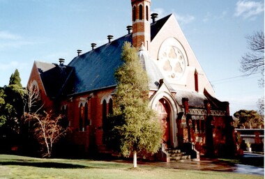
Photograph, St Stephen's Presbyterian Church, Surrey Hills, viewed from Warrigal Road, 1980's
The first service of the Surrey Hills Presbyterian Church was held at ‘Kinnoul’, the home of Thomas Hogg, located in The Avenue. This was while the church was being built. St Stephens Presbyterian Church opened in March 1899 on land that had previously been part of Klepper's orchard. The first minister was Rev F A Darling. He resigned in 1892 to open Surrey College. The church building pictured was built in 1910 adjacent on land gifted to the church. Noted features of the interior are the pulpit and honor board carved by sculptor John Kendrick Blogg. There are also memorial windows to Charles de Burgh Hogg and William Thomas Hogg, both killed in WW1.Red brick church with bell tower and slate roof. Cyprus tree at side; other trees fronting Canterbury Road.Canterbury Road - Warrigal Rd (written in biro on th back of photo)stained glass, lead lights, churches, presbyterian church, st stephens presbyterian church, 1980-1989, surrey hills, canterbury road, warrigal road, john kendrick blogg, charles de burgh hogg, thomas william hogg -
 Glen Eira Historical Society
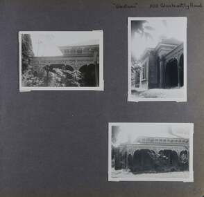
Album - Album page, Glentana, Glen Huntly Road, 805, Circa 1972
This photograph is part of the Caulfield Historical Album 1972. This album was created in approximately 1972 as part of a project by the Caulfield Historical Society to assist in identifying buildings worthy of preservation. The album is related to a Survey the Caulfield Historical Society developed in collaboration with the National Trust of Australia (Victoria) and Caulfield City Council to identify historic buildings within the City of Caulfield that warranted the protection of a National Trust Classification. Principal photographer thought to be Trevor Hart, member of Caulfield Historical Society. Most photographs were taken between 1966-1972 with a small number of photographs being older and from unknown sources. All photographs are black and white except where stated, with 386 photographs over 198 pages. Melbourne Mansions database indicates that its architect may have been Charles Webb.Page 66 of Photograph Album with three exterior photographs (two portrait and one landscape) of Glentana, a single storey Victorian residence, focussing on views of its verandah.Hand written: "Glentana" 805 Glenhuntly Road [top right] / 66 [bottom right] trevor hart, brick, polychrome brickwork, cast iron frieze, decorative brackets, italianate, return verandah, glentana, glen huntly road, caulfield, cast iron work, verandahs, glenhuntly road, charles webb, glen tana, house names -
 Bacchus Marsh & District Historical Society
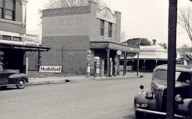
Photograph, Simon Brothers Motor Garage corner of Main Street and Grant Street c.1940s
This image shows one of the busiest intersections of Bacchus Marsh, the corner of Main and Grant Streets. The main building shown in the image is Simon Brothers Motor Service and Cycle Depot. In 1903 the Simon brothers, Herbert (Bert) and Walter began making Monarch bicycles and later Monarch motor cycles. In 1913 they moved into newly constructed premises shown in this image. The business operated as both a garage, service station and cycle depot. The business operated until 1948 when P. S. Carey brought the premises to expand his Grant Street car dealership business which was located next to the Simon Brothers garage. Black and white photograph showing Simon Brothers Motor garage Bacchus Marsh seen from the northern side of Main Street looking south west towards Grant Street. BMDHS Location: AR/R4/S2 Photo Album Jack Coe Collection, and digital image on BMDHS computer network.On reverse, "Jack Coe Collection"small businesses bacchus marsh, simon family bacchus marsh, simon brothers garage, petrol stations -
 Surrey Hills Historical Society Collection
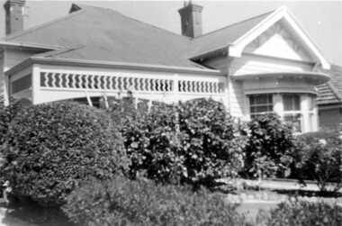
Photograph, 44 Guildford Road Surrey Hills, 1940, 1940
This was the home of the Offszanka family from 1913; they came to Surrey Hills from Richmond. Carl Theodore Offszanka (1874-1944) was a furrier. Both he and his wife Ida, nee Schade, (1882-1963) were born in Germany. They married in Victoria in 1908. Their home was called 'Westfalia' (ref: 1919 electoral roll), presumably after the region in NW Germany. They had at least 4 children: Carl Bernard - b 1909 Marie Eliese - b 1910 Erna Helena - b 1913; d 1996 - listed at Guildford Road in electoral rolls. Bernard George - b 1914; d 1987 (Surrey Hills) - listed at Guildford Road in electoral rolls. The family were associated with Our Holy Redeemer and also donated class photos of the school to the collection. Carl and Ida are buried in Box Hill Cemetery (RC 032-0034). The semi-circular bay window is not original to the house. This home has had a 2nd storey added to it in late 1990s. According to a family descendant (REF: Email 1/8/20 from grandson) Carl Theodor Offszanka purchased the home in 1913 for £616. He also purchased the adjoining vacant block of land at 42 Guildford Road and ran a large orchard on it before later selling it. This appears to have been between 1920-1930. The family continued to occupy the house until after 1980 when Erna Helena and Bernard George are listed in the electoral rolls. Our property register lists Erna Helena Offszanka as the last member there. She died on 5 May 1996. Members of the Offszanka family lived in this property from its beginnings for more than 70 years. Such longstanding tenancy is unusual.Black and white photo of a timber Edwardian home at 44 Guildford Road Surrey Hills. The home has 2 bricks chimneys, a corrugated iron roof, timber fretwork to the verandah and a semi-circular bay window. The facade of the house is partially obscured by mature garden, possibly including large camellias, with rock-edged garden beds and a central path. The front fence is not visible.edwardian style, guildford road, offszanka family, carl theodor offszanka, ida schade (miss), carl bernard offszanka, bernard george offszanka, westfalia, ida offszanka (mrs), erna helena offszanka (miss), marie eliese offszanka (miss) -
 Glen Eira Historical Society
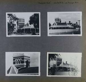
Album - Album page, Fairfield Hall, 225 North Road, Circa 1972
This photograph is part of the Caulfield Historical Album 1972. This album was created in approximately 1972 as part of a project by the Caulfield Historical Society to assist in identifying buildings worthy of preservation. The album is related to a Survey the Caulfield Historical Society developed in collaboration with the National Trust of Australia (Victoria) and Caulfield City Council to identify historic buildings within the City of Caulfield that warranted the protection of a National Trust Classification. Principal photographer thought to be Trevor Hart, member of Caulfield Historical Society. Most photographs were taken between 1966-1972 with a small number of photographs being older and from unknown sources. All photographs are black and white except where stated, with 386 photographs over 198 pages. Glen Eira Heritage Management Plan 1996 by Andrew Ward https://www.gleneira.vic.gov.au/media/4777/heritage_mment_plan_vol_3b.pdf (as of 27/01/2021) - p90 An imposing single storeyed Italianate bi-chromatic brick villa with three staged tower surmounting the entry and facetted corner bay with conical roof. White tuckpointed black body bricks are relieved with reds and stucco work. Gable ends are fretted and there is a concave cast iron verandah to the principal elevations.Victorian Heritage Database (as of 27/10/2020) - HO49 225 North Road Caulfield South https://vhd.heritagecouncil.vic.gov.au/places/42426 "Maniar" (?) is a substantial late Victorian Italianate villa with tower and extensive grounds built for Frederick Curwan, an inspector of the National Bank, in 1890. It is aesthetically and historically important. An imposing single storeyed ltalianate bi-chromatic brick villa with three staged tower surmounting the entry and facetted comer bay with conical roof. White tuckpointed black body bricks are relieved with reds and stucco work. Gable ends are fretted and there is a concave cast iron verandah to the principal elevations. It is aesthetically important as an imposing and substantially intact villa residence demonstrating the changing architectural fashions of the 1890's, evidenced by the use of face brickwork and fretted gables in the Queen Anne manner. It is historically important for the manner in which it demonstrates the lifestyle to which a businessman could aspire during the boom period.Page 150 of Photograph Album with four landscape photographs of Fairfield Hall on North Road.Handwritten: "Fairfield Hall" 225 North Rd cnr Younger Ave [top right] / 150 [bottom right]trevor hart, jenny o'donnell, verandah, porch, tower house, tower, mansion, three storey tower, bichromatic brickwork, fairfield hall, 1890's, george jobbins, conical roofed projecting corner bay, conical roofed bay, timber ceilings, north road, younger avenue, frederick wallis curwan, curwan, italianate, queen anne, australian homestead, arched windows, curved windows, columned parapet, return verandah, fairfield estate, fairfield street, slate roofed, red brick, polychrome bricks, victorian style, cast iron work, caulfield south, maniar, house names -
Whitehorse Historical Society Inc.
Pamphlet, Junction Road, Blackburn North, 1/05/1995
Auction of 'Harwood', 17-21 Junction Road, Blackburn North, 6/5/1995.auctions, harwood, junction road, blackburn north, nos. 17-21 -
Whitehorse Historical Society Inc.
Newspaper - Article, Boronia Road, Vermont, 11/04/1994
7 Boronia Road, Vermont, 'Linford', family home and part of Campbell's Estate subdivisions.boronia road, vermont, campbells estate, cotswold close vermont, linford, auctions -
 Kew Historical Society Inc
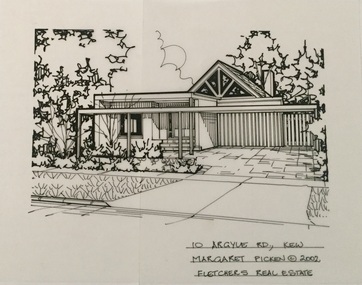
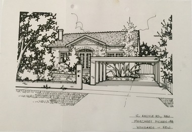
Drawing - Property Illustration, Margaret Picken, 10 Argyle Road, Kew, 2002
After training as a Cartographic Draftsman within the mining industry, I worked as a property illustrator for real estate firms in the eastern suburbs of Melbourne for 23 years from 1983. I initially photographed houses with a Polaroid camera and made a 'thumbnail' sketch while there. The photos were used to scale off a sketch in pencil and then that sketch was overlaid with drafting film and the 'pen and ink' completed. The pens I used were the Rotring ‘Rapidigraph’ drafting pens. The ink was also made by Rotring (German).The film was ‘Rapidraw’, polyester drafting film, double matte. It takes a very fine line and doesn’t bleed. As well as house sketches, there were often floor plans and site plans ordered. Aerial sketches were ordered when the property needed an overall view. (Margaret Picken, 2020)This drawing is one of a series created by Margaret Picken for a range of real estate agents in Melbourne between c.1983 and c.2005. Each work is signed and dated by the artist.Gift of Margaret Picken, 2020Pen and ink drawing on drafting film of 10 Argyle Road, Kew by Margaret Picken.10 ARGYLE RD., KEW / MARGARET PICKEN (c) 2002 / FLETCHERS REAL ESTATEartist -- margaret picken 1950-, architectural drawings -- houses -- kew (vic.), 10 argyle road -- kew (vic) -
 Kew Historical Society Inc
Drawing - Property Illustration, Margaret Picken, 12 Argyle Road, Kew, 1994
After training as a Cartographic Draftsman within the mining industry, I worked as a property illustrator for real estate firms in the eastern suburbs of Melbourne for 23 years from 1983. I initially photographed houses with a Polaroid camera and made a 'thumbnail' sketch while there. The photos were used to scale off a sketch in pencil and then that sketch was overlaid with drafting film and the 'pen and ink' completed. The pens I used were the Rotring ‘Rapidigraph’ drafting pens. The ink was also made by Rotring (German).The film was ‘Rapidraw’, polyester drafting film, double matte. It takes a very fine line and doesn’t bleed. As well as house sketches, there were often floor plans and site plans ordered. Aerial sketches were ordered when the property needed an overall view. (Margaret Picken, 2020)This drawing is one of a series created by Margaret Picken for a range of real estate agents in Melbourne between c.1983 and c.2005. Each work is signed and dated by the artist.Gift of Margaret Picken, 2020Pen and ink drawing on drafting film of 12 Argyle Road, Kew by Margaret Picken.12 ARGYLE RD., KEW / MARARET PICKEN ~94 / WOODARDS KEWartist -- margaret picken 1950-, architectural drawings -- houses -- kew (vic.), 12 argyle road -- kew (vic.) -
 Kew Historical Society Inc
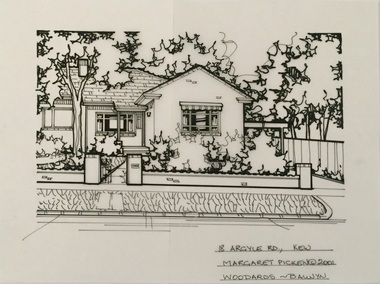
Drawing - Property Illustration, Margaret Picken, 18 Argyle Road, Kew, 2001
After training as a Cartographic Draftsman within the mining industry, I worked as a property illustrator for real estate firms in the eastern suburbs of Melbourne for 23 years from 1983. I initially photographed houses with a Polaroid camera and made a 'thumbnail' sketch while there. The photos were used to scale off a sketch in pencil and then that sketch was overlaid with drafting film and the 'pen and ink' completed. The pens I used were the Rotring ‘Rapidigraph’ drafting pens. The ink was also made by Rotring (German).The film was ‘Rapidraw’, polyester drafting film, double matte. It takes a very fine line and doesn’t bleed. As well as house sketches, there were often floor plans and site plans ordered. Aerial sketches were ordered when the property needed an overall view. (Margaret Picken, 2020)This drawing is one of a series created by Margaret Picken for a range of real estate agents in Melbourne between c.1983 and c.2005. Each work is signed and dated by the artist.Gift of Margaret Picken, 2020Pen and ink drawing on drafting film of 18 Argyle Road, Kew by Margaret Picken.18 ARGYLE RD., KEW / MARARET PICKEN (c) 2001 / WOODARDS ~ BALWYNartist -- margaret picken 1950-, architectural drawings -- houses -- kew (vic.), 18 argyle road -- kew (vic.)