Showing 4551 items matching "historical map"
-
 Bendigo Historical Society Inc.
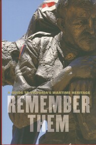
Book - REMEMBER THEM, 2009
Rember Them a guide to Victorias's wartime heritage, a 308 page hardcover book containing photographs in colour & black & white and maps. Funded by the Government of Victoria and produced by the Veteran's unit, Dept of Planning and Community Development. Published by Hardie Grant Books Prahran.Government of Victoriabook, wartime heritage, victoria's wartime heritage, war memorials. -
 Bendigo Historical Society Inc.
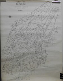
Map - JACK FLYNN COLLECTION: BENDIGO, Revised 1/01/1961
Map: Bendigo city, it has City of Bendigo Planning Scheme as the title. Showing the city within the Municipal Boundaries, also has contour lines and the Major Gullies. Revised 1.1.1962.map, bendigo, city streets, bendigo planning scheme -
 Bendigo Historical Society Inc.
Map - JACK FLYNN COLLECTION: COHUNA, 1963
Map: Photocopy of parish plan showing Cohuna and a portion of the Gunbower Creek.By Authority. A.C. Brooks Government Printer, Melbourne. Drawn and Reproduced at the Department of Lands and Survey, Melbourne.1963.map, gunbower, parish plan, cohuna , gunbower creek -
 Bendigo Historical Society Inc.
Map - JACK FLYNN COLLECTION: BET BET, 18/08/1931
Map: Parish of Bet Bet, Counties of Gladstone and Talbot . Parish plan.By Authority H.J. Green Govt, Printer. Photo Lithographed at the Department of Lands and Survey, Melbourne. 18.8.31map, gladstone, parish plan, bet bet, counties of gladstone and talbot. -
 Bendigo Historical Society Inc.
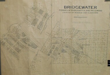
Map - JACK FLYNN COLLECTION: BRIDGEWATER, 10/09/1931
Map: Bridgewater, Parishes of Bridgewater and Inglewood, Counties of Bendigo and Gladstone. Parish plan.map, bendigo, parish plan, bridgewater inglewood -
 Bendigo Historical Society Inc.
Map - JACK FLYNN COLLECTION: KARA KARA, 1932
Map: County of Kara Kara, map sheet showing the whole of the County of Kara Kara and all of the Parishes within. Scale 2 miles to 1 inch.By Authority: W.M. Houston, Government Printer Melbourne. Department of Lands and Survey, Melbourne, 1958map, kara kara, county, kara kara -
 Bendigo Historical Society Inc.
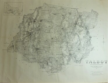
Map - JACK FLYNN COLLECTION: TALBOT, 1937
Map: County of Talbot, map sheet showing the whole of the County of Talbot and all of the Parishes within. Scale 2 Miles to 1 inch.By Authority: A.C. Brooks, Government Printer, Melbourne. Department of Lands and Survey Melbourne. 1959map, talbot, county, talbot -
 Bendigo Historical Society Inc.
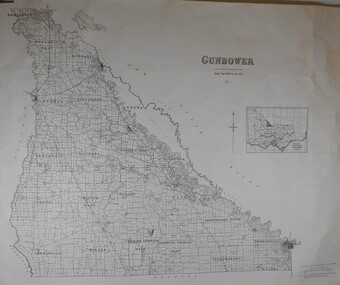
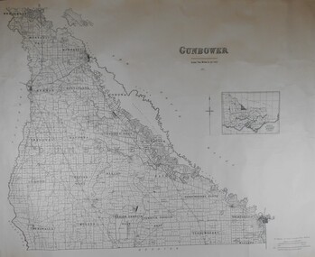
Map - JACK FLYNN COLLECTION: GUNBOWER, 1935
Map: County of Gunbower, map sheet showing the whole of the County of Gunbower and all of the Parishes within.map, gunbower, county, gunbower -
 Bendigo Historical Society Inc.
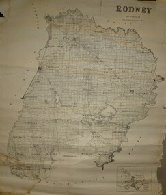
Map - JACK FLYNN COLLECTION: RODNEY, Revised in 1935
Map: County of Rodney, map sheet showing the whole of the County of Rodney and all of the Parishes within.Drawn at the Department of Lands and Survey, Melbourne. Revised to 1935map, rodney, parish plan, rodney -
 Bendigo Historical Society Inc.
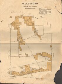
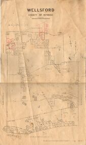
Map - JACK FLYNN COLLECTION: WELLSFORD, 15/12/1941
Map: Parish of Wellsford, County of Bendigo. Parish plan. 2 copies of the same plan.map, bendigo, parish plan, wellsford -
 Bendigo Historical Society Inc.
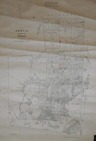
Map - JACK FLYNN COLLECTION: HUNTLY, August 1954
Map: Parish of Huntly, County of Bendigo. Parish plan.By Authority W.M. Houston, Government Printer. Drawn and Reproduced at the Dept, of Lands and Survey, Melbourne, Victoria. August 1954.map, bendigo, parish plan, huntly -
 Bendigo Historical Society Inc.
Map - JACK FLYNN COLLECTION: WELLSFORD, 2/11/1914
Map: Parish of Wellsford, County of Bendigo. Parish plan.Photo-Lithographed at the Department of Lands and Survey Melbourne By H.J. Butson. 2-.11.14map, bendigo, parish plan, wellsford -
 Bendigo Historical Society Inc.
Map - JACK FLYNN COLLECTION: GOORNONG, August 1953
Map: Township of Goornong, Parish of Goornong, County of Bendigo. Parish plan.By Authority W.M. Houston. Government Printer. Drawn and Reproduced at the Dept., of Lands and Survey, Melbourne, Victoria. August 1953map, bendigo, township, goornong -
 Bendigo Historical Society Inc.
Map - JACK FLYNN COLLECTION: HUNTLY, 12.03.1932
Map: Township of Huntly, Parish of Huntly , County of Bendigo. Parish plan. Western and South Riding Division on Main St. (Main Northern Highway) - written in ink below name of map.BY Authority H.J. Green. Photo-Lithographed at the Dept., of Lands and Survey, Melbourne. 12.3.32map, bendigo, township, huntly -
 Bendigo Historical Society Inc.
Map - JACK FLYNN COLLECTION: COUNTY OF GLADSTONE, 1934
Map: County of Gladstone, map sheet showing the whole of the County and the Parishes within. Scale 2 Miles to 1 inch.Engraved at the Department of Lands and Survey Melbourne. 1958. By Authority of W.M. Houston, Government Printermap, gladstone, parish plan, gladstone -
 Bendigo Historical Society Inc.
Map - JACK FLYNN COLLECTION: COUNTY OF GUNBOWER, 1935
Map; County of Gunbower. Sheet containing the whole of the County, showing parishes within. Scale 2 Miles to 1 inch.map, gunbower, parish plan, gunbower -
 Bendigo Historical Society Inc.
Map - JACK FLYNN COLLECTION: YARRAYNE, 6/01/1932
Map: Parish of Yarrayne, County of Bendigo. Parish plan.By Authority, H.J. Green, Govt., Printer. Photo-Lithographed at the Department of Lands and Survey, Melbourne. 5.1.32.map, bendigo, parish plan, yarrayne -
 Bendigo Historical Society Inc.
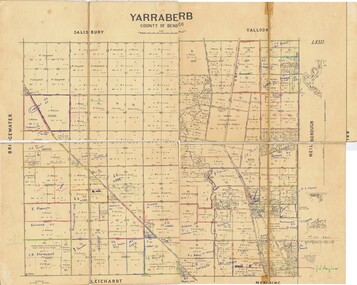
Map - JACK FLYNN COLLECTION: YARRABERB, NO date visible
Map: Parish of Yarraberb, County of Bendigo. Parish plan.By Authority H.J. Green. Govt., Printer.map, bendigo, parish plan, yarraberb -
 Bendigo Historical Society Inc.
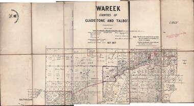
Map - JACK FLYNN COLLECTION: WAREEK, Examined 1918
Map: L.1053. Parish of Wareek, Counties of Gladstone and Talbot. Parish plan. Looks like half of the sheet is missing.Second Issue. Examined by S.F. Green. July 1918. William J. Swan, Draughtsman, August 1884. Photo-Lithographic Fac-Simile, W 36.map, gladstone, parish plan, wareek -
 Bendigo Historical Society Inc.
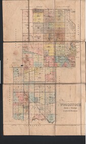
Map - JACK FLYNN COLLECTION: WOODSTOCK, 27/03/75
Map: Parish of Woodstock , County of Bendigo. Parish plan.Photo-Lithographed at the Department of Lands and Survey Melbourne by J. Noone. 27.3.79map, bendigo, parish plan, woodstock -
 Bendigo Historical Society Inc.
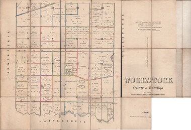
Map - JACK FLYNN COLLECTION: WOODSTOCK, 4/07/1935
Map: Parish of Woodstock, County of Bendigo. Parish plan.By Authority H.J. Green. Govt Printer. Drawn and Reproduced at the Dept of Lands and Survey, Melbourne Victoria. 4.7.35map, bendigo, parish plan, woodstock -
 Bendigo Historical Society Inc.
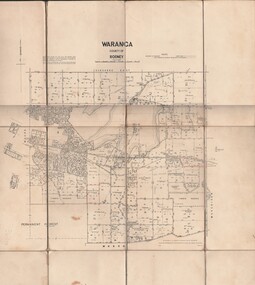
Map - JACK FLYNN COLLECTION: WARANGA, 1959
Map: Parish of Waranga, County of Rodney. Parish plan.By Authority. A.C. Brooks. Government Printer Melbourne. Drawn and Reproduced at the Department of lands and survey. Melbourne 1959.map, rodney, parish plan, waranga -
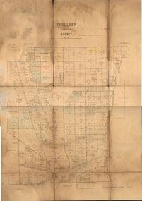 Bendigo Historical Society Inc.
Map - JACK FLYNN COLLECTION: TOOLLEEN, 25/05.1926
Map: Parish of Toolleen, County of Rodney. Parish plan.By Authority, H.J. Green. Govt., Printer. Photo-Lithographed at the Department of Lands and Survey Melbourne. W. J. Butson 25.5.26.map, rodney, parish plan, toolleen -
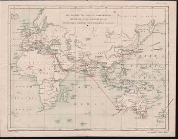 Bendigo Historical Society Inc.
Document - KELLY AND ALLSOP COLLECTION: MAP OF P & O SHIPPING ROUTES
Document. KELLY & ALLSOP COLLECTION. Map of Europe, Africa and Asia showing the shipping routes of the Peninsular & Oriental Steam Navigation Co. Routes highlighted in red. Produced by Nissen & Arnold, Fenchurch St., London. Date estimated as early 20th century.Nissen & Arnoldbusiness, stockbroker, kelly & allsop, kelly & allsop collection, p & o map, shipping routes, nissen & arnold. -
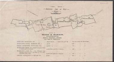 Bendigo Historical Society Inc.
Document - KELLY AND ALLSOP COLLECTION: HUSTLERS LINE OF REEF MAP, 30/07/1891
Document. KELLY & ALLSOP COLLECTION. Map of the Hustlers Line of Reef, Bendigo (South portion). Issued by Wood & McNair, Sharebrokers, Beehive Chambers, Bendigo and High St., Eaglehawk. Mines shown on map are Fortuna Hustler's Co., Hustler's Royal Reserve No.2, Great Extended Hustlers Co., Hustlers Reef Co., Hustler's Reef No.1 Co., United Hustler's & Redan Co. Number of shares is listed against each of these mines.Wood & McNairbusiness, stockbroker, kelly & allsop, kelly & allsop collection, hustlers line of reef map, wood & mcnair. -
 Bendigo Historical Society Inc.
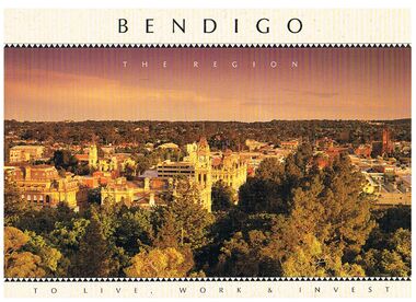
Book - BENDIGO - THE REGION TO LIVE, WORK & INVEST
Pale yellow 12 page book titled 'Bendigo the Region to Live Work & Invest'. On the front cover is a scenic view of Bendigo and on the back cover a picture of some quartz and gold nuggets on a green background. Sections in the book are: Live Work & Invest, Lifestyle, Access, Community, Infrastructure, Labour Force, Business, Opportunity, Successes and Information. Each page has a colour picture, they are:- Hargreaves Mall, Eaglehawk Golf Course, Map of Victoria, La Trobe University, Big Hill, Regional Office Department of Planning & Development, Sandhurst Farms, Construction Activity, Products of the Region, Dr. Ian Macbean, Mr Evan Jones and the Capital Theatre with information on each.book, bendigo, bendigo, bendigo - the region to live, work & invest, bendigo regional development board, dr ian macbean, mr evan jones, kate mildren, richard gibbs, express printers, hargreaves mall, eaglehawk golf course, map of victoria, la trobe university, big hill, regional office department of planning & development, sandhurst farms, construction activity, products of the region, capital theatre -
 Bendigo Historical Society Inc.
Map - KANGAROO FLAT SUBDIVISION, 26/11/1900
Map: Plan of Subdivision at Kangaroo flat, Parish of Sandhurst, County of Bendigo ( number 149 in Map Cupboard 1)map, bendigo, parish plan, kangaroo flat, parish of sandhurst, county of bendigo -
Bendigo Historical Society Inc.
Map - KANGAROO FLAT, 27/.01/1932
Map: Township of Kangaroo Flat, Parish of Sandhurst, County of Bendigo ( number 148 in Map Cupboard 1)map, bendigo, township, kangaroo flat, parish of sandhurst, county of bendigo -
Bendigo Historical Society Inc.
Map - PART PARISHES OF MANDURANG AND SANDHURST, No date visible
Map: Section of Parish plan of Bendigo covering Mandurang, Diamond Hill, and Quarry Hill, ( number 147 in Map Cupboard 1).Map 11map, bendigo, city streets, parish of mandurang, parish of sandhurst, diamond hill , quarry hill -
Bendigo Historical Society Inc.
Map - PART PARISHES OF MARONG AND LOCKWOOD, No date visible
Map: Section of Parish plan of Bendigo, covering Kangaroo Flat, Golden Square, and Specimen Hill ( number 146 in Map Cupboard 1)Map 10map, bendigo, city streets, parish of marong, parish of lockwood, kangaroo flat, golden square, specimen hill