Showing 11095 items matching "society records"
-
 Bendigo Historical Society Inc.
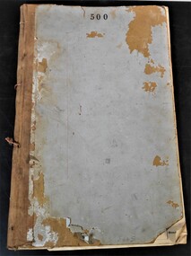
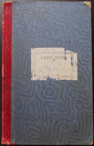
Administrative record - Dividend payments ledger
... Society Inc. History House 11 Mackenzie Street Bendigo goldfields Money order Ledger The Bank of Victoria Foolscap ledger. Used and unused receipts for dividend and other various money orders. Filled with names of clients and reasons for payments. Board front and back cover, cloth spine, paper inside, printed and handwritten. Dates: 1888- 1890. Only location mentioned is Melbourne. Administrative record ...Foolscap ledger. Used and unused receipts for dividend and other various money orders. Filled with names of clients and reasons for payments. Board front and back cover, cloth spine, paper inside, printed and handwritten. Dates: 1888- 1890. Only location mentioned is Melbourne. money order, ledger, the bank of victoria -
 Bendigo Historical Society Inc.
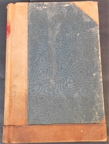
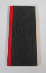
Administrative record - Loan Ledger
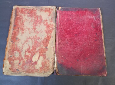
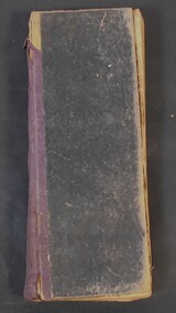
... Society Inc. History House 11 Mackenzie Street Bendigo goldfields loans ledger finance Larger loan ledger book, covered by a thick board cover and back, with a layer of possibly embossed silk, bound by thick material possibly leather. Paper inside, 402 pages are indicated, not all written in. Ledger filled with first, alphabetical names and notes, then the rest (139 pages) are records ...Larger loan ledger book, covered by a thick board cover and back, with a layer of possibly embossed silk, bound by thick material possibly leather. Paper inside, 402 pages are indicated, not all written in. Ledger filled with first, alphabetical names and notes, then the rest (139 pages) are records for loans and payments for clients, including full names, dates and financial details of clients. Spine says: Loan Register. 6 loose pieces of paper of various financial notes, other loose papers attached by paper clip. Dates: 1900 - 1969loans, ledger, finance -
 Bendigo Historical Society Inc.
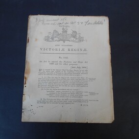
Legal record - Abbott collection: Factories and shops act 1896
... Society Inc. History House 11 Mackenzie Street Bendigo goldfields Act of Parliament Factories and Shops act 1896 Writing in pencil of the front: 8 points (?) numbered 1 to 8 leaves not cat. as numbers 3 and 7 are alike Twenty five pages booklet. On the front page under the coat of arms of Victoria the words: Anno Sexagesimo Victoriae Reginae. No. 1445 An act to amend the Factories and Shops Act 1890 and for other purposes, 28th July, 1896 Legal record ...Twenty five pages booklet. On the front page under the coat of arms of Victoria the words: Anno Sexagesimo Victoriae Reginae. No. 1445 An act to amend the Factories and Shops Act 1890 and for other purposes, 28th July, 1896Writing in pencil of the front: 8 points (?) numbered 1 to 8 leaves not cat. as numbers 3 and 7 are alikeact of parliament, factories and shops act, 1896 -
 Bendigo Historical Society Inc.
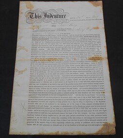
Financial record - Abbott collection: Indenture from 1889
... Society Inc. History House 11 Mackenzie Street Bendigo goldfields Indenture Financial record 1889 Indenture made the 29th day of April, 1889 between James Craig of Newport and Henry Griffiths of Coppin Street Richmond. ...Indenture made the 29th day of April, 1889 between James Craig of Newport and Henry Griffiths of Coppin Street Richmond. indenture, financial record, 1889 -
 Bendigo Historical Society Inc.
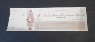
Financial record - Abbott Collection: blank check
... Society Inc. History House 11 Mackenzie Street Bendigo goldfields Financial record The Australian & European Bank One blank check and stub. ...One blank check and stub. The check is from the Australian & European Bank Limited.financial record, the australian & european bank -
 Bendigo Historical Society Inc.
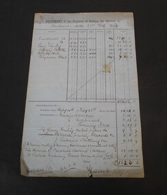
Financial record - Abbott Collection: Statement of the expenses of holding the election for Sandhurst
... Society Inc. History House 11 Mackenzie Street Bendigo goldfields State election 1883 Sandhurst Two pages statement of the expenses of holding the election for Sandhurst on the 22nd of February,1883. On the first page break down of the expenses by division: Sandhurst A, Sandhurst B, Long Gully, Spring Creek, White Hills, Elysian Flat. The second page gives the expenses by candidate: Burrowes, Clark, Perry, Quick, White. On the back of the second page in red pencil the words: final result of poll. Financial record ...Two pages statement of the expenses of holding the election for Sandhurst on the 22nd of February,1883. On the first page break down of the expenses by division: Sandhurst A, Sandhurst B, Long Gully, Spring Creek, White Hills, Elysian Flat. The second page gives the expenses by candidate: Burrowes, Clark, Perry, Quick, White. On the back of the second page in red pencil the words: final result of poll.state election, 1883, sandhurst -
 Bendigo Historical Society Inc.
Administrative record - Abbott collection: letter book
... Society Inc. History House 11 Mackenzie Street Bendigo goldfields Business Letters Abbott Hardcover book with blue front cover and brown spine. On the spine a red square with gold letters "Letter Book''. The book has an alphabetical index at the beginning without any entry. Five hundred pages of very thin paper complete the book, only four pages have writing with letters dated 1898 and 1899. The letters are from Mr. Abbott relating to business orders. Administrative record ...Hardcover book with blue front cover and brown spine. On the spine a red square with gold letters "Letter Book''. The book has an alphabetical index at the beginning without any entry. Five hundred pages of very thin paper complete the book, only four pages have writing with letters dated 1898 and 1899. The letters are from Mr. Abbott relating to business orders.business, letters, abbott -
 Bendigo Historical Society Inc.
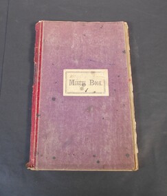
Administrative record - Abbott Collection: Wages book
... Society Inc. History House 11 Mackenzie Street Bendigo goldfields Wages book Business One hundred eighty-five page wages book. Maroon cover, on the front white sticker: Minute book with the word minute cancelled and Wages in pencil over it. The book gives details of the wages paid in date order covering the years 1899 to 1901. Names mentioned in the book are: Wittmann, Hargreaves, Moran, Pieper, Cooper, Abbott, Tattersall, Frawley. Administrative record ...One hundred eighty-five page wages book. Maroon cover, on the front white sticker: Minute book with the word minute cancelled and Wages in pencil over it. The book gives details of the wages paid in date order covering the years 1899 to 1901. Names mentioned in the book are: Wittmann, Hargreaves, Moran, Pieper, Cooper, Abbott, Tattersall, Frawley.wages book, business -
 Bendigo Historical Society Inc.
Administrative record - Abbott Collection: records of purchases
... Society Inc. History House 11 Mackenzie Street Bendigo goldfields Business Mining Comanies 1900/1901 Abbott Twenty-one pages of handwritten records of merchandise supplied by Abbott Co. to various mining companies. ...Twenty-one pages of handwritten records of merchandise supplied by Abbott Co. to various mining companies. The records are from 1900 and 1901. Items mentioned: gelignite, candles fuses, iron.business, mining comanies, 1900/1901, abbott -
 Bendigo Historical Society Inc.
Administrative record - Abbott Collection: account books
... Society Inc. History House 11 Mackenzie Street Bendigo goldfields Bendigo businesses Abbott Account book Two index books listing the name of clients of Abbott Co. in alphabetical order. The names of individuals and companies are followed by various amounts. These accounts books don't have dates on. Administrative record ...Two index books listing the name of clients of Abbott Co. in alphabetical order. The names of individuals and companies are followed by various amounts. These accounts books don't have dates on.bendigo businesses, abbott, account book -
 Bendigo Historical Society Inc.
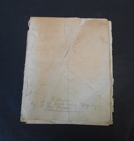
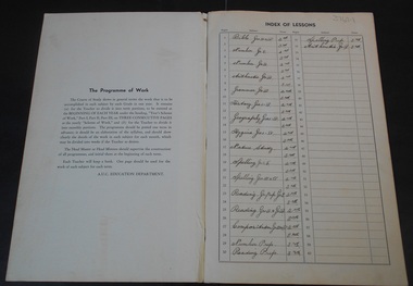
Document - Seventh Day Adventist Collection: School Record 1943
... Society Inc. History House 11 Mackenzie Street Bendigo goldfields Education Seventh Day Adventist Church 1943 Term and Monthly Programme of Work, Prep. Grades 1-3. Teacher - V. Mobbs. Red hard cover with red tape on spine. 60 numbered pages inside, content information written in ink. Document Seventh Day Adventist Collection: School Record ...1943 Term and Monthly Programme of Work, Prep. Grades 1-3. Teacher - V. Mobbs. Red hard cover with red tape on spine. 60 numbered pages inside, content information written in ink. education, seventh day adventist church -
 Bendigo Historical Society Inc.
Administrative record - Abbott Collection: Inventory book
... Society Inc. History House 11 Mackenzie Street Bendigo goldfields Business Inventory Blue and brown index book. Listings of the various items on stock are under the appropriate letter. Administrative record ...Blue and brown index book. Listings of the various items on stock are under the appropriate letter.business, inventory -
 Bendigo Historical Society Inc.
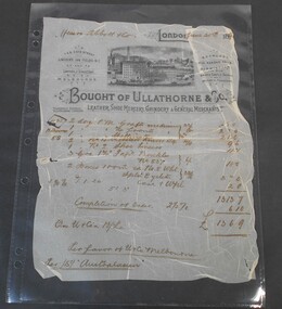
Financial record - Abbott Collection: Invoice
... Society Inc. History House 11 Mackenzie Street Bendigo goldfields Invoice Abbott Business An invoice from Ullathorne & Co. leather, shoe mercery, grindery & general merchants dated June 30th 189? issued to Messrs. Abbott & Co. for a total of 13 pounds 6 shillings 9 pennies. Financial record ...An invoice from Ullathorne & Co. leather, shoe mercery, grindery & general merchants dated June 30th 189? issued to Messrs. Abbott & Co. for a total of 13 pounds 6 shillings 9 pennies.invoice, abbott, business -
 Bendigo Historical Society Inc.
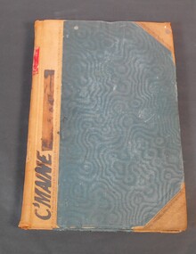
Administrative record - Reports of sales by auction
... Society Inc. History House 11 Mackenzie Street Bendigo goldfields Land Sales Crown land Auctions 11/1/1893 to 12/03/06 written on the spine. Land sale reports 1880 written on inside cover. Blue book with brown corners and spine, red label on spine with the title in gold letters "Reports of sales by auction". Letter "C" on spine. C'Maine on front cover. The book contains official Crown land sales documents, the papers are glued into the book. The book contains the purchasers' names, land section, allotments and price. Cover the period from 1893 to 1905. Administrative record ...Blue book with brown corners and spine, red label on spine with the title in gold letters "Reports of sales by auction". Letter "C" on spine. C'Maine on front cover. The book contains official Crown land sales documents, the papers are glued into the book. The book contains the purchasers' names, land section, allotments and price. Cover the period from 1893 to 1905.11/1/1893 to 12/03/06 written on the spine. Land sale reports 1880 written on inside cover. land sales, crown land, auctions -
 Bendigo Historical Society Inc.
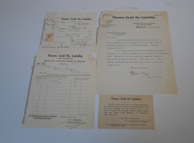
Financial record - Kelly and Allsop collection: Thomo Gold company
... Society Inc. History House 11 Mackenzie Street Bendigo goldfields Shares Gold company Thomo Gold A letter dated 2nd June 1925, addressed to Messrs. Allsop & Co, acknowledging receipt of cheque in payment of call on shares registered in the name of M. Kelly. The letter is signed by the manager of Thomo Gold No Liability. A receipt is attached to the letter. Two more receipts are included one dated 28th April 1925, the other 5th May 1925 A notice given that a call of 3 pounds per share has been made by the board of Thomo Gold is also included. Financial record ...A letter dated 2nd June 1925, addressed to Messrs. Allsop & Co, acknowledging receipt of cheque in payment of call on shares registered in the name of M. Kelly. The letter is signed by the manager of Thomo Gold No Liability. A receipt is attached to the letter. Two more receipts are included one dated 28th April 1925, the other 5th May 1925 A notice given that a call of 3 pounds per share has been made by the board of Thomo Gold is also included.shares, gold company, thomo gold -
 Bendigo Historical Society Inc.
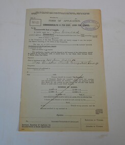
Financial record - Kelly and Allsop collection: application for loan
... Society Inc. History House 11 Mackenzie Street Bendigo goldfields Application form Commonwealth Loan Michael Kelly Application form for Commonwealth 6 per cent loan for states. The sum of two hundred pounds of inscribed stock of the Commonwealth 6 per cent loan has been applied for by Mrs. Jane Adler of 123 Gladstone Street Quarry Hill. The stamp of Michael Kelly, Bendigo at top right. Financial record ...Application form for Commonwealth 6 per cent loan for states. The sum of two hundred pounds of inscribed stock of the Commonwealth 6 per cent loan has been applied for by Mrs. Jane Adler of 123 Gladstone Street Quarry Hill. The stamp of Michael Kelly, Bendigo at top right.application form, commonwealth loan, michael kelly -
 Bendigo Historical Society Inc.
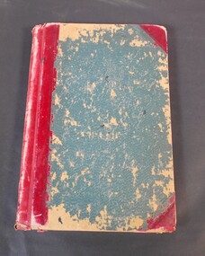
Administrative record - Truscott collection: grocer's day book
... Society Inc. History House 11 Mackenzie Street Bendigo goldfields Business Grocer Book with black cover and red spine. It is a grocer's daybook listing of produce sold. Only the first twenty-seven pages are filled in and it covers the period from January 12th, 1920, to June 30th, 1920. Administrative record ...Book with black cover and red spine. It is a grocer's daybook listing of produce sold. Only the first twenty-seven pages are filled in and it covers the period from January 12th, 1920, to June 30th, 1920.business, grocer -
 Bendigo Historical Society Inc.
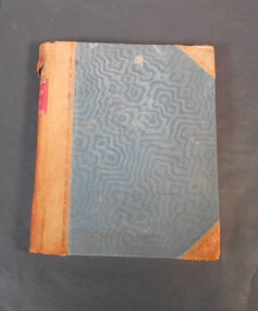
Administrative record - Mallee Index
... Society Inc. History House 11 Mackenzie Street Bendigo goldfields Ledger name index Mallee Mallee index on the spine Blue and red Index book. The book contains list of names in alphabetical order, next to the names a series of numbers. Possibly relating to land sales. Date unknown. Administrative record ...Blue and red Index book. The book contains list of names in alphabetical order, next to the names a series of numbers. Possibly relating to land sales. Date unknown. Mallee index on the spineledger, name index, mallee -
 Bendigo Historical Society Inc.
Administrative record - Land Act 1901, no. 1749
... Society Inc. History House 11 Mackenzie Street Bendigo goldfields Legislation Land Act 1901 Government On the front and back cover in pen and pencil lists of land sales. On the first page in red "Land Office Bendigo" Brown, beige book titled: Land Act 1901, No. 1749. at the back there are four amendments No. 1831 from 6th April 1903; No. 1957from 30Th November 1904; No 1991from 5th December. 1905 and No. 2228 from 4th January 1910. Administrative record ...Brown, beige book titled: Land Act 1901, No. 1749. at the back there are four amendments No. 1831 from 6th April 1903; No. 1957from 30Th November 1904; No 1991from 5th December. 1905 and No. 2228 from 4th January 1910.On the front and back cover in pen and pencil lists of land sales. On the first page in red "Land Office Bendigo"legislation, land act 1901, government -
 Bendigo Historical Society Inc.
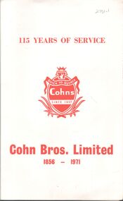
Booklet - Cohn Bros Ltd 115 years of service (1856-1971)
... Society Inc. History House 11 Mackenzie Street Bendigo goldfields Cohn Bros Hotels Bendigo Handwritten inscription inside front cover by Jack Cohn dedicated to Mrs. Bovaird 74-page printed historical record ...74-page printed historical record of growth and development of Cohn Bros Ltd of Bendigo. Entitled '115 years of Service'. Includes 6-page Index insert of hotels, people and businesses. Preface by J.M.Cohn , Managing Director, June 1971Handwritten inscription inside front cover by Jack Cohn dedicated to Mrs. Bovairdcohn bros, hotels, bendigo -
 Bendigo Historical Society Inc.
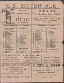
Flyer - Bendigo Football League record
... Society Inc. History House 11 Mackenzie Street Bendigo goldfields Bendigo Football League Hartley's Buckell & Jeffreys Hughan Les Pascoe Robt Howard Double sided Football record for the Bendigo Football League and games to be played on Saturday 7 July 1924, includes adverts for local businesses. ...Double sided Football record for the Bendigo Football League and games to be played on Saturday 7 July 1924, includes adverts for local businesses. B&W printed flyer could be folded on long page axis. South Bendigo V Eaglehawk and Sandhurst v Echuca. bendigo football league, hartley's, buckell & jeffreys, hughan, les pascoe, robt howard -
 Bendigo Historical Society Inc.
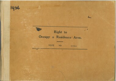
Administrative record - Right to Occupy Certificates, 1936
... Society Inc. History House 11 Mackenzie Street Bendigo goldfields Right to Occupy Central Victoria Some items have pencil and pen marks and ink stains. Twelve books containing stubs of Right to Occupy Certificates for 1936. Includes name and address of person receiving the Right to Occupy certificate and the description of the land including allotment, Section, City, Town, Borough or Township and Parish name. List of record ...Twelve books containing stubs of Right to Occupy Certificates for 1936. Includes name and address of person receiving the Right to Occupy certificate and the description of the land including allotment, Section, City, Town, Borough or Township and Parish name. List of record Numbers in Box 906 Some items have pencil and pen marks and ink stains.right to occupy, central victoria -
 Bendigo Historical Society Inc.
Document - Day Book
... Society Inc. History House 11 Mackenzie Street Bendigo goldfields Company Day Book Efron and Symmans Drapers Tailors This day book dating from September 4th, 1905 to April 7, 1906 is a record of cash transactions for a store in that dealt in clothing items and fabrics. ...This day book dating from September 4th, 1905 to April 7, 1906 is a record of cash transactions for a store in that dealt in clothing items and fabrics. A later day book identifies the business as Efron and Symman, Drapers and Tailers 166 of Mitchell St, Bendigocompany day book, efron and symmans, drapers, tailors -
 Bendigo Historical Society Inc.
Document - Day Book for Efron and Symman Drapers and Tailors
... Society Inc. History House 11 Mackenzie Street Bendigo goldfields Company Day Book Efron and Symmans Drapers Tailors This day book dating from April 9, 1906 to December 7, 1906 is a record of cash transactions for a store in that dealt in clothing items and fabrics. ...This day book dating from April 9, 1906 to December 7, 1906 is a record of cash transactions for a store in that dealt in clothing items and fabrics. A stamp at the rear of the book identifies the business as Efron and Symman, Drapers and Tailers 166 of Mitchell St, Bendigocompany day book, efron and symmans, drapers, tailors -
 Bendigo Historical Society Inc.
Administrative record - Day Book
... Society Inc. History House 11 Mackenzie Street Bendigo goldfields Company Day Book Efron and Symmans Drapers Tailors Day Book for Efron and Symman Drapers and Tailors This day book dating from November 12, 1906 to April 25 , 1907 is a record of cash transactions for a store in that dealt in clothing items and fabrics. ...Day Book for Efron and Symman Drapers and Tailors This day book dating from November 12, 1906 to April 25 , 1907 is a record of cash transactions for a store in that dealt in clothing items and fabrics. A stamp at the rear of a similar book book identifies the business as Efron and Symman, Drapers and Tailers 166 of Mitchell St, Bendigocompany day book, efron and symmans, drapers, tailors -
 Bendigo Historical Society Inc.
Map - Three Road Maps of Bendigo, 1962
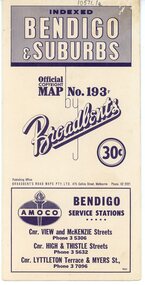
... Society Inc. History House 11 Mackenzie Street Bendigo goldfields George Robert Broadbent (1863-1947), cyclist and map publisher, was born on 3 November 1863 at Ashby near Geelong, Victoria, son of George Adam Broadbent, Lancashire-born draper, and his wife Elizabeth, née Ruffhead. When the family moved to North Melbourne Broadbent attended the Errol Street school, followed his father's trade, and became an early cycling and cycle-racing enthusiast. At various times Broadbent held most Victorian and Australian road records ...George Robert Broadbent (1863-1947), cyclist and map publisher, was born on 3 November 1863 at Ashby near Geelong, Victoria, son of George Adam Broadbent, Lancashire-born draper, and his wife Elizabeth, née Ruffhead. When the family moved to North Melbourne Broadbent attended the Errol Street school, followed his father's trade, and became an early cycling and cycle-racing enthusiast. At various times Broadbent held most Victorian and Australian road records, and two of his performances on solid tyres—203 miles (327 km) in 24 hours on a penny farthing, and 100 miles (161 km) in 6 hours 20 minutes on a 'safety' bicycle—were never bettered. He established records for all distances between 130 and 220 miles (209 and 354 km), and for all times between 8 and 12 hours, at the Exhibition Grounds track in May 1894, and road records for 50 and 100 miles (80 and 161 km) in October 1896. The Australian Cyclist acknowledged him 'the finest road rider that Australia has ever produced'. A foundation councillor of the League of Victorian Wheelmen in October 1893, Broadbent contested the first Warrnambool-Melbourne race in 1895, and was active in the Good Roads Movement. Next year he issued a road map of Victoria, 'prepared … after some sixteen years riding and touring in all parts of the Colony', which indicated general topography, distances, and roads classified as 'good', 'fair' or 'ridden with difficulty'. It was to become Victoria's standard map, and the basis of a continuous publishing programme by Broadbent's Official Road Guides Co.Three Road Maps of Bendigo, Bendigo and Suburbs, Bendigo and Eaglehawk. Two fold out maps printed in colour and produced by Broadbent's Road Maps Pty. Ltd. 475 Collins Street Melbourne. One map printed by Bolton's Bendigo.history, bolton's, bendio broadbent maps -
 Bendigo Historical Society Inc.
Administrative record - Sign
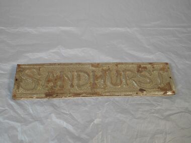
... Society Inc. History House 11 Mackenzie Street Bendigo goldfields Signs Advertising Wooden and metal sign with imprint of SANDHURST put on decorative background. Metal sign attached to a wooden backing. Attached by six screws and two nails. Wooden backing has a cream painted 2 cm border. Administrative record ...Wooden and metal sign with imprint of SANDHURST put on decorative background. Metal sign attached to a wooden backing. Attached by six screws and two nails. Wooden backing has a cream painted 2 cm border.signs, advertising -
 Bendigo Historical Society Inc.
Legal record - Solicitor's Costs Journal
... Society Inc. History House 11 Mackenzie Street Bendigo goldfields Frederick Douglas Jones Solicitor's Cash Book Handwritten entries Frederick Douglas Jones solicitor's Cash journal No 3 - blue light card cover to cash entries (17 July 1914 to 30 June 1926), balance of book unused. Front page entry of F D Jones solicitor's Cash Journal noting "Costs Journal No 3 Fred Douglas Jones, corresponds with Cash Book No 4 and Ledger No 4" Frederick Douglas Jones Collection Legal record ...Frederick Douglas Jones solicitor's Cash journal No 3 - blue light card cover to cash entries (17 July 1914 to 30 June 1926), balance of book unused. Front page entry of F D Jones solicitor's Cash Journal noting "Costs Journal No 3 Fred Douglas Jones, corresponds with Cash Book No 4 and Ledger No 4" Frederick Douglas Jones CollectionHandwritten entriesfrederick douglas jones, solicitor's cash book -
 Bendigo Historical Society Inc.
Legal record - Cash Book
... Society Inc. History House 11 Mackenzie Street Bendigo goldfields F D Jones Solicitor's records Handwritten entries Frederick Douglas Jones solicitor's Cash Book No 5 (8 Sept 1919 to 31 June 1926). ...Frederick Douglas Jones solicitor's Cash Book No 5 (8 Sept 1919 to 31 June 1926). Formal Ledger with dark green shot silk cover over stick card with red bound spine. Book used to page 87 of 93 F D Jones solicitor's Cash Book No 5. Includes loose solicitor's notes / receipts/ debentures / postal order & correspondence (separated and separately stored in pockets). Frederick Douglas Jones CollectionHandwritten entriesf d jones, solicitor's records -
 Bendigo Historical Society Inc.
Financial record - St. Mungo Gold Mining Company
... Society Inc. History House 11 Mackenzie Street Bendigo goldfields St.Mungo Mine Gold Mine Shares receipts Book of shares receipts. The receipts are numbered from 1751 to 2000 only the first four are detached, all are blank. The words on the receipt are: extended St. Mungo Gold Mining Company No-Liability St. Mungo's Reef, Eaglehawk. Registered under the mining companies' act, 1871. Capital: pounds 7,500 in 30,000 shares of five shillings each. Financial record ...Book of shares receipts. The receipts are numbered from 1751 to 2000 only the first four are detached, all are blank. The words on the receipt are: extended St. Mungo Gold Mining Company No-Liability St. Mungo's Reef, Eaglehawk. Registered under the mining companies' act, 1871. Capital: pounds 7,500 in 30,000 shares of five shillings each.st.mungo mine, gold mine, shares receipts