Showing 174304 items matching "nellie-street"
-
 Camberwell Historical Society
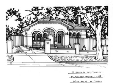
Drawing (series) - Architectural drawing, 5 Stodart Street, Camberwell, 1999
artist, architectural drawings, margaret picken, camberwell, housesartist, architectural drawings, margaret picken, camberwell, houses -
 Camberwell Historical Society
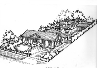
Drawing (series) - Architectural drawing, 10 Stodart Street, Camberwell, Unknown
artist, architectural drawings, margaret picken, camberwell, housesartist, architectural drawings, margaret picken, camberwell, houses -
 Camberwell Historical Society
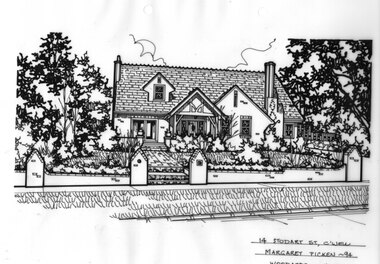
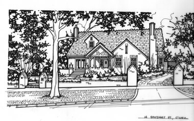
Drawing (series) - Architectural drawing, 14 Stodart Street, Camberwell, 1994
artist, architectural drawings, margaret picken, camberwell, housesartist, architectural drawings, margaret picken, camberwell, houses -
 Camberwell Historical Society
Drawing (series) - Architectural drawing, 14 Stodart Street, Camberwell, Unknown
artist, architectural drawings, margaret picken, camberwell, housesartist, architectural drawings, margaret picken, camberwell, houses -
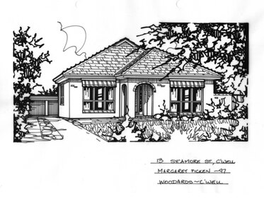 Camberwell Historical Society
Drawing (series) - Architectural drawing, 13 Sycamore Street, Camberwell, 1997
artist, architectural drawings, margaret picken, camberwell, housesartist, architectural drawings, margaret picken, camberwell, houses -
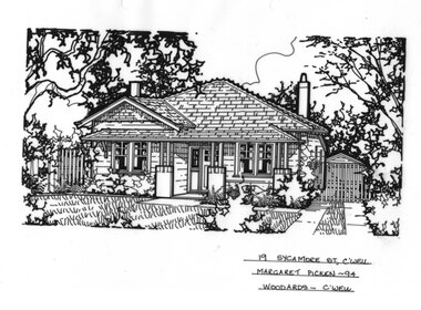 Camberwell Historical Society
Drawing (series) - Architectural drawing, 19 Sycamore Street, Camberwell, 1994
artist, architectural drawings, margaret picken, camberwell, housesartist, architectural drawings, margaret picken, camberwell, houses -
 Camberwell Historical Society
Drawing (series) - Architectural drawing, 33 Sycamore Street, Camberwell, Unknown
artist, architectural drawings, margaret picken, camberwell, housesartist, architectural drawings, margaret picken, camberwell, houses -
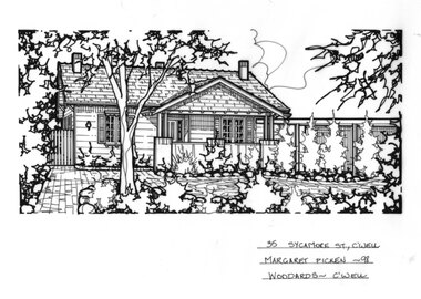 Camberwell Historical Society
Drawing (series) - Architectural drawing, 35 Sycamore Street, Camberwell, 1998
artist, architectural drawings, margaret picken, camberwell, housesartist, architectural drawings, margaret picken, camberwell, houses -
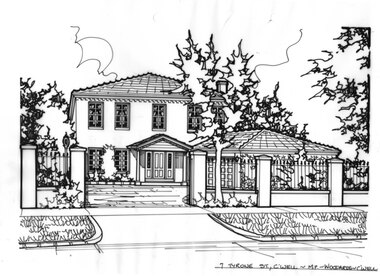 Camberwell Historical Society
Drawing (series) - Architectural drawing, 7 Tyrone Street, Camberwell, Unknown
artist, architectural drawings, margaret picken, camberwell, housesartist, architectural drawings, margaret picken, camberwell, houses -
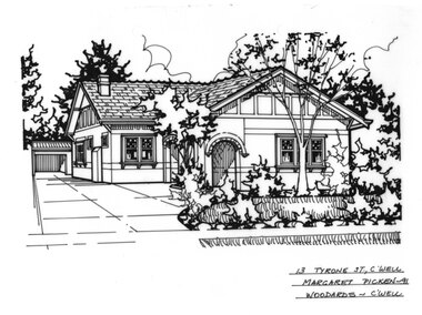 Camberwell Historical Society
Drawing (series) - Architectural drawing, 13 Tyrone Street, Camberwell, 1991
artist, architectural drawings, margaret picken, camberwell, housesartist, architectural drawings, margaret picken, camberwell, houses -
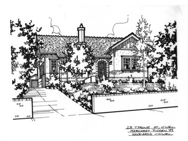 Camberwell Historical Society
Drawing (series) - Architectural drawing, 23 Tyrone Street, Camberwell, 1989
artist, architectural drawings, margaret picken, camberwell, housesartist, architectural drawings, margaret picken, camberwell, houses -
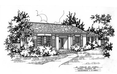 Camberwell Historical Society
Drawing (series) - Architectural drawing, 31 Tyrone Street, Camberwell, 1988
artist, architectural drawings, margaret picken, camberwell, housesartist, architectural drawings, margaret picken, camberwell, houses -
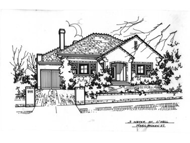 Camberwell Historical Society
Drawing (series) - Architectural drawing, 3 Water Street, Camberwell, 1987
artist, architectural drawings, margaret picken, camberwell, housesartist, architectural drawings, margaret picken, camberwell, houses -
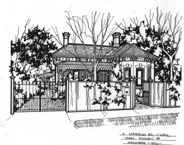 Camberwell Historical Society
Drawing (series) - Architectural drawing, 6 Waterloo Street, Camberwell, 1988
artist, architectural drawings, margaret picken, camberwell, housesartist, architectural drawings, margaret picken, camberwell, houses -
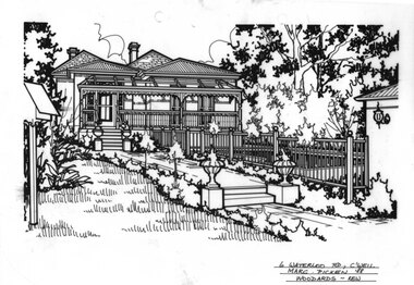 Camberwell Historical Society
Drawing (series) - Architectural drawing, 6 Waterloo Street, Camberwell, 1988
artist, architectural drawings, margaret picken, camberwell, housesartist, architectural drawings, margaret picken, camberwell, houses -
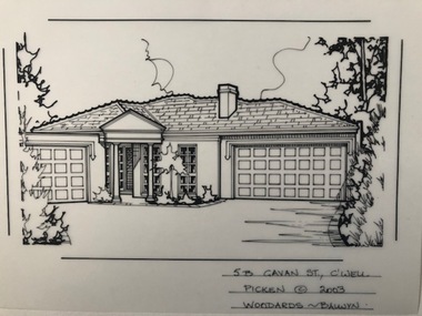 Camberwell Historical Society
Drawing (series) - Architectural drawing, 5B Gavan Street, Camberwell, 2003
artist, architectural drawings, margaret picken, camberwell, housesartist, architectural drawings, margaret picken, camberwell, houses -
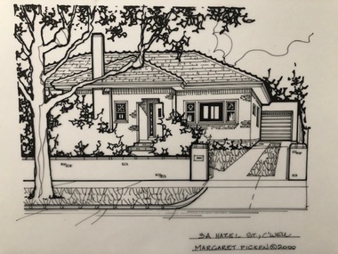 Camberwell Historical Society
Drawing (series) - Architectural drawing, 3A Hazel Street, Camberwell, 2000
artist, architectural drawings, margaret picken, camberwell, housesartist, architectural drawings, margaret picken, camberwell, houses -
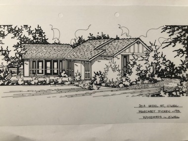 Camberwell Historical Society
Drawing (series) - Architectural drawing, 20A Hazel Street, Camberwell, 1993
artist, architectural drawings, margaret picken, camberwell, housesartist, architectural drawings, margaret picken, camberwell, houses -
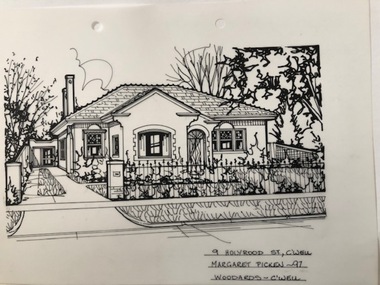 Camberwell Historical Society
Drawing (series) - Architectural drawing, 9 Holyrood Street, Camberwell, 1997
artist, architectural drawings, margaret picken, camberwell, housesartist, architectural drawings, margaret picken, camberwell, houses -
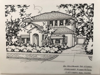 Camberwell Historical Society
Drawing (series) - Architectural drawing, 20 Holyrood Street, Camberwell, 2002
artist, architectural drawings, margaret picken, camberwell, housesartist, architectural drawings, margaret picken, camberwell, houses -
 Camberwell Historical Society
Drawing (series) - Architectural drawing, 21 Holyrood Street, Camberwell, 1987
artist, architectural drawings, margaret picken, camberwell, housesartist, architectural drawings, margaret picken, camberwell, houses -
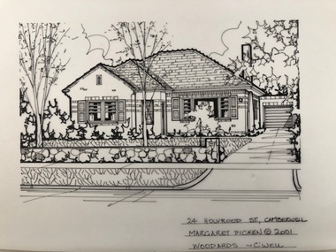 Camberwell Historical Society
Drawing (series) - Architectural drawing, 24 Holyrood Street, Camberwell, 2001
artist, architectural drawings, margaret picken, camberwell, housesartist, architectural drawings, margaret picken, camberwell, houses -
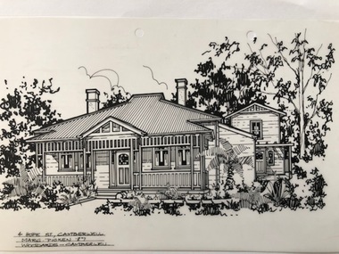 Camberwell Historical Society
Drawing (series) - Architectural drawing, 4 Hope Street, Camberwell, 1987
artist, architectural drawings, margaret picken, camberwell, housesartist, architectural drawings, margaret picken, camberwell, houses -
 Camberwell Historical Society
Drawing (series) - Architectural drawing, 12 Hope Street, Camberwell, 1990
artist, architectural drawings, margaret picken, camberwell, housesartist, architectural drawings, margaret picken, camberwell, houses -
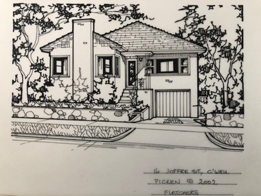 Camberwell Historical Society
Drawing (series) - Architectural drawing, 16 Joffre Street, Camberwell, 2002
artist, architectural drawings, margaret picken, camberwell, housesartist, architectural drawings, margaret picken, camberwell, houses -
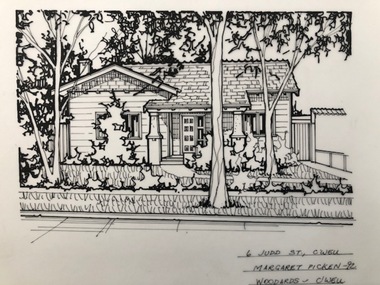 Camberwell Historical Society
Drawing (series) - Architectural drawing, 6 Judd Street, Camberwell, 1992
artist, architectural drawings, margaret picken, camberwell, housesartist, architectural drawings, margaret picken, camberwell, houses -
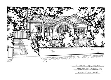 Camberwell Historical Society
Drawing (series) - Architectural drawing, 17 Nevis Street, Camberwell, 1991
artist, architectural drawings, margaret picken, camberwell, housesartist, architectural drawings, margaret picken, camberwell, houses -
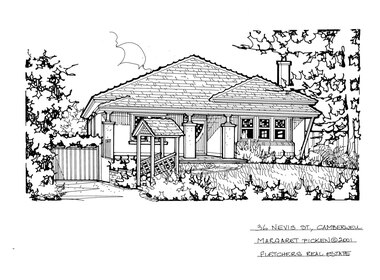 Camberwell Historical Society
Drawing (series) - Architectural drawing, 36 Nevis Street, Camberwell, 2001
artist, architectural drawings, margaret picken, camberwell, housesartist, architectural drawings, margaret picken, camberwell, houses -
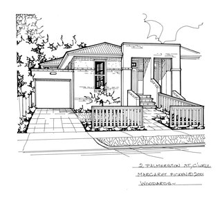 Camberwell Historical Society
Drawing (series) - Architectural drawing, 2 Palmerston Street, Camberwell, 2001
artist, architectural drawings, margaret picken, camberwell, housesartist, architectural drawings, margaret picken, camberwell, houses -
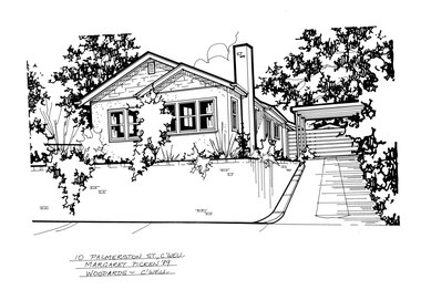 Camberwell Historical Society
Drawing (series) - Architectural drawing, 10 Palmerston Street, Camberwell, 1989
artist, architectural drawings, margaret picken, camberwell, housesartist, architectural drawings, margaret picken, camberwell, houses