Showing 1282 items
matching back creek
-
 Eltham District Historical Society Inc
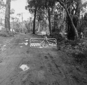
Photograph, Rodda Parade looking towards the creek, 1960. Chapman home to the right, 1960
My Recollections of Eltham Past by Margaret Joy Harding (nee Joy Chapman.) My family of Elizabeth and Alec Chapman moved to Eltham in 1946 into a cottage on the opposite side of the Diamond Creek from where the little train now operates in the Lower Park. At that time Eltham truly was a country town and the Pub was the main meeting place for most inhabitants on a Saturday afternoon in the beer garden. I attended Eltham Primary School where I started as a 4-year-old (my birthday being slightly after the mid-year intake) that happened then. My mother spent a lot of days taking me back to school when I had dismissed myself and walked the one kilomtre home alone. Bremner's Common (now Wingrove Park) was a big attraction with its dam and tad poling which I found much more entertaining than school. (Mrs Bremner ran a Service Station on the site of the current one). Another attraction at this site was the circus that came a couple of times a year. Watching them put up the circus tent was very interesting and even more of an attraction was the feeding of the Lions in cages and the monkeys and elephants among the other animals that are not found in a circus these days. At school then we were provided with hot chocolate at morning recess where the mothers would prepare it in the shelter shed. The only form of classroom heating was an open fire. Worse was the warm milk given in the summer months. By the time I was near finishing at Primary school we used to be able to walk along the Main Road at lunchtime to Mrs. Mitchell's shop to a delicious hot pie. As I recall there was no supervision for this departure from the school grounds. It is interesting that some of the other children I started school with I still have contact with, in fact one is a very good friend although now living in Perth. That is the other thing about Eltham; many who grew up here continue to live in the area. Following primary school, the natural progression was to Eltham High School. There was only the main building at that time and I can remember our first assembly at the front entrance. During the time I was at High School several new class rooms were added and the school hall. I remember the musical plays such as HMS Pinafore and other classical musicals being performed. I also remember countless hours doing marching practice. The main street shops when I was young consisted of the Blue Gum milk bar at the far end, a Grocery store and a shoe maker where Coles currently stands. Opposite there was Lyon's Garage. They also provided a bus service and when we got off the train this little bus would tour the back streets taking each individual to their home, sometimes this could take quite considerable time. There was also a Black Smith next to the Chiropractic Practice opposite Alistair Knox Park, another Milk Bar/General Store on the comer of Bridge Street/Main Road where a shop currently still operates. There was also a Butcher's shop down from the pub opposite Franklin Street. The only doctor was next to the courthouse on the other side of Brougham Street. On Saturday afternoon I was occasionally allowed to go the movies in the Town Hall which also stood on the site of the Coles centre. Often the Fire Alarm would sound and everyone would run outside to watch the fire truck leave with the volunteers clutching on the back. The other attraction during summer of course was the swimming pool which was a small concrete pool filled with water pumped from the Diamond Creek, sometimes it was like a mud puddle so for me the nearer to home Yarra/Diamond Creek junction was a much better option. We swam in the water hole which was quite deep and with fallen trees and sometimes carcasses of cows and kangaroos floating past. As recreation, the churches were another attraction for the Sunday school picnics to Mordialloc in the back of the moving van with benches tied into the back for us to "sit" on. Too bad when we went around a corner! In the early days we had an Ice Man deliver the ice once a week for "refrigeration". The green grocer came around in a horse and cart as did the milkman and the bread was delivered but I constantly got into trouble for eating the middle out on the way from the box it was delivered to in Mt Pleasant road across the paddock. The milkman finally would not come down our street after his horse bolted one morning and took off across the paddock. We also had the "Pan Man" come weekly and whose visit I would avoid. Our nearest shop was where the flower stall is located opposite the Lower Park. It consisted of a Tea Room and Milk Bar. There was a Public Telephone there which was the only contact to anyone else. We were a one car family so my mother’s movements were very limited as the Eltham Station was a couple of kilometres away and a trip to the city was an event. Being an only child growing up was a little lonely however rambling along the creek with my Mum, picking mushrooms and picking cherry plums for jam and the dogs catching rabbits which we ate if we could get them away from the dogs. We also liked to go into the Lower Park during school holidays when the Greek people came to camp and they would sing and dance around the camp fire and it all seemed so different to us as this was early days of immigration. Childhood was relatively simple and carefree and I wish the kids of today had the freedom of my youth and the healthy outdoor lifestyle of the "olden days". SHOW GIRL COMPETITION In 1965 Eltham was more like a country town than the suburb it has become today. People knew each other, if not personally then certainly of the family name. The big event for the year was a Gymkhana or show at Lower Eltham Park. I can remember marching as a teenager from the town centre to the park in the marching girls with the decorated floats. In 1965, just on a whim on the day, I decided to enter the Miss Eltham Show Girl which was a part of the festivities at the park. I seem to remember that the show mainly consisted of horse events, cattle judging and dog show. As I had not given any serious thought to entering the competition, I wore a suit that I had for work which was brown wool, with a coffee coloured shirt under, black shoes, bag, and gloves but no hat. I duly paraded for the judges and much to my surprise I was announced the winner. I eventually went on to compete at the Miss Victoria Show Girl competition which was held at the Royal Melbourne Show. There I met many country girls who were representing their rural Victoria home. I made it into a final round of judging but I think justice prevailed when someone from a country background was crowned. It was fun to go into the show as I had not really been before and to see the displays of handcraft, cooking and wood chopping events was great as well as the judging of farm animals interesting. It is hard to remember the Eltham I grew up in. The Lyons Garage company bus that actually drove you home (or close to it) when we got off the train at night. The Eltham Hotel on a Saturday afternoon a usual social meeting place where people just sat and chatted. The pictures held in the Town Hall and when the fire alarm sounded all the men just jumped up and ran to help. Suburbia has now swallowed most of that life but thankfully we at least do have the trestle bridge and parkland. Digital file only - Black and white photo print on loan for scanning by EDHSalec chapman, annie bremner, blacksmith, bremner's flat, brougham steet, bus services, circus, diamond creek, dianne bell, doctor bradbury, easter gymkhana, elizabeth chapman, eltham high school, eltham hotel, eltham lower park, eltham public hall, eltham state school, eltham trestle bridge, general store, grace mitchell, ice man, joy chapman, lyons garage, margaret harding, milk bar, miss eltham 1965, miss victoria show girl, mount pleasant road, pan man, rodda parade, shops, show girl competition, swimming pool, water hole, yarra river -
 Eltham District Historical Society Inc
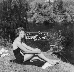
Photograph, Joy Chapman at the river junction, February 1962, Feb 1962
My Recollections of Eltham Past by Margaret Joy Harding (nee Joy Chapman.) My family of Elizabeth and Alec Chapman moved to Eltham in 1946 into a cottage on the opposite side of the Diamond Creek from where the little train now operates in the Lower Park. At that time Eltham truly was a country town and the Pub was the main meeting place for most inhabitants on a Saturday afternoon in the beer garden. I attended Eltham Primary School where I started as a 4-year-old (my birthday being slightly after the mid-year intake) that happened then. My mother spent a lot of days taking me back to school when I had dismissed myself and walked the one kilomtre home alone. Bremner's Common (now Wingrove Park) was a big attraction with its dam and tad poling which I found much more entertaining than school. (Mrs Bremner ran a Service Station on the site of the current one). Another attraction at this site was the circus that came a couple of times a year. Watching them put up the circus tent was very interesting and even more of an attraction was the feeding of the Lions in cages and the monkeys and elephants among the other animals that are not found in a circus these days. At school then we were provided with hot chocolate at morning recess where the mothers would prepare it in the shelter shed. The only form of classroom heating was an open fire. Worse was the warm milk given in the summer months. By the time I was near finishing at Primary school we used to be able to walk along the Main Road at lunchtime to Mrs. Mitchell's shop to a delicious hot pie. As I recall there was no supervision for this departure from the school grounds. It is interesting that some of the other children I started school with I still have contact with, in fact one is a very good friend although now living in Perth. That is the other thing about Eltham; many who grew up here continue to live in the area. Following primary school, the natural progression was to Eltham High School. There was only the main building at that time and I can remember our first assembly at the front entrance. During the time I was at High School several new class rooms were added and the school hall. I remember the musical plays such as HMS Pinafore and other classical musicals being performed. I also remember countless hours doing marching practice. The main street shops when I was young consisted of the Blue Gum milk bar at the far end, a Grocery store and a shoe maker where Coles currently stands. Opposite there was Lyon's Garage. They also provided a bus service and when we got off the train this little bus would tour the back streets taking each individual to their home, sometimes this could take quite considerable time. There was also a Black Smith next to the Chiropractic Practice opposite Alistair Knox Park, another Milk Bar/General Store on the comer of Bridge Street/Main Road where a shop currently still operates. There was also a Butcher's shop down from the pub opposite Franklin Street. The only doctor was next to the courthouse on the other side of Brougham Street. On Saturday afternoon I was occasionally allowed to go the movies in the Town Hall which also stood on the site of the Coles centre. Often the Fire Alarm would sound and everyone would run outside to watch the fire truck leave with the volunteers clutching on the back. The other attraction during summer of course was the swimming pool which was a small concrete pool filled with water pumped from the Diamond Creek, sometimes it was like a mud puddle so for me the nearer to home Yarra/Diamond Creek junction was a much better option. We swam in the water hole which was quite deep and with fallen trees and sometimes carcasses of cows and kangaroos floating past. As recreation, the churches were another attraction for the Sunday school picnics to Mordialloc in the back of the moving van with benches tied into the back for us to "sit" on. Too bad when we went around a corner! In the early days we had an Ice Man deliver the ice once a week for "refrigeration". The green grocer came around in a horse and cart as did the milkman and the bread was delivered but I constantly got into trouble for eating the middle out on the way from the box it was delivered to in Mt Pleasant road across the paddock. The milkman finally would not come down our street after his horse bolted one morning and took off across the paddock. We also had the "Pan Man" come weekly and whose visit I would avoid. Our nearest shop was where the flower stall is located opposite the Lower Park. It consisted of a Tea Room and Milk Bar. There was a Public Telephone there which was the only contact to anyone else. We were a one car family so my mother’s movements were very limited as the Eltham Station was a couple of kilometres away and a trip to the city was an event. Being an only child growing up was a little lonely however rambling along the creek with my Mum, picking mushrooms and picking cherry plums for jam and the dogs catching rabbits which we ate if we could get them away from the dogs. We also liked to go into the Lower Park during school holidays when the Greek people came to camp and they would sing and dance around the camp fire and it all seemed so different to us as this was early days of immigration. Childhood was relatively simple and carefree and I wish the kids of today had the freedom of my youth and the healthy outdoor lifestyle of the "olden days". SHOW GIRL COMPETITION In 1965 Eltham was more like a country town than the suburb it has become today. People knew each other, if not personally then certainly of the family name. The big event for the year was a Gymkhana or show at Lower Eltham Park. I can remember marching as a teenager from the town centre to the park in the marching girls with the decorated floats. In 1965, just on a whim on the day, I decided to enter the Miss Eltham Show Girl which was a part of the festivities at the park. I seem to remember that the show mainly consisted of horse events, cattle judging and dog show. As I had not given any serious thought to entering the competition, I wore a suit that I had for work which was brown wool, with a coffee coloured shirt under, black shoes, bag, and gloves but no hat. I duly paraded for the judges and much to my surprise I was announced the winner. I eventually went on to compete at the Miss Victoria Show Girl competition which was held at the Royal Melbourne Show. There I met many country girls who were representing their rural Victoria home. I made it into a final round of judging but I think justice prevailed when someone from a country background was crowned. It was fun to go into the show as I had not really been before and to see the displays of handcraft, cooking and wood chopping events was great as well as the judging of farm animals interesting. It is hard to remember the Eltham I grew up in. The Lyons Garage company bus that actually drove you home (or close to it) when we got off the train at night. The Eltham Hotel on a Saturday afternoon a usual social meeting place where people just sat and chatted. The pictures held in the Town Hall and when the fire alarm sounded all the men just jumped up and ran to help. Suburbia has now swallowed most of that life but thankfully we at least do have the trestle bridge and parkland. Digital file only - Black and white photo print on loan for scanning by EDHSalec chapman, annie bremner, blacksmith, bremner's flat, brougham steet, bus services, circus, diamond creek, dianne bell, doctor bradbury, easter gymkhana, elizabeth chapman, eltham high school, eltham hotel, eltham lower park, eltham public hall, eltham state school, eltham trestle bridge, general store, grace mitchell, ice man, joy chapman, lyons garage, margaret harding, milk bar, miss eltham 1965, miss victoria show girl, mount pleasant road, pan man, rodda parade, shops, show girl competition, swimming pool, water hole, yarra river -
 Eltham District Historical Society Inc
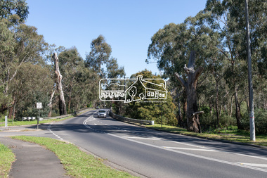
Photograph, Peter Pidgeon, Manna Gum, Main Road Bridge, Eltham South, 8 Sep. 2021
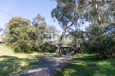
... and Diamond Creek Trail footbridge over the Diamond Creek at Eltham... and Diamond Creek Trail footbridge over the Diamond Creek at Eltham ...This significant tree located near the Main Road Bridge and Diamond Creek Trail footbridge over the Diamond Creek at Eltham dates back to the early 1900s. The original timber bridge over the Diamond Creek was built around 1840. It was destroyed by floodwaters in October 1923. A temporary bridge was rigged up but further damaged in April 1924. A new concrete bridge was built and opened in October 1926. The bridge decking was widened along with Main Road to Dalton Street by the Road Construction Authority in 1984., The uygraded bridge was opened in October 1984, 78 years after its original opening.These trees are not only significant for the natural environment but also present a navigational beacon back in time as the environmental landscape is developed around them.Born Digitaleltham south, main road bridge, manna gum, significant tree, diamond creek trail -
 Eltham District Historical Society Inc
Photograph, Peter Pidgeon, Manna Gum, Main Road Bridge, Eltham South, 8 Sep. 2021
... and Diamond Creek Trail footbridge over the Diamond Creek at Eltham... and Diamond Creek Trail footbridge over the Diamond Creek at Eltham ...This significant tree located near the Main Road Bridge and Diamond Creek Trail footbridge over the Diamond Creek at Eltham dates back to the early 1900s. The original timber bridge over the Diamond Creek was built around 1840. It was destroyed by floodwaters in October 1923. A temporary bridge was rigged up but further damaged in April 1924. A new concrete bridge was built and opened in October 1926. The bridge decking was widened along with Main Road to Dalton Street by the Road Construction Authority in 1984., The uygraded bridge was opened in October 1984, 78 years after its original opening.These trees are not only significant for the natural environment but also present a navigational beacon back in time as the environmental landscape is developed around them.Born Digitaleltham south, main road bridge, manna gum, significant tree, diamond creek trail -
 Eltham District Historical Society Inc
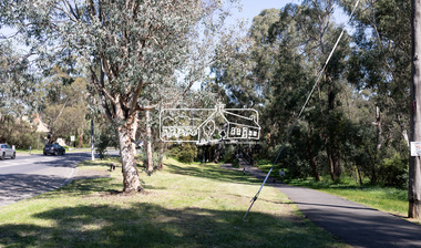
Photograph, Peter Pidgeon, Manna Gums, Main Road Bridge, Eltham South, 8 Sep. 2021
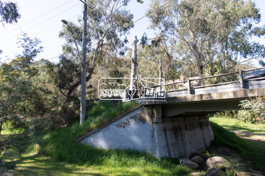
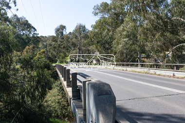
The original timber bridge over the Diamond Creek was built around 1840. It was destroyed by floodwaters in October 1923. A temporary bridge was rigged up but further damaged in April 1924. A new concrete bridge was built and opened in October 1926. The bridge decking was widened along with Main Road to Dalton Street by the Road Construction Authority in 1984., The uygraded bridge was opened in October 1984, 78 years after its original opening.These trees are not only significant for the natural environment but also present a navigational beacon back in time as the environmental landscape is developed around them.Born Digitaleltham south, main road bridge, manna gum, diamond creek trail -
 Eltham District Historical Society Inc
Photograph, Peter Pidgeon, Manna Gums, Main Road Bridge, Eltham South, 8 Sep. 2021
The original timber bridge over the Diamond Creek was built around 1840. It was destroyed by floodwaters in October 1923. A temporary bridge was rigged up but further damaged in April 1924. A new concrete bridge was built and opened in October 1926. The bridge decking was widened along with Main Road to Dalton Street by the Road Construction Authority in 1984., The uygraded bridge was opened in October 1984, 78 years after its original opening.These trees are not only significant for the natural environment but also present a navigational beacon back in time as the environmental landscape is developed around them.Born Digitaleltham south, main road bridge, manna gum, diamond creek trail -
 Eltham District Historical Society Inc
Photograph, Peter Pidgeon, Manna Gum, Main Road Bridge, Eltham South, 8 Sep. 2021
... and Diamond Creek Trail footbridge over the Diamond Creek at Eltham... and Diamond Creek Trail footbridge over the Diamond Creek at Eltham ...This significant tree located near the Main Road Bridge and Diamond Creek Trail footbridge over the Diamond Creek at Eltham dates back to the early 1900s. The original timber bridge over the Diamond Creek was built around 1840. It was destroyed by floodwaters in October 1923. A temporary bridge was rigged up but further damaged in April 1924. A new concrete bridge was built and opened in October 1926. The bridge decking was widened along with Main Road to Dalton Street by the Road Construction Authority in 1984., The uygraded bridge was opened in October 1984, 78 years after its original opening.These trees are not only significant for the natural environment but also present a navigational beacon back in time as the environmental landscape is developed around them.Born Digitaleltham south, main road bridge, manna gum, significant tree, diamond creek trail -
 Eltham District Historical Society Inc
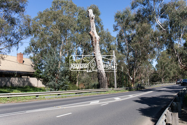
Photograph, Peter Pidgeon, Manna Gum, Main Road Bridge, Eltham South, 8 Sep. 2021
... and Diamond Creek Trail footbridge over the Diamond Creek at Eltham... and Diamond Creek Trail footbridge over the Diamond Creek at Eltham ...This significant tree located near the Main Road Bridge and Diamond Creek Trail footbridge over the Diamond Creek at Eltham dates back to around 1870-1880. The original timber bridge over the Diamond Creek was built around 1840. It was destroyed by floodwaters in October 1923. A temporary bridge was rigged up but further damaged in April 1924. A new concrete bridge was built and opened in October 1926. The bridge decking was widened along with Main Road to Dalton Street by the Road Construction Authority in 1984., The uygraded bridge was opened in October 1984, 78 years after its original opening.These trees are not only significant for the natural environment but also present a navigational beacon back in time as the environmental landscape is developed around them.Born Digitaleltham south, main road bridge, manna gum, significant tree, diamond creek trail -
 Eltham District Historical Society Inc
Photograph, Peter Pidgeon, Manna Gum, Main Road Bridge, Eltham South, 8 Sep. 2021
... and Diamond Creek Trail footbridge over the Diamond Creek at Eltham... and Diamond Creek Trail footbridge over the Diamond Creek at Eltham ...This significant tree located near the Main Road Bridge and Diamond Creek Trail footbridge over the Diamond Creek at Eltham dates back to around 1870-1880. The original timber bridge over the Diamond Creek was built around 1840. It was destroyed by floodwaters in October 1923. A temporary bridge was rigged up but further damaged in April 1924. A new concrete bridge was built and opened in October 1926. The bridge decking was widened along with Main Road to Dalton Street by the Road Construction Authority in 1984., The upgraded bridge was opened in October 1984, 78 years after its original opening.These trees are not only significant for the natural environment but also present a navigational beacon back in time as the environmental landscape is developed around them.Born Digitaleltham south, main road bridge, manna gum, significant tree, diamond creek trail -
 Eltham District Historical Society Inc
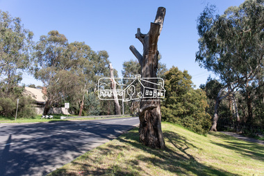
Photograph, Peter Pidgeon, Manna Gum, Main Road, Eltham South, 8 Sep. 2021
... over the Diamond Creek at Eltham dates back to approximately... over the Diamond Creek at Eltham dates back to approximately ...This significant tree located near the Main Road Bridge over the Diamond Creek at Eltham dates back to approximately 1870-1880. Though dead now, its trunk has been left as a wildlife habitat.These trees are not only significant for the natural environment but also present a navigational beacon back in time as the environmental landscape is developed around them.Born Digitaleltham south, main road bridge, manna gum, significant tree -
 Eltham District Historical Society Inc
Photograph, Peter Pidgeon, Manna Gum, Main Road Bridge, Eltham South, 8 Sep. 2021
... over the Diamond Creek at Eltham dates back to approximately... over the Diamond Creek at Eltham dates back to approximately ...This significant tree located near the Main Road Bridge over the Diamond Creek at Eltham dates back to approximately 1870-1880. Though dead now, its trunk has been left as a wildlife habitat. The original timber bridge over the Diamond Creek was built around 1840. It was destroyed by floodwaters in October 1923. A temporary bridge was rigged up but further damaged in April 1924. A new concrete bridge was built and opened in October 1926. The bridge decking was widened along with Main Road to Dalton Street by the Road Construction Authority in 1984., The uygraded bridge was opened in October 1984, 78 years after its original opening.These trees are not only significant for the natural environment but also present a navigational beacon back in time as the environmental landscape is developed around them.Born Digitaleltham south, main road bridge, manna gum, significant tree -
 Eltham District Historical Society Inc
Photograph, Peter Pidgeon, Manna Gum, Main Road Bridge, Eltham South, 8 Sep. 2021
... and Diamond Creek Trail footbridge over the Diamond Creek at Eltham... and Diamond Creek Trail footbridge over the Diamond Creek at Eltham ...This significant tree located near the Main Road Bridge and Diamond Creek Trail footbridge over the Diamond Creek at Eltham dates back to the early 1900s. The original timber bridge over the Diamond Creek was built around 1840. It was destroyed by floodwaters in October 1923. A temporary bridge was rigged up but further damaged in April 1924. A new concrete bridge was built and opened in October 1926. The bridge decking was widened along with Main Road to Dalton Street by the Road Construction Authority in 1984., The uygraded bridge was opened in October 1984, 78 years after its original opening.These trees are not only significant for the natural environment but also present a navigational beacon back in time as the environmental landscape is developed around them.Born Digitaleltham south, main road bridge, manna gum, significant tree, diamond creek trail -
 Eltham District Historical Society Inc
Slide - Photograph, Eltham Town Park, c.May 1988
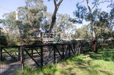
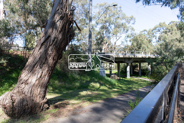
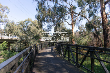
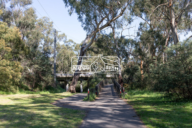
In 1981 the Shire of Eltham Historical Society was asked by the Victorian Place Names Committee to comment on a proposal by the Shire of Eltham to assign names to parklands in Eltham as follows:- "Eltham Common" - the area between the municipal offices, Main Road, the Eltham railway -line, and Panther Place and containing Shillinglaw Cottage. The Shire has advised that this name has been used locally for the site since about 1975. "Alistair Knox Park" - the area bounded by the Eltham railway -line, Panther Place, Main Road, Bridge Street, and Susan Street, and through which flows the Diamond Creek. The area has been known locally as "Eltham Town Park" The proposed name "Alistair Knox Park" had created some local controversy with a number of reversals of the Council's decision and letters to the local paper both for and against the proposal. The society was reluctant to be drawn into this controversy particularly as there were known to be members with strong views both for and against the proposed name. The society appreciated the work done by Alistair Knox both in the formulation of the park concept and in its development but because of the controversy generated by the proposed naming and also because of the wide general use of the park by the public·, the name Eltham Town Park was felt more appropriate. The society noted that there was no outstanding historical associations with the land comprising the park which would warrant naming the park after any particular person, place or event. No objection was raised to the Eltham Common proposal as set-out above. The decision was made in the knowledge that Alistair Knox had been associated with the society over many years and was a prominent figure in the recent history of Eltham. He was regarded as a key figure in the environmental building movement and in particular was renowned for his use of mud bricks as a building material. He served as a councillor of the Shire of Eltham from 1971-1975, his final year as Shire President. It was during these years that the proposals to create the park in its present form were shaped and Alistair played a leading part in the decision to make it a landscaped passive recreational park rather than a sporting area. The parklands comprise a section of the Diamond Creek valley. The creek itself flows through the centre of the area which is overlooked by steep hills on each side. The parks form part of the land purchased from the Crown in 1851 by J.M. Holloway and then subdivided into allotments and called "Little Eltham". While most of the area was subdivided into residential lots the creek valley was subdivided into lots suitable for small farms. Some further subdivision took place over the years and the whole of the parks now comprises eight separate titles. A list of some of the former owners has been compiled but exhaustive research on all owners has not been carried out. The ownership of one parcel has been traced back to when it was purchased from Holloway by John Hicks Petty in 1874, long after it was subdivided. Other families owning land within the area over the years included Lyon, Rees, Clark, Waterfall, Carrucan, Graham, Hill and Morant. The character of the valley area has remained rural while development occurred on each side. Early photos show the area as orchard and grazing land. In 1901 the railway was constructed through the area resulting in the timber trestle bridge across the Diamond Creek. which is an important feature of the park landscape. A memorial obelisk to the Eltham servicemen killed in World War 1 was erected at the south eastern corner of the park. The site is now within the intersection of Main Road and Bridge Street and the memorial was shifted in the 1950s to the Eltham R.S.L. clubrooms. Following the financial failure of the local sub-branch, the memorial obelisk was again relocated to the Eltham War Memorial building precinct in 2011. During the early 1960's the Council started purchasing the land which now comprises the parks. In the late 1960's the area to the east of the Diamond Creek was used as a garbage tip and filled above the flood plain of the creek. When this area was filled the tip was transferred to the west side of the creek. From the early 1970's the area has been progressively developed as a park for passive recreation with ornamental lakes, extensive tree planting and landscaping. The character of the valley before the days of the tip has been recreated and this has earned a Landscape classification from the National Trust, an unusual honour for a man-made landscape. The parks are not only attractive in appearance. The large number of people using them, particularly at weekends and holidays is evidence of their popularity and the foresight and careful planning of local residents, Councillors and Council Staff. 35mm colour positive transparency (1 of 23) Mount - Kodak EktachromeProcess Date MAY 88Meltham, main road, alistair knox park, eltham town park -
 Eltham District Historical Society Inc
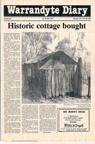
Folder, Warrandyte Miner's Cottage, 1984
Report and photograph about purchase of historically significant slab cottage in Castle Road, Warrandyte. Newspaper also includes articles relating to Jock Macneish and his ultra-light aircraft, construction of foot bridge over Andersons Creek, Mrs Ruth Norman, Warrandyte Co-op, local results of the 1981 census, construction of elderly citizens' flats in Stiggant Street (Warrandyte), South Warrandyte Primary School, Professor's Hill and Warrandyte Football Club. The road guide features advertisments for Inglenook Tea Rooms, Warrandyte, Warrandyte Recreation Reserve Cafe (Mrs C. Miller, Proprietress), Eltham Motor Garage, Plaza Cafe Eltham, Eltham Park Team Rooms, Diamond Creek Garage and Engineering Works and The Dean Guesthouse Strathewen.Complete issue of "Warrandyte Diary" No 145, May 1984 with feature article headed "Historic cottage bought". 12 pages with section cut out of back page. Also includes photocopy of Broadbents Roadguide: central Victoria, 1946 pages 230-231HG Booklet 281981 census, advertisment, andersons creek, castle road, diamond creek garage and engineering works, eltham motor garage, eltham park team rooms, footbridge, harry gilham collection, inglenook tea rooms, jock macneish, mrs c. miller, mrs ruth norman, plaza cafe eltham, professor's hill, senior citizens, south warrandyte primary school, stiggant street, the dean guesthouse strathewen, warrandyte, warrandyte co-op, warrandyte football club, warrandyte recreation reserve cafe, warrandyte slab cottage -
 Eltham District Historical Society Inc
Book, Percy Leason: an artist's life by Margot Tasca, 2016
"Who would have thought that a boy born in 1889 from the Victorian Mallee would become a successful artist on New York’s Staten Island? This finely illustrated, exhaustively researched and beautifully written biography on Leason features the artist’s entire career as a painter and cartoonist renowned for his depictions of Australian society in the 1920s and 1930s. Leason’s story is a poignant one tracing his beginnings as a cartoonist, to the bohemian Melbourne art scene in the early 20th century, to his involvement in the artists’ camps of Eltham, to his important series of portraits of Lake Tyers Indigenous Australians, and his eventual move to the US where he has been acknowledged as making an enormous contribution to the New York arts scene. This story, as yet untold, fills a gap in the history of art in Australia and offers a new perspective on Australian art in the first half of the 20th century." - Thames and Hudson website A NEW HOME IN ELTHAM Once they had settled back into Melbourne, Perry and Belle began to look for a place to make a permanent home. Having enjoyed the bush setting of Mosman, they decided to explore the rural fringes of Melbourne. Each weekend they packed a picnic and travelled to the towns in the nearby hills - such as Ferntree Gully, Sassafras, Lilydale and, of course, Cockatoo Creek. Eventually deciding these places might be a little too far from The Herald office, they searched closer to the city. The Heidelberg and Box Hill regions that had inspired his old teacher McCubbin, had become busy, urban areas but further east, towards Warrandyte and Templestowe, there were still large tracts of bush. Finally they settled on Eltham, an area Percy knew very well, having often painted there with Jock Frater. Perry's old friend Dick McCann and his wife Margery had also settled in Eltham. The township was fifteen miles from Melbourne and serviced by an electric train that went to the central Melbourne station of Flinders Street, near where The Herald offices were located. Eltham was a small village in 1925, separated from Melbourne by the Yarra River, and surrounded by orchards and large tracts of bush. Small farms dotted the landscape and the main businesses revolved around ironmongers, blacksmiths, and farming supplies. Of particular appeal to artists was Eltham Park, a large expanse of bushland bounded by the Yarra River on the south side and the Diamond Creek on the east. The park included a playing field that was busy on weekends with cricket or football matches, but for the rest of the week it was mostly empty and an ideal place to paint. The scenery there provided the inspiration for many paintings by Leason, Meldrum and other artists such as Colin Colahan and Peter (A.E.) Newburv. The Leasons found a rundown old farmhouse on four-and-a-half acres of land in New Street, now known as Lavender Park Road. The site was splendid, at the top of a gentle slope which gave panoramic views east to the Dandenong hills, south over the Templestowe orchards and north to Kinglake. The front lawn was taken over by onion grass (or wiregrass as Leason called it) and scattered about the property were many wattles and gum trees. Aloe cacti covered much to the front of the house, while old quince and lucerne hedges separated the house and out-buildings from a rundown apple orchard. Here they would build a new home. ·with financial assistance from The Herald, Leason bought the property and immediately commissioned an architectural firm to design a new house in the popular bungalow style of the time. The old farm house was demolished but Percy saved the siding boards, bricks and corrugated iron for the outbuildings of his new home. The new house was a two storey, triple brick with a large, gabled, terracotta tiled roof. It was situated at the very top of the slope. The paint and varnish were barely dry when the family moved in during the summer of 1925-26 and the fumes were overpowering in the heat. Despite the house being wired for electricity, power poles had not yet reached the area and initially the family had to rely on kerosene lamps and candles. When electricity did arrive, Leason reflected on the community's reception of electricity at the expense of the old growth gum tree corridors in his cartoon, Electricity comes to Wiregrass. The family had now grown to seven. Jack was nearly nine, Jean was seven, Marjory was four, Nancy was two and the baby Patricia was seven months old. Jack and Jean were enrolled in the local primary school down the hill. A retired farmer, Jock McMillan, came to live on the property and help out with the general maintenance. Jock built himself a shack and Belle provided him with meals. He was kept occupied building structures around the property·, such as the garage, the outside toilet, garden beds, trellis arbours and a number of ponds. The elderly, bearded Scotsman with his old hat and baggy pants also provided the inspiration for one of the characters Leason regularly included in his cartoons. Like Leason, Jock smoked a straight stemmed pipe. A neighbour was employed to help Belle with domestic chores, and so the family settled down to live comfortably in their new Eltham house. Two dogs, Maginary and Wodger, completed the large and vibrant household. “Percy Leason; an artist’s life” by Margot Tasca, Thames & Hudson Australia Pty Ltd, Port Melbourne 2016, pp 63-64 Hardback Bookpercy leason, margot tasca, biography, artist, landscape -
 Marysville & District Historical Society
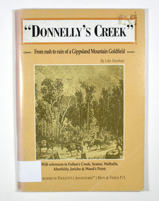
Book - Paperback book, Donnelly's Creek-From rush to ruin of a Gippsland Mountain Goldfield, 1990
A history of the Donnelly's Creek gold mine in VictoriaPaperback. Front cover has a drawing depicting two horses carrying packs followed by a man mounted on a horse. There is also two men on foot following with packs and walking poles. They are walking along a forest track that has some tree stumps alongside it.The back cover has two colour photographs. The top one is of an old wooden building with what appears to be an attached lean to. Both of the buildings have stone chimneys. There is a group of people sitting and standing outside the main building. The bottom photograph appears to be the ruins of a building and a fence. There are three people viewing the ruins.The captions accompanying the photographs are: History revisited - O'Sullivans Old Toombon Hotel Recreated and Remnants of a Bygone Mining Era.Stamp of the Marysville & District Historical Society Inc / P O Box 22 / Marysville 3779gold, gold miner, gold mining, gold field, gippsland, victoria, australia, history, fulton's creek, seaton, walhalla, aberfeldy, jericho, wood's point -
 Marysville & District Historical Society
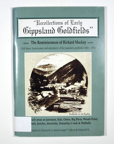
Book - Paperback book, Recollections of Early Gippsland Goldfields-The Reminiscences of Richard Mackay, 2000
Recollections by Richard Mackay of the early history of the Gippsland goldfieldsPaperback. Cover is green. Front cover has a sepia photograph of a drawing with the caption 'Walhalla in its heyday. Back cover has a photograph of an old building with a sign on it that says 'Copper Mine Hotel'. There is a man standing in front of the building. In the foreground is a four wheel drive vehicle.Stamp of the Marysville & District Historical Society Inc / P.O. Box 22 / Marysville 3779gold, gold fields, gold miner, gold mining, gold town, gippsland, victoria, australia, history, jamieson, sale, omeo, big river, wood's point, matlock, jericho, aberfeldy, donnelly's creek, walhalla -
 Marysville & District Historical Society
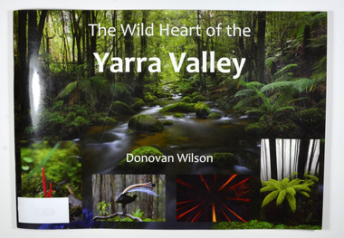
Book, The Wild Heart of the Yarra Valley
A pictorial book of the flora, fauna, rivers, waterfalls and rainforest in the Upper Yarra ValleyPaperback. Front cover has a main photograph of a creek running through a forest. There is also four smaller photographs. They are of a Red Coral Fungi, a Superb Lyrebird, a night time view looking upwards in a grove of trees and a view of a Soft tree fern. The back cover has a photograph of a Superb Lyrebird.yarra valley, upper yarra valley, flora, fauna, photography, rivers, waterfalls, rainforest, nature, donovan wilson -
 Lara RSL Sub Branch
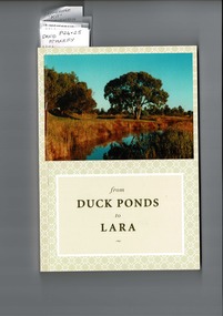
from Duck Ponds to Lara, Booklet from Duck Ponds to Lara, 2004
Lara - Duck Ponds history and input by local population. Insight into the History of a small community.Local knowledge of Lara's History, some items are not well known, Excellant referamce.Soft back booklet a collection of of memories "From Duck Ponds to Lara." Published by the Lara Heritage Festival Inc 2004. Edited by Mary Budd, Caroline Delaney, and John Grainger. Contributions of short stories to the project have come from local residents. Booklet also came with a fold-up heritage map of Lara printed on both sides. The booklet is tagged for the names of contributors who are members of Lara R. S. L. Front of the Booklet is half covered by a photograph of Lara Creek and environes. Booklet also came with a fold-up heritage map of Lara printed on both sides.duck ponds, lara -
 Marysville & District Historical Society
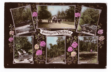
Postcard (item) - Colour postcard, Stanley Mullen Pty Ltd, Greetings from Victoria, Early 1900's
A colour postcard with six colour photographs of attractions in an around Marysville in Victoria. This postcard was produced by Stanley Mullen Pty Ltd. of Melbourne as a souvenir of Marysville.A colour postcard with four colour photographs of attractions in an around Marysville in Victoria.Greetings from Victoria The Yea River, Tallangi/ Resting, Fernshaw/ The Rapids, Watts River/ Waterfalls, Sylvia Creek/ Tram Track, Warburton/ Bush Bridge POST CARD Stanley Mullen Pty Ltd., Melbourne Printed in Germany Date Stamp-CARLTON NORTH-VICTORIA/ -2FE10 French stamp Ma soer voudrait favie/ les memes exchanges/ que moi. Son/ addresse est./ Miss. B. Coleman/ 95 Richardson St/ N. Carlton/ Avee mes meilleurs/ souhaits/ Votre tres devouee/ R. Coleman STAMP/ ON/ BACK Monsieur A. Rochet/ 22 Rue Longue,/ Lyon/ Rhone/ Francemarysville, victoria, yea river, tallangi, fernshaw, watts river, waterfall, sylvia creek, warburton, bridge, stanley mullen, postcard, souvenir, tram track -
 Marysville & District Historical Society
Book, The Wild Heart of the Yarra Valley
A pictorial book of the flora, fauna, rivers, waterfalls and rainforest in the Upper Yarra ValleyPaperback. Front cover has a main photograph of a creek running through a forest. There is also four smaller photographs. They are of a Red Coral Fungi, a Superb Lyrebird, a night time view looking upwards in a grove of trees and a view of a Soft tree fern. The back cover has a photograph of a Superb Lyrebird.yarra valley, upper yarra valley, flora, fauna, photography, rivers, waterfalls, rainforest, nature, donovan wilson -
 Marysville & District Historical Society
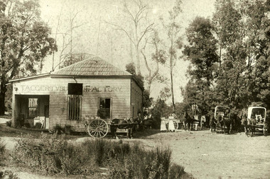
Photograph (Item) - Black and white photograph, 1904
A black and white photograph of the Taggerty Butter Factory in Victoria.A black and white photograph of the Taggerty Butter Factory in Victoria taken around 1904. The Taggerty Butter factory opened in 1892 in the township on the Little River. It was run by the Kennedy family and built by J.B. Coombs of Acheron Station. Coombs was later Shire President. Milk had been previously taken daily to the steam-driven separators at Thornton. Upper Thornton. The cream was separated and the remains were taken back to the farms for the pigs and calves. Before these town separators existed butter had been made at home in a barrel, salted, and stored. The operation at Taggerty ceased in 1908 and the Alexandra Dairy Company took over production. The building no longer exists but materials from the original Taggerty Butter factory building now form part of the Williamson house off Swamp Creek Road.taggerty, victoria, taggerty butter factory, little river, kennedy family, j b coombs, acheron station, thornton, upper thornton, alexandra dairy company, williamson, swamp creek road -
 Phillip Island and District Historical Society Inc.
Photograph - Post Card, 1974
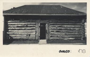
Postcard sent to Jean Archibald by Helen Jansson whilst holidaying at Mt Beauty, Omeo and Fall's Creek area. Donated by Helen Jansson.Black & White postcard of the Gaol in Omeo. Letter on back to Jean Archibald from Helen Jansson posted on the 18th April 1974."Omeo - Vic" by HSomeo gaol, mrs helen jansson, jean archibald -
 Greensborough Historical Society
Newsletter, Greenhills and North Greensborough Progress Association, Community News: official journal of the Greenhills and Nth. Greensborough Progress Association and the Apollo Parkways Progress Association. 1980, 1980
Duplication of Diamond Creek Road : the first stage of the F5 Freeway, Community News welcome back! But the news is not good!, Thunder over the hill, And it came to pass... Newsletter, 6 p.greenhills and north greensborough progress association, greenhills, apollo parkways progress association, apollo parkways -
Greensborough Historical Society
Oral History, Memories are rushing back. By Trinnie Di Giacomo, 1932o
This oral history tells the story of Trinnie Di Giacomo (nee Whittingham) and her family's experiences on their farm on Diamond Creek Road in the early part of the 20th century. As told to Rosie Bray.A recollection of life in early Greensborough.3 pages, colour illustration.oral history, greensborough, diamond creek road, whittingham, trinnie di giacomo -
 Greensborough Historical Society
Aerial Photograph, Flintoff land - View from above, 1945_
Section of the 1945 Greensborough aerial survey, focusing on the land belonging to the Flintoff familyPhotocopy of section of 1945 aerial survey of Greensborough area"Flintoff land to west of Diamond Creek Rd" written in pencil on backflintoff family, aerial photograph -
Glenelg Shire Council Cultural Collection
Photograph - Photograph - Fawthrop Lagoon, Portland Victoria, n.d
Black and white photo. Original photo 7731 7731 - Black and white photo of the causeway across Wattle Creek end of Fawthrop Lagoon. Lagoon visible on left. Taken from bottom of Magazine Hill.Back: '56' in pencil