Showing 1938 items
matching flood
-
 Merbein District Historical Society
Film, 1959 Jubilee Parade, Flood, Farm & Circus footage, 1950's
circus, merbein township, birthday celebrations merbein 1959, merbein jubliee celebrations, floods, paschendale avenue, keera station -
Merbein District Historical Society
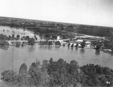
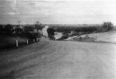
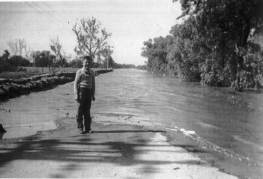
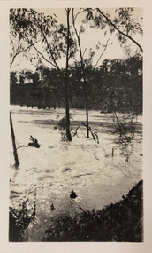
Photograph, River Road 1956 flood, 1956
floods, murray river flood 1956 -
Merbein District Historical Society
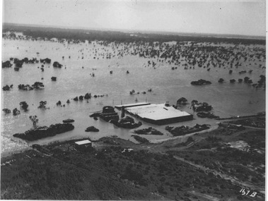
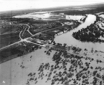
Photograph, Johnston Block 1956 Flood - Ranfurly, 1956
murray river flood 1956 -
Merbein District Historical Society
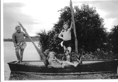
Photograph, Krake Children 1956 Flood Johnson Block Ranfurly, 1956
murray river flood 1956 -
Merbein District Historical Society
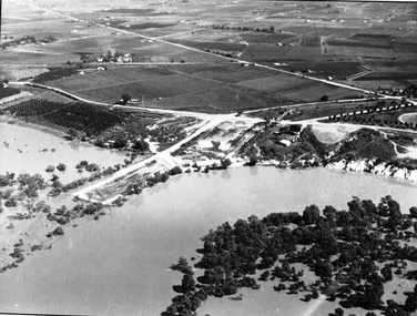
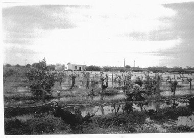
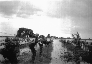
Photograph, Flooded Vines 1956 Flood, 1956
murray river flood 1956 -
Merbein District Historical Society
Photograph, Pumphill Merbein making sandbags 1956 Flood, 1956
-
 Merbein District Historical Society
Photograph, Murray River flood pumping station, 1956
merbein pumping station -
 Merbein District Historical Society
Photograph, Murray River flood brickworks, 1956
-
 Merbein District Historical Society
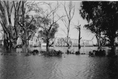
Photograph, Murray River flood Abbotsford, 1956
abbotsford bridge, murray river, floods -
 Merbein District Historical Society
Photograph, Murray River flood River Road, 1956
-
 Merbein District Historical Society
Photograph, Murray River flood Pump Hill Merbein Residents, 1956
-
 Merbein District Historical Society
Photograph, Murray River flood pumping station 1, 1956
-
 Merbein District Historical Society
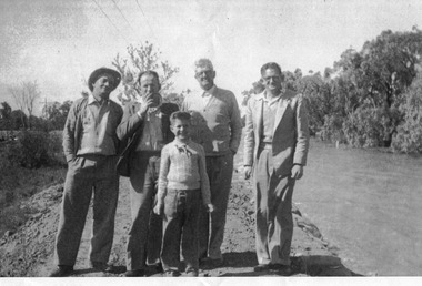
Photograph, Murray River flood Krake children boat, 1956
marlene krake, geoffrey krake, heather killingbeck, lesley killingbeck, johnston block 1956 flood - lake hawthorn gibbs st -
 Merbein District Historical Society
Photograph, Murray River flood Pump Hill, 1956
-
 Merbein District Historical Society
Photograph, Murray River flood Kimpton, 1956
geoffrey kimpton -
 Merbein District Historical Society
Photograph, Murray River flood Johnston Block Lake Hawthorn, 1956
murray river flood johnston block lake hawthorn, miff johnston -
 Merbein District Historical Society
Photograph, Murray River flood Miff Johnston Block, 1956
-
 Merbein District Historical Society
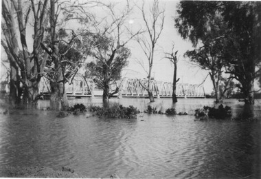
Photograph, Murray River flood Abbotsford Bridge, 1956
abbotsford bridge, murray river, floods -
 Eltham District Historical Society Inc
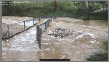
Film - Video (Digital), Carlota Quinlan, Diamond Creek in flood, Diamond Creek Trail, Eltham South, 16 Oct 2021
diamond creek (creek), diamond creek trail, eltham south, flooding, floods, floodwater -
 Narre Warren and District Family History Group
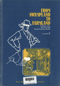
Book, David Roberts, From Swampland to Farmland - A history of the Koo Wee Rup flood protection district, 1985
A history of the Koo Wee Rup Flood Protection Districtvii, 53 p.; 25 cmnon-fictionA history of the Koo Wee Rup Flood Protection Districtkoo wee rup (vic.), koo wee rup flood protection, rural water commission of victoria -
 Kew Historical Society Inc
Photograph - Flood, Zig-Zag, Kew, 1924
Henry Beater Christian (1886-1962) , was a descendant of one of the earliest settler families in Kew. Employed at the Kew Asylum as a 'public servant', he was a skilled amateur photographer, photographing numerous scenes in Kew and on his travels around Victoria. The majority of his photographs date from 1916 to 1929. His finest photographs are housed in two photograph albums. Digital copy of a photograph from page 5 of the 47-page photograph album containing 261 gelatinous silver images, loaned by Diane Washfold with permission given to digitise and hold a copy in our collection. This is a photograph of a section of the river at Kew during a flood in January 1924."Flood / Zig-Zag Kew / 1.24"henry beater christian (1886-1962), landscape photography, kew (vic.) — yarra river, christian-washfold collection, photograph albums, floods -- yarra river -- kew (vic.) -
 Bendigo Military Museum
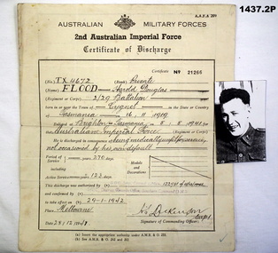
Administrative record - CERTIFICATE OF DISCHARGE WW2, 28.12.1941
.1) Discharge Certificate No 21266 re TX4672 Pte Flood, Harold Douglas 2/29 Battalion, POB Cygnet Tasmania .2) Poor quality photo of Pte Flood.documents, discharge certificate, photos, flood -
Tarnagulla History Archive
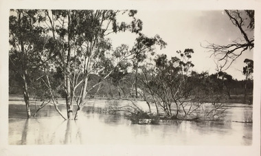
Photographs: Laanecoorie Weir In Flood, 1956, 1956
David Gordon Collection. Series of five small monochrome photographs of Laanecoorie Weir In Flood, on June 3rd 1956. Taken at Laanecoorie, Victoria.water, flood -
 Sunbury Family History and Heritage Society Inc.
Photograph, 1916 - 1917
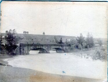
The Jacksons Creek is prone to flooding when rainfall is very heavy. The flood pictured in the photograph occurred either in 1916 or 1917 and reached at a level close to the arches on the Macedon Street bridge.A sepia photograph backed on cardboard of a two arched bridge with a river in flood.floods, jacksons creek, macedon street bridge -
 Orbost & District Historical Society
black and white photographs, second half 20th century
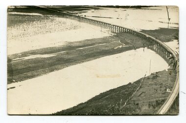
3154.1 is a postcard of the Orbost viaduct over the flooded Snowy River flats. 4153.2 is of a goods train on the viaduct. 3154.3 is of a loaded goods train with the driver at the window. Two men are standing on the plate and there are two workers below where there is some water and flood debris. 3154.4 is of amachine moving flood debris on the rail line. 3154.5 shows flood damage to the viaduct across the Snowy River flats. Two men are driving a dozer.This item is associated with the history of the Orbost-Bairnsdale railway line and therefore reflects the role that the rail line played in the social and economic history of Orbost.Five black / white photographs associated with the Orbost railway line during a flood.orbost-railway east-gippsland -railway orbost-floods -
 Greensborough Historical Society
Photograph, Plenty River Greensborough, 1910c
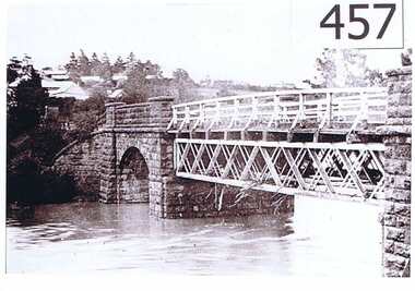
It shows the Plenty river in Greensborough in flood and the bluestone bridge at the bottom of the Main Street hill.The bluestone bridge was built in the mid 1860's and was demolished 1970's.A black and white photograph of a bridge over a river in flood.Nilgreensborough, plenty river, floods, bridges, bluestone -
University of Melbourne, Burnley Campus Archives
Newspaper - Newspaper Cutting, The Leader, Horticultural Notes, 1891
Copy of article in "The Leader" (Melbourne) on 18 July, 1891 p14. Description of damage the recent flood had done to the Horticultural Gardens. Deemed to have done more damage than the 1863 flood.the leader, horticultural gardens, flood, damage to gardens -
 Chelsea & District Historical Society Inc
Photograph - Chelsea Flood December 1934
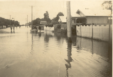
In December 1934, 700 houses were inundated with water, when the Dandenong Creek and Patterson River broke their banks.Two Black and white photo of flood waters in Chelsea. flood, chelsea, dandenong creek, nepean highway, point nepean road -
 Kew Historical Society Inc
Photograph - Flood, Zig-Zag, Kew, 1924
Henry Beater Christian (1886-1962) , was a descendant of one of the earliest settler families in Kew. Employed at the Kew Asylum as a 'public servant', he was a skilled amateur photographer, photographing numerous scenes in Kew and on his travels around Victoria. The majority of his photographs date from 1916 to 1929. His finest photographs are housed in two photograph albums. Digital copy of a photograph from page 5 of the 47-page photograph album containing 261 gelatinous silver images, loaned by Diane Washfold with permission given to digitise and hold a copy in our collection. This is a photograph of the river at Kew during a flood in January 1924. A section of the Zig-Zag Bridge can be seen in the distance. "Flood / Zig-Zag Kew / 1.24"henry beater christian (1886-1962), landscape photography, kew (vic.) — yarra river, christian-washfold collection, photograph albums, floods -- yarra river -- kew (vic.), zig-zag bridge -
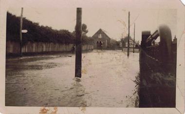 Kew Historical Society Inc
Photograph - Flooded street, 1940-50
View of unknown flooded streetscape.Original, black and white positive of a flooded street, originally believed to have been in Kew, but based on an examination of the history, deemed not to be a location in Kew or Kew East. The flooding is of a T-intersection with a brick church and a house in the background.Inscribed verso: "? Kew / R 774 / VELOX"floods