Showing 427 items
matching topography
-
 Lakes Entrance Historical Society
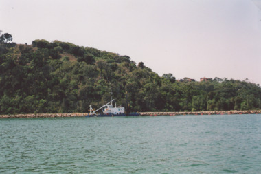
Photograph - Dredge on Gippsland Lakes, M Holding, 2008 c
dredge working on edge of lake below Jemmys Point. Glimpse of houses on Kalimna Heights in distance Lakes Entrance VictoriaColour photograph showing dredge working on edge of lake below Jemmys Point. Glimpse of houses on Kalimna Heights in distance Lakes Entrance Victoria waterways, topography, dredges -
 Lakes Entrance Historical Society
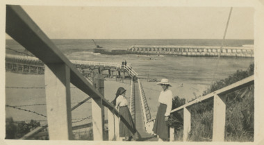
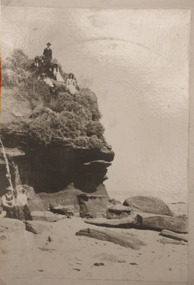
Photograph, Flagstaff to Eastern Pier, Lakes Entrance Victoria, 1920 Easter
Sepia photograph taken top of steps leading down from Flagstaff to Eastern Pier walkway two women on steps, crane on end of Western Pier Lakes Entrance Victoria. Also same photo in black and white topography, waterways, navigation -
 Lakes Entrance Historical Society
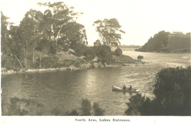
Postcard - North Arm Lakes Entrance Victoria. c1930, 1930 c
04324.1, 9 x 14 cmBlack and white postcard showing two people in a rowing boat on the lower reaches of the North Arm looking downstream Lakes Entrance Victoria c1930. Second black and white postcard of lower reaches of North Arm looking upstream Lakes EntranceNorth Arm Lakes Entrancewaterways, topography, vegetation -
 Lakes Entrance Historical Society
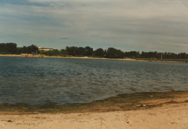
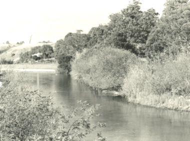
Photograph - Cunninghame Arm Lakes Entrance Victoria, M Fish, 1985
Colour photograph taken from lakefront near Stock Street looking across Cunninghame Arm to the footbridge old Surf Club and paddle boats Lakes Entrance Victoriatopography, waterways, gippsland lakes -
 Lakes Entrance Historical Society
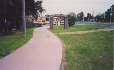
Photograph - Eastern entrance to Lakes Entrance, Lakes Entrance Tidy Town Committee, 1990
Colour photograph showing Eastern entrance to town Princes Highway on right of image pathway to left of Welcome to Lakes Entrance sign holding metal sign indicating local services Lakes Entrance Victoria. Also two other colour photographs taken at Eastern entrance to Lakes Entrance from pathway beside St. Brendans looking towards Eastern Beah Road Tidy Town signs in foreground topography, signage, tidy town -
 Lakes Entrance Historical Society
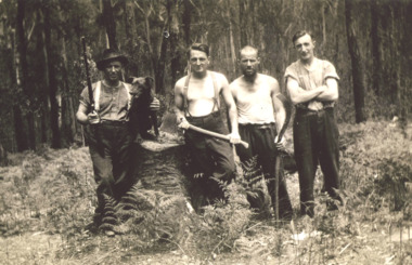
Photograph - Four Mile camp, Buchan East Gippsland Victoria, 1935-36
Black and white photograph of four bush workers with a dog, axe and fern hook or slasher, one man with a rifle at Four Mile camp Buchan Road East Gippsland Victoriaforestry, government services, topography -
 Lakes Entrance Historical Society
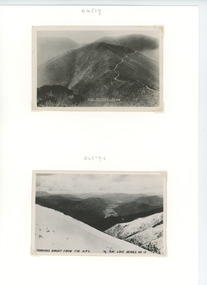
Postcard - Alpine Road High Country Victoria
Black and white postcard showing a section of the Alpine Road the route from Omeo to Bright across the High Countrytownship, topography, roads and streets -
 Lakes Entrance Historical Society
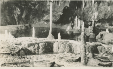
Postcard - stalagmites at Buchan Victoria, H D Bulmer, 1940 c
Black and white postcard of view of Font of Gods pool surrounded by stalagmites in a cave at Buchan Victoria. Also six small postcards taken inside various caves at Buchan topography, parks, tourism -
 Lakes Entrance Historical Society
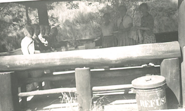
Postcard - Buchan caves Victoria, 1958 c
Black and white postcard showing group of people inside rustic picnic shelter in caves reserve Buchan Victoriatownship, topography, tourism -
 Lakes Entrance Historical Society
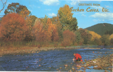
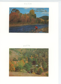
Postcard - autumn foliage at Buchan Victoria, Rose Series, 1960 c
Colour postcard of shallow river and trees showing autumn foliage at Buchan VictoriaGreetings from Buchan Caves Victopography, trees, rivers -
 Lakes Entrance Historical Society
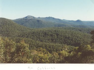
Photograph - Wombargo Saddle, Mt Cobberas Victoria, Bessie Larkin, 2/04/1994 12:00:00 AM
Colour photograph taken from Wombargo Saddle in the high country of Mt Cobberas Victoriatopography, mountains, forest -
 Lakes Entrance Historical Society
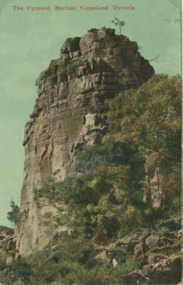
Postcard - Pyramid Rock Buchan Victoria, Valentines V.G. 221, 1925
A tinted postcard of the Pyramid Rock Buchan Victoriaenvironment, parks, topography -
 Lakes Entrance Historical Society
Postcard - Caves Reserve, Buchan Victoria, Rose Series, 1960 c
Colour postcard showing overview of autumn foliage amongst native trees in Caves Reserve, Buchan Victoriatourism, topography, trees -
 Lakes Entrance Historical Society
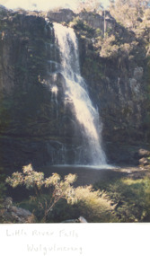
Photograph - Little River Falls , Wulgulmerang near Buchan Victoria, Bess Larkins, 1980 c
Colour photograph of the Little River Falls in full spate at Wulgulmerang near Buchan Victoriaenvironment, parks, topography -
 Lakes Entrance Historical Society
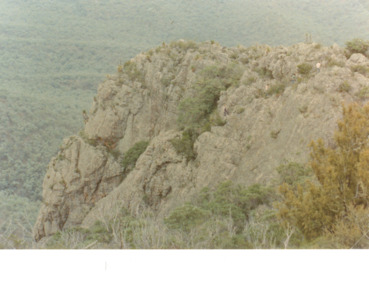
Photograph - Black Mountain Gelantipy Victoria, 1/03/1989 12:00:00 AM
Colour photograph of Rocky Mountain opposite Rogers old house Black Mountain Gelantipy Victoria. Also a second photograph taken from a sl ightly different angle topography, vegetation, mountains -
 Lakes Entrance Historical Society
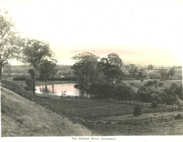
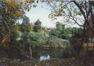
Postcard - Mitchell River Bairnsdale Victoria, 1920 c
One of the series of postcards used in the tourist industryPostcard of scene of Mitchell River with fences in the foreground and in the background bridge and Bairnsdale VictoriaThe Mitchell River Bairnsdalehouses, rivers, topography -
 Lakes Entrance Historical Society
Photograph - Mitchell River Eagle Point Victoria, M Holding, 1/11/1989 12:00:00 AM
Colour photograph of Mitchell River and low bank approaching Eagle Point Victoria waterways, rivers, topography -
 Lakes Entrance Historical Society
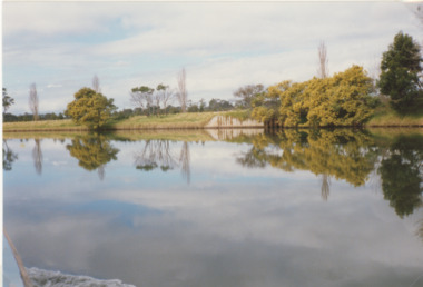
Photograph - Mitchell River Bairnsdale Victoria, 1991 c
taken from across the river looking back towards picnic area on right, site of old swimming pool below Court House. Colour photograph of Mitchell River Bairnsdale Victoria. Also three colour photographs of Mitchell River at Bairnsdale taken autumn 1991 settlement, rivers, topography -
 Lakes Entrance Historical Society
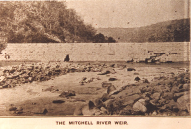
Photograph - Mitchell River Weir, Glenaladale Victoria, 1900 c
The Mitchell River Weir was commenced in 1900 work continued until almost completed, Foundation stone laid in March 1893 but the extensive flood damage in December 1893 ended the high hopes of the planners.Sepia toned photograph of weir on the Mitchell River at Glenaladale Victoriatopography, waterways, weir's -
 Lakes Entrance Historical Society
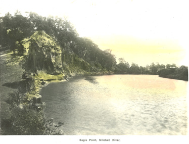
Postcard - Eagle Point bluff Eagle Point Victoria, Bulmer H D, 1920 c
Postcard lightly tinted of Mitchell River depicting the river at Eagle Point bluff with two men seated on bank, farm house in background Eagle Point VictoriaEagle Point, Mitchell River waterways, rivers, topography -
 Lakes Entrance Historical Society
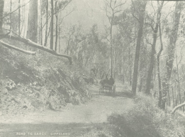
Photograph - road to Dargo Victoria, 1900 c
Road to Dargo GippslandBlack and white photograph of a horse drawn vehicle on a road through bushland on the way to Dargo Victoriatransport, roads and streets, topography -
 Lakes Entrance Historical Society
Postcard - Pyramid Rock Buchan Victoria, 1940 c
Black and white postcard showing the mountains in distance beyond the valley and township of Buchan Victoriafarming, topography, settlement -
 Lakes Entrance Historical Society
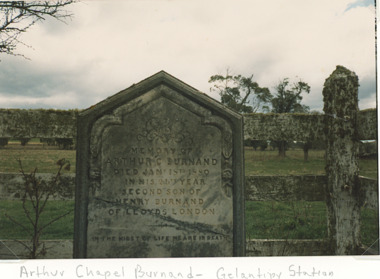
Photograph - Arthur Chapel Burnand memorial at Gelantipy Victoria, Bessie Larkin, 1994 c
Burnand was a young stockman dying when he fell from his horse only four years after arriving in AustraliaColour photograph showing top section of memorial to Arthur Chapel Burnand at Gelantipy Victoriaalpine region, topography, headstones -
 Lakes Entrance Historical Society
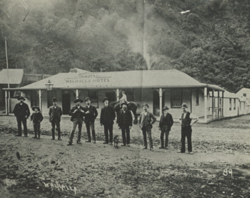
Photograph - Gilberts Hotel Walhalla Victoria, 1910
Black and white photograph showing Gilberts Walhalla Hotel and another building around corner, nine men and a boy standing on road in front, boy on horse in front of building, thick bush in background Walhalla Victoria land settlement, mining, topography -
 Lakes Entrance Historical Society
Photograph, HD Bulmer, Lakes Tyers Beach Victoria, 1915 1920 c
, erosion under cliff, cliff top intact. Lakes Tyers Beach VictoriaSepia toned photograph of west side of Red Bluff near Lake Tyers showing seven people on cliff top and two ladies seated on rock at beach environment, topography, beaches -
 Lakes Entrance Historical Society
Photograph, G Legg Bairnsdale, Tambo River, Tambo Upper Victoria, 1970 1980 c
Black and white photograph of Tambo River, Tambo Upper Victoria. Also a black and white photograph of flood in the Tambo River location not identified rivers, topography, farming -
 Lakes Entrance Historical Society
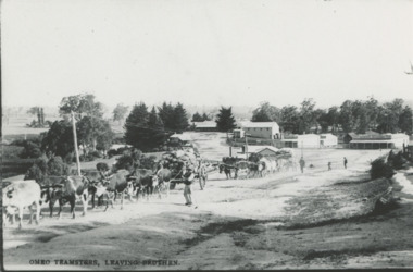
Photograph - Bullocks at Bruthen Victoria, 1900 c
Black and white photograph of two bullock teams and wagons leaving Bruthen bound for Omeo, Bruthen Hotel in background, General Merchant store on right Bruthen VictoriaOmeo Teamsters leaving Bruthentowns, transport, topography -
 Lakes Entrance Historical Society
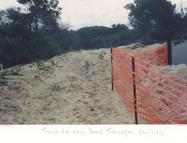
Photograph, Judy Davies, sand transfer system at New Works Lakes Entrance Victoria, 1998 c
Colour photograph of sand track to new sand transfer system at New Works area Lakes Entrance Victoriaenvironment, gippsland ports, topography -
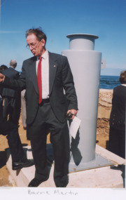 Lakes Entrance Historical Society
Photograph, Lakes Post Newspaper, Bruce Warr (Gippsland Ports CEO) Lakes Entrance Victoria, 1/04/1999 12:00:00 AM
Colour photograph of Gippsland Ports CEO Bruce Warr launching new safety bollard at entrance Lakes Entrance Victoriaenvironment, gippsland ports, topography -
 Lakes Entrance Historical Society
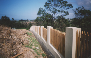
Photograph - Garden Cemetery Lakes Entrance Victoria, Lakes Post Newspaper, Western boundary of Garden Cemetery Lakes Entrance Victoria, 2003
Colour photograph of new boundary fence at Western boundary of Garden Cemetery Lakes Entrance Victoria. Also a second photograph of fence from a different anglegenealogy, cemeteries, topography