Showing 316 items matching "kinglake road"
-
 Eltham District Historical Society Inc
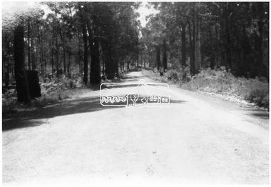
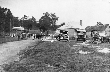
Photograph, Road from Hotel to Hall, Kinglake at later stage
... image Road from Hotel to Hall, Kinglake at later stage ...Source: Mrs. McMinn, Kinglake Cross Ref: SEPP_0036This photo forms part of a collection of photographs gathered by the Shire of Eltham for their centenary project book,"Pioneers and Painters: 100 years of the Shire of Eltham" by Alan Marshall (1971). The collection of over 500 images is held in partnership between Eltham District Historical Society and Yarra Plenty Regional Library (Eltham Library) and is now formally known as the 'The Shire of Eltham Pioneers Photograph Collection.' It is significant in being the first community sourced collection representing the places and people of the Shire's first one hundred years.Digital imagesepp, shire of eltham pioneers photograph collection, kinglake -
 Eltham District Historical Society Inc
Photograph, Betty Lynch (left), Russell and Marion Yeoman at the Everard Memorial, Mt Everard, Kinglake National Park, c.April, 2004, 2004
Betty Lynch OAM, daughter of William Everard and sister of Blanche Shallard This photo appears to have been taken at a later date to the dedication ceremony of 22 April.This lockup used to be located at the Police Station in Pryor Street and was then stored in Youth Road before being acquired for the Local History Centre Colour photographbetty lynch, everard memorial, mt everard, kinglake national park, blanche shallard -
 Eltham District Historical Society Inc
Photograph, 35 Ingrams Road, Research, Eltham Heritage Tour, 24 May 1992, 24/05/1992
ELTHAM HERITAGE TOUR The Society excursion on 24th May 1992 was arranged by David Bick, leader of the team carrying out the Shire's heritage study. David selected a number of sites or buildings identified in the study, some of them lesser known components of the Shire's heritage. The tour commenced at the Eltham Shire Office at 10.00 am. Travel was by private car and mini-bus with stops at about twelve locations for commentary by David.It included a short walk in Hurstbridge and lunch at Kinglake. Highlights of the tour included: - 10 am Leave from Shire Offices - 3 Important Trees - A Physical Link to Eltham's First Settlers - Toorak Mansion Gates - A Surviving Farm House - An Intact Circa 1900 Main Street - First Settlers - Gold Miners, and Timber-getters - An Early Hotel - A Pioneering Homestead - Changing Eltham Shire - 20th Century - 4 pm Afternoon Tea and Finish Tour Extract from ELTHAM CULTURAL HERITAGE TOUR (Newsletter No. 85, July 1992, by Bettina Woodburn) "On a right-angle turning of the Eltham Road is Wellers Pub, a Cobb & Co. coaching stop on the way to distant gold-fields and places north of the Yarra River. The Hotel dates from the 1870's. Daily distances for a bullock team was eight miles, horses could do double that distance. We turned into Cassells Road and on the corner of Ingrams Road we admired an elaborate Edwardian villa, 1900 style. The Aqueduct conveying Melbourne's water supply was a communication line and a technological advance in 1891. It has been enlarged and re-faced and no longer used here but piped underground. Proclaimed a linear park it has reverted to crown land, controlled by local Council. Maroondah Dam was constructed in. 1920 to replace the original weir and at that time: the Aqueduct - as established into the landscape - with bridges and tunnels and pine trees were used to stop rubbish polluting the water."Record of the Society's history and activities and highlighting various aspects of the Heritage Study undertaken by David Bick used to create the future heritage overlay for the Shire of Eltham and later Nillumbik Shire.Roll of 35mm colour negative film, 4 stripsKodak Gold 100 5095shire of eltham historical society, activities, heritage tour, ingrams road, research (vic.) -
 Eltham District Historical Society Inc
Magazine, Sun News-Pictorial, Bush Fires: A pictorial survey of Victoria's most tragic week, January 8-15, 1939, 1939
THE WEEK REVIEWED (Article; Bush Fires: A pictorial survey of Victoria's most tragic week, January 8-15, 1939. Published in aid of the Bush Fire Relief Fund by the Sun News-Pictorial in co-operation with its newsagents, pp2-3) THE fiercest bush fires Australia has known since its discovery are quiescent at the moment, and Victoria, in the comparative coolness of the change which came with rain on Sunday night, has begun·to count its losses. In the fiery eight days, from Sunday to Sunday, at least sixty-six men, women and children have lost their lives in forest fires, or have succumbed to burns and shock; many others have died from heat; and several serious cases of burns are being treated in hospitals. Two babies in Narrandera district have died, and ten others are in hospital, because of milk soured by the record temperatures of those eight days. Forest damage totals at least a million pounds, and incalculable damage has been done to the seedlings which were to have been the forests of the future. Water conservation will be seriously affected by the silting-up of reservoirs and streams from which protective timber has been taken by the all-engulfing flames. More than a thousand houses have been destroyed, and these, with 40 mills, and schools, post-offices, churches, and other buildings, represent a loss of at least half a million. At least 1500 are homeless. For their aid, money raised in appeals has now passed the £50,000 mark, and the biggest relief organisation ever set up in peace time has swung into operation. The First Hint Victoria's first hint of what was to come appeared on Sunday, January 8, when most parts of the State awoke to find a blistering day awaiting. At 12.20 p.m., when the thermometer reached its highest for the day, 109.6 degrees, the first fire victims were at that moment going to their death on a bush track five feet wide off the main road to Narbethong. They were the forestry officers Charles Isaac Demby and John Hartley Barling, who went to warn Demby of his danger when he parted from his companions, and was himself surrounded by the treacherous fire. It was not until 8 o'clock next morning that the tragic news was flashed throughout the State. Searchers found the two charred bodies close together, one seeking protection in the nook of two logs. Barling's watch had stopped at 1.20. In the meantime, tragedy was spreading its cloak. By Monday, big fires were raging at Toolangi, Erica, Yallourn, Monbulk, Frankston, Dromana, Drouin South, Glenburn, and Blackwood, with smaller outbreaks at many other centres. In the ensuing week, while women and children were evacuated as fast as the flames would permit, Erica-scene of the 1926 fire disaster-thrice escaped doom by a change of wind. Indeed, those who have been in the fire country these past days say that the numbers of times a change of wind has saved towns from destruction is amazing. In the towns they speak of miracles. Monday's Miracles The escapes from Monett's Mill at Erica and from the Hardwood Company's Mill at Murrindindi, near where Demby and Barling went to their death, were Monday's miracles. Twenty came out alive from each mill. At the first a 60ft. dugout provided an oven-like refuge; at the second, 12 women and children survived in the smoke-filled gloom of a three-roomed cottage while their eight men, their clothes sometimes afire, poured water on the wooden walls. Three houses out of ten remained when the fire had passed. Record Temperatures Sunday had been the hottest Melbourne day for 33 years; Monday dropped to a 76.1 degree maximum; but Tuesday dawned hotter than ever, the mercury reaching 112.5. By now rumor was racing ahead of fact; whole towns were being reported lost; the alarm was raised for scores of missing persons. But fact soon overtook rumor, and within a few days the staggering toll began to mount to a figure beyond the wildest imaginings of the panic-stricken. Six died from heat on this torrid Tuesday, and the fires spread in a wide swathe from south-west to north-east across the State. Fish died in shallow streams. A curtain of smoke hid the sky from all Victoria, and hung far out to sea. It alarmed passengers on ships. On the Ormonde, on the voyage to Sydney from Burnie, women ran on deck, believing fire had broken out in the hold. Days later the smoke reached New Zealand. In Melbourne thousands of fire-volunteers were leaving in cars: vans, motor-buses-anything reliable on wheels-to aid the country in its grim fight. In the fires at Rubicon and. Narbethong, seventeen were facing death this day. But not till Wednesday, when Melbourne breathed again in a cool change, while the country still sweltered in temperatures up to 117 degrees, did the news come through the tree blocked roads. A woman and her little daughter, trapped on the road, were among those who died. Their bodies, and those of menfolk with them, were found strewn out at intervals along the road, where the furnace of the surrounding fire had dropped them in their tracks as they ran. Twelve died at a Rubicon mill, five on the road at Narbethong. At Alexandra, not far distant, a baby was born while the fires raged, and stretcher-bearers brought in the injured. On Thursday the State Government voted £5000 for the relief of fire victims. The Governor (Lord Huntingfield) and the Lord Mayor (Cr. Coles) visited some of the stricken areas, and dipped into their pockets personally. Later, the City Council, too, voted £5000. Friday, The 13th Friday, the Thirteenth, justified its evil name. A blistering northerly came early in the morning, presaging destruction, and forcing the mercury to a new record of 114 degrees. Racing fires killed at least ten in those terrible 12 hours. Four children were engulfed in the furnace at Colac. Panic drove them, uncontrollable, into the smoke-filled road when the fire raced down behind their home. They choked to death. In other parts fires were joining to make fronts of scores of miles. Kinglake was being menaced on two fronts, £60,000 worth of timber was going up in smoke in Ballarat district. Warburton was surrounded. Residents at Lorne, favoured resort, were being driven to the sea-front by a fire which destroyed at least 20 homes. Healewille. with flames visible from the town at one stage, was in a trough between two fires which burned four guest-houses, seven homes and left its surrounding beauty-spots wastes of bowed-over, blackened tree-fern fronds; with its famous Sanctuary, however, intact. Most of Omeo was destroyed this black day: Noojee. while 200 residents crouched in the river, was being reduced to a waste of buckled iron and smoking timber; Erica was once again saved by a change of wind. Beneath a pall of smoke, the Rubicon victims were buried at Alexandra. Friday night and the early hours of Saturday saw the streets of beleagured towns strewn with exhausted fire-fighters. Their flails beside them, ready for the next call, they lay where exhaustion overtook them-on footpaths, beside lamp-posts, in gutters, in cars, under trucks. Saturday's dawn brought clear skies and lower temperatures in many parts, and from the burnt-out areas came a great rush of tragic reports. The death-roll rushed past the fifty mark with incredible speed. Some had been trapped on roads, others at mills; some, after burying their treasures, had clung too long to the places they had made their homes for many years. Four men lost their lives because one went back for his dog. By Sunday, when the first of the saving rain came, nearly another score of names had been added to the list.Newspaper magazine, 48 pages (incl. covers). Fully digitised and searchable PDFPublished in aid of the Bush Fire Relief Fund by the Sun News-Pictorial in co-operation with its newsagents.bushfires, 1939 bushfires, black friday, warrandyte -
 Eltham District Historical Society Inc
Folder, Mr Grimshaw, Miner, Kinglake and Caledonian Diggings
We have three folders catalogued for the Grimshaw name and these will in due course be consolidated/corrected: 1. EDHS_01361 – A.H. Grimshaw of Research, Vic., 1927 2. EDHS_01362 – John Grimshaw of Greensborough, 1862 (Correct name is Josiah Grimshaw) 3. EDHS_01375 – Mr Grimshaw, miner of Kinglake and Caledonian Diggings. (This is believed to be Mr J.L. (Jack) Grimshaw who reportedly discovered the first gold in Kinglake. These folders are made up of copies of pages of research undertaken by Mr Keith Chappel in the 1970s, which is now catalogued as a separate item. EDHS_04448 - Eltham District History, Eltham Road Board, 1856-1871; Research by Keith Chappel https://victoriancollections.net.au/items/5e4a290521ea671e9ccf9661 There is further information from this research concerning a William Grimshaw. Also included as part of EDHS_01375 is a photocopy of page44 from the book "Caledonia Diggings (St Andrews)", Gold Discovery in Victoria, James Flett, 1970, which references No. 2 Creek at the Caledonian Diggings as also been known as Grimshaws. We have a photo of J.L.(Jack) Grimshaw who discovered gold at Kinglake, which is part of the Shire of Eltham Pioneers Photograph Collection (SEPP) SEPP_0056 - Mr. J.L. Grimshaw; the man who found the first gold at Kinglake https://victoriancollections.net.au/items/5a6c158721ea6906ac29bd3c We also have another record of interest involving Aaron Grimshaw, Farmer of Greensborough who was an indentured Trustee of the Wesleyan Chapel in Little Eltham in 1856: EDHS_04610-3-1 - Document, Conveyance of Lot 20 Henry Street, Little Eltham North to Trustees of Wesleyan Chapel, 1856 https://victoriancollections.net.au/items/60f6d644ac5d4de270b83615 The record of Joshia Grimshaw of Greensborough is grim. He was arrested and charged with the murder of John Mitchell at Greensborough, September 24, 1962. Grimshaw was ultimately convicted of manslaughter and sentenced for three years in prison. Newspaper reports of the day show his name as Josiah. Whether he was also known as John is not clear, and whether he is the same as J.L. (Jack) Grimshaw who discovered gold at Kinglake, again is unclear without undertaking further research into the matter. This murder trial was extensively reported in the newspapers and you can find those reports on the National Library of Australia’s Trove https://trove.nla.gov.au/ Some of the reports of interest: TRIAL OF GRIMSHAW FOR MURDER (1862, October 23). The Kyneton Observer (Vic. : 1856 - 1900), p. 3. Retrieved April 21, 2023, from http://nla.gov.au/nla.news-article240899299 THE GREENSBOROUGH MURDER. (1862, September 30). The Argus (Melbourne, Vic. : 1848 - 1957), p. 6. Retrieved April 21, 2023, from http://nla.gov.au/nla.news-article5722929 MELBOURNE CRIMINAL SESSIONS. (1862, October 18). The Age (Melbourne, Vic. : 1854 - 1954), p. 6. Retrieved April 21, 2023, from http://nla.gov.au/nla.news-article154967162 CRIMINAL SESSIONS. I (1862, October 18). The Argus (Melbourne, Vic. : 1848 - 1957), p. 6. Retrieved April 21, 2023, from http://nla.gov.au/nla.news-article6480408 Folder of information on Mr Grimshaw, Miner, Kinglake and Caledonian Diggingsgrimshaw -
 Eltham District Historical Society Inc
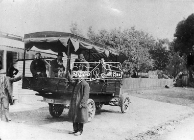
Negative - Photograph, Mail coach en route to Hurstbridge, c.1922
Coach with flaps takes aboard passengers. It travelled between Kinglake and Hurstbridge. The vehicle has advertising on the side indicating: W. BODY. HURSTBRIDGE bread and pastry. The Advertiser on 15 Sep 1922 has a display advertisement on page 2 indicating that Hurstbridge bakery 'W. Body wishes to notify the Public of Hurstbridge and surrounding district that he has purchased Mr Oliver's business'. The Advertiser, Friday 10 November 1922, page 2: Mr J. D. Chalmers, who runs the motor service from Hurstbridge to Kinglake, has just had a large, body built on a two-ton motor, which will be serviceable for either 25 passengers or general goods. The work was entrusted to Mr. D.G. Graham, motor and coach builder, Hurstbridge, who completed it within a month, the finish, painting, etc.. being quite up to the standard of a city shop. The mail coach operated the route between Kinglake and Hurstbridge motor route, on which Mr. Sharpe had pioneered and run a motor mail route with a bus which carried 20 passengers, for many years but Sharpe's license for his motor bus was refused by the Country Roads Board mid 1930 as his bus was considered too large . In February 1935, Mr Sharpe was granted a license to carry passengers between Hurstbridge and Kinglake and Mr Kell between Kinglake and Hurstbridge. In 1936 the mail contract from Heidelberg to Knglake was via car and members of the community were concerned that there was no further any conveyance of passengers from Hurstbridge to Kinglake.This photo forms part of a collection of photographs gathered by the Shire of Eltham for their centenary project book,"Pioneers and Painters: 100 years of the Shire of Eltham" by Alan Marshall (1971). The collection of over 500 images is held in partnership between Eltham District Historical Society and Yarra Plenty Regional Library (Eltham Library) and is now formally known as 'The Shire of Eltham Pioneers Photograph Collection.' It is significant in being the first community sourced collection representing the places and people of the Shire's first one hundred years.Digital image 4 x 5 inch B&W Neg 9 x 12.5 cm B&W printsepp, shire of eltham pioneers photograph collection, kinglake, mail coach, w. body, public transport, bus, bus travel, hurstbridge, pioneers and painters -
 Eltham District Historical Society Inc
Photograph, Albert Jones, Returned soldiers picnic, Police Paddocks, Queenstown, c.1916
Queenstown (St Andrews) looking towards Panton Hill . A picnic is taking place. Streetscape with dirt road, buildings, Model T Fords and people. Police station far left, the gaol was behind (not visible). On the right is a boarding house according to Mr. Ninks, next to right the Mechanics Institute or library according to Miss Muller. On far right, Coach House (stables not shown) - end of coach run from Heidelberg. This is possibly a picnic for returned servicemen from Gallipoli. The house on the right still existed c.1970 and was alongside Hotel on Kinglake side. Reproduced page 35 Pioneers & Painters also on the back cover and on page 59 of "St Andrews: a village built on gold". Described in chapter headed "The Police Paddocks". This photo forms part of a collection of photographs gathered by the Shire of Eltham for their centenary project book,"Pioneers and Painters: 100 years of the Shire of Eltham" by Alan Marshall (1971). The collection of over 500 images is held in partnership between Eltham District Historical Society and Yarra Plenty Regional Library (Eltham Library) and is now formally known as the 'The Shire of Eltham Pioneers Photograph Collection.' It is significant in being the first community sourced collection representing the places and people of the Shire's first one hundred years.Digital image 4 x 5 inch B&W Neg Prints 20 x 25 and 9 x 12.5 cm sepp, shire of eltham pioneers photograph collection, queenstown, cars, police station, st andrews, model t ford, pioneers and painters, boarding house, gallipoli, picnic, police paddocks, retuned soldiers -
 Eltham District Historical Society Inc
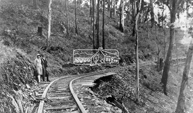
Negative - Photograph, Timber Tramway at Wright's Falls, Kinglake District, c.1920
Man and woman stand beside timber tramway track at Wright's falls Kinglake. The tramway was constructed alongside the road to support the large traffic in firewood between the mountains to Whittlesea. The Wright family owned the land on which the Falls were situated and were sold for a penny an acre according to a Wright family story. This photo forms part of a collection of photographs gathered by the Shire of Eltham for their centenary project book,"Pioneers and Painters: 100 years of the Shire of Eltham" by Alan Marshall (1971). The collection of over 500 images is held in partnership between Eltham District Historical Society and Yarra Plenty Regional Library (Eltham Library) and is now formally known as 'The Shire of Eltham Pioneers Photograph Collection.' It is significant in being the first community sourced collection representing the places and people of the Shire's first one hundred years.Digital image 4 x 5 inch B&W Negshire of eltham pioneers photograph collection, kinglake, timber tramway, wrights falls -
 Eltham District Historical Society Inc
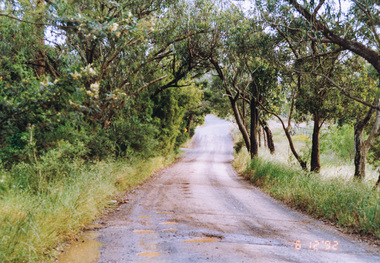
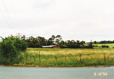
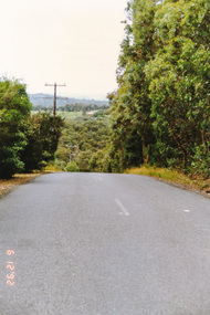
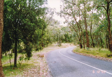
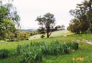
Photograph, Ingrams Road at Allendale Road, 6 December 1992, 06/12/1992
The Eltham Horse Trail: Research and Warrandyte to Kinglake: Survey of proposed route, December 1992: (1) Research to Kangaroo GroundColour photographallendale road, eltham horse trail (1992 survey), ingrams road -
 Eltham District Historical Society Inc
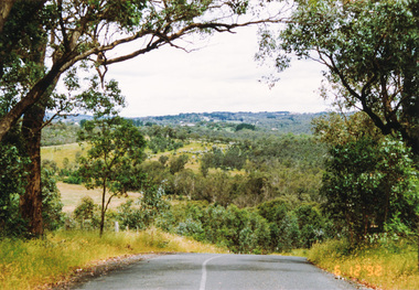
Photograph, From Lorimer Road through Pretty Hill to Kangaroo Ground, 6 December 1992, 06/12/1992
The Eltham Horse Trail: Research and Warrandyte to Kinglake: Survey of proposed route, December 1992: (1) Research to Kangaroo GroundColour photographeltham horse trail (1992 survey), kangaroo ground, lorimer road, pretty hill -
 Eltham District Historical Society Inc
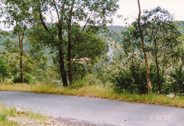
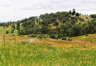
Photograph, Northeast corner of Pretty Hill, Wattle Glen Road, Kangaroo Ground, 6 December 1992, 06/12/1992
The Eltham Horse Trail: Research and Warrandyte to Kinglake: Survey of proposed route, December 1992: (1) Research to Kangaroo GroundColour photographeltham horse trail (1992 survey), kangaroo ground, pretty hill, wattle glen road -
 Eltham District Historical Society Inc
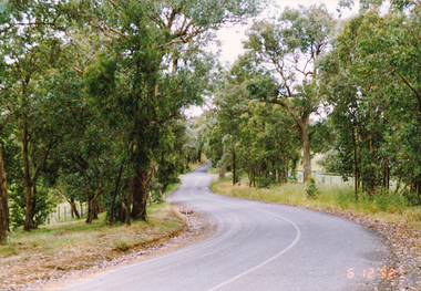
Photograph, St Andrews Road near Ness Lane, Kangaroo Ground, 6 December 1992, 06/12/1992
The Eltham Horse Trail: Research and Warrandyte to Kinglake: Survey of proposed route, December 1992: (1) Research to Kangaroo GroundColour photographeltham horse trail (1992 survey), kangaroo ground, ness lane, st andrews road -
 Eltham District Historical Society Inc
Photograph, Dawson Road from St Andrews Road, Kangaroo Ground, 6 December 1992, 06/12/1992
The Eltham Horse Trail: Research and Warrandyte to Kinglake: Survey of proposed route, December 1992: (1) Research to Kangaroo GroundColour photographeltham horse trail (1992 survey), kangaroo ground, dawson road, st andrews road -
 Eltham District Historical Society Inc
Photograph, Junction of Kings Road (left) and Dawson Road, Kangaroo Ground, 6 December 1992, 06/12/1992
The Eltham Horse Trail: Research and Warrandyte to Kinglake: Survey of proposed route, December 1992: (1) Research to Kangaroo GroundColour photographeltham horse trail (1992 survey), kangaroo ground, dawson road, kings road -
 Eltham District Historical Society Inc
Photograph, Pigeon Bank Road at Kangaroo Ground Road, Kangaroo Ground, 6 December 1992, 06/12/1992
The Eltham Horse Trail: Research and Warrandyte to Kinglake: Survey of proposed route, December 1992: (2) Warrandyte to Kangaroo GroundColour photographeltham horse trail (1992 survey), kangaroo ground, pigeon bank road, kangaroo ground road -
 Eltham District Historical Society Inc
Photograph, Pigeon Bank Road, Kangaroo Ground, 6 December 1992, 06/12/1992
The Eltham Horse Trail: Research and Warrandyte to Kinglake: Survey of proposed route, December 1992: (2) Warrandyte to Kangaroo GroundColour photographeltham horse trail (1992 survey), kangaroo ground, pigeon bank road -
 Eltham District Historical Society Inc
Photograph, Menzies Road from Pigeon Bank Road, Kangaroo Ground, 6 December 1992, 06/12/1992
The Eltham Horse Trail: Research and Warrandyte to Kinglake: Survey of proposed route, December 1992: (2) Warrandyte to Kangaroo GroundColour photographeltham horse trail (1992 survey), kangaroo ground, pigeon bank road, menzies road -
 Eltham District Historical Society Inc
Photograph, Looking south along Menzies Road, Kangaroo Ground, 6 December 1992, 06/12/1992
The Eltham Horse Trail: Research and Warrandyte to Kinglake: Survey of proposed route, December 1992: (2) Warrandyte to Kangaroo GroundColour photographeltham horse trail (1992 survey), kangaroo ground, menzies road -
 Eltham District Historical Society Inc
Photograph, Pigeon Bank Road from Menzies Road, Kangaroo Ground, 6 December 1992, 06/12/1992
The Eltham Horse Trail: Research and Warrandyte to Kinglake: Survey of proposed route, December 1992: (2) Warrandyte to Kangaroo GroundColour photographeltham horse trail (1992 survey), kangaroo ground, menzies road, pigeon bank road -
 Eltham District Historical Society Inc
Photograph, Looking north along Menzies Road, Kangaroo Ground, 6 December 1992, 06/12/1992
The Eltham Horse Trail: Research and Warrandyte to Kinglake: Survey of proposed route, December 1992: (2) Warrandyte to Kangaroo GroundColour photographeltham horse trail (1992 survey), kangaroo ground, menzies road -
 Eltham District Historical Society Inc
Photograph, Menzies Road near Henley Road, Kangaroo Ground, 6 December 1992, 06/12/1992
The Eltham Horse Trail: Research and Warrandyte to Kinglake: Survey of proposed route, December 1992: (2) Warrandyte to Kangaroo GroundColour photographeltham horse trail (1992 survey), kangaroo ground, menzies road, henley road -
 Eltham District Historical Society Inc
Photograph, Widened road reserve, Henley Road, Kangaroo Ground, 6 December 1992, 06/12/1992
The Eltham Horse Trail: Research and Warrandyte to Kinglake: Survey of proposed route, December 1992: (2) Warrandyte to Kangaroo GroundColour photographeltham horse trail (1992 survey), kangaroo ground, henley road -
 Eltham District Historical Society Inc
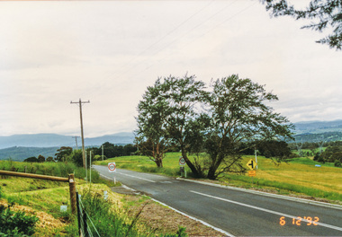
Photograph, Widened road reserve near Memorial Tower, Eltham-Yarra Glen Road, Kangaroo Ground, 6 December 1992, 06/12/1992
The Eltham Horse Trail: Research and Warrandyte to Kinglake: Survey of proposed route, December 1992: (2) Warrandyte to Kangaroo GroundColour photographeltham horse trail (1992 survey), kangaroo ground, eltham-yarra glen road, war memorial tower -
 Eltham District Historical Society Inc
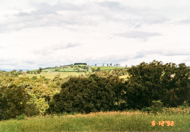
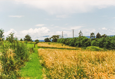
Photograph, Looking north from Eltham-Yarra Glen Road, Kangaroo Ground, 6 December 1992, 06/12/1992
The Eltham Horse Trail: Research and Warrandyte to Kinglake: Survey of proposed route, December 1992: (2) Warrandyte to Kangaroo Ground, trail route to be determined (1992)Four colour photographseltham horse trail (1992 survey), kangaroo ground, eltham-yarra glen road -
 Eltham District Historical Society Inc
Photograph, Route north to Dawson Road near Kangaroo Ground Cemetery, 6 December 1992, 06/12/1992
The Eltham Horse Trail: Research and Warrandyte to Kinglake: Survey of proposed route, December 1992: (2) Warrandyte to Kangaroo GroundColour photographeltham horse trail (1992 survey), kangaroo ground cemetery, dawson road -
 Eltham District Historical Society Inc
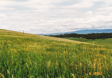
Photograph, Looking south from Dawson Road, Kangaroo Ground, 6 December 1992, 06/12/1992
The Eltham Horse Trail: Research and Warrandyte to Kinglake: Survey of proposed route, December 1992: (2) Warrandyte to Kangaroo Ground, trail route to be determined (1992)Colour photographeltham horse trail (1992 survey), kangaroo ground, dawson road -
 Eltham District Historical Society Inc
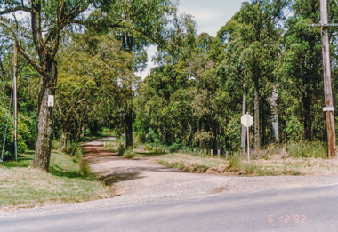
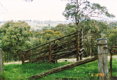
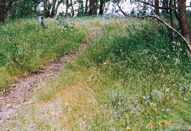
Photograph, Track along unopened section of Kings Road, Kangaroo Ground, 6 December 1992, 06/12/1992
The Eltham Horse Trail: Research and Warrandyte to Kinglake: Survey of proposed route, December 1992: (3) Kangaroo Ground to KinglakeColour photographeltham horse trail (1992 survey), kangaroo ground, kings road -
 Eltham District Historical Society Inc
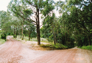
Photograph, Unopened section of Kings Road south from Glenvern Road, Panton Hill, 6 December 1992, 06/12/1992
The Eltham Horse Trail: Research and Warrandyte to Kinglake: Survey of proposed route, December 1992: (3) Kangaroo Ground to KinglakeColour photographeltham horse trail (1992 survey), glenvern road, kings road, panton hill -
 Eltham District Historical Society Inc
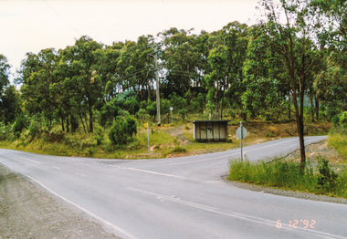
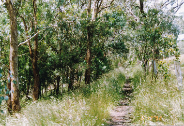
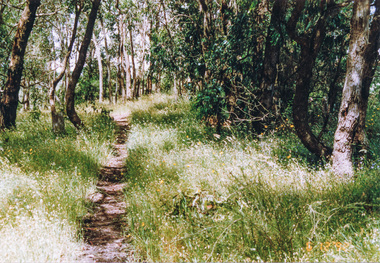
Photograph, Track along Glenvern Road, Panton Hill, 6 December 1992, 06/12/1992
The Eltham Horse Trail: Research and Warrandyte to Kinglake: Survey of proposed route, December 1992: (3) Kangaroo Ground to KinglakeColour photographeltham horse trail (1992 survey), glenvern road, panton hill -
 Eltham District Historical Society Inc
Photograph, Track along Cracknells Road, Panton Hill, 6 December 1992, 06/12/1992
The Eltham Horse Trail: Research and Warrandyte to Kinglake: Survey of proposed route, December 1992: (3) Kangaroo Ground to KinglakeColour photographeltham horse trail (1992 survey), panton hill, cracknells road