Showing 518 items matching "map of mine"
-
 Bendigo Historical Society Inc.
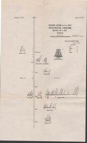
Map - STRUGNELL COLLECTION: UNITED HUSTLER'S & REDAN MINE, September 1913
... Map STRUGNELL COLLECTION: UNITED HUSTLER'S & REDAN MINE. ...Map, Transverse Sections N. & S. Of shaft, United Hustler's & Redan Mine, Hustler's Line of Reef, Bendigo. Plate No. XXX (30).Bulletin No 33 Signed H.A.Whitelaw. Drawing shows the vertical shaft descending to over 976 feet and appears to show samples of connecting horizontal shafts with their respective mineral contentsUnderground Survey Office, Bendigo.map, bendigo, hustler's & redan mine -
 Bendigo Historical Society Inc.
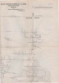
Map - STRUGNELL COLLECTION: UNITED HUSTLER'S & REDAN & K.K.MINES, September,1913
Map, United Hustler's & Redan & K.K.Mines, Hustler's Line of Reefs, Bendigo.Plat No.XXX1(31),. NOTE:- Plates 4,8,13,20,26,& 31 form a Longitudinal Section from Fortuna Hustler's to Hystler's Consols Mine. Bulletin 33.Signed H.A.Whitelaw. Drawing shows the vertical shafts descending to over 1932 feet and 1805 feet respectively .Underground Survey Office, Bendigo.map, bendigo, united hustler's, redan, k.k.mines -
 Bendigo Historical Society Inc.
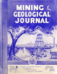
Book - MINING & GEOLOGICAL JOURNAL, September, 1941
... of Yea district published half yearly by the Department of Mines... by the Department of Mines Victoria contains photographs, maps ...Mining & Geological Journal September 1941, Geology in the search for metals, fire assaying, Bendigo goldfields, Geology of Yea district published half yearly by the Department of Mines Victoria contains photographs, maps and illustrations.gold, mining, journal -
 Bendigo Historical Society Inc.
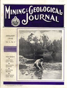
Book - MINING & GEOLOGICAL JOURNAL, 1940
... Mining & Geological Journal January 1940 Vol.2 No.2 Mine... Department of Mines Victoria contains photographs, maps ...Mining & Geological Journal January 1940 Vol.2 No.2 Mine reports Chewton Gold Field, Geological Glossary, Flotation Process, Wonthaggi Coal Field published hald yearly by he Department of Mines Victoria contains photographs, maps and illustrations.gold, mining, journal -
 Bendigo Historical Society Inc.
Map - GEOLOGICAL MAP: BENDIGO GOLD FIELDS
... GOLDFIELDS Victorian Minister of Mines GEOLOGICAL MAP - BENDIGO GOLD ...GEOLOGICAL MAP - BENDIGO GOLD FIELDS - Donated by JOHN HORWOOD. Two geological maps of the Bendigo Gold fields. The maps display , reef lines, Hills, Dams and mine locations. Also Anticlines, sinclines, shafts, alluvial deposits, contours and gullys. All items are superimposed on a map of the major roads and streets of Bendigo. The maps were printed by The Victorian Minister for Mines in 1923 and re-issued in 1936. The maps have been specifically framed and donated to The Bendigo Historical Society Inc. in May 2015 for display at Specimen Cottage. John had been a student at The School of Mines- Bendigo and found them useful as a student living in Bendigo. Prior to being framed , the maps have been kept rolled up in his home. Accession Number 309/15 Were on Display at Specimen Cottage 2015 - 2020. After all items removed from SC to the BRAC in 2021 the framed maps could not be located. Search ongoing. BP 2.3.2023Victorian Minister of Minesgoldfields -
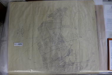 Coal Creek Community Park & Museum
Mine Map, 1942
... Mine Map... surface features such as railway sidings & Leura Creek. Mine Map ...6291.1 - Plan of "Austral Coal Mining Co" Lease in Korumburra detailing the mine tunnel plan, coal seam areas and some surface features such as railway sidings & Leura Creek. -
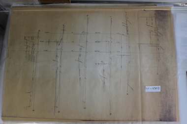 Coal Creek Community Park & Museum
Mine Map
... Mine Map... of sections. Mine Map ...6303.1 - Cross sections of Korumburra coal mining area detailing local faulting and seam location/depth, boreholes, as well as elevation & surface topography along lines of sections. -
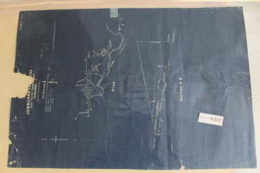 Coal Creek Community Park & Museum
Mine Map, 1929
... Mine Map... tunnels, coal limits, faults, etc. Mine Map ...6301.1 - Blueprint diagram of Jumbunna coal mine tunnel proposal, with bird's-eye view and cross section showing tunnels, coal limits, faults, etc. -
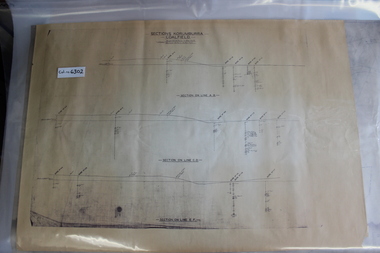 Coal Creek Community Park & Museum
Mine Map
... Mine Map..., boreholes and elevation. Seems to be a copy of original. Mine Map ...6302.1 - 3 cross sections through the Korumburra coal field area, showing topography, surface features, boreholes and elevation. Seems to be a copy of original. -
 Coal Creek Community Park & Museum
Mine Map
... Mine Map... boundaries and a creek. Mine Map ...6306.1 - Map of Outtrim mining area, with modification where damage/erasure has occurred. Shows tunnels, faults, tramways, boreholes, surface roads and (apparently) paddock boundaries and a creek. -
 Coal Creek Community Park & Museum
Mine Map, Amended 09/09/1946
... Mine Map.... Mine Map ...6294.1 - Stained amended copy of object No. 6298. -
 Coal Creek Community Park & Museum
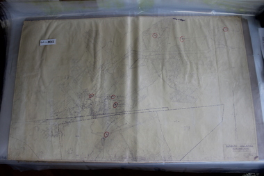
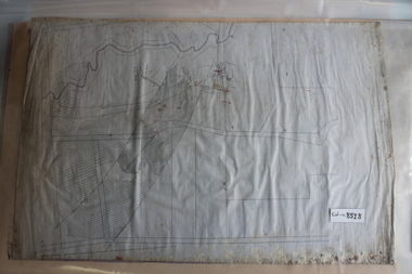
Mine Map, Amended 12/10/1949 Last visible date
... Mine Map.... Mine Map ...8522.1 - Amended copy of object No. 6298, with red texta circles highlighting mine tunnel exits/entrances. -
 Coal Creek Community Park & Museum
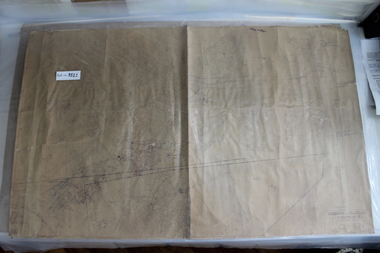
Mine Map, Amended 12/10/1949
... Mine Map... No. 6298. Further amended compared to object No. 6294. Mine Map ...8521.1 - Stained, amended copy of object No. 6298. Further amended compared to object No. 6294. -
 Coal Creek Community Park & Museum
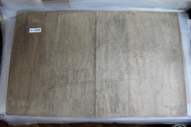
Mine Map
... Mine Map... map of Korumburra area. Mine Map ...8518.1 - Unlabelled map of mining tunnels, coal seams, boreholes, creeks, roads and (presumably) paddock boundaries. Based on features in common with other maps, very likely map of Korumburra area. -
 Coal Creek Community Park & Museum
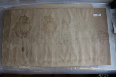
Farmed Mine Map, Map Of Underground Workings of Coal Creek Mine, 1896
... Farmed Mine Map... beyond legibility. Map Of Underground Workings of Coal Creek Mine ...8515.1 - Map of underground tunnels at a coal creek mine. Frame has a paper label rotted and faded almost beyond legibility. -
Bendigo Historical Society Inc.
Booklet - Bendigo Goldfield, Geological Survey Report No 93
Soft cover booklet of 50 pages. Geological Survey Report No 93. Bendigo Goldfield. Spring Gully, Golden Square, Eaglehawk By C.E. Willman and H.E.Wilkinson. Colour photo of the North Deborah mine poppet-head on a pale-yellow front cover. Illustrated with B&W photos, maps and sketches. Published 1992 by the Department of Manufacturing and Industry Development , Victoria Errata page pasted inside front cover. M & J Qualtrough sticker on title page. bendigo goldfield, geological survey -
 Monbulk RSL Sub Branch
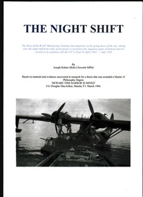
Book, Cleworth, Bob (Joseph Robert), The night shift : the story of RAAF minelaying Catalinas in coalition with US 7th Fleet, 22 April 1943 - 1 July 1945, 2015
An account of the minelaying by 4 Squadrons of the RAAF that between April 1943 and July 1945 in coalition with the USN 7th Fleet mined virtually every important Japanese port in the Southwest Pacific and as far North as Wenzhou (Wenchow) this was a substantial contribution to the Allied victory in the Pacific in WW2.Index, notes, bib, ill, maps, p.272.non-fiction An account of the minelaying by 4 Squadrons of the RAAF that between April 1943 and July 1945 in coalition with the USN 7th Fleet mined virtually every important Japanese port in the Southwest Pacific and as far North as Wenzhou (Wenchow) this was a substantial contribution to the Allied victory in the Pacific in WW2.world war 1939-1945 - aerial operations - australia, world war 1939-1945 - mining operations -
 Bendigo Historical Society Inc.
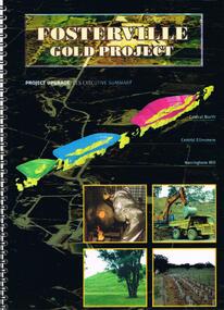
Document - FOSTERVILLE GOLD MINE COLLECTION: FOSTERVILLE GOLD PROJECT UPGRADE EXECUTIVE SUMMARUY
Black cover book, wire binding, 13 pages of text and maps. On front: Fosterville Gold Project' Map of ore body on cover - Central North, Central Ellesmere, Harringtons Hill. Contents include: open pits, heap leaching, waste dumps, estimated project life, changes from previously approved project, estimated project life, main project components, expanded open pits and underground mines, processing sulphide ore, tailings storages, waste rock dumps. Principles of rehabilitation, site preparation, rehabilitation activities during operation and decommissioning activities. Environmental issues, and summary of proposed new operating conditions.bendigo, mining, fosterville gold mine -
 Bendigo Historical Society Inc.
Map - LONG GULLY HISTORY GROUP COLLECTION: GEOLOGICAL MAP - BENDIGO GOLD FIELD
... Group - Geological map - Bendigo Gold Field Mines Department H ...Copy of a Geological Map of the Bendigo Gold Field. Map shows Lines of Reef, Anticlines, Synclines, Shafts, Alluvial Contours Gullies and some street names. Copy is hard to read. There are two pages.bendigo, history, long gully history group, the long gully history group - geological map - bendigo gold field, mines department, h herman, lightning hill line, hustlers line, derby line, paddy's gully line, garden gully line, deborah line, sheepshead line, new chum line, nell gwynne line, british and foreign line, napoleon line, carshalton line, thistle line, christmas line, lancashire line -
Bendigo Historical Society Inc.
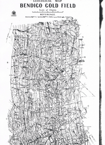
Map - GEOLOGICAL MAP OF BENDIGO GOLD FIELD
Two framed laminated maps (a,b) of Bendigo goldfield reef lines, map (b) is a continuation of the reef lines in map (a). On map(a) written in black on top: 'Geological Map, Bendigo Gold Field', Scale of chains, anticlines, synclines, shafts, alluvial and contours marked. Map (b) is continuation of (a). Written on the bottom RH corner of map: 'Prepared in 1923 in the Bendigo Office Mines Department under the direction of H. Herman, Director of Geological Surveys, from surveys by H.S. Whitelaw, Fiield Geologist, assisted by E.S. Usher & J. J. Moore. Re-issued in 1936.'H. Herman, Director of Geological Surveys, from surveys by H.S. Whitelaw, Fiield Geologist, assisted by E.S. Usher & J. J. Moore. Re-issued in 1936.'bendigo, mining, geological map. -
 Bendigo Historical Society Inc.
Document - MCCOLL, RANKIN AND STANISTREET COLLECTION: SMITH GREAT CENTRAL LEASE, 1934/36
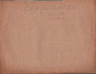
Documents: folder contains - correspondence N L Long re: prospecting, re lease 10731 Bendigo 1936 printed notice of application for a Mining Lease - Ernest Smith, map of Lease 10731 showing expired mining rights and consents, 1936 correspondence re application for lease 10731. Great Central Lease and New Chum Line.MCCOLL RANKIN AND STANSISTREETorganization, business, gold mining - legal, mccoll rankin and stansistreet, great central mine, new chum line. -
 Bendigo Historical Society Inc.
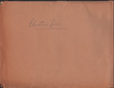
Document - MCCOLL, RANKIN AND STANISTREET COLLECTION: CHRISTMAS LEASE DOCUMENTS, 1941
Documents: folder contains - 'Consent to the Inclusion of Certain Lands in a Mining Lease', forms for Lease No. 11106, Map of No. 11106, List of land owners re: Lease 11106, Blank consent forms, Lease 11106 was below the 400foot level.MCCOLL RANKIN AND STANSISTREETorganization, business, gold mining, mccoll rankin and stansistreet, christmas gold mine. -
 Bendigo Historical Society Inc.
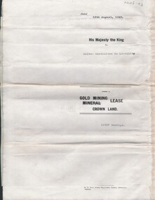
Document - MCCOLL, RANKIN AND STANISTREET COLLECTION: GOLDEN CARSHALTON NO LIABILITY, 1949
Documents: Gold Mining Lease No. 11257 FOL.36397 Bendigo 16/8/1949. Golden Carshalton N\L Map of Bendigo Sandhurst Lease No 11257 showing the Carshalton Mines Ltd New Main Shaft, Hansel Mundy Shaft.MCCOLL RANKIN AND STANSISTREETorganization, business, gold mining - legal, mccoll rankin and stansistreet. golden carshalton n\l. mundy shaft. -
 Bendigo Historical Society Inc.
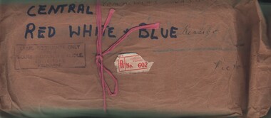
Document - MCCOLL, RANKIN AND STANISTREET COLLECTION: CENTRAL RED WHITE AND BLUE - BUNDLE OF PAPERS, 1912
Documents: Whitelaw Central Red White and Blue Mine Bendigo. 28 pages summary of gold mining correspondence - mortgage mining leases 943689340, contract of sale to Central Blue Gum GM 1933, leases with mining rights, treatment of pyrites agreement 1917 - J. Edwards & Co, Helen Streader - release of liability after being paid (pounds)125 by mine due to accidental death of husband 1912. Another for Ellen Lane 1916, list of titles held by Co , lease agreements Filcock and Manning, Andrew Harkness 'winding plant at mine' 1923, notice to perform agreement to Manning's 1916, Edwards Metallurgical Works 1917, map for 9777 Bendigo, contract for explosives with Dalgety & Co 1917, new scrip for lost shares 1917, Miner's Right 1911, sale of land Ra. A. Rankin 1910.MCCOLL RANKIN AND STANISTREETorganization, mining, central red white and blue, mccoll rankin and stanistreet. -
 Bendigo Historical Society Inc.
Map - GUIDE MAP OF BENDIGO & EAGLEHAWK, Late 1920's
Map. Guide Map of Bendigo & Eaglehawk. Light brown coloured booklet containing folded map of Bendigo and Eaglehawk. Outer cover is printed in blue and red ink and states - With compliments of J H Curnow & Son, Auctioneers, Real Estate Agents, Farm & Dairy Produce Merchants, Bendigo. Printed by J B Young, Lithographer. Map shows tramways & bus routes. Map shows Agricultural Showgrounds located between Park Street, Water Street, Barnard Street and Bridge Lane. Also shows Acclimitization Reserve located behind The Botanical Gardens at White Hills. Shows the location of Sailors Gully, Peg-Leg Gully, Jobs Gully, California Gully, Long Gully, Ironbark Gully, Golden Gully, Poverty Gully, Sheepshead Gully, Charcoal Gully, Eaglehawk Creek, Bendigo Creek and Back Creek. Contains interesting facts about Bendigo - Area 7,900 acres. Population - 26,000. First Council elected - 1855. Proclaimed a Borough - 1863. Proclaimed a City - 1871. Gold Rush broke out - 1851. For first 10 years gold yield averaged 8,600 ozs. per week . Total gold yield to 1923 - 572 tons valued at 82,000,000 pounds. Deepest mines - Victoria Quartz 4,614 ft., New Chum Railway 4,318 ft. 13 mines over 3.000 ft. deep. 53 mines over 2,000 ft. deep. Sewering of City commenced 1922, all principal buildings now sewered. Map printed by Arnall & Jackson, General Printers, Stationers & Engravers, 476 Collins Street. Map displays advertisement for J H Curnow & Son, Bendigo's leading Auctioneer and Estate Agents, Mitchell & Queen Sts. Bendigo. Map Scale 20 chs. = 1 in.cottage, miners, guide map of bendigo and eaglehawk -
 Bendigo Historical Society Inc.
Map - GUIDE MAP OF BENDIGO & EAGLEHAWK, Late 1920's
Map. Guide map of Bendigo & Eaglehawk. Folded map of Bendigo & Eaglehawk with blue outer cover booklet. Map is compiled by E E Parker, Eaglehawk. Map shows tramways, bus routes and cost one shilling. Map shows Agricultural Showgrounds located between Park Street, Water Street, Barnard Street and Bridge Lane. Also shows Acclimitization Reserve located behind the Botanical Gardens at White Hills. Shows the location of Sailors Gully, Peg-Leg Gully, Jobs Gully, California Gully, Long Gully, Ironbark Gully, Golden Gully, Poverty Gully, Sheepshead Gully, Charcoal Gully, Eaglehawk Creek, Bendigo Creek and Back Creek.Contains interesting facts about Bendigo:- Area - 7,900 acres, Population - 26,000, First Council elected - 1855, Proclaimed a City - 1871. Gold Rush broke out - 1851. For first 10 years gold yield averaged 8,600 ozs. Per week. Total gold yield to 1923 - 572 tons valued at 82,000,000 pounds. Deepest mines - Victoria Quartz 4,614 ft., New Chum Railway 4,318 ft., 13 mines over 3,000ft. deep, 53 mines over 2,000 ft. deep. Sewering of City commenced 1922. All principal buildings now sewered. Map printed by Arnall & Jackson, General Printers, Stationers & Engravers, 476 Collins Street. Outer map blue cover printed in red and blue ink by J B Young, Lithographer. Map displays advertisement for Bendigo Timber Co. Outer blue cover displays advertisement for Campbell Connelly & Co. Pty. Ltd, Ironmongers, Timware Manufacturers, Plumbers, Sewerage Contractors, High and Forest Sts, Bendigo 9outside back cover) and for Hartleys ( J L Shoosmith) Bendigo, displaying Indian Motor Cycles (inside back cover).map, bendigo, township, guide map of bendigo & eaglehawk -
 Bendigo Historical Society Inc.
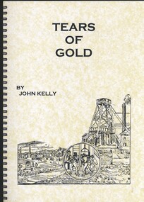
Book - TEARS OF GOLD, FATALITIES ON THE BENDIGO GOLDFIELDS 1852 - 1950, 2010
Tears of Gold, fatalities on the Bendigo Goldfields 1852-1950. Signed by the author, John R. Kelly, 6 July 2010, dedication thanks to the Bendigo Historical Society Soft covered spiral bound book of 91 pages with black and white photographs, maps and illustrations.John Kellybendigo, gold mining, fatalities, bendigo history, goldmining, miners, mine accidents, family history. -
 Bendigo Historical Society Inc.
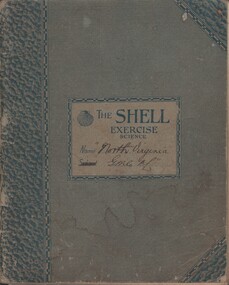
Document - MCCOLL, RANKIN AND STANISTREET COLLECTION: NORTH VIRGINIA GMC N L - CROSS SECTION PLAN OF THE MINE, 1942 1947
Document. Grey/green exercise book with 'North Virginia GMC NL. Book contains hand drawings of shafts and their metalurgical content at every depth. Symbols have been used to indicate different metals and earth. 2 maps loose in the book.McColl, Rankin & Stanistreetorganization, business, north virginia gmc n l, mccoll, rankin & stanistreet, north virginia gmc n l, gold mining, cross section plan of the north virginia -
 Bendigo Historical Society Inc.
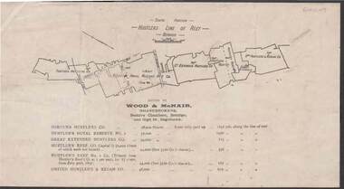
Document - KELLY AND ALLSOP COLLECTION: HUSTLERS LINE OF REEF MAP, 30/07/1891
... Document. KELLY & ALLSOP COLLECTION. Map of the Hustlers... Hustlers Line of Reef Map Wood & McNair. Wood & McNair Document ...Document. KELLY & ALLSOP COLLECTION. Map of the Hustlers Line of Reef, Bendigo (South portion). Issued by Wood & McNair, Sharebrokers, Beehive Chambers, Bendigo and High St., Eaglehawk. Mines shown on map are Fortuna Hustler's Co., Hustler's Royal Reserve No.2, Great Extended Hustlers Co., Hustlers Reef Co., Hustler's Reef No.1 Co., United Hustler's & Redan Co. Number of shares is listed against each of these mines.Wood & McNairbusiness, stockbroker, kelly & allsop, kelly & allsop collection, hustlers line of reef map, wood & mcnair. -
 Bendigo Historical Society Inc.
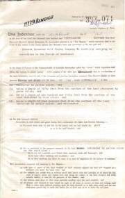
Document - MCCOLL, RANKIN AND STANISTREET COLLECTION: DEBORAH EXTENDED GOLD MINING COMPANY N/L GOLD MINING LEASE, 18 April 1957
Document Deborah Extended Gold Mining Company N/L document - gold mining lease document, Vol 334 071, dated 18 April 1957, 4 pages with map. Map adjoins Bendigo Cemetery. Lease between Deborah Extended Gold Mining Company N/L and the State of Victoria. No. 11339, Vol 334 Fol 071.organization, mining, gold mining lease, deborah extended gold mine, gold mining lease