Showing 270 items matching "mile creek"
-
 Wodonga & District Historical Society Inc
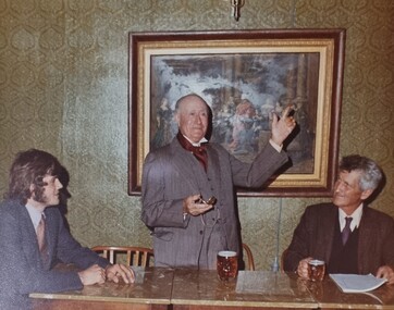
Album - Ringer's River by Des Martin - Plate 17 - Drawing the Calcutta Sweep for Piney Creek Picnic Race Club
On the morning of the Piney Creek Picnic Race Club's annual meeting Squire Pilkington of Piney Creek Homestead, President of the Club, draws the Calcutta Sweep. Graeme Oliver nominates his horse for the Ladies' Bracelet in the name of Elaine Montieth and O'Day, as Manager for MacLough gives his nomination to her friend Penny Sefton whom Reg Apperton is sparking. With Keiran O'Hara for his rider, Squire Pilkington nominates in the name of his pretty niece, Susan Bundy. Harry MacLean as Squire Pilkington. Bill Tenteye as the Hon. Secretary Jim McGrath as the Hon. Treasurer.The album and images are significant because they document literature written by a prominent member of the Wodonga community. The presentation of this precis was supported by several significant district families and individuals.Ringer's River Album Coloured photo Plate 17des martin, many a mile, ringer's river, northeast victoria stories -
 Wodonga & District Historical Society Inc
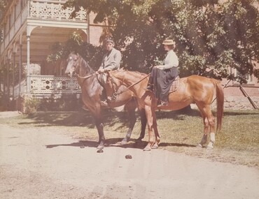
Album - Ringer's River by Des Martin - Plate 10 - Bringing in the race horses
A short time later Elaine and Graeme Oliver, a young station owner, prepare to ride from Barmagula homestead down to the horse yards to assist in bringing in the "grasseaters". These are racehorses that have all been paddocked together for some weeks prior to the forthcoming Piney Creek Amateur Picnic Race Club's annual meeting. Paddocking ensures that every horse has the same training period before the private meeting at which members only may race or ride a horse, and attendance is by invitation. Tony Conway as Oliver.The album and images are significant because they document literature written by a prominent member of the Wodonga community. The presentation of this precis was supported by several significant district families and individuals.Ringer's River Album Coloured photo Plate 10des martin, many a mile, ringer's river, northeast victoria stories -
 Wodonga & District Historical Society Inc
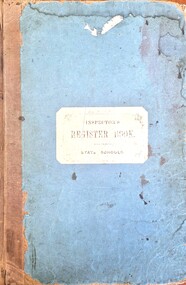
Document - House Creek School 2266 Inspector's Register Book 1881 - 1905
... for House Creek School Number 2266. Inspections were carried out..., between Huon and House Creeks, about four miles southwest ...This folder contains the official Inspector's reports for House Creek School Number 2266. Inspections were carried out every six months for all Victorian Government Schools. On 8th October 1879 Mathew Parnaby and others applied for the establishment of a school, between Huon and House Creeks, about four miles southwest of Wodonga. The District Inspector approved and Albert Schlink offered two acres of freehold land as a site, four chains from the southeast corner of Allotment Eight, Section 10, of the Parish of Wodonga in the County of Bogong. A portable classroom, 22ft x14ft, with quarters was erected at a total cost of £192, and SS2266 opened on 1st of June 1880 with Edwin Davis as Head Teacher. In 1883 the average attendance ranged between 12 and 20. Both school and quarters fell into a very bad state of repair. Temporarily closed in 1894, the school reopened as a result of a petition by Ferdinand Godde and others. By 1902 the school had a nett enrolment of 37, the grounds had been fenced, and a shelter shed erected by local effort. By 1907 the nett enrolment had risen to 45 with an average attendance of 37. Ferdinand V. Godde served as Correspondent of the Committee in 1911. House Creek was unstaffed in February 1917 and closed on 8th of November 1917. It reopened on 4th August 1921, but with a nett enrolment of 6, closed on the 24th July 1926. The building was sold for removal. Many of the reports in this Register were written and signed by Henry Finch Rix. He was a pioneer of the Victorian School Inspection System and from 1884 to 1887 worked as a Chief Inspector in the Beechworth Education District. He had previously played with the Carlton Football Club for one season. Henry Rix was a highly regarded educator and a staunch advocate of the establishment of school libraries to teach children of "the rich stores of profitable pleasure to be found in books."This item is significant because it documents progress and recommendations for students at an early government primary school in the Wodonga district.A large bound folder of printed forms. The majority have been completed in handwritten reports including names, notes and statistics. On cover: INSPECTOR'S REGISTER BOOK STATE SCHOOLShenry finch rix, house creek school, victorian school inspectors, school 2266 -
 Victorian Harness Racing Heritage Collection at Lord's Raceway Bendigo
Clothing - Race colours, Jack Hargreaves, 13/8/21
Jack Hargreaves drove Adaptor to win the 1969 Bendigo Cup. Jack Hargreaves, who died on December 6 at the Bendigo Hospital aged 77, trained and drove countless winners during a 34-year harness racing career in which he became one of the true icons of the sport. Born John Henry Hargreaves in Wedderburn on December 3, 1926, harness racing was always in his blood. His father, Hughie, was a successful driver and trainer who raced horses all over Victoria. Jack drove his first winner at the age of 16 at Woodend. He lived on the family farm at Kuracca, near Wedderburn, until the age of 22, when he then married Elvie Stephenson from Fentons Creek. He and Elvie went on to have four children - Helen (now 53), Judi (51), Roslyn (49) and John (45). They are grandparents of 15 and great-grandparents of two. After spending two years at Tallarook where he worked on a sheep property, Jack and Elvie then moved to Korong Vale, where Jack set up his own training stable. He kept about 20 horses at a time at his Korong Vale stable, training and racing all of them for 26 years at his property. His greatest moment was the 1969 Miracle Mile, when he drove Adaptor to victory. Adaptor would later be sold to America for the then highest figure paid for an export horse - about $250,000. He also notched up many wins in country pacing cups, including Bendigo, Geelong, Maryborough, Kilmore and St Arnaud. During his career, Jack built a reputation of being a fine judge of pace and he consistently brought out the best in some difficult horses. His natural ability led to him being crowned Bendigo's leading driver for the season on two occasions. But an accident at Mildura on November 26, 1976 - just days before his 50th birthday - led to his driving career being cut short prematurely. Jack sustained head injuries after he was trampled by another horse after being tipped out of his sulky while driving Go Ned. He was regaining his senses and sitting up in the middle of the track when the horse went straight over him. The hoof of the horse came down between his left ear and skullcap, shattering that part of his skull. In the weeks following the accident, Jack underwent lengthy operations in Melbourne, to firstly clear splinters of bone from his brain. He then had a piece of bone removed from one of his ribs to cover a hole in his skull. He was left with injuries that were described as being similar to those of a person who had suffered a stroke. Months of physiotherapy and speech therapy followed in Melbourne and later Bendigo, before he was finally allowed to go hone in August, 1977 - almost one year after the accident. After losing part of his speech in the accident, Jack learned to communicate using his hands. "It became second-nature to us that we could read his hand signals and most of the people in the harness racing world could, too," Jack's daughter, Judi Bond, said."He learned his own way to communicate with people."While Jack was no longer able to continue his passion of driving competitively, he would still take the reins at the training track when given a chance to by his fellow drivers.He also continued to breed horses. "He was a skilled horseman, a good farrier and horses were the love of his life," Judi said. Two years after the accident, Jack and Elvie built a house in Wedderburn, directly above the trotting track. "That was so in the early days after his accident he could still see what was going on at the track," Judi said. "Everyday, he would watch the trainers . . . he'd watch what they were up to on the track."Jack was able to sit in his loungeroom and look out through large glass doors with a "grandstand" view of Leg 5 races, trials and training at the trotting track. Jack's love of harness racing filtered through to his children, with both Judi and John having careers as drivers. Judi drove for 10 years, finishing in 1978, but she continues to breed horses. Judi won the first women's race where bets were allowed to be made when she drove Youdini to victory at the Melbourne Showgrounds track in 1974.Blue with yellow vertical panelbendigo cup, adaptor, horse, jack hargreaves, bhrc, bendigo harness racing club, lords raceway, j hargreaves -
 Falls Creek Historical Society
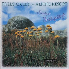
Booklet - Falls Creek Alpine Resort Summer Breakaways 1996/1997
Part of a yearly marketing and information program to promote Falls Creek region for the summer season. . General activities explained in he brochure are:- Enjoying A Bushwalk In The Alpine National Park, Water Sports, Horse Riding, Mountain Bike Riding, Two & Four Wheel Driving, High Country Wining & Dining, Discovering The Wildlife. Daybreaks & Golden Sunsets And Pure Relaxation. The specific activities in the Summer Program of Events include:- Alpine Nature Rambles. Angling Expeditions, Christmas Carols, National Distance Camp, Food, Wine & Wildflower Weekend, High-O Orienteering Event, Mile High Tennis Tournament, High Country Mountain Bike Ride, Classical Music Weekend, Cadbury Red Tulip Giant Easter Egg Hunt And Festivities. The “Breakaways” brochure is a publication of the Falls Creek Chamber of Commerce, an organisation dedicated to establishing Falls Creek as the premier alpine resort In Australia. This item is important as it documents seasonal activities at Falls Creek Alpine ResortA brochure for summer program at Falls Creek for 1996/7. The front cover features an image of yellow wildflowers, mountain rocks and the sky with the title"Falls Creek Alpine Resort Summer Breakawaysfalls creek marketing, falls creek summer programs., falls creek alpine resort, falls creek events and activities -
 Falls Creek Historical Society
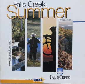
Booklet - Falls Creek Summer 2001 - 2002
... & Art Exhibition, Falls Creek Off-Road Triathlon, Mile High... Creek Off-Road Triathlon, Mile High Tennis Tournament, Stanton ...Part of a yearly marketing program promoting Falls Creek region for the summer season. The table of events runs from December 2001 until April 2002 and includes Falls Creek Multi-Sport Camps, Christmas Day Luncheon, Summer Paste Workshop, New Year's Eve Celebrations' National Distance Training Camp, Jazz & Blues, Food, WIne & Wildflower Weekend, HIgh Country Photography & Art Exhibition, Falls Creek Off-Road Triathlon, Mile High Tennis Tournament, Stanton & Killeen WInemaker Dinner, Classical Music and Easter at Falls Creek.This item is important as it documents seasonal activities at Falls Creek Alpine Resort outside the most recognised snow skiing programs.A small leaflet advertising summer program at Falls Creek for 2001-2002. Front cover features four images, the title in tan and white print and the Falls Creek logo at the bottom. The slogan printed at the foot of the front page is "Catch the buzz". falls creek summer, events at falls creek, falls creek summer programs., falls creek marketing -
 Falls Creek Historical Society
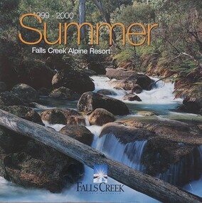
Booklet - Falls Creek Alpine Resort Summer 1999 - 2000
Part of a yearly marketing and information material promoting Falls Creek Resort for the summer season. It includes a table of events from November 1999 until April 2000. Events listed include:- Falls Creek Multi-Sports Camps, Christmas Day Luncheon and New Year's Eve celebrations, National Distance Training Camp, Cajun Blues Weekend, Food, Wine and Wildflower Weekend, Mile High Tennis Tournament, High Country Photo Exhibition, Falls Creek Off-Road Triathlon, Stanton & Killeen WInemaker Dinner, Classical Music Weekend, Adventures with Style and an Easter Egg Hunt.This item is important as it documents seasonal activities at Falls Creek Alpine ResortA brochure for summer program at Falls Creek Alpine resort for 1999 - 2000. Text is in orange and white print.falls creek marketing, falls creek events, falls creek summer, falls creek camps -
 Ringwood and District Historical Society
Book, Elizabeth Dole Porteus, Let's Go Exploring: The Life Of Stanley D. Porteus - Hawaii's Pioneer Psychologist, 1991
White hard covered book. Biography by daughter-in-law of Stanley Porteus, pioneer of modern psychology and one-time resident of Ringwood, Victoria. SUMMARY NOTES. Stanley David Porteus was born in Box Hill, Victoria, Australia in 1883, the only son of a Methodist minister. Like other now large suburbs of Melbourne such as Canterbury, Mitcham and Ringwood, Box Hill was a mere village. Each was surrounded by bush. He grew up like most Australian boys with a love of sport and, although lightly built, did quite well at Australian Rules football and was above average at cricket. He became a schoolteacher with the Victorian Education Department. Promotion within the department depended on experience gained at teaching in tiny rural schools so he applied for such a position at Glenaladale, on the Dargo Road, some 35 miles north west of Bairnsdale. He walked about 6 miles from the nearest railway station at Fernbank to find the school surrounded by virgin forest with only one dwelling in sight. Attached to the school were lean-to rooms that were to be his residence for the next 2 ½ years. He was fascinated by the nearby Den of Nargun and Bull Creek, which joined the Mitchell River in a deep gorge containing a profusion of rainforest vegetation. While at Glenaladale, he met Frances Evans who became his wife. To seek promotion, he left Glenaladale and taught at Leneva and Benambra. While at the latter school, he learned of a position becoming available as superintendent of special schools in Melbourne. As the available means of transport, coach and horses to Bairnsdale, then by train to Melbourne, would not get him to Melbourne before the close of applications, he borrowed a bicycle and rode through the bush to his in-laws home at Lindenow and thus made it before the deadline. He was successful in his application and it set him on a course that lead to him becoming Australia's first Clinical Psychologist. His work, particularly, the development of the Porteus Maze Test, attracted the attention of American educators and he was offered an appointment for a year at Vineland Training School in New Jersey. On a stopover in Honolulu, he was impressed to the extent that he expressed a desire to work there. Not the least of its attractions was the mix of races that offered opportunities to study psychological differences, if any, between various races. His wish was to be granted unexpectedly as he was, in 1919, invited to Honolulu to set up a Psychological and Psychopathic Clinic at the University of Hawaii. From his home in the hills north of Honolulu, on December 7th 1941, he saw the Japanese attack on Pearl Harbour. He lived there until his death in about 1980. -
 Eltham District Historical Society Inc
Photograph - Digital Photograph, Marguerite Marshall, Eltham Lower Park, 20 April 2008
Originally a race course, the park has brought the community together with a variety of activities. Published: Nillumbik Now and Then / Marguerite Marshall 2008; photographs Alan King with Marguerite Marshall.; p45 Once used for horse racing, which attracted visitors from Melbourne, the Eltham Lower Park has brought the community together with a wide range of activities. Horse riding is now enjoyed as a recreation in the park as are other sports. The park also includes the Diamond Valley Railway miniature trains and a sanctuary for the rare and vulnerable Eltham Copper Butterfly. Eltham Lower Park, with other parks, forms an almost continuous green band from Eltham’s centre, along the Diamond Creek to the Yarra River.1 Before European settlement the Wurundjeri people met on this land, particularly at the junction of the Diamond Creek with the Yarra River, which they called Birr-arung. This is commemorated by the sculpture, Not just a Pretty Place by Aleks Danko, winner of the 2000 Nillumbik Art in Public Places Award. The first European to settle here was probably Henry Foley, who in 1841 used it as part of his pastoral run. Foley sold his leasehold to Joseph Wilson in 1845, who soon after sold it to Frederick Falkiner. During the 1840s the future park was part of a government square mile (2.6 sqkm) reserve, north of the Yarra, within the Parish of Nillumbik, later named Eltham. Soon the land was used for horse racing after nearby residents cleared ten acres (4ha) in the early 1850s. A three-quarter of a mile (1.2km) race secured the winner the £10 Publican’s Prize. In response to popular demand, the newly formed Eltham District Road Board petitioned the Surveyor General of the Colony of Victoria, in 1856, for 36 acres (14.6ha) of crown land for a racecourse and recreation. By 1858 the Eltham races had become an institution. ‘Many skirmishes occurred and the way home was paved with temptation, with sly-grog for sale.3 In the early 1870s, two jockeys were sons of the police officer in charge of the Eltham Police Station, Miles S Lyons. Another ten acres (4ha) was added to the area in 1866 and 12 acres (4.8ha) – Hohnes Hill – in 1870. In 1866, two acres (0.8ha) on the creek banks became an animal pound with William Walsh the pound keeper in 1870, but this was later incorporated into the park. By 1877 the area was called a public park but horse racing and training continued into the 1920s. In the mid-1900s trotters were trained on a circuit road. In 1953 the Eltham Pony Club was established and used a cross-country course on Hohnes Hill. From the mid 1950s the club held the Eltham Easter Fair at the park, later to include a procession along Main Road from the town centre to the park. The park also attracted picnic parties and campers from the inner suburbs as did Wingrove Park, and businesses catering for visitors, sprang up on the opposite side of Main Road. Bus-loads of school children visited the park for Gould League bird days in the 1960s. In 1979 the Eltham Shire Council bought Lenister Farm, linking the park with the Yarra River. The Lenister Farm wetland includes a bird hide, viewing platform and interpretive signs.5 Pioneer Henry Stooke, later Road Board chairman, bought the 11 acres (4.5ha) - later to become Lenister Farm - from the Crown in 1862. Stooke never lived on this site and the two houses at Lenister Farm were built in the 20th century. Since its formation in 1871, the Council has controlled this crown land, which it named Eltham Park. But in the 1920s Eltham Council bought land near the town centre for a park, which it named Eltham Central Park. To avoid confusion the Council renamed Eltham Park, Eltham Lower Park. Since 2004 the Yarra footbridge has linked the park with the Yarra Valley Metropolitan Park and the Main Yarra Trail.This collection of almost 130 photos about places and people within the Shire of Nillumbik, an urban and rural municipality in Melbourne's north, contributes to an understanding of the history of the Shire. Published in 2008 immediately prior to the Black Saturday bushfires of February 7, 2009, it documents sites that were impacted, and in some cases destroyed by the fires. It includes photographs taken especially for the publication, creating a unique time capsule representing the Shire in the early 21st century. It remains the most recent comprehenesive publication devoted to the Shire's history connecting local residents to the past. nillumbik now and then (marshall-king) collection, eltham lower park, eltham park -
 Eltham District Historical Society Inc
Photograph - Digital Photograph, Marguerite Marshall, One Tree Hill Mine, Smiths Gully, 8 June 2006
Gold was discovered on One Tree Hill in 1854. The site has been worked intermittently until fairly recent times. Published: Nillumbik Now and Then / Marguerite Marshall 2008; photographs Alan King with Marguerite Marshall.; p53 Though still a working mine, One Tree Hill Mine at Smiths Gully, now stands in a tranquil reserve surrounded by bush and native animals - in contrast to its heyday. In the mid 19th century, when the mine was part of the Caledonia Goldfields, hundreds of men in search of their fortune worked the alluvial gold in the Yarra River, its tributaries and the reefs that made up the goldfields. Miner Stan Bone, assisted by Wilfred Haywood, is the last of the independent gold miners in the area and still uses the quartz crushing battery as miners did when gold was first discovered in the area in 1851.1 Stan, who is the last of six generations of miners in his family, was aged 17 when he began mining on his father Alex’ mine, The Golden Crown in Yarrambat. These days, after blasting the gold-bearing rock in Mystery Reef, one of the four reefs at One Tree Hill, Stan transports it around five kilometres by tip truck to the Black Cameron Mine for crushing. There he uses water from the waterlogged mine, (which still contains gold), as the Happy Valley Creek at One Tree Hill is usually dry.2 The One Tree Hill Mine has been worked for close to a century since it opened around the late 1850s.3 The Swedish Reef was its most productive reef and one of the largest in the area. Around 1859, extractions included 204 ounces (5.8kg) of gold, won from 57 pounds (26kg) of stone.4 Then during World War Two, Stan’s uncle, Bill Wallace, and Alex Bone, closed the mine. In 1973, Stan, with his Uncle Bill, reopened the Black Cameron Mine and worked there until 1988. Stan resumed mining One Tree Hill in 1998. As late as the 1920s gold was picked up by chance! When crossing a gully on his way to vote at the St Andrews Primary School, Bill Joyce picked up some quartz containing gold. This site was to become the Black Cameron Mine. The Caledonia Diggings, named after Scotland’s ancient name by local Scots, began around Market Square (now Smiths Gully) and included Queenstown (St Andrews), Kingstown (Panton Hill) and Diamond Creek. There were also poorer bearing fields in Kangaroo Ground and Swipers Gully (now Research). * None of these compared in riches to the Ballarat and Bendigo fields5, but the Caledonia Diggings continued intermittently for close to 100 years. Gold was discovered in Victoria following a bid to stem the disappearance of much needed workmen to the New South Wales diggings. Several businessmen offered a reward of £200, for the discovery of gold within 200 miles (322 km) of Melbourne. Late in June 1851, gold was first discovered at Andersons Creek, Warrandyte. Then in 1854, George Boston and two other men discovered gold at Smiths Gully. Gold transformed the quiet districts, with a constant flow of families and vehicles on the dirt tracks en route to the Caledonia Diggings. Three thousand people worked the gullies in Market Square, including about 1000 Chinese miners. The square established its own police, mining warden, gold battery, school, shops and cemetery and grog flowed. Market Square flourished until the middle 1860s. Bullocks transported quartz from the Caledonia Goldfields to the crushing machinery at the Queenstown/St Andrews Battery, near Smiths Gully Cemetery. It was destroyed by bushfire in 1962. By the late 1850s, most early alluvial fields were in decline, but minor rushes continued until around 1900 and some until the early 1940s. Some miners did well, although most earned little from their hard labour in the harsh and primitive conditions.6 But according to historian, Mick Woiwod, the gold fields helped to democratise society, as individuals from all walks of life were forced to share experiences, and the ability to succeed, depended less on inherited wealth or social rank.This collection of almost 130 photos about places and people within the Shire of Nillumbik, an urban and rural municipality in Melbourne's north, contributes to an understanding of the history of the Shire. Published in 2008 immediately prior to the Black Saturday bushfires of February 7, 2009, it documents sites that were impacted, and in some cases destroyed by the fires. It includes photographs taken especially for the publication, creating a unique time capsule representing the Shire in the early 21st century. It remains the most recent comprehenesive publication devoted to the Shire's history connecting local residents to the past. nillumbik now and then (marshall-king) collection, gold mining, one tree hill mine, smiths gully -
 Eltham District Historical Society Inc
Photograph - Digital Photograph, Alan King, Maroondah Aqueduct Siphon Bridge over the Plenty River, 26 January 2008
Opened in 1891, the bridge formed part of the Maroondah Aqueduct carrying water from Watts River near Healesville to the reservoir at Preston where it joined Melbourne's metropolitan water system. Covered under Heritage Overlay, Nillumbik Planning Scheme. Published: Nillumbik Now and Then / Marguerite Marshall 2008; photographs Alan King with Marguerite Marshall.; p99 Built to supply thirsty Melbourne in the late 19th century, the siphon bridge spanning the Plenty River off Leischa Court, Greensborough, was part of an engineering masterpiece. Opened in 1891, the bridge formed part of the Maroondah Aqueduct carrying water from the Watts River near Healesville to the reservoir at Preston where it joined the metropolitan distribution system. A major link in Melbourne’s water supply, it also had a huge impact on communities, which mushroomed along its route. Named after the Aboriginal word for the area around the Maroondah Reservoir, the Maroondah Aqueduct was fully operational until the 1970s. Since the 1980s the land along parts of the aqueduct have been used for walking and bicycle riding, shaded in places by Monterey Pine trees planted to stabilise the surrounding ground. From 1857 the Yan Yean Reservoir supplied Melbourne’s water but the growing city needed additional catchments.1 In 1886 work began on a weir on the Watts River to enable the aqueduct to carry most of the river water 41 miles (66km) to Melbourne. The aqueduct, built by the Board of Works, is the oldest remaining aqueduct near Melbourne and was probably the first built with concrete.2 Although the aqueduct is now only used between the Maroondah and Sugarloaf Reservoirs, it can still be traced across the Shire. It extends from the Maroondah Reservoir through Christmas Hills, Kangaroo Ground, Research, Eltham, St Helena and then previously wound west through Greensborough to Reservoir.3 Built by horse and manpower the aqueduct gravity fed 25 million gallons (113.6ML) of water a day to Melbourne along a gradient of one foot to the mile. It included 25 miles (41km) of open concrete and brick channel, six miles (10km) of tunnels, and nine miles (15km) of 14 inverted siphons of riveted wrought-iron across creeks. Bricks for the aqueduct were made from clay found near the sites and remains of several kilns can still be found between Kangaroo Ground and Christmas Hills. Building the aqueduct transformed local communities. An abattoir was established at Christmas Hills. Grog shanties and labourers’ camps sprang up and local courts dealt with cases of ‘petty pilfering and boisterous behaviour’.4 The Kangaroo Ground school population jumped to 91, crammed into a room with one teacher. Miners who built the tunnels camped just north of Churinga in Greensborough – then called Tunnel Hill Camp – and adjacent to the Evelyn Arms Hotel. The miners’ high spirits were sometimes quenched in horse troughs or by a ‘welt under the ear and kick on the behind’ as the local constable calmed them down rather than lock them up.5 But the growing city of Melbourne needed more water, so the O’Shannassy catchment, east of Warburton, was added to the system in 1914. In 1920 work began on the present concrete Maroondah Dam one mile (1.6km) from the weir on the Watts River. The aqueduct capacity was thus doubled to 50 million gallons (227ML) a day.6 Intense land development threatened to pollute the open water supply, so channel sections were replaced with large pipes. In the late 1960s a large water main was built from the tunnel outlet at Research and extended through St Helena and Greensborough, so this section of the aqueduct was taken out of use. Long sections of the unused open channels in Greensborough and Bundoora were destroyed, but the old channel in Research and Eltham North remained largely intact. In the 1970s, the Sugarloaf Reservoir was constructed, inundating 445 hectares of land in Christmas Hills. Sugarloaf was officially opened in 1980 and serves as a water storage and treatment plant supplying Melbourne. In the early 1980s pipes replaced the section from Sugarloaf Reservoir to the tunnel entrance at Kangaroo Ground. The Research-Kangaroo Ground tunnel operates as part of the pipeline system.This collection of almost 130 photos about places and people within the Shire of Nillumbik, an urban and rural municipality in Melbourne's north, contributes to an understanding of the history of the Shire. Published in 2008 immediately prior to the Black Saturday bushfires of February 7, 2009, it documents sites that were impacted, and in some cases destroyed by the fires. It includes photographs taken especially for the publication, creating a unique time capsule representing the Shire in the early 21st century. It remains the most recent comprehenesive publication devoted to the Shire's history connecting local residents to the past. nillumbik now and then (marshall-king) collection, maroondah aqueduct, pipe bridge, siphon bridge -
 Eltham District Historical Society Inc
Photograph - Digital Photograph, Alan King, St Andrews Anglican Church, St Andrews, 30 January 2008
Built c.1868, St Andrew’s Anglican Church is Nillumbik Shire’s oldest timber church and is historically, socially, and spiritually significant to the Shire of Nillumbik. The church is historically significant because it may have given its name 'St Andrews' to the town (another suggestion is that the name came from the local hotel), it is also historically significant as one of only four buildings that remain from the Caledonian goldfields era of Queenstown (now St Andrews) and one of only a handful of buildings that survived the 1960s bushfires. The church is historically, socially, and spiritually significant because it has played an important part in community life for more than 150 years; a proposal to move the church in 1984 met with strenuous opposition. Much of the fires on Black Saturday 2009 were the north of the town. The town itself remained intact - as did this heritage building. Covered under Heritage Overlay, Nillumbik Planning Scheme. National Trust of Australia (Victoria) Local significance Published: Nillumbik Now and Then / Marguerite Marshall 2008; photographs Alan King with Marguerite Marshall.; p69 The St Andrews Anglican Church and former St Andrews Primary School, are two reminders of the district’s early days, when it was founded on gold. St Andrews, then called Queenstown, was the earliest goldfield in the Caledonia Diggings.1 It was the Upper Diamond Gold Mining and Administrative Centre, with 3000 miners. Queenstown was also the seat of the Court of Petty Sessions. The church and school then stood close to European and Chinese stores, three hotels, a brewery and a quartz mill.2 In 1861, Queenstown was officially proclaimed a township. From 1865, the name Queenstown was interchangeable with St Andrews, until 1952, when the town was officially named St Andrews. As gold declined from the early 1880s, Queenstown changed dramatically into a settlement of small farms. St Andrew’s Anglican Church, built in 1868, is the Shire’s oldest timber church and possibly gave its name to the township.3 The small timber church was opened on November 1, 1869, by the Dean of Melbourne. Anniversary tea meetings helped raise funds, and in 1889, a three-bedroom parsonage was built alongside. In 1910, the vicar, the Rev Selwyn Chase (and friend of the Scouting Movement’s founder, Baden Powell), established the 1st Queenstown Scout Troop, only two years after Scouting began in Australia. The church was important to the lives of many local residents who were baptised, married and had funeral services there. But by the 1950s the population had decreased and so did the weekly attendances. Around the mid-1960s the church closed, then fell into disrepair. So in the mid 1980s it was sold to the Education Department and was under threat of relocation or demolition. However this caused such opposition from locals,4 that instead, the Anglican church leased it as part of the Panton Hill parish5 and it was reconsecrated in 1987. Queenstown’s first school was held in a tent after transferring from Andersons Creek, Warrandyte.6 From 1858 a church school, Caledonia Diggings, stood west of the main road, a quarter of a mile (0.4km) before Buttermans Track. In 1882 the school was moved from a leased building, owned by headmaster Robert Harris, into a larger building on the corner of the School and the Heidelberg-Kinglake Roads. It had been moved from Smiths Gully and included a teacher’s three-roomed residence.7 In 1887 the school was replaced by the Queenstown State School No 128, although it was also called Caledonia Diggings until 1891. In 1956 it was renamed St Andrews. Still standing, this building is now used as the St Andrews Community Centre and the residence is leased for private use. The original timber-lined room remains alongside the extensions, and is distinctive with its high ceiling and tall small-paned windows. In 1984 a new school was built 500 metres west of the old school. Many residents have contributed much to St Andrews but one family that has done so for several generations is the Harris family. Robert Harris was an active member of the St Andrew’s Anglican Church, and worked hard at improving the town’s amenities until his death in 1887. He was a signatory to the successful 1863 petition to the Chief Commissioner of Police, against the proposed removal of the Court of Petty Sessions and police station at the Caledonia Diggings. The police station stayed in the town until 1917. Harris was Head Teacher of Queenstown State School from 1864 to 1874, then of the Smiths Gully school until it closed in 1882, and he continued teaching at Panton Hill until his death. His son, Robert Charles Harris, was editor and printer of the local newspaper, The Evelyn Observer, from 1873 until 1915. Robert’s son, William Shelley Harris, served in the Boer War and in World War One. In 1928 he became Kinglake National Park’s first park ranger. Robert’s daughter Elizabeth, taught needlework at Queenstown State School, and later ran the post office in Kinglake.This collection of almost 130 photos about places and people within the Shire of Nillumbik, an urban and rural municipality in Melbourne's north, contributes to an understanding of the history of the Shire. Published in 2008 immediately prior to the Black Saturday bushfires of February 7, 2009, it documents sites that were impacted, and in some cases destroyed by the fires. It includes photographs taken especially for the publication, creating a unique time capsule representing the Shire in the early 21st century. It remains the most recent comprehenesive publication devoted to the Shire's history connecting local residents to the past. nillumbik now and then (marshall-king) collection, st andrews, st andrews anglican church -
 Eltham District Historical Society Inc
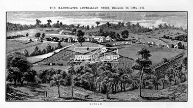
Photograph, Samuel Calvert, Eltham, The Illustrated Australian News, December 26, 1884, p212, 1884
A description in the newspaper near the illustration (page 210) reads as follows: "Eltham is a pretty little township on the Yarra Flats road, about 14 miles east north east of Melbourne, from which place there is communication by way of Heidelberg. It has a population of nearly 400 inhabitants, but in addition it is the centre of a large district extending over about 203 square miles, having a population of 2344. The land in the district is mostly used for grazing purposes, although as a rule the small farms grow a good deal of wheat, oats and other agricultural produce. A large quantity of fruit, especially raspberries and strawberries, is also produced, the rich alluvial flats along the creek upon which the township is situated being very well adapted for that purpose. Gold has also been found in the vicinity of the township, but not in remunerative quantities". This photo forms part of a collection of photographs gathered by the Shire of Eltham for their centenary project book,"Pioneers and Painters: 100 years of the Shire of Eltham" by Alan Marshall (1971). The collection of over 500 images is held in partnership between Eltham District Historical Society and Yarra Plenty Regional Library (Eltham Library) and is now formally known as 'The Shire of Eltham Pioneers Photograph Collection.' It is significant in being the first community sourced collection representing the places and people of the Shire's first one hundred years.Digital imageshire of eltham pioneers photograph collection, eltham, illustrated australian news -
 Bacchus Marsh & District Historical Society
Map, Lerderderg Park Lands sale plan. 1911
This plan was for the sale of parcels of land from the Lerderderg Park Estate property in 1911. Advertising for the sale appeared in the Bacchus Marsh Express newspaper through July of 1911. The property was situated only a few kilometers from the township of Bacchus Marsh. The agents for the sale were L. A. Fairbairn & Co.Lerderderg Park Estate was a significant and early colonial property in the Bacchus Marsh area. This plan provides details about the first time the property was subdivided for sale. It is therefore documents an important moment in the history of this property and the broader trend of the subdivision of older and larger properties in the district.A single page paper plan showing allotments of land for sale from the Lerderderg Park property owned by John Wills. The parcels of land for sale are coloured in red.The Lerderderg River and Pyke's Creek Irigation Channel shown on the plan are in blue ink. The rest of the plan is a dark cream or beige colur with the text in black ink. The plan has been extensively annotated with hand-written notes indicating the names of people who purchased the various parcels of lands and the prices paid for those lands. Part of the top of the plan containing some text appears to be missing. The plan is pasted into a bound volume containing 76 maps or plans in total. Top: Have received instructions to Sell, account Mr John Wills, his renowned LERDERDERG PARK LANDS, so well and favourably known throughout the Commonwealth. In areas from 3 acres to 1276 acres. Every lot is either rich lucerne land (or portion now under lucerne) with some higher land adjoining Railway Station, and 2 Milk factories within 2 miles, absolutely the finest land in Victoria. Bottom: THIS IS THE FIRST SUBDIVISIONAL SALE of Rich Flats in Bacchus Marsh since the Pyke's Creek Scheme, and every lot is commanded by it. Only 32 miles from Melbourne.bacchus marsh victoria maps, land sales, lerderderg park estate, land subdivision -
 Kew Historical Society Inc
Work on paper - Sepia Wash & Ink, G B Richardson, Creek and Old Watering Stage, on the Yarra, East Collingwood, 1854, 1854
Blind Creek was located between the Abbotsford Convent and what is now the Collins Bridge in Studley Park. In an 1858 map of East Collingwood by Clement Hodgkinson, in the State Library of Victoria, one can see how the creek was originally a significant landmark in Collingwood; remaining vacant land until a barrel drain enclosed it. The area was later filled in, surveyed and developed. The position where Blind Creek entered the Yarra was in the immediate vicinity of Hodgson’s Punt, which had linked Kew to the other side of the Yarra from 1839. The Punt was purchased by the Colonial Government in 1852 and was in use until the opening of the Studley Park Road (Johnston Street) Bridge in 1858 made its continued use redundantThe point of view selected by the artist for the watercolour is from the banks of Blind Creek in East Collingwood, looking across the Yarra to the Kew side of the river.Inscribed verso 'Creek and Old Watering stage, on the Yarra East Collingwood 1854 / Trees, stage, &c have long since disappeared / [Artist Signature] / FT 110 / Creek itself now being filled in 1903.gb richardson, blind creek - abbotsford, yarra river - abbotsford (vic) - kew (vic), colonial artists, australian art - 19th century, george bouchier richardson -
 Bendigo Historical Society Inc.
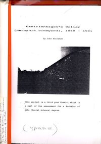
Book - STRAUCH COLLECTION: GREIFFENHAGENS CELLAR (HERCYNIA VINEYARD)
"Hercynia" was the largest vineyyard in the Bendigo District. It was started by Carl Wilhelm Greiffenhagen (William) and his cousins, twins, Carl and August Heine. The first vine cuttings were planted in 1860. The partners owned 300 acres at Axe Creek and in 1862 had 24 acres under vines and an orchard of 4 acres. By 1884 they had expanded to 30 acres of vines. They produced many award winning wines. August Heine ( 1832 - 1898) was born in Germany and came to Australia in 1854 with his twin brother Carl and their cousin William Greiffenhagen. Initially the three took up mining successfully but then the partnership bought 300 acres at Axe Creek and planted a vineyard. They also grew fruit and crops to feed the working horses. In 1870 August sold his interest in the vineyard and set up his own smaller vineyard at Sheepwash Gully. He had several business interests before he took up the caretaker position at the newly dug Weeroona lake, a position he held until his death. Carl Heine sold his interest in the vineyard in 1873 and returned to Germany. WIlliam Grieffenhagen (1834-1916) continued his very successful vineyard until the region was hit with a highly infectious vine disease in 1893. Although his own vines escaped infection, he was within the 2 mile quarantine area and was forced to dig out all his vines. He never replanted but depended on his orchard instead. He was a founding member of the Bendigo Agricultural Society and a local Shire councillor for several years. In 1870 he married Margaret Boyd.Binder containing information relating to Greiffenhagen's cellar (Hercynia Vineyard) 1860 - 1991 including black and white photographs & maps, compiled by John Houlahan as a third year thesis whichnis pat of the assessment for a Bachelor of Arts (Social Science) degree. Donated to the German Society 15/2/96 by the Grandfather of author Jack Houlahan.John Houlahanbook, bendigo, wineries, bendigo-history-axe creek- wineries- german -
 Falls Creek Historical Society
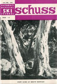
Journal - Schuss Vol. 26. No 1 January - February 1960
Schuss was advertised as Victoria’s Official Ski Journal It was issued monthly from 1935 to 1961 except during the war when summer issues covered two months. This continued after the war, but it averaged 10 issues annually over its 25 year life. Schuss was published by the Ski Club of Victoria which had a membership of 38 Ski Clubs and demanded to be recognised as the prime authority on skiing in the state. The other 30 ski clubs with 85% of the members disagreed and the politics of skiing became heated. These clubs formed the Federation of Victorian Ski Clubs with their own journal, Ski Horizon. With the establishment of the Victorian Ski Association, Ski-Horizon published its last issue in Nov - Dec. 1955 and the role of the official journal was fully taken over by “Schuss”. This item is significant because it contains stories, images and information documenting the development of the ski facilities at Falls Creek.The journal includes stories and events chronicling developments in Victoria and internationally. The cover features a photo of snow gums at Mount Buffalo. Page 24 has a photo taken by C. Bottomley, of the Chair Lift at Falls Creek where the National Championships were to be held. On page 26 there was Birdseye view photo of Falls Creek with the Ski Tow in the foreground and Mt Nelse towering over the village. Page 27 had a short report of the beginning of the construction of a road "over the top" of the Bogong High Plains. It included a note on the farewell held for Dick Walpole by the Myrtleford Ski Club as he departed for the Winter Olympics. The Galleon Ski Club Lodge was advertised for sale on page 30. On page 41 a report explained the extension of the Downhill Course at Falls Creek in preparation for the National Championships to be held from the 21st to 27th August 1960. This would result in a course with a vertical descent of 1,200 to 1,300 feet and about a mile in length.schuss journal, national championships 1960, dick walpole, galleon ski club lodge -
 Bendigo Military Museum
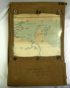
Accessory - MAP CASE & MAPS, C.1939 -45
John James Davies No VX35280 enlisted in the 2nd AIF on 1.8.40 age 31 years. At discharge on 30.11.45 he held the rank of WO 2nd class in 2/108th Aust Light Anti Aircraft detachment..1) Map case, canvas khaki. .2) Map of Darwin, NT. Scale 4 miles to 1 inch. .3) Map, folded, New Guinea made by Hec Robinson Sydney .4) Map Pine Creek N.T.zippered section marked "J. J. Davies VX35280 108 LAD”maps, canvas case, military -
 Lakes Entrance Historical Society
Book, Boddy Doris M, Beyond the Ninety Mile
The early happenings of Woodside Bruthen Creek Snugborough Mullundung Cherry Tree Flat and Balloong in South Gippsland Victoria collected from local families and named sources.township, settlers -
 Wangaratta RSL Sub Branch
Photograph - Framed Photographs, Courtney's Thelma Studio
... , was Stephen Hart from the Three Mile Creek. He first attended ...These men were either born, worked or enlisted at Wangaratta prior to serving their country in the First World War. There names also appear on the South Wangaratta School and District Honour Board (27) Private William John LAW 1221 - 19 years - Born Murchison in Victoria. Occupation Carpenter Next of Kin - Father John Wilson LAW of Wangaratta Joined 2-3-1916 Enlisted at Wangaratta Unit 37th Battalion. Embarked Melbourne 3-6-1916 HMAT Persic A34 Discharged 21-9-1919. Private Joseph Henry LAW 986 - 21 years Born Euroa in Victoria Occupation Labourer Next of Kin - Mother Mrs Robert (Esther) LAW of Yatte Yattah - 18 NSW Joined 29-3-1915 Enlisted at Wangaratta Unit 24th Battalion. Embarked Melbourne 10-5-1915 HMAT Euripidies A14 Killed in Action 29-7-1916 France. Private Norman William FOSTER 7785 -18 1/2 years - Born Wangaratta in Victoria Occupation Labourer Next of Kin - Sister Mrs William (Florence) McLean of Wangaratta Joined 15-7-1915 Enlisted at Melbourne Unit 54th Battalion Killed in Action 1-9-1918 France Private James Archibald McCORMICK 3195 - 19 years Born Wangaratta Occupation Engineer Next of Kin Father Samuel McCormick Enlisted Melbourne 27-7-1915 Embarked 26/11/1915 Unit 24th Battalion Killed in Action 5-8-1916 France Private Roland Caractacus HUGHES 3134(3131) - 20 years 5 months Born Wangaratta Occupation Blacksmith Next of Kin Father Roland W Hughes Joined 21-10-1915 Enlisted at Seymour 7th REIN 24th Battalion Embarked 26-11-1915 Wounded - GSW Leg and thigh RTA Discharged 11-10-1917 Private James Kelly O'CALLAGHAN 1250 - 22 years Born Mansfield Occupation Labourer Next of Kin Father John O'Callaghan Swanpool via Benalla Joined 6-3-1916 Enlisted at Wangaratta 37th/59th Battalions Embarked 3-6-1916 Wounded GSW Face and arm. RTA 30-1-1918 Discharged 2-7-1918 Private Samuel William DAVISON 6793 - 22 years 5 months Born Benalla Occupation Baker - Employer A Watson of Wangaratta Next of Kin Mother Mrs Ellen Tutty of South Wangaratta Enlisted Melbourne 3-1-1917 21/24th Battalions Embarked 11-5-1917 Wounded 9-8-1918 GSW Arm RTA 16-4-1920 (with wife) Discharged 26-7-1920 Private William Leslie HUNTER (Depot) 18 years 2 months Born Yan Yean Occupation Farmer/Labourer Next of Kin Father William James Hunter of Wangaratta Joined 18-2-1916 Enlisted Wangaratta 3-4-1916 Discharged at Seymour on 26-5-1916 Medically Unfit due to DiabetesThe school was completed in May 1875 and commenced operating as South Wangaratta State School No 1580, on the 15th June 1875 with 47 children in attendance. By the end of that year the number had grown to 72. The pupil recorded as number 98, in the school register of 1876, was Stephen Hart from the Three Mile Creek. He first attended the school at the age of 17 years and within two years he was a member of the infamous Kelly Gang. During World War I, 22 former pupils volunteered for active service and four gave their lives. Brown timber frame and mount containing eight photographs of soldiers.Photos of the following Soldiers: Pte J H Law, Pte J McCormick, Pte N Foster, Pte R Hughes, Pte W J Law, Pte J O'Callaghan, Pte S Davison, Pte W Hunterlaw, mccormick, foster, hughes, o'callaghan, davison, hunter -
Lakes Entrance Historical Society
Book, LERHS, Bunga Creek School 3365, 2010
Folder containing sparse information about the Bunga Creek State School no 3365 which was situated a few miles north east of the township Lakes Entrance Victoriaschools, education -
 Wodonga & District Historical Society Inc
Book - Bound Manuscript - Many a Mile, Des Martin, 1975
This manuscript and letter represent the connection between two significant people from the North East of Victoria and their common interest in literature and development of the Upper Murray. Des Martin was raised on the family property Aherlo in the Huon Creek Valley. He joined the 8th Light Horse Regiment and in May 1940 led his Wodonga Troop into the 2/2nd Australian Pioneer Battalion, serving in Syria, Java, New Guinea and Borneo. After the war, Des returned to Aherlo and his horses. Amongst other pursuits he became the first President of the Victorian Amateur Riders Association and founded the Murray Valley Hunt Club. Des also played a major role in Australia entering an equestrian team in the Melbourne Olympics in 1956 and served as a Steward at that event. As well as “Many a Mile”, Des also wrote “Australia Astride” in 1959, a history of the Albury Racing Club – a Century of Racing and a “Tale of Twin Cities” as well as collaborating with R. M. Williams to develop the “Hoofs and Horns” publication. From 1969 to 1973, Des Martin also wrote a column for the Border Mail newspaper. Des Martin died on 12th April 1995. Thomas Walter Mitchell was born at "Towong Hill" near Corryong, Victoria and was educated at Cranbrook School, Sydney and Cambridge University. A keen skier, Mitchell founded the Australian National Ski Federation, captained the Australian skiing team and won gold medals in competitions against England and New Zealand. He was an Australian champion in the downhill and long-time member of the Ski Club of Australia. In 1937 he published Australia’s first ski handbook "Ski Heil". Mitchell joined the Second Australian Imperial Force in 1940 and was a Captain in the 2/22nd Battalion and Headquarters 8th Division. He was captured and interned in Changi POW camp until 1945. Tom Mitchell served as the Country Party Member for Benambra in the Victorian Legislative Assembly from 1947 to 1976. He was awarded the C.M.G. “For distinguished services to the Community, particularly in the fields of Politics, Alpine Sports and Safety, and Writing.” He died on 4th February 1984. This volume is significant because it is the manuscript of a book written by a local Wodonga author. The letter written to Tom Mitchell contains anecdotes and details of the writing of the novel, Many a Mile.An original typed manuscript bound in blue coverboard. It is accompanied by a typed letter.des martin, tom mitchell, many a mile -
 Clunes Museum
Photograph, BAWDEN PHOTOGRAPHER, CIRCA 1890
TULLAROOP CREEK FROM "ROCKS" NEAR SITE OF PORT PHILLIP MINE. ABOUT 1890 - NOTE GOVERNMENT BRIDGE IN DISTANCE. THIS WAS REBUILT IN STRAIGHT STEEL GIRDERS IN 1896.ORIGINAL SEPIA PHOTOGRAPH OF TULLAROOP CREEK, IN FOREGROUND VIEWS OF CLUNES TOWNSHIP. TWO MILE HILL IN LEFT FAR DISTANCE. (SUSPENSION BRIDGE IN FOREGROUND)local history, photography, bridges - buildings and landscape of clunes -
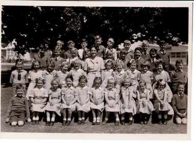 MYLI My Community Library
Photograph - Pakenham Consolidated School Grade Two Class Photo, 1953
Grade 2 of Pakenham Consolidated School in 1953 with their teacher Mrs Joyce Hosking. Back row L to R: Paul Manestar or Bill Vallender, Bernie Carter, (?), Norman Whitelaw, Richard Shelton, Rodney Shallard, Ian Reid (Reidy?) or Duncan Beard (Reidy), Ken Jarred, Glen Jolly. 2nd back row L to R: Keith Crofts, Peter Johnstone, Kevin Lewis, Robert Tulloch (Bones), Nipper Reid, Duncan Beard(?), Bruce Weatherhead, Peter Hobson (Hobbo). 2nd row from front L to R: David Langley, Kath Mauger, Jill Peck, Rosamund Hunt, Beth Schilling, Roslyn Smith, Lynne Tuena, Pat Stone, Joy Higgins, Lynette Wheeler, Grif Fearon or Kevin McInnis. Front row L to R: Ken McCaffrey, Marion Butcher, Helen Stephens, Mary Lou Walsh, Glenis Tuena, Dawn Hillderbrick/ Hillbrick(?), Marion Hansford, Kaye Wollard, Beverley Payne (Payney), Edna Sinclair(?), Paul Braemar. In the 1940s and 1950s there was a movement to consolidate small rural schools into one larger school. This was partly a response to a shortage of teachers, due to many male teachers enlisting during the Second World War. The War also caused a shortage of materials and labour and many Schools fell into disrepair. The Education Department decided that Pakenham would be one of the first six Consolidated Schools to be established and that all schools within 8 kms or 5 miles would be closed. The Pakenham Consolidated School was officially opened on May 29, 1951, on the site of the Pakenham State School, No.1359, in Main Street. The original Pakenham School had opened on a site near the Toomuc Creek in January 1875 and it moved to the Main Street site in 1891. The first Head Master was Charles Hicks. The School offered classes up to Year 10 (Form 4). The schools that formed the Consolidated School were Pakenham Upper No. 2155 (closed January 1952), Pakenham South No. 3755 (closed September 1951), Toomuc Valley No. 3034 (closed September 1951), Army Road No. 3847 (closed April 1947), Mount Burnett No. 4506 (closed October 1949), Tynong No. 2854 (closed April 1951), Tynong North No.4464 (closed December 1951), Nar Nar Goon North No. 2914 (closed October 1951), Nar Nar Goon South No. 4554 (closed May 1951), Rythdale No. 4231 (closed September 1951), Officedale No. 4242 (closed May 1951), Cora Lynn No. 3502 (closed May 1951) and Koo-Wee-Rup North (Five Mile) No. 3198 (closed November 1959). The School consisted of new buildings, which at the time cost one hundred thousand pounds, and many of the old School buildings. Some towns did not realise that their School buildings would be removed from the sites and transferred to Pakenham. The Pakenham Consolidated School moved from its original location in Main Street to its current location in Rundell, Way in 1997.This photograph is of historic and social significance. Pakenham Consolidated School was one of the first six Consolidated Schools established by the Education Department, and was born out of shortages of teachers, labour, and materials during World War II. The school can be used more broadly to reflect on the evolution of education in the state of Victoria, as the school can trace its origins all the way back to 1875, when the original Pakenham School was opened near Toomuc Creek. The photograph is also of social significance to many community groups, including Cardinia Shire, past and current students and teachers, allowing various groups to reflect on and share intangible memories of times spent at Pakenham Consolidated School.Copy of a rectangular black and white photograph on matte photographic paperpakenham consolidated school, primary school, class photo, grade two, grade 2, pakenham, school, photo -
 Sunbury Family History and Heritage Society Inc.
Photograph, Rosa McCall, Old Broadmeadows Township, 1949
The small town in the photograph is the former Broadmeadows Township (now part of Westmeadows). It was situated on the Old Sydney Road (Mickleham Road) and 2 miles east of the Broadmeadows Station. The stone bridge in the foreground spans the Moonee Ponds Creek and Fawkner Street is the road, which leads southwards to Gladstone Park and Tullamarine. The little building was a lolly shop that Mrs. Ethel Mitchell owned and ran for many years.Until 1869, before Sydney Road was finally opened, travellers on their way to Sydney would pass through the Broadmeadows Township.A copy of a non-digital black and white photograph of a road way with a bridge in the foreground leading to a small settlement. Small building with a pitched roof and a verandah is on the RHS of the image and the road leading out of the town is bordered with an avenue of pine trees.old broadmeadows township, fawkner street, moonee ponds creek, westmeadows, bridges -
 Bendigo Historical Society Inc.
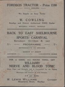
Document - BACK TO EAST SHELBOURNE SPORTS CARNIVAL, 8 October, 1927
Back To East Shelbourne Sports Carnival, Saturday, October 8, 1927. Programme. Refreshments on grounds, dance at night. 1/- Casamento's Buses. Executive Committee: President; W Harris. Vice-President; M De Araugo. Messrs. E Wright, A D Holden, W Hamilton, J Bartels, J Hinck, and H Hinck. Hon. Sec.; H M Burke. Asst. Hon. Sec.; G H Marshall. Ladies; Mesdames J Bartels, H Burke, G H Marshall, E Pocock, R Vines, and E Wright. General Committee; In addition to the above, Messrs. E Pocock, J De Araugo, F J Roberts, and W Marshall, Mesdames W Harris, A Holden, J De Araugo, F J Roberts, and Miss Pocock. Officials Judges: Messrs. T D Cairns, J Craven, and Geo. Hogben. Handicappers: Mr P Davidson (Northern District Walker's Assn.) Starter: Mr W Harris, M De Araugo, J Hinck, H Hovenden, E Pocock, W Hamilton, F J Roberts, A D Holden. Timekeeper: Mr H Hinck. Patrons: Cr, J Bartels, Nuttall & Clarke, Mrs D Punton, R S V Cocking, J Murray, and A Wells. Next 8 pages contain information on the history of East Shelbourne beginning with; This district is situated about ten miles west of south-west of Bendigo on Back Creek or Spring Creek, which received its names from the early diggers of Bendigo who, through shortage of water, were compelled to puddle at Bullock Creek or further 'back,' hence Back Creek; and because of the number of springs it contained - Spring Creek. Among the first to settle, in 1860, were Messrs. John Jenkinson, J Kilgour, T Connelly, G Nichols, R Fox, (who married Mrs James Jenkinson), Kenny, J Roberts, J Genders, J Curry, G Nevinson, Bartram, J Geary, A Nicholl, H Spencer, W Saunders, Mrs Prichard, and J Stansfield. History of East Shelbourne continues . . . Events held were Boy's (State School) Bicycle Race, Stepping the Distance (Gents), Stepping the Distance (Ladies), Bowling at the Stump, Kicking Football Through Hoop, Sheaf Toss, Bucket Ball, Sheffield, Children's Relay Race, Men's Potato Race, Tilting Rings, on Bikes, Walking Contest 1 mile, Car Race through pegs, Slow Bicycle Race 50 yards, Handicap Bicycle Race 2 miles, Tilting Rings in Cars, High Jump, Ladies' and Gent's Cigarette Race, Weight Guessing. Prizes were awarded for first and second placing of these events.In 1923, a Sports Carnival was held in the precincts of what was then a water reserve, situated south of the State School. The area was reserved for watering purposes on 1st May, 1894; and on July 15th, 1912, a small portion was excised. By 1923 its usefulness for water storage had disappeared, and being ideal for recreation purposes, it was decided, at the final meeting of the above sorts carnival, to apply for the area appointed, Mr W Harris (chairman), Messrs. G H Marshall, J Roberts, D Gill, M Connolly, R Vines, E Pocock, and H M Burke (secretary). The matter terminated in a Land Board, presided over by Mr McPherson, being held in Bendigo. The application was granted, but was not gazetted, until Messrs. W Harris and F J Roberts, with Messrs. A E Cook, MLA and Hon. H Keck, MLC interviewed the Minister for Lands. Soon afterwards, at a public meeting, the following members were elected to constitute the first Board of management, Messrs. W Harris (chairman), G H Marshall, A D Holden, F J Roberts (tres.), M D'Araugo, E Wright, and H M Burke (sec.). Since then the arena has been cleared and levelled by residents, and labor and material to the value of 150 pounds have been put into the reserve. At least 2/3rds of the program contain ads from business in Bendigo. Fordson Tractor - W Cowling, W Lewis William's Chymist, Collier footwear, William Wallace Land and Clearing Sales, Bain & Daws Groceries, Farmers & Citizens Trustees Company Bendigo Limited, Northern Seed Supply Co., Marong Bakery, Bennetts' Arcade Store, Marong Hotel, Warren's Drapery & Clothing, Jas. Friswell Butcher, Webster's Wireless, Baker & Woods Tennis Supplies, Hartleys Wireless, Cycle Hartleys, Bendigo Book & Stationery Centre Frank J Every's, T R Jones Chemist, Wool Skins & Hides F Ferguson, Furniture Carpets Linoleums Morley Johnsons, Jewellery & Silverware Prescott & Dawe, Drapers Honan & O'Toole, Stilwell's of Bendigo, Gents' & Ladies' Tailoring Hatters & Mercers Messrs. Denton Bros., Groceries Ales Wines & Spirits W Jeffrey, Ashman's Tailors Hatters Mercers, Myer's, Farmers' Grocery D Whyte & Co., Drapers & Furniture Stores The Beehive, Butcher les. Friswell, Tobacconist & Hairdresser W J Lenten, Timber Merchants & Ironmongers Hume & Iser, Stock E M Vains & Co., Ladies' & Gents' Tailors Clifford & Fulton, Printers & Stationers Bolton Bros. Pty Ltd, Bendigo Leather Shop, Everything Musical Suttons, Andrew's Auction Rooms Butter Eggs Poultry etc, Meats A C Petherick's, Albert Bush's Produce Stores & Chaff Mills, T D Cairns & Co., Jeweller C J Kirby, Casamento's Garage & Ballarat Motor Bus Service, Webster Bros. Sporting House Cycle Builders Motor Cycle & Car Agents, British Motors Bendigo, Webb's Bacon Depot. 20 pages plus coverBoltons Print, Bendigoevent, social, east shelbourne sports carnival -
 Ringwood and District Historical Society
Map, Partially Trimmed Copy of Ringwood Heights Estate, Ringwood, Vic. - circa 1923
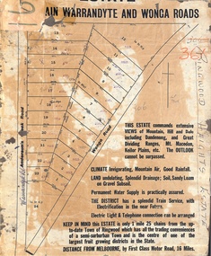
Clipped copy of a subdivision advertisement on cardboard backing. Sales notations on numbered allotments in Andersons's Creek Road (later Warrandyte Road) and Wonga Road, Ringwood. Handwritten title reference - LP7305. Captions - This Estate commands extensive views of mountain, hill and dale including Dandenong and Great Dividing Ranges, Mt. Macedon, Keilor Plains, etc. The outlook cannot be surpassed. Climate invigorating, mountain air, good rainfall. Land undulating, splendid drainage; soil, sandy loam on gravel subsoil. Permanent water supply is practically assured. The district has a splendid train service, with electrification in the near future. Electric light & telephone connection can be arranged. Keep in mind this estate is only 1 mile 25 chains from the up-to-date town of Ringwood which has all the trading conveniences of a semi-suburban town and is the centre of one of the largest fruit growing districts in the state. Distance from Melbourne by first class motor road, 16 miles. -
 The Beechworth Burke Museum
Photograph
This image is a reproduction of an 1899 original depicting the 'Williams Good Luck Mine' on the Mopoke Reef (also called 'Morepork Gully') in the Dingle Ranges, approximately three miles from Beechworth. A large opening to a mine can be seen behind the men in the photograph, with a wheeled cart on a track leading to the men's position, where the soil and rocks have been hauled away. This photograph interestingly contains dogs alongside the miners. While dogs have been recorded as deterrents to thieves in the Victorian goldfields, these dogs appear as companions to these men. Following the discovery of gold at Beechworth in 1852, rushes quickly followed at surrounding creeks and gullies in the district. In the late nineteenth and early twentieth centuries, small syndicates of miners continued to work old or abandoned quartz reefs, often persisting without the assistance of heavy machinery to remove the large amounts of rock, in order to obtain yields at ever greater depths. The group of miners in this photograph are Mr. Roger Williams and Sons, who revived operations at the ‘Old Good Luck’ mine on the Mopoke Reef in the Dingle Range near Beechworth around 1892, working the site for more than two decades. An emigrant from Cornwall with experience in the tin mining industry, 19 year old Roger Williams senior sailed to New Zealand in 1840, then to Australia where he spent time in the Bendigo Gold Fields before settling in Beechworth in the early 1860s. Mr Williams senior worked on various mining activities in the district, including the Rocky Mountain Tunnel project. Conversant with the character of gold-bearing reefs in the area, the syndicate dug an eight hundred foot tunnel, digging down as far down as two hundred feet with little capital save their labour, to connect and provide better working access to the mass of reefs and veins in the vicinity. Progress was hampered by poor air quality charged with fumes from dynamite and large quantities of rock had to be crushed to obtain payable yields. The Victorian Goldfields are filled with ruins and remnants of the area's rich mining history, ranging from small alluvial diggings to the remains of huge mining companies. Site names often changed several times throughout the nineteenth and twentieth centuries. Some sites were abandoned and forgotten, others were worked continuously over many decades. The names of mines were often repeated at different locations throughout the Victorian Goldfields. For example, there is a Mopoke Gully heritage mine near Fryers Creek, Victoria. 'Mopoke' is a common onomatopoeic name for Morepork and Australian Boobook owls.This image has historical, social and research significance for patterns of emigration during of the Victorian Gold Rush, and the historical, social and environmental impacts of mining at Beechworth at the turn of the nineteenth and twentieth centuries. As gold became scarce and government support and large company investment waned, poor hard-working miners laboured intensively to make a living through periods of high unemployment. This image can be compared and studied alongside other historical mining photographs and objects in the Burke Museum Collection. It has potential to improve our understanding of miners working conditions and the shifting character of mining in the Beechworth district.Sepia coloured rectangular photograph printed on gloss photographic paper mounted on card. Obverse: Williams/ Good/ Luck Reverse: A02498/ 1997. 2498/ Good Luck/ Mine/ 1899/ Mopoke. burke museum, beechworth museum, beechworth, gold fields, gold rush, victorian gold rush, gold ming history, colonial australia, australian gold rushes, mining technology, beechworth historic district, indigo gold trail, migration, indigo shire, good luck gold mine, victorian goldfields, mining syndicates, gold fever, quartz-mining, small-scale mining, old good luck mine, mopoke gully, quartz reefs beechworth -
 The Beechworth Burke Museum
Photograph
This image is a reproduction of an 1899 original depicting the 'Williams Good Luck Mine' on the Mopoke Reef (also called 'Morepork Gully') in the Dingle Ranges, approximately three miles from Beechworth. The foreground of the image is littered with piles of smashed rock and detritus, known as ‘mullock’, beside a reinforced mine shaft, a vertical access passageway allowing miners to enter the mine and haul ore out using lifting technology such as a poppet heads, whims or windlasses. A group of miners and a dog appear close to an open-sided miner’s hut. Following the discovery of gold at Beechworth in 1852, rushes quickly followed at surrounding creeks and gullies in the district. In the late nineteenth and early twentieth centuries, small syndicates of miners continued to work old or abandoned quartz reefs, often persisting without the assistance of heavy machinery to remove the large amounts of rock, in order to obtain yields at ever greater depths. The group of miners in this photograph are Mr. Roger Williams and Sons, who revived operations at the ‘Old Good Luck’ mine on the Mopoke Reef in the Dingle Range near Beechworth around 1892, working the site for more than two decades. An emigrant from Cornwall with experience in the tin mining industry, 19 year old Roger Williams senior sailed to New Zealand in 1840, then to Australia where he spent time in the Bendigo Gold Fields before settling in Beechworth in the early 1860s. Mr Williams senior worked on various mining activities in the district, including the Rocky Mountain Tunnel project. Conversant with the character of gold-bearing reefs in the area, the syndicate dug an eight hundred foot tunnel, digging down as far down as two hundred feet with little capital save their labour, to connect and provide better working access to the mass of reefs and veins in the vicinity. Progress was hampered by poor air quality charged with fumes from dynamite and large quantities of rock had to be crushed to obtain payable yields. The Victorian Goldfields are filled with ruins and remnants of the area's rich mining history, ranging from small alluvial diggings to the remains of huge mining companies. Site names often changed several times throughout the nineteenth and twentieth centuries. Some sites were abandoned and forgotten, others were worked continuously over many decades. The names of mines were often repeated at different locations throughout the Victorian Goldfields. For example, there is a Mopoke Gully heritage mine near Fryers Creek, Victoria. 'Mopoke' is a common onomatopoeic name for Morepork and Australian Boobook owls.This image has historical, social and research significance for patterns of emigration during of the Victorian Gold Rush, and the historical, social and environmental impacts of mining at Beechworth at the turn of the nineteenth and twentieth centuries. As gold became scarce and government support and large company investment waned, poor hard-working miners laboured intensively to make a living through periods of high unemployment. This image can be compared and studied alongside other historical mining photographs and objects in the Burke Museum Collection. It has potential to improve our understanding of miners working conditions and the shifting character of mining in the Beechworth district.Sepia coloured rectangular photograph printed on gloss photographic paper mounted on card.Obverse: Reverse: A02497/ 1997.2497/ 'Good/ Luck/ Mine'/ Morepork/ Gully/ Mrs Joyce/ Bright/ Tunnel/ 800 ft/ 1899. burke museum, beechworth museum, beechworth, gold fields, gold rush, victorian gold rush, gold ming history, colonial australia, australian gold rushes, mining technology, beechworth historic district, indigo gold trail, migration, indigo shire, good luck gold mine, victorian goldfields, mining syndicates, gold fever, quartz-mining, small-scale mining, old good luck mine, mopoke gully, quartz reefs beechworth -
 Bendigo Historical Society Inc.
Document - MINING REPORTS - LINE OF REEF AT YANKEE CREEK NEAR BENDIGO
BHS CollectionTyped photocopy of a letter dated September 19th, 1898, from W. H. Cundy, Underground Survey Office, Bendigo. Letter refers to a locality, eight miles due east from Bendigo, and five miles west from Hunt's line of Reef Ellesmere. The writer did not think there was any necessity for a special survey to define the position of the reef. Handwritten at the bottom of the letter: for Report by Whitelaw. See Progress Report No 10.document, gold, mining reports, line of reef at yankee creek near bendigo, underground survey office bendigo, c tillach, koch's pioneer battery, mr grieve, hallidays claim, w h cundy, whitelaw