Showing 500 items
matching mining - maps
-
 Bendigo Historical Society Inc.
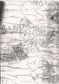
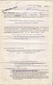
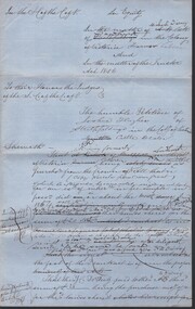
Document - CONSTABLE RYAN COLLECTION: MAP OF NORTH BENDIGO CHINESE CAMP
... Photocopy of a map showing various mining leases around... Bendigo North Bendigo Photocopy of a map showing various mining ...Photocopy of a map showing various mining leases around North Bendigo. The photocopy is not of a very good quality.map, bendigo, north bendigo -
 Bendigo Historical Society Inc.
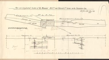
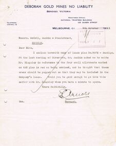
Document - MCCOLL, RANKIN AND STANISTREET COLLECTION: MONUMENT HILL CO., DEBORAH CO. LEASE ON DEBORAH LINE
Plan of Monument Hill Co., and Deborah Co. leases on the Deborah line. Black line drawing, showing longitudinal section. 'Deborah shaft to Nth Deborah 1100 ft ' noted in pencil . 'Nth Deborah shaft to Central Deb shaft 2000ft' in pencil. Other pencil notation on map re distance of leases. Map is attached to back page of booklet, rest of information missing.business, mining, mccoll rankin & stanistreet -
 Bendigo Historical Society Inc.
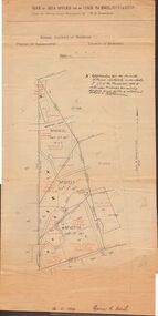
Document - MCCOLL, RANKIN AND STANISTREET COLLECTION: PLAN OF AREA LEASE 10425, 10733 AND 10734, 1934
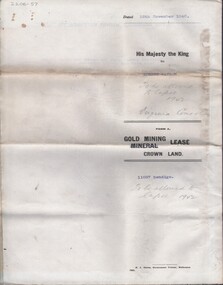
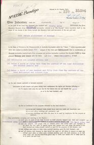
Plan of area applied for on lease No 10425, 10733 and 10734. Applied for by Mr. R.A. Rankin. Plan shows Marong Road, state school site ; leases held by H.E. Kronk, Francis Gramann; T. Wearne; C.E. Foggitt; A. Pitcher, Crown land and Aur. licences also marked. Lease numbers marked on plan. Map signed on bottom by Garnet G. Birch on 26.11.1934. On top Rh side in black pen " applications for the Minister of Mines Authority under section 5 (1) of the Mines Act 1928 to enter upon and occupy for mining purposes such portion of allotments lodged on 19/2/35'gold, mining, lease, mining, leases, kronk, garnet g. birch -
 Bendigo Historical Society Inc.
Document - MCCOLL, RANKIN AND STANISTREET COLLECTION: MAP OF MINE LEASES SYMONDS STREET, MCKENZIE ST WEST AREA BENDIGO, 2nd September, 1936
... Blue waxed linen paper map. On top' Mining District... map. On top' Mining District of Bendigo' Parish of Sandhurst ...Blue waxed linen paper map. On top' Mining District of Bendigo' Parish of Sandhurst, County of Bendigo' Map shows lease 10135, area 32.1.19; lease 10371, area 30.0.23; lease 10179 area 41.3.4; lease 10370, area 49.0.1. Map indicates gully leading into and State Rivers and Water supply reservoir, water race; siphon, shaft, dam, residential area and some residential lots marked. Streets include Holly Street, MacKenzie Street West, Symonds Street, Aspinall Street, Emmett Street; Bendigo Creek marked at bottom of map. Scale 4 chains to one inch. Map is not dated.bendigo, mining, mccoll rankin & stanistreet -
 Bendigo Historical Society Inc.
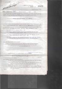
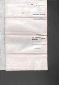
Document - MCCOLL, RANKIN AND STANISTREET COLLECTION: INDENTURE BETWEEN KING EDWARD VIII AND MONUMENT HILL CONSOLIDATED MINE, 2/09/1936
Indenture document number 10878, Vol 317 Folio 35044. Foolscap 4 pages including a map, dated 2nd September, 1936, between King Edward VIII (Crown land) and Monument Hill Consolidated (Bendigo) No Liability 'carrying on operations in the Parish of Sandhurst, to occupy and use the land demised as a site for machinery buildings and offices to be used in connexion with 'mining purposes' ' Document signed by Right Hon William Charles Arcedeckne, (Baron Huntingfield) and J. Stanistreet, Manager, affixed with the Common Seal of Monument Hill Consolidated (Bendigo) No Liability. Map drawn on dark buff paper, and fixed to document. Map shows lease 10878 in the Mining District of Bendigo, Parish of Sandhurst, County of Bendigo. N.Area 2.2.24 ( 2 acres, 2 roods, 24 perches ) Lease site on Rowan Street, bordered by Ophir Street. Coloured in purple on plan with small red area. On bottom: ' Note Red Areas Excised. Scale 4 chains to 1 inch, M.M. Var. 8 degrees 32' E. On lease site, New Chum Gully marked, W.B. House, and Permanent Occy. marked on red area. On last page ownership of lease details from 1937 to 1942.bendigo, mining, monument hill consolidated, common seal of monument hill consolidated, nell gwynne mine, south nell gwynne gold mining company, bendigo mine, ophir street, rowan street, mackenzie street.indenture vol 317 fol. 35044. j stanistreet. -
 Bendigo Historical Society Inc.
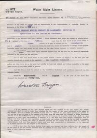
Document - MCCOLL, RANKIN AND STANISTREET COLLECTION: WATER RIGHT LICENCE NORTH DEBORAH MINING COMPANY NO LIABILITY, 19th August, 1941
4 page document plus map, Water Right Licence No. 1172, between King George VI ( the Crown ) and North Deborah Mining Company No Liability, Parish of Sandhurst., dated 19th August 1941. "to take and divert water at the points marked 'source of supply' on the said plan the quantity thereof not to exceed in the aggregate one hundred thousand gallons per diem' Plan: 'Mining District of Bendigo No. 1172 W.R., County of Bendigo, Parish of Sandhurst. Plan has dam area coloured in red, with pipe line drawn in red, leading from Battery marked on lease 11145 across lease 9988 to dam. Streets marked: Adams Road, Honeybone Street, Griston Street. (Golden Square area)bendigo, mining, north deborah mining company, north deborah mining company, adams, honeybone, and griston streets. (golden square) -
 Bendigo Historical Society Inc.
Document - MCCOLL, RANKIN AND STANISTREET COLLECTION: INDENTURE GOLD MINING LEASE 11012 CROWN AND NORTH DEBORAH MINING COMPANY, 3rd June to 13th Nov 1939
6 page document plus map: indenture No. 11012, Gold Mining Lease, between Crown and North Deborah Mining Company carrying on operations in the Parish of Sandhurst, dated 3rd June, 1939. Map shows land excised for mining in pink and Crown land in orange cross-hatching . Streets shown: Queen Street, King Street, Hargreaves Street, Breen Street. Leases: No's. 10939, 1363 TL, 11012, 10937, Railway line through centre of lease holding. On last page 'Deborah Gold Mines No Liability of 125 queen Street Melbourne is now the proprietor of the within described estate by transfer registered on 13th November, 1939 and numbered 1752584'.bendigo, mining, north deborah mining company, j sweeney, common seal of north deborah mining company, stanistreet, breen street, king street, queen street, hargreaves street. -
 Bendigo Historical Society Inc.
Map - GEOLOGICAL MAP OF BENDIGO GOLD FIELD
... BENDIGO Mining Geological Map. H. Herman, Director of Geological ...Two framed laminated maps (a,b) of Bendigo goldfield reef lines, map (b) is a continuation of the reef lines in map (a). On map(a) written in black on top: 'Geological Map, Bendigo Gold Field', Scale of chains, anticlines, synclines, shafts, alluvial and contours marked. Map (b) is continuation of (a). Written on the bottom RH corner of map: 'Prepared in 1923 in the Bendigo Office Mines Department under the direction of H. Herman, Director of Geological Surveys, from surveys by H.S. Whitelaw, Fiield Geologist, assisted by E.S. Usher & J. J. Moore. Re-issued in 1936.'H. Herman, Director of Geological Surveys, from surveys by H.S. Whitelaw, Fiield Geologist, assisted by E.S. Usher & J. J. Moore. Re-issued in 1936.'bendigo, mining, geological map. -
 Bendigo Historical Society Inc.
Document - MCCOLL, RANKIN AND STANISTREET COLLECTION: CHRISTMAS LEASE DOCUMENTS, 1941
Documents: folder contains - 'Consent to the Inclusion of Certain Lands in a Mining Lease', forms for Lease No. 11106, Map of No. 11106, List of land owners re: Lease 11106, Blank consent forms, Lease 11106 was below the 400foot level.MCCOLL RANKIN AND STANSISTREETorganization, business, gold mining, mccoll rankin and stansistreet, christmas gold mine. -
 Bendigo Historical Society Inc.
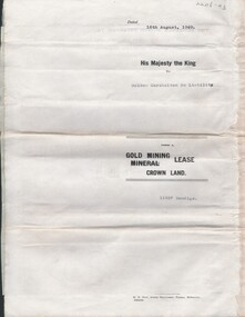
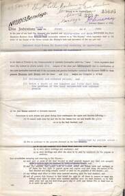
Document - MCCOLL, RANKIN AND STANISTREET COLLECTION: GOLDEN CARSHALTON NO LIABILITY, 1949
Documents: Gold Mining Lease No. 11257 FOL.36397 Bendigo 16/8/1949. Golden Carshalton N\L Map of Bendigo Sandhurst Lease No 11257 showing the Carshalton Mines Ltd New Main Shaft, Hansel Mundy Shaft.MCCOLL RANKIN AND STANSISTREETorganization, business, gold mining - legal, mccoll rankin and stansistreet. golden carshalton n\l. mundy shaft. -
 Bendigo Historical Society Inc.
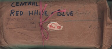
Document - MCCOLL, RANKIN AND STANISTREET COLLECTION: CENTRAL RED WHITE AND BLUE - BUNDLE OF PAPERS, 1912
Documents: Whitelaw Central Red White and Blue Mine Bendigo. 28 pages summary of gold mining correspondence - mortgage mining leases 943689340, contract of sale to Central Blue Gum GM 1933, leases with mining rights, treatment of pyrites agreement 1917 - J. Edwards & Co, Helen Streader - release of liability after being paid (pounds)125 by mine due to accidental death of husband 1912. Another for Ellen Lane 1916, list of titles held by Co , lease agreements Filcock and Manning, Andrew Harkness 'winding plant at mine' 1923, notice to perform agreement to Manning's 1916, Edwards Metallurgical Works 1917, map for 9777 Bendigo, contract for explosives with Dalgety & Co 1917, new scrip for lost shares 1917, Miner's Right 1911, sale of land Ra. A. Rankin 1910.MCCOLL RANKIN AND STANISTREETorganization, mining, central red white and blue, mccoll rankin and stanistreet. -
 Bendigo Historical Society Inc.
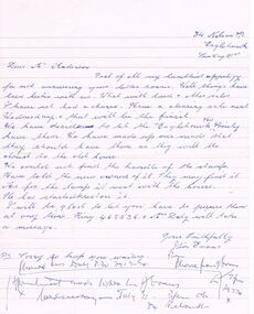
Document - CONNELLY, TATCHELL, DUNLOP COLLECTION: LEGAL PAPERS, 1878 1889
Document. Various legal papers. 1 - 1856? - Petition for Vesting Order in the matter of Diviney Michael, late of Sandhurst. Mentions Hughes Joshua and Freame H S? for Flegg Wm Sandhurst. 2 - Hughes J. Application for Vesting Order. Mentions Doran Joseph Christopher & Diviney. 3 - 1878 - In the matter of the Hope Tribute Mining Company Reg and in the matter of the Mining Companies Act 1891 between the Commercial Bank of Australia Ltd. (Appellant) and the Hope Tribute Mining Company Reg (Respondent). Appeal case. 4 - 1889 - Transfer of Land in Kerang from Ellis Asher (Postmaster) to Victorian Railways Commissioners. Contains map of said land.cottage, miners, connelly, tatchell & dunlop, diviney michael, hughes joshua, freame h s?, flegg wm, doran joseph christopher, hope tribute mining company, commercial bank of australia, ellis asher, victorian railways commissioners -
 Bendigo Historical Society Inc.
Document - OLD TOM LEASE MAP
... PLACE Land mining Hand Drawn map of Old Tom Lease - Parish ...Hand Drawn map of Old Tom Lease - Parish of Huntly, County of Bendigo, Mining district of Sandhurst.place, land, mining -
 Bendigo Historical Society Inc.
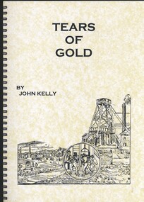
Book - TEARS OF GOLD, FATALITIES ON THE BENDIGO GOLDFIELDS 1852 - 1950, 2010
Tears of Gold, fatalities on the Bendigo Goldfields 1852-1950. Signed by the author, John R. Kelly, 6 July 2010, dedication thanks to the Bendigo Historical Society Soft covered spiral bound book of 91 pages with black and white photographs, maps and illustrations.John Kellybendigo, gold mining, fatalities, bendigo history, goldmining, miners, mine accidents, family history. -
 Bendigo Historical Society Inc.
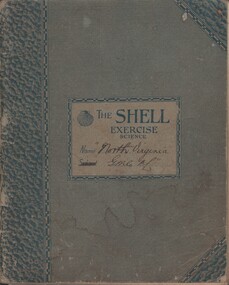
Document - MCCOLL, RANKIN AND STANISTREET COLLECTION: NORTH VIRGINIA GMC N L - CROSS SECTION PLAN OF THE MINE, 1942 1947
Document. Grey/green exercise book with 'North Virginia GMC NL. Book contains hand drawings of shafts and their metalurgical content at every depth. Symbols have been used to indicate different metals and earth. 2 maps loose in the book.McColl, Rankin & Stanistreetorganization, business, north virginia gmc n l, mccoll, rankin & stanistreet, north virginia gmc n l, gold mining, cross section plan of the north virginia -
 Bendigo Historical Society Inc.
Document - MCCOLL, RANKIN AND STANISTREET COLLECTION: NORTH VIRGINIA GMC N L - TITLE DEED/LEASE, 30/11/1940
Document. Coarse cream coloured paper typed. Corrections and additions. Assistant Registrar of Titles. Made out to Robert Watson of Eaglehawk. Has map of lease in the back.McColl, Rankin & Stanistreetorganization, business, north virginia gmc n l, mccoll, rankin & stanistreet, north virginia gmc n l, r watson, gold mining, title deed/lease -
 Bendigo Historical Society Inc.
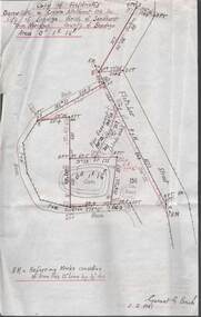
Plan - MCCOLL, RANKIN AND STANISTREET COLLECTION: PLAN OF SURVEY OF DAM SITE, 1941
McColl Rankin & Stanistreet, Plan of Survey of Dam site, Part of Crown Allotment 98 Section C, City of Bendigo, Parish of Sandhurst, County of Bendigo. Signed by Garnet G Birch 1 Feb 1941. 33.5 x 43. Attached is a Copy of Field notes, Dam Site in Crown Allotment 198 Sec. City of Bendigo, Parish of Sandhurst. True Meridian, County of Bendigo, Area 0A 1R 16P. Signed Garnet G Birch, 1/2/1941. Drawn in red and black pen. 20.8 x 33. Both maps are for Deborah Extended Gold Mining Co. No Liabilityorganization, mining, deborah extended gold mining co nl, mccoll rankin & stanistreet, plan of survey of dam site -
 Bendigo Historical Society Inc.
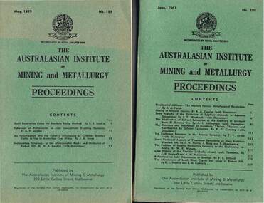
Document - MCCOLL, RANKIN AND STANISTREET COLLECTION: THE AUSTRALASIAN INSTITUTE OF MINING AND METALLURGY, 1959 to 1965
McColl Rankin & Stanistreet, The Australasian Institute of Mining & Metallurgy Proceedings. A/No. 189 May, 1959. B/ No. 198 June, 1961. C/ No. 207 September, 1963. D/ No. 210 June, 1964. E/ No. 211 September, 1964. F/ No. 212 December, 1964. G/ No. 213 March, 1965. H/ No. 214 June, 1965. I/ No. 215 September, 1965. They include Maps, diagrams, tables and photographs. Published by The Australasian Institute of Mining & Metallurgy, 399 Little Collins Street, Melbourne.organization, mining, industrial, mccoll rankin & stanistreet, the australasian institute of mining & metallurgy proceedings -
 Bendigo Historical Society Inc.
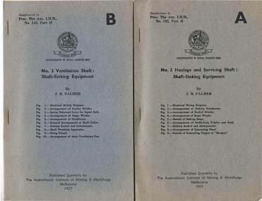
Document - MCCOLL, RANKIN AND STANISTREET COLLECTION: THE AUSTRALIASIAN INSTITUTE OF MINING ANDMETALLURGY MELB, 1957
McColl Rankin & Stanistreet, The Australasian Institute of Mining & Metallurgy, Melbourne. a/ No. 3 Haulage and Servicing Shaft: Shaft-Sinking A. b/No. 3 Ventilation Shaft: Shaft-Sinking Equipment C. c/ Architectural Design and Treatment of Surface Area and Buildings C. d/ Electricity and Compressed Air Power Supply to Surface and Underground Workings D. e/ No. 3 Shaft Winders and Winder House E. f/ No. 3 Headframe F. g/ No. 3 Breaker Station and Mullock Bin G. h/ No. 3. Change house H. i/ No. 3. Shaft Sub-Brace Area I. j/ No. 3 Services and Surface Areas J. All Supplements to Proc. The Aus. I.M.M., No. 182, Part II. Dated 1957. Published Quarterly by The Australasian Institute of Mining & Metallurgy Melbourne. Includes diagrams and maps.organization, mining, mccoll rankin & stanistreet, mining and metallurgy -
 Bendigo Historical Society Inc.
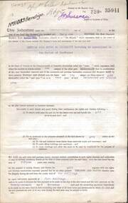
Document - MCCOLL, RANKIN AND STANISTREET COLLECTION: DEBORAH EXTENDED GOLD MINING COMPANY N/L GOLD MINING LEASE, 18 April 1957
Document Deborah Extended Gold Mining Company N/L document - gold mining lease document, Vol 334 071, dated 18 April 1957, 4 pages with map. Map adjoins Bendigo Cemetery. Lease between Deborah Extended Gold Mining Company N/L and the State of Victoria. No. 11339, Vol 334 Fol 071.organization, mining, gold mining lease, deborah extended gold mine, gold mining lease -
 Bendigo Historical Society Inc.
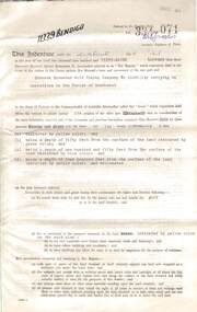
Document - MCCOLL, RANKIN AND STANISTREET COLLECTION: GOLD MINING LEASE, 1937
Document: McColl, Rankin and Stanistreet: document - gold mining lease document, 3 pages with map. Map adjoins Upper California Gully Road. Sheaf of 5 letters attached to inside of document with pin. Lease between Herbert Jackson Leed of Bendigo and State of Victoria. No. 10901, Vol 320 Fol 35364.organization, mining, gold mining lease, mccoll, rankin and stanistreet: herbert jackson leed, gold mining lease -
 Bendigo Historical Society Inc.
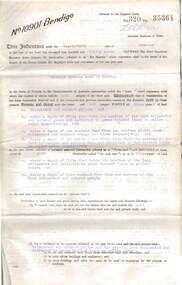
Document - MCCOLL, RANKIN AND STANISTREET COLLECTION: DEBORAH GOLD MINES NL GOLD MINING LEASE DOC, 1941
Document: McColl, Rankin and Stanistreet: Gold Mining Lease Private Land, 11089 Bendigo on front of document., Deborah Gold Mines NL - 3 pages, with map. Lease adjoins Railway Reserve, Breen Street. Transferred to North Deborah Mining Company NL on 9th. October, 1950. No. 11089, Vol 326 Fol 35941.organization, mining, gold mining lease, mccoll, rankin and stanistreet:, deborah gold mines nl, north deborah mining company nl, gold mining, lease -
 Bendigo Historical Society Inc.
Document - MCCOLL, RANKIN AND STANISTREET COLLECTION: DEBORAH GOLD MINES NL GOLD MINING LEASE ON PRIVATE LAND, 1941
Document McColl, Rankin and Stanistreet: - 3 page lease document Deborah Gold Mines NL, with map., Lease adjoins Railway Reserve, Breen Street, Bendigo. Transferred to North Deborah Mining Company NL of Charing Cross, Bendigo on 9th. Oct. 1950. No. 11013, Vol 323, Fol 35696.organization, mining, gold mining lease documents, mccoll, rankin and stanistreet:, deborah gold mines nl, north deborah mining company nl, gold mining, lease document -
 Bendigo Historical Society Inc.
Document - MCCOLL, RANKIN AND STANISTREET COLLECTION: GOLD MINING LEASE RONALD ALEXANDER RANKIN, 1941
Document: McColl, Rankin and Stanistreet: lease document between Ronald Alexander Rankin of Bendigo and the State of Victoria. 3 pages with map - lease adjoins Bellevue Road. Lease transferred to Deborah Gold Mines NL in 1945.organization, mining, gold mining lease, mccoll, rankin and stanistreet:, ronald alexander rankin, lease document, gold mining -
 Bendigo Historical Society Inc.
Document - MCCOLL, RANKIN AND STANISTREET COLLECTION:SOUTH NELL GWYNNE GOLD MINING COMPANY NO LIABILITY, 1940
Document: South Nell Gwynne Gold Mining Company No Liability - gold mining lease document no. 11074 Bendigo. Document of 3 pages with map insert.organization, mining, south nell gwynne gold mining co., bendigo, mccoll, rankin & stanistreet -
 Bendigo Historical Society Inc.
Document - MCCOLL, RANKIN AND STANISTREET COLLECTION: DEBORAH GOLD MINE NL - LEASE DOCUMENTS, 1935, 1941
Document: McColl, Rankin and Stanistreet: lease documents. 12 pages of lease details, with attached map plan on no 9672 Bendigo. ( Abel and Eve Street marked )organization, mining, deborah gold mines nl, mccoll, rankin and stanistreet: deborah gold mines nl, gold mining, lease -
 Bendigo Historical Society Inc.
Document - MCCOLL, RANKIN AND STANISTREET COLLECTION: GOLD MINING LEASE CROWN LAND, 1937
Document : McColl, Rankin and Stanistreet: gold mining lease crown land 10916 Bendigo. Foolscap size document, includes map County of Bendigo, Parish of Mandurang. Dated 1937 between King George VI and John Jepson Stanistreet.person, mining, john jepson stanistreet, mccoll, rankin and stanistreet: bendigo, mining, goldmining, john stanistreet -
Bendigo Historical Society Inc.
Map - MINING PLAN, Circa 1880's
... . Map MINING PLAN ...Mining Plan: showing the following companies: New Chum and Victoria Co., South Victoria Co., Lansell's 180, Victoria Quartz Mining Co.topic, mining, plans, mining in bendigo, new chum and victoria co., south victoria co., lansell's 180, victoria quartz ming co. -
 Bendigo Historical Society Inc.
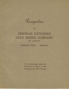
Document - MCCOLL, RANKIN AND STANISTREET COLLECTION: DEBORAH EXTENDED GOLD MINING COMPANY NL, 1940
McColl Rankin & Stanistreet, 12 Copies of Prospectus of Deborah Extended Gold Mining Company No Liability, Deborah Reef, Bendigo. To be incorporated under the Provisions of Part II, of the Companies Act 1938, Victoria. Application form and map of mines included in book form, dated 1940. Profit and Loss Account for Term ended 31st August, 1945 also included on separate sheet (has been folded in half across). Auditors: Wm. R. McKie & W. J. Sparkman.organization, mining, deborah extended gold mining cpy nl, mccoll rankin & stanistreet, deborah extended gold mining company nl, prospectus, profit and loss account for 31 august 1945, map of mine, form application -
 Bendigo Historical Society Inc.
Document - MCCOLL, RANKIN AND STANISTREET COLLECTION: ALICE PEEL GOLD MINING LEASE DOCUMENT, 8/7/1945
Document : McColl, Rankin and Stanistreet - gold mining lease document in name of Alice Peel, Executrix of Will of Edward Peel, deceased. 3 pages with map. No. 11198, Vol. 328., Fol. 36141. Lease crosses Houston Street, Quarry Hill. Transferred to South Deborah Gold Mines NL on 15/8/1946.organization, mining, south deborah gold mines nl, mccoll, rankin and stanistreet, alice peel, edward peel, gold mining lease, gold mining