Showing 319 items
matching nepean road
-
 Kingston Arts
Painting, Carol Linton, Mc Allister River, 1985
... Kingston Arts 979 Nepean Hwy (Cnr South Road and Nepean Hwy ... -
 Kingston Arts
Painting, Doris Percival, Landscape
... Kingston Arts 979 Nepean Hwy (Cnr South Road and Nepean Hwy ... -
 Kingston Arts
Painting, Bruce Fairless, Untitled, 1977
... Kingston Arts 979 Nepean Hwy (Cnr South Road and Nepean Hwy ... -
 Kingston Arts
Painting, Margery Fitzgerald Boyle, Mordialloc Creek Towards Wells Road, 1976
... Kingston Arts 979 Nepean Hwy (Cnr South Road and Nepean Hwy ... -
 Kingston Arts
Painting, R. Russell Fletcher, Mornington Mooring
... Kingston Arts 979 Nepean Hwy (Cnr South Road and Nepean Hwy ... -
 Kingston Arts
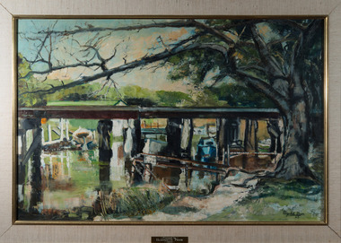
Painting, Elizabeth Prior, The Bridge, 1963
... Kingston Arts 979 Nepean Hwy (Cnr South Road and Nepean Hwy ... -
 Kingston Arts
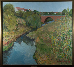
Painting, Undine Padons, Merrie Creek Footbridge, 1978
... Kingston Arts 979 Nepean Hwy (Cnr South Road and Nepean Hwy ... -
 Kingston Arts
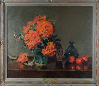
Painting, Judith Wills, Gum Blossom, 1981
... Kingston Arts 979 Nepean Hwy (Cnr South Road and Nepean Hwy ... -
 Kingston Arts
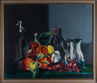
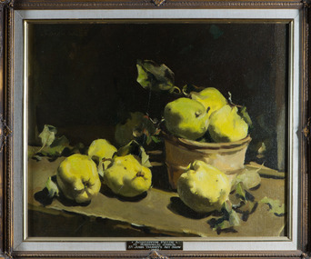
Painting, Denis Farney, Still Life with Fruit and Jug, 1987
... Kingston Arts 979 Nepean Hwy (Cnr South Road and Nepean Hwy ... -
 Kingston Arts
Painting, Judith Wills, Still Life - Fruit, 1979
... Kingston Arts 979 Nepean Hwy (Cnr South Road and Nepean Hwy ... -
 Kingston Arts
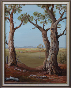
Painting, I. Laurens, Grampians Morning
... Kingston Arts 979 Nepean Hwy (Cnr South Road and Nepean Hwy ... -
 Kingston Arts
Painting, John Canning, Twilight
... Kingston Arts 979 Nepean Hwy (Cnr South Road and Nepean Hwy ... -
 Kingston Arts
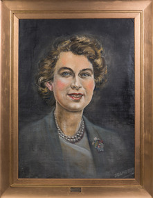
Painting, Crampton, Queens Portrait 1952, 1952
... Kingston Arts 979 Nepean Hwy (Cnr South Road and Nepean Hwy ... -
 Kingston Arts
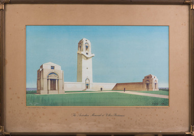
Print, Cyril A. Farey, The Australian Memorial, 1935
... Kingston Arts 979 Nepean Hwy (Cnr South Road and Nepean Hwy ... -
 Kingston Arts
Painting, Paul Warner, Morning Near Yea
... Kingston Arts 979 Nepean Hwy (Cnr South Road and Nepean Hwy ... -
 Kingston Arts
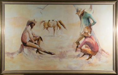
Painting, Bette Hays, Stockman, 1979
... Kingston Arts 979 Nepean Hwy (Cnr South Road and Nepean Hwy ... -
 Kingston Arts
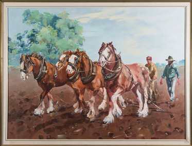
Painting, Penelope Coridas, Wiltshire Clydesdales, 1986
... Kingston Arts 979 Nepean Hwy (Cnr South Road and Nepean Hwy ... -
 Kingston Arts
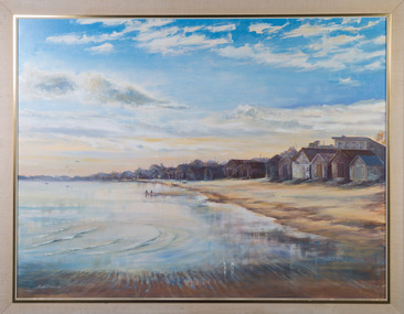
Painting, John Canning, Chelsea Beach
... Kingston Arts 979 Nepean Hwy (Cnr South Road and Nepean Hwy ... -
 Kingston Arts
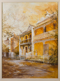
Painting, Shirley Hunter, Royal Parade - Parkville
... Kingston Arts 979 Nepean Hwy (Cnr South Road and Nepean Hwy ... -
 Kingston Arts
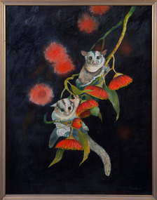
Painting, Dawn Stubbs, Sugar Gliders, 1989
... Kingston Arts 979 Nepean Hwy (Cnr South Road and Nepean Hwy ... -
 Kingston Arts
Painting, Norma Turner, Storm Clouds
... Kingston Arts 979 Nepean Hwy (Cnr South Road and Nepean Hwy ... -
 Kingston Arts
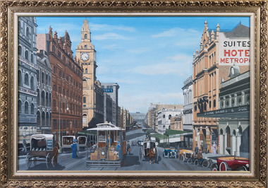
Painting, Graeme Hardiman, Bourke Street, April,1993
... Kingston Arts 979 Nepean Hwy (Cnr South Road and Nepean Hwy ... -
 Kingston Arts
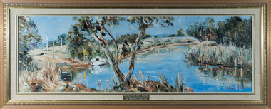
Painting, Pauline Quinn, Patterson River, 1981
... Kingston Arts 979 Nepean Hwy (Cnr South Road and Nepean Hwy ... -
 Kingston Arts
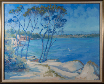
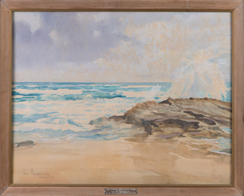
Painting, John Morrisey, Surf Beach Sorrento
... Kingston Arts 979 Nepean Hwy (Cnr South Road and Nepean Hwy ... -
 Kingston Arts
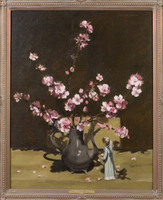
Painting, Judith Wills, Flowering Almond Blossom, 1978
... Kingston Arts 979 Nepean Hwy (Cnr South Road and Nepean Hwy ... -
 Kingston Arts
Painting, A. Todman, Morning Haze
... Kingston Arts 979 Nepean Hwy (Cnr South Road and Nepean Hwy ... -
 Kingston Arts
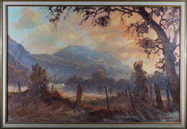
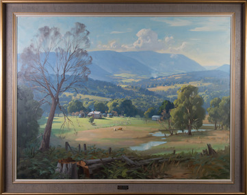
Painting, Ernest Buckmaster, Yarra Valley Towards Warburton, 1963
... Kingston Arts 979 Nepean Hwy (Cnr South Road and Nepean Hwy ... -
 Kingston Arts
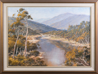
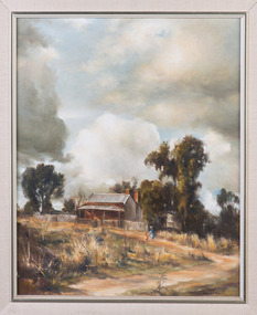
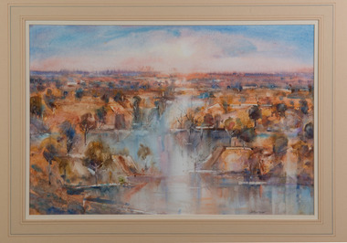
Painting, Charles Moodie, Inland River, 1988
... Kingston Arts 979 Nepean Hwy (Cnr South Road and Nepean Hwy ... -
 Kingston Arts
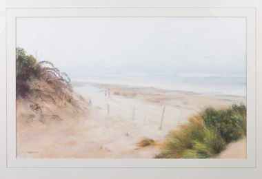
Painting, John Sterchele, Autumn - Woolamai Beach
... Kingston Arts 979 Nepean Hwy (Cnr South Road and Nepean Hwy ... -
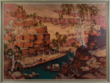 Kingston Arts
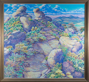
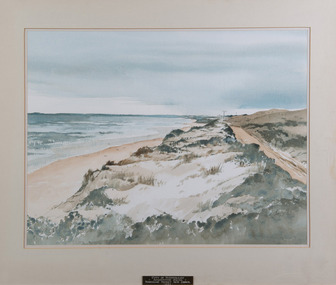
Painting, C. Dudley Wood, Dale's Gorge - Hammersley Range, 1968
... Kingston Arts 979 Nepean Hwy (Cnr South Road and Nepean Hwy ...