Showing 293 items
matching nyora
-
 Eltham District Historical Society Inc
Photograph, Liz Pidgeon, Heritage Excursion; East of Eltham, 6 Sep 2014, 20 May 2017
Newsletter No. 218, September 2014 September Excursion - East of Eltham Walk In Newsletter No. 197, March 2011, there was a brief history of Crown Allotment 15 Section 5 Parish of Nillumbik (CA 15) a parcel of land of a quarter of a square mile extending from Eucalyptus Road to Reynolds Road at the eastern extremity of Eltham. From the 1940s it was known as Stokes orchard. In later years it has been subdivided for residential purposes but leaving significant areas as power line and water supply reserves and bushland reserves that are habitat for the threatened For our excursion on 6th September we intend to walk through CA 15 to a bushland reserve east of Reynolds Road. The walk will traverse the boundary between suburban Eltham and the non-urban areas to the south and east. This is a pleasant walk through residential areas and bushland. Along the way we will discuss the early and more recent history of CA 15 as well as local natural history and geology. This walk is about 3.5 km in length and will take 2 to 2.5 hours. It will start at 2pm at the corner of Eucalyptus Road, Pitt Street and Nyora Road.Born Digitaleltham east, eltham district historical society, heritage excursion, activities, nyora road, reynolds road, gum tree road reserve, diosma road, stokes orchard, eucalyptus road -
 Uniting Church Archives - Synod of Victoria
Banner - Banners
The letters of the completed banner were made by different churches within in the presbytery of Gippsland and spell a sentence, presumably, "BUILD YOUR CHURCH LORD!" Orbost was one of the churches that had the finished banner on display. 24 small banners with tabs at the top of each for hanging on a rod. 19 have large blue letters appliqued on them. Twenty two of the banners are roughly square and two are smaller and oblong. Three have no letters and are used as spacers in the four word sentence that the letters make. The banners are decorated with rural and coastal images. BN068.1 "B" with an embroidered boat with the number 1 on the sail. BN068.2 "U" fabric paint words: "LOCH POOWONG east poowong nyora strezlecki kernang athlone" BN068.3 "I" "Korumburra" BN068.4 "L" with a pelican, fishing boat with a net, shells and sand BN068.5 "D" with the UCA emblem and "BUNYIP Garfield Longwarry" BN068.6 "Y" BN068.7 "O" with fabric paint flag, ram, road and trees and a cow BN068.8 "U" BN068.9 "R" with green and yellow wattle in fabric paint BN068.10 "C" with ric-rac round the letter and three churches appliqued in the top left corner BN068.11 "H" edged with pale blue metallic fabric paint BN068.12 "U" with sunrise over the sea with gold chain sunbeams and sequins BN068.13 "R" with fine blue embroidery at each corner and only two tabs BN068.14 "C" with appliqued boat, sky and sun BN068.15 "H" with a black swan with a red beak BN068.16 "L" with appliqued and fabric painted scene of a beach, hills and city smoke on the horizon BN068.17 "O" with painted corn cobs in each corner BN068.18 "R" with cows, hills, sheep and a sack BN068.19 "D" with machine embroidered church "St Matthews Yinnar", hands "Friendship", building "UCA Yinnar", chuch "Holy Innocents YINNAR STH" "(Californian RED WOOD)", tree "BIG TREE grows at Christ Church Boolarra" BN068.20 "!" with fabric brown cow in grass BN068.21 spacer with appliqued house, bushes and barn BN068.22 spacer with appliqued sun with ribbon rays and black white and brown figures BN068.23 & BN068.24 spacer with a small UCA red dove in the centre "B U I L D Y O U R C H U R C H L O R D !"uniting church adult fellowship -
 Eltham District Historical Society Inc
Folder, Material pertaining to closure of Eltham RSL Sub-Branch and relocation of Obelisk memorial, 2010-2011
Contents: Minutes of Eltham RSL and Community Meeting held at 29 Nyora Road, Eltham, 23 June 2010 (Community meeting re closure of Eltham RSL sub-branch and relocation of the WW1 Obelisk) Open Letter to the Residents of ELTHAM and MONTMORENCY [And their Surrounding Districts]; 19 March 2012 draft (Invitation to attend the Montomorency Eltham RSL 2012 Anzac Day service at the new site of the Cenotaph in front of the Eltham War Memorial. Includes a brief history of the obelisk and the Eltham War Memorial) Newspaper clipping - Hall 'scruffy' - war vet, Diamond Valley Leader, 17 February 2010, p2 Newspaper clipping - RSL branch has a fight on its hands by Alana Schetzer, Heidelberg & Valley Weekly, 3 August 2010, p7 Newspaper clipping - Locals battle state RSL over building, Diamond Valley Leader, 4 August 2010, p7 Newspaper clipping - New home for cenotaph; Councillors support proposal for relocation to Eltham's War Memorial Hall, Diamond Valley Leader, 12 January 2011 Newspaper clipping - CFA hot for RSL site; MP presses for 'fast-track' purchase, Diamond Valley Leader, 23 february 2011, p1 Newspaper clipping - New home for cenotaph delights war veterans, Diamond Valley Leader, 31 August 2011, p9 Council's Heritage Advisor, Samantha Westbrooke Pty Ltd advised Council in 2014 that the relocation of the cenotaph had compromised the significance of the War Memorial Building Complex as the two memorials, while both commemorating World Wars, demonstrate two very different methods of memorialising. The World War Two War Memorial Building Complex with its civic purpose was a conscious shift away from memorialisation by monuments and a focus on the future and not the past. The cenotaph is an example of the post World War One memorialising practice of erecting monuments to commemorate the past. The location of the cenotaph in front of the former Infant Welfare Centre confuses the history of the site and obscures the ability to view the three buildings as a united complex. Additional subsequent modifications with the provision of access ramps and rails has further impacted upon the garden design. Nine A4 pages printed and six newspaper clippingsalan field, cfa, eltham rsl sub-branch, eltham war memorial hall, eltham war memorial, john cohen, montmorency-eltham rsl sub-branch, obelisk, war memorial garden -
 Eltham District Historical Society Inc
Photograph - Digital Photograph, Alan King, Sweet Bursaria, 2008
Published: Nillumbik Now and Then / Marguerite Marshall 2008; photographs Alan King with Marguerite Marshall.; p181 The rare Eltham Copper Butterfly, Paralucia pyro-discus, was saved from near extinction by a community campaign in the late 1980s. Thanks to that effort, the butterfly, a form of the Fiery Copper Butterfly, with a wing span of only 2.5cm, can be seen in parts of Eltham and Greensborough from late November to April. As late as 1987 the butterfly was thought to be near extinction. But that year, entomologist, Michael Braby, found several colonies, including two major ones in natural bushland on Diosma Road, Eltham. However these were threatened with destruction, as their habitat was to be destroyed by a development of 71 houses. The colonies were on a 14 hectare subdivision owned by Esanda Finance, an ANZ Bank subsidiary. It would cost around $5 million, to reimburse the bank for the land. The butterfly, which depends on woodland, a stunted form of the Sweet Bursaria bush, and the Notoncus ant, was considered too fragile to relocate. Braby’s discovery led to a sometimes fiery two-year campaign, which even became an election issue. It involved the local community, local and state governments and the developer, before a compromise was reached. The larvae have an intricate relationship with the small black ant, Notoncus. During the day, the larvae shelter in nests made by the ants around the base of the trunk and roots of the Sweet Bursaria (Bursaria spinosa). The ants are thought to protect the larvae from predators and parasites, as they attend them from the nests to feed on the Bursaria leaves at night. In return, the larvae excrete a sugar solution, which the ants love to eat. The butterfly was first recorded in Victoria in 1893, and first collected scientifically from Eltham in 1931. But it was only officially named in 1951, by Victoria’s then top butterfly expert, David Crosby.2 However, from 1970, rapid housing development in Eltham destroyed much of the butterfly’s habitat. The discovery of several major colonies in 1987 met with great excitement, and 250 people attended the first local public meeting. The State Government commissioned Crosby to investigate how to protect the butterfly, and the council froze development for three weeks. Then Esanda agreed to suspend development for several months, until a compromise was reached. Crosby recommended that 62 of the 71 lots be kept to ensure the butterflys’ survival. However this would cost $1 million to $1.5million in compensation to Esanda. Greensborough MP Pauline Toner, launched a $1million fundraising campaign and many artists donated their works to the appeal. Toner offered Clifton Pugh’s painting Eltham Copper Country to millionaire Alan Bond for $1 million, after having heard that he had offered $6 million for the Van Gough painting Sunflowers. However Bond did not accept. The butterfly was considered a ‘hot’ election issue during the by-election, following Pauline Toner’s resignation. Liberal party candidate, Margaret Brown, was accused of falsely saying she had been involved in the butterfly campaign so as to win votes. Sadly, the $1million appeal fell short at $426,000, so a compromise was reached. The State Government donated the Education Department site on Eucalyptus Road, but only nine lots of the Diosma site were bought, and the rest of the development went ahead. On March 3, 1989, Ms Toner died, and the Eucalyptus Road site was named in her honour. Around 2000 the butterfly was further threatened by proposed developments on Pitt Street, facing the Pauline Toner Reserve and between Diosma and Nyora Roads. Fortunately the Friends of the ECB, with the Shire of Nillumbik, ensured that more habitat was made available. The butterfly now survives in seven sites in Eltham and Greensborough, including the main sites at the Pauline Toner Reserve on Eucalyptus Road, the Western and Eastern colonies on Diosma Road, and the Yandell Reserve in Greensborough.The butterfly survives also in Castlemaine and in the Kiata and Salisbury areas. However, it remains endangered.This collection of almost 130 photos about places and people within the Shire of Nillumbik, an urban and rural municipality in Melbourne's north, contributes to an understanding of the history of the Shire. Published in 2008 immediately prior to the Black Saturday bushfires of February 7, 2009, it documents sites that were impacted, and in some cases destroyed by the fires. It includes photographs taken especially for the publication, creating a unique time capsule representing the Shire in the early 21st century. It remains the most recent comprehenesive publication devoted to the Shire's history connecting local residents to the past. nillumbik now and then (marshall-king) collection, eltham copper butterfly, sweet bursaria -
 Eltham District Historical Society Inc
Photograph - Digital Photograph, Alan King, Pauline Toner Butterfly Reserve, 2008
One of seven sites in Eltham and Greensborough where the butterfly survives. Published: Nillumbik Now and Then / Marguerite Marshall 2008; photographs Alan King with Marguerite Marshall.; p181 The rare Eltham Copper Butterfly, Paralucia pyro-discus, was saved from near extinction by a community campaign in the late 1980s. Thanks to that effort, the butterfly, a form of the Fiery Copper Butterfly, with a wing span of only 2.5cm, can be seen in parts of Eltham and Greensborough from late November to April. As late as 1987 the butterfly was thought to be near extinction. But that year, entomologist, Michael Braby, found several colonies, including two major ones in natural bushland on Diosma Road, Eltham. However these were threatened with destruction, as their habitat was to be destroyed by a development of 71 houses. The colonies were on a 14 hectare subdivision owned by Esanda Finance, an ANZ Bank subsidiary. It would cost around $5 million, to reimburse the bank for the land. The butterfly, which depends on woodland, a stunted form of the Sweet Bursaria bush, and the Notoncus ant, was considered too fragile to relocate. Braby’s discovery led to a sometimes fiery two-year campaign, which even became an election issue. It involved the local community, local and state governments and the developer, before a compromise was reached. The larvae have an intricate relationship with the small black ant, Notoncus. During the day, the larvae shelter in nests made by the ants around the base of the trunk and roots of the Sweet Bursaria (Bursaria spinosa). The ants are thought to protect the larvae from predators and parasites, as they attend them from the nests to feed on the Bursaria leaves at night. In return, the larvae excrete a sugar solution, which the ants love to eat. The butterfly was first recorded in Victoria in 1893, and first collected scientifically from Eltham in 1931. But it was only officially named in 1951, by Victoria’s then top butterfly expert, David Crosby.2 However, from 1970, rapid housing development in Eltham destroyed much of the butterfly’s habitat. The discovery of several major colonies in 1987 met with great excitement, and 250 people attended the first local public meeting. The State Government commissioned Crosby to investigate how to protect the butterfly, and the council froze development for three weeks. Then Esanda agreed to suspend development for several months, until a compromise was reached. Crosby recommended that 62 of the 71 lots be kept to ensure the butterflys’ survival. However this would cost $1 million to $1.5million in compensation to Esanda. Greensborough MP Pauline Toner, launched a $1million fundraising campaign and many artists donated their works to the appeal. Toner offered Clifton Pugh’s painting Eltham Copper Country to millionaire Alan Bond for $1 million, after having heard that he had offered $6 million for the Van Gough painting Sunflowers. However Bond did not accept. The butterfly was considered a ‘hot’ election issue during the by-election, following Pauline Toner’s resignation. Liberal party candidate, Margaret Brown, was accused of falsely saying she had been involved in the butterfly campaign so as to win votes. Sadly, the $1million appeal fell short at $426,000, so a compromise was reached. The State Government donated the Education Department site on Eucalyptus Road, but only nine lots of the Diosma site were bought, and the rest of the development went ahead. On March 3, 1989, Ms Toner died. Thee Eucalyptus Road site was named in her honour. Around 2000 the butterfly was further threatened by proposed developments on Pitt Street, facing the Pauline Toner Reserve and between Diosma and Nyora Roads. Fortunately the Friends of the ECB, with the Shire of Nillumbik, ensured that more habitat was made available. The butterfly now survives in seven sites in Eltham and Greensborough, including the main sites at the Pauline Toner Reserve on Eucalyptus Road, the Western and Eastern colonies on Diosma Road, and the Yandell Reserve in Greensborough.5 The butterfly survives also in Castlemaine and in the Kiata and Salisbury areas. However, it remains endangered.This collection of almost 130 photos about places and people within the Shire of Nillumbik, an urban and rural municipality in Melbourne's north, contributes to an understanding of the history of the Shire. Published in 2008 immediately prior to the Black Saturday bushfires of February 7, 2009, it documents sites that were impacted, and in some cases destroyed by the fires. It includes photographs taken especially for the publication, creating a unique time capsule representing the Shire in the early 21st century. It remains the most recent comprehenesive publication devoted to the Shire's history connecting local residents to the past. nillumbik now and then (marshall-king) collection, eltham copper butterfly, pauline toner butterfly reserve -
 Eltham District Historical Society Inc
Photograph - Aerial Photograph, Landata, Eltham, Feb. 1956
Centred on present day Mount Plaeasant Road near Dalton Street, Eltham bounded by Luck Street to north, Eltham Lower Park to south, Reynolds Road to east and Central Park to west Historic Aerial Imagery Source: Landata.vic.gov.au Aerial Photo Details: Project No :250 Project : MELBOURNE OUTER SUBURBS PROJECT Run : 18 Frame : 93 Date : 02/1956 Film Type : B/W Camera : EAG9 Flying Height : 10000 Scale : 12000 Film Number : 1176 GDA2020 : 37°43'02"S, 145°09'38"E MGA2020 : 337871, 5823961 (55) Melways : 22 B6 (ed. 42)aerial photo, 1956-02, neil webster collection, eltham, central park, eltham lower park, luck street, melway 22b6, nyora road, reynolds road, dalton street, mount pleasant road -
 Eltham District Historical Society Inc
Journal, Peter Doughtery, ArtStreams: Whittlesea, Banyule, Darebin, Manningham, Nillumbik & Yarra; Vol. 9, No. 1, Mar-Apr 2004, 2004
Vol. 9, No. 1, Mar-Apr 2004 CONTENTS Comment 2 Coming to a festival near you 3 Eltham Jazz and Blues Festival 7 Marco Luccio - printmaker, by Clive Dickson 8 Easy Living at Dizzy's by Odette Kelada 10 Reading Arcadia by John Jenkins 12 Poetry News by Ian McBryde 14 Local Colour - photography by Bill Bachman 16 Tributes to Melanie Shanahan 18 Nel Douglas & the Murrumbeena Connection 20 Book Reviews 22 CD Review 24 War Memorial Sculptures 25 Artin' About 26 Wining & Dining 30 Art Services and Classes 32 "Peter Dougherty has been involved in the local art scene for many years. As publisher and editor of the arts magazine Artstreams, his comments on the various branches of the arts are widely respected. His "The Arts" column in the Diamond Valley Leader presents a brief summary for a much wider cross section of the local community. Peter also operates his own gallery and the Artstreams Cafe at the St Andrews market. Peter has a wealth of knowledge about present day and historical aspects of local art and artists." - Eltham District Historical Society Newsletter No. 161, March 2005Colour front and back cover with feature articles and literary pieces with photographs and advertisements printed in black and white. 36 pages, 30 cm. Vol. 1, no. 1 (Nov. 1996) - Vol. 10, no. 5 (summer ed. 2005/06) art streams, city of whittlesea community festival, chris smither, mary coughlan, eliza carthy, alison brown quartet, music festivals, sushi wushi eltham, bundoora homestead, eltham jazz festival, marco luccio, warrandyte cafe, clive dickson, bahnhof cafe, montsalvat, eltham fullife pharmacy, nyora road gallery, john jenkins, latrobe university, poetry, ian mcbryde, potters, eltham gourmet poultry & game, eltham wiregrass gallery, bill bachman, melanie shanahan, neil douglas, murrumbeena collection, hurnall's decorative arts gallery, st andrews hotel, leigh conkie, greensborough war memorial park sculptures, il primo restaurant carlton, bulleen art & garden centre, northcote pottery, hurstbridge galleries, thompsons amcal pharmacy, bendigo bank, hurstbridge & districts community bank branch -
 Eltham District Historical Society Inc
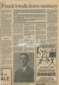
Newsclipping, Frank's walk down memory lane ... , Diamond Valley News, 11 September 1984, 11 Sep 1984
Digital file only - Digitised by EDHS from a scrapbook on loan from Beryl Bradbury (nee Stokes), daughter of Frank Stokes.beryl bradbury (nee stokes) collection, eltham, frank stokes, nyora road, stokes orchard -
 Eltham District Historical Society Inc
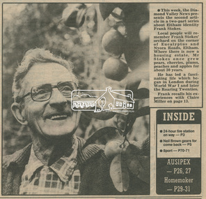
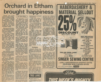
Newsclipping, Orchard in Eltham brought happiness, Diamond Valley News, 18 September 1984, 11 Sep 1984
Digital file only - Digitised by EDHS from a scrapbook on loan from Beryl Bradbury (nee Stokes), daughter of Frank Stokes.beryl bradbury (nee stokes) collection, eltham, frank stokes, nyora road, stokes orchard -
 Eltham District Historical Society Inc
Newsclipping, Orchard in Eltham brought happiness, Diamond Valley News, 18 September 1984, 18 Sep 1984
Digital file only - Digitised by EDHS from a scrapbook on loan from Beryl Bradbury (nee Stokes), daughter of Frank Stokes.beryl bradbury (nee stokes) collection, eltham, frank stokes, nyora road, stokes orchard -
 Warrnambool RSL Sub Branch
Pre-WW1 Correspondence HAROLD to BOB & JT SNAPE (father) to BOB, Jan'y 1906. 'My first trip to Nyora' (Bob: short story)
snape collection -
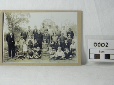 Poowong Historical Group
Sepia photograph, Untitled, Poowong North School 1932, 1932 (exact)
Shows teacher and students of the Poowong North School in 1932. This school no longer exists but shows members of both past and present families of this community. Particularly interesting in showing the fashions of rural communities during the Great Depression. Not many copies are known to exist.Copy of photograph of Poowong North School class mounted on card.Shows teacher with 17 male and 12 female students sitting on mat behind small blackboard. Taken outdoors with remnant forest in background.On blackboard in photo "Poowong Nth / School 4102 / 1932"school, pupils, students, poowong north, school photo, 1932, 4102, school 4102, class, class photo, poowong nth