Showing 1046 items
matching trails
-
 Eltham District Historical Society Inc
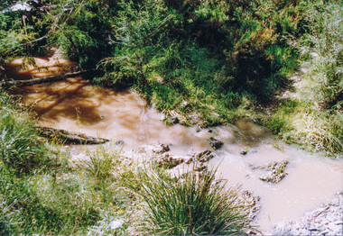
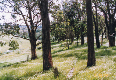
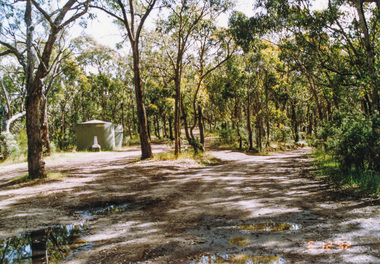
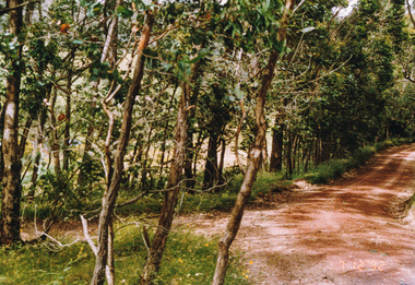
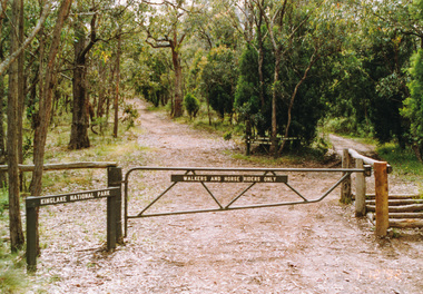
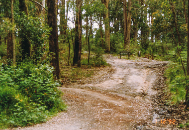
Photograph, Creek crossing, Long Gully Bushland Reserve, Panton Hill, 6 December 1992, 06/12/1992
The Eltham Horse Trail: Research and Warrandyte to Kinglake: Survey of proposed route, December 1992: (3) Kangaroo Ground to KinglakeColour photographeltham horse trail (1992 survey), panton hill, long gully road -
 Eltham District Historical Society Inc
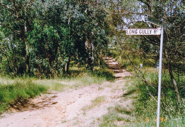
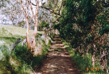
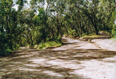
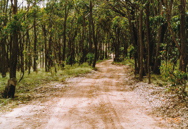
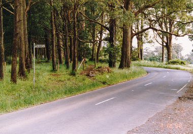
Photograph, Motschalls Road from Long Gully Road, Panton Hill, 6 December 1992, 06/12/1992
The Eltham Horse Trail: Research and Warrandyte to Kinglake: Survey of proposed route, December 1992: (3) Kangaroo Ground to KinglakeColour photographeltham horse trail (1992 survey), panton hill, motschalls road, long gully road -
 Eltham District Historical Society Inc
Photograph, Motschalls Road near Gills Road (now Turnung Road), Panton Hill, 6 December 1992, 06/12/1992
The Eltham Horse Trail: Research and Warrandyte to Kinglake: Survey of proposed route, December 1992: (3) Kangaroo Ground to KinglakeTwo colour photographseltham horse trail (1992 survey), panton hill, motschalls road, gills road, turnung road -
 Eltham District Historical Society Inc
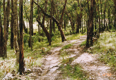
Photograph, Thick bush along unopened Government Road off Motschalls Road, Panton Hill, 6 December 1992, 06/12/1992
The Eltham Horse Trail: Research and Warrandyte to Kinglake: Survey of proposed route, December 1992: (3) Kangaroo Ground to KinglakeColour photographeltham horse trail (1992 survey), panton hill, motschalls road -
 Eltham District Historical Society Inc
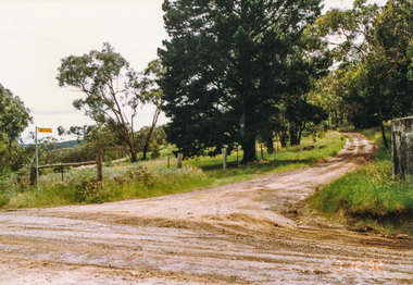
Photograph, Near Clintons Road, Panton Hill, 6 December 1992, 06/12/1992
The Eltham Horse Trail: Research and Warrandyte to Kinglake: Survey of proposed route, December 1992: (3) Kangaroo Ground to KinglakeColour photographeltham horse trail (1992 survey), panton hill, clintons road -
 Eltham District Historical Society Inc
Photograph, Rob Roy Road, Panton Hill to Christmas Hills, 6 December 1992, 06/12/1992
The Eltham Horse Trail: Research and Warrandyte to Kinglake: Survey of proposed route, December 1992: (3) Kangaroo Ground to KinglakeColour photographeltham horse trail (1992 survey), panton hill, rob roy road, christmas hills -
 Eltham District Historical Society Inc
Photograph, Happy Valley bushland from Rob Roy Road, Panton Hill, 6 December 1992, 06/12/1992
The Eltham Horse Trail: Research and Warrandyte to Kinglake: Survey of proposed route, December 1992: (3) Kangaroo Ground to KinglakeColour photographeltham horse trail (1992 survey), panton hill, rob roy road, happy valley -
 Eltham District Historical Society Inc
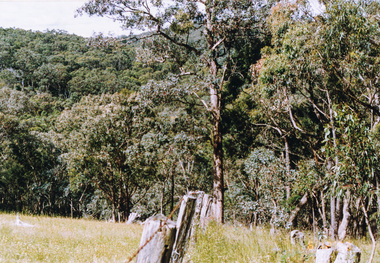
Photograph, Western end of Mineshaft Road, Smiths Gully, 6 December 1992, 06/12/1992
The Eltham Horse Trail: Research and Warrandyte to Kinglake: Survey of proposed route, December 1992: (3) Kangaroo Ground to KinglakeColour photographeltham horse trail (1992 survey), mineshaft road, smiths gully -
 Eltham District Historical Society Inc
Photograph, Mineshaft Road at One Tree Hill Road, Smiths Gully, 6 December 1992, 06/12/1992
The Eltham Horse Trail: Research and Warrandyte to Kinglake: Survey of proposed route, December 1992: (3) Kangaroo Ground to KinglakeColour photographeltham horse trail (1992 survey), mineshaft road, smiths gully, one tree hill road -
 Eltham District Historical Society Inc
Photograph, Hairpin bend on One Tree Hill Road, Smiths Gully, 6 December 1992, 06/12/1992
The Eltham Horse Trail: Research and Warrandyte to Kinglake: Survey of proposed route, December 1992: (3) Kangaroo Ground to KinglakeColour photographeltham horse trail (1992 survey), smiths gully, one tree hill road -
 Eltham District Historical Society Inc
Photograph, Smiths Gully Road looking west near Joyce Road, Smiths Gully, 7 December 1992, 07/12/1992
The Eltham Horse Trail: Research and Warrandyte to Kinglake: Survey of proposed route, December 1992: (3) Kangaroo Ground to KinglakeColour photographeltham horse trail (1992 survey), smiths gully, joyce road, smiths gully road -
 Eltham District Historical Society Inc
Photograph, Looking west from Fox Road, Smiths Gully, 7 December 1992, 07/12/1992
The Eltham Horse Trail: Research and Warrandyte to Kinglake: Survey of proposed route, December 1992: (3) Kangaroo Ground to KinglakeColour photographeltham horse trail (1992 survey), smiths gully, fox road -
 Eltham District Historical Society Inc
Photograph, Track to Rifle Range Road off Fox Road, Smiths Gully, 7 December 1992, 07/12/1992
The Eltham Horse Trail: Research and Warrandyte to Kinglake: Survey of proposed route, December 1992: (3) Kangaroo Ground to KinglakeTwo colour photographseltham horse trail (1992 survey), smiths gully, fox road, rifle range road -
 Eltham District Historical Society Inc
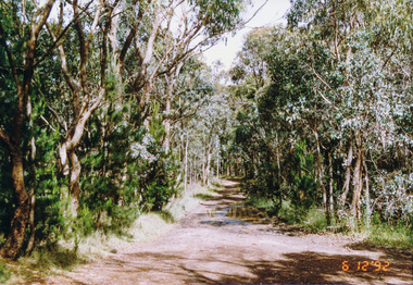
Photograph, Rifle Range Road, Smiths Gully, 7 December 1992, 07/12/1992
The Eltham Horse Trail: Research and Warrandyte to Kinglake: Survey of proposed route, December 1992: (3) Kangaroo Ground to KinglakeColour photographeltham horse trail (1992 survey), smiths gully, rifle range road -
 Eltham District Historical Society Inc
Photograph, Rifle Range Road Track near Buttermans Track, St Andrews, 7 December 1992, 07/12/1992
The Eltham Horse Trail: Research and Warrandyte to Kinglake: Survey of proposed route, December 1992: (3) Kangaroo Ground to KinglakeColour photographeltham horse trail (1992 survey), buttermans track, rifle range road track, st andrews -
 Eltham District Historical Society Inc
Photograph, Marshalls Road from Buttermans Track, St Andrews, 7 December 1992, 07/12/1992
The Eltham Horse Trail: Research and Warrandyte to Kinglake: Survey of proposed route, December 1992: (3) Kangaroo Ground to KinglakeColour photographeltham horse trail (1992 survey), st andrews, marshalls road, buttermans track -
 Eltham District Historical Society Inc
Photograph, Mt Everard Track at Marshalls Road, St Andrews, 7 December 1992, 07/12/1992
The Eltham Horse Trail: Research and Warrandyte to Kinglake: Survey of proposed route, December 1992: (3) Kangaroo Ground to KinglakeColour photographeltham horse trail (1992 survey), st andrews, marshalls road, mt everard track -
 Eltham District Historical Society Inc
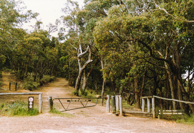
Photograph, Northern end of Mt Everard Track, Kinglake, 7 December 1992, 07/12/1992
The Eltham Horse Trail: Research and Warrandyte to Kinglake: Survey of proposed route, December 1992: (3) Kangaroo Ground to KinglakeColour photographeltham horse trail (1992 survey), mt everard track, kinglake -
 Eltham District Historical Society Inc
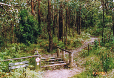
Photograph, Southern end of Cooksons Hill Track, Kinglake, 7 December 1992, 07/12/1992
The Eltham Horse Trail: Research and Warrandyte to Kinglake: Survey of proposed route, December 1992: (3) Kangaroo Ground to KinglakeColour photographeltham horse trail (1992 survey), kinglake, cooksons hill track -
 Eltham District Historical Society Inc
Photograph, Northern end of Cooksons Hill Track, Kinglake, 7 December 1992, 07/12/1992
The Eltham Horse Trail: Research and Warrandyte to Kinglake: Survey of proposed route, December 1992: (3) Kangaroo Ground to KinglakeColour photographeltham horse trail (1992 survey), kinglake, cooksons hill track -
 Eltham District Historical Society Inc
Photograph, Pinchgut Lane to left and Jerusalem Track straight ahead, Kinglake, 7 December 1992, 07/12/1992
The Eltham Horse Trail: Research and Warrandyte to Kinglake: Survey of proposed route, December 1992: (3) Kangaroo Ground to KinglakeColour photographeltham horse trail (1992 survey), kinglake, jerusalem track, pinchgut lane -
 Eltham District Historical Society Inc
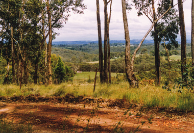
Photograph, Hurstbridge Road at Pinchgut Lane, Kinglake, 7 December 1992, 07/12/1992
The Eltham Horse Trail: Research and Warrandyte to Kinglake: Survey of proposed route, December 1992: (3) Kangaroo Ground to KinglakeColour photographeltham horse trail (1992 survey), kinglake, pinchgut lane, hurstbridge road -
 Eltham District Historical Society Inc
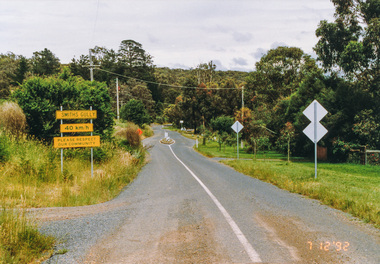
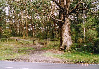
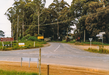
Photograph, Main Road junction, Kinglake, 7 December 1992, 07/12/1992
The Eltham Horse Trail: Research and Warrandyte to Kinglake: Survey of proposed route, December 1992: (3) Kangaroo Ground to KinglakeColour photographeltham horse trail (1992 survey), kinglake, healesville-kinglake road, heidelberg-kinglake road, whittlesea-kinglake road -
 Eltham District Historical Society Inc
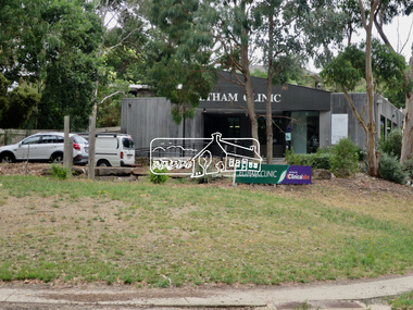
Photograph, Jim Connor, Avenue of Honour, Main Road, Eltham, 14 Jan 2017
Eltham Gateway, Eltham Clinic, 700 Main Road, Elham viewed from Wingrove Park Trail opposite Dalton StreetTomorrow's history documented todayeltham, jim connor collection, main road, eltham gateway, avenue of honour, dalton street, eltham clinic -
 Uniting Church Archives - Synod of Victoria
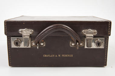
Travelling Communion Set, c1940s
The Rev A W Pederick was a chaplain who served in the New Guinea Campaign during WWII. His service included the Kokoda Trail. Brown leather carry case with a brown metal base, a carry handle and two lockable latches on the font. The box has a blue velvet lining. The box holds a paten, diameter 12.0 cm, and a wafer tin which are held in pouches in the lid. Two bottles with cork and silver lids are in fitted compartments inside the box which also contains a small white embroidered cloth. There is embossed gold lettering on the front of the box. The box also holds a letter from the Rev Douglas W Risstrom."CHAPLAIN A. W. PEDERICK" inside the lid: "The gift of the Methodist Padres Auxiliary of Australia"portable communion set, rev a w pederick -
 Greensborough Historical Society
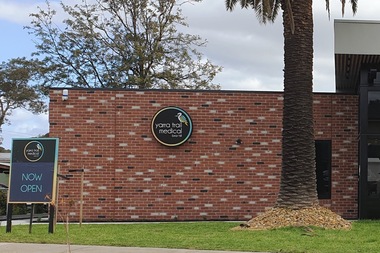
Photograph - Photograph - Digital Image, Marilyn Smith, Yarra Trail Medical 113 Mountainview Road Montmorency, 04/09/2021
Digital image of Yarra Trail Medical 113 Mountainview Road Montmorency. This medical centre was purpose built following a fire at this address.Part of a collection of miscellaneous historical images with a connection to the local area.Digital colour photograph. yarra trail medical, mountainview road briar hill, medical centres -
 Bendigo Historical Society Inc.
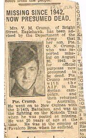
Newspaper - BADHAM COLLECTION: PTE. G.N. CRUMP MISSING - PRESUMED DEAD ON 30.8.1942, 30/08/1942
Badham collection: Newspaper clipping regarding Private G. N. Crump missing, presumed dead on 30.8.1942. He served in 2/14th Battalion fighting on the Kokoda Trail Private Crump was 20 years old and employed by Favalro Bros. when enlisted. Small newspaper clipping.document, newspaper, bendigo theme, pte. g.n. crump 30.8.1942. 2/14th battalion. kokoda trail. favalro bros. -
 Bendigo Historical Society Inc.
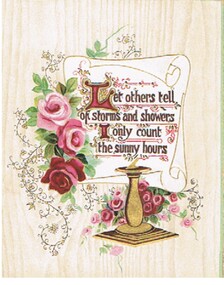
Document - MALONE COLLECTION: GREETING CARDS
Document. Greeting Cards. Cream coloured card with timber pattern & green edges. Red & pink roses beside a white, gold edged scroll. Below the scroll is a gold sundial. Trailing vine with gold and black stems & berries. Verse printed on the scroll in brown, gold & red.Raphael Tuck & Sonsperson, greeting cards, malone collection, malone collection, greeting cards -
 Eltham District Historical Society Inc
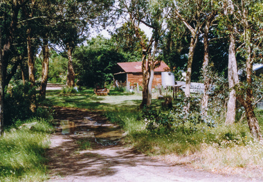
Photograph, Doug Orford, Completion of bridge works across Yarra River at rear of Eltham Lower Park, July 2004
Bitumen shared pathway under construction at the new Eltham-Templestowe footbridge over the Yarra River off Homestead Road, Eltham which was completed in July 2004. The Yarra River Footbridge was opened in August 2004 and links the Diamond Creek Trail between the Shire of Nillumbik and City of Manningham. It is a shared pathway and also links with the Main Yarra Trail. It affords lovely views over the Yarra River.Three colour photographs showing commencement of construction of Eltham-Templestowe footbridge over Yarra River off Homestead Road, Eltham which was completed July 2004. Third photograph of dedictaion plaque at opening 30 Aug 2004bridges, yarra river, eltham south, eltham lower park, lenister farm, homestead road, asphaldt, bitumen, shared pathway, diamond creek trail -
 Glen Eira Historical Society
Article - Rosstown Railway
This file contains three items: 1/A review of the ROSSTOWN RAIL TRAIL from LIVING IN GLEN EIRA, vol. 11, 2004, Issue 4, no. 25, date and author unknown. The review explains the purpose of the Rail Trail with a brief narrative of the history behind Rosstown Sugar Mill Railway line. Concluding with information on the location of the Trail and the expected time required to walk the entire track included in the review is a map of the Rail Trail, which marks significant sites along the trail with historic pictures. 2/A newspaper article from THE AGE, dated Tuesday 21/10/1980 and written by Iola Matthews, reporting on the circumstances that led to the publication of the book RETURN TO ROSSTOWN written by Des Jowett and Ian Weickhardt. The article begins with a brief biography of the authors before moving into details of the book’s content, providing a further biography of W. Murray Ross which includes information on his financial ventures – particularly the Rosstown Rail – his marriage and children. The article includes a black and white photograph of Weickhardt and Jowett walking along the route of the railway line, an illustration of the Rosstown sugar works and a map of the area surrounding the site of the mill. 3/Three photocopies of a black and white illustration of the Rosstown sugar works from the east, undated and artist unknown.rosstown rail trail, rosstown, ross william, ross w. murray, ross murray, sugar beet mills, mills, elsternwick, land transport, railways, railway lines, railway routes, carnegie neville street, carnegie miller street, factories, market gardens, horticulture, peat, soils, land forms, topography, geology, civic issues, cone sugar industry, elsternwick plaza, elsternwick, glenhuntly road, parks and reserves, ee gunn reserve, caulfield racecourse, sportsgrounds, caulfield, carnegie, riddell parade, clarence street, aileen avenue, princes park, dover street, marara road, oakleigh road, rosanna street, murrumbeena crescent, north road, kooyong road, hawthorn road, booran road, koornang road, poath road, warragul road, railway platforms, railway buildings, bambra road, swamps, landforms, landfill, council landfill, railway bridges, bridges, railway underpasses, sporting clubs, tennis clubs, bowls clubs, rosstown railway, rosanna street reserve, maps, railway maps, living in glen eira, weickhardt ian, jowett des, caulfield south, curraweena road, oakleigh, caulfield technical school, return to rosstown, beet sugar industry, crops, land booms, land development and subdivisions, bent thomas, fink benjamin, sugar works, rosstown hotel, oamdenong road, rosstown dry cleaners, shops, rosstown road, rosstown plate, people by circumstance, migrants, accountants, occupations, professionals, the grange, real estate, grange road, financial agents, judges, rosstown estate, financial trouble, rabbit preserving, breweries, political debates, political issues, political electorates, politics, political science, debt, financial loans, court procedures, court cases, legal events and activities, malleson and riggall, widowers, seabeach railway, economics, economic deadline, depression 1890s, economic crash, mortgages, divorce, social problems, poverty, ross claude, ross roderick, world war 1914-1918, wars, military history, servicemen, australian flying corps, engineers, caulfield council, swagmen, homelessness, glenhuntly road, glenhuntly road tram, woornack road, leila road, wild cherry road, melten avenue, illustrations, steam trains, trains, horse and cart, horse-drawn transport, railway stations