Showing 4549 items matching "historical map"
-
 Bendigo Historical Society Inc.
Map - SANDHURST SHEET 5, Circa 1940's
Map: Sandhurst sheet 5. Parish plan ( number 197 in Map Cupboard 1)map, bendigo, city streets, sandhurst -
Bendigo Historical Society Inc.
Map - SANDHURST SHEET 6, 1947
Map: Sandhurst sheet 6. Parish plan ( number 196 in Map Cupboard 1)map, bendigo, city streets, sandhurst -
Bendigo Historical Society Inc.
Map - SANDHURST : COUNTY OF BENDIGO (PART), Circa 1940's
Map: Large scale (2 chains=1') of part of the city of Bendigo. Showing the area from Sommerville St. to Edwards Rd. Flora Hill ( number 195 in Map Cupboard 1)map, bendigo, city streets, bendigo, flora hill, sommerville st. -
Bendigo Historical Society Inc.
Map - TOWNSHIP OF KANGAROO FLAT, 27/01/1932
Map: Township of Kangaroo flat, Parish of Sandhurst , County of Bendigo. Parish plan ( number 194 in Map Cupboard 1)map, bendigo, township, kangaroo flat -
Bendigo Historical Society Inc.
Map - BENDIGO WEST IRRIGATION SETTLEMENT, 27/07/1910
Map: bendigo West Irrigation Settlement, Parish of Sandhurst, County of Bendigo. Parish plan ( number 193 in Map Cupboard 1)map, bendigo, irrigation settlement, bendigo west irrigation settlement -
Bendigo Historical Society Inc.
Map - LANDS AVAILABLE FOR SELECTION, 6/05/1912
Map: Lands available for selection, County of Bendigo. Parish plan ( number 192 in Map Cupboard 1)map, bendigo, lands available for selection, lands available for selection, bendigo -
Bendigo Historical Society Inc.
Map - BENDIGO WEST IRRIGATION SETTLEMENT, 13/02/1909
Map: Bendigo West Irrigation Settlement, Parish of Sandhurst, County of Bendigo. Parish plan. ( number 191 in Map Cupboard 1)map, bendigo, irrigation settlement, bendigo west irrigatioon settlement -
Bendigo Historical Society Inc.
Map - NERRING. SHEET ?, Circa 1894
Map: Nerring, Part ( number unreadable), County of Bendigo. Parish plan ( number 190 in Map Cupboard 1)map, bendigo, parish plan, nerring -
 Bendigo Historical Society Inc.
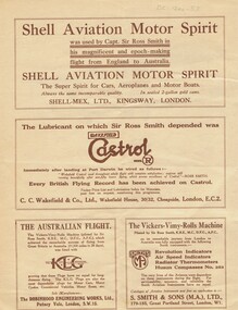
Document - BASIL WATSON COLLECTION: 'THE ROSS SMITH FLIGHT FROM ENGLAND TO AUSTRALIA' - TRAVELOGUE PROMOTION, c. 1920
Booklet: 'The Ross Smith Flight from England to Australia' - 4 page Travelogue booklet promotion for the Lowell Thomas Travelogues series, Re flight from England to Australia. On cover ' Under the patronage of HRH The Prince of Wales, The Ross Smith Flight from England to Australia' Includes short story of the flight by Capt. Sir Ross Smith, KB, MC, DFC, AFC. , map of flight and photos of Ross and Keith Smith. List of pictures shown in the travelogue. Original signatures of Ross and Keith Smith on the front cover.person, individual, ross smith -
 Bendigo Historical Society Inc.
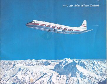
Document - MCCOLL, RANKIN AND STANISTREET COLLECTION: NAC AIR ATLAS OF NEW ZEALAND, 1955
McColl Rankin & Stanistreet, NAC Air Atlas of New Zealand. Photographs, arial photographs & maps. Shows air routes. Information on commercial air flights in New Zealand. Published by New Zealand National Airways Corp.organization, business, bendigo businesses, mccoll rankin & stanistreet, nac air atlas of new zealand -
 Bendigo Historical Society Inc.
Document - MCCOLL, RANKIN AND STANISTREET COLLECTION: PROSPECTUS OF CENTRAL DEBRORAH GOLD MINING CO NL, 1939
McColl Rankin & Stanistreet, Prospectus of Central Deborah Gold Mining Company NL. Item date: June 1939. Book soft cover 3 copies. A/ Application and map intact. Excellent condition. B/ Map and Application intact, fold crease down centre. Good condition. C/ No map no Application. Good condition.McColl Rankin & Stanistreetorganization, mining, central deborah gold mining co nl, mccoll rankin & stanistreet, prospectus of central deborah gold mining company nl. june 1939. -
 Bendigo Historical Society Inc.
Document - MCCOLL, RANKIN AND STANISTREET COLLECTION: PROSPECTUS OF NORTH DEBORAH MINING COMPANY NL, 1937
McColl Rankin & Stanistreet, Prospectus of North Deborah Mining Co NL. Date: 17 April 1937. Book soft cover 6 copies; A/ Excellent condition map and applicant form intact. B/ Good condition. Map and application form intact, copy has been folded down middle. Inscription on front cover, date altered to 1938, No 1978. C/ Good condition. Map and application intact. D/ Map intact, application removed. Good condition. Map intact, application removed. Good condition. F/ Application removed, map intact, prospectus removed, fair condition. Markings: on page 2, 3, 4, & 6. G/ Application removed, map intact, fair condition. Markings on page;2, 3, 4, & 5.organization, mining, north deborah mining company nl, mccoll rankin & stanistreet, prospectus of north deborah mining co nl. date: 17 april 1937 map application form -
 Bendigo Historical Society Inc.
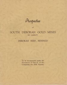
Document - MCCOLL, RANKIN AND STANISTREET COLLECTION: PROSPECTUS OF SOUTH DEBORAH GOLD MINES NL, 1939
McColl Rankin & Stanistreet, Prospectus of South Deborah Gold Mines NL. 5 Copies. A/ Complete with map, application for Shares still intact. Excellent condition. B/ Complete, application detached, excellent condition. C/ Complete, application form detached, excellent condition. D/No map, Application Form still intact. Has been folded down middle. Good condition. E/No map or Application Form, Good condition. Markings/inscriptions: Prospectus of South Deborah Gold Mines No Liability, Deborah Reef, Bendigo. 8 pages.organization, mining, south deborah gold mines nl, mccoll rankin & stanistreet, prospectus of south deborah gold mines nl -
Bendigo Historical Society Inc.
Map - NERRING SHEET 4, Circa 1890's
Map: Nerring (part 4) . Parish plan ( number 189 in Map Cupboard 1)map, bendigo, parish plan, nerring -
Bendigo Historical Society Inc.
Map - NERRING SHEET 3, 1/12/1894
Map:Neriing sheet 3. parish plan ( number 188 in Map Cupboard 1)map, bendigo, parish plan, nerring -
Bendigo Historical Society Inc.
Map - NERRING SHEET 2, 21/12/1894
Map[: Nerring sheet 2 ( number 187 in Map Cupboard 1)map, bendigo, parish plan, nerring -
Bendigo Historical Society Inc.
Map - BOROUGH OF EAGLEHAWK SHEET 1A, 30/11/1931
Map: Borough of Eaglehawk, Parish of Nerring. Parish plan ( number 186 in Map Cupboard 1)map, bendigo, parish plan, borough of eaglehawk, parish of nerring -
Bendigo Historical Society Inc.
Map - BOROUGH OF EAGLEHAWK, 30/11/1931
Map: Borough of Eagle hawk, Parish of Nerring. Parish plan with coloured areas ( number 185 in Map Cupboard 1)map, bendigo, parish plan, borough of eaglehawk, parish of nerring -
Bendigo Historical Society Inc.
Map - MAP PORTION OF BENDIGO GOLDFIELD, Circa 1912
Map: Portion of Bendigo Goldfield showing Sheepshead, Deborah, Garden Gully, Paddy's Gully and Derby lines of reef. Showing statistical records of all the Companies on these lines. Issued by Wood and McNair, Sharebrokers, Bendigo and Eaglehawk. The map illustrates the main lines of reef as they appeared with mines and details of their calls and dividends as well as gold produced. Drawn by mining surveyor and geologist William Henry Cundy, who trained and worked for the Tasmanian Mines Department until 1893, when he moved and settled in Bendigo. Cundy was responsible for the surveying of the southern end of the field of Diamond Hill and beyond.topic, mining, companies, bendigo goldfield, sheepshead , deborah, garden gully, paddy's gully derby, wood and mcnair -
Bendigo Historical Society Inc.
Map - VICTORIA, Circa 1926
Map: Map showing Counties, including Railway lines and Geographic features. Compiled and engraved at the Department of Lands and Survey Melbourne, Revised October 1926 ( number 184 in Map Cupboard 1)map, victoria, counties, counties of victoria, geographic features -
Bendigo Historical Society Inc.
Map - GEOLOGICAL MAP BENDIGO GOLDFIELD, See above
Map: Geological map of the Bendigo Goldfield comprising 2 sheets , Numbered 9358a and 9358b. Prepared in 1923 re-issued in 1936map, bendigo, geological, geological map, bendigo goldfield -
Bendigo Historical Society Inc.
Map - PASTORAL HOLDINGS, See above
Map: Copy of 'Map showing the Pastoral Holdings of the Port Phillip District 1835-51, Now Victoria'. Comiled by A.S.Kenyon M.I.E. Aus. Historical society of Victoria 1932map, victoria, pastoral holdings, pastoral holdings, port phillip district -
Bendigo Historical Society Inc.
Map - RAYWOOD, 18/09/1930
Map: Township of Raywood, Parish of Neilborough,County of Bendigo. Parish plan (number 270 in map cupboard 1)map, bendigo, township, raywood -
Bendigo Historical Society Inc.
Map - GOORNONG, 1/10/1906
Map: Town of Goornong, Parish of Goornong, County of Bendigo. Parish plan (number 269 in map cupboard 1)map, bendigo, township, goornong -
Bendigo Historical Society Inc.
Map - STRATHFIELDSAYE, See above
Map: Township of Strathfieldsaye, Group of 4 plans, 2 hand drafted and 2 printed. Applied to canvas and stapled to the backing. The printed plans are dated January 1859 and 6th January 1871 (number 267 in map cupboard 1)map, bendigo, township, strathfieldsaye -
Bendigo Historical Society Inc.
Map - RAVENSWOOD, April 6th 1872
Map: Township of Ravenswood. Parish plan, has a 1913 calendar as a backing (number 266 in map cupboard 1)map, bendigo, township, ravenswood -
Bendigo Historical Society Inc.
Map - HARCOURT, No date visible
Map: Township of Harcourt, Parish pf Harcourt, County of Talbot, (number 265 in map cupboard 1)map, talbot, township, harcourt -
Bendigo Historical Society Inc.
Map - HARCOURT, 2/04/1917
Map: Town of Harcourt, County of Talbot. Parish plan (number 264 in map cupboard 1)map, talbot, township, harcourt -
Bendigo Historical Society Inc.
Map - BENDIGO (COUNTY), Circa 1870's
Map:Plan showing the whole of the County of Bendigo-- attached handwritten sheet in the top left hand corner-'Proclaimed Commons Sandhurst District'. Also attached is a separate plan of the parish of Kimbolton (number 262 in map cupboard 1)map, bendigo, parish plan, bendigo, proclaimed commons -
Bendigo Historical Society Inc.
Map - TARNAGULLA (PARTS), Circa 1880's
Map: Compilation of 3 hand draughted parish plans showing portions of Tarnagulla (number 261 in map cupboard 1)map, parish plan, tarnagulla