Showing 174704 items
matching 34-schutt-street
-
 Camberwell Historical Society
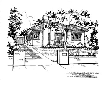
Drawing (series) - Architectural drawing, 7 Cornell Street, Camberwell, 1987
artist, architectural drawings, margaret picken, camberwell, housesartist, architectural drawings, margaret picken, camberwell, houses -
 Camberwell Historical Society
Drawing (series) - Architectural drawing, 4 Davis Street, Camberwell, 1997
artist, architectural drawings, margaret picken, camberwell, housesartist, architectural drawings, margaret picken, camberwell, houses -
 Camberwell Historical Society
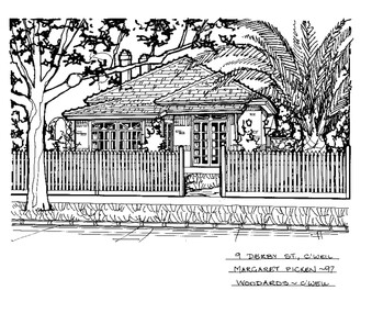
Drawing (series) - Architectural drawing, 9 Derby Street, Camberwell, 1997
artist, architectural drawings, margaret picken, camberwell, housesartist, architectural drawings, margaret picken, camberwell, houses -
 Camberwell Historical Society
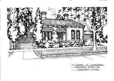
Drawing (series) - Architectural drawing, 17 Derby Street, Camberwell, 1990
artist, architectural drawings, margaret picken, camberwell, housesartist, architectural drawings, margaret picken, camberwell, houses -
 Camberwell Historical Society
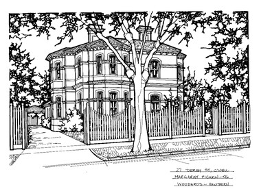
Drawing (series) - Architectural drawing, 27 Derby Street, Camberwell, 1996
artist, architectural drawings, margaret picken, camberwell, housesartist, architectural drawings, margaret picken, camberwell, houses -
 Camberwell Historical Society
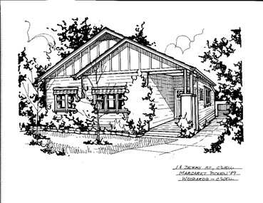
Drawing (series) - Architectural drawing, 1A Derby Street, Camberwell, 1989
artist, architectural drawings, margaret picken, camberwell, housesartist, architectural drawings, margaret picken, camberwell, houses -
 Camberwell Historical Society
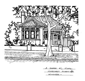
Drawing (series) - Architectural drawing, 3 Derby Street, Camberwell, It is a bit illegible but could be 1993
artist, architectural drawings, margaret picken, camberwell, housesartist, architectural drawings, margaret picken, camberwell, houses -
 Camberwell Historical Society
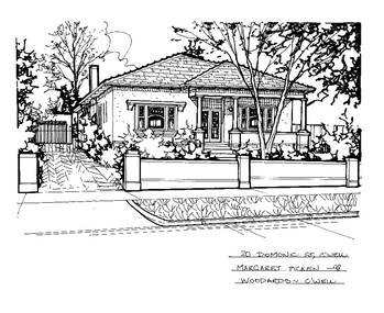
Drawing (series) - Architectural drawing, 20 Domonic Street, Camberwell, 1998
artist, architectural drawings, margaret picken, camberwell, housesartist, architectural drawings, margaret picken, camberwell, houses -
 Camberwell Historical Society
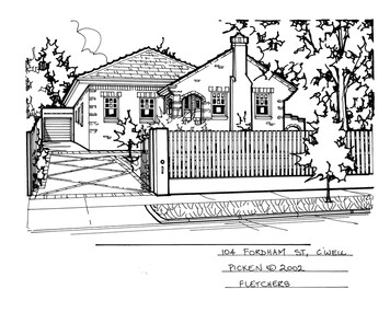
Drawing (series) - Architectural drawing, 104 Fordham Street, Camberwell, 2002
artist, architectural drawings, margaret picken, camberwell, housesartist, architectural drawings, margaret picken, camberwell, houses -
 Camberwell Historical Society
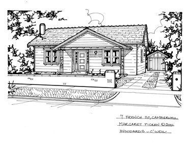
Drawing (series) - Architectural drawing, 7 French Street, Camberwell, 2001
artist, architectural drawings, margaret picken, camberwell, housesartist, architectural drawings, margaret picken, camberwell, houses -
 Camberwell Historical Society
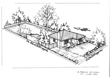
Drawing (series) - Architectural drawing, 13 French Street, Camberwell, Unknown
artist, architectural drawings, margaret picken, camberwell, housesartist, architectural drawings, margaret picken, camberwell, houses -
 Camberwell Historical Society
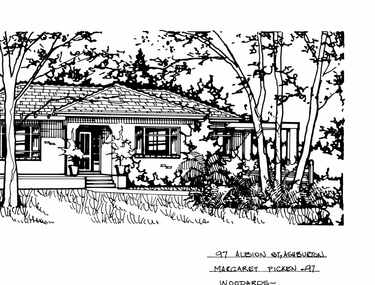
Drawing (series) - Architectural drawing, 97 Albion Street, Ashburton, 1997
artist, architectural drawings, margaret picken, camberwell, housesartist, architectural drawings, margaret picken, camberwell, houses -
 Camberwell Historical Society
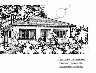
Drawing (series) - Architectural drawing, 84 Albion Street, Ashburton, 1996
artist, architectural drawings, margaret picken, camberwell, housesartist, architectural drawings, margaret picken, camberwell, houses -
 Camberwell Historical Society
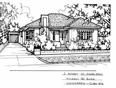
Drawing (series) - Architectural drawing, 2 Amery Street, Ashburton, 2002
artist, architectural drawings, margaret picken, camberwell, housesartist, architectural drawings, margaret picken, camberwell, houses -
 Camberwell Historical Society
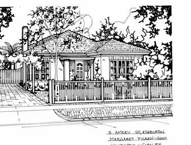
Drawing (series) - Architectural drawing, 5 Amery Street, Ashburton, 2000
artist, architectural drawings, margaret picken, camberwell, housesartist, architectural drawings, margaret picken, camberwell, houses -
 Camberwell Historical Society
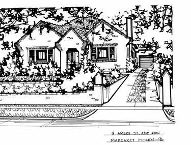
Drawing (series) - Architectural drawing, 18 Amery Street, Ashburton, 1996
artist, architectural drawings, margaret picken, camberwell, housesartist, architectural drawings, margaret picken, camberwell, houses -
 Camberwell Historical Society
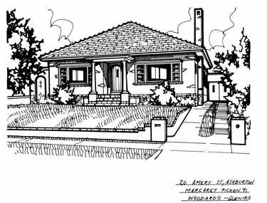
Drawing (series) - Architectural drawing, 20 Amery Street, Ashburton, 1991
artist, architectural drawings, margaret picken, camberwell, housesartist, architectural drawings, margaret picken, camberwell, houses -
 Camberwell Historical Society
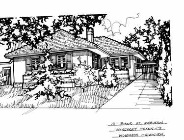
Drawing (series) - Architectural drawing, 10 Baker Street, Ashburton, 1991
artist, architectural drawings, margaret picken, camberwell, housesartist, architectural drawings, margaret picken, camberwell, houses -
 Camberwell Historical Society
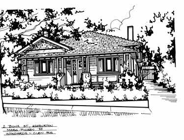
Drawing (series) - Architectural drawing, 2 Bona Street, Ashburton, 1988
artist, architectural drawings, margaret picken, camberwell, housesartist, architectural drawings, margaret picken, camberwell, houses -
 Camberwell Historical Society
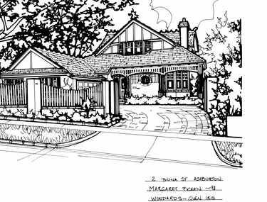
Drawing (series) - Architectural drawing, 2 Bona Street, Ashburton, 1998
artist, architectural drawings, margaret picken, camberwell, housesartist, architectural drawings, margaret picken, camberwell, houses -
 Camberwell Historical Society
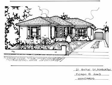
Drawing (series) - Architectural drawing, 21 Boyle Street, Ashburton, 2003
artist, architectural drawings, margaret picken, camberwell, housesartist, architectural drawings, margaret picken, camberwell, houses -
 Camberwell Historical Society
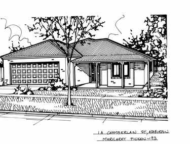
Drawing (series) - Architectural drawing, 1A Chamberlain Street, Ashburton, 1993
artist, architectural drawings, margaret picken, camberwell, housesartist, architectural drawings, margaret picken, camberwell, houses -
 Camberwell Historical Society
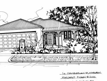
Drawing (series) - Architectural drawing, 1A Chamberlain Street, Ashburton, 2000
artist, architectural drawings, margaret picken, camberwell, housesartist, architectural drawings, margaret picken, camberwell, houses -
 Camberwell Historical Society
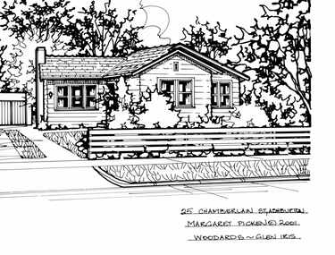
Drawing (series) - Architectural drawing, 25 Chamberlain Street, Ashburton, 2001
artist, architectural drawings, margaret picken, camberwell, housesartist, architectural drawings, margaret picken, camberwell, houses -
 Camberwell Historical Society
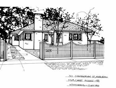
Drawing (series) - Architectural drawing, 30 Chamberlain Street, Ashburton, 1999
artist, architectural drawings, margaret picken, camberwell, housesartist, architectural drawings, margaret picken, camberwell, houses -
 Camberwell Historical Society
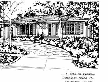
Drawing (series) - Architectural drawing, 4 Cyril Street, Ashburton, 1995
artist, architectural drawings, margaret picken, camberwell, housesartist, architectural drawings, margaret picken, camberwell, houses -
 Camberwell Historical Society
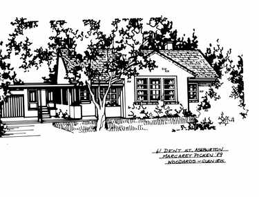
Drawing (series) - Architectural drawing, 61 Dent Street, Ashburton, 1989
artist, architectural drawings, margaret picken, camberwell, housesartist, architectural drawings, margaret picken, camberwell, houses -
 Camberwell Historical Society
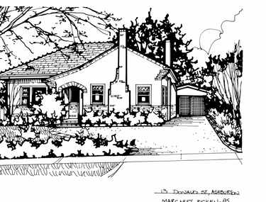
Drawing (series) - Architectural drawing, 13 Donald Street, Ashburton, 1995
artist, architectural drawings, margaret picken, camberwell, housesartist, architectural drawings, margaret picken, camberwell, houses -
 Camberwell Historical Society
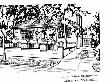
Drawing (series) - Architectural drawing, 14 Donald Street, Ashburton, 1997
artist, architectural drawings, margaret picken, camberwell, housesartist, architectural drawings, margaret picken, camberwell, houses -
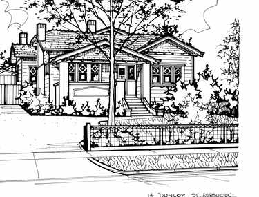 Camberwell Historical Society
Drawing (series) - Architectural drawing, 14 Dunlop Street, Ashburton, 2001
artist, architectural drawings, margaret picken, camberwell, housesartist, architectural drawings, margaret picken, camberwell, houses