Showing 4549 items matching "historical map"
-
 Victorian Aboriginal Corporation for Languages
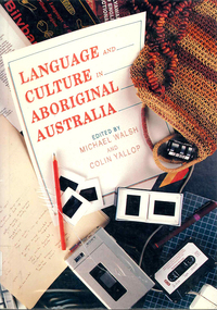
Book, Michael Walsh, Language and culture in Aboriginal Australia, 1993
A series of studies of aspects of language and culture in different parts of Aboriginal Australia. It includes ?language ownership?, historical aspects and how Aboriginal languages are now being used in media and education.Maps, word listssociolinguistics, linguistics, social history -
 Victorian Aboriginal Corporation for Languages
Book, Patrick McConvell, Archaeology and linguistics : Aboriginal Australia in global perspective, 1997
Various authors: studies of wider patterns in Aboriginal language and culture, including migration, tool exchange, and particularly the role of linguistic evidence in establishing historical connections between Australian tribes as well as further afield in the Australasian region.B&w illustrations, b&w photographs, maps, word listsanthropological linguistics -
 Victorian Aboriginal Corporation for Languages
Book, Nicholas Thieberger, Paper and talk : a manual for reconstituting materials in Australian Indigenous languages from historical sources, 1995
Collection of essays about language and language sources.Sheet music, b&w photographs, maps, word listslinguistics, murri, endangered languages -
 Victorian Aboriginal Corporation for Languages
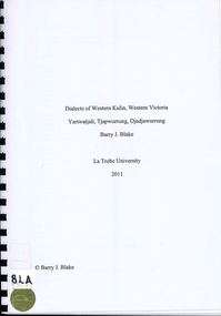
Book, Barry J Blake, Dialects of Western Kulin, Western Victoria : Yartwatjali, Tjapwurrung, Djadjawurrung, 2011
Technical linguistic grammar based on historical sources of Western Kulin languages Yartwatjali, Tjapwurrung and Djadjawurrung. Includes dictionary and information on historical source material.Maps, b&w illustration, tables,yartwatjali, tjapwurrung, djadjawurrung, western district, george augustus robinson, edward stone parker, william thomas, james dawson, edward curr, robert hamilton matthews -
 Victorian Aboriginal Corporation for Languages
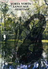
Book, Heather Bowe et al, Yorta Yorta language heritage, 1997
An account of the Yorta Yorta language, with a full Yorta Yorta-English dictionary, a detailed grammar section, background information about previous language revival projects, hymns, historical records and place names. A chapter devoted to Yabula Yabula is also included.Maps, b&w photographs, dictionary, word lists, worksheets,yorta yorta, yabula yabula, bangerang, language revival, geraldine briggs, hymns, murray goulburn, cummeragunja, maloga mission, place names -
 Victorian Aboriginal Corporation for Languages
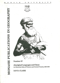
Book, Ian D Clark, Aboriginal languages and clans : an historical atlas of Western and Central Victoria, 1800-1900, 1990
Comprehensive coverage of language in the Western and Central Victorian areas, 1800-1900. Includes detailed language structures and historical details, Aboriginal Protectors and their work are included.maps, b&w illustrations, b&w photographsaboriginal clans, spatial and social organization, dhauwurd wurrung, gundijimara, djab wurrung, dja dja wurrung, djargurd wurrung, gadubanud, girai wurrung, gulidjan, jardwadjali, wada wurrung, wergaia -
 Victorian Aboriginal Corporation for Languages
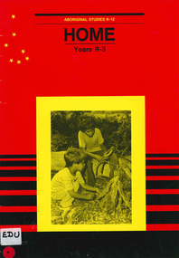
Book, Education Department of South Australia, Aboriginal studies R-12. Years R-3., Home, 1988
This unit is one of eleven making up the R-7 Aboriginal studies course, developed to meet the needs of students, teachers and Aboriginal people. It contains a course outline, cultural and historical information and activities.photographs, illustrations, mapsprimary school education, aboriginal studies, teaching aboriginal culture -
 Victorian Aboriginal Corporation for Languages
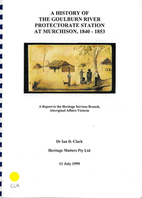
Book, Ian D Clark, A history of the Goulburn River Protectorate Station at Murchison, 1840-1853 : a report to the Heritage Services Branch, Aboriginal Affairs Victoria, 1999
Contains histories of the Aboriginal Protectors in the Goulburn River area and their work with the people in this region using journal entries and historical records.maps, b&w photograph, colour illustrations, tables -
 Victorian Aboriginal Corporation for Languages
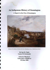
Book, Ian D Clark et al, An Indigenous history of Stonnington : a report to the City of Stonnington, 2006
This report presents the results of historical research into the Aboriginal history of the City of Stonnington.maps, colour illustrations, b&w illustrations, colour photographs, tableswoiwurrung, woi wurrung, boonwurrung, boon wurrung, derrimut, william thomas, stonnington, local history, victorian history -
Victorian Aboriginal Corporation for Languages
Book, C C Culvenor, The boundaries of the Mount Franklin Aboriginal Reserve, 1992
"This enquiry into the boundaries of the Mount Franklin Aboriginal Reserve had its origins in the preparation of a biography of geologist Thomas Smith of Sandon, which raised queries about Boundary Gully Road, Parkers Gully and the location in that vicinity of the Reserve boundary. At a subsequent meeting of the Daylesford Historical Society, commemorating the 150th anniversary of the founding of the Aboriginal Reserve at Franklinford in 1841, it became clear that the actual boundaries were only poorly known ... A search for information srouces in Melbourne and Sydney did not produce an overall Plan, but it is hoped that the material obtained will present a sufficiently accurate picture to be useful to other local historians and be of some interest also to the general reader" --Preface. Contents: The boundaries of the Mt. Franklin Aboriginal Reserve The five mile radius The Tarrengower challenge Provisional boundaries Survey of the Reserve Breakup of the Reserve References Appendices.maps, b&w illustrations, b&w photographsmount franklin -
 Victorian Aboriginal Corporation for Languages
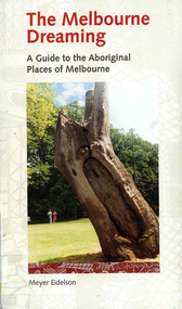
Book, Meyer Eidelson, The Melbourne dreaming : a guide to the Aboriginal places of Melbourne, 1997
This guide shows Melbourne?s Aboriginal places so that people using it can gain easy access to and a greater knowledge of them. Important historical events occurred at some of them. Others are Archaeological sites where there are still physical remains of Aboriginal activity before settlement. Locations have been mapped and Melways references and maps are included.maps, b&w illustrations, colour illustrations, colour photographs, word listswoi wurrung, wurundjeri, boon wurrung, kulin, yarra yarra, yarra river, werribee river, bunjil, waa, moieties, maribyrnong, sacred sites -
 Victorian Aboriginal Corporation for Languages
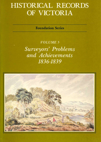
Book, Michael Cannon, Historical records of Victoria : foundation series : volume 5 : surveyors? problems and achievements 1836-1839, 1988
Reproductions of various transactions and reports dealing with the surveying history of Port Phillip, including letters, maps, illustrations, tables, and a detailed history of the surveying of Victoria.maps, b&w illustrations, b&w photographs, tablesvictorian history, port phillip, robert hoddle, monee monee creek, geelong, barwon river, werribee river -
 Victorian Aboriginal Corporation for Languages
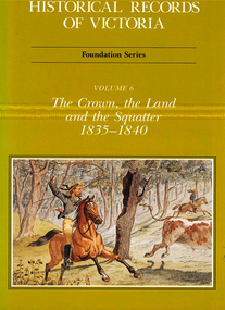
Book, Michael Cannon, Historical records of Victoria : foundation series : volume 6 : the crown, the land and the squatter 1835-1840, 1991
Reproductions of various transactions and reports dealing with squatting, land tenure and agricultural production in Port Phillip in the years 1835-1840. A history of land grants, surveying, squatters? life and land use during this period.maps, b&w illustrations, colour illustrationsvictorian history -
 Victorian Aboriginal Corporation for Languages
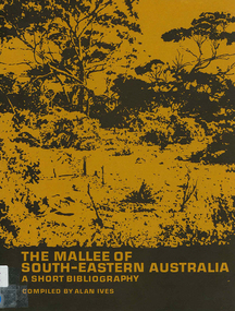
Book, The Mallee of south-eastern Australia : a short bibliography, 1973
mapsmallee region, south-eastern australia, geography, geology, climatology, water, agriculture, soils, botany, zoology, national parks, historical geography, australian literature, anthropology, sociology -
 Victorian Aboriginal Corporation for Languages
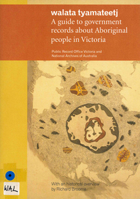
Book, Public Record Office Victoria et al, Walata tyamateetj : a guide to government records about Aboriginal people in Victoria, 2014
Public Record Office Victoria and the National Archives of Australia hold many government records about Aboriginal people in Victoria. This guide is designed to help Victorian Aboriginal people find records about their family and country. It will also assist anyone researching the history and administration of Aboriginal affairs in Victoria to find relevant records.document reproductions, maps, b&w photographsarchives, archives directories, historical sources, public records, victorian history -
Victorian Aboriginal Corporation for Languages
Book, City of Whitehorse, City Of Whitehorse parks and reserves: names and origins, 1985
... , with Melway map points and brief historical references to those places...., with Melway map points and brief historical references to those places ...Spiral bound book released by City of Whitehorse council. Alphabetically listed placenames within the local government area, with Melway map points and brief historical references to those places.Black and white photographs, colour photographsplace names, city of whitehorse, box hill, mitcham, mont albert, blackburn, surrey hills, burwood, nunawading, forest hill -
 Victorian Aboriginal Corporation for Languages
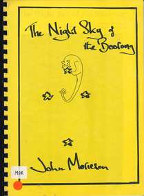
Book, John Morieson, The night sky of the Boorong
Based on historical notes of a variety of people, it explains the Night Skies of the Lake Tyrell area of Victoria and the mythology of the people regarding the legends of the skies.Maps, b&w illustrations, b&w photographsboorong, astronomy, ecological zodiac, william stanbridge, lake tyrell -
 Victorian Aboriginal Corporation for Languages
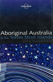
Book, Sarina Singh, Aboriginal Australia & the Torres Strait Islands : guide to Indigenous Australia, 2001
Comprehensive text with maps, coloured photos etc., dealing with all of Indigenous Australia. Provides historical references. Details of the Mabo finding.maps, b&w photographs, colour photographs, illustrations, word listsculture, travel guide, tourism, art, food -
Creswick Campus Historical Collection - University of Melbourne
Document, Forests Commission Victoria, A list of rare, very localised and endangered indigenous plants of Victoria, c.1982
1 Booklet and 29 maps in boxed set.Maps and Booklet -
Creswick Campus Historical Collection - University of Melbourne
Equipment, Curvimeter
Steel tool with moving wheel attached to measurement dial. For measuring distance of irregular line on maps. Cased in blue box with clear lidEquipment -
Creswick Campus Historical Collection - University of Melbourne
Still Image, 1952
Subject: King Lake . 6 brown envelopes marked Run 3, 4, 7, 7a, 8, 9 containing c. 80 prints. 1 section of a topographical map marked State Aerial Survey. Stored in a brown cardboard file box marked King Lake Run No.3 - 9. (x9). Photos commissioned by Forests Commission Victoria.Aerial Photographs -
Creswick Campus Historical Collection - University of Melbourne
Still Image, 1968
Subject: Creswick 1968 Project . 1 x annotated map in envelope marked Run 3 No's 30 - 38 with runs marked up from aerial phtographs flown 1956 - 1968 on drafted plan of Creswick Plantations. 1 x topographical map marked Creswick with annotation "Mapsheet key diagram". 1 x topographical map marked Ballarat annotated with a grid of numbers. 13 brown envelopes marked Run 1 -3 No. 21 - 38 (missing sequences) of c.44 prints total. Mix of black and white and colour. Range of dates. Stored in a brown cardboard file box marked Creswick 1968 Project.Aerial Photographs -
Creswick Campus Historical Collection - University of Melbourne
Map, 1980
Arboretum plant census locality mapsMap -
Creswick Campus Historical Collection - University of Melbourne
Map, 1923
Creswick proposed extension, 25-5-1923.Cloth map -
 Creswick Campus Historical Collection - University of Melbourne
Manuscript
These items are notes and maps by K.J SimpfendorferDocuments -
Creswick Campus Historical Collection - University of Melbourne
Equipment
This is a six drawer horizontal map cabinet.Equipment -
Creswick Campus Historical Collection - University of Melbourne
Map, 1923
Includes detail of Plantation layout and plantings at the time and later plantings (1930's) in pencil.Map -
 Creswick Campus Historical Collection - University of Melbourne
Map - Campus map, framed, 1969-1974
VSF Fire protection Plan. Framed. Prepared in interval between construction of Science Block and commencement of Certificate Courses (1969-1974) (Bob Orr)Mapfire protection, victorian school of forestry, creswick -
Creswick Campus Historical Collection - University of Melbourne
Map, 1937-1942
Linen backed topographical Maps - Victoria. 26 folding mapsMapsSchool of Botany, Univerity of Melbourne -
Creswick Campus Historical Collection - University of Melbourne
Map, 1937-1942
Linen backed topographical Maps - Victoria. 21 folding mapsMapsSchool of Botany, Univerity of Melbourne