Showing 23747 items
matching sardine-creek
-
 Eltham District Historical Society Inc
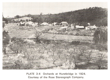
Work on paper (Sub-Item) - Photograph, Orchards at Hurstbridge, 1924
With the extension of the railway to Hurstbridge in 1912, large commercial orchards were able to expand. By 1914, 1,886 acres of orchards were under cultivation, with a considerable proprotion of the fruit being exported overseas. After World War One, the industry declined, mainly due to competition from other areas. This photo shows an orchard in the foreground with the township of Hurstbridge in the distance. The photo was taken in 1924, the same year that Hurstbridge was declared a township. orchard, hurstbridge, rose postcard -
 Eltham District Historical Society Inc
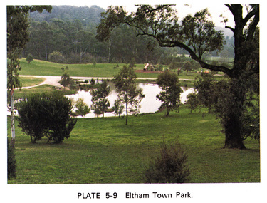
Work on paper (Sub-Item) - Photograph, Eltham Town park
Colour photograph of Eltham Town Park showing duck pond and children's playground in the background. This photograph was taken soon after the council reclaimed the site from a tip and before it was named for Alistair Knox. eltham, diamond creek, eltham town park, alistair knox park, pond, playground -
 Eltham District Historical Society Inc
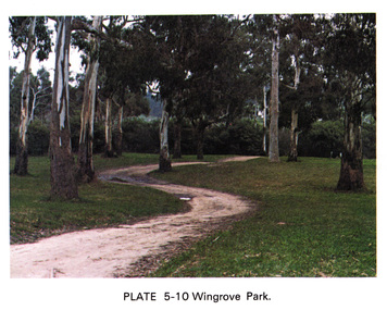
Work on paper (Sub-Item) - Photograph, Wingrove Park
Colour photograph of winding walking trail through trees at Wingrove Park. Wingrove Park in named for Eltham pioneer Charles S. Wingrove, Secretary and Engineer to the Eltham Road Board and Shire Council, 1858-1904eltham, gum trees, eucalpypts, walking trail, wingrove park -
 Eltham District Historical Society Inc
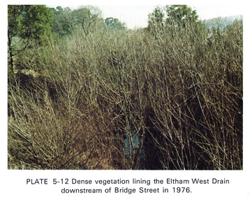
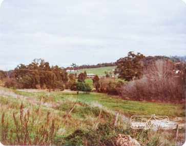
Work on paper (Sub-Item) - Photograph, Dense vegetaton lining the Eltham West Drain downstream of Bridge Street in 1976, 1976
Colour photograph of dense vegetation lining the Eltham West drain downstream of Bridge Street, Elthameltham, vegetation, weeds, eltham west drain -
 Eltham District Historical Society Inc
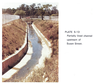
Work on paper (Sub-Item) - Photograph, Partially lined channel upstream of Susan Street
Colour photograph of Partially lined concrete channel upstream of Susan Street, Elthameltham, susan street, concrete, channel, drain -
 Eltham District Historical Society Inc
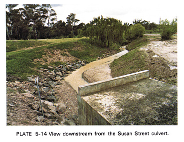
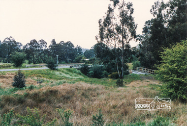
Work on paper (Sub-Item) - Photograph, View downstream from the Susan Street culvert
Colour photograph of the view downstream from the Susan Street culvert, Elthameltham, susan street, culvert, drain, channel -
 Eltham District Historical Society Inc
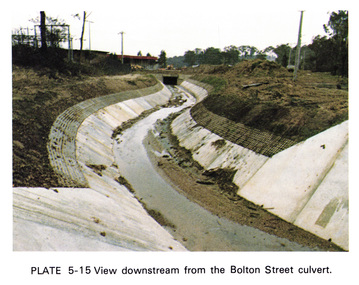
Work on paper (Sub-Item) - Photograph, View downstream from the Bolton Street culvert
Colour photograph of the view downstream from the Bolton Street culvert, Elthameltham, channel, concrete, drain, bolton street -
 Eltham District Historical Society Inc
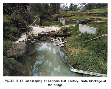
Work on paper (Sub-Item) - Photograph, Landscaping at Latiners Hat Factory
Colour photograph of Landscaping at Latiners Hat Factory, Sherbourne Road, Eltham. Note blockage at the bridgeeltham, drain, latiners, hat factory, landscaping, footbridge, blockage -
 Eltham District Historical Society Inc
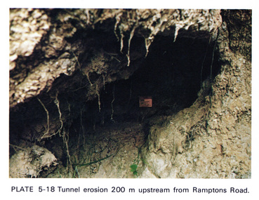
Work on paper (Sub-Item) - Photograph, Tunnel erosion 220 m upstream from Ramptons Road
Colour photograph of tunnel erosion 220 metres upstream from Ramptons Road, Eltham North eltham, erosion, eltham north, drain -
 Eltham District Historical Society Inc
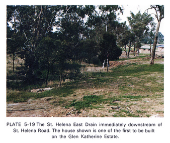
Work on paper (Sub-Item) - Photograph, St Helena East drain immediately downstream of St Helena Road
Colour photograph of St Helena East drain immediately downstream of St Helena Road, Greensborough. The house shown is one of the first to be built on the Glen Katherine Estate.eltham, drain, st helena, glen katherine estate, greensborough -
 Eltham District Historical Society Inc
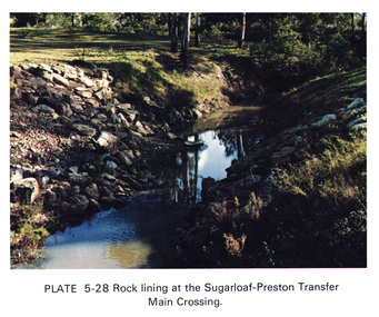
Work on paper (Sub-Item) - Photograph, Rock lining at the Sugarloaf-Preston transfer main crossing, 1976
Colour photograph of rock lining at the Sugarloaf-Preston transfer main crossing. The Sugarloaf Reservoir and the Winneke Water Treatment Plant (Winneke) are located 32 km north-east of Melbourne, near Christmas Hills. rock lining, water supply -
 Eltham District Historical Society Inc
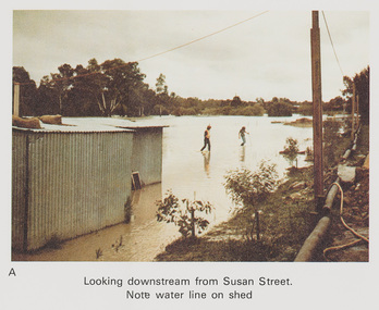
Work on paper (Sub-Item) - Photograph, Flooding, looking downstream from Susan Street, Eltham 8 April 1977
Colour photograph. Looking downstream from Susan Street, Eltham , 8 April 1977. Note water line on shed flood, diamond creek, flooding, susan street -
 Eltham District Historical Society Inc
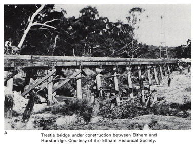
Work on paper (Sub-Item) - Photograph, Trestle bridge under construction between Eltham and Hurstbridge
Black and white photograph of the bridge under construction. The line opened at Hurstbridge in 1912.bridge, hurstbridge -
 Federation University Historical Collection
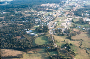
Photograph - Colour Photograph, Aerial View of Mt Clear, 1985, 1985
Aerial View of Mt Clear showing Mt Clear Technical School and Canadian Creek.mount clear, mount clear techncial school, canadian creek -
 Phillip Island and District Historical Society Inc.
Photograph, c 1895
Sunday School Picnic - children standing and seated mostly in dark coloured clothing all in hats and caps. Three teachers also in best Sunday clothing and hats. Bracken fern in foreground.Close-up enlarged photograph of Sunday School children with their teachers, Bourne Creek, Kilcundalocal history, photography, photographs, slides, film, sunday school picnic, sepia photograph, miss elms san remo -
 Lorne Historical Society
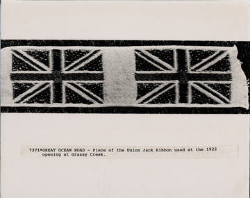
Photograph, Piece of Union Jack used at opening of G.O.R
Photograph showing a piece of the Union Jack ribbon used at opening at Grassy Creek, 1922g.o.r.; grassy-creek-opening-1922 -
Glenelg Shire Council Cultural Collection
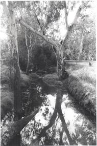
Negative - Glass Plate Negative - Bush Scene, 1890-1910
Stereoscopic glass plate negative. Image shows a Bush scene, bridge over creek. -
Glenelg Shire Council Cultural Collection
Negative - Glass Plate Negative - Bridge across Salt Creek with 'Kingsley' in background, c. 1890
Glass plate negative. Image shows the bridge across Salt Creek with 'Kingsley' in background. -
 Kiewa Valley Historical Society
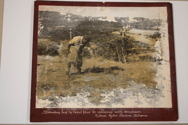
Photo - Kiewa Hydro Electric Scheme - Soil Conservation, Official S.E.C.V. photos
Soil Conservation used on banks of the Racelines on the Bogong High Plains near Falls Creek. -
 Eltham District Historical Society Inc
Photograph, Peter Bassett-Smith, Construction of Eltham Community Centre, June 1977, 1977
The valley of Diamond Creek from Bridge Street looking south to Eltham Community Centreeltham, eltham community centre, buildings, construction -
 Eltham District Historical Society Inc
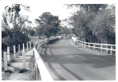
Photograph, Burkes Bridge, Hurstbridge
Colour photograph showing the old and new Burkes Bridges over Arthurs Creek, Hurstbridgeburkes bridges, bridges, hurstbridge, hurstbridge arthurs creek road, arthurs creek road, arthurs creek -
 Ringwood and District Historical Society
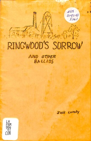
Booklet, Ringwood's Sorrow and other Ballads, 1982
Ballads - Ringwood's Sorrow, Mullum Creek, The Little Church That Was, Lorry Flynn Printed 1982 -
 Bendigo Historical Society Inc.
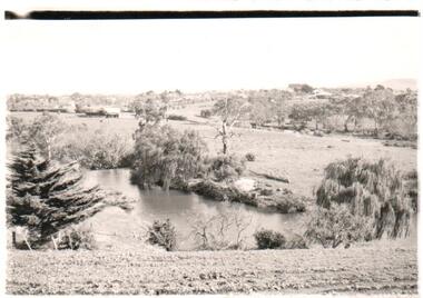
Photograph - BENDIGO ADVERTISER COLLECTION: BULLOCK CREEK (PROBABLY) AT LOCKWOOD SOUTH
Probably Bullock Creek at Lockwood South. No writing on rear of image but in Lockwood South folder.region, small towns, lockwood south -
 Robin Boyd Foundation
Slide, Robin Boyd, 1966
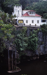
Robin Boyd was appointed Exhibits Architect for the Australian Pavilion at Expo ‘67 in Montreal. In 1966 Boyd travelled to Far North Queensland and the Northern Territory for research – the Expo exhibits included a coral display and native plant garden.Colour slide in a mount. Paronella Park, Mena Creek, outside Innisfail, Queensland, AustraliaMade in Australia / 10 / DEC 66 M8queensland, slide -
 Hume City Civic Collection
Photograph
A b/w photograph of the Macedon Street bridge over Jackson's Creek, with a car approaching.macedon street, bridges, jackson's creek, transport, sunbury, george evans collection -
 Hume City Civic Collection
Photograph
A b/w photograph of a landscape view showing Jackson's Creek with the Sunbury township in the background.Handwritten on back: McMahonmcmahon, landscapes, jackson's creek, sunbury, george evans collection -
 Hume City Civic Collection
Photograph
A black and white photograph mounted on cardboard of a blustone bridge across Deep Creek at Bulla.written on back: Bulla Bridgedeep creek, bulla, bridges, bulla bridge, george evans collection -
 Clunes Museum
Photograph
LANDS DEPARTMENT COLOURED PHOTOGRAPH - CLEARING AREA ALONG CREEK TO MAKE PICNIC AREAlocal history, photography, photographs, clunes landscape -
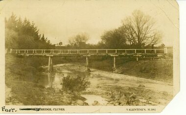 Clunes Museum
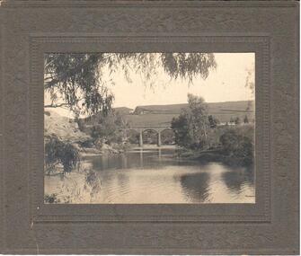
Photograph, FOOT BRIDGE, CIRCA 1920
POST CARD PHOTOGRAPH OF FOOTBRIDGE IN CLUNES OVER TULLAROOP CREEK. TAKEN ABOUT 1920.FOOT BRIDGE CLUNES. VALENTINES M 5982local history, photographs, bridges, foot bridge -
 Clunes Museum
Photograph
PHOTO COPY. WATERSHED DAMS WEIR CREEK FOR THE COLLECTION OF WATER FOR THE CLUNES TOWNSHIP AND MINES.local history, photography, photographs, water supply