Showing 722 items matching "field book"
-
 Monbulk RSL Sub Branch
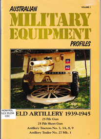
Book, Michael K Cecil, Australian Military Equipment Profiles: Field Artillery 1939-1945. 25 Pdr Gun, 25 Pdr Short Gun, Artillery Tractors No.3, 3A, 8,9, Artillery Trailer No. 27 Mk.1, 1992
... Monbulk RSL Sub Branch 48 Main Road Monbulk yarra-valley-and-the-dandenong-ranges Military weapons - Australia Weapons - Australia Illustrative and textual description of Australian field artillery 1939-1945 Ill, p.40 Australian Military Equipment Profiles: Field Artillery 1939-1945. 25 Pdr Gun, 25 Pdr Short Gun, Artillery Tractors No.3, 3A, 8,9, Artillery Trailer No. 27 Mk.1 Book Michael K Cecil Michael K Cecil ...Illustrative and textual description of Australian field artillery 1939-1945Ill, p.40non-fictionIllustrative and textual description of Australian field artillery 1939-1945military weapons - australia, weapons - australia -
 Monbulk RSL Sub Branch
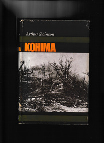
Book, Cassell, Kohima, 1966
... Field Marshal Slim held the Japanese assault on Kohima Ridge. By late June the Japanese were in headlong retreat. Kohima ranks for strategic importance with Alamein, Midway and Stalingrad. The increasing dominance of Allied airpower in the region in the aftermath of the battle was a major factor. Index, bibliography, ill, maps, p.275. Kohima Book ...On 7 March 1944 Tokyo announced that the Japanese invasion of British India had begun. By mid-month, the Japanese 31st Division had crossed the Chindwin River in northern Burma, advancing on a wide front towards Imphal and Kohima. In bitter jungle fighting from early April, the British Fourteenth Army under Field Marshal Slim held the Japanese assault on Kohima Ridge. By late June the Japanese were in headlong retreat. Kohima ranks for strategic importance with Alamein, Midway and Stalingrad. The increasing dominance of Allied airpower in the region in the aftermath of the battle was a major factor.Index, bibliography, ill, maps, p.275.non-fictionOn 7 March 1944 Tokyo announced that the Japanese invasion of British India had begun. By mid-month, the Japanese 31st Division had crossed the Chindwin River in northern Burma, advancing on a wide front towards Imphal and Kohima. In bitter jungle fighting from early April, the British Fourteenth Army under Field Marshal Slim held the Japanese assault on Kohima Ridge. By late June the Japanese were in headlong retreat. Kohima ranks for strategic importance with Alamein, Midway and Stalingrad. The increasing dominance of Allied airpower in the region in the aftermath of the battle was a major factor. kohima - siege - 1944, world war 1939-1945 - land operations - india -
 Monbulk RSL Sub Branch
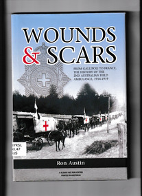
Book, Slouch Hat Publications, Wounds and scars : from Gallipoli to France, the history of the 2nd Australian Field Ambulance, 1914-1919, 2012
... Wounds and scars : from Gallipoli to France, the history of the 2nd Australian Field Ambulance, 1914-1919 Book Slouch Hat Publications Ron Austin ...Recounts the dedication and bravery of the men who made up the 2nd Field AmbulanceIndex, bib, ill, maps, p.144.non-fictionRecounts the dedication and bravery of the men who made up the 2nd Field Ambulanceworld war 1914-1918 - medical care - australia, world war 1914-1918 - regimental histories -
 Monbulk RSL Sub Branch
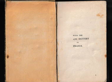
Book, St. Clements Press, le With the 27th Battery in France : 7th Bde., Australian Field Artillery, 1919
... Monbulk RSL Sub Branch 48 Main Road Monbulk yarra-valley-and-the-dandenong-ranges World War 1914-1918 - History World war 1914-1918 - Artillery The history of the 27th battery in the first World War Ill, p.168. le With the 27th Battery in France : 7th Bde., Australian Field Artillery Book St. Clements Press TD Bridger ...The history of the 27th battery in the first World WarIll, p.168.non-fictionThe history of the 27th battery in the first World Warworld war 1914-1918 - history, world war 1914-1918 - artillery -
 Women's Art Register
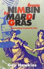
Book, Gay Hawkins, From Nimbin to Mardi Gras. Constructing Community Arts, 1993
... Women's Art Register Richmond Library, 415 Church Street Richmond melbourne Complements other material held in the Women's Art Register community arts Art and Working Life Community Arts Board Community Arts Network Australia Council Trade Unions Murals posters activism arts funding A study of the field of Community Arts in Australia and the history of the Community Arts Board. S. Kirby From Nimbin to Mardi Gras. Constructing Community Arts Book ...A study of the field of Community Arts in Australia and the history of the Community Arts Board.non-fictionA study of the field of Community Arts in Australia and the history of the Community Arts Board.community arts, art and working life, community arts board, community arts network, australia council, trade unions, murals, posters, activism, arts funding -
 Bendigo Historical Society Inc.
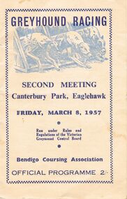
Book - GREYHOUND RACE MEETING BOOK
... field)style racing. At Canterbury Park racing was held over a 340 yard track and up to 20 bookmakers attended. In 1978 the club moved its operations to Lord's Raceway at Junourton. BENDIGO Sporting clubs greyhound racing Bendigo Coursing Association C.W. Seymour Print. Bendigo Greyhound Race Meeting Book ...Track racing commenced at Canterbury Park in 1936. Prior to this racing was held at Epsom and was Plumpton (open field)style racing. At Canterbury Park racing was held over a 340 yard track and up to 20 bookmakers attended. In 1978 the club moved its operations to Lord's Raceway at Junourton.Greyhound Race Meeting Book: Cream book with blue print and two metal staples at the side for binding. A picture of three greyhound jumping out of the starting gates on the front cover. Printed * Greyhound Racing Second Meeting Canterbury park, Eaglehawk. Friday, March 8, 1957. * Run under Rules and Regulations of the Victorian Greyhound control Board * Bendigo Coursing Association. Official Programme 2/-. Inside with black print are rules regulations, Settling sheet, Bookmaker's Names, Bendigo Coursing Association members. Races 1 to 7 with markings in pencil by the user on each race. Box 625C.W. Seymour Print. Bendigobendigo, sporting clubs, greyhound racing, bendigo coursing association -
 Bendigo Historical Society Inc.
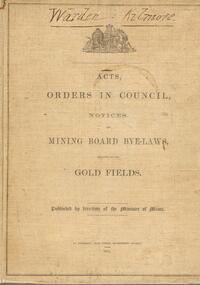
Book - AUSTIN COLLECTION: MINING BOARD BYE-LAWS, 1874
... book. Buff colour covers, dark brown print. 'Acts, Orders in Council, Notices and Mining Board Bye-laws relating to the Gold Fields', published by direction of the Minister of Mines. 1874. ...book. Buff colour covers, dark brown print. 'Acts, Orders in Council, Notices and Mining Board Bye-laws relating to the Gold Fields', published by direction of the Minister of Mines. 1874. ...BHS CollectionHard cover book. Buff colour covers, dark brown print. 'Acts, Orders in Council, Notices and Mining Board Bye-laws relating to the Gold Fields', published by direction of the Minister of Mines. 1874. 'Warden Kilmore' written in pen and ink at top.bendigo, mining, mining board bye-laws, sandhurst, kilmore -
 Bendigo Historical Society Inc.
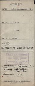
Document - H.A. & S.R. WILKINSON COLLECTION: CONDITION OF SALE
... Fields (seller) and Mr. B.T. Owins (buyer) for land being part of allotment 7 section L, Long Gully colored red on the map hereof and being described in Indenture of Conveyance No.422 Book 610 and situate in Inglewood Street Bendigo, together with fencing thereon. ...Fields (seller) and Mr. B.T. Owins (buyer) for land being part of allotment 7 section L, Long Gully colored red on the map hereof and being described in Indenture of Conveyance No.422 Book 610 and situate in Inglewood Street Bendigo, together with fencing thereon. ...BHS CollectionContract of sale of land dated 6th September 1954 between Mr G.A. Fields (seller) and Mr. B.T. Owins (buyer) for land being part of allotment 7 section L, Long Gully colored red on the map hereof and being described in Indenture of Conveyance No.422 Book 610 and situate in Inglewood Street Bendigo, together with fencing thereon. Price 130 pounds.organization, business, h.a. & s.r wilkinson real estate -
 Bendigo Historical Society Inc.
Document - ALBERT RICHARDSON COLLECTION: CARSHALTON LINE OF REEF
... book (not referenced) with information about the Carshalton Gold Mining Company NL 2. Some facts and figures and comments ( about Bendigo mines generally) topics include deep shafts, shafts made safe, men employed on field, cost of firewood, winding ropes - flat and round, size of mining shafts, weekly wages, 'years of pride' and 'years of destruction'. ...book (not referenced) with information about the Carshalton Gold Mining Company NL 2. Some facts and figures and comments ( about Bendigo mines generally) topics include deep shafts, shafts made safe, men employed on field, cost of firewood, winding ropes - flat and round, size of mining shafts, weekly wages, 'years of pride' and 'years of destruction'. ...Five page handwritten document with: 1. details of the Carshalton line of reef and a photocopied extract from an book (not referenced) with information about the Carshalton Gold Mining Company NL 2. Some facts and figures and comments ( about Bendigo mines generally) topics include deep shafts, shafts made safe, men employed on field, cost of firewood, winding ropes - flat and round, size of mining shafts, weekly wages, 'years of pride' and 'years of destruction'. Signed by Albert Richardson, 29 Harrison Street, Bendigo.March 1968.bendigo, mining, carshalton reef line -
 Bendigo Historical Society Inc.
Book - GOLD ESCORT, 1971
... book by :L.J. Blake entitled 'Gold Escort' The story of how thousands of pounds of gold were sent in escorted wagons from the gold fields at Mt Alexander to South Australia. ...book by :L.J. Blake entitled 'Gold Escort' The story of how thousands of pounds of gold were sent in escorted wagons from the gold fields at Mt Alexander to South Australia. ...228 page hardcover book by :L.J. Blake entitled 'Gold Escort' The story of how thousands of pounds of gold were sent in escorted wagons from the gold fields at Mt Alexander to South Australia. Emphasis on the Gold Commissioner Alexander Tolmer. Illustrated with B&W photos and maps inside front and back covers. First published and printed 1971 by The Hawthorn Press Pty Ltd.L.J.Blakegold escort, mining, bendigo -
 Bendigo Historical Society Inc.
Book - LORD ROBERT CECIL'S GOLDFIELDS DIARY, 1945
... Fields Diary', with introduction and notes by Ernest Scott. Published 1945 by Melbourne University Press. Robert Cecil arrived in Melbourne in 1852 and journeyed to the Victorian Goldfields. Illustrated with 20 B&W pictures, mostly by ST Gill. Portrait sketch of Robert Cecil on flyleaf. Book ...32 page soft cover booklet 'Lord Robert Cecil's Gold Fields Diary', with introduction and notes by Ernest Scott. Published 1945 by Melbourne University Press. Robert Cecil arrived in Melbourne in 1852 and journeyed to the Victorian Goldfields. Illustrated with 20 B&W pictures, mostly by ST Gill. Portrait sketch of Robert Cecil on flyleaf.Ernest Scott -
 Bendigo Historical Society Inc.
Book - HOSKING AND HUNKIN COLLECTION: COMMON PRAYER BOOK, 1800s
... First Page: The Book of Common Prayer and Administration of the sacrements, and other rites and cermonies of the Church according to the United Church of England and Ireland: together with the Psalter or psalms of David., pointed as they are and the form and manner of making, ordaining and consecrating of Bishops, Priests, and Deacons. Oxford: Printed at the University Press, for the Society for Promoting Christian Knowledge. Sold at the Society's Depository, Great Queen Street, Lincoln's Inn Field...First Page: The Book of Common Prayer and Administration of the sacrements, and other rites and cermonies of the Church according to the United Church of England and Ireland: together with the Psalter or psalms of David., pointed as they are and the form and manner of making, ordaining and consecrating of Bishops, Priests, and Deacons. Oxford: Printed at the University Press, for the Society for Promoting Christian Knowledge. Sold at the Society's Depository, Great Queen Street, Lincoln's Inn Field ...HOSKING AND HUNKIN COLLECTION: Common Prayer Book inside envelope. On Front Cover: Society for Promoting Christian Knowledge 1698 On Indside of Cover: Rasim xx x Vinixxxxx gives this book to Emely Hosking for her sake. First Page: The Book of Common Prayer and Administration of the sacrements, and other rites and cermonies of the Church according to the United Church of England and Ireland: together with the Psalter or psalms of David., pointed as they are and the form and manner of making, ordaining and consecrating of Bishops, Priests, and Deacons. Oxford: Printed at the University Press, for the Society for Promoting Christian Knowledge. Sold at the Society's Depository, Great Queen Street, Lincoln's Inn Field, London. y24Nonparell 24's M.DCCCLIK. Cum Privilegio Slip of paper inside book: 1000M 800 DCCC 50 L 9 IX = 1859 Front of Envolope: Another book given (by?) when family left Redruth for Australia. Rear of Envelope: Betty Knight (Great Grand-daughter) 29 Gilbertson Street Essendon Vic 3040book -
 Bendigo Historical Society Inc.
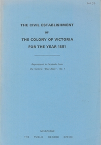
Booklet - The Civil Establishment of the Colony of Victoria for 1851
... This statistical book lists public servants for the colony alphabetically, their role, place of employment, and a page reference to a description of the role can be found. Included positions in the fields...This statistical book lists public servants for the colony alphabetically, their role, place of employment, and a page reference to a description of the role can be found. Included positions in the fields ...Port Phillip was first settled in 1803 and became a part of NSW in 1836. It became it's own governing colony in 1851. This statistical book lists public servants for the colony alphabetically, their role, place of employment, and a page reference to a description of the role can be found. Included positions in the fields of Government officers, Police , penal, judicial medical, ecclesiastical and education. Includes salaries for the various positions.Blue soft cover booklet of 76 pages. Titled 'The Civil Establishment of The Colony of Victoria for the Year 1851' Reproduced in facsimile from the Victoria 'Blue Book, No,1 First published in 1976 by the Public Record Office, Melbourne. Printed by C.H.Rixon, Government Printer, Melbourne civil establishment, victoria 1851 -
 Bendigo Historical Society Inc.
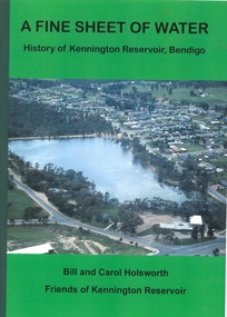
Book - A FINE SHEET OF WATER - HISTORY OF KENNINGTON RESERVOIR BENDIGO, 2012
... book 'A Fine Sheet of Water, History of Kennington Reservoir, Bendigo'. By Bill and Carol Holsworth with the help of the Friends of the Kennington Reservoir and members of the Bendigo Field Naturalists Club. ...Field Naturalists Club 2012 . Illustrated with B&W photos, maps and sketches. Colour arial photo of the Reservoir on front cover. Descriptions of early development plus flora and fauna. Book ...174 page soft cover book 'A Fine Sheet of Water, History of Kennington Reservoir, Bendigo'. By Bill and Carol Holsworth with the help of the Friends of the Kennington Reservoir and members of the Bendigo Field Naturalists Club. Published by the Bendigo Field Naturalists Club 2012 . Illustrated with B&W photos, maps and sketches. Colour arial photo of the Reservoir on front cover. Descriptions of early development plus flora and fauna.Bill and Carol Holsworthfriends of kennington reservoir, kennington reservoir -
 Bendigo Historical Society Inc.
Book - JAMES & ANN BINKS & FAMILY, 1992
... 32 page soft cover book 'James & Ann Binks & Family, their lives around the Bendigo Gold Field c1853-1856.' ...History House 11 Mackenzie Street Bendigo goldfields Bendigo Goldfields James Binks Ann Binks Quentin C Binks 32 page soft cover book 'James & Ann Binks & Family, their lives around the Bendigo Gold Field c1853-1856.' ...32 page soft cover book 'James & Ann Binks & Family, their lives around the Bendigo Gold Field c1853-1856.' Illustrated with B&W photos and newspaper extracts. Edited & compiled by Quentin C Binks for the Binks/Potter third reunion, Blakeville, April 1992Quentin C Binksbendigo, goldfields, james binks, ann binks -
 Bendigo Historical Society Inc.
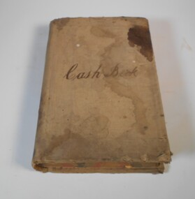
Financial record - Kelly and Allsop collection: cash book
... fields, including running, lacrosse, cricket, football and lawn bowls. He was an independent bookmaker and was elected to the Bendigo Stock Exchange in 1906. He was also a Past Grand Master of the MUIOOF lodge. After his time in Bendigo, and following the death of his wife in 1914, he moved to Melbourne and then Sydney where he died. For full biography see Item 6896.5 Kelly and Allsop cash book ...1. Michael Peter Kelly (1853-1929) was born in Galway, Ireland and came to Australia in 1870. He was a director of many mines and was elected to the Bendigo Stock Exchange in 1882. At one point he was the chairman of the Exchange. He married Margaret Jane Carr in 1887 and they lived at "Norwood", Wills St., Bendigo. 2. Arthur Allsop (1856 - 1921) was a renowned athlete in many fields, including running, lacrosse, cricket, football and lawn bowls. He was an independent bookmaker and was elected to the Bendigo Stock Exchange in 1906. He was also a Past Grand Master of the MUIOOF lodge. After his time in Bendigo, and following the death of his wife in 1914, he moved to Melbourne and then Sydney where he died. For full biography see Item 6896.5Very large cash book for Kelly and Allsop stockbrokers. The book has 386 double pages, recording the daily cash movements. The book covers the period from September 1897 to December 1906. All pages are filled.Cash book on the front coverkelly and allsop, cash book, stockbrokers -
 Bendigo Historical Society Inc.
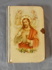
Book - German Bible
... fields and they mainly focussed on deep quartz mining. German enclaves existed at Diamond Hill, New Chum Gully, Victoria Hill, Ironbark and in the Whipstick area. The first Lutheran Church was built in 1865 and there were also two German schools. German Bible Religion Small bible with hard cover, possibly bakelite/plastic. The cover has an image of Jesus with and angel above each of his shoulders and plants at the bottom of the image. Pages of bible have gold edging. There is a metal clasp to lock. The back is plain and a creamy color. Book ...There was a large influx of German miners to the Bendigo gold fields and they mainly focussed on deep quartz mining. German enclaves existed at Diamond Hill, New Chum Gully, Victoria Hill, Ironbark and in the Whipstick area. The first Lutheran Church was built in 1865 and there were also two German schools. Small bible with hard cover, possibly bakelite/plastic. The cover has an image of Jesus with and angel above each of his shoulders and plants at the bottom of the image. Pages of bible have gold edging. There is a metal clasp to lock. The back is plain and a creamy color.german, bible, religion -
 Otway Districts Historical Society
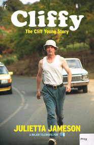
Book, The Text Publishing Company, Cliffy: the Cliff Young story, 2013
... With his distinctive shuffle, friendly wave and innocent grin, he beat a field of professional runners to take out the inaugural Westfield Sydney to Melbourne Ultra-marathon starting on April 27 and finishing May 2 in 1983. cliff young; beech forest; sydney; melbourne; ultra-marathon; otways; Cliffy: the Cliff Young story. Julietta Jameson. 1st ed. Melbourne (Vic); The Text Publishing Company; 2013. vi, 218 p.; illus. ISBN 978 1922 0798 6 2 Soft cover Cliffy: the Cliff Young story. Book ...Cliff Young was a sixty-one-year-old potato farmer from Beech Forest in the Otway Ranges, a couple of hundred kilometres south-west of Melbourne. With his distinctive shuffle, friendly wave and innocent grin, he beat a field of professional runners to take out the inaugural Westfield Sydney to Melbourne Ultra-marathon starting on April 27 and finishing May 2 in 1983.Cliffy: the Cliff Young story. Julietta Jameson. 1st ed. Melbourne (Vic); The Text Publishing Company; 2013. vi, 218 p.; illus. ISBN 978 1922 0798 6 2 Soft covercliff young; beech forest; sydney; melbourne; ultra-marathon; otways; -
 Port Melbourne Historical & Preservation Society
Book, Terry Keenan, "The Road Less Travelled - Port Melbourne Stands Alone", May 2012
... "The Road Less Travelled - Port Melbourne Stands Alone" Book Terry Keenan Level Playing-field Eucalyptus Press ...Written following the amazing 2011 season and premiership and published the week PMFC won their 28th consecutive match (the next week they lost to Colingwood).Signed copy of "The Road Less Travelled - Port Melbourne Stands Alone" a 148 page paperback by Terry KEENAN. Cover apple green with red, navy and white lettering (colour photograph by David THOMPSON, front and back cover). A coverage of the six stand-alone years for the PMFC, from 2006 to the 2012 undefeated premiership.Signed by author on title pagepeter saultry, terry keenan, gary ayres, pmfc, port melbourne football club, sport - australian rules football -
Port Melbourne Historical & Preservation Society
Book, G.W.Green & Sons Pty. Ltd, Moore Golden Jubilee, 1971
... The book celebrates Malcolm Moore's contributions to the field of mechanical engineering and the building of material handling equipment....Port Melbourne Historical & Preservation Society Port Melbourne Town Hall 333 Bay Street Port Melbourne melbourne The book celebrates Malcolm Moore's contributions to the field of mechanical engineering and the building of material handling equipment. ...The book celebrates Malcolm Moore's contributions to the field of mechanical engineering and the building of material handling equipment.White covered book with blue & white Malcolm Moore logo inside a gold laurel wreath with 50 entwined in the bottom of the wreath. Malcolm Moore Industries Limited in black at the bottom of the front cover. malcolm moore pty ltd, built environment - industrial, industry - manufacturing -
 Bendigo Historical Society Inc.
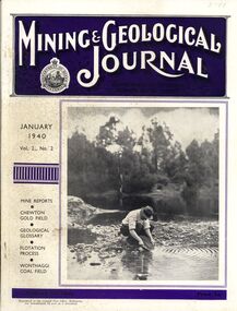
Book - MINING & GEOLOGICAL JOURNAL, 1940
... History House 11 Mackenzie Street Bendigo goldfields GOLD Mining journal Mining & Geological Journal January 1940 Vol.2 No.2 Mine reports Chewton Gold Field, Geological Glossary, Flotation Process, Wonthaggi Coal Field published hald yearly by he Department of Mines Victoria contains photographs, maps and illustrations. Book ...Mining & Geological Journal January 1940 Vol.2 No.2 Mine reports Chewton Gold Field, Geological Glossary, Flotation Process, Wonthaggi Coal Field published hald yearly by he Department of Mines Victoria contains photographs, maps and illustrations.gold, mining, journal -
 Bendigo Historical Society Inc.
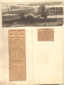
Ephemera - HOWARD AND VIOLET JOLLEY COLLECTION: NEWSPAPER CUTTINGS
... book titled 'Newspaper Cuttings' in gold leaf with black leather binding and corners on blue cloth covered cardboard cover. Stiff paper pages inside numbered top right -hand corners 1-90 in printed black ink. Poor condition overall. Pages 37 - 44 missing. Page 45-46 pertaining to Violet Jolley separately bagged. Entries mostly pertain to Mr Howard Jolley , an aviation field...book titled 'Newspaper Cuttings' in gold leaf with black leather binding and corners on blue cloth covered cardboard cover. Stiff paper pages inside numbered top right -hand corners 1-90 in printed black ink. Poor condition overall. Pages 37 - 44 missing. Page 45-46 pertaining to Violet Jolley separately bagged. Entries mostly pertain to Mr Howard Jolley , an aviation field ...A book titled 'Newspaper Cuttings' in gold leaf with black leather binding and corners on blue cloth covered cardboard cover. Stiff paper pages inside numbered top right -hand corners 1-90 in printed black ink. Poor condition overall. Pages 37 - 44 missing. Page 45-46 pertaining to Violet Jolley separately bagged. Entries mostly pertain to Mr Howard Jolley , an aviation field inspector of the Life Insurance Company of Australia. First entry page 16 -17 contains photographs and newspaper cuttings relating to an air crash on Bendigo racecourse in May 1921. Jolley was involved in numerous air-crashes for the next ten years. Photographs and newspaper cuttings related to these, along with dinner invitations, etc, are pasted into the book. Entry's into the book finish shortly before his death as a result of an air crash in 1931.Enclosed in pocket: copies of newspaper articles relating to the death of Howard Jolley in aircraft accident; donation form from Janice van der Spek, copy of advertisement Howard Jolley, touring Australia on life insurance business.bendigo, history, aviation 1920s. -
 Bendigo Historical Society Inc.
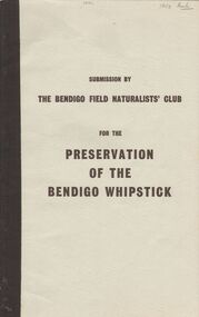
Book - 'PRESERVATION OF THE BENDIGO WHIPSTICK'' (SUBMISSION)
... Field Naturalists' Club 1971). An application to the Forests Commission for two areas to be declared Forest Parks under the Appropriate Act. (The two areas are indicated on a map submitted under separate cover). Supportive material includes listings of various categories e.g. flora i.e Whipstick native plants; Additional Plant Species; Species of Birds; Mammals of the Whipstick; historical summary; Whipstick nuggets; Bendigo Whipstick 'Statistics'. . Book ...Preservation of the Bendigo Whipstick'' (Third Edition of a Submission by the Bendigo Field Naturalists' Club 1971). An application to the Forests Commission for two areas to be declared Forest Parks under the Appropriate Act. (The two areas are indicated on a map submitted under separate cover). Supportive material includes listings of various categories e.g. flora i.e Whipstick native plants; Additional Plant Species; Species of Birds; Mammals of the Whipstick; historical summary; Whipstick nuggets; Bendigo Whipstick 'Statistics'. .Bendigo Field Naturalist Club.government, state, whipstick, bendigo whipstick, the bendigo field naturalists club. shire of lodden map. -
 Bendigo Historical Society Inc.
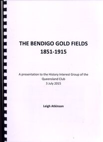
Book - THE BENDIGO GOLDFIELDS 1851-1915, 3 july 2015
... History House 11 Mackenzie Street Bendigo goldfields BOOK Bendigo bendigo history & its people Leigh Atkinson The Bendigo Gold Fields 1851-1915 a presentation to the history interest group of Queensland Club 3 July 2015 by Leigh Atkinson 12 pages in a spring bound binder contains black and white and colour photographs with info on Vahland, Lansell, Harry Leigh Atkinson & Ravenswood Run. ...The Bendigo Gold Fields 1851-1915 a presentation to the history interest group of Queensland Club 3 July 2015 by Leigh Atkinson 12 pages in a spring bound binder contains black and white and colour photographs with info on Vahland, Lansell, Harry Leigh Atkinson & Ravenswood Run.Leigh Atkinsonbook, bendigo, bendigo history & its people -
 Bendigo Historical Society Inc.
Document - PETER ELLIS COLLECTION: PETER ELLIS EULOGY
... Peter was also a life member of the Field Naturalists and was extremely active in campaigns to preserve Lake Pedder, the Whipstick Forest and Kamarooka Forest (now part of Bendigo National Park and preserved forever) One Tree Hill, Jackass Flat Flora Reserve and Saloman's Gully bushlands. Peter has discovered and named plants in the whipstick and enjoyed propagating native plants. He loved his amazing bush block in suburban Bendigo. Peter was also a keen photographer and had photos published in the book...Peter was also a life member of the Field Naturalists and was extremely active in campaigns to preserve Lake Pedder, the Whipstick Forest and Kamarooka Forest (now part of Bendigo National Park and preserved forever) One Tree Hill, Jackass Flat Flora Reserve and Saloman's Gully bushlands. Peter has discovered and named plants in the whipstick and enjoyed propagating native plants. He loved his amazing bush block in suburban Bendigo. Peter was also a keen photographer and had photos published in the book ...2 A4 sheets. Handwritten pencil note at top of first page reads: Eulogy published in Trad & Now Magazine. Vale Peter Ellis OAM. By John Williams. The folk community lost a giant on May 18th when Peter Ellis passed away after a short illness. Peter had been a collector, author and musician for nearly forty years and his work has been prodigious to say the least. Peter has the largest collection of dance related material in the National Library and had travelled Australia on his collection trips. He produced twenty CDs of dance music and historical music with his Bendigo based band the Celebrated Emu Creek Bush Band which he founded and led for thirty four years. His final project was the double CD 'Cooee, Songs of the ANZACS' which he organised in conjunction with the Bendigo Historical Society. It was launched on 24th April and was Peter's last performance. Peter has also been a member of the Wedderburn Old Timers for over thirty years and has assisted with many of their recordings including their latest Bush Concert CD which Peter Organised. Peter has contributed to many other CDs over the years and has been thanked on many a CD cover by many folk artists. Peter has also written several books, the three volume 'Collectors' Choice,' 'Two Hundred Dancing Years' co-written with Shirley Andrews OAM, and 'Music Makes Me Smile' the history of the Nariel Valley musicians co-written with Harry Gardner. Peter's recent major work The Merry Country Dance will become the bible for people wishing to learn about our bush music heritage with its matching six CD collection. Peter has also contributed to 'Verandah Music' edited by Rob Willis and Graham Seal and 'The Oxford Companion to Australian Folklore' edited by Graham Seal and is a regular contributor to Trad & Now. He completed his last Trad & Now article the week before he died. Peter was also a life member of the Field Naturalists and was extremely active in campaigns to preserve Lake Pedder, the Whipstick Forest and Kamarooka Forest (now part of Bendigo National Park and preserved forever) One Tree Hill, Jackass Flat Flora Reserve and Saloman's Gully bushlands. Peter has discovered and named plants in the whipstick and enjoyed propagating native plants. He loved his amazing bush block in suburban Bendigo. Peter was also a keen photographer and had photos published in the book 'Wildflowers of Bendigo'. Peter taught dancing and music classes with Continuing Education for many years and encouraged many young musicians over the years. Peter was an accomplished ballroom dancer and had achieved gold medal status in that field. He was one of Australia's finest exponents of the button accordion, concertina, harmonica and tin whistle. Peter also played piano, organ and ukulele as well as the Swanee whistle and bones. Peter was the founder of the Annual Dinki Di Ball held each September in Eaglehawk as a tribute to the old MC's. Peter was happy playing for fund-raisers for any organisation who asked and also enjoyed plying the big gigs such as for the opening of the Melbourne Museum or for State Parliament. He played in the National Folk Festivals in four states and was a regular at the National in Canberra where he gave regular classes, performed with his bands and was a stalwart of the Aussie section of the session bar. He performed at nearly every Maldon Folk Festival and was MC at Nariel Folk Festival dances for many years. Peter was very proud of his OAM and wore the little medal at all of his performances. That honour was rightly given to one who did so much to preserve Australia's dance history. Peter lived a full life and was a friend to hundreds of people. He was taken far too young and in typical fashion was planning new projects right till the end. His passing is a huge loss for us all but one thing is certain. He will never be forgotten.person, individual, peter ellis oam -
 Bendigo Historical Society Inc.
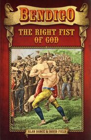
Book - BENDIGO THE RIGHT FIST OF GOD
... History House 11 Mackenzie Street Bendigo goldfields BOOKS Fiction bendigo thompson Alan Dance & David Field Bendigo The Right Fist Of God, soft cover 193 pages published by Arundel books, this book is based around the true story of one of Englands greatest sporting heroes. ...Bendigo The Right Fist Of God, soft cover 193 pages published by Arundel books, this book is based around the true story of one of Englands greatest sporting heroes.Alan Dance & David Fieldbooks, fiction, bendigo thompson -
 Bendigo Historical Society Inc.
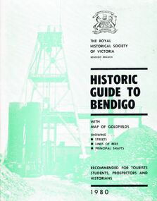
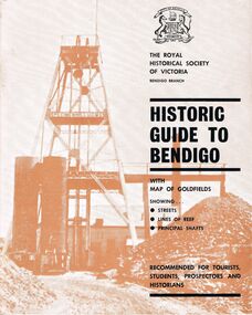
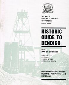
Book - HISTORIC GUIDE TO BENDIGO
... History House 11 Mackenzie Street Bendigo goldfields BENDIGO History gold mining book books Bendigo history history Victoria Victorian history Australian history gold gold fields gold discoveries place The Royal Historical Society of Victoria Bendigo Branch A book titled ' The Royal Historical Society of Victoria Bendigo Branch, Historic Guide to Bendigo with map(Loose), of goldfields showing streets, lines of reef, principal shafts. ...A book titled ' The Royal Historical Society of Victoria Bendigo Branch, Historic Guide to Bendigo with map(Loose), of goldfields showing streets, lines of reef, principal shafts. Recommended for tourists, students, prospectors and historians. 1980.' Cambridge Press, Bendigo. Eighth Edition. Maps, photos, illustrations.bendigo, history, gold mining, book, books, bendigo history, history, victoria, victorian history, australian history, gold, gold fields, gold discoveries, place, the royal historical society of victoria bendigo branch -
 Bendigo Historical Society Inc.
Book - HISTORIC GUIDE TO BENDIGO
... History House 11 Mackenzie Street Bendigo goldfields BENDIGO History gold mining book books Bendigo Bendigo history history Victorian history Victoria Australian history gold fields gold gold discoveries The Royal Historical Society of Victoria Five copies of ' The Royal Historical Society of Victoria Bendigo Branch Historic Guide to Bendigo with map of goldfields showing streets, lines of reef, principal shafts. ...Five copies of ' The Royal Historical Society of Victoria Bendigo Branch Historic Guide to Bendigo with map of goldfields showing streets, lines of reef, principal shafts. Recommended for tourists, students, prospectors and historians.' Cambridge Press, Bendigo. Third Edition. Maps, photos, illustratons. Only four copies have maps.bendigo, history, gold mining, book, books, bendigo, bendigo history, history, victorian history, victoria, australian history, gold fields, gold, gold discoveries, the royal historical society of victoria -
 Bendigo Historical Society Inc.
Book - HISTORIC GUIDE TO BENDIGO
... History House 11 Mackenzie Street Bendigo goldfields BENDIGO History gold mining book books Bendigo Bendigo history Victoria Victorian history Australian history gold gold fields The Royal Historical Society of Victoria gold discoveries Three books titled ' The Royal Historical Society of Victoria Bendigo Branch Historic Guide to Bendigo with map of goldfields showing streets, lines of reef, principal shafts. ...Three books titled ' The Royal Historical Society of Victoria Bendigo Branch Historic Guide to Bendigo with map of goldfields showing streets, lines of reef, principal shafts. Recommended for tourists, students, prospectors and historicans.' Sixth Edition. Cambridge Press, Bendigo. Maps, photos, diagrams.bendigo, history, gold mining, book, books, bendigo, bendigo history, victoria, victorian history, australian history, gold, gold fields, the royal historical society of victoria, gold discoveries -
 Bendigo Historical Society Inc.
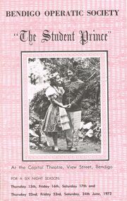
Document - THE STUDENT PRINCE, CAPITAL THEATRE, 15 June, 1972
... Book & Lyrics by Dorothy Donnelly. Stage Manager Malcolm Cannon. Musical Director Gwen Grose. Choreography Madge Welch. Wardrobe Miss M Welch... Mrs A Ball. Cast: Kerry Hogan Brian Fitzpatrick... Garry Burns... Alan Petrie... Graham Bumford... John McCormick... John Boquest... Graeme Daws... Annette Beckwith Margaret McQueenie... Michael Filippini... Nicholas Kasterovic... Max Rule... Graham Bumford... Ian Beckwith... Ferd Lorenz... Shane Brennan... Jill James... Patricia Lyon... Valerie Griffiths... Jim Feteris... John Tonkin. Time _ Spring 1860. Female Chorus: Marion Alcock... Ann Ball... Wilma Baldwin... Dorothy Field...Book & Lyrics by Dorothy Donnelly. Stage Manager Malcolm Cannon. Musical Director Gwen Grose. Choreography Madge Welch. Wardrobe Miss M Welch, Mrs A Ball. Cast: Kerry Hogan Brian Fitzpatrick, Garry Burns, Alan Petrie, Graham Bumford, John McCormick, John Boquest, Graeme Daws, Annette Beckwith Margaret McQueenie, Michael Filippini, Nicholas Kasterovic, Max Rule, Graham Bumford, Ian Beckwith, Ferd Lorenz, Shane Brennan, Jill James, Patricia Lyon, Valerie Griffiths, Jim Feteris, John Tonkin. Time _ Spring 1860. Female Chorus: Marion Alcock, Ann Ball, Wilma Baldwin, Dorothy Field...Book & Lyrics by Dorothy Donnelly. Stage Manager Malcolm Cannon. Musical Director Gwen Grose. Choreography Madge Welch. Wardrobe Miss M Welch Mrs A Ball. Cast: Kerry Hogan Brian Fitzpatrick Garry Burns Alan Petrie Graham Bumford John McCormick John Boquest Graeme Daws Annette Beckwith Margaret McQueenie Michael Filippini Nicholas Kasterovic Max Rule Graham Bumford Ian Beckwith Ferd Lorenz Shane Brennan Jill James Patricia Lyon Valerie Griffiths Jim Feteris John Tonkin. Time _ Spring 1860. Female Chorus: Marion Alcock Ann Ball Wilma Baldwin Dorothy Field ...The Student Prince, Capital Theatre, View Street, Bendigo. For a six night season: Thursday 15th, Friday 16th, Saturday 17th and Thursday 22nd, Friday 23, Saturday 24th June, 1972. Bendigo Operatic Society: Mr J McK. Cannon, Mr F Trewarne, Miss Ann Ball, Mr L Spencely, Mrs P Lyon. Committee: Mesdames J Cannon, M Reed, Misses P McCraken & M Welch, Messrs. J Beaumont, J Boquest, G Daws. Photos: Producer-Max Collis, Assistant Producer, Ballet & Wardrobe Mistress-Madge Welch, Assistant Pianist-Edith John, Musical Director-Gwen Grose, Society Pianist- Ruth Gorman. Photos of cast: Margaret McQueenie, John Boquest, John McCormack, Graham Bumford, Graeme Daws, Annette Beckwith, Jill James, Ferd Lorenz, Shane Brennan, Patricia Lyon, Max Rule, Ian Beckwith, John Tonkin, Michael Filippini, Valerie Griffiths, Jim Feteris. Synopsis if Story. Synopsis of Scenes. Bendigo Operatic Society Presents by arrangement with Allan's Music (Australia) Pty. Ltd. ''The Student Prince'' A Max Collis Production. Music by Sigmond Romburg. Book & Lyrics by Dorothy Donnelly. Stage Manager Malcolm Cannon. Musical Director Gwen Grose. Choreography Madge Welch. Wardrobe Miss M Welch, Mrs A Ball. Cast: Kerry Hogan Brian Fitzpatrick, Garry Burns, Alan Petrie, Graham Bumford, John McCormick, John Boquest, Graeme Daws, Annette Beckwith Margaret McQueenie, Michael Filippini, Nicholas Kasterovic, Max Rule, Graham Bumford, Ian Beckwith, Ferd Lorenz, Shane Brennan, Jill James, Patricia Lyon, Valerie Griffiths, Jim Feteris, John Tonkin. Time _ Spring 1860. Female Chorus: Marion Alcock, Ann Ball, Wilma Baldwin, Dorothy Field, Ann Garrat, Dawn Moncrieff, Coral Rivett, Lois Semmens, Marilyn Storey, Marion Wright. Male Chorus: Garry Burns, Edmund, Burke, Peter Edgley, Brian Fitzpatrick, Jim Feteris, Kerry Hogan, Ross Jones, Nicholas Kasterovic, Bernie Keogh, John Keogh, Alan Petrie, Fred Trewarne, Philip Wilkin. Ballet: Dianne Austin, Annette Basset, Wendy Kent, Jocelyn Lyon, Lyn Rowe, Ann Rendell, Helen Southby, Pauline Waugh. Publicity Officer: Mrs J Cannon. Scenery & Properties: M & J Cannon, J Moncrieff, R Spicer. Art Work: M Cannon, S James, B Agnew, Tony Lorenz, J Hall, Karl Steinberg. Prompt: Mrs J Cannon. Lighting: L Reed, H Bridges & T Vincent. Make-up: Mrs H Cannon & Mrs D Coia. Hairdressing: Ross Coiffure. House Manager: Garry McDonald. Bendigo Concert Orchestra Violins: Mrs R Weldon, Mrs A Boulton, Mrs M Robbins, Mrs C Messer, Mr C Gill, Mr J Jordan, Mr P Phillips, Mr T French. Violas: Mr E Jarrett, Mr H Werry. Cellos: Mrs C Bubb. Bass: Mr S Anderson. Flute: Mr C Bubb. Clarinets: Mr R Holyoake. Trombones: Mr W Neuman. Trumpets: Mr D Gray, Mr David Gray, Mr Ian De Araugc. Percussion: Mr Brian Beale. Pianoforte: Mrs P Gorman. Songs From ''The Student Prince'' (wording). Acknowledgement; Bendigo Advertiser, BCV8, 3BO, 3CV, St Mary's. Advertisements through last half of program: Don Semmens Photographic Studio, The Copper Pot Licensed Restaurant, Ross Coiffure Beatty Salon. A and b are both the same copy a in the better of the copies as b is lightly faded. Otherwise excellent condition.program, music, bedigo operatic society, the student prince, capital theatre, view street, bendigo. 15th, 16th, 17th 22nd, 23, 24th june, 1972. bendigo operatic society: mr j mck. cannon, mr f trewarne, miss ann ball, mr l spencely, mrs p lyon. committee: mesdames j cannon, m reed, misses p mccraken & m welch, messrs. j beaumont, j boquest, g daws. photos: producer-max collis, assistant producer, ballet & wardrobe mistress-madge welch, assistant pianist-edith john, musical director-gwen grose, society pianist- ruth gorman. photos of cast: margaret mcqueenie, john boquest, john mccormack, graham bumford, graeme daws, annette beckwith, jill james, ferd lorenz, shane brennan, patricia lyon, max rule, ian beckwith, john tonkin, michael filippini, valerie griffiths, jim feteris. synopsis if story. synopsis of scenes. bendigo operatic society presents by arrangement with allan's music (australia) pty. ltd. ''the student prince'' a max collis production. music by sigmond romburg. book & lyrics by dorothy donnelly. stage manager malcolm cannon. musical director gwen grose. choreography madge welch. wardrobe miss m welch, mrs a ball. cast: kerry hogan brian fitzpatrick, garry burns, alan petrie, graham bumford, john mccormick, john boquest, graeme daws, annette beckwith margaret mcqueenie, michael filippini, nicholas kasterovic, max rule, graham bumford, ian beckwith, ferd lorenz, shane brennan, jill james, patricia lyon, valerie griffiths, jim feteris, john tonkin. time _ spring 1860. female chorus: marion alcock, ann ball, wilma baldwin, dorothy field, ann garrat, dawn moncrieff, coral rivett, lois semmens, marilyn storey, marion wright. male chorus: garry burns, edmund, burke, peter edgley, brian fitzpatrick, jim feteris, kerry hogan, ross jones, nicholas kasterovic, bernie keogh, john keogh, alan petrie, fred trewarne, philip wilkin. ballet: dianne austin, annette basset, wendy kent, jocelyn lyon, lyn rowe, ann rendell, helen southby, pauline waugh. publicity officer: mrs j cannon. scenery & properties: m & j cannon, j moncrieff, r spicer. art work: m cannon, s james, b agnew, tony lorenz, j hall, karl steinberg. prompt: mrs j cannon. lighting: l reed, h bridges & t vincent. make-up: mrs h cannon & mrs d coia. hairdressing: ross coiffure. house manager: garry mcdonald. bendigo concert orchestra violins: mrs r weldon, mrs a boulton, mrs m robbins, mrs c messer, mr c gill, mr j jordan, mr p phillips, mr t french. violas: mr e jarrett, mr h werry. cellos: mrs c bubb. bass: mr s anderson. flute: mr c bubb. clarinets: mr r holyoake. trombones: mr w neuman. trumpets: mr d gray, mr david gray, mr ian de araugc. percussion: mr brian beale. pianoforte: mrs p gorman. songs from ''the student prince'' (wording). acknowledgement; bendigo advertiser, bcv8, 3bo, 3cv, st mary's. advertisements: don semmens photographic studio, the copper pot licensed restaurant, ross coiffure beatty salon.