Showing 1928 items
matching flooding
-
 Bendigo Military Museum
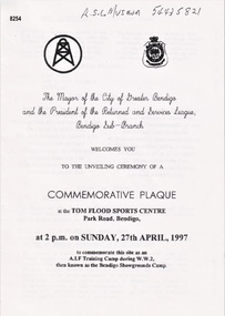
Pamphlet - COMMEMORATIVE PLAQUE 1997, C.1997
The Tom Flood Sports Centre was originally called The Bendigo Show Grounds. This plaque was unveiled by the City of Greater Bendigo & the Bendigo RSL Sub Branch to Commemorated the venue as a "Training Camp" during WW2. Order of Service was, Welcome, Mr Alan Holmes (President Bendigo RSL) Introduction of Recruits & Others associated with the Camp. A brief history of the Camp and Anecdotes was read by Mr Alan Holmes. Presentation and unveiling of the Plaque by Cr Barry Ackerman, Mayor City of Greater Bendigo. The wording: "Commemorating this site as an Australian Imperial Force Training Camp during WW2. "To the following Corps we pay Tribute" "10th AIF Training Depot" "Australian Army Medical Corps" "Australian Army Ordnance Corps" "Australian Army Service Corp". "Australian Electrical and Mechanical Engineers" Prayer of Thanksgiving & Commemoration by; Rev J. South. This was followed the "ODE, Last Post, One minutes Silence, Reveille and The National Anthem. As far as records available the Camp was first set up on 17.6.1940 with an Advance Party. The last Troops left there on 30.4.1943 for Ingleburn NSW, the Camp was vacated in May 1943. Pamphlet white paper, A4 folded making 4 pages, all print in black.On the front, "This Commemorative Plaque was unveiled at the Tom Flood Sports Centre Park Road Bendigo Sunday 27th April 1997"brsl, smirsl, plaque, tom flood, training camp -
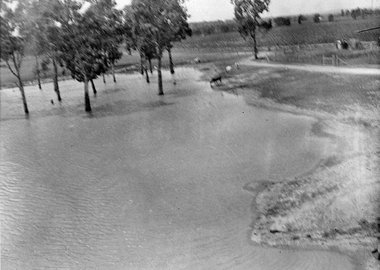
 Eltham District Historical Society Inc
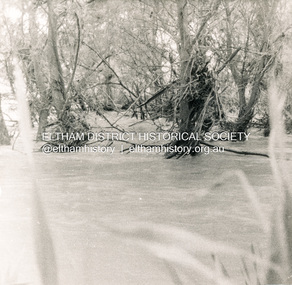
Photograph, George W. Bell, Flood Eltham early 1950's, 1950c
Black and white photograph of Diamond Creek in flood at Eltham early 1950sfloods, diamond creek, eltham, george w bell collection -
 Eltham District Historical Society Inc
Photograph, Floods Falkiner Street, Eltham, 1956, 1956
Four photographs of floods in Falkiner Street area, Eltham, October 1956diamond creek, floods, falkiner street, main road, eltham -
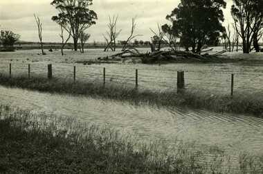
 Eltham District Historical Society Inc
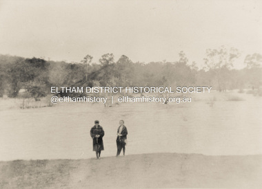
Photograph, Diamond Creek in flood 1924, 1924
Colour photograph of original showing Diamond Creek in flood at Eltham 1924floods, diamond creek, eltham -
Clunes Museum
Photograph
COPY OF PHOTOGRAPH OF FLOOD ON CRESWICK CREEK AT SUSPENSION BRIDGE BEHIND KEEBLE'S 8/9/1909 TALBOT RD CLUNES. IT WAS THIS BRIDGE THAT MR. WATSON WAS SO NEARLY CARRIED DOWN WITH THE RUSHING WATERS. HE WAS STANDING ON PART OF IT, WHEN IT BROKE AWAY AND HE MANAGED TO CLING TO TO THE REMAINSsuspension bridge flood, flood creswick creek, 1909 flood -
University of Melbourne, Burnley Campus Archives
Document, Improvements (Completed files), 1925-1935
Correspondence mainly re drainage, repairs after 1934 floods. etc.drainage, repairs, floods, improvements -
 Ballarat Heritage Services
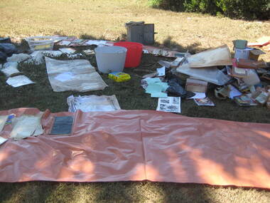
Photograph - Colour, Flood recovery, Carisbrook, 40 degree heat
Colour photographs of paperbased items being 'recovered' after the Carisbrook floods.carisbrook, flood, flood recovery -
 Kew Historical Society Inc
Photograph, Floods, North Kew, 1923
Floods in North Kew in the vicinity of Willsmere Park, donated by Kerry Woollard.floods (kew), yarra river -
 University of Melbourne, Burnley Campus Archives
Photograph - Black and white print, Orchard After Flood, 1934
Black and white photograph. Orchard after flood: shows uprooted trees.orchard, yarra river, floods, 1934, fruit trees -
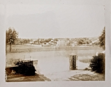
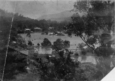
 Orbost & District Historical Society
black and white photograph, mid 1930s
This is a photograph of McKillop's Bridge probably taken just after its rebuilding. The current McKillop’s Bridge was built by the Country Roads Board in two stages between 1931-36, during which its height was raised after the original bridge superstructure was washed away in record floods of January 1934, prior to its original official opening. In its reconstructed form the original concrete abutments were turned into additional piers and the welded-steel trusses were cantilevered back over them to meet the new higher road approaches. "McKillops Bridge was Heritage listed due to its social and technological significance – the steel trusses' arc-welded construction technique was a pretty big deal in the 1930s. It was once an important route for cattlemen, who used the ford across the Snowy in the years preceding the bridge's existence"This is a pictorial record of McKillop's Bridge just after its construction.A black / white photograph of a wooden bridge across a river. At the bottom right is a man with his back to the camera. He is looking at flood debris on the bank. At the bottom left are two men near a pylon.on back - McKillops Bridgebridge-mckillop's snowy-river-bridge -
Glenelg Shire Council Cultural Collection
Postcard, c. 1946
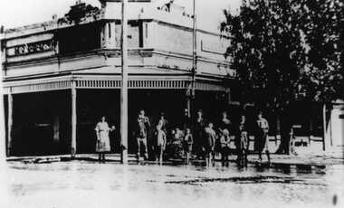
Sourced from Casterton Town Hall former Shire of GlenelgBlack and white photo/postcard, showing ? Island Park Casterton during 1946 flood. Tractor in flooded yard near shed. Tin back fence with 'The World's Favourite' written on it. (Rest of advertisement underwater)Back: Purple photographer's stamp. 'Postcard' - purple -
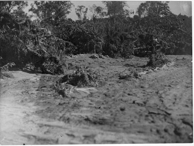
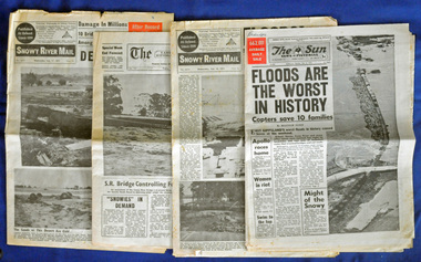 Orbost & District Historical Society
newspapers, February 1971
The 1971 floods at Orbost were the worst on record. At Jarrahmond the river rose to a height of 11 metres and on the flats spread to one and a half kilometres wide. Considerable damage was done to railway infrastructure, roads and farms. More information from the APRIL, 2008 newsletter by John Phillips. (see orbosthistory.com.au)These newspapers are contemporary records of a significant local event.Four newspapers and a set of clippings from various papers. They contain information and photographs pertaining to the 1971 floods in Orbost. 2557.1 is a Sun News Pictorial dated 8.2.1971. 2557.2 is a Snowy River Mail dated 10.2.1971. 2557.3 is an east Gippsland News dated 12.2.1971. 2557.4 is a Snowy River mail dated 12.2.1971 and 2557.5 is a collection of various clippings.floods-orbost-1971 newspaper snowy-river-mail sun-news-pictorial -
Glenelg Shire Council Cultural Collection
Postcard - Postcard - Flooding in Casterton, n.d
SOURCED FROM CASTERTON TOWN HALL (FORMER SHIRE OF GLENELG) Sourced From Casterton Town Hall (Former Shire of Glenelg)Black and white photo postcard. 1946 flood. Water halfway up tin fence, man standing on railing, tractor towing horse float, flooded shed, trees part submerged, no dry land visibleBack: Purple stamp - 'POSTCARD' Purple photographer's stamp -
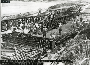 Lorne Historical Society
Photograph, Bailey Bridge at Hutt Gully
Assembling the Bailey Bridge at Hutt Gully after the floods 4/2/1954g.o.r.: bailey bridge: hutt gully: 4/2/1954 -
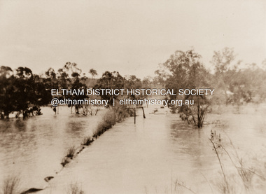 Eltham District Historical Society Inc
Photograph, Diamond Creek in flood 1924, 1924
Colour reproduction copy of an original sepia photograph of Diamond Creek in flood 1924diamond creek, floods -
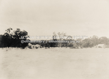 Eltham District Historical Society Inc
Photograph, North Eltham floods, 1924, 1924
Colour photograph of original showing Diamond Creek in flood at north Eltham 1924floods, diamond creek, eltham, north eltham -
 Stawell Historical Society Inc
Photograph, Flood on Concongella Creek, Great Western, early 1900's
Digital Photo taken from glass slide by Geoff McMillan, Cooper Street Stawell and reproduced as a photo - printed at Stawell Historical Society 2019Black & White Photo of flood on the Concongella Creek at Best's vineyard, Great Western. -
Whitehorse Historical Society Inc.
Article, Nunawading residents see red over drainage scheme 'waste', 1993
Residents are concerned that the proposed easement drain in Esdale Street will not solve flooding problems.Residents are concerned that the proposed easement drain in Esdale Street will not solve flooding problems.Residents are concerned that the proposed easement drain in Esdale Street will not solve flooding problems.city of nunawading., esdale street, nunawading, springfield road, nunawading, swingler, phillipa, neal, andrew, drainage -
Whitehorse Historical Society Inc.
Article, Flood plan, 1993
$100,000 will be spent by Melbourne Water to solve flooding problems in the Fulton Road area.$100,000 will be spent by Melbourne Water to solve flooding problems in the Fulton Road area.$100,000 will be spent by Melbourne Water to solve flooding problems in the Fulton Road area.melbourne water, fulton road, blackburn south, drainage -
 Charlton Golden Grains Museum Inc
Photograph, Charlton Tribune, B/W photograph of 1971 flood, Nov 1971
B/W photograph of 1971 flood. Paddocks & roadside along Calder Highwayflood, charlton, calder highway -
 Lakes Entrance Historical Society
Photograph, Lakes Post Newspaper, floods 1998, Lakes Entrance Victoria, 1/06/1998 12:00:00 AM
Colour photograph taken during floods of part of Esplanade Lakes Entrance Victoriafloods, gippsland lakes, natural disasters -
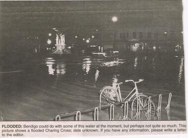 Bendigo Historical Society Inc.
Newspaper - JENNY FOLEY COLLECTION: FLOODED
BHS CollectionBendigo Advertiser ''The way we were'' from 2003. Flooded: Bendigo could do with some of this water at the moment, but perhaps not quite so much. This picture shows a flooded Charing Cross, date unknown. The clip is in a folder.newspaper, bendigo advertiser, the way we were -
 Kew Historical Society Inc
Photograph - Construction of the Eastern Freeway (F19), Ron Setford, March 1972
Ron Setford and his wife Grace Setford lived in Tanner Avenue, East Kew, from c.1946 to c.1995. A keen photographer, he recorded the changing face of Kew over a 20 year period. Apart from 30 photographs of built structures and places in Kew dating from 1960 and 1961, 145 of his 35mm colour slides chronicle the development of the F19 (later renamed Eastern) Freeway through the Yarra Valley in Kew over a five year period from c.1972 to c.1977. This important collection was donated to the Society by his granddaughter in 2025.This collection of 175 35mm slides is of local and statewide significance, owing to its subject matter, particularly the major development of road transport infrastructure during the 1970s with the construction of the Eastern Freeway. The photographer also took care to annotate and date most of his slides which enable the researcher to pinpoint temporal and spatial locations."Eastern Freeway 6/72 / Willsmere Park flood underpass"ron setford, eastern freeway, f19 freeway -
 Charlton Golden Grains Museum Inc
Photograph, 1923 Flood - Telegraph Hotel, Armstrong Street Charlton, c. 1923
1923 Flood, Telegraph Hotel, Armstrong Street, Charlton, Victoria1923 flood - Telegraph Hotel, Armstrong Street Charlton. Obituary: Charlton 100 years ago 18-02-1922 - 24/02/1922. Mr Francis Gilbert Livingstone passed away at Castlemaine on 14th ins. He was a very well known & highly respected old resident of Charlton & Narrewillock. Until October last he held the license of the Telegraph Hotel and was a familiar figure in his wheel chair under the shade trees at land at Narrewillock, where he farmed until failing health compelled him to give up the strenuous work of those early pioneering days, and in 1892 he took the license of the Telegraph Hotel which he retained until recently. He was 61 years of age.flood, telegragh hotel, charlton, livingstone -
 Upper Yarra Museum
Negative Photographic Reproduction, Floods at Kelly’s flat 1933, Warburton
Floods at Kelly’s flat 1933, Warburton Negative Black white Scanned at 600 dpi -
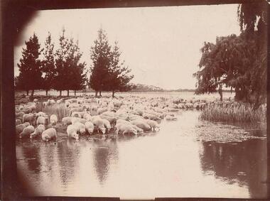 Phillip Island and District Historical Society Inc.
Photograph, Early 1900's
Donated by Jessie Smith (nee Small)Black & White photograph of flock of sheep drinking from flood water - unknown area.On back: "Drink Time"flock of sheep, phillip island, jessie smith -
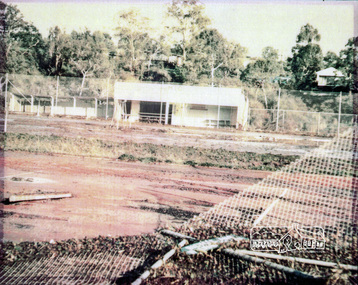 Eltham District Historical Society Inc
Photograph, Montmorency Tennis Club, 1974c
Fully laminated colour photograph of Montmorency Tennis Courts after flooding c.1974.tennis courts, montmorency, floods -
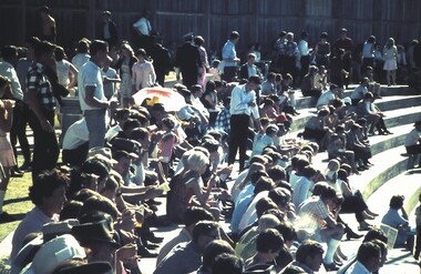 Bendigo Historical Society Inc.
Slide - VAL DENSWORTH COLLECTION: BENDIGO EASTER FAIR, 1967
Slide. Bendigo Easter Fair. A crowd of spectators at the Tom Flood Centre watching the cyclists.slide, bendigo, bendigo easter fair., bendigo easter fair. -
Whitehorse Historical Society Inc.
Article, Water walkout, 1993
An article in which the City of Nunawading council is blamed for continual flooding in Barbara Street Vermont.An article in which the City of Nunawading council is blamed for continual flooding in Barbara Street Vermont.An article in which the City of Nunawading council is blamed for continual flooding in Barbara Street Vermont.city of nunawading, barbara street, vermont, daly, lyn -
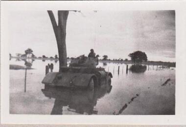 8th/13th Victorian Mounted Rifles Regimental Collection
Photograph
The 8th/13th Victorian Mounted Rifles was raised as a regiment of the Royal Australian Armoured Corps on 1 May 1948 with Headquarters in Melbourne and squadrons in Sale, Benalla/Wangaratta and Albury. In 1955 Regimental Headquarters moved to Wangaratta and a second squadron was located at Albury. The Sale squadron transferred to 4th/19th Prince of Wales’s Light Horse. In 1977 8/13 VMR Regiment was reduced to an independent squadron A Squadron 8th/13th Victorian Mounted Rifles and in 1991 was linked with 4th/19th Prince of Wales’s Light Horse forming the VMR Squadron of that regiment.Collection of photographs showing early evolution of an armoured regiment of the Citizen Forces as it progressed from WWII equipment and uniforms to post-war equipment and uniforms. Silver regimental hat badges are worn in place of Rising Sun badge.Black and white photograph of Staghound Armoured Car wheel-hub deep in flood water' 1956 Staghound Armoured Car settling. Exercise in Chiltern/ Rutherglen area. "