Showing 1755 items
matching intersection
-
 Eltham District Historical Society Inc
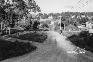
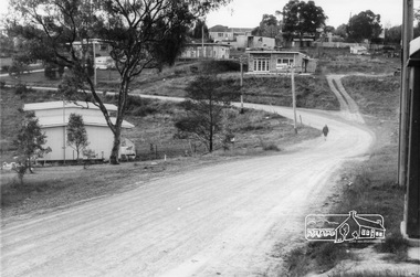
Photograph, Looking southeast along Kett Street towards intersection with Alma Street, Lower Plenty, c.July 1967, 1967
Packaged in "Filmpro King Size prints Definitely Better EST. 1918" envelope. Pencil notes: 36 shots $2.87 Eltham Shire J. McD and 19/7/67. Alma Street and Kett Street Lower Plenty c.July 1967.Black and white photographlower plenty, houses, streets, kett street, alma street -
 Eltham District Historical Society Inc
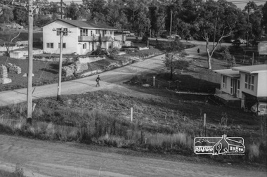
Photograph, Looking towards the intersection of Kett Street with Main Road from 8 Kett Street, Lower Plenty, c.July 1967, 1967
Packaged in "Filmpro King Size prints Definitely Better EST. 1918" envelope. Pencil notes: 36 shots $2.87 Eltham Shire J. McD and 19/7/67. Alma Street and Kett Street Lower Plenty c.July 1967.Black and white photographlower plenty, houses, streets, kett street, main road -
 Eltham District Historical Society Inc
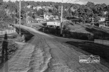
Photograph, Looking south along Kett Street to intersection with Main Road, Lower Plenty, c.July 1967, 1967
Packaged in "Filmpro King Size prints Definitely Better EST. 1918" envelope. Pencil notes: 36 shots $2.87 Eltham Shire J. McD and 19/7/67. Alma Street and Kett Street Lower Plenty c.July 1967.Black and white photographlower plenty, houses, streets, kett street, main road -
 Eltham District Historical Society Inc
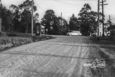
Photograph, Looking north along Kett Street from near the intersection with Main Road, Lower Plenty, c.July 1967, 1967
Packaged in "Filmpro King Size prints Definitely Better EST. 1918" envelope. Pencil notes: 36 shots $2.87 Eltham Shire J. McD and 19/7/67. Alma Street and Kett Street Lower Plenty c.July 1967.Black and white photographlower plenty, houses, streets, kett street, main road -
 Eltham District Historical Society Inc
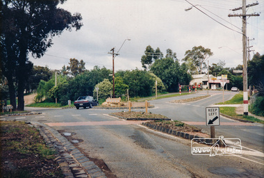
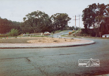
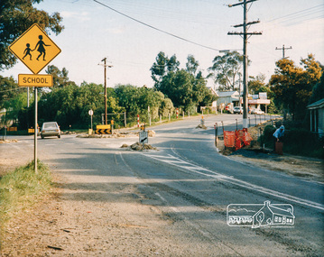
Photograph, Panton Hill Store near the intersection of Merritts Road and Kangaroo Ground-St Andrews Road, Panton Hill, c. Oct 1987, 1987
Date based on other similar display panels visible in images of the Shire of Eltham display at the Eltham Community Festival, 7 November 1987. Colour photographinfrastructure, display panel, eltham festival, shire of eltham, general store, kangaroo ground-st andrews road, merritts road, panton hill, roads, roundabouts -
 Eltham District Historical Society Inc
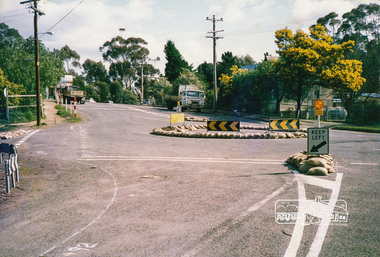
Photograph, Intersection of Kangaroo Ground-St Andrews Road with Rodger Road and Church Road, Panton Hill, c. Oct 1987, 1987
Date based on other similar display panels visible in images of the Shire of Eltham display at the Eltham Community Festival, 7 November 1987. Colour photographinfrastructure, display panel, eltham festival, shire of eltham, kangaroo ground-st andrews road, panton hill, roads, roundabouts, rodger road, church road -
 Eltham District Historical Society Inc
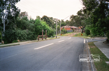
Photograph, Intersection of Nicholson Close and Thompson Crescent, Research, c.October 1990, 15/10/1990
Prints were originally housed in a photo print envelope with note indicating they were taken 15 October 1990.Roll of 35mm colour negative film, 6 of 7 stripsKodak Gold 100-2 5095infrastructure, roadworks - gutters, shire of eltham, streets, nicholson close, research (vic.), thompson crescent -
 Eltham District Historical Society Inc
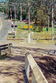
Negative - Photograph, Looking southeast along Wattletree Road towards Main Road intersection, Eltham, 1998c
Roll of 35mm colour negative film, 8 strips and associated 10 x 15 cm colour printKodak Gold 100-5wattletree road, eltham, main road, railway crossing -
 Eltham District Historical Society Inc
Photograph, Fred Mitchell, Looking north along Bible Street approaching the intersection with Arthur Street, Eltham, 1967, 1967
Digital copy of colour photographfred mitchell collection, 1967, arthur street, bible street, streets -
 Eltham District Historical Society Inc
Photograph, Fred Mitchell, Looking east along Arthur Street just down from intersection with Bible Street, Eltham, 1968, 1968
Valiant is parked outside what was no. 43 now part of a unit complex at no. 41. Immediately in front of Valiant is no. 45, which has been a vacant block since before 1990. Gentleman in hat with paper walking up hill is outside no. 39, now a unit complex and the old house on left is no. 37 (since replaced) which borders what is now the Walter Withers ReserveDigital copy of colour photographfred mitchell collection, 1968, bible street, arthur street, eltham, houses, streets -
 Eltham District Historical Society Inc
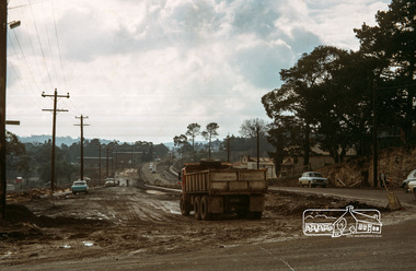
Photograph, Fred Mitchell, Main Road duplication at intersection with Bridge Street, Eltham, 1968, 1968
Shows the Eltham Shire Office, the construction of Panther Place and the new section of Main Road which was to become the northbound lanes.Digital copy of colour photographfred mitchell collection, 1968, eltham, eltham shire office, eltham stock feed, main road, panther place, road construction, shire offices, duplication -
 Eltham District Historical Society Inc
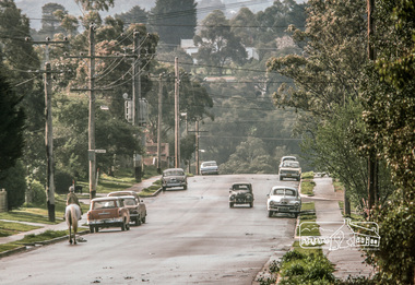
Photograph, Fred Mitchell, Heading north along Main Road approaching intersection with Mount Pleasant Road, Eltham, 1968, 1968
Wingrove Cottage visible in distance.Digital copy of colour photographfred mitchell collection, 1968, main road, wingrove cottage -
 Eltham District Historical Society Inc
Photograph, Fred Mitchell, Looking south along Main Road from the intersection with Dalton Street (left), 5 September 2007, 05/09/2007
Digital copy of colour photographfred mitchell collection, 2007 -
 Eltham District Historical Society Inc
Photograph, Looking northeast along the Heidelberg-Kinglake Road from intersection with Cherry Tree Road, Hurstbridge, c. Oct 1987, 1987
Used in Shire of Eltham display at the Eltham Community Festival, 7 November 1987.Colour photograph mounted on green-painted chipboard with string on back for hangingdisplay panel, eltham festival, infrastructure, shire of eltham, roundabouts, heidelberg-kinglake road, cherry tree road, hurstbridge -
 Eltham District Historical Society Inc
Photograph, Panton Hill Store near the intersection of Merritts Road and Kangaroo Ground-St Andrews Road, Panton Hill, c. Oct 1987, 1987
Date based on other similar display panels visible in images of the Shire of Eltham display at the Eltham Community Festival, 7 November 1987.Colour photographdisplay panel, eltham festival, infrastructure, shire of eltham, bishops road, general store, kangaroo ground-st andrews road, merritts road, panton hill, roads, roundabouts -
 Eltham District Historical Society Inc
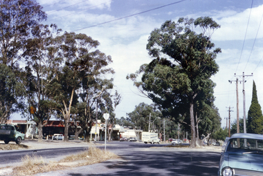
Photograph, Looking north along Looker Road at intersection with Buena Vista Drive, Montmorency
Roll of 35mm colour negative film, 4 stripsFuji 100buena vista drive, looker road, montmorency, streets -
 Eltham District Historical Society Inc
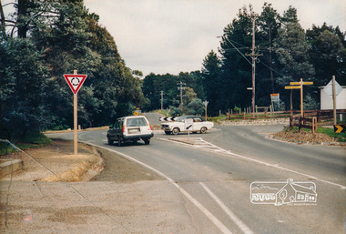
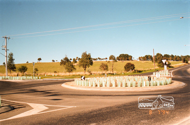
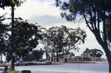
Photograph, Looking south-east at the intersection of Eltham-Yarra Glen Road and Kangaroo Ground-Warrandyte Road, Kangaroo Ground, 8 July 1994, 08/07/1994
Roll of 35mm colour negative film, 4 stripsFuji 100kangaroo ground, eltham-yarra glen road, kangaroo ground-warrandyte road -
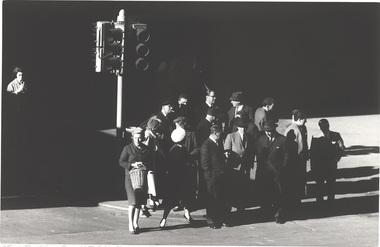
 Horsham Regional Art Gallery
Photograph, Mark STRIZIC, Intersection of Latrobe and William Streets, 1963 (printed 1989)
Donated through the Australian Government's Cultural Gifts Program by Dr Jonathan Hartley, 2006 -
 Horsham Regional Art Gallery
Photograph, Mark STRIZIC, Intersection of Swanston and Little Collins Street - 1, 1963 (printed 1998)
Donated through the Australian Government's Cultural Gifts Program by Dr Jonathan Hartley, 2006silver gelatin photograph -
 Whitehorse Historical Society Inc.
Photograph, Vermont Intersection C.1967, C.1967
Part of Tim Shambrook's Collection for 'This is Vermont'. Not used.Coloured photo of Corner of Canterbury, Mitcham & Boronia Roads, Vermont, taken in 1967, looking West from outside Scout Hall and showing Vermont Shops.vermont scout hall, canterbury road, vermont, boronia road, mitcham road, shambrook, tim -
 Whitehorse Historical Society Inc.
Photograph, Vermont Intersection C.1967, 1/04/1967 12:00:00 AM
Part of Tim Shambrook's Collection for 'This is Vermont', P. 37.Coloured photo of Corner of Canterbury, Mitcham & Boronia Roads, Vermont, looking towards Boronia Road, showing Vermont Shops and corner of Vermont Primary School, since demolished.canterbury road, vermont, mitcham road, boronia road, shambrook, tim -
 Whitehorse Historical Society Inc.
Photograph, Vermont Intersection C.1967, C.1967
Part of Tim Shambrook's Collection for 'This is Vermont'. Not used.Coloured photo of Shell Service Station (since replaced by Convenience Store) on corner of Boronia & Canterbury Roads, Vermontboronia road, vermont, canterbury road, shambrook, tim -
 Whitehorse Historical Society Inc.
Photograph, Vermont Intersection, 1967, C.1967
Part of Tim Shambrook's Collection for 'This is Vermont'. Not used.Coloured photo of Corner of Boronia Road & Canterbury Road, Vermont, taken from Porch of Vermont State School on corner of Mitcham Road in 1967.vermont state school, no. 1022, boronia road, vermont, canterbury road, mitcham road, shambrook, tim -
 Whitehorse Historical Society Inc.
Photograph, Vermont Intersection C.1967, C.1967
Part of Tim Shambrook's Collection for 'This is Vermont'. Not used.Coloured photo of Shell Service Station (since replaced with Convenience Store) on corner of Boronia & Canterbury Roads, Vermont. Taken outside St. Lukes Anglican Church on Mitcham Road.shell service station, vermont, boronia road, canterbury road, mitcham road, st. lukes anglican church, shambrook, tim -
 Whitehorse Historical Society Inc.
Article, Intersection Needs Remedy, 2020
Cars trying to make right turns from Rooks Road & Dunlavin Road on to Whitehorse Road end up on a collision course and the problem needs remedyingCars trying to make right turns from Rooks Road & Dunlavin Road on to Whitehorse Road end up on a collision course and the problem needs remedying.Cars trying to make right turns from Rooks Road & Dunlavin Road on to Whitehorse Road end up on a collision course and the problem needs remedyingwhitehorse road, rooks roads, dunlavin road, mitcham road, springvale road, city of whitehorse, nunawading -
 Federation University Art Collection
Artwork, 'Intersection' by Noella Stratford, 2006
This item is part of the Federation University Art Collection. The Art Collection features over 1000 works and was listed as a 'Ballarat Treasure' in 2007.art, artwork, noella stratford -
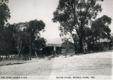 Wonga Park Community Cottage History Group
Photograph (sub-item) - Black and White, The Kiosk/Store in Wonga Park about 1948, owned by Mr. Arthur Davis. This view is from the intersection of Yarra and Jumping Creek Roads
-
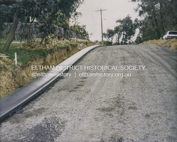 Eltham District Historical Society Inc
Photograph - Colour Print, Shire of Eltham, Bolton Street, Eltham, just north of Sackville Street intersection, c.1983
A single rollover kerb has just been laid on western side cut into the embankment. At the crest of the hill on right in front of the Ford Laser is a fire hyrdant. This photo was processed at the same time as image EDHS_07261 of roadworks in Sackville Street about 200 m away which has been dated as c.1983 (between Sep 1982 and May 1983). The paling fence on the left has a change of angle just before the crest of the hill then flattens. More recent Google Streetviews show the same fence and shape and in more recent times a new fence but same shape. Google Streetview for Jan 2008 indicates a more recent road widening and new profile kerb and channel. The embankment was further cut away and the footpath that was adjacent to the fence lowered to road level. The fire hydrant that was on the right hand side has been relocated to the left next to the footpath. Significantly more electrical wires are now strung on the telephone poles. In 2017 Bolton Street was again upgraded. The fire hyrdrant was then relocated to another (unknown) location.1983, footpaths and gutters, road construction, road drainage, road sealing, bolton street, eltham, sackville street