Showing 518 items
matching map of mine
-
 Bendigo Historical Society Inc.
Map - GUIDE MAP OF BENDIGO & EAGLEHAWK, Late 1920's
Map. Guide map of Bendigo & Eaglehawk. Folded map of Bendigo & Eaglehawk with blue outer cover booklet. Map is compiled by E E Parker, Eaglehawk. Map shows tramways, bus routes and cost one shilling. Map shows Agricultural Showgrounds located between Park Street, Water Street, Barnard Street and Bridge Lane. Also shows Acclimitization Reserve located behind the Botanical Gardens at White Hills. Shows the location of Sailors Gully, Peg-Leg Gully, Jobs Gully, California Gully, Long Gully, Ironbark Gully, Golden Gully, Poverty Gully, Sheepshead Gully, Charcoal Gully, Eaglehawk Creek, Bendigo Creek and Back Creek.Contains interesting facts about Bendigo:- Area - 7,900 acres, Population - 26,000, First Council elected - 1855, Proclaimed a City - 1871. Gold Rush broke out - 1851. For first 10 years gold yield averaged 8,600 ozs. Per week. Total gold yield to 1923 - 572 tons valued at 82,000,000 pounds. Deepest mines - Victoria Quartz 4,614 ft., New Chum Railway 4,318 ft., 13 mines over 3,000ft. deep, 53 mines over 2,000 ft. deep. Sewering of City commenced 1922. All principal buildings now sewered. Map printed by Arnall & Jackson, General Printers, Stationers & Engravers, 476 Collins Street. Outer map blue cover printed in red and blue ink by J B Young, Lithographer. Map displays advertisement for Bendigo Timber Co. Outer blue cover displays advertisement for Campbell Connelly & Co. Pty. Ltd, Ironmongers, Timware Manufacturers, Plumbers, Sewerage Contractors, High and Forest Sts, Bendigo 9outside back cover) and for Hartleys ( J L Shoosmith) Bendigo, displaying Indian Motor Cycles (inside back cover).map, bendigo, township, guide map of bendigo & eaglehawk -
 Bendigo Historical Society Inc.
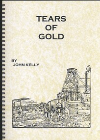
Book - TEARS OF GOLD, FATALITIES ON THE BENDIGO GOLDFIELDS 1852 - 1950, 2010
Tears of Gold, fatalities on the Bendigo Goldfields 1852-1950. Signed by the author, John R. Kelly, 6 July 2010, dedication thanks to the Bendigo Historical Society Soft covered spiral bound book of 91 pages with black and white photographs, maps and illustrations.John Kellybendigo, gold mining, fatalities, bendigo history, goldmining, miners, mine accidents, family history. -
 Bendigo Historical Society Inc.
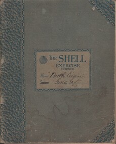
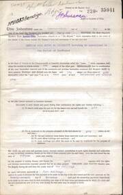
Document - MCCOLL, RANKIN AND STANISTREET COLLECTION: NORTH VIRGINIA GMC N L - CROSS SECTION PLAN OF THE MINE, 1942 1947
Document. Grey/green exercise book with 'North Virginia GMC NL. Book contains hand drawings of shafts and their metalurgical content at every depth. Symbols have been used to indicate different metals and earth. 2 maps loose in the book.McColl, Rankin & Stanistreetorganization, business, north virginia gmc n l, mccoll, rankin & stanistreet, north virginia gmc n l, gold mining, cross section plan of the north virginia -
 Bendigo Historical Society Inc.
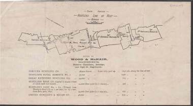
Document - KELLY AND ALLSOP COLLECTION: HUSTLERS LINE OF REEF MAP, 30/07/1891
... Document. KELLY & ALLSOP COLLECTION. Map of the Hustlers... Hustlers Line of Reef Map Wood & McNair. Wood & McNair Document ...Document. KELLY & ALLSOP COLLECTION. Map of the Hustlers Line of Reef, Bendigo (South portion). Issued by Wood & McNair, Sharebrokers, Beehive Chambers, Bendigo and High St., Eaglehawk. Mines shown on map are Fortuna Hustler's Co., Hustler's Royal Reserve No.2, Great Extended Hustlers Co., Hustlers Reef Co., Hustler's Reef No.1 Co., United Hustler's & Redan Co. Number of shares is listed against each of these mines.Wood & McNairbusiness, stockbroker, kelly & allsop, kelly & allsop collection, hustlers line of reef map, wood & mcnair. -
 Bendigo Historical Society Inc.
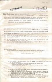
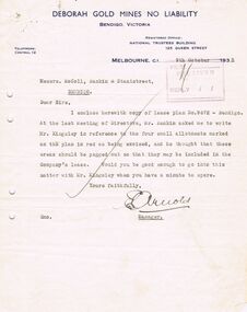
Document - MCCOLL, RANKIN AND STANISTREET COLLECTION: DEBORAH EXTENDED GOLD MINING COMPANY N/L GOLD MINING LEASE, 18 April 1957
Document Deborah Extended Gold Mining Company N/L document - gold mining lease document, Vol 334 071, dated 18 April 1957, 4 pages with map. Map adjoins Bendigo Cemetery. Lease between Deborah Extended Gold Mining Company N/L and the State of Victoria. No. 11339, Vol 334 Fol 071.organization, mining, gold mining lease, deborah extended gold mine, gold mining lease -
 Bendigo Historical Society Inc.
Document - MCCOLL, RANKIN AND STANISTREET COLLECTION: DEBORAH GOLD MINES NL GOLD MINING LEASE DOC, 1941
... ., Deborah Gold Mines NL - 3 pages, with map. Lease adjoins Railway... Gold Mines NL - 3 pages, with map. Lease adjoins Railway ...Document: McColl, Rankin and Stanistreet: Gold Mining Lease Private Land, 11089 Bendigo on front of document., Deborah Gold Mines NL - 3 pages, with map. Lease adjoins Railway Reserve, Breen Street. Transferred to North Deborah Mining Company NL on 9th. October, 1950. No. 11089, Vol 326 Fol 35941.organization, mining, gold mining lease, mccoll, rankin and stanistreet:, deborah gold mines nl, north deborah mining company nl, gold mining, lease -
 Bendigo Historical Society Inc.
Document - MCCOLL, RANKIN AND STANISTREET COLLECTION: DEBORAH GOLD MINES NL GOLD MINING LEASE ON PRIVATE LAND, 1941
... document Deborah Gold Mines NL, with map., Lease adjoins Railway... and Stanistreet: - 3 page lease document Deborah Gold Mines NL, with map ...Document McColl, Rankin and Stanistreet: - 3 page lease document Deborah Gold Mines NL, with map., Lease adjoins Railway Reserve, Breen Street, Bendigo. Transferred to North Deborah Mining Company NL of Charing Cross, Bendigo on 9th. Oct. 1950. No. 11013, Vol 323, Fol 35696.organization, mining, gold mining lease documents, mccoll, rankin and stanistreet:, deborah gold mines nl, north deborah mining company nl, gold mining, lease document -
 Bendigo Historical Society Inc.
Document - MCCOLL, RANKIN AND STANISTREET COLLECTION: GOLD MINING LEASE RONALD ALEXANDER RANKIN, 1941
Document: McColl, Rankin and Stanistreet: lease document between Ronald Alexander Rankin of Bendigo and the State of Victoria. 3 pages with map - lease adjoins Bellevue Road. Lease transferred to Deborah Gold Mines NL in 1945.organization, mining, gold mining lease, mccoll, rankin and stanistreet:, ronald alexander rankin, lease document, gold mining -
 Bendigo Historical Society Inc.
Document - MCCOLL, RANKIN AND STANISTREET COLLECTION: DEBORAH GOLD MINE NL - LEASE DOCUMENTS, 1935, 1941
Document: McColl, Rankin and Stanistreet: lease documents. 12 pages of lease details, with attached map plan on no 9672 Bendigo. ( Abel and Eve Street marked )organization, mining, deborah gold mines nl, mccoll, rankin and stanistreet: deborah gold mines nl, gold mining, lease -
 Bendigo Historical Society Inc.
Document - MCCOLL, RANKIN AND STANISTREET COLLECTION: ALICE PEEL GOLD MINING LEASE DOCUMENT, 8/7/1945
Document : McColl, Rankin and Stanistreet - gold mining lease document in name of Alice Peel, Executrix of Will of Edward Peel, deceased. 3 pages with map. No. 11198, Vol. 328., Fol. 36141. Lease crosses Houston Street, Quarry Hill. Transferred to South Deborah Gold Mines NL on 15/8/1946.organization, mining, south deborah gold mines nl, mccoll, rankin and stanistreet, alice peel, edward peel, gold mining lease, gold mining -
 Bendigo Historical Society Inc.
Document - MCCOLL, RANKIN AND STANISTREET COLLECTION: SOUTH DEBORAH GOLD MINES NL GOLD LEASE DOCUMENT, 14/1/1941
Document: McColl, Rankin and Stanistreet - South Deborah Gold Mines NL. Gold mining lease document. No. 11141, Vol. 325, Fol. 35893. Lease adjoins Railway Reserve, Breen Street. Attached to plan with pin piece of paper, written in pencil ' application Atherton 14/4/46 - consent refused - hand drawn map with Honeybone Street.organization, mining, south deborah gold mines nl, mccoll, rankin and stanistreet, south deborah gold mines nl, gold mining lease documents -
 Bendigo Historical Society Inc.
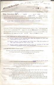
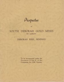
Document - MCCOLL, RANKIN AND STANISTREET COLLECTION: PROSPECTUS OF SOUTH DEBORAH GOLD MINES NL, 1939
McColl Rankin & Stanistreet, Prospectus of South Deborah Gold Mines NL. 5 Copies. A/ Complete with map, application for Shares still intact. Excellent condition. B/ Complete, application detached, excellent condition. C/ Complete, application form detached, excellent condition. D/No map, Application Form still intact. Has been folded down middle. Good condition. E/No map or Application Form, Good condition. Markings/inscriptions: Prospectus of South Deborah Gold Mines No Liability, Deborah Reef, Bendigo. 8 pages.organization, mining, south deborah gold mines nl, mccoll rankin & stanistreet, prospectus of south deborah gold mines nl -
 Bendigo Historical Society Inc.
Map - MAP PORTION OF BENDIGO GOLDFIELD, Circa 1912
Map: Portion of Bendigo Goldfield showing Sheepshead, Deborah, Garden Gully, Paddy's Gully and Derby lines of reef. Showing statistical records of all the Companies on these lines. Issued by Wood and McNair, Sharebrokers, Bendigo and Eaglehawk. The map illustrates the main lines of reef as they appeared with mines and details of their calls and dividends as well as gold produced. Drawn by mining surveyor and geologist William Henry Cundy, who trained and worked for the Tasmanian Mines Department until 1893, when he moved and settled in Bendigo. Cundy was responsible for the surveying of the southern end of the field of Diamond Hill and beyond.topic, mining, companies, bendigo goldfield, sheepshead , deborah, garden gully, paddy's gully derby, wood and mcnair -
 Bendigo Historical Society Inc.
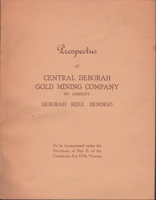
Document - MCCOLL, RANKIN AND STANISTREET COLLECTION: CENTRAL DEBORAH GOLD MINE NL: PROSPECTUS, 1939
Document: McColl, Rankin & Stanistreet Collection: Central Deborah Gold Mine NL - 4 copies of prospectus. Buff covered booklet. Written on front ' Prospectus of Central Deborah Gold Mining Company No Liability Deborah Reef, Bendigo. To be incorporated under the Provisions of Part II of the companies Act 1938. Victoria.' Details capital, proposed directors and manager. Contains map of Central and North Deborah mines and Monument Hill.organization, business, central deborah gold mine, mccoll, rankin & stanistreet collection: central deborah gold mine nl. gold mining -
Bendigo Historical Society Inc.
Archive - MCCOLL, RANKIN AND STANISTREET COLLECTION COLLECTION: CENTRAL NAPOLEON
Mining Box: metal box, painted dark blue, formerly box number 472 - Now Central Napoleon Mining Box 3. Tag affixed to front ' box 472' Printed on door in white paint ' Central Napoleon'. Box contains various documents relating to Central Napoleon Mine. Documents are individually catalogued within box.mining, parish map, mccoll, rankin & stanistreet, mccoll rankin & stanistreet, mining, gold mining, central napoleon -
Bendigo Historical Society Inc.
Archive - MCCOLL, RANKIN AND STANISTREET COLLECTION: CENTRAL DEBORAH MINING BOX
... MINING Parish Map central deborah gold mine McColl Rankin ...Mining Box: metal box, painted dark blue, formerly box number 481 - Now Central Deborah Mining Box 1. Tag affixed to front ' Box 481' Printed on door in white paint ' Central Deborah'. Box contains various documents relating to Central Deborah Mine. Documents are individually catalogued within box.Central Deborah - printed on doormining, parish map, central deborah gold mine, mccoll, rankin and stanistreet, mining, goldmining, central deborah gold mine. -
 Bendigo Historical Society Inc.
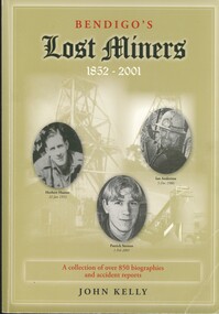
Book - BENDIGO'S LOST MINERS 1852 - 2001, 2008
Bendigo's Lost Miners 1852 - 2001, a collection of over 850 biographies and accident reports with copies of some inquest reports, mine managers reports, applications for graves and other documents with regard to the deaths of men, boys and one woman who were killed in Bendigo's mines from 1852 to 2006. Published by Australian Institute of Genealogical Studies Bendigo area, 381 pages with photographs, illustrations and maps.John Kellybendigo, mining, deaths, bendigo - history - gold mines - bendigo gold miners, mine accidents. -
 Bendigo Historical Society Inc.
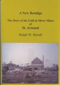
Book - A NEW BENDIGO, THE STORY OF THE GOLD & SILVER MINES OF ST ARNAUD, 2008
A New Bendigo, The Story of the Gold & Silver Mines of St Arnaud. Published by R.W.Birrell, 257 pages with photographs, illustrations & Map. Signed by the Author.Ralph.W.Birrell.book, st arnaud, st arnaud - history, mining - gold & silver. -
 Bendigo Historical Society Inc.
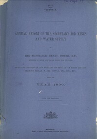
Book - ANNUAL REPORT OF THE SECRETARY FOR MINES AND WATER SUPPLY, c1897
Annual Report Of The Secretary For Mines And Water Supply, Victoria 1896. Publisher: Government Printer, Melbourne. 71 pages. Maps & drawings. Inscriptions: Little 180, see page 59 (cover), A Richardson, 29 Harrison St, Bendigo (1st page).victoria, victorian mining report, mining machinery mine safety mining statistics bendigo mines -
 Bendigo Historical Society Inc.
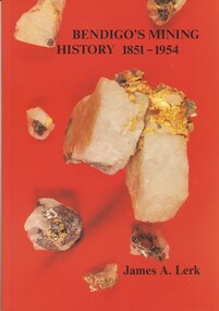
Book - BENDIGOS MINING HISTORY 1851 - 1954, 1991
Bendigos Mining History 1851 - 1954. An overview of some of the trends in mining growth, development and ultimate decline of gold mining in Bendigo. Published by the Bendigo Trust, first edition of 4000 copies, 79 pages with photographs, illustrations & maps plus a newspaper cutting dated 1997.James A Lerk.bendigo, history, gold mining, bendigo - history, gold mining, bendigo gold mines. -
Bendigo Historical Society Inc.
Archive - MCCOLL, RANKIN AND STANISTREET COLLECTION: SOUTH NELL GWYNNE MINE BOX, 1930's
Metal trunk painted dark blue. Formerly box 478. Now South Nell Gwynne Box 8. Tag attached to front 'box 478'. Paper pasted on the front with Sth. Nell Gwynne printed on it. Box contains documents relating to the South Nell Gwynne and are individually catalogued within.Some paint scuffsmining, parish map, mccoll, rankin & stanistreet, south nell gwynne, gold mining, metal box -
Bendigo Historical Society Inc.
Archive - MCCOLL, RANKIN AND STANISTREET COLLECTION: NORTH DEBORAH MINING BOX
Mining Box: metal box, painted dark blue, formerly box number 482 - Now North Deborah Mining Box 7. Tag affixed to front ' box 482' Printed on door in white paint ' North Deborah'. Box contains various documents relating to North Deborah Mine. Documents are individually catalogued within box.mining, parish map, mccoll rankin & stanistreet, mining, gold mining, north deborah -
 Bendigo Historical Society Inc.
Document - MCCOLL, RANKIN AND STANISTREET COLLECTION: CENTRAL NELL GWYNNE, March - April 1943
Document. Manila folder & 4 letters, 1 map The 4 letters pertain to an application by the Commonwealth of Australia to the lands Depart. For sale of an area of 8 acres 0 roods 31 perches now comprising the garden of Fortuna to unlimited depth.McColl, Rankin & Stanistreetorganization, business, central nell gwynne, mccoll, rankin & stanistreet, central nell gwynne gmc, south nell gwynne, gold mining, dept of mines -
 Bendigo Historical Society Inc.
Document - MCCOLL, RANKIN AND STANISTREET COLLECTION: NAPOLEON REEF GOLD MINING CO. N.L, 22 August 1950
Document: 5 Page legal document with map of lease area, Lease No. 11273 Bendigo, Vol.331, Fol. 36453, 15 year lease from 12 December 1949, in vicinity of Inglis, Harvey & Curnow Streets, Signed by Dallas Brooks, Gov of Victoria & J.J. Stanistreet, Mine Manager.organization, business, industrial - mining, mccoll rankin & stanistreet, mining, gold mining, napoleon reef -
Bendigo Historical Society Inc.
Archive - MCCOLL, RANKIN AND STANISTREET COLLECTION: NAPOLEON REEF MINING BOX
Mining Box: metal box, painted dark blue, formerly box number 489 - Now Napoleon Reef Mining Box 5. Tag affixed to front ' box 489' Printed on door in white paint ' Napoleon Reef'. Box contains various documents relating to Napoleon Reef Mine. Documents are individually catalogued within box.mining, parish map, mccoll, rankin & stanistreet, mccoll rankin & stanistreet, mining, gold mining, napoleon reef -
Bendigo Historical Society Inc.
Map - BIG 180 SHAFT POSITION, No date visible
... Bendigo mining plan Mining Gold Mines. Victoria Hill Big 180 Map ...Map: Plan showing the location of various shafts in the Victoria Hill area, hand draughted in pencil. Scale 2 Chains to 1 inchmap, bendigo, mining plan, mining , gold mines. victoria hill, big 180 -
 Bendigo Historical Society Inc.
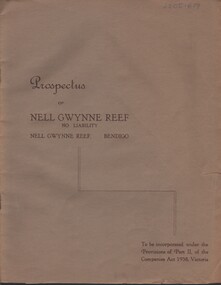
Document - MCCOLL, RANKIN AND STANISTREET COLLECTION: NELL GWYNNE REEF N/L - PROSPECTUS, 1938
Document. Slim, stapled Greybrown book. Nell Gwynne Reef N/L Prospectus. Contains underground maps.McColl, Rankin & Stanistreetorganization, business, nell gwynne reef mine, mccoll, rankin & stanistreet, nell gwynne reef n/l, gold mining, prospectus -
Bendigo Historical Society Inc.
Map - BENDIGO GOLDFIELD, No date visible
... Bendigo mining plan Bendigo Goldfield Gold Mines Mining Map ...Map: Bendigo Goldfield. Scale 20 chains to 1 inch. Printed by Cambridge Press, Bendigo. (number 318 in map cupboard 1)map, bendigo, mining plan, bendigo goldfield, gold mines, mining -
Bendigo Historical Society Inc.
Archive - MCCOLL, RANKIN AND STANISTREET COLLECTION: BLUE MINING BOX - NEW DON MINE
Object: blue metal mining box. 'New Don' printed on front of box in white paint. Box contains documents relating to New Don mine. Tag affixed to front of box, (formerly ) box number 475.mining, parish map, new don, mining, bendigo, gold, gold mining, mccoll, rankin & stanistreet, new don -
Clunes Museum
Map, 1890
Features location of Club Hotel, Union Bank, Engine rooms, Port Phillip Hotel, Pyrites furnace, Battery, Office, Smith Shop,Surface Tramway to BatteryPhotocopy of map/plan of Dixon's New North Clunes, Central Clunes Co. and South Clunes utd showing various shafts and pre-emptive rights. Scale 1 inch = 100 feetOn front in red ink; "drawn in 1890"mine shafts, hotels, plans