Showing 33469 items
matching c.1900s
-
 Eltham District Historical Society Inc
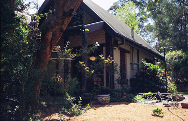
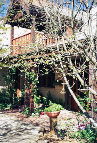
Photograph, Gayle Blackwood, Mudbrick house, Eltham district, c.2002
Roll of 35mm colour negative film, 10 strips Kodak Gold 100-6 Cross Ref: 02061 (print) and 03183 (negative)gayle blackwood collection, houses, mudbrick -
 Eltham District Historical Society Inc
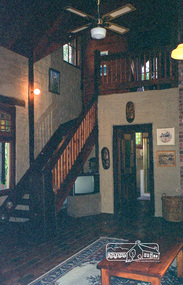
Photograph, Gayle Blackwood, Mudbrick house, Eltham district, c.2002
Roll of 35mm colour negative film, 10 strips Kodak Gold 100-6 Cross Ref: 02061 (print) and 03183 (negative)gayle blackwood collection, houses, mudbrick -
 Eltham District Historical Society Inc
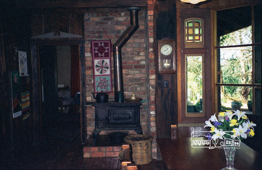
Photograph, Gayle Blackwood, Mudbrick house, Eltham district, c.2002
Roll of 35mm colour negative film, 10 strips Kodak Gold 100-6 Cross Ref: 02061 (print) and 03183 (negative)gayle blackwood collection, houses, mudbrick -
 Eltham District Historical Society Inc
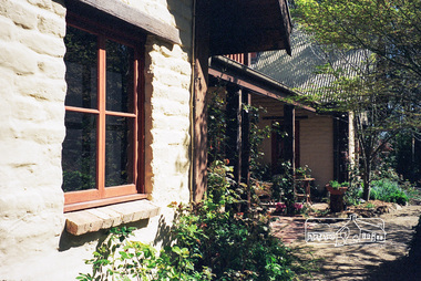
Photograph, Gayle Blackwood, Mudbrick house, Eltham district, c.2002
Roll of 35mm colour negative film, 10 strips Kodak Gold 100-6 Cross Ref: 02061 (print) and 03183 (negative)gayle blackwood collection, houses, mudbrick -
 Eltham District Historical Society Inc
Photograph, Gayle Blackwood, Mudbrick house, Eltham district, c.2002
Roll of 35mm colour negative film, 10 strips Kodak Gold 100-6 Cross Ref: 02061 (print) and 03183 (negative)gayle blackwood collection, houses, mudbrick -
 Eltham District Historical Society Inc
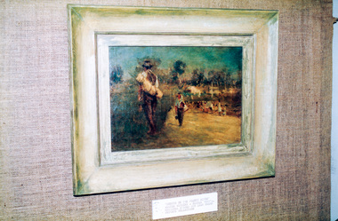
Photograph, Peter Bassett-Smith, Sketch on the Plenty River, Walter Withers (c.1895), 1988
Bicentennial/Heritage Week Display, "The Eltham Tradition", Eltham Shire Office, 17-22 April 1988 Colour photographactivities, eltham shire office, heritage display, heritage week, walter withers -
 Eltham District Historical Society Inc
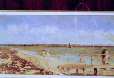
Photograph, Peter Bassett-Smith, Breezy day at Point Henry, near Geelong, Walter Withers (c. 1900), 1988
Bicentennial/Heritage Week Display, "The Eltham Tradition", Eltham Shire Office, 17-22 April 1988 Purchased by the NGV 1958 Colour photographactivities, eltham shire office, heritage display, heritage week, walter withers -
 Eltham District Historical Society Inc
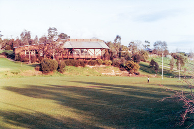
Photograph, Eltham Community Centre, c.1989, 1989c
Colour photographeltham community centre -
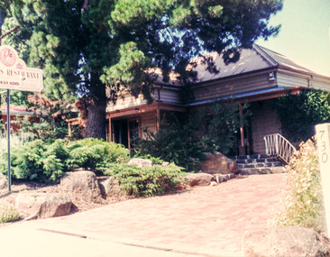 Eltham District Historical Society Inc
Photograph, Nautalus Restaurant, 732 Main Road, Eltham, c.1990, 1990c
Adjacent to Eltham Courthouse, now Mercers RestaurantTwo colour photographseltham, eltham courthouse, main road, mercers restaurant, nautalus restaurant, restaurants -
 Eltham District Historical Society Inc
Photograph, Yings Chinese Restaurant, 561 Main Road, Eltham, c.1990, 1990c
Now the Eltham Teahouse Restaurant, Yings was owned and operated by Phyllis and John Chan. Their daughter, Karmein Chan was abducted from their home in Templestowe on 13 April 1991 whilst her parents were at work and subsequently murdered. The murder remains unsolved. Colour photographrestaurants, eltham teahouse restaurant, yings chinese restaurant -
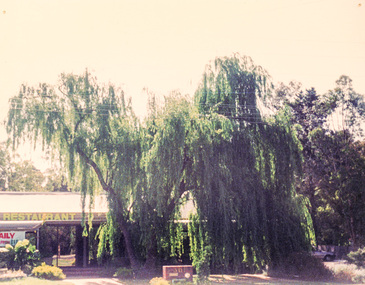
 Eltham District Historical Society Inc
Photograph, Shillinglaw Cottage, c.1990, 1990c
Two colour photographsrestaurants, shillinglaw cottage -
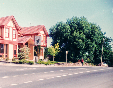 Eltham District Historical Society Inc
Photograph, Eltham Hotel, cnr Pitt Street and Main Road, Eltham, c.1990, 1990c
Colour photographrestaurants, eltham hotel -
 Eltham District Historical Society Inc
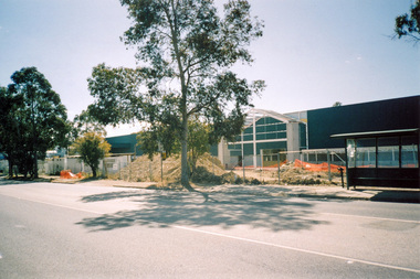
Photograph, Construction of Bunnings store at cnr of Susan and Bridge streets, Eltham c.2007-2008, 2007c
Three colour photographsbridge street, bunnings, construction, industries, susan street -
 Eltham District Historical Society Inc
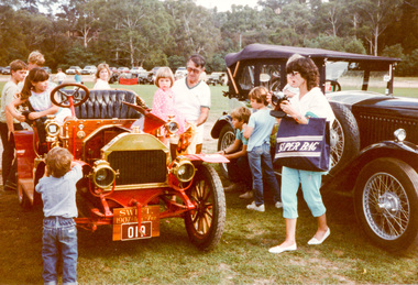
Photograph, Rolls Royce and Bentley Club at Sugarloaf, Christmas Hills, c. May 1986, 1986
Originally contained in a 'magnetic' photo album believed to have been donated by Mr Eric Stephenson, Jingalong, 110 Ryans Road, Eltham, Vic. 3095; relocated to archival safe storage.Seven colour photographscars, rolls royce and bentley club, sugarloaf -
 Eltham District Historical Society Inc
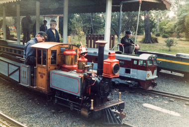
Photograph, Diamond Valley Railway, Eltham Lower Park, c.1990, 1990c
Originally contained in a 'magnetic' photo album believed to have been donated by Mr Eric Stephenson, Jingalong, 110 Ryans Road, Eltham, Vic. 3095; relocated to archival safe storage.Two colour photographseltham lower park, diamond valley railway -
 Eltham District Historical Society Inc
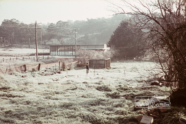
Photograph, Russell Yeoman, Frosty morning, 66 Susan Street, Eltham, c.1965, 1965c
Now the site of the Eltham Skate Park; Susan Street north of Bridge Street has since been renamed as an extension of Brisbane Street.Digital file only; created from original colour positive slide transparencyeltham, streets, susan street, eltham skate park, russell yeoman collection -
 Eltham District Historical Society Inc
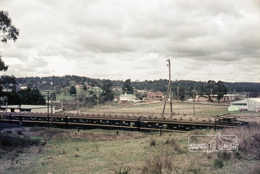
Photograph, Russell Yeoman, Looking south from Swan Street, Eltham, c,1965, 1965c
Train in foreground, Bridge street running parallel to train in background and Brisbane Street obscured by train. Susan Street north of Bridge Street (now Brisbane Street) on left. Vacant block of land is now the site of Bunnings. Presnt day SES building at corner of Susan and Bridge Street can be seen in centre background.The factory in lower left on Brisbane Street is the Sibbel Builders factory of Martin and Herman Sibbel who were ahead of their time with design and prefabricated frames and also built cabinetry in this factory.Digital file only; created from original colour positive slide transparencyeltham, streets, susan street, bridge street, brisbane street, train, bunnings, ses, state emergency service, sibbel builders, martin sibbel, herman sibbel -
 Eltham District Historical Society Inc
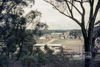
Photograph, Russell Yeoman, Looking south from Swan Street, Eltham, c,1965, 1965c
Shows Susan Street, Brisbane Street and Bridge Street. Large open field in centre now site of Bunnings The factory in lower centre on Brisbane Street is the Sibbel Builders factory of Martin and Herman Sibbel who were ahead of their time with design and prefabricated frames and also built cabinetry in this factory.Digital file only; created from original colour positive slide transparencyeltham, streets, susan street, bridge street, brisbane street, bunnings, ses, state emergency service, herman sibbel, martin sibbel, sibbel builders -
 Eltham District Historical Society Inc
Photograph, Russell Yeoman, Diamond Street near the current entrance of Catholic Ladies College, Eltham, c.1965, 1965c
Digital file only; created from original colour positive slide transparencyeltham, streets, diamond street, catholic ladies college, russell yeoman collection -
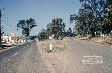
 Eltham District Historical Society Inc
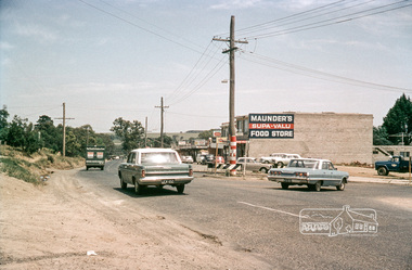
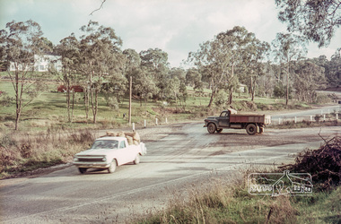
Photograph, Intersection of Para Road with Main Road, Lower Plenty, c.1965, 1965c
Digital file only; created from original colour positive slide transparencystreets, lower plenty, main road, para road, shops, maunder's food store, russell yeoman collection, shoe inn, maunder's food store -
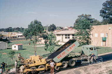 Eltham District Historical Society Inc
Photograph, Russell Yeoman, Asphalting Eltham Shire Office driveway at 895 Main Road, Eltham, c.1966, 1966c
This is now known as Library Place following the demolition of the Shire Offices in August 1996. The Eltham Senior Citizens Club building where EDHS holds its meetings is located to the left of the driveway where the grass is.Digital file only; created from original colour positive slide transparencystreets, main road, eltham shire office, library place, russell yeoman collection -
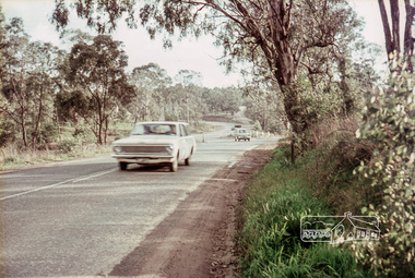
 Eltham District Historical Society Inc
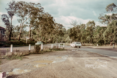
Photograph, Russell Yeoman, Intersection of Old Eltham Road at Main Road, Lower Plenty, c.1965, 1968
Digital file only; created from original colour positive slide transparencystreets, main road, lower plenty, old eltham road, russell yeoman collection -
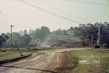 Eltham District Historical Society Inc
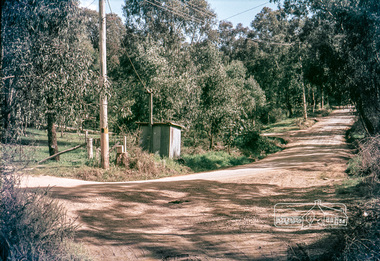
Photograph, Russell Yeoman, Para Road, c.1969, 1969c
Looking north from behind the Lower Plenty shops at Main Road and Para Road.Digital file only; created from original colour positive slide transparencystreets, lower plenty, para road, russell yeoman collection -
 Eltham District Historical Society Inc
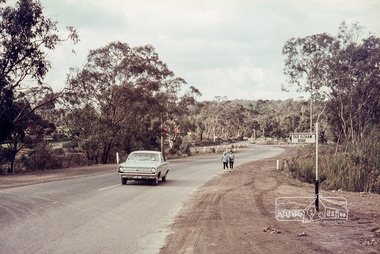
Photograph, Russell Yeoman, Intersection of Fitzsimons Lane with Main Road, Eltham, c.1969, 1969c
Digital file only; created from original colour positive slide transparencystreets, eltham, main road, fitzsimons lane, russell yeoman collection -
 Eltham District Historical Society Inc
Photograph, Russell Yeoman, Intersection of Fitzsimons Lane with Main Road, Eltham, c.1969, 1969c
Viewed from what is now the Caltex Service Station; visible in background are houses along Jayson AvenueDigital file only; created from original colour positive slide transparencystreets, eltham, main road, jayson avenue, houses, fitzsimons lane, russell yeoman collection -
 Eltham District Historical Society Inc
Photograph, Russell Yeoman, Intersection of Fitzsimons Lane with Main Road, Eltham, c.1969, 1969c
Digital file only; created from original colour positive slide transparencystreets, eltham, main road, fitzsimons lane, russell yeoman collection -
 Eltham District Historical Society Inc
Photograph, Russell Yeoman, Intersection of Fitzsimons Lane with Main Road, Eltham, c.1969, 1969c
Shows intersection of Old Eltham RoadDigital file only; created from original colour positive slide transparencystreets, eltham, main road, fitzsimons lane, old eltham road -
 Eltham District Historical Society Inc
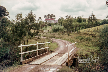
Photograph, Russell Yeoman, Long Gully Road Bridge over Long Gully at Panton Hill, c.1970, 1970c
The house on the hill burnt down in 1977Digital file only; created from original colour positive slide transparencystreets, panton hill, long gully, long gully road, bridge, russell yeoman collection -
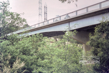 Eltham District Historical Society Inc
Photograph, Russell Yeoman, Fitzsimons Lane Bridge, c.1970, 1970c
New Fitzsimons Lane Bridge prior to duplicationDigital file only; created from original colour positive slide transparencystreets, eltham, bridge, fitzsimons lane bridge, fitzsimons lane, russell yeoman collection -
 Eltham District Historical Society Inc
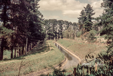
Photograph, Russell Yeoman, Maroondah Aqueduct, Research, c.1979, 1979c
Looking west, The Esplanade to the right and Ingrams Road Bridge in centre distance. Digital file only; created from original colour positive slide transparencymaroondah aqueduct, research (vic.), ingrams road, the esplanade, russell yeoman collection