Showing 9466 items
matching film
-
 Eltham District Historical Society Inc
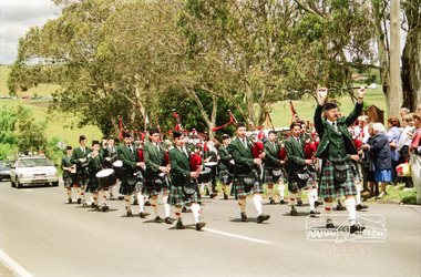
Photograph, St Andrews Primary School, Eltham Heritage Tour, 24 May 1992, 24/05/1992
ELTHAM HERITAGE TOUR The Society excursion on 24th May 1992 was arranged by David Bick, leader of the team carrying out the Shire's heritage study. David selected a number of sites or buildings identified in the study, some of them lesser known components of the Shire's heritage. The tour commenced at the Eltham Shire Office at 10.00 am. Travel was by private car and mini-bus with stops at about twelve locations for commentary by David.It included a short walk in Hurstbridge and lunch at Kinglake. Highlights of the tour included: - 10 am Leave from Shire Offices - 3 Important Trees - A Physical Link to Eltham's First Settlers - Toorak Mansion Gates - A Surviving Farm House - An Intact Circa 1900 Main Street - First Settlers - Gold Miners, and Timber-getters - An Early Hotel - A Pioneering Homestead - Changing Eltham Shire - 20th Century - 4 pm Afternoon Tea and Finish Tour Extract from ELTHAM CULTURAL HERITAGE TOUR (Newsletter No. 85, July 1992, by Bettina Woodburn) "At St Andrews we noted the old and new schools, the Anglican Church, the Hall, the Bakery and the pub – still a popular watering and eating place. Climbing towards Panton Hill the soil was not rich and supported only scarce growth. Perfunctory prospecting and mining had taken place in this area, though not with the diligence applied at Research. Again we saw the ingredients of a settlement, this one organised by Government, the Hotel, the Store, the School. Down from Memorial Park the School grounds had original tree planting and the School Bell dedicated to Maud Rattray who died in 1922. There is a new Hall and opposite in the grounds of the Church and Sunday School a modest Memorial Cross of granite with inscriptions and in memory of four 'fallen comrades'. This small section of the main road retained the small village atmosphere; although the population had increased there had been little alteration."Record of the Society's history and activities and highlighting various aspects of the Heritage Study undertaken by David Bick used to create the future heritage overlay for the Shire of Eltham and later Nillumbik Shire.Roll of 35mm colour negative film, 4 stripsKodak Gold 100 5095shire of eltham historical society, activities, heritage tour, st andrews -
 Eltham District Historical Society Inc
Photograph, Kangaroo Ground War Memorial, Eltham Heritage Tour, 24 May 1992, 24/05/1992
ELTHAM HERITAGE TOUR The Society excursion on 24th May 1992 was arranged by David Bick, leader of the team carrying out the Shire's heritage study. David selected a number of sites or buildings identified in the study, some of them lesser known components of the Shire's heritage. The tour commenced at the Eltham Shire Office at 10.00 am. Travel was by private car and mini-bus with stops at about twelve locations for commentary by David.It included a short walk in Hurstbridge and lunch at Kinglake. Highlights of the tour included: - 10 am Leave from Shire Offices - 3 Important Trees - A Physical Link to Eltham's First Settlers - Toorak Mansion Gates - A Surviving Farm House - An Intact Circa 1900 Main Street - First Settlers - Gold Miners, and Timber-getters - An Early Hotel - A Pioneering Homestead - Changing Eltham Shire - 20th Century - 4 pm Afternoon Tea and Finish Tour Extract from ELTHAM CULTURAL HERITAGE TOUR (Newsletter No. 85, July 1992, by Bettina Woodburn) "Now we drove through stands of pines to the Kangaroo Ground Lookout Tower, a most unusual War Memorial, World War I. The tower and a shed/residence (it had a chimney) were built from local sandstone. Below to the south and east of Melbourne spread 'suburbia'. Close by the landscape seemed so contrived - English fields and hedgerows! Although only about twenty inches deep, the soil of this ancient volcano, its crater lost under subsequent weathering, was rich, deserving the name of "Garden Hill". Now native trees are taking over again. In Kangaroo Ground itself stand the inevitable Store, School and Church - and two Norfolk pines and a monkey puzzle tree."Record of the Society's history and activities and highlighting various aspects of the Heritage Study undertaken by David Bick used to create the future heritage overlay for the Shire of Eltham and later Nillumbik Shire.Roll of 35mm colour negative film, 4 stripsKodak Gold 100 5095shire of eltham historical society, activities, heritage tour, kangaroo ground, kangaroo ground tower, war memorials, kangaroo ground memorial -
 Eltham District Historical Society Inc
Photograph, 35 Ingrams Road, Research, Eltham Heritage Tour, 24 May 1992, 24/05/1992
ELTHAM HERITAGE TOUR The Society excursion on 24th May 1992 was arranged by David Bick, leader of the team carrying out the Shire's heritage study. David selected a number of sites or buildings identified in the study, some of them lesser known components of the Shire's heritage. The tour commenced at the Eltham Shire Office at 10.00 am. Travel was by private car and mini-bus with stops at about twelve locations for commentary by David.It included a short walk in Hurstbridge and lunch at Kinglake. Highlights of the tour included: - 10 am Leave from Shire Offices - 3 Important Trees - A Physical Link to Eltham's First Settlers - Toorak Mansion Gates - A Surviving Farm House - An Intact Circa 1900 Main Street - First Settlers - Gold Miners, and Timber-getters - An Early Hotel - A Pioneering Homestead - Changing Eltham Shire - 20th Century - 4 pm Afternoon Tea and Finish Tour Extract from ELTHAM CULTURAL HERITAGE TOUR (Newsletter No. 85, July 1992, by Bettina Woodburn) "On a right-angle turning of the Eltham Road is Wellers Pub, a Cobb & Co. coaching stop on the way to distant gold-fields and places north of the Yarra River. The Hotel dates from the 1870's. Daily distances for a bullock team was eight miles, horses could do double that distance. We turned into Cassells Road and on the corner of Ingrams Road we admired an elaborate Edwardian villa, 1900 style. The Aqueduct conveying Melbourne's water supply was a communication line and a technological advance in 1891. It has been enlarged and re-faced and no longer used here but piped underground. Proclaimed a linear park it has reverted to crown land, controlled by local Council. Maroondah Dam was constructed in. 1920 to replace the original weir and at that time: the Aqueduct - as established into the landscape - with bridges and tunnels and pine trees were used to stop rubbish polluting the water."Record of the Society's history and activities and highlighting various aspects of the Heritage Study undertaken by David Bick used to create the future heritage overlay for the Shire of Eltham and later Nillumbik Shire.Roll of 35mm colour negative film, 4 stripsKodak Gold 100 5095shire of eltham historical society, activities, heritage tour, ingrams road, research (vic.) -
 Eltham District Historical Society Inc
Photograph, Woodburn residence, mudbrick adobe (1949), Eltham Heritage Tour, 24 May 1992, 24/05/1992
ELTHAM HERITAGE TOUR The Society excursion on 24th May 1992 was arranged by David Bick, leader of the team carrying out the Shire's heritage study. David selected a number of sites or buildings identified in the study, some of them lesser known components of the Shire's heritage. The tour commenced at the Eltham Shire Office at 10.00 am. Travel was by private car and mini-bus with stops at about twelve locations for commentary by David.It included a short walk in Hurstbridge and lunch at Kinglake. Highlights of the tour included: - 10 am Leave from Shire Offices - 3 Important Trees - A Physical Link to Eltham's First Settlers - Toorak Mansion Gates - A Surviving Farm House - An Intact Circa 1900 Main Street - First Settlers - Gold Miners, and Timber-getters - An Early Hotel - A Pioneering Homestead - Changing Eltham Shire - 20th Century - 4 pm Afternoon Tea and Finish Tour Extract from ELTHAM CULTURAL HERITAGE TOUR (Newsletter No. 85, July 1992, by Bettina Woodburn) "In some respects Eltham is a 'back-water' and it has its own distinctive flavour. On the outskirts the homes date from the 1960's, 70's and 80s with a sprinkling of 'earth homes', mud-brick or pise, rammed dirt. Crossing Main Road into Beddoe Street and Thompson Crescent a very pleasant drive past pines and old fence lines, front lawns unfenced, the occasional ·old farm building, we eventually looked down on a huge circular roof of a 1992 adobe home. Other distinctive places included the Pauline Toner Butterfly Reserve, Gordon Ford's splendid garden at Fulling in Pitt Street, cypress hedges and old houses in Bridge Street and in every direction Eltham's special feature - a totally treed horizon. We were now in the part of the Shire closest to Melbourne - Montmorency - not on the way to anywhere, with no through road going across it, developed in the 1950's and 1960's with conventional gardens, now converted to native plants. The rail looped between Greensborough and Eltham and a shopping street (Were Street) served the area, growing up the hill from the station. It was a typical outer Melbourne suburb with lawns and roses with patches of originality. The shopping precinct still has 1950 characteristics - walls which sloped back, projecting roofs, the original shop fronts are nearly all tiled below the old windows. There's an air of past times about the School, the Dairy, the Butcher's (now a milk bar) and the Castlemaine stone face of the Commonwealth Bank. The final stop for the tour was at the mud-brick Woodburn residence, adobe of 1949 with additions. After War Service, Bill Woodburn had commenced an Architecture course at Melbourne University and after second year in the Christmas vacation, with his wife, Betti, built the two bedroom house - with amazing saving of costs. In the three and a half months they made over 3000 bricks (external walls 18" x 12" x 4", internal walls 12" x 9" x 4"), sifted top soil for mortar and laid them, on concrete foundations and slab floor, made all the structural window frames, door frames and roof members to carry 'super six' asbestos sheets, laboured for the electrician and plumber, did all the glazing and, still without electricity, moved in in March 1949. Rooms have been added, at first with glass walls, later using concrete blocks, to accommodate three daughters and a son. The house not only grew from the earth, but also with the family."Record of the Society's history and activities and highlighting various aspects of the Heritage Study undertaken by David Bick used to create the future heritage overlay for the Shire of Eltham and later Nillumbik Shire.Roll of 35mm colour negative film, 4 stripsKodak Gold 100 5095shire of eltham historical society, activities, heritage tour, woodburn house -
 Eltham District Historical Society Inc
Photograph, Opening of Andrew Ross Museum, Kangaroo Ground, 20 Nov 1994, 20/11/1994
In 1992 Shire of Eltham Historical Society member and Kangaroo Ground resident, Bruce Ness became aware that the old school teacher residence at Kangaroo Ground School was no longer being used. Over the years Bruce had been storing a growing collection of the Society's artifacts and objects including various machinery and farm tools. He proposed that this might present an opportunity to set up a museum with the Society's objects. It was proposed that a board be appointed containing representatives of the Society, the School Council, Shire of Eltham and "Friends of the Andrew Ross Museum." As a consequence, most of the Society's objects were transferred to the museum and the Society became more focused on documents, maps and photographs, etc.Roll of 35mm colour negative film, 3 stripsFuji 100shire of eltham historical society -
 Eltham District Historical Society Inc
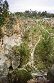
Photograph, Balaclava Open Cut Mine near Whroo Historic Reserve; 9 Oct 1994, 20/11/1994
Whroo Historic Reserve contains a number of interesting features relating to the former township and gold workings.Record of the Society's history of activities - Spring 1994 excursionRoll of 35mm colour negative film, 4 stripsKodak Gold 100-4shire of eltham historical society, activities, whroo, balaclava hill, balaclava mine, gold mining, whroo historic reserve -
 Eltham District Historical Society Inc
Photograph, Whroo Historical Area; 9 Oct 1994, 20/11/1994
Whroo Historic Reserve contains a number of interesting features relating to the former township and gold workings.Record of the Society's history of activities - Spring 1994 excursionRoll of 35mm colour negative film, 4 stripsKodak Gold 100-4shire of eltham historical society, activities, whroo, balaclava hill, balaclava mine, gold mining, whroo historic reserve -
 Eltham District Historical Society Inc
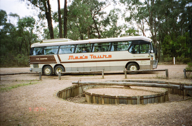
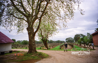
Photograph, Chateau Tahbilk Winery; 9 Oct 1994, 20/11/1994
Brief visit of the Major Mitchell Trail. This car based trail follows the route of the famous explorer right across Victoria. It crosses the Goulbum River near Chateau Tahbilk and Mitchelton Wineries and passes through Nagambie.Record of the Society's history of activities - Spring 1994 excursionRoll of 35mm colour negative film, 4 stripsKodak Gold 100-4shire of eltham historical society, activities, chateau tahbilk winery, major mitchell trail -
 Eltham District Historical Society Inc
Photograph, Upper Yarra Dam, Spring Tour, 22 Oct 1995, 22/10/1995
EXPLORING THE UPPER YARRA (Newsletter No. 105, November 1995, by Bettina Woodburn) We enjoyed the Spring Excursion, this year "Exploring the Upper Yarra" - in spite of the constant rain and the countryside under the cloud cover, especially in the valleys, being mainly shiny shades of green. The occasional fields of buttercups, clumps of arum lilies and splendid rhododendron and other flowering bushes became very special. The Cobb and Co coach was warm and a cosy retreat as we zig-zagged on the highways and byways to glimpse the Yarra River, upstream and down, its secret places, and particularly the many bridges. Russell excelled as 'Poet Laureate', reading from Dacre Smyth's book. This 1979 publication includes paintings of all the bridges along the river with poems and brief descriptions of each one. Some of the bridges are in out of the way places and are not very well known. We looked forward to hearing the poetry as much as seeing the ' constructions'…Big Pat (was he short or tall, lean or fat? He did win the two hundred pound reward for discovering gold and had the creek named after him), about the 'Eddies'?, and the disliked 'meccano' bridge in Warburton, etc. etc. The hot roast lunch in the old Reefton Hotel was also most welcome. It was easy to imagine it peopled by miners and early settlers. Starting by crossing the new (1974) concrete bridge at Warrandyte we headed through Wonga Park with views to the Christmas Hills and to the escarpment of the Yering Gorge, which causes flood waters to back up through the Yarra Glen plain, so avoiding disasters downstream. At the end of a long driveway we found the wooden, privately owned Henley Bridge (1935 after the 1934 floods). This facilitates access to different parts of Henley Farm and to Lilydale. Everard Park, named after Blanche Shallard's father, a State Member for 17 years, below the Highway Yarra crossing was in need of care. It is 10 miles from Yarra Glen by road but, as "Yarra Marra” canoeists well know, 32 winding miles down by water. After more delightful countryside scenes we joined the Warburton Highway at Woori Yallock. From the old Railway Station at Launching Place the Centennial Trail for walkers, cyclists and ' horse riders has replaced the rails. The line from Lilydale was opened in 1901, and the last diesel freight train ran to Warburton in 1965. It continued to rain as we had morning tea in Warburton in a shelter between footbridges. From here we continued upstream past the Bridge to O'Shannasy Lodge and Reservoir, Starvation Creek, and the Peninsular tunnel (miners dug it as at Pound Bend) which we visited (scrambling down those steps!) on our return after lunch. Our furthermost point was the Upper Yarra Dam Reserve (and vast catchment area). Finished in 1957 after ten years work and 100 years after Yan Yean, it supplies much of Melbourne's water. After crossing the 30m Launching Place Bridge to the Eltham side of the Yarra and Healesville, we saw in the distance the Yarra Glen Timber Trestle Bridge over the river flats "the longest for years in the land it was said!" Harry's dream of "better weather over the Divide" unfortunately didn't come true, but I'm sure we 36 members will retain happy memories of a day that was wet and green and filled with Bridges. Bettina Woodburn - October 1995 Record of the Society's history of activities - Spring 1995 excursionRoll of 35mm colour negative film, 3 stripsKodak Gold 200-4shire of eltham historical society, activities, upper yarra dam, henley bridge -
 Eltham District Historical Society Inc
Photograph, Upper Yarra Dam, Spring Tour, 22 Oct 1995, 22/10/1995
EXPLORING THE UPPER YARRA (Newsletter No. 105, November 1995, by Bettina Woodburn) We enjoyed the Spring Excursion, this year "Exploring the Upper Yarra" - in spite of the constant rain and the countryside under the cloud cover, especially in the valleys, being mainly shiny shades of green. The occasional fields of buttercups, clumps of arum lilies and splendid rhododendron and other flowering bushes became very special. The Cobb and Co coach was warm and a cosy retreat as we zig-zagged on the highways and byways to glimpse the Yarra River, upstream and down, its secret places, and particularly the many bridges. Russell excelled as 'Poet Laureate', reading from Dacre Smyth's book. This 1979 publication includes paintings of all the bridges along the river with poems and brief descriptions of each one. Some of the bridges are in out of the way places and are not very well known. We looked forward to hearing the poetry as much as seeing the ' constructions'…Big Pat (was he short or tall, lean or fat? He did win the two hundred pound reward for discovering gold and had the creek named after him), about the 'Eddies'?, and the disliked 'meccano' bridge in Warburton, etc. etc. The hot roast lunch in the old Reefton Hotel was also most welcome. It was easy to imagine it peopled by miners and early settlers. Starting by crossing the new (1974) concrete bridge at Warrandyte we headed through Wonga Park with views to the Christmas Hills and to the escarpment of the Yering Gorge, which causes flood waters to back up through the Yarra Glen plain, so avoiding disasters downstream. At the end of a long driveway we found the wooden, privately owned Henley Bridge (1935 after the 1934 floods). This facilitates access to different parts of Henley Farm and to Lilydale. Everard Park, named after Blanche Shallard's father, a State Member for 17 years, below the Highway Yarra crossing was in need of care. It is 10 miles from Yarra Glen by road but, as "Yarra Marra” canoeists well know, 32 winding miles down by water. After more delightful countryside scenes we joined the Warburton Highway at Woori Yallock. From the old Railway Station at Launching Place the Centennial Trail for walkers, cyclists and ' horse riders has replaced the rails. The line from Lilydale was opened in 1901, and the last diesel freight train ran to Warburton in 1965. It continued to rain as we had morning tea in Warburton in a shelter between footbridges. From here we continued upstream past the Bridge to O'Shannasy Lodge and Reservoir, Starvation Creek, and the Peninsular tunnel (miners dug it as at Pound Bend) which we visited (scrambling down those steps!) on our return after lunch. Our furthermost point was the Upper Yarra Dam Reserve (and vast catchment area). Finished in 1957 after ten years work and 100 years after Yan Yean, it supplies much of Melbourne's water. After crossing the 30m Launching Place Bridge to the Eltham side of the Yarra and Healesville, we saw in the distance the Yarra Glen Timber Trestle Bridge over the river flats "the longest for years in the land it was said!" Harry's dream of "better weather over the Divide" unfortunately didn't come true, but I'm sure we 36 members will retain happy memories of a day that was wet and green and filled with Bridges. Bettina Woodburn - October 1995 Record of the Society's history of activities - Spring 1995 excursionRoll of 35mm colour negative film, 2 stripsKodak Gold 100-4shire of eltham historical society, activities, upper yarra dam, henley bridge -
 Eltham District Historical Society Inc
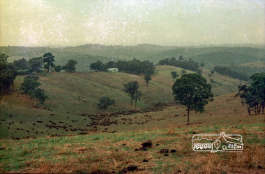
Photograph, Possibly the Bassett-Smith property at Menzies Road, Kangaroo Ground, c.1980, 1980c
Record of the Society's history of activities - The Society members would have picnics on the Bassett-Smith propertyRoll of 35mm colour negative film, 4 stripsKodacolor IIshire of eltham historical society, activities, kangaroo ground, bassett-smith -
 Eltham District Historical Society Inc
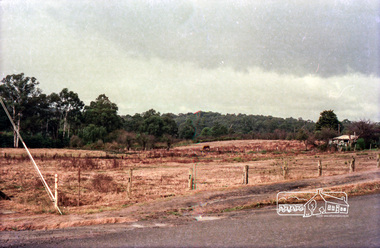
Photograph, Site of the future Eltham Leisure Centre built 1981, bounded by Brougham St, Susan Street and Withers Way, c.1980, 1980c
Fabbro's farm on Bell Street to the left of frame 11Roll of 35mm colour negative film, 4 stripsKodacolor IIsusan street, fabbro's farm, eltham leisure centre, brougham street, bell street -
 Eltham District Historical Society Inc
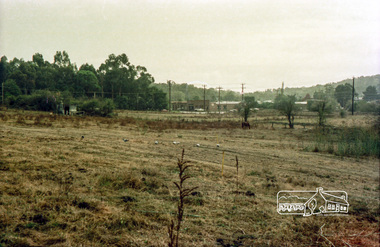
Photograph, Looking northwest to corner of Susan and Brougham Streets, Eltham, c.1980, 1980c
In the foreground is the site of the current Leisure Centre built 1981 and in the background the current site of Eltham Crash RepairRecord of the Society's history of activities - The Society members would have picnics on the Bassett-Smith propertyRoll of 35mm colour negative film, 4 stripsKodacolor IIsusan street, fabbro's farm, eltham leisure centre, brougham street, bell street -
 Eltham District Historical Society Inc
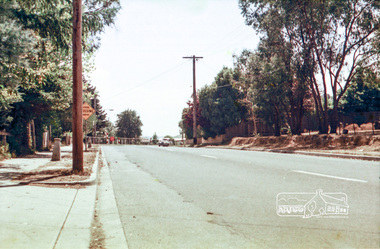
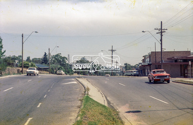
Photograph, Mountain View Road, Briar Hill, c.1976, 1976c
Taken opposite No., 140Streetscape development over timeRoll of 35mm colour negative film, 2 stripsAgfa CN S602mountain view road, briar hill -
 Eltham District Historical Society Inc
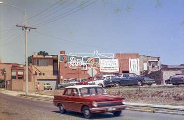
Photograph, Rear view of Lower Plenty shops from Para Road, c.1976, 1976c
Streetscape development over timeRoll of 35mm colour negative film, 2 stripsAgfa CNSpara road, lower plenty, shops, shoe inn, maunder's food store -
 Eltham District Historical Society Inc
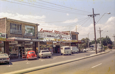
Photograph, Lower Plenty shops, Main Road, c.1976, 1976c
Streetscape development over timeRoll of 35mm colour negative film, 2 stripsAgfa CNSlower plenty, shops, main road, shoe inn, maunder's food store -
 Eltham District Historical Society Inc
Photograph, Para Road and Main Road, Lower Plenty, c.1976, 1976c
Streetscape development over timeRoll of 35mm colour negative film, 2 stripsAgfa CNSpara road, lower plenty, shops, main road, shoe inn, maunder's food store -
 Eltham District Historical Society Inc
Photograph, Eltham RSL and Uniting Church, Main Road, Eltham, c.1979, 1979c
Changing streetscape - RSL branch merged with Montmorency. Land sold and since developed into units.Roll of 35mm colour negative film, 6 stripsUnidentified; half-frame numberingmonuments, church, eltham rsl sub-branch, eltham uniting church, main road -
 Eltham District Historical Society Inc
Photograph, Eltham RSL and Uniting Church, cnr John Street and Main Road, Eltham, c.1979, 1979c
Changing streetscape - RSL branch merged with Montmorency. Land sold and since developed into units.Roll of 35mm colour negative film, 6 stripsUnidentified; half-frame numberingmonuments, church, eltham rsl sub-branch, eltham uniting church, main road, john street -
 Eltham District Historical Society Inc
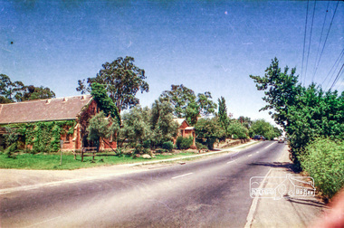
Photograph, Eltham RSL and Uniting Church, looking from cnr of Pitt Street and Main Road, Eltham, c.1979, 1979c
Changing streetscape - RSL branch merged with Montmorency. Land sold and since developed into units.Roll of 35mm colour negative film, 6 stripsUnidentified; half-frame numberingmonuments, church, eltham rsl sub-branch, eltham uniting church, main road, pitt street, eltham community centre -
 Eltham District Historical Society Inc
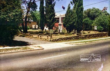
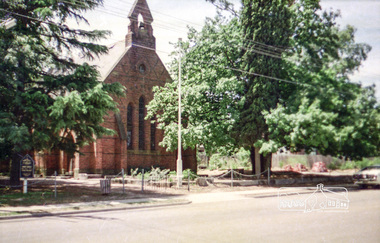
Photograph, St Margaret's Anglican Church, Pitt Street, Eltham, c.1979, 1979c
Changing streetscapeRoll of 35mm colour negative film, 6 stripsUnidentified; half-frame numberingchurch, pitt street, st margaret's anglican church -
 Eltham District Historical Society Inc
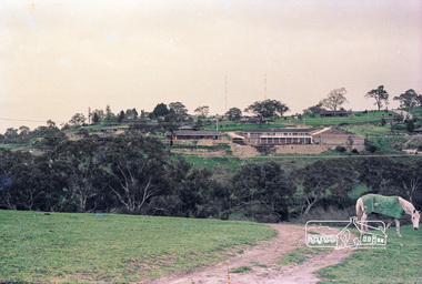
Photograph, Believed to be in the region of Cleveland Avenue, Lower Plenty, c.1980s, 1980s
Roll of 35mm colour negative film, 3 stripsKodacolor IIlower plenty, radio transmission tower, cleveland avenue -
 Eltham District Historical Society Inc
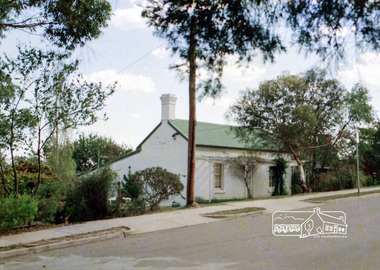
Photograph, Stebbing's Cottage (c.1860s), 88 Pitt St, Eltham, built by George Stebbing
Roll of 35mm colour negative film, 3 stripsFuji 100george stebbing, stebbing's cottage, pitt street, eltham -
 Eltham District Historical Society Inc
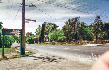
Photograph, Eltham Community Centre, Pitt Street, Eltham
Roll of 35mm colour negative film, 3 stripsFuji 100pitt street, eltham, eltham community centre -
 Eltham District Historical Society Inc
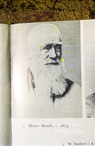
Photograph, Henry Dendy, c.1875
Roll of 35mm colour negative film, 3 stripsFuji 100henry dendy -
 Eltham District Historical Society Inc
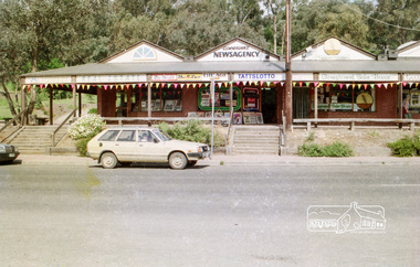
Photograph, Hurstbridge shops, Heidelberg-Kinglake Road, c.1989, 1989c
Streetscape evolutionRoll of 35mm colour negative film, 6 stripsFuji 200Ahurstbridge, shops, corrigan's newsagency, jowett real estate, heidelberg-kinglake road, stoneground bake house -
 Eltham District Historical Society Inc
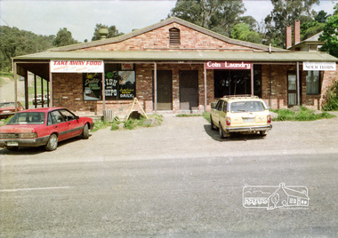
Photograph, Hurstbridge shops, cnr of Heidelberg-Kinglake Road and Parker Road, c.1989, 1989c
Streetscape evolutionRoll of 35mm colour negative film, 6 stripsFuji 200Ahurstbridge, shops, heidelberg-kinglake road, parker road, coin laundry, ian mccubbin and associates solicitors, naomi's nook, take away food -
 Eltham District Historical Society Inc
Photograph, Mannish Road, Wattle Glen, c.1989, 1989c
Streetscape evolutionRoll of 35mm colour negative film, 6 stripsFuji 200Awattle glen, mannish road, houses, streets -
 Eltham District Historical Society Inc
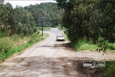
Photograph, Looking west along Mannish Road to the Heidelberg-Kinglake Road and beyond to the railway crossing on Wilson Road, Wattle Glen, c.1989, 1989c
Streetscape evolutionRoll of 35mm colour negative film, 6 stripsFuji 200Awattle glen, mannish road, houses, streets, wilson road, railway crossing, railway line -
 Eltham District Historical Society Inc
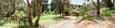
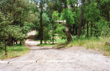
Photograph, 5 Mannish Road, Wattle Glen, c.1989, 1989c
Streetscape evolutionRoll of 35mm colour negative film, 6 stripsFuji 200Awattle glen, mannish road, houses, streets