Showing 11106 items
matching planning
-
 Bacchus Marsh & District Historical Society
Map, Gorrockburkchap Parish Map, County of Grant c.1906
The parish of Gorrockburkchap (sometimes spelled Gorrockburkghap) lies to the west and south west of the township of Bacchus Marsh. The locality of Rowsley is situated within this parish area.A single page paper map showing the parish plan for Gorrockburkchap in the County of Grant. A cadastral map showing parish boundaries and land ownership The map is pasted into a bound volume containing 76 maps or plans in total. High resolution digital image stored on BMDHS computer network. gorrockburkchap parish maps, rowsley victoria maps, bacchus marsh region parish plans -
 Bendigo Historical Society Inc.
Document - LANDS OFFICE: DISTRICT SURVEYORS SANDHURST INDEX OF PLANS, no date probably 19C
Document: dark green hard cover journal with buff spine and corners. Index in front A - Z. 400 pages, pages not indexed but numbered. Index lists places of various districts e.g. Bridgewater on page 7. Plan details give allotments, parish, sections, plan number.Lands Officelands office, index of plans, plans, bendigo -
 University of Melbourne, Burnley Campus Archives
Plan - Photocopy, Horticultural Society of Victoria's Experimental Gardens, 1888, 1888
Photocopy of Plan of Richmond stretching N past Barkers Rd., W to Stawell St. E past Power St and S below Richmond Park - takes in loop in river around the Horticultural Society's Garden and Richmond Park. This plan was used in the Burnley College Centenary display. richmond, parks, centenary, experimental gardens, hoticultural society of victoria -
Clunes Museum
Plan - TITLE PLAN, DEPARTMENT OF LANDS AND SURVEY, PARISH OF CLUNES - COUNTY OF TALBOT, 1959
.1 1 PAGE PLAN LISTING TITLES FOR THE PARISH OF CLUNES 1959 (3 COPIES) SHEET 1 SCALE: 1 INCH TO 40 CHAINS .2 1 PAGE PLAN LISTING TITLES FOR THE PARISH OF CLUNES 1959 SHEET 2 SCALE: 1 INCH TO 2 CHAINSBY AUTHORITY A C BROOKS GOVT. PRINTER, MELBOURNE PARISH OF CLUNESparish of clunes, title plans clunes -
 Kew Historical Society Inc
Plan - Subdivision Plan, Jas R Mathers Son & McMillan, The Dale Estate, Deepdene, 1918
Pru Sanderson, in her groundbreaking ‘City of Kew Urban Conservation Study : Volume 2 - Development History’ (1988), summarised the periods of urban development and subdivisions of land in Kew. The periods that she identified included 1845-1880, 1880-1893, 1893-1921, 1921-1933, 1933-1943, and Post-War Development. These periods were selected as they represented periods of rapid growth or decline in urban development. An obvious starting point for Sanderson’s groupings involved population growth and the associated economic cycles. These cycles also highlighted urban expansion onto land that was predominantly rural, although in other cases it represented the decline and breakup of large estates. A number of the plans in the Kew Historical Society’s collection can also be found in other collections, such as those of the State Library of Victoria and the Boroondara Library Service. A number are however unique to the collection.The Kew Historical Society collection includes almost 100 subdivision plans pertaining to suburbs of the City of Melbourne. Most of these are of Kew, Kew East or Studley Park, although a smaller number are plans of Camberwell, Deepdene, Balwyn and Hawthorn. It is believed that the majority of the plans were gifted to the Society by persons connected with the real estate firm - J. R. Mathers and McMillan, 136 Cotham Road, Kew. The Plans in the collection are rarely in pristine form, being working plans on which the agent would write notes and record lots sold and the prices of these. The subdivision plans are historically significant examples of the growth of urban Melbourne from the beginning of the 20th Century up until the 1980s. A number of the plans are double-sided and often include a photograph on the reverse. A number of the latter are by noted photographers such as J.E. Barnes.The Dale Estate in Deepdene was made possible by the death of Robert Sparrow Smythe, Australian journalist, newspaper editor/owner and theatrical manager. Smythe lived in his residence ‘Highate’, Deepdene until his death in 1917. In the subdivision proposed one year later, before the end of the First World War, 18 allotments were to be created. The very fragmentary plan in the Society’s collection notes that a large weatherboard [house] will need to be removed. This may be Smythe’s own home. The proposed subdivision included allotments facing Burke and Whitehorse Roads and Dale Street. Bordering the subdivision is the Deepdene Station and the Outer Circle Railway Line. The clear directions on the plan indicate that in 1918 it was possible to travel by train from Deepdene to East Camberwell and Ashburtonsubdivision plans - deepdene, the dale estate -
 Warrnambool and District Historical Society Inc.
Letter book 15, 1920s
This letter book contains letters, sketch maps and plans and dates from 1929 to 1934. It came from the office of John William Crawley Junior, an engineer, surveyor, and architect in private practice in Warrnambool and also the engineer for the Shire of Warrnambool from 1895 to 1935. His father, brother and son were also engineers, working in that capacity or as Shire Secretary for the Shire of Warrnambool, with the Crawley family recording a total of 132 years of service to the Shire. The Shire of Warrnambool existed from 1863 to 1994. The letter book was passed on to John Crawley’s son, Rolf who was the engineer for the Shire of Warrnambool from 1935 to 1968. It then came into the possession of Michael Hand who took over the private surveying business of Rolf Crawley in Warrnambool. The Warrnambool and District Historical Society acquired the letter book, along with several other Crawley ledgers, from the estate of Michael Hand. This letter book is of considerable importance as it contains letters and maps from the late 1920s and 1930s and was compiled by John Crawley Junior, an engineer in the Shire of Warrnambool for 40 years. It will be a useful research tool. This is a hard-cover letter book of 1005 pages. It contains an alphabetical index at the front, handwritten letters, sketch maps and plans and some loose sheets. It has brown leather binding on the corners of the cover and on the spine but the spine covering is completely detached. The gold lettering on the spine is now almost completely obliterated. The cover is scuffed and torn. ‘Private Book’ ‘1929 to 1934’ john william crawley junior, warrnambool, rolf crawley, warrnambool, shire of warrnambool -
Federation University Historical Collection
Plan - Architectural Plan, Architectural Plan for the Front Elevation of the Ballarat School of Mines New Classrooms, 1899
Framed original plan of the fron televation of Ballarat School of Mines New Classrooms (later called the Administration Building). ballarat school of mines, architectural plan, administration building, new classrooms -
 Phillip Island and District Historical Society Inc.
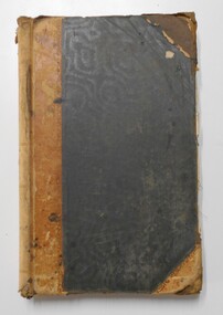
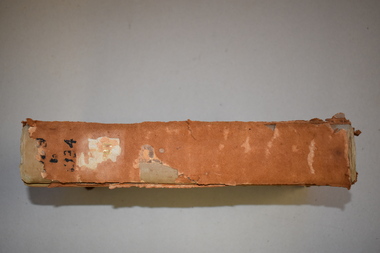
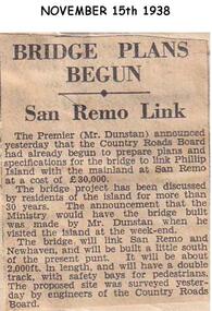
Newspaper clippings, 15/11/1938
Newspaper articleArticle stating Country Roads Board had begun to prepare plans for the San Remo Phillip Island Bridge.local history, documents, newspapers, bridges, phillip island, black & white newspaper clipping, mr dunstan premier of victoria, country roads board -
 Phillip Island and District Historical Society Inc.
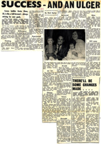
Newspaper Clipping, 7/11/1968
Article from a collection of newspaper clippings from October 1968 to July 1971Article about Kevin Shaw and his building success on Phillip Island and future plans for many projects on the island.phillip island, kevin shaw, builder -
Glenelg Shire Council Cultural Collection
Letter - Letter - Vanda Savill to Frances Hall, n.d
Two photocopies of a letter from Vanda Savill to Frances Hall, Historic Buildings Council, Department of Planning and Housing.historic buildings, heywood, vanda savill -
Glenelg Shire Council Cultural Collection
Flyer - Flyer - Maretimo, Portland Victoria, n.d
Foolscap size flyer, yellow, burgundy print. Information for visitors to 'Maretimo' Portland, including floor plan of building -
4th/19th Prince of Wales's Light Horse Regiment Unit History Room
Booklet, Arbuckle Waddell Pty Ltd, Operations Military Training Pamphlet No 23 Part 1 General Principles, Fighting Troops & Their Characteristics, 1939
Soft covered booklet, covering the principles of war, tactics, planning, command & control etc and the fighting troops and their characteristics. tactics, training, world war 2 -
4th/19th Prince of Wales's Light Horse Regiment Unit History Room
Booklet, Land/Air Warfare Pam 4 Airborne & Air Transported Operations 1953, 1953
A soft covered booklet as a guide to all Army and RAF officers on the planning or conduct of airborne operations. With amdt No 1WO Code No 8785airborne operations -
 Eltham District Historical Society Inc
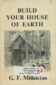
Book, George Frederick Middleton, Build your house of earth : a manual of earth wall construction / G.F. Middleton, 1979
"This book was "the bible" of mud brick and Pise builders in the 1950s"Paperback; xiii, 130 p., [8] p. of plates : ill. (some col.), diagrs., plans ; 25 cm.ISBN 0908136722 (pbk.)buildings, mudbrick, mud brick construction -
 Orbost & District Historical Society
plans, 1966?
These survey plans are a useful research tool.A flat green fabric folder with a white label with "SNOWY RIVER FLATS" hand-written in black. It contains plans.plans-survey snowy-river-flats department-crown-lands-victoria -
Ringwood and District Historical Society
Plans - Building, Browning, George et al, Heathmont Pre-School architects plans. 1999, Feb-99
Photocopy of architects plans of Heathmont Pre-School Centre. +Additional Keywords: Secomb, Frank, F.R.A.I.A. / Ritchie, Alan -
 Federation University Historical Collection
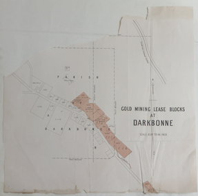
Plan, Goldmining Lease Blocks at Darkbonne, c1887
This map was originally inserteed into the Reports of Mining Registrars for the Quarter ender 30th June 1887.Paper plan showing Goldmining Lease Blocks at Darkbonne, north west of and near St Arnaud, on the Sunraysia Highway. darkbonne, st arnaud, new bendigo mine, alpha mine, working miners mine, chinese camp, donald/st arnaud railway, saint arnaud, darkbonne state school -
 Federation University Historical Collection
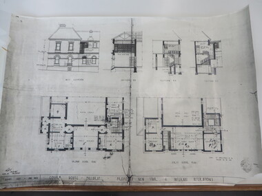
Plan, Court House Ballarat Proposed New Stair & Internal Alterations, 1935, 10/05/1935
Photocopy of a plan of the former Ballarat Supreme Court House showing ground floor, first floor and three sections. former ballarat supreme court house, ballarat school of mines, architectural plans -
 Bendigo Historical Society Inc.
Document - CERTIFICATE OF TITLE
Certificate of titles and its subdivision plans for land bought by George Lansell in Toorak. Dated 27th August 1874.melbourne -
Port Melbourne Historical & Preservation Society
Plan - Bayside development, Port Melbourne, Feb 1987
1987 proposal plan for Bayside development incorporating Princes and Station Piers, with Missions to Seamen Building bordered by canals.town planning - proposals shelved - bayside, sandridge city development company pty ltd, scdc -
Port Melbourne Historical & Preservation Society
Plan - Drainage, Board of Works, William Pentland (Coach builders), corner Ingles Street and Crockford Street, 8 Mar 1905
Board of Works drainage plan for William Pentland (Coach builders) at Ingles St and Crockford St corner. 1905built environment - industrial, sue pentland, william pentland -
Port Melbourne Historical & Preservation Society
Photograph - Participants, Bayside Open Planning Forum, Aug 1992
8 lasercopies of photos of participants in the Bayside Open Planning Forum, held between 6 and 10 August 1992town planning, built environment, bayside development action group, bdag, joh drury, lyn allison, neil robinson, david raynor, leanne matheson, robin edmond, bayside open planning forum, wendy morris, neil beddoe, city engineers -
Port Melbourne Historical & Preservation Society
Plan - Air raid shelter, Engineering Department, City of Port Melbourne, Shelter Type 'A', 7 Jan 1942
Plan for air raid shelter comprising 5'3" reinforced concrete pipe with seating - probably for schoolyard. January 1942.war - world war ii, built environment, city engineers, fred cook -
Port Melbourne Historical & Preservation Society
Document - Specification, Williamstown Road, Derham Street to Raglan Street, Port Melbourne, 14 Mar 1893
Written specification of works attached to plan of Williamstown Road from Derham Street to Raglan Street. (67.1) 1893.A.V. Heath (Town Surveyor). J.J. Bartlett (Mayor).engineering - roads streets lanes and footpaths, arthur victor heath, town clerks, james john bartlett, mayors -
Port Melbourne Historical & Preservation Society
Plan - Soundings, Webb Dock, Port Melbourne, Operation Division, Port of Melbourne Authority, Jul 1987
Port of Melbourne Authority. Plan: soundings taken at Webb Dock, Port Melbourne, Berhs 1 to 5, approachesmelbourne harbor trust - port of melbourne authority, webb dock -
Port Melbourne Historical & Preservation Society
Document - Specification, Metalling and channelling Liardet Street from Esplanade East to Esplanade West, 14 Mar 1893
Specifications (102.1) & Plan (102.2) for metalling and channelling Liardet Street from Esplanade East to Esplanade West 1893..Both signed by J.J. Bartlett. (Mayor).engineering - roads streets lanes and footpaths, town planning, town clerks, mayors, arthur victor heath, james john bartlett, liardet street -
Port Melbourne Historical & Preservation Society
Plan - Metalling and channelling Liardet Street from Esplanade East to Esplanade West, 14 Mar 1893
Specifications (102.1) & Plan (102.2) for metalling and channelling Liardet Street from Esplanade East to Esplanade West 1893..Both signed by J.J. Bartlett. (Mayor).engineering - roads streets lanes and footpaths, town planning, town clerks, mayors, arthur victor heath, james john bartlett -
Port Melbourne Historical & Preservation Society
Plan - Housing Commission Victoria, Erection of State houses, Fishermen's Bend, 1930s
Housing Commission Victoria. Plan of area at Fishermen's Bend Port Melbourne, to be used for erection of State houses. late1930sNotations in Pencil.town planning, garden city, fishermans bend -
Port Melbourne Historical & Preservation Society
Plan - Bow Fender, Inner East berth, Ferry Terminal, Station Pier, Port Melbourne, Port of Melbourne Authority, 1984
Plan - general arrangement of Bow Fender Station Pier - Inner East - Ferry Terminal - preliminary print only.melbourne harbor trust - port of melbourne authority, piers and wharves - station pier -
Port Melbourne Historical & Preservation Society
Plan - Sandridge, 1859
1859 plan of Sandridge. Photocopy made from joined photocopies. Appears that original was joined or reinforced by narrow tapetown planning, sandridge, land sales