Showing 5249 items
matching view road
-
 Ringwood and District Historical Society
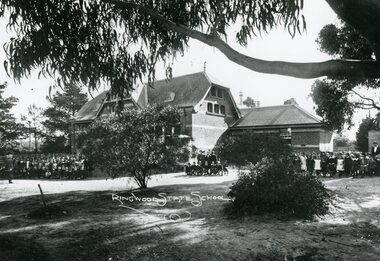
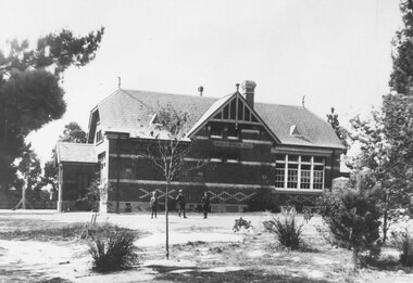
Photograph, Ringwood State School- Building in Ringwood Street. c1912
Black and white photographs (3)Ringwood State School- View of building with students assembled outside. -
 Ringwood and District Historical Society
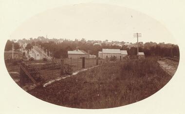
Postcard, View of Ringwood looking East from Warrandyte Road /Whitehorse Road intersection. Circa 1916
Sepia photograph on front of Postcard"Written on back of Postcard" View of Ringwood looking East from Warrandyte Road/Whitehorse Road intersection. Circa 1916. Presbyterian Church in foreground -
 Ringwood and District Historical Society
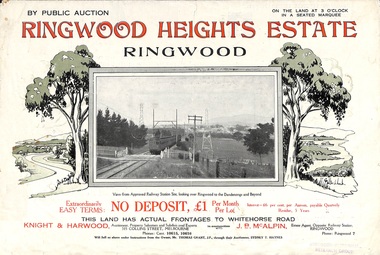
Flyer, Subdivision Advertisement - Ringwood Heights Estate Public Auction - 1924
... Subdivision includes Whitehorse Road, Bon View Avenue...) Subdivision includes Whitehorse Road, Bon View Avenue, Grant Crescent ...Refer also to Reg. No. 5185 for Ringwood Heights Estate final section release (August 1924)Folded double-sided brochure advertising Ringwood Heights Estate Public Auction on Saturday March 1, 1924, with town photographs, location map, terms of sale, and summary of local features and services.Subdivision includes Whitehorse Road, Bon View Avenue, Grant Crescent, Hillcrest Avenue, Heatherbrae Avenue, Margaret Street, and Mary Street. (Agents) Knight & Harwood, 315 Collins Street, Melbourne, Phones Central 10615, 10616, in conjunction with J.B. McAlpin, Opposite Railway Station, Ringwood, Phone Ringwood 7. -
 Ringwood and District Historical Society
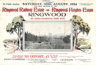
Flyer, Auction Sale Advertisement - Ringwood Railway Estate and Ringwood Heights Estate, Ringwood, Victoria - 1924
Refer also to Reg. No. 5183 for Ringwood Railway Estate (September 1923) and Reg. No. 5184 for Ringwood Heights Estate previous release (March 1924)Folded double-sided brochure advertising public auction of Final Sections of Ringwood Railway Estate and Ringwood Heights Estate on Saturday, 30 August, 1924, with town photographs, location map, terms of sale, and summary of local features and services.Subdivision includes Whitehorse Road, Sherbrooke Avenue, Burwood Avenue, Bon View Avenue, Grant Crescent, Hillcrest Avenue, Heatherbrae Avenue, Margaret Street, and Mary Street. (Agents) Knight & Harwood, 315 Collins Street, Melbourne, Phones Central 10615, 10616, in conjunction with J.B. McAlpin, Opposite Railway Station, Ringwood, Phone Ringwood 7. Footnote - "Will sell as above under instructions from the Owner, Mr. Thomas Grant, J.P.". -
 Ringwood and District Historical Society
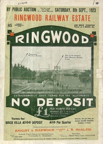
Flyer, Subdivision Advertisement - Ringwood Railway Estate Public Auction - 1923
... Subdivision includes Whitehorse Road, Bon View Avenue...) Subdivision includes Whitehorse Road, Bon View Avenue, Grant Crescent ...Refer also to Reg. No. 5185 for Ringwood Railway Estate final section release (August 1924)Folded double-sided brochure advertising 85 residential allotments and brick cemented villa - Ringwood Railway Estate Public Auction on Saturday 8th September, 1923, with town photographs, location map, terms of sale, and summary of local features and services.Subdivision includes Whitehorse Road, Bon View Avenue, Grant Crescent, Heatherbrae Avenue, Burwood Avenue, and Sherbrooke Avenue. (Agents) Knight & Harwood, 315 Collins Street, Melbourne, Phones Central 10615, 10616, in conjunction with J.B. McAlpin, Opposite Railway Station, Ringwood, Phone Ringwood 7. -
 Ringwood and District Historical Society
Photograph, Ringwood black and white photographs
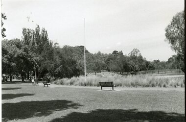
Black and white photographRingwood Lake viewed from North -
 Ringwood and District Historical Society
Photograph, Ringwood black and white photographs
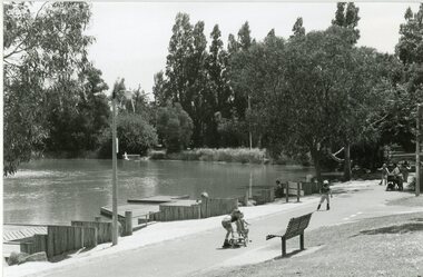
Black and white photographRingwood Lake viewed from East -
 Ringwood and District Historical Society
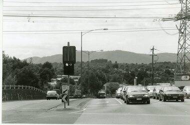
Photograph, Ringwood black and white photographs
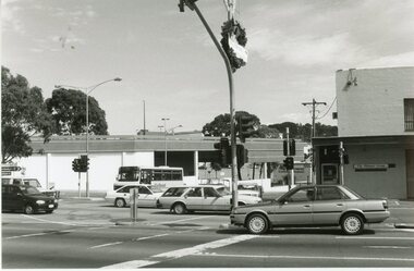
Black and white photographMaroondah Hwy & Warrandyte Rd intersection view to NW. (Pinemont just visible) -
 Ringwood and District Historical Society
Photograph, Ringwood black and white photographs
Black and white photographMaroondah Hwy & Warrandyte Rd intersection view to West, past railway station entrance -
 Ringwood and District Historical Society
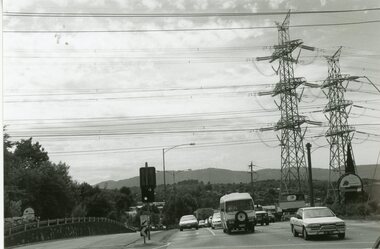
Photograph, Ringwood black and white photographs
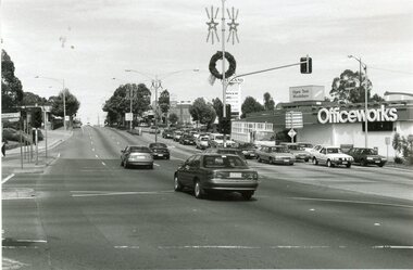
Black and white photographMaroondah Hwy. view East to Wantirna Rd. -
 Ringwood and District Historical Society
Photograph, Ringwood black and white photographs
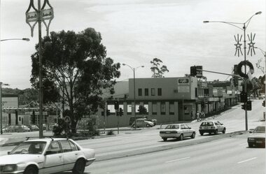
Black and white photographMaroondah Hwy. view to NE. across former clocktower site from Station vehicle entrance -
 Ringwood and District Historical Society
Photograph, Ringwood black and white photographs
Black and white photographAdelaide St. view to W. towards entrance to carpark beneath the Library complex. -
 Ringwood and District Historical Society
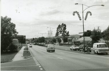
Photograph, Ringwood black and white photographs
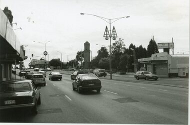
Black and white photographMaroondah Hwy. view East from Heatherdale Rd -
 Ringwood and District Historical Society
Photograph, Ringwood black and white photographs
Black and white photographMaroondah Hwy. view East from Heatherdale Rd -
 Ringwood and District Historical Society
Photograph, Ringwood black and white photographs
Black and white photographMaroondah Hwy. view East from bonview Ave near proposed site of Eastern Ring Road -
 Ringwood and District Historical Society
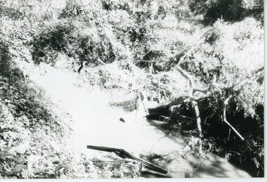
Photograph, Mullum Mullum Creek- 29-10-89
Black and white photograph"Written on back of photograph" Mullum Mullum Creek North bank view towards the West. Taken West of Harrison St.. Weed infested scrub on banks. -
 Ringwood and District Historical Society
Photograph, Mullum Mullum Creek- 29-10-89
Black and white photograph"Written on back of photograph" Mullum Mullum Creek North bank West of Harrison St Rubbish and weeds - view generally to the East -
 Ringwood and District Historical Society
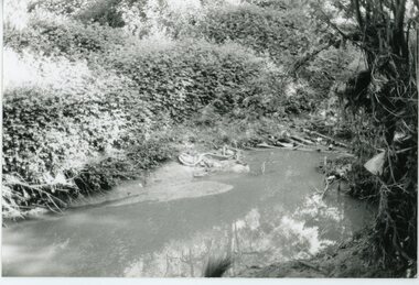
Photograph, Mullum Mullum Creek- 29-10-89
Black and white photograph"Written on back of photograph" Mullum Mullum Creek From North bank (Munro St side)View generally downstream West of Harrison St Note rubbish and weeds. -
 Ringwood and District Historical Society
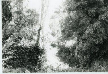
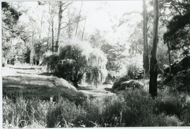
Photograph, Mullum Mullum Creek- 29-10-89
Black and white photograph"Written on back of photograph" Mullum Mullum Creek View downstream from North bank. A most pleasant part near New St (South bank) -
 Ringwood and District Historical Society
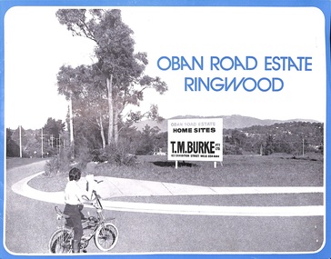
Flyer, Land Sale Advertisement, Oban Road Estate, Ringwood, Vic. - 1974
Double-sided folded page with blue border advertising sale of Oban Road Estate Ringwood building allotments. Front page features photograph of view from the estate towards Dandenong Ranges. Centrefold pages include terms of sale, layout and features of the subdivision, and summary of local services. Photocopy of typewritten price list for the 52 lots also attached.Subdivision includes Oban Road, Ambrie Avenue, Hendra Grove, and Mullum Mullum Road. (Agent) T.M. Burke Pty Ltd., 63 Exhibition Street Melbourne, Telephone 654 4144. -
 Ringwood and District Historical Society
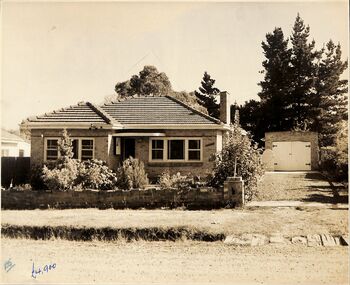
Photograph, 3 street view photographs of unidentified houses in Ringwood circa1960
One sepia and two black and white photographs of houses with prices in pounds, indicating prior to currency decimalisation in 1966.Photograph by The Ringwood Studio, Shop 14, Ringwood Shopping Centre. Phone WU7609 Copyright. -
 Ringwood and District Historical Society
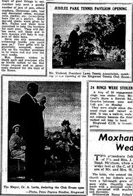
Photograph and Newspaper Clipping, Views of Jubilee Park Tennis Pavilion opening. 'Mail' 17/12/1959
9 photographs and one newspaper clippingWritten on back of photograph, "General view of the courts. 'Mail' 17/12/1959". Written on back of another photograph, "Jubilee Park Tennis Pavilion opening. Mr. Vroland, President, Lawn Tennis Association. 'Mail' 17/12/1959". -
 Ringwood and District Historical Society
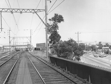
Photograph, Ringwood Railway Station overlooking Maroondah Hwy viewed from bridge over Warrandyte Road in foreground, 1974
Written on back of photograph, "Ringwood Railway Station, 1974 from bridge over Warrandyte Road." -
 Ringwood and District Historical Society
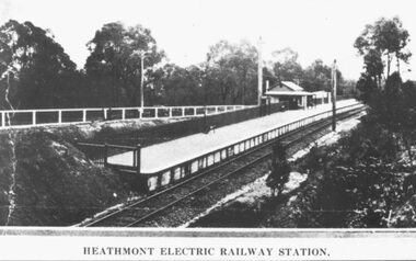
Photograph, Heathmont Railway Station, 1926. Image taken from a land sale brochure advertising Charm-View Estate Sub-division opposite the station
Written on back of photograph, "Photo taken from Sub. Div. Land Sale - Heathmont Electric Railway Station right opposite Estate. Charm-View Estate. Heathmont (For private Sale), 1926?" -
 Ringwood and District Historical Society
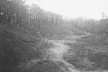
Photograph, View up range from the target pit at Ringwood Rifle Range, Jumping Creek Reserve after the January 1962 bushfires
Written on back of photograph, "Looking from target pit up range after fires, 1962." -
 Ringwood and District Historical Society
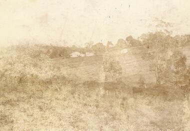
Photograph, Quambee, North Ringwood, 1912 - viewed from Coombes' property
Written on back of photograph, "Quambee, North Ringwood, 1912 - viewed from Coombes' property." -
 Ringwood and District Historical Society
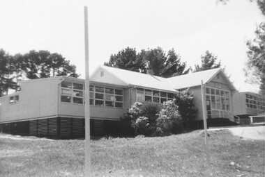
Photograph, External views of North Ringwood State School in Oban Road, including newly completed section - December 1972
Written on back of photograph, "North Ringwood State School. New section, Dec. 1972". -
 Ringwood and District Historical Society
Photograph, 1973 view of the former site of Cass's School (1873-1894) at the corner of Everard Road and Maroondah Highway Ringwood East
Typed below photograph, "Site of Cass's School 1873-1894. Photo taken 1973. Present site of 'Lionsbrae'". -
 Ringwood and District Historical Society
Photograph, Ringwood State School No. 2997 viewed northward from Maroondah Highway. C1912 After building partitioned
Black and White School Building Photographedearly c1912, following structural alterations by partitioning the original single room into two classrooms during that year (According to Ringwood Primary School History) See VC# 6876 et al for images before the partitioning. Typed below photograph, "Ringwood State School No. 2997 seen from Maroondah Highway. Entrance was from Ringwood St. opposite end of Charter St. School was behind site of present Coles store. c1900". (Note: Actually c1912) -
 Ringwood and District Historical Society
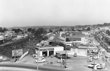
Photograph, Maroondah Highway West, Ringwood- 1969. Westward view from Ringwood Clocktower, cnr Maroondah Hwy and Wantirna Road
Black and white photographWritten on back of photograph: "Dec 1969, looking West.