
Showing 4458 items matching " boroondara estate"
-
 Kew Historical Society Inc
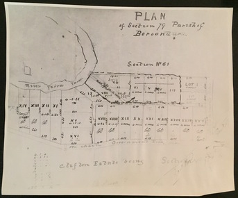
Print - Subdivision Plan (copy), Plan of Section 79 Parish of Boroondara (Clifton Estate), Nineteenth Century
... Plan of Section 79 Parish of Boroondara (Clifton Estate)...Plan of Section 79 Parish of Boroondara (Clifton Estate) Print Subdivision Plan (copy) ...This work forms part of the collection assembled by the historian Dorothy Rogers, that was donated to the Kew Historical Society by her son John Rogers in 2015. The manuscripts, photographs, maps, and documents were sourced by her from both family and local collections or produced as references for her print publications. Many were directly used by Rogers in writing ‘Lovely Old Homes of Kew’ (1961) and 'A History of Kew' (1973), or the numerous articles on local history that she produced for suburban newspapers. Most of the photographs in the collection include detailed annotations in her hand. The Rogers Collection provides a comprehensive insight into the working habits of a historian in the 1960s and 1970s. Together it forms the largest privately-donated collection within the archives of the Kew Historical Society.A photographic reproduction of a plan in the Vale Collection of the State Library of Victoria. The numbered lots represent the first land sales in Kew in the area north of Studley Park Road.maps (kew), plan of section 79 parish of boroondara -
 Canterbury History Group
Document - School Project: A history of 137 Mont Albert Road, Canterbury, Rush, Anne-Marie
... ... Boroondara Estate...Canterbury Mont Albert Road "Haslemere" Quittenton> Richard Elgar> Henry Elgar's Special Survey Boroondara Estate A research paper for the Australian History option describing the history of 137 Mont Albert Road, Canterbury. ...A research paper for the Australian History option describing the history of 137 Mont Albert Road, Canterbury. The writer looks at the lives of various owners, particularly Henry Elgar and Richard Quittenton, and how the house has changed since it was built in 1890. includes 2 pages of plans of Elgar's Special Surveycanterbury, mont albert road, "haslemere", quittenton> richard, elgar> henry, elgar's special survey, boroondara estate -
Surrey Hills Historical Society Collection
Work on paper - Vertical File, Elgar's Special Survey
... ‘Elgar’s special survey - Boroondara Estate’ – summary by Jocelyn Hall (1 page) 6. ...‘Elgar’s special survey - Boroondara Estate’ – summary by Jocelyn Hall (1 page) 6. ...1. ‘Elgar’s special survey’, extract from ‘Glimpses of Camberwell, Camberwell Historical Society, 1973 (1 page). 2. ‘Henry Elgar’s road’s history’, Gwen McWilliam, Progress Press, 26.10.1978 (1 page). 3. ‘Elgar’s special survey – 5120 acres”, Alan Holt notes undated (1 page). 4. ‘Elgar’s special survey - Boroondara Estate’, Alan Holt, 1990; includes information re Henry Elgar and his family (3 pages). 5. ‘Elgar’s special survey - Boroondara Estate’ – summary by Jocelyn Hall (1 page) 6. ‘Elgar’s special survey - Boroondara Estate’, similar but not the same as No 4 (3 pages) 7. Elgar’s special survey, Alan Holt’s talk notes, undated (4 pages) henry elgar -
Canterbury History Group
Article - House prices in Boroondara, 2002, 2003
... Boroondara... Auctions... Real Estate...Canterbury City of Boroondara Auctions Real Estate Agents Houses Land Values A collection of articles from the Progress Leader, the Herald-Sun and Noel Jones relating to the price of houses in Boroondara for 2002 and 2003 Article House prices in Boroondara, 2002, 2003 ...A collection of articles from the Progress Leader, the Herald-Sun and Noel Jones relating to the price of houses in Boroondara for 2002 and 2003A collection of articles from the Progress Leader, the Herald-Sun and Noel Jones relating to the price of houses in Boroondara for 2002 and 2003canterbury, city of boroondara, auctions, real estate agents, houses, land values -
 Surrey Hills Historical Society Collection
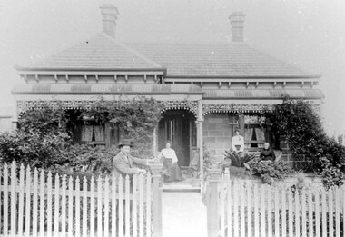
Photograph, "Braemar" 18 Suffolk Road, Surrey Hills
... ...boroondara cemetery...real estate...They are buried in Boroondara Cemetery (Pres B0522) with their daughter Jane (1864-1928). James Sneddon (Snr) was an important man in early Surrey Hills. He established real estate...estate business continued on the corner of Windsor Crescent and Union Road (north side) until the business was sold to the Doubleday (family) after WW2. The Sneddon family were early settlers and business owners in Surrey Hills and remained over 3 generations. Different family members held many roles in community organisations. This photo is also important in documenting built heritage that has been demolished. buildings structures and establishments houses timber houses house names braemar architectural styles victorian style families family group sneddon family james sneddon (snr) boroondara cemetery real estate agent ironmonger Image of a Victorian, weatherboard, block fronted, single storey house with decorative veranda, viewed from the front. ..."Braemar" at 18 Suffolk Road, Surrey Hills - built c1894, demolished in1977 – and home of James Sneddon Snr. and family from 1890 until c1950. We believe it is James is at the gate and his family on the veranda. James was born in Alloa, Clackmannanshire Scotland in 1833, as was his wife Jane. He died in March 1901 and she in March 1911. They are buried in Boroondara Cemetery (Pres B0522) with their daughter Jane (1864-1928). James Sneddon (Snr) was an important man in early Surrey Hills. He established real estate and ironmongery businesses in Union Road – first on the corner of Stirling Crescent and later over the road on the corner of Windsor Crescent. He was chairman of Surrey Hills’ MUIOOF (Manchester Unity Independent Order of Oddfellows). James Sneddon Jnr. followed his father in the family real estate business and was an even busier community man. He was a JP and had roles in the Surrey Hills ANA, the Progress Association and the Choral Society. He lived 2 doors from his father. The real estate business continued on the corner of Windsor Crescent and Union Road (north side) until the business was sold to the Doubleday (family) after WW2.The Sneddon family were early settlers and business owners in Surrey Hills and remained over 3 generations. Different family members held many roles in community organisations. This photo is also important in documenting built heritage that has been demolished.Image of a Victorian, weatherboard, block fronted, single storey house with decorative veranda, viewed from the front. The garden in front of the house is well established and a light-coloured picket fence surrounds the property. Four people are in the photograph, three women (two seated and one standing) on the veranda and one male, who is leaning against the gate post.buildings, structures and establishments, houses, timber houses, house names, braemar, architectural styles, victorian style, families, family group, sneddon family, james sneddon (snr), boroondara cemetery, real estate agent, ironmonger -
 Kew Historical Society Inc
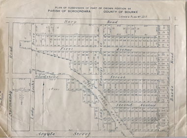
Plan - Subdivision Plan, Plan of Subdivision of Part of Crown Portion 84 / Parish of Boroondara / County of Bourke / Lodged Plan No. 2217, Twentieth Century
... estates. A number of the plans in the Kew Historical Society’s collection can also be found in other collections, such as those of the State Library of Victoria and the Boroondara Library Service. ...estates. A number of the plans in the Kew Historical Society’s collection can also be found in other collections, such as those of the State Library of Victoria and the Boroondara Library Service. ...Pru Sanderson, in her groundbreaking ‘City of Kew Urban Conservation Study : Volume 2 - Development History’ (1988), summarised the periods of urban development and subdivisions of land in Kew. The periods that she identified included 1845-1880, 1880-1893, 1893-1921, 1921-1933, 1933-1943, and Post-War Development. These periods were selected as they represented periods of rapid growth or decline in urban development. An obvious starting point for Sanderson’s groupings involved population growth and the associated economic cycles. These cycles also highlighted urban expansion onto land that was predominantly rural, although in other cases it represented the decline and breakup of large estates. A number of the plans in the Kew Historical Society’s collection can also be found in other collections, such as those of the State Library of Victoria and the Boroondara Library Service. A number are however unique to the collection.The Kew Historical Society collection includes almost 100 subdivision plans pertaining to suburbs of the City of Melbourne. Most of these are of Kew, Kew East or Studley Park, although a smaller number are plans of Camberwell, Deepdene, Balwyn and Hawthorn. It is believed that the majority of the plans were gifted to the Society by persons connected with the real estate firm - J. R. Mathers and McMillan, 136 Cotham Road, Kew. The Plans in the collection are rarely in pristine form, being working plans on which the agent would write notes and record lots sold and the prices of these. The subdivision plans are historically significant examples of the growth of urban Melbourne from the beginning of the 20th Century up until the 1980s. A number of the plans are double-sided and often include a photograph on the reverse. A number of the latter are by noted photographers such as J.E. Barnes.Undated Plan of Subdivision of Crown Portion 84 in what is now Kew. The area shown is bordered by Burke Road, Harp Road, Arglye Road and Normanby Road.subdivision plans -- kew (vic), harp road, burke road, normanby road, lady loch's drive, gladstone street, second avenue, first avenue -
 Surrey Hills Historical Society Collection
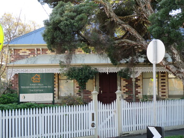
Photograph - 1 Bedford Avenue, Surrey Hills, The Street Where You Live Project
... This was organised through the Surrey Hills Neighbourhood Centre and covered the postcode 3127 in the cities of Boroondara and Whitehorse. These photos provide a snapshot of real estate in the suburbs of Mont Albert and Surrey Hills during a period of rapid change with many properties on large blocks demolished to create higher density residential development or renewal of single dwellings. ...Photos documenting this address as part of a photographic series undertaken by volunteer photographers during 2013 and 2014 for The Street Where You Live Project. This was organised through the Surrey Hills Neighbourhood Centre and covered the postcode 3127 in the cities of Boroondara and Whitehorse.These photos provide a snapshot of real estate in the suburbs of Mont Albert and Surrey Hills during a period of rapid change with many properties on large blocks demolished to create higher density residential development or renewal of single dwellings. At particular risk were properties not covered by heritage overlays in particular interwar housing and post 1950's housing. -
 Surrey Hills Historical Society Collection
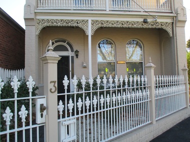
Photograph - 3 Bedford Avenue, Surrey Hills, The Street Where You Live Project
... This was organised through the Surrey Hills Neighbourhood Centre and covered the postcode 3127 in the cities of Boroondara and Whitehorse. These photos provide a snapshot of real estate in the suburbs of Mont Albert and Surrey Hills during a period of rapid change with many properties on large blocks demolished to create higher density residential development or renewal of single dwellings. ...Photos documenting this address as part of a photographic series undertaken by volunteer photographers during 2013 and 2014 for The Street Where You Live Project. This was organised through the Surrey Hills Neighbourhood Centre and covered the postcode 3127 in the cities of Boroondara and Whitehorse.These photos provide a snapshot of real estate in the suburbs of Mont Albert and Surrey Hills during a period of rapid change with many properties on large blocks demolished to create higher density residential development or renewal of single dwellings. At particular risk were properties not covered by heritage overlays in particular interwar housing and post 1950's housing. -
 Surrey Hills Historical Society Collection
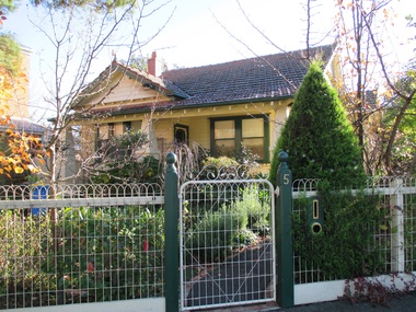
Photograph - 5 Bedford Avenue, Surrey Hills, The Street Where You Live Project
... This was organised through the Surrey Hills Neighbourhood Centre and covered the postcode 3127 in the cities of Boroondara and Whitehorse. These photos provide a snapshot of real estate in the suburbs of Mont Albert and Surrey Hills during a period of rapid change with many properties on large blocks demolished to create higher density residential development or renewal of single dwellings. ...Photos documenting this address as part of a photographic series undertaken by volunteer photographers during 2013 and 2014 for The Street Where You Live Project. This was organised through the Surrey Hills Neighbourhood Centre and covered the postcode 3127 in the cities of Boroondara and Whitehorse.These photos provide a snapshot of real estate in the suburbs of Mont Albert and Surrey Hills during a period of rapid change with many properties on large blocks demolished to create higher density residential development or renewal of single dwellings. At particular risk were properties not covered by heritage overlays in particular interwar housing and post 1950's housing. -
 Surrey Hills Historical Society Collection
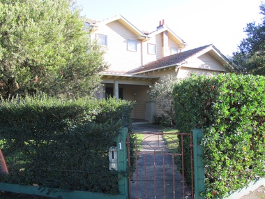
Photograph - 1 Blackburn Street, Surrey Hills, The Street Where You Live Project
... This was organised through the Surrey Hills Neighbourhood Centre and covered the postcode 3127 in the cities of Boroondara and Whitehorse. These photos provide a snapshot of real estate in the suburbs of Mont Albert and Surrey Hills during a period of rapid change with many properties on large blocks demolished to create higher density residential development or renewal of single dwellings. ...Photos documenting this address as part of a photographic series undertaken by volunteer photographers during 2013 and 2014 for The Street Where You Live Project. This was organised through the Surrey Hills Neighbourhood Centre and covered the postcode 3127 in the cities of Boroondara and Whitehorse.These photos provide a snapshot of real estate in the suburbs of Mont Albert and Surrey Hills during a period of rapid change with many properties on large blocks demolished to create higher density residential development or renewal of single dwellings. At particular risk were properties not covered by heritage overlays in particular interwar housing and post 1950's housing. -
 Surrey Hills Historical Society Collection
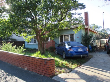
Photograph - 2 Blackburn Street, Surrey Hills, The Street Where You Live Project
... This was organised through the Surrey Hills Neighbourhood Centre and covered the postcode 3127 in the cities of Boroondara and Whitehorse. These photos provide a snapshot of real estate in the suburbs of Mont Albert and Surrey Hills during a period of rapid change with many properties on large blocks demolished to create higher density residential development or renewal of single dwellings. ...Photos documenting this address as part of a photographic series undertaken by volunteer photographers during 2013 and 2014 for The Street Where You Live Project. This was organised through the Surrey Hills Neighbourhood Centre and covered the postcode 3127 in the cities of Boroondara and Whitehorse.These photos provide a snapshot of real estate in the suburbs of Mont Albert and Surrey Hills during a period of rapid change with many properties on large blocks demolished to create higher density residential development or renewal of single dwellings. At particular risk were properties not covered by heritage overlays in particular interwar housing and post 1950's housing. -
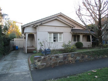 Surrey Hills Historical Society Collection
Photograph - 3 Blackburn Street, Surrey Hills, The Street Where You Live Project
... This was organised through the Surrey Hills Neighbourhood Centre and covered the postcode 3127 in the cities of Boroondara and Whitehorse. These photos provide a snapshot of real estate in the suburbs of Mont Albert and Surrey Hills during a period of rapid change with many properties on large blocks demolished to create higher density residential development or renewal of single dwellings. ...Photos documenting this address as part of a photographic series undertaken by volunteer photographers during 2013 and 2014 for The Street Where You Live Project. This was organised through the Surrey Hills Neighbourhood Centre and covered the postcode 3127 in the cities of Boroondara and Whitehorse.These photos provide a snapshot of real estate in the suburbs of Mont Albert and Surrey Hills during a period of rapid change with many properties on large blocks demolished to create higher density residential development or renewal of single dwellings. At particular risk were properties not covered by heritage overlays in particular interwar housing and post 1950's housing. -
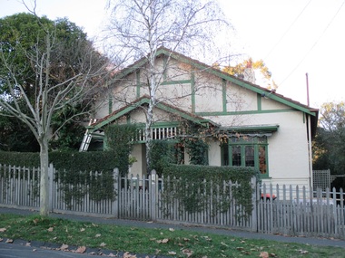 Surrey Hills Historical Society Collection
Photograph - 4 Blackburn Street, Surrey Hills, The Street Where You Live Project
... This was organised through the Surrey Hills Neighbourhood Centre and covered the postcode 3127 in the cities of Boroondara and Whitehorse. These photos provide a snapshot of real estate in the suburbs of Mont Albert and Surrey Hills during a period of rapid change with many properties on large blocks demolished to create higher density residential development or renewal of single dwellings. ...Photos documenting this address as part of a photographic series undertaken by volunteer photographers during 2013 and 2014 for The Street Where You Live Project. This was organised through the Surrey Hills Neighbourhood Centre and covered the postcode 3127 in the cities of Boroondara and Whitehorse.These photos provide a snapshot of real estate in the suburbs of Mont Albert and Surrey Hills during a period of rapid change with many properties on large blocks demolished to create higher density residential development or renewal of single dwellings. At particular risk were properties not covered by heritage overlays in particular interwar housing and post 1950's housing. -
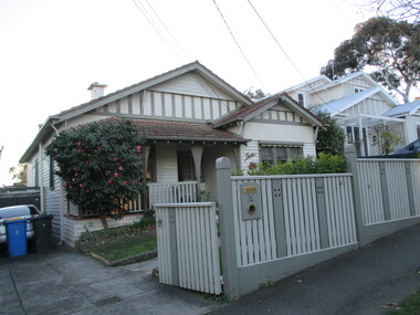 Surrey Hills Historical Society Collection
Photograph - 5 Blackburn Street, Surrey Hills, The Street Where You Live Project
... This was organised through the Surrey Hills Neighbourhood Centre and covered the postcode 3127 in the cities of Boroondara and Whitehorse. These photos provide a snapshot of real estate in the suburbs of Mont Albert and Surrey Hills during a period of rapid change with many properties on large blocks demolished to create higher density residential development or renewal of single dwellings. ...Photos documenting this address as part of a photographic series undertaken by volunteer photographers during 2013 and 2014 for The Street Where You Live Project. This was organised through the Surrey Hills Neighbourhood Centre and covered the postcode 3127 in the cities of Boroondara and Whitehorse.These photos provide a snapshot of real estate in the suburbs of Mont Albert and Surrey Hills during a period of rapid change with many properties on large blocks demolished to create higher density residential development or renewal of single dwellings. At particular risk were properties not covered by heritage overlays in particular interwar housing and post 1950's housing. -
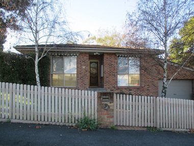 Surrey Hills Historical Society Collection
Photograph - 6 Blackburn Street, Surrey Hills, The Street Where You Live Project
... This was organised through the Surrey Hills Neighbourhood Centre and covered the postcode 3127 in the cities of Boroondara and Whitehorse. These photos provide a snapshot of real estate in the suburbs of Mont Albert and Surrey Hills during a period of rapid change with many properties on large blocks demolished to create higher density residential development or renewal of single dwellings. ...Photos documenting this address as part of a photographic series undertaken by volunteer photographers during 2013 and 2014 for The Street Where You Live Project. This was organised through the Surrey Hills Neighbourhood Centre and covered the postcode 3127 in the cities of Boroondara and Whitehorse.These photos provide a snapshot of real estate in the suburbs of Mont Albert and Surrey Hills during a period of rapid change with many properties on large blocks demolished to create higher density residential development or renewal of single dwellings. At particular risk were properties not covered by heritage overlays, in particular interwar housing and post 1950's housing. -
 Surrey Hills Historical Society Collection
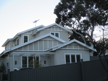
Photograph - 7 Blackburn Street, The Street Where You Live Project
... This was organised through the Surrey Hills Neighbourhood Centre and covered the postcode 3127 in the cities of Boroondara and Whitehorse. These photos provide a snapshot of real estate in the suburbs of Mont Albert and Surrey Hills during a period of rapid change with many properties on large blocks demolished to create higher density residential development or renewal of single dwellings. ...Photos documenting this address as part of a photographic series undertaken by volunteer photographers during 2013 and 2014 for The Street Where You Live Project. This was organised through the Surrey Hills Neighbourhood Centre and covered the postcode 3127 in the cities of Boroondara and Whitehorse.These photos provide a snapshot of real estate in the suburbs of Mont Albert and Surrey Hills during a period of rapid change with many properties on large blocks demolished to create higher density residential development or renewal of single dwellings. At particular risk were properties not covered by heritage overlays, in particular interwar housing and post 1950's housing. -
 Surrey Hills Historical Society Collection
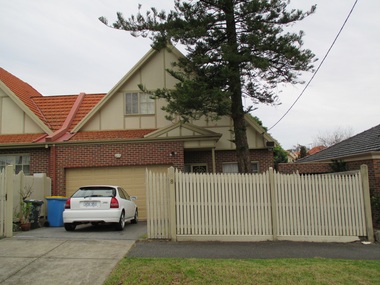
Photograph - 8 Blackburn Street, Surrey Hills, The Street Where You Live Project
... This was organised through the Surrey Hills Neighbourhood Centre and covered the postcode 3127 in the cities of Boroondara and Whitehorse. These photos provide a snapshot of real estate in the suburbs of Mont Albert and Surrey Hills during a period of rapid change with many properties on large blocks demolished to create higher density residential development or renewal of single dwellings. ...Photos documenting this address as part of a photographic series undertaken by volunteer photographers during 2013 and 2014 for The Street Where You Live Project. This was organised through the Surrey Hills Neighbourhood Centre and covered the postcode 3127 in the cities of Boroondara and Whitehorse.These photos provide a snapshot of real estate in the suburbs of Mont Albert and Surrey Hills during a period of rapid change with many properties on large blocks demolished to create higher density residential development or renewal of single dwellings. At particular risk were properties not covered by heritage overlays, in particular interwar housing and post 1950's housing. -
 Surrey Hills Historical Society Collection
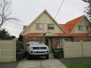
Photograph - 8A Blackburn Street, Surrey Hills, The Street Where You Live Project
... This was organised through the Surrey Hills Neighbourhood Centre and covered the postcode 3127 in the cities of Boroondara and Whitehorse. These photos provide a snapshot of real estate in the suburbs of Mont Albert and Surrey Hills during a period of rapid change with many properties on large blocks demolished to create higher density residential development or renewal of single dwellings. ...Photos documenting this address as part of a photographic series undertaken by volunteer photographers during 2013 and 2014 for The Street Where You Live Project. This was organised through the Surrey Hills Neighbourhood Centre and covered the postcode 3127 in the cities of Boroondara and Whitehorse.These photos provide a snapshot of real estate in the suburbs of Mont Albert and Surrey Hills during a period of rapid change with many properties on large blocks demolished to create higher density residential development or renewal of single dwellings. At particular risk were properties not covered by heritage overlays, in particular interwar housing and post 1950's housing. -
 Surrey Hills Historical Society Collection
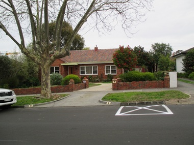
Photograph - 9 Blackburn Street, Surrey Hills, The Street Where You Live Project
... This was organised through the Surrey Hills Neighbourhood Centre and covered the postcode 3127 in the cities of Boroondara and Whitehorse. These photos provide a snapshot of real estate in the suburbs of Mont Albert and Surrey Hills during a period of rapid change with many properties on large blocks demolished to create higher density residential development or renewal of single dwellings. ...Photos documenting this address as part of a photographic series undertaken by volunteer photographers during 2013 and 2014 for The Street Where You Live Project. This was organised through the Surrey Hills Neighbourhood Centre and covered the postcode 3127 in the cities of Boroondara and Whitehorse.These photos provide a snapshot of real estate in the suburbs of Mont Albert and Surrey Hills during a period of rapid change with many properties on large blocks demolished to create higher density residential development or renewal of single dwellings. At particular risk were properties not covered by heritage overlays, in particular interwar housing and post 1950's housing. -
 Surrey Hills Historical Society Collection
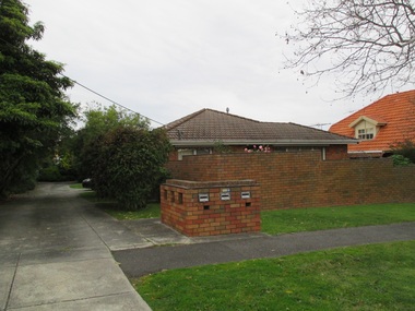
Photograph - 10 Blackburn Street, Surrey Hills, The Street Where You Live Project
... This was organised through the Surrey Hills Neighbourhood Centre and covered the postcode 3127 in the cities of Boroondara and Whitehorse. These photos provide a snapshot of real estate in the suburbs of Mont Albert and Surrey Hills during a period of rapid change with many properties on large blocks demolished to create higher density residential development or renewal of single dwellings. ...Photos documenting this address as part of a photographic series undertaken by volunteer photographers during 2013 and 2014 for The Street Where You Live Project. This was organised through the Surrey Hills Neighbourhood Centre and covered the postcode 3127 in the cities of Boroondara and Whitehorse.These photos provide a snapshot of real estate in the suburbs of Mont Albert and Surrey Hills during a period of rapid change with many properties on large blocks demolished to create higher density residential development or renewal of single dwellings. At particular risk were properties not covered by heritage overlays, in particular interwar housing and post 1950's housing. -
 Surrey Hills Historical Society Collection
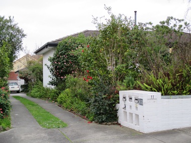
Photograph - 11 Blackburn Street, Surrey Hills, The Street Where You Live Project
... This was organised through the Surrey Hills Neighbourhood Centre and covered the postcode 3127 in the cities of Boroondara and Whitehorse. These photos provide a snapshot of real estate in the suburbs of Mont Albert and Surrey Hills during a period of rapid change with many properties on large blocks demolished to create higher density residential development or renewal of single dwellings. ...Photos documenting this address as part of a photographic series undertaken by volunteer photographers during 2013 and 2014 for The Street Where You Live Project. This was organised through the Surrey Hills Neighbourhood Centre and covered the postcode 3127 in the cities of Boroondara and Whitehorse.These photos provide a snapshot of real estate in the suburbs of Mont Albert and Surrey Hills during a period of rapid change with many properties on large blocks demolished to create higher density residential development or renewal of single dwellings. At particular risk were properties not covered by heritage overlays, in particular interwar housing and post 1950's housing. -
 Surrey Hills Historical Society Collection
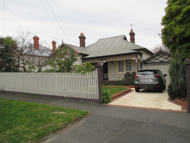
Photograph - 12 Blackburn Street, Surrey Hills, The Street Where You Live Project
... This was organised through the Surrey Hills Neighbourhood Centre and covered the postcode 3127 in the cities of Boroondara and Whitehorse. These photos provide a snapshot of real estate in the suburbs of Mont Albert and Surrey Hills during a period of rapid change with many properties on large blocks demolished to create higher density residential development or renewal of single dwellings. ...Photos documenting this address as part of a photographic series undertaken by volunteer photographers during 2013 and 2014 for The Street Where You Live Project. This was organised through the Surrey Hills Neighbourhood Centre and covered the postcode 3127 in the cities of Boroondara and Whitehorse.These photos provide a snapshot of real estate in the suburbs of Mont Albert and Surrey Hills during a period of rapid change with many properties on large blocks demolished to create higher density residential development or renewal of single dwellings. At particular risk were properties not covered by heritage overlays, in particular interwar housing and post 1950's housing. -
 Surrey Hills Historical Society Collection
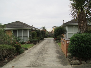
Photograph - 13 Blackburn Street, Surrey Hills, The Street Where You Live Project
... This was organised through the Surrey Hills Neighbourhood Centre and covered the postcode 3127 in the cities of Boroondara and Whitehorse. These photos provide a snapshot of real estate in the suburbs of Mont Albert and Surrey Hills during a period of rapid change with many properties on large blocks demolished to create higher density residential development or renewal of single dwellings. ...Photos documenting this address as part of a photographic series undertaken by volunteer photographers during 2013 and 2014 for The Street Where You Live Project. This was organised through the Surrey Hills Neighbourhood Centre and covered the postcode 3127 in the cities of Boroondara and Whitehorse.These photos provide a snapshot of real estate in the suburbs of Mont Albert and Surrey Hills during a period of rapid change with many properties on large blocks demolished to create higher density residential development or renewal of single dwellings. At particular risk were properties not covered by heritage overlays, in particular interwar housing and post 1950's housing. -
 Surrey Hills Historical Society Collection
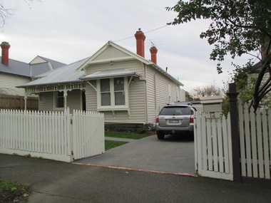
Photograph - 14 Blackburn Street, Surrey Hills, The Street Where You Live Project
... This was organised through the Surrey Hills Neighbourhood Centre and covered the postcode 3127 in the cities of Boroondara and Whitehorse. These photos provide a snapshot of real estate in the suburbs of Mont Albert and Surrey Hills during a period of rapid change with many properties on large blocks demolished to create higher density residential development or renewal of single dwellings. ...Photos documenting this address as part of a photographic series undertaken by volunteer photographers during 2013 and 2014 for The Street Where You Live Project. This was organised through the Surrey Hills Neighbourhood Centre and covered the postcode 3127 in the cities of Boroondara and Whitehorse.These photos provide a snapshot of real estate in the suburbs of Mont Albert and Surrey Hills during a period of rapid change with many properties on large blocks demolished to create higher density residential development or renewal of single dwellings. At particular risk were properties not covered by heritage overlays, in particular interwar housing and post 1950's housing. -
 Surrey Hills Historical Society Collection
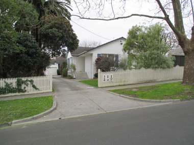
Photograph - 15 Blackburn Street, Surrey Hills, The Street Where You Live Project
... This was organised through the Surrey Hills Neighbourhood Centre and covered the postcode 3127 in the cities of Boroondara and Whitehorse. These photos provide a snapshot of real estate in the suburbs of Mont Albert and Surrey Hills during a period of rapid change with many properties on large blocks demolished to create higher density residential development or renewal of single dwellings. ...Photos documenting this address as part of a photographic series undertaken by volunteer photographers during 2013 and 2014 for The Street Where You Live Project. This was organised through the Surrey Hills Neighbourhood Centre and covered the postcode 3127 in the cities of Boroondara and Whitehorse.These photos provide a snapshot of real estate in the suburbs of Mont Albert and Surrey Hills during a period of rapid change with many properties on large blocks demolished to create higher density residential development or renewal of single dwellings. At particular risk were properties not covered by heritage overlays, in particular interwar housing and post 1950's housing. -
 Surrey Hills Historical Society Collection
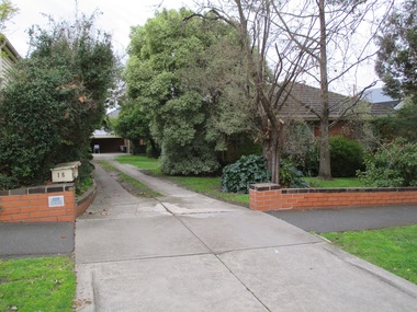
Photograph - 18 Blackburn Street, Surrey Hills, The Street Where You Live Project
... This was organised through the Surrey Hills Neighbourhood Centre and covered the postcode 3127 in the cities of Boroondara and Whitehorse. These photos provide a snapshot of real estate in the suburbs of Mont Albert and Surrey Hills during a period of rapid change with many properties on large blocks demolished to create higher density residential development or renewal of single dwellings. ...Photos documenting this address as part of a photographic series undertaken by volunteer photographers during 2013 and 2014 for The Street Where You Live Project. This was organised through the Surrey Hills Neighbourhood Centre and covered the postcode 3127 in the cities of Boroondara and Whitehorse.These photos provide a snapshot of real estate in the suburbs of Mont Albert and Surrey Hills during a period of rapid change with many properties on large blocks demolished to create higher density residential development or renewal of single dwellings. At particular risk were properties not covered by heritage overlays, in particular interwar housing and post 1950's housing. -
 Surrey Hills Historical Society Collection
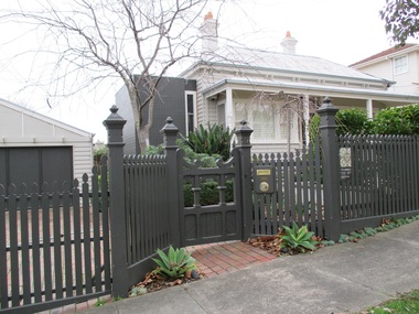
Photograph - 17 Blackburn Street, Surrey Hills, The Street Where You Live Project
... This was organised through the Surrey Hills Neighbourhood Centre and covered the postcode 3127 in the cities of Boroondara and Whitehorse. These photos provide a snapshot of real estate in the suburbs of Mont Albert and Surrey Hills during a period of rapid change with many properties on large blocks demolished to create higher density residential development or renewal of single dwellings. ...Photos documenting this address as part of a photographic series undertaken by volunteer photographers during 2013 and 2014 for The Street Where You Live Project. This was organised through the Surrey Hills Neighbourhood Centre and covered the postcode 3127 in the cities of Boroondara and Whitehorse.These photos provide a snapshot of real estate in the suburbs of Mont Albert and Surrey Hills during a period of rapid change with many properties on large blocks demolished to create higher density residential development or renewal of single dwellings. At particular risk were properties not covered by heritage overlays, in particular interwar housing and post 1950's housing. -
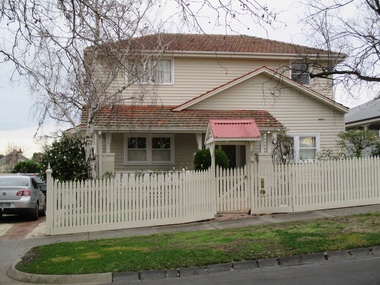 Surrey Hills Historical Society Collection
Photograph - 19 Blackburn Street, Surrey Hills, The Street Where You Live Project
... This was organised through the Surrey Hills Neighbourhood Centre and covered the postcode 3127 in the cities of Boroondara and Whitehorse. These photos provide a snapshot of real estate in the suburbs of Mont Albert and Surrey Hills during a period of rapid change with many properties on large blocks demolished to create higher density residential development or renewal of single dwellings. ...Photos documenting this address as part of a photographic series undertaken by volunteer photographers during 2013 and 2014 for The Street Where You Live Project. This was organised through the Surrey Hills Neighbourhood Centre and covered the postcode 3127 in the cities of Boroondara and Whitehorse.These photos provide a snapshot of real estate in the suburbs of Mont Albert and Surrey Hills during a period of rapid change with many properties on large blocks demolished to create higher density residential development or renewal of single dwellings. At particular risk were properties not covered by heritage overlays, in particular interwar housing and post 1950's housing. -
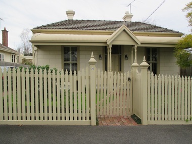 Surrey Hills Historical Society Collection
Photograph - 20 Blackburn Street, Surrey Hills, The Street Where You Live Project
... This was organised through the Surrey Hills Neighbourhood Centre and covered the postcode 3127 in the cities of Boroondara and Whitehorse. These photos provide a snapshot of real estate in the suburbs of Mont Albert and Surrey Hills during a period of rapid change with many properties on large blocks demolished to create higher density residential development or renewal of single dwellings. ...Photos documenting this address as part of a photographic series undertaken by volunteer photographers during 2013 and 2014 for The Street Where You Live Project. This was organised through the Surrey Hills Neighbourhood Centre and covered the postcode 3127 in the cities of Boroondara and Whitehorse.These photos provide a snapshot of real estate in the suburbs of Mont Albert and Surrey Hills during a period of rapid change with many properties on large blocks demolished to create higher density residential development or renewal of single dwellings. At particular risk were properties not covered by heritage overlays, in particular interwar housing and post 1950's housing. -
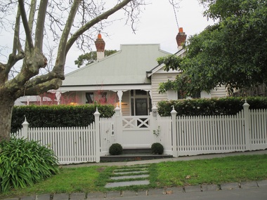 Surrey Hills Historical Society Collection
Photograph - 21 Blackburn Street, Surrey Hills, The Street Where You Live Project
... This was organised through the Surrey Hills Neighbourhood Centre and covered the postcode 3127 in the cities of Boroondara and Whitehorse. These photos provide a snapshot of real estate in the suburbs of Mont Albert and Surrey Hills during a period of rapid change with many properties on large blocks demolished to create higher density residential development or renewal of single dwellings. ...Photos documenting this address as part of a photographic series undertaken by volunteer photographers during 2013 and 2014 for The Street Where You Live Project. This was organised through the Surrey Hills Neighbourhood Centre and covered the postcode 3127 in the cities of Boroondara and Whitehorse.These photos provide a snapshot of real estate in the suburbs of Mont Albert and Surrey Hills during a period of rapid change with many properties on large blocks demolished to create higher density residential development or renewal of single dwellings. At particular risk were properties not covered by heritage overlays, in particular interwar housing and post 1950's housing.
