Showing 2818 items matching " goldfields north"
-
 Bendigo Historical Society Inc.
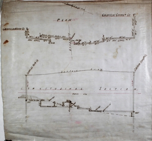
Plan - Goldfields Consolidated Co
... Goldfields North and Goldfields Consolidated Co. were located on Diamond Hill, Spring Gully. ...Plan and longitudinal section of Goldfields North and Goldfields Consolidated Co. ...Goldfields North and Goldfields Consolidated Co. were located on Diamond Hill, Spring Gully. ...Goldfields North and Goldfields Consolidated Co. were located on Diamond Hill, Spring Gully. Plan and longitudinal section of Goldfields North and Goldfields Consolidated Co. Plan drawn on off white paper. Plan forms part of the Margaret Roberts Collection of mining records. margaret roberts, gold, gold mine, goldfields consolidated co., bendigo -
 Bendigo Historical Society Inc.
Document - MINING REPORTS - DIAMOND HILL - NELL GWYNNE LINE
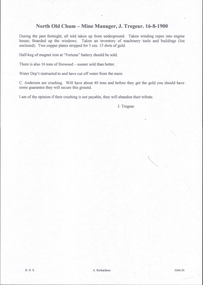
... ... Goldfields North...Mines mentioned are:- North Bendigo, Nell Gwynne, Goldfields North, Goldfields Ext'd, South Concord and the Concord....Mines mentioned are:- North Bendigo, Nell Gwynne, Goldfields North, Goldfields Ext'd, South Concord and the Concord. ...Handwritten notes with name of mine, height of sill and depth of bottom level. Four mines have the name of a gully beside them. Mines mentioned are:- North Bendigo, Nell Gwynne, Goldfields North, Goldfields Ext'd, South Concord and the Concord.document, gold, mining reports, diamond hill nell gwynne line, north bendigo, nell gwynne, goldfields north, goldfields ext'd, south concord, concord -
 Bendigo Historical Society Inc.
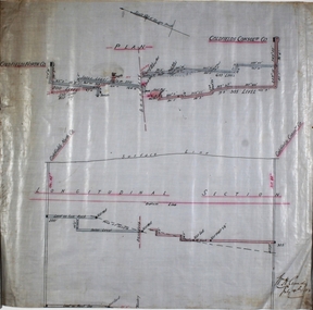
Plan - Goldfields Consolidated Co
... Goldfields North and Goldfields Consolidated Co. were located near Diamond Hill, Spring Gully....Plan and longitudinal section of Goldfields North and Goldfields Consolidated Co, hand drawn on waxed paper. ...Goldfields North and Goldfields Consolidated Co. were located near Diamond Hill, Spring Gully. ...Goldfields North and Goldfields Consolidated Co. were located near Diamond Hill, Spring Gully.Plan and longitudinal section of Goldfields North and Goldfields Consolidated Co, hand drawn on waxed paper. Written on plan: 'Longitudinal Section' and 'W.H. Cundy, July 14th, 1908'. Plan forms part of the Margaret Roberts Collection of mining records. margaret roberts, gold, gold mine, goldfields consolidated co., bendigo -
 Bendigo Historical Society Inc.
Document - BENDIGO MINES 1906
... ... Goldfields North...Others listed are: Catherine Reef United, Carlisle, Clarence United, Central Ellesmere, Collman & Tacchi, Confidence Extended Cornish United, Ellenborough, Extd South Devonshire, Eureka, Fortuna Hustlers, Garden Gully United, G G Consolidated, Geribaldi, Great Southern, Gt Northern, Gt Extended Hustlers, Gt Central Victoria, Golden Age, Golden Pyke, Goldfields North, Goldfields Consolidated, North Johnsons, Pearl, Princess Dagmar, Phoenix, Railway Prince of Wales, Shamrock, St Mungo, Sadowa, Sea, Specimen Hill Sth St Mungo, South New Moon, South Devonshire, Suffolk United, United Devonshire, Unity, United Hustlers & Redan, United Ulster, Victoria Consols, Victoria Quartz, Pansora, Virginia, Victoria Proprietory, Williams United, Hustlers Reef, Hustlers Royal Reserve, Hercules & Energetic, Ironbark, Johnsons Reef No 1, Hustlers Royal Reserve, Ironbark, Johnsons Reef, Johnsons Extended, Kochs Pioneer, Lazarus New Chum, Lady Barkly - Lightning Hill, McDuff Amalgamated, Morning Star, New Chum Consolidated, New Chum Railway, New Chum & Victoria, New Blue Consolidated, New Hopefu, New St Mungo, New Argus, New Moon, New Victoria Catherine, New Chum Goldfields, North New Moon and North Argus. ...History House 11 Mackenzie Street Bendigo goldfields DOCUMENT Gold bendigo mines 1906 Bendigo Mines 1906 Catherine Reef United Carlisle Clarence United Central Ellesmere Collman & Tacchi Confidence Extended Cornish United Ellenborough Extd South Devonshire Eureka Fortuna Hustlers Garden Gully United G G Consolidated Geribaldi Great Southern Gt Northern Gt Extended Hustlers Gt Central Victoria Golden Age Golden Pyke Goldfields North Goldfields Consolidated North Johnsons Pearl Princess Dagmar Phoenix Railway Prince of Wales Shamrock St Mungo Sadowa Sea Specimen Hill Sth St Mungo South New Moon South Devonshire Suffolk United United Devonshire Unity United Hustlers & Redan United Ulster Victoria Consols Victoria Quartz Pansora Virginia Victoria Proprietory Williams United Hustlers Reef Hustlers Royal Reserve Hercules & Energetic Ironbark Johnsons Reef No 1 Hustlers Royal Reserve Ironbark Johnsons Reef Johnsons Extended Kochs Pioneer Lazarus New Chum Lady Barkly - Lightning Hill McDuff Amalgamated Morning Star New Chum Consolidated New Chum Railway New Chum & Victoria New Blue Consolidated New Hopefu New St Mungo New Argus New Moon New Victoria Catherine New Chum Goldfields North New Moon North Argus Bgo Library 'Healthy Golden Bendigo' - 1906 Handwritten notes mentioning Bendigo Mines. ...Handwritten notes mentioning Bendigo Mines. Four mines, Garden Gully United, South New Moon, Hustlers Reef and Catherine Reef United have some information about them. Others listed are: Catherine Reef United, Carlisle, Clarence United, Central Ellesmere, Collman & Tacchi, Confidence Extended Cornish United, Ellenborough, Extd South Devonshire, Eureka, Fortuna Hustlers, Garden Gully United, G G Consolidated, Geribaldi, Great Southern, Gt Northern, Gt Extended Hustlers, Gt Central Victoria, Golden Age, Golden Pyke, Goldfields North, Goldfields Consolidated, North Johnsons, Pearl, Princess Dagmar, Phoenix, Railway Prince of Wales, Shamrock, St Mungo, Sadowa, Sea, Specimen Hill Sth St Mungo, South New Moon, South Devonshire, Suffolk United, United Devonshire, Unity, United Hustlers & Redan, United Ulster, Victoria Consols, Victoria Quartz, Pansora, Virginia, Victoria Proprietory, Williams United, Hustlers Reef, Hustlers Royal Reserve, Hercules & Energetic, Ironbark, Johnsons Reef No 1, Hustlers Royal Reserve, Ironbark, Johnsons Reef, Johnsons Extended, Kochs Pioneer, Lazarus New Chum, Lady Barkly - Lightning Hill, McDuff Amalgamated, Morning Star, New Chum Consolidated, New Chum Railway, New Chum & Victoria, New Blue Consolidated, New Hopefu, New St Mungo, New Argus, New Moon, New Victoria Catherine, New Chum Goldfields, North New Moon and North Argus. Document from Albert Richardson Collection of mining history.document, gold, bendigo mines 1906, bendigo mines 1906, catherine reef united, carlisle, clarence united, central ellesmere, collman & tacchi, confidence extended cornish united, ellenborough, extd south devonshire, eureka, fortuna hustlers, garden gully united, g g consolidated, geribaldi, great southern, gt northern, gt extended hustlers, gt central victoria, golden age, golden pyke, goldfields north, goldfields consolidated, north johnsons, pearl, princess dagmar, phoenix, railway prince of wales, shamrock, st mungo, sadowa, sea, specimen hill sth st mungo, south new moon, south devonshire, suffolk united, united devonshire, unity, united hustlers & redan, united ulster, victoria consols, victoria quartz, pansora, virginia, victoria proprietory, williams united, hustlers reef, hustlers royal reserve, hercules & energetic, ironbark, johnsons reef no 1, hustlers royal reserve, ironbark, johnsons reef, johnsons extended, kochs pioneer, lazarus new chum, lady barkly - lightning hill, mcduff amalgamated, morning star, new chum consolidated, new chum railway, new chum & victoria, new blue consolidated, new hopefu, new st mungo, new argus, new moon, new victoria catherine, new chum goldfields, north new moon, north argus, bgo library 'healthy golden bendigo' - 1906 -
 Bendigo Historical Society Inc.
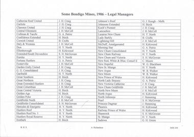
Document - MINING REPORTS - LIST OF LEGAL MANAGERS
... ... Goldfields North...History House 11 Mackenzie Street Bendigo goldfields DOCUMENT Gold miner's right Mining Reports List of Legal Managers J H Craig J H McColl G A Petrie H Birch B Crofts H Y North H Kirkwood S H McGowan G J Keogh C Moore W G Blackham W B Walker J Humming G H Green Catherine Reef United Carlisle Clarence United Central Ellesmere Collman & Tacchi Confidence Extended Cornish United Daly & Westons Don Ellenborough Extended SouthDevonshire Eureka Fortuna Hustlers Fosterville Garden Gully United G G Consolidated Garibaldi Great Southern Great Northern Great Extended Hustlers Great Columbian Great Central Victoria Golden Age Golden Pyke Goldfields North Goldfields Consolidated Hercules & Energetic Hustlers Reef Hustlers Reef No 1 Hustler's Royal Reserve Ironbark Johnson's Reef Johnsons Extended Koch's Pioneer lancashire Lazarus New Chum Lady Barkly Lightning Hill McDuff Amalgamated Morning Star New Chum Consolidated New Chum Railway New Chum & Victoria New Red White & Blue Consolidated New Hopeful New St Mungo New Argus New Moon New Prince of Wales North Lady Brassey New Victoria Catherine New Chum Goldfields North New Moon North Argus North Johnsons Pearl Princess Dagmar Phoenix Railway Prince of Wales Shamrock St Mungo Sadowa Sea Stewart's United Specimen's Hill South St Mungo South New Moon South Devonshire Suffolk United South Prince of Wales Spring Gully Junction True Blue Thomas United United Devonshire Unity United Hustlers & Redan United Ulster Victoria Consols Victoria Reef Quartz Victory and Pandora Virginia Victoria Proprietory Williams United Handwritten list by Albert Richardson, with typed copy of same, of some Bendigo Mines and their Legal Managers, as at September 30th, 1906. ...Handwritten list by Albert Richardson, with typed copy of same, of some Bendigo Mines and their Legal Managers, as at September 30th, 1906. Document is part of the Albert Richardson Collection. document, gold, miner's right, mining reports, list of legal managers, j h craig, j h mccoll, g a petrie, h birch, b crofts, h y north, h kirkwood, s h mcgowan, g j keogh, c moore, w g blackham, w b walker, j humming, g h green, catherine reef united, carlisle, clarence united, central ellesmere, collman & tacchi, confidence extended, cornish united, daly & westons, don, ellenborough, extended southdevonshire, eureka, fortuna hustlers, fosterville, garden gully united, g g consolidated, garibaldi, great southern, great northern, great extended hustlers, great columbian, great central victoria, golden age, golden pyke, goldfields north, goldfields consolidated, hercules & energetic, hustlers reef, hustlers reef no 1, hustler's royal reserve, ironbark, johnson's reef, johnsons extended, koch's pioneer, lancashire, lazarus new chum, lady barkly, lightning hill, mcduff amalgamated, morning star, new chum consolidated, new chum railway, new chum & victoria, new red white & blue consolidated, new hopeful, new st mungo, new argus, new moon, new prince of wales, north lady brassey, new victoria catherine, new chum goldfields north new moon, north argus, north johnsons, pearl, princess dagmar, phoenix, railway prince of wales, shamrock, st mungo, sadowa, sea, stewart's united specimen's hill, south st mungo, south new moon, south devonshire, suffolk united, south prince of wales, spring gully junction, true blue, thomas united, united devonshire, unity, united hustlers & redan, united ulster, victoria consols, victoria reef quartz, victory and pandora, virginia, victoria proprietory, williams united -
 Kiewa Valley Historical Society
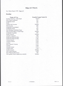
Document - Four Geological reports on the North-east Goldfields, Geological Survey of Victoria 1958 Bulletin
... Four Geological reports on the North-east Goldfields...Covering 1941-1958 a) Glen Wills and Sunnyside b) Sunnyside Tunnel c) Red Robin d) Maud and Yellow Girl Government Printer, Mines Department, Melbourne, Victoria Geological Survey of Victoria 1958 Bulletin Document Four Geological reports on the North-east Goldfields ...Geological Surveys of N.E. Goldfields Victoria included mines and tunnels. A resurvey of goldfields was necessary to re-assess economic possibilities using modern techniques and structural interpretation. It included an examination of a considerable surface area with maps and underground workings. Results were correlated and integrated and published by the Mines Department.The mines are in the Bogong Alpine Area.Foolscap printed Victorian Bulletins. Each stapled in the top left corner and each with varying number of pages. Covering 1941-1958 a) Glen Wills and Sunnyside b) Sunnyside Tunnel c) Red Robin d) Maud and Yellow Girl Government Printer, Mines Department, Melbourne, Victoriageology in the north-east, gold fields, goldmines, glen wills -
 Bendigo Historical Society Inc.
Document - MINING REPORTS - FOURTH COMPARTMENT INTRODUCED
... ... Goldfields North...History House 11 Mackenzie Street Bendigo goldfields DOCUMENT Gold Mining Reports Fourth Compartment Introduced Mines Report 1909 page 117 Hustlers Reef No 1 Park Shaft New Chum Goldfields Goldfields South North Central Nell Gwynne Nell Gwynne Goldfields Consolidated Goldfields North New Bendigo Goldfields Propy Nell Gwynne Bdgo G'Fields Propy Goldfields Extended South Concord Lansell's Concord South Red White & Blue North Red White & Blue Victoria Quartz Victoria Consols Lazarus New Chum & Victoria Carlisle Cornish United United Ulster South Concord New Chum Railway Red White & Blue Ext'd New Golden Fleece North New Moon New Moon South Moon Clarence United New Argus Specimen Hill Williams United Golden Age (Shellback Shaft) Johnsons No 2 Confidence Ext'd Callman & Tachhi Needle Shaft Catherine Reef Ext'd Bruhn's Consolidated New Argus New Prince of Wales Handwritten list of mines in Bendigo and Eaglehawk with the depth when the fourth compartment was introduced. ...Handwritten list of mines in Bendigo and Eaglehawk with the depth when the fourth compartment was introduced. Number of Shafts with fourth Compartment. Total at end of year 1908, 22, total at end of year 1909 - 42 - or an increase of 20 for the year. This is approximately 40% of all the working shafts on the year.document, gold, mining reports, fourth compartment introduced, mines report 1909 page 117, hustlers reef no 1 park shaft, new chum goldfields, goldfields south, north, central nell gwynne, nell gwynne, goldfields consolidated, goldfields north, new bendigo goldfields propy, nell gwynne bdgo g'fields propy, goldfields extended, south concord, lansell's concord, south red white & blue, north red white & blue, victoria quartz, victoria consols, lazarus, new chum & victoria, carlisle, cornish united, united ulster, south concord, new chum railway, red, white & blue ext'd, new golden fleece, north new moon, new moon, south moon, clarence united, new argus, specimen hill, williams united, golden age (shellback shaft), johnsons no 2, confidence ext'd, callman & tachhi, needle shaft, catherine reef ext'd, bruhn's consolidated, new argus, new prince of wales -
 Bendigo Historical Society Inc.
Book - THE EARLY DAYS OF THE WOOLSHED, 1988
... A history of the early days of Woolshed, Reid's Creek, and Sebastopol of the owners of the Ovens Goldfield, North Eastern Victoria....A history of the early days of Woolshed, Reid's Creek, and Sebastopol of the owners of the Ovens Goldfield, North Eastern Victoria. Book THE EARLY DAYS OF THE WOOLSHED ...The Early Days of the Woolshed. A history of the early days of Woolshed, Reid's Creek, and Sebastopol of the owners of the Ovens Goldfield, North Eastern Victoria.G. F. Craiggoldfields, gold woolshed, reid's creek, sebpol -
 Stawell Historical Society Inc
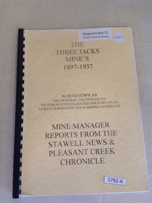
Book, Greg Cameron, The Three Jacks Mines 1897-1937, 2004
... The Three Jacks Mine's 1897 - 1937 Also known as The General Goldfield Co. North Newington Gold Mining Syndicate Mine Manager Reports from The Stawell News & Pleasant Creek Chronicle...Stawell Historical Society Inc 46 Longfield St Stawell grampians Contains Historic Information and Newspaper Cuttings: also photo's taken in 1960-1980's stawell gold mining The Three Jacks Mine's 1897 - 1937 Also known as The General Goldfield Co. North Newington Gold Mining Syndicate Mine Manager Reports from The Stawell News & Pleasant Creek Chronicle Yellow card cover with black print, black plastic spine and yellow card rear cover The Three Jacks Mines 1897-1937 Book Greg Cameron ...Contains Historic Information and Newspaper Cuttings: also photo's taken in 1960-1980'sYellow card cover with black print, black plastic spine and yellow card rear coverThe Three Jacks Mine's 1897 - 1937 Also known as The General Goldfield Co. North Newington Gold Mining Syndicate Mine Manager Reports from The Stawell News & Pleasant Creek Chroniclestawell gold mining -
 Kew Historical Society Inc
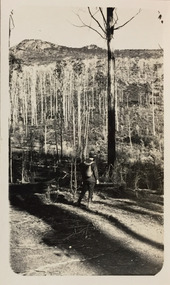
Photograph - Sunnyside and Mt Wills, c.1926
... Mt Wills and Sunnyside were at the time goldfields north of Omeo. This small black and white point-of-view photograph shows the photographer, Henry B Christian, staring across a treed landscape to Mt Wills in the distance....Mt Wills and Sunnyside were at the time goldfields north of Omeo. This small black and white point-of-view photograph shows the photographer, Henry B Christian, staring across a treed landscape to Mt Wills in the distance. ...Henry Beater Christian (1886-1962) , was a descendant of one of the earliest settler families in Kew. Employed at the Kew Asylum as a 'public servant', he was a skilled amateur photographer, photographing numerous scenes in Kew and on his travels around Victoria. The majority of his photographs date from 1916 to 1929. His finest photographs are housed in two photograph albums. Digital copy of a photograph from page 35 of the 47-page photograph album containing 261 gelatinous silver images, loaned by Diane Washfold with permission given to digitise and hold a copy in our collection. John Chapman has written in 'Bushwalking Clubs - A Brief History', about the establishment in Victoria of the first bushwalking club in 1888, and the popularisation of bushwalking during the interwar period. Henry Christian's 'walks' appear to have been undertaken solely or with a companion/s. This black and white photo is part of a group of photos taken in the Victorian High Country. The page is labelled 'Mt Wills / Sunnyside' and includes photos of landscapes and built structures. Mt Wills and Sunnyside were at the time goldfields north of Omeo. This small black and white point-of-view photograph shows the photographer, Henry B Christian, staring across a treed landscape to Mt Wills in the distance."MT WILLS / SUNNYSIDE"henry beater christian (1886-1962), landscape photography, christian-washfold collection, photograph albums, bushwalking, northeast victoria, victorian high country, mt wills, sunnyside -
 Bendigo Historical Society Inc.
Book - HISTORIC MINING SITES IN THE SANDHURST EAGLEHAWK AND RAYWOOD MINING DIVISIONS, 1992
... Contains project outline and report for North Central Goldfields Project: Bendigo Goldfield...History House 11 Mackenzie Street Bendigo goldfields BENDIGO Mining goldfields report Bendigo gold goldfields Eaglehawk Raywood David Bannear Historic Mining Sites in the Sandhurst, Eaglehawk and Raywood mining divisions. White cover, with spiral binding. Contains project outline and report for North ...Historic Mining Sites in the Sandhurst, Eaglehawk and Raywood mining divisions. White cover, with spiral binding. Contains project outline and report for North Central Goldfields Project: Bendigo GoldfieldDavid Bannearbendigo, mining, goldfields report, bendigo, gold, goldfields, eaglehawk, raywood -
 Bendigo Historical Society Inc.
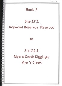
Book - RAYWOOD RESERVOIR RAYWOOD TO MYER'S CREEK DIGGINGS MYER'S CREEK, 1992
... Significance reports prepared for North Central Goldfields Project: Bendigo Goldfield ....History House 11 Mackenzie Street Bendigo goldfields BENDIGO Mining goldfields report Bendigo gold goldfields history report David Bannear Book 5 - Site 17.1 to Raywood Reservoir, Raywood to Site 24.1, Myer's Creek Diggings, Myer's Creek. Significance reports prepared for North ...Book 5 - Site 17.1 to Raywood Reservoir, Raywood to Site 24.1, Myer's Creek Diggings, Myer's Creek. Significance reports prepared for North Central Goldfields Project: Bendigo Goldfield .David Bannearbendigo, mining, goldfields report, bendigo, gold, goldfields, history, report -
 Bendigo Historical Society Inc.
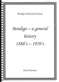
Book - BENDIGO A GENERAL HISTORY 1880S - 1970S, 1992
... Prepared for North Central Goldfields Project: Bendigo Goldfield....History House 11 Mackenzie Street Bendigo goldfields BENDIGO Mining goldfields report Bendigo gold goldfields mining history David Bannear Bendigo - a general history 1880's - 1970s. Book contains a chronological history of Bendigo from 1880s - 1970s. Material is referenced. Prepared for North ...Bendigo - a general history 1880's - 1970s. Book contains a chronological history of Bendigo from 1880s - 1970s. Material is referenced. Prepared for North Central Goldfields Project: Bendigo Goldfield.David Bannearbendigo, mining, goldfields report, bendigo, gold, goldfields, mining, history -
 Bendigo Historical Society Inc.
Book - GOLDEN GULLY ALLUVIAL WORKINGS DIAMOND HILL TO MCCORMICK'S BATTERY AND CYANIDE WORKS, 1992
... Reports prepared for the North Central Goldfields Project: Bendigo Goldfield....goldfields history. David Bannear Book 1, report on investigations into the significance of the mining sites 1.1 - site 8.6 ( as detailed in index of book ) White cover with spiral binding. Reports prepared for the North ...Book 1, report on investigations into the significance of the mining sites 1.1 - site 8.6 ( as detailed in index of book ) White cover with spiral binding. Reports prepared for the North Central Goldfields Project: Bendigo Goldfield.David Bannearbendigo, mining, goldfields report, bendigo, gold, goldfields, history. -
 Bendigo Historical Society Inc.
Book - LIGHTNING HILL MINE SITE HUSTLERS LIGHTNING HILL EAGLEHAWK TO IRON'S DAM NEILBOROUGH, 1992
... Contains significance reports prepared for North Central Goldfields Project: Bendigo Goldfield....History House 11 Mackenzie Street Bendigo goldfields BENDIGO Mining goldfields reports Bendigo gold goldfields history reports David Bannear Book 3, Site 10.1, Lightning Hill Mine Site, Hustler's/Lightning Hill, Eaglehawk to site 14.4, Iron's Dam, Neilborough. Contains significance reports prepared for North ...Book 3, Site 10.1, Lightning Hill Mine Site, Hustler's/Lightning Hill, Eaglehawk to site 14.4, Iron's Dam, Neilborough. Contains significance reports prepared for North Central Goldfields Project: Bendigo Goldfield.David Bannearbendigo, mining, goldfields reports, bendigo, gold, goldfields, history, reports -
 Bendigo Historical Society Inc.
Book - BENDIGO A GENERAL HISTORY 1851 - 1880S, 1992
... Prepared for the North Central Goldfields Project: Bendigo Goldfield....History House 11 Mackenzie Street Bendigo goldfields BENDIGO Mining goldfields report Bendigo gold goldfields history David Bannear Bendigo a general history - 1851 - 1880's White cover with spiral binding. Contains a chronological record of Bendigo's history through the period 1851 - 1880. Material is referenced. Prepared for the North ...Bendigo a general history - 1851 - 1880's White cover with spiral binding. Contains a chronological record of Bendigo's history through the period 1851 - 1880. Material is referenced. Prepared for the North Central Goldfields Project: Bendigo Goldfield.David Bannearbendigo, mining, goldfields report, bendigo, gold, goldfields, history -
 Bendigo Historical Society Inc.
Book - NEW CHUM GOLDFIELDS MINE SITE DIAMOND HILL TO LANSELL'S 222 MINE SITE NEW CHUM REEF GOLDEN SQUARE, 1992
... Book 4, Site 15.1 New Chum Goldfields Mine site Diamond Hill to site 16.22, Lansell's 222 Mine site, New Chum Reef, Golden Square. Significance reports prepared for North Central Goldfields Project: Bendigo Goldfield....History House 11 Mackenzie Street Bendigo goldfields BENDIGO Mining goldfields report Bendigo gold goldfields history David Bannear Book 4, Site 15.1 New Chum Goldfields Mine site Diamond Hill to site 16.22, Lansell's 222 Mine site, New Chum Reef, Golden Square. Significance reports prepared for North Central Goldfields Project: Bendigo Goldfield. ...Book 4, Site 15.1 New Chum Goldfields Mine site Diamond Hill to site 16.22, Lansell's 222 Mine site, New Chum Reef, Golden Square. Significance reports prepared for North Central Goldfields Project: Bendigo Goldfield.David Bannearbendigo, mining, goldfields report, bendigo, gold, goldfields, history -
 Bendigo Historical Society Inc.
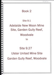
Book - ADELAIDE NEW MOON MINE GARDEN GULLY REEF WOODVALE TO ULSTER UNITED MINE SITE, WOODVALE, 1992
... Book contains details of significance reports prepared for North Central Goldfields Project: Bendigo Goldfield....History House 11 Mackenzie Street Bendigo goldfields BENDIGO Mining goldfields report Bendigo goldfields gold mining reports history David Bannear Book 2 - Site 9.1, Adelaide New Moon Mine site, Garden Gully Reef, Woodvale to site 9.27, Ulster United Mine Site, Garden Gully Reef, Woodvale. Book contains details of significance reports prepared for North ...Book 2 - Site 9.1, Adelaide New Moon Mine site, Garden Gully Reef, Woodvale to site 9.27, Ulster United Mine Site, Garden Gully Reef, Woodvale. Book contains details of significance reports prepared for North Central Goldfields Project: Bendigo Goldfield.David Bannearbendigo, mining, goldfields report, bendigo, goldfields, gold, mining, reports, history -
 Ringwood and District Historical Society
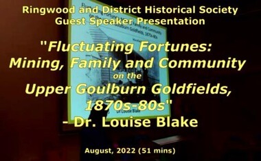
Mixed media - Video, RDHS Guest Speaker Presentation - "Fluctuating Fortunes on the Upper Goulburn Goldfields 1870s-1880s" - Dr. Louise Blake
... Inspired by her family connection to the gold mining settlement of Woods Point, Louise completed a PhD on Women and Community on the Upper Goulburn Goldfields in north-east Victoria in 2019. In this talk Louise will share her research on Lawrence and Esther Chubb, who lived and worked at Gaffneys Creek on the Upper Goulburn Goldfields in the 1870s and 80s. ...Inspired by her family connection to the gold mining settlement of Woods Point, Louise completed a PhD on Women and Community on the Upper Goulburn Goldfields in north-east Victoria in 2019. In this talk Louise will share her research on Lawrence and Esther Chubb, who lived and worked at Gaffneys Creek on the Upper Goulburn Goldfields in the 1870s and 80s. ...Digitised video (2.66GB) Duration: 51 minutes. Recorded August, 2022 (Video is available for viewing at Ringwood & District Historical Society Archives by appointment)Presenter: Louise Blake is a writer and historian with an interest in the stories of women, families, and communities on the nineteenth-century goldfields in Australia and New Zealand. Inspired by her family connection to the gold mining settlement of Woods Point, Louise completed a PhD on Women and Community on the Upper Goulburn Goldfields in north-east Victoria in 2019. In this talk Louise will share her research on Lawrence and Esther Chubb, who lived and worked at Gaffneys Creek on the Upper Goulburn Goldfields in the 1870s and 80s. In a series of letters Lawrence wrote to his family in England, and now held by the State Library of Victoria, Lawrence shared his early struggles as an independent miner on the central Victorian goldfields, his protracted courtship with Esther, the ordinary intimacies of their life at Gaffneys Creek, the work that Esther did to support the family in this remote mining region, as well as the material and emotional support provided by and to family, friends and neighbours. A rare and revealing source, these letters help to expand our understanding of the lived experience of mining families, particularly the work that women did to sustain families and communities, in this period of waged labour and tribute mining in Victoria. -
 Bendigo Historical Society Inc.
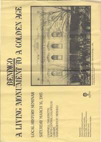
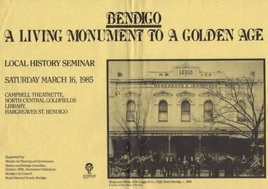
Document - BENDIGO - A LIVING MONUMENT TO A GOLDEN AGE, 16 March 1985
... Local History Seminar Saturday March 16,1985, Campbell Theatrette, North Central Goldfields Library, Hargreaves St, Bendigo. ...History House 11 Mackenzie Street Bendigo goldfields DOCUMENT Names of bendigo pioneers h.m.leggo & co Document, Bendigo , A Living Monument To A Golden Age. Local History Seminar Saturday March 16,1985, Campbell Theatrette, North Central Goldfields Library, Hargreaves St, Bendigo. ...Document, Bendigo , A Living Monument To A Golden Age. Local History Seminar Saturday March 16,1985, Campbell Theatrette, North Central Goldfields Library, Hargreaves St, Bendigo. Supported by: Ministry for Planning and Environment, History and Heritage Committee, Victoria's 150th. Anniversary Celebrations. Bendigo City Council. Royal Historical Society, Bendigo. 2 Copies. Pictured H.M. Leggo & Co, Merchants & Importers, High Street, Bendigo.c 1896, shops and offices.Excelsior House name on building. Horses Carts Bicycles and People out the front of the premises.document, names of bendigo pioneers, h.m.leggo & co -
 Bendigo Historical Society Inc.
Document - DOCUMENT - FLYER FOR LOCAL HISTORY SEMINAR, 1985, BENDIGO
... ... North Central Goldfields Library...Bright yellow flyer of local history seminar, Saturday March 16, 1985 titled Bendigo - A Living Monument to a Golden Age, held at the Campbell Theatrette, North Central Goldfields Library, Hargreaves St. Bendigo. ...BENDIGO History city history Flyer for Local History Seminar Bendigo North Central Goldfields Library Ministry for Planning and Environment History and Heritage Committee Victoria's 150th. ...Bright yellow flyer of local history seminar, Saturday March 16, 1985 titled Bendigo - A Living Monument to a Golden Age, held at the Campbell Theatrette, North Central Goldfields Library, Hargreaves St. Bendigo. Has a copy of photo of Shops and Offices, H. M. Leggo & Co., High Street Bendigo. C. 1896. The photo shows a number of men outside H. M. Leggo & Co. Merchants & Importers, Wholesale Grocers. There are two horse drawn vehicles with two horses in each and some of the men have bicycles.bendigo, history, city history, flyer for local history seminar bendigo, north central goldfields library, ministry for planning and environment, history and heritage committee, victoria's 150th. anniversary celebrations, bendigo citycouncil, royal historical society bendigo, h m leggo & co, state library of victoria -
 The Beechworth Burke Museum
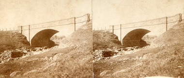
Photograph - Stereoscopic Photograph, Unknown c1875
... Beechworth held a distinct role in the administrative and commercial management of Victoria's north-eastern goldfields, with many objects and structures still well preserved from the towns establishment. ...Beechworth held a distinct role in the administrative and commercial management of Victoria's north-eastern goldfields, with many objects and structures still well preserved from the towns establishment. ...Depicted in the photograph is Newtown Bridge or the Newtown Falls Bridge, in Beechworth, Victoria. Noted for its location, detailed craftsmanship and stonemasonry by Scottish stonemasons the Newtown Bridge was built in the 19th century provincial town of Beechworth (completed in 1875). The bridge was built over Spring Creek, spanning 6.3 meters wide and 24.8 meters tall. Beechworth held a distinct role in the administrative and commercial management of Victoria's north-eastern goldfields, with many objects and structures still well preserved from the towns establishment. The bridge indicates the growth of the town, replacing a previous timber structure as well as its association to the mining activity in the area and the rapid increase in Australia's economy that led to investment and development of roads and railways. The local granite used in the construction of the single arch Newtown Bridge makes the bridge and other buildings made with the granite unique to the area, the honey-toned material distinct to Beechworth. This photograph is historically significant as it provides insight into the industrial development of Beechworth and the surrounding area, contributed to by the goldfields. The photograph further captures the representation of vernacular engineering traditions and Scottish stonemasonry.Two sepia-toned rectangular photographs featuring a bridge in the background printed on matte photographic paper mounted on card.Reverse: 97.2324/ Newtown Bridge/ Beechworthbridge, newtown beechworth, newtown bridge, newtown, beechworth, beechworth falls bridge, beechworth mining district, spring creek, -
 Unions Ballarat
Journal of Australasian mining history 2007, Australian Mining History Association, 2007
... A Thirsty and Confusing Diggings: The Albert Goldfield, Milparinka-Tibooburra, north-western NSW. ‘Another Broken Hill’: The Mount Deddick Silver-Lead Field. ...A Thirsty and Confusing Diggings: The Albert Goldfield, Milparinka-Tibooburra, north-western NSW. ‘Another Broken Hill’: The Mount Deddick Silver-Lead Field. ...Periodical/journal: "Embracing all aspects of mining history, mining archaeology and heritage." Articles by various contributors Copper Triangle’s Spanish Legacy: Leaching the Waste Dumps at Moonta Mines 1901-1944. Australian Geochemical Mineral Exploration: It all began at Moonta through V.P. Sokoloff. Hegemony, localism and ethnicity: The ‘Welsh’ mining communities of Currawang and Frogmore in southern New South Wales. A Thirsty and Confusing Diggings: The Albert Goldfield, Milparinka-Tibooburra, north-western NSW. ‘Another Broken Hill’: The Mount Deddick Silver-Lead Field. Michael Dineen O’Keeffe: Union Leader - a ‘colourful personality. Radium Hill: Bindi To Boom Town. Tragedy on the Strickland: Jack Hides and the Investors Ltd Expedition of 1937 COMMENTS Observations on the History of the Blackwater Gold Mine. Comment on Brian R. Hill, ‘A Reinterpretation of the History of the Acquisition of the Blackwater Gold Mine’, Journal of Australasian Mining History, vol. 4, September 2006, pp. 156-165. BOOK REVIEWS Bullfinch and the Yilgarn Goldfield, Hesperian Press, Victoria Park, Western Australia, 2007; xvi +265pp Reviewer: Lenore Layman, Murdoch University Fool’s Gold: Myths and Legends of Gold seeking in Australia, Lothian Books, Sydney, 2006. Reviewer: Philip Payton, Exeter University Relevant to Australian and New Zealand history, particularly around miners and mining.Paperback. Front cover: crème coloured background; black and white photo; red and black lettering; 180 pages.Front cover: title and publisher.btlc, ballarat trades and labour council, ballarat trades hall, history - mining, moonta mines, albert goldfield, milparinka-tibooburra, mount deddick, michael dineen o'keeffe, radium hill, strickland, investers ltd, blackwater gold mine, bullfinch, yilgam goldfield, gold -
 Warrnambool and District Historical Society Inc.
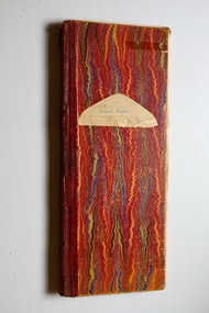
Administrative record - Debtors' Ledger, early 20th century
... Many of the debtors are Chinese, mostly working as market gardeners in the north Warrnambool area and the debts usually concerned rents and the supply of agricultural items such as chaff. These Chinese, many of whom came from the Victorian goldfields, operated market gardens and businesses in the town of Warrnambool from the 1870s to the 1930s or 40s....Many of the debtors are Chinese, mostly working as market gardeners in the north Warrnambool area and the debts usually concerned rents and the supply of agricultural items such as chaff. These Chinese, many of whom came from the Victorian goldfields, operated market gardens and businesses in the town of Warrnambool from the 1870s to the 1930s or 40s. ...This ledger contains details of debts owed by people in the Warrnambool district. It dates from 1906 to 1916. The compiler of the ledger is unknown. Many of the debtors are Chinese, mostly working as market gardeners in the north Warrnambool area and the debts usually concerned rents and the supply of agricultural items such as chaff. These Chinese, many of whom came from the Victorian goldfields, operated market gardens and businesses in the town of Warrnambool from the 1870s to the 1930s or 40s.This ledger is of interest because of the names of people listed as debtors and in particular the names of Chinese working in the district. The ledger is thus a valuable research tool. This is a ledger with a thick card cover in a mottled pattern in red, black, blue and yellow colours The spine, which has some damage, is covered in a maroon coloured leather. The pages are ruled with red lines and the entries are handwritten in ink. There are some loose pages.Debtor's Ledger C.L.warrnambool chinese market gardeners, warrnambool, chinese -
 Warrnambool and District Historical Society Inc.
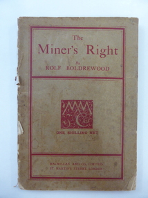
Book, The Miner’s Right, 1922
... goldfields was written by Rolf Boldrewood in 1890. It is retained because the author played a significant part in Warrnambool’s history. Rolf Boldrewood, the pen name of Thomas Browne, first came to the Warrnambool district in 1842, visiting the Bolden brothers’ property, Grasmere. He camped on the banks of the Merri River for about six months and described the area, including Warrnambool Bay, some years later in his book Old Melbourne Memories. In 1844 Thomas Browne established the property, Squattleseamere near Bessiebelle, north...goldfields was written by Rolf Boldrewood in 1890. It is retained because the author played a significant part in Warrnambool’s history. Rolf Boldrewood, the pen name of Thomas Browne, first came to the Warrnambool district in 1842, visiting the Bolden brothers’ property, Grasmere. He camped on the banks of the Merri River for about six months and described the area, including Warrnambool Bay, some years later in his book Old Melbourne Memories. In 1844 Thomas Browne established the property, Squattleseamere near Bessiebelle, north ...This book about the New South Wales goldfields was written by Rolf Boldrewood in 1890. It is retained because the author played a significant part in Warrnambool’s history. Rolf Boldrewood, the pen name of Thomas Browne, first came to the Warrnambool district in 1842, visiting the Bolden brothers’ property, Grasmere. He camped on the banks of the Merri River for about six months and described the area, including Warrnambool Bay, some years later in his book Old Melbourne Memories. In 1844 Thomas Browne established the property, Squattleseamere near Bessiebelle, north west of Portland. He remained there for ten years then moved to New South Wales. The last forty years of his life were spent writing and he became well-known for the classic Australian novel, Robbery Under Arms. This book is retained because it is a 19th century example of the writings of Rolf Boldrewood. He is important in Warrnambool’s early history as he was in the area in the early 1840s. His account of the area at that time is the most important one we have of the area that was later to be the site of the new settlement of Warrnambool.This is a soft cover book of 188 pages. The cover is brown with red edging and lettering and is partly detached from the binding. The spine is partly missing. The pages are dog-eared and there is some foxing. The text is printed in two columns to a page. Frank J. Donovanrolf boldrewood (thomas browne), bolden brothers in the warrnambool area, warrnambool history, the miners right -
 Bendigo Military Museum
Administrative record - 1 Fd Svy Sqn Project Report - Operation Carto Mercury 1986, 28 Jan 1986
... Bendigo Military Museum 37 - 39 Pall Mall Bendigo goldfields Operation Carto Mercury was a field completion Operation mounted by 1 Fd Svy Sqn 11 Aug 1985 to field complete 4 x 1:25000 compiled map sheet in the Cabarlah area to the North of Tawoomba. ...Operation Carto Mercury was a field completion Operation mounted by 1 Fd Svy Sqn 11 Aug 1985 to field complete 4 x 1:25000 compiled map sheet in the Cabarlah area to the North of Tawoomba. Included maps: 9243 - 23 Kingsthorpe, 9243 -24 Goombungee, 9243 - 21 Gomaren Creek, 9243 - 22 High FieldsA4 Typed document and diagrams, 14 pages. Report produced by 1 Fd Svy Sqn 1986royal australian survey corps, rasvy, fortuna, army survey regiment, army svy regt, asr, 1 fd svy sqn -
 Bendigo Military Museum
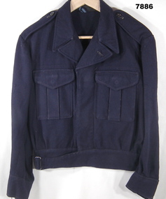
Uniform - JACKET, RAAF, c.WW2
... goldfields The name "HOLLOWAY' regarding RAAF - only one possible name for WW2. Uniform RAAF Battle Dress Jacket WW2 Holloway Manufacturers information - black ink print. "C.G.C.F. /A^F/ SIZE S". Handwritten blue ink pen "HOLLOWAY". Jacket - dark blue colour wool serge fabric. This jacket has been adapted from a RAAF Service dress jacket to resemble a RAAF Battle Dress Jacket. possibly made in the Norther ...The name "HOLLOWAY' regarding RAAF - only one possible name for WW2.Jacket - dark blue colour wool serge fabric. This jacket has been adapted from a RAAF Service dress jacket to resemble a RAAF Battle Dress Jacket. possibly made in the Norther Territory or on the Islands WW2. Collar, shoulder epaulettes, long sleeves with cuffs and buttons, two front patch pockets with concealed button flaps. Waistband with belt strap and metal slide buckle to fasten jacket. Black colour Bakelite buttons front and cuffs. Mid blue colour cotton lining to pockets and waistband. White colour cotton manufacturers label.Manufacturers information - black ink print. "C.G.C.F. /A^F/ SIZE S". Handwritten blue ink pen "HOLLOWAY".uniform, raaf, battle dress jacket, ww2, holloway -
 Bendigo Military Museum
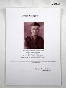
Document - DOCUMENT, SOLDIERS STORY WW2, Brenda M Tranter, "FROM GLOEGOER", 2013
... goldfields Refer to Cat No. 7944. Item in the collection of "Arthur E. Tranter", V50166 - VX52843 2/29th Bn. P.O.W. Document Booklet WW2 Arthur E Tranter Information on title page (front page); "From Gloegoer/ A book written for his little daughter Brenda,/ between June 21, 1943 and / December 17, 1943/ by Lieut. Arthur E. Tranter, VX52843/ whilst a POW in Gloegoer, North ...Refer to Cat No. 7944. Item in the collection of "Arthur E. Tranter", V50166 - VX52843 2/29th Bn. P.O.W.Document - copy of a soldier's story from WW2. White colour paper with black print. Illustrated front page - black and white portrait of A.E. Tranter; and a colour cartoon on Page 30. 66 pages - cut, plain A4 paper. Loose pages stored in plastic sleeve.Information on title page (front page); "From Gloegoer/ A book written for his little daughter Brenda,/ between June 21, 1943 and / December 17, 1943/ by Lieut. Arthur E. Tranter, VX52843/ whilst a POW in Gloegoer, North Sumatra". "(included are two lectures by Lieut. Wessels, a Dutch POW, in October and November/ 1943, his notes)".document, booklet, ww2, arthur e tranter -
 Bendigo Military Museum
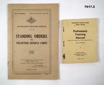
Manual - VOLUNTEER DEFENCE CORP TRAINING, Victorian Railway Workshops, 1942
... goldfields WW2 Volunteer Defence Corps (V.D.C.) 1. THIS IS A MEDIUM SIZED MANUAL. THE COVER IS A STIFF CARDBOARD OF KHAKI COLOUR. TOP CENTRE IS THE AUSTRALIAN CREST. AUSTRALIAN MILITARY FORCES. Standing orders for Volunteer Defence Corps 1942. At the bottom is a line stating: By Authority Victorian Railways Printing Works, North ...1. THIS IS A MEDIUM SIZED MANUAL. THE COVER IS A STIFF CARDBOARD OF KHAKI COLOUR. TOP CENTRE IS THE AUSTRALIAN CREST. AUSTRALIAN MILITARY FORCES. Standing orders for Volunteer Defence Corps 1942. At the bottom is a line stating: By Authority Victorian Railways Printing Works, North Melbourne. Inside are 24 pages of orders and a couple of loose amendments. 2. Pocket size Manual. Khaki Cover. Printing on front in black ink. Title - VOLUNTEER DEFENCE CORPS (HOME GUARD) "Preliminary Training Manual" 5th Edition. Headquarters Perth W.A. August 1942. The manual has 128 pages of text and drawings. It is bound with 3 rusty staples.ww2, volunteer defence corps (v.d.c.) -
 Bendigo Military Museum
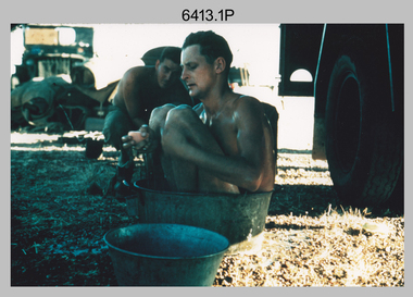
Photograph - Royal Australian Survey Corps Surveyors in the Field – North Queensland, 1958
... Bendigo Military Museum 37 - 39 Pall Mall Bendigo goldfields This is a set of seven photographs of surveyors and support staff in the field undertaking duties in North Queensland in 1958. ...This is a set of seven photographs of surveyors and support staff in the field undertaking duties in North Queensland in 1958. The surveyors were employed in the establishment of mapping and geodetic control. In this era surveyors used theodolites to observe horizontal and vertical angles and chains to measure base line distances between survey stations. Bob Skitch shown in photos .4P to .6P was in the 2nd year of his career in the Australian Army. He achieved the rank of Lieutenant Colonel and his last appointment was the CO of the Army Survey Regiment from 1976 to 1980. The annotation on the back of photo .5P ‘Black foreground is where Bob Skitch boiled billy and started a grass fire’.This is a set of seven photographs of surveyors and support staff in the field undertaking duties in North Queensland in 1958. The photographs were printed on photographic paper and are part of the Army Survey Regiment’s Collection. The photographs were scanned at 300 dpi. .1) - Photo, colour, 1958. Surveyor in Nth QLD enjoying a bath. L to R: Don Cocker, Bob Thompson. .2) - Photo, colour, 1958. Don Cocker surveyor in Nth QLD, enjoying a bath. .3) - Photo, colour, 1958. Surveyors Nth QLD undertaking survey observations, using MRA1 tellurometer to measure base-line distances. L to R: Len Davies, Lou Sommer, John Van De Graff. MRA1 was covered to stop overheating. .4) - Photo, colour, 1958. Surveyors south of Richmond, QLD digging holes for the erection of a Bilby observation tower. L to R: John Van De Graff, Bob Skitch, Kev Moody, Mal Hayes, Don Gray .5) - Photo, colour, 1958. Surveyors south of Richmond, QLD erecting a Bilby observation tower. L to R: Tom Royle, Bob Skitch (on ground level), Mal Hayes. .6) - Photo, colour, 1958. Surveyors south of Richmond, QLD erecting a Bilby observation tower. L to R: Tom Royle, Bob Skitch, Mal Hayes, Jim McGill (on ground level). .7) - Photo, colour, 1958. Surveyors south of Richmond, QLD undertaking survey measurements from a Bilby observation tower..1P to .7P annotated on back – personnel names, the year and the location. Annotated on back of .5P ‘Black foreground is where Bob Skitch boiled billy and started a grass fire’.royal australian survey corps, rasvy, army survey regiment, asr, army svy regt, fortuna, surveying