Showing 48 items matching " grange estate"
-
 City of Moorabbin Historical Society (Operating the Box Cottage Museum)
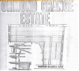
Flyer - Ormond Grange Estate, Ormond, 1913
... Ormond Grange Estate, Ormond...Ormond Grange Estate...Example of the progress of the Municipality of Moorabbin Holloway Street Wild Cherry Road Parker Street Ormond Land sales real estate Ormond Grange Estate Photo copy of advertising flyer for auction of real estate sales - plan of building blocks for sale Flyer Ormond Grange Estate, Ormond ...At the end of World War One, there was a renewed interest in residential land and a number of estates opened up in the Municipality of Moorabbin.Example of the progress of the Municipality of MoorabbinPhoto copy of advertising flyer for auction of real estate sales - plan of building blocks for saleOrmond Grange Estateholloway street, wild cherry road, parker street, ormond, land sales, real estate -
 Canterbury History Group
Map - Canterbury Subdivisions
... ... Grange Estate...Canterbury Logans Estate Shrublands Estate Claremount Park Estate Arklow Hill Estate Griffin Estate Monomeath Estate Mont Albert Park Estate Great Railway Estate Grange Estate Map Canterbury Subdivisions ...A collection of 6 maps with notations showing the names and dates of land subdivision in Canterbury and surrounding suburbs.canterbury, logans estate, shrublands estate, claremount park estate, arklow hill estate, griffin estate, monomeath estate, mont albert park estate, great railway estate, grange estate -
Canterbury History Group
Pamphlet - Range Estate, Canterbury, 1/04/1916 12:00:00 AM
... ... Grange Estate...Canterbury History Group 190A Canterbury Road Canterbury melbourne Canterbury Balwyn Road Hopetoun Avenue Mont Albert Road View Street Coghill & Haughton Land Sales Grange Estate Auctioneers Photocopy of a Coghill & Haughton brochure advertising the sale by auction of '19 superb Villa and Mansion' sites in Canterbury on 15 April 1916. ...Photocopy of a Coghill & Haughton brochure advertising the sale by auction of '19 superb Villa and Mansion' sites in Canterbury on 15 April 1916. Includes map of the allotments and photographs of five existing homes on the estate.canterbury, balwyn road, hopetoun avenue, mont albert road, view street, coghill & haughton, land sales, grange estate, auctioneers -
Glen Eira Historical Society
Article - Rosstown Railway
... GRANGE... Real Estate...Murray Ross Murray Sugar Beet Mills Mills Elsternwick Land Transport Railways Railway Lines Railway Routes Carnegie Neville Street Carnegie Miller Street Factories Market Gardens Horticulture Peat Soils Land Forms Topography Geology Civic Issues Cone Sugar Industry Elsternwick Plaza Elsternwick Glenhuntly Road Parks and Reserves EE Gunn Reserve Caulfield Racecourse Sportsgrounds Caulfield Carnegie Riddell Parade Clarence Street Aileen Avenue Princes Park Dover Street Marara Road Oakleigh Road Rosanna Street Murrumbeena Crescent North Road Kooyong Road Hawthorn Road Booran Road Koornang Road Poath Road Warragul Road Railway Platforms Railway Buildings Bambra Road Swamps Landforms Landfill Council Landfill Railway Bridges Bridges Railway Underpasses Sporting Clubs Tennis Clubs Bowls Clubs Rosstown Railway Rosanna Street Reserve Maps Railway Maps LIVING IN GLEN EIRA Weickhardt Ian Jowett Des Caulfield South Curraweena Road Oakleigh Caulfield Technical School RETURN TO ROSSTOWN Beet Sugar Industry Crops Land Booms Land Development and Subdivisions Bent Thomas Fink Benjamin Sugar Works Rosstown Hotel Oamdenong Road ROSSTOWN DRY CLEANERS Shops Rosstown Road Rosstown Plate People by Circumstance Migrants Accountants Occupations Professionals THE GRANGE Real Estate Grange Road Financial Agents Judges ROSSTOWN ESTATE Financial Trouble Rabbit Preserving Breweries Political Debates Political Issues Political Electorates Politics Political Science Debt Financial Loans Court Procedures Court Cases Legal Events and Activities MALLESON AND RIGGALL Widowers SEABEACH RAILWAY Economics Economic Deadline Depression 1890s Economic Crash Mortgages Divorce Social Problems Poverty Ross Claude Ross Roderick World War 1914-1918 Wars Military History Servicemen AUSTRALIAN FLYING CORPS Engineers Caulfield Council Swagmen Homelessness Glenhuntly Road Glenhuntly Road Tram Woornack Road Leila Road Wild Cherry Road Melten Avenue Illustrations Steam Trains Trains Horse and Cart Horse-drawn Transport Railway Stations Article Rosstown Railway ...This file contains three items: 1/A review of the ROSSTOWN RAIL TRAIL from LIVING IN GLEN EIRA, vol. 11, 2004, Issue 4, no. 25, date and author unknown. The review explains the purpose of the Rail Trail with a brief narrative of the history behind Rosstown Sugar Mill Railway line. Concluding with information on the location of the Trail and the expected time required to walk the entire track included in the review is a map of the Rail Trail, which marks significant sites along the trail with historic pictures. 2/A newspaper article from THE AGE, dated Tuesday 21/10/1980 and written by Iola Matthews, reporting on the circumstances that led to the publication of the book RETURN TO ROSSTOWN written by Des Jowett and Ian Weickhardt. The article begins with a brief biography of the authors before moving into details of the book’s content, providing a further biography of W. Murray Ross which includes information on his financial ventures – particularly the Rosstown Rail – his marriage and children. The article includes a black and white photograph of Weickhardt and Jowett walking along the route of the railway line, an illustration of the Rosstown sugar works and a map of the area surrounding the site of the mill. 3/Three photocopies of a black and white illustration of the Rosstown sugar works from the east, undated and artist unknown.rosstown rail trail, rosstown, ross william, ross w. murray, ross murray, sugar beet mills, mills, elsternwick, land transport, railways, railway lines, railway routes, carnegie neville street, carnegie miller street, factories, market gardens, horticulture, peat, soils, land forms, topography, geology, civic issues, cone sugar industry, elsternwick plaza, elsternwick, glenhuntly road, parks and reserves, ee gunn reserve, caulfield racecourse, sportsgrounds, caulfield, carnegie, riddell parade, clarence street, aileen avenue, princes park, dover street, marara road, oakleigh road, rosanna street, murrumbeena crescent, north road, kooyong road, hawthorn road, booran road, koornang road, poath road, warragul road, railway platforms, railway buildings, bambra road, swamps, landforms, landfill, council landfill, railway bridges, bridges, railway underpasses, sporting clubs, tennis clubs, bowls clubs, rosstown railway, rosanna street reserve, maps, railway maps, living in glen eira, weickhardt ian, jowett des, caulfield south, curraweena road, oakleigh, caulfield technical school, return to rosstown, beet sugar industry, crops, land booms, land development and subdivisions, bent thomas, fink benjamin, sugar works, rosstown hotel, oamdenong road, rosstown dry cleaners, shops, rosstown road, rosstown plate, people by circumstance, migrants, accountants, occupations, professionals, the grange, real estate, grange road, financial agents, judges, rosstown estate, financial trouble, rabbit preserving, breweries, political debates, political issues, political electorates, politics, political science, debt, financial loans, court procedures, court cases, legal events and activities, malleson and riggall, widowers, seabeach railway, economics, economic deadline, depression 1890s, economic crash, mortgages, divorce, social problems, poverty, ross claude, ross roderick, world war 1914-1918, wars, military history, servicemen, australian flying corps, engineers, caulfield council, swagmen, homelessness, glenhuntly road, glenhuntly road tram, woornack road, leila road, wild cherry road, melten avenue, illustrations, steam trains, trains, horse and cart, horse-drawn transport, railway stations -
Glen Eira Historical Society
Letter - HUNT, WILLIAM HOGARTH
... Estate... Grange Road...Long and Co Jennings A.V Timber yards Builders ‘The Estate’ Hillcrest Estate Grange Road Marara Road Rosedale Avenue Hobart Jack Mackie Road Confectionery Stores Ross Murray Glenhuntly Athletic Club Godfrey Evelyn Athletics Clubs Railways Glenhuntly Junior Football Club Elsternwick Princess Park Carnegie Oval Booran Road Koornang Park Ormond Oval – EE. ...Two sets of this man's handwritten memories: 1/Five pages of handwritten personal memories, written by William Hogarth Hunt 13/07/1977. He outlines his family, their travels and settlement in 1908 at Glenhuntly: a detailed account of residents, shop owners, land sales and identities, Murray Ross, Mr Burr of Burr’s Gun Oil and Mr Zarman. Also details Glenhuntly Methodist Church, football, athletics, Glenhuntly Aerodrome and an extensive list of local residents and their stories. 2/Two pages of handwritten personal memories, written by William Hogarth Hunt 02/09/1977. A detailed account of residents, shop owners, identities, athletes, local policemen and their stories in the Glen Huntly area.personal memories, hunt william hogarth, glenhuntly, grange road, trams, plumber, stone mary ann, neerim road, wanalta road, schurme mrs, private hospital, hospitals, watson grove, hunt jessie, hunt alfred, hunt charles, smith mr, fisher mr, smith mrs, jockeys, dore george, ‘willis’, builders, house names, mernda, roseberry grove, el nido, neerim road, glenhuntly post office, mrs fielder’s sweetshop, mrs beer’s sweet shop, paddocks, confectionery, fielder fred, maroona road, murrumbeena, grocers, callister dave, carnegie state school, hay and corn store, james street, woodyard, hillards chemist, hughes body works, chemists, davidson’s, glenhuntly printing, hay and corn stores, railway gates, anz bank, fox mr, martin jack, fox mrs, clothing stores, steam rollers, radio and tv shop, beasley j, delicatessen/ham and beef shop, butchers, schurme’s private hospital, gellatley george, tailors, commonwealth banks, watson grove, banks, preston peter, e.j. & h. amos, hardware stores, estate agents, glenhuntly picture theatre, whittle mr, theatres, newsagency, cooper and cooke, station street, f.j. long and co, jennings a.v, timber yards, builders, ‘the estate’, hillcrest estate, grange road, marara road, rosedale avenue, hobart jack, mackie road, confectionery stores, ross murray, glenhuntly athletic club, godfrey evelyn, athletics clubs, railways, glenhuntly junior football club, elsternwick, princess park, carnegie oval, booran road, koornang park, ormond oval – ee. gunn reserve, glenhuntly oval, oakleigh road, victorian amateur turf club, koornang road, glenhuntly aerodrome, neville street, glenhuntly state school, rosslyn street, geary mr, lauriston tennis courts, bakers, carnegie r.s.l., east bentleigh, bowling clubs, tucker road, tennis clubs, centre road, murrumbeena road, larman mr, hollway street, nurseries, parker street, lyle marshall, burr mr, solicitors, builders, bones nursery, ‘burr’s gunoil’, glenhuntly methodist church, carnegie, smith alf, ezard family, clemens family, noy family, noy clarrie, dickie family, storey family, storey george, davis family, joss house, chinese community, wattle avenue, grange road, glenhuntly amateur football club, football clubs, glenhuntly athletic club, athletic clubs, glen huntly junior football club, carnegie oval, koornang park, glenhuntly oval, victorian amateur turf club, glenhuntly aerodome, glenhuntly state school, geary mr., bakers, east bentleigh, tucker road, centre road, larman mr, nurseries, lyle marshall, solicitors, bones nursery, carnegie, "the estate", royal avenue, mckay avenue, dumsday bertha miss, love family, gilmour family, waratah ave, sinclair mr, tuckpointers, bricks, donegan mr, plumbers, frazer mr, frazer and jenkinson printers, frazer arthur, ezard manufacturing, jewellers, private hospital, maroona road, o'carroll mr, beattie mr, horse trainer, morton tom, lord harry, estate agents, ormond, councillors, taylor mr, builders, gibson family, westley alf, o'carroll j (jack) d, glenhuntly athletics club, athletes, jack page's bakery and cake shop, nay clarrie, hunt william h., hunt alf, page jack, armstrong jack, manchester grove, morgan advertising, cusdin sid, farrier, glenhuntly cricket club, caulfield racecourse, neerim road, hoffman's plumbing, emma street, st. agnes school, st. agnes church hall, jenkin 'boss' mr, teachers, hawthorn miss, quinn miss, chitty charlie, chitty's timber, crystal palace picture theatre, theatres, marsh bill, hardware shops, watson arthur w, j.s. kidd and company, marshes hardware, kidd's hardware, bruce ivy, 'belgrave', house names, belgrave road, dandenong road, hunter 'pud', police officers, hunt jess, kangaroo road, murrumbeena, glen huntly -
 Glen Eira Historical Society
Document - PRAHRAN AND MALVERN TRAMWAYS TRUST
... Estate register... National Trust Register... Rusden Street... Balaclava Road... Orrong Road... Hawthorn Road... Dandenong Road... Glen Huntly Road... Grange...Prahran and Malvern Tramways Trust P+MTT Tram companies Land transport Public transport Substation Tram shelter Powerhouse Parapet Brick Stuccoed Roof lanterns Historic Buildings register National Estate register National Trust Register Rusden Street Balaclava Road Orrong Road Hawthorn Road Dandenong Road Glen Huntly Road Grange Road Elsternwick Elsternwick Railway Station Caulfield Caulfield North Caulfield Railway Station Point Ormond Grimwade House Breydon Graeme Tramcar Edwardian Transport Trams Tram Depot Document PRAHRAN AND MALVERN TRAMWAYS TRUST ...This file has 3 items. 1/Photocopy of Caulfield Conservation Study Report by Andrew Ward dated January 1995 of 6-8 Rusden Street, Elsternwick being former Prahran and Malvern Tramways Trust substation. Report includes image, existing registrations, description of substation building and condition. 2/Original photograph (black and white) of tram shelter at corner of Balaclava Road and Orrong Road, Caulfield North, outside Grimwade House (school), description written on back of photo. 3/Original copy of magazine of the Tramway Museum Society of Victoria Ltd. ‘Running Journal’ Vol 7 No. 3 dated June 1970. Article (pages 3-7) entitled ‘Feeding & Filling, The Story of the Prahran & Malvern Tramways Trust’ written by Graeme Breydon. Article written for the 60th anniversary of the trust which opened for business on 30/05/1910 and describes the establishment and development of Tramways between suburbs of Malvern & Prahran including Elsternwick, Caulfield & Glen Huntly. Article includes 4 images plus map and diagram. Included: Photograph 3: Opening ceremony of tramway extension from Balaclava junction to Elsternwick railway station on Glen Huntly Road dated 13/11/1913. Diagram of various tramway routes including Prahran & Malvern Tramways Trust routes.prahran and malvern tramways trust, p+mtt, tram companies, land transport, public transport, substation, tram shelter, powerhouse, parapet, brick, stuccoed, roof lanterns, historic buildings register, national estate register, national trust register, rusden street, balaclava road, orrong road, hawthorn road, dandenong road, glen huntly road, grange road, elsternwick, elsternwick railway station, caulfield, caulfield north, caulfield railway station, point ormond, grimwade house, breydon graeme, tramcar, edwardian, transport, trams, tram depot -
 Glen Eira Historical Society
Photograph - CARNEGIE
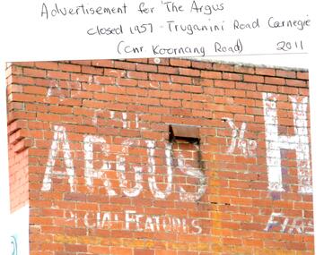
... Grange Road... Carnegie Primary School... Primary schools... Murrumbeena... Neerim Road... Dandenong Road... Koornang Park... Lord Reserve... Rosanna Street Reserve... Packer Oval Reserve... Caulfield Swim Centre... Holywood Grove... Mile End Road... McPherson Avenue... Munster Avenue... Rosstown Hotel... Leila Road... Methodist Church... Toolambool Street... Carnegie Theatre... Carnegie Estate...Tranmere Avenue Carnegie Railway Station Stations Libraries Post Offices Memorial Hall Carnegie Progress Hall Carnegie Community Singing Social clubs Chadstone progress Newspapers Temminghoff Robert Carnegie Chamber of Commerce Caulfield City Council Rob’s Chocolate Box Rosstown Ross William Murray Rosstown Railway Elsternwick Oakleigh City of Caulfield Glen Huntly Road Glenhuntly Road Grange Road Carnegie Primary School Primary schools Murrumbeena Neerim Road Dandenong Road Koornang Park Lord Reserve Rosanna Street Reserve Packer Oval Reserve Caulfield Swim Centre Holywood Grove Mile End Road McPherson Avenue Munster Avenue Rosstown Hotel Leila Road Methodist Church Toolambool Street Carnegie Theatre Carnegie Estate Agency – Sims and Broadbent Woorayl Street Estate agents Cowie J. ...24 photographs relating to Carnegie plus 1 slide: 1/Two photographs, one of Koornang Road c.1920’s and one of flower shop rear of library, date unknown. 2/One photograph of Carnegie Post Office c. undated. 3/Two photographs Koornang Road, Carnegie and phone boxes, Carnegie, dated 1914. 4/Two photographs (the same) of an RSL Ball dated 15/08/1937. 5/17 black and white negative photos – reprinted, date unknown, of Carnegie Library, shop front opening Koornang Road. 6/Slide showing Koornang Road, Carnegie looking South. 7/6 photocopied postcards from Valentines Real Photo Series, in album owned by Mrs. Zoe Mason, collected and returned to Pam Speedy (daughter) 12 Wattle Grove, East Malvern, 15/03/1999. Photocopied pages from 1923 Sands and McDougalls included with some prints to give an idea of architecture and other retail trade. 8/Two photocopied prints of Carnegie Flood. 1946 – Koornang Road, shows shopkeepers in street at that time. 9/Two photographs of brick wall advertising the "Argus" newpaper, which closed in 1957. Photos taken in 2011 when building was exposed prior to rebuilding on site.koornang road, rosstown road, carnegie, shepparson street, carnegie library, carnegie post office, mcallister b., glen huntly, glenhuntly, phone boxes, memorial hall, bamfield m., tranmere avenue, carnegie railway station, stations, libraries, post offices, memorial hall carnegie, progress hall, carnegie community singing, social clubs, chadstone progress, newspapers, temminghoff robert, carnegie chamber of commerce, caulfield city council, rob’s chocolate box, rosstown, ross william murray, rosstown railway, elsternwick, oakleigh, city of caulfield, glen huntly road, glenhuntly road, grange road, carnegie primary school, primary schools, murrumbeena, neerim road, dandenong road, koornang park, lord reserve, rosanna street reserve, packer oval reserve, caulfield swim centre, holywood grove, mile end road, mcpherson avenue, munster avenue, rosstown hotel, leila road, methodist church, toolambool street, carnegie theatre, carnegie estate agency – sims and broadbent, woorayl street, estate agents, cowie j. mrs., confectioner, woodhouse e., stationer, mckay jno. a., mckay jonathon, small goods, perry w. b., chemists, kinsman e. h., newsagents, jones a. w., mckee wm., furniture stores, neil geo. m., grocer, truganini road, brick -
Glen Eira Historical Society
Photograph - Elsternwick
... Estate Agents... Elsternwick... Paddocks... Glen Huntly Road... Walter Kelly... Elsternwick Park... Slaughter yards... Glen Eira roads... Point Ormond... Glenhuntly Railway Station... Nepean Highway... Grange...Batters Philippe Real Estate Agents Elsternwick Paddocks Glen Huntly Road Walter Kelly Elsternwick Park Slaughter yards Glen Eira roads Point Ormond Glenhuntly Railway Station Nepean Highway Grange Road Holdsworth’s Jewellers Staniland Grove Coles store Shops Orrong Road Fosseys Hattams Mensware Woolworths Dalgarnos Crockery and Kitchenware Chapmans Gifts Garth’s Shoe Store Garth Jack Allen’s Furniture and Auction Rooms Elsternwick Market Adam’s Cakes Mr. ...This file contains three items. Photocopied and three page retyped article, undated c.1930s and source unknown from Real Estate Agent Philippe Batters 03/09/1997. Three page document from Keith James Smith, undated, on research on Elsternwick and Glen Huntly Road shops and traders. Three articles from THE AGE 13/05/2000 and 15-16/02/2013 and MELB BAYSIDE WEEKLY 03/11/2010 giving snap shots of Elsternwick housing and facts.batters philippe, real estate agents, elsternwick, paddocks, glen huntly road, walter kelly, elsternwick park, slaughter yards, glen eira roads, point ormond, glenhuntly railway station, nepean highway, grange road, holdsworth’s jewellers, staniland grove, coles store, shops, orrong road, fosseys, hattams mensware, woolworths, dalgarnos crockery and kitchenware, chapmans gifts, garth’s shoe store, garth jack, allen’s furniture and auction rooms, elsternwick market, adam’s cakes, mr. green’s pet shop, turner mr., grocer shop, moores lendring library, hopetown gardens, gardens, jack hatheralls butchershop, butchers, chinese laundry, chinese community, laundries, mr. & mrs. darbyshires milkbar, st. johns church, kooyong road, hasseles garage, garages, royal parade, glenhuntly, camden, hawthorn road, blacksmiths, camden town, dolls hospital, caulfield state school 773, independent picture, theatres, camden theatre, southern indoor bowl centre, larch street, montessorie school, collins milk bar, milk bars, collins lin, hartrick miss, armond mr., lennie mr., rothells sausage factory, north road, red bus service transport, furlonger miss, dance studio, moran and cato grocery, cato family, newsagent, tozer brook, furniture store, green gables american style soda fountain and milk bar, hoyts renown theatre, state savings bank, riddell parade, clarence street, aileen avenue, smith keith james, camden town, sports club, peer gary, gary peer & associates, brukarz jack, ray white real estate, real estate agents, classic cinema theatres, st. george’s road, elizabeth street, allison road, gladstone park, myrtle street, victoria street, caulfield, st kilda east, lisbon house, orrong road, house names, rippon lea estate, caulfield south, carnegie, gordon street, carre street, main street, clarence street, elsternwick club, jewish holocaust museum, daily planet, brothels, wesley college, elsternwick primary, st. joseph’s primary, scholem aleichen college, liebler yavneh, hopetoun gardens, harleston park -
Glen Eira Historical Society
Document - GLEN HUNTLY
... Grange Road... Glen Huntly Road... Watson Crescent... Garden Avenue... Wattle Avenue... Park Avenue... McKay Avenue... Neville Street... Miller Street... Morgan Street... Truganini Road... Koornang Road... Glen Huntly Park and Recreation Reserve... Glen Huntly Park Estate...It includes 1 black and white photograph (52mm x 375mm) of shops along Koornang Road and 1 black and white photograph (52mm x 375mm) of shops along Glen Huntly Road. 3/1 black and white aerial photograph (undated and unattributed) (164mm x 272mm) of Glen Huntly Park Estate and surrounding area, with street names added, which indicates the second section of the Estate for sale. Glen Huntly Grange Road Glen Huntly Road Watson Crescent Garden Avenue Wattle Avenue Park Avenue McKay Avenue Neville Street Miller Street Morgan Street Truganini Road Koornang Road Glen Huntly Park and Recreation Reserve Glen Huntly Park Estate Royal Avenue Glen Huntly Railway Station tram depots Lyons Street Moira Avenue Katandra Road Ormond Mimosa Road Glen Huntly Park Pty Ltd City of Caulfield Lord H land sales auctions parks and reserves shops Elsternwick Caulfield Document GLEN HUNTLY ...This file contains 3 items about land subdivision and development in Glen Huntly: 1/1 colour real estate advertisement (undated) for the auction of lots of land in Glen Huntly Park Estate, Glen Huntly to be held 06/12/1930. The poster includes1 black and white photograph (85mm x 201mm) of the Shopping Centre on Glen Huntly Road and a colour map (95mm x 107mm) of the Estate and surrounding locality. Also included on the poster is 1 black and white photograph of the Glen Huntly Park Estate and Cypress Plantation of the Glen Huntly Park. 2/1 undated advertisement for an auction of land in Glen Huntly Park to be held 19/03/1938 pursuant to an order to an order for sale made by the Supreme Court of Victoria. It includes 1 black and white photograph (52mm x 375mm) of shops along Koornang Road and 1 black and white photograph (52mm x 375mm) of shops along Glen Huntly Road. 3/1 black and white aerial photograph (undated and unattributed) (164mm x 272mm) of Glen Huntly Park Estate and surrounding area, with street names added, which indicates the second section of the Estate for sale.glen huntly, grange road, glen huntly road, watson crescent, garden avenue, wattle avenue, park avenue, mckay avenue, neville street, miller street, morgan street, truganini road, koornang road, glen huntly park and recreation reserve, glen huntly park estate, royal avenue, glen huntly railway station, tram depots, lyons street, moira avenue, katandra road, ormond, mimosa road, glen huntly park pty ltd, city of caulfield, lord h, land sales, auctions, parks and reserves, shops, elsternwick, caulfield -
Glen Eira Historical Society
Document - GLEN HUNTLY (HISTORY OF)
... Grange’... North Road... Leila Road... Wild Cherry Road... Caulfield Roads Board... Elsternwick... Land Sales... Sugar Mills... Koornang Road... Woornack Road... Elsternwick Railway Station... Riddell Parade... Clarence Street... Dover Street... Oakleigh Road... Murrumbeena Crescent... Carlisle Crescent... Railways... Trains... Parks and Reserves... Caulfield Council... Sussex Street... Caulfield City Council... Swamps... Rosstown Sugar Mill... Rosstown Estate...Waratah Avenue Royal Avenue Munster Avenue James Street Rothschild Street Peace Memorial Organ Singers Bremner Marie Scotland Betty Carden Joan Rosstown Railway South Caulfield Plants Marata Road Curraweena Road Bambra Road Ross William Murray Ross Leila Ross Constance Vautin Constance ‘The Grange’ North Road Leila Road Wild Cherry Road Caulfield Roads Board Elsternwick Land Sales Sugar Mills Koornang Road Woornack Road Elsternwick Railway Station Riddell Parade Clarence Street Dover Street Oakleigh Road Murrumbeena Crescent Carlisle Crescent Railways Trains Parks and Reserves Caulfield Council Sussex Street Caulfield City Council Swamps Rosstown Sugar Mill Rosstown Estate ‘The Swagman’s Retreat’ Arnott Herb Rosstown Carnegie ‘Ross’s Folly’ Carnegie Andrew Rosstown Hotel Dandenong Road Rosstown Road Rosstown Plate Horse Race Caulfield Racecourses Ames Avenue Rosstown Court Hostels Murrumbeena Cinemas Innovations (Cabinetry Film) Films Music Pianos Manchester Grove Safeway Store Squash Courts Airports Lord Reserve Aeroplanes Air Navigation Act 1921 Neville Street Larkin Sopwith Aviation Company of Australasia Lyons Street Morgan Street Bookmakers Nightsoil Poultry Weatherboard Buildings Glen Huntly Railway Station Rosedale Avenue Rifle Clubs Scout Groups 1st Glen Huntly Troop ANA Dowding Jack Mr. ...This file contains one item: 1/A loose-leaf, 23-page document titled ‘The History of Glen Huntly’, by Alfred R. Jones, dated 20/06/1991, describing the history of the suburb. The author has drawn heavily from the 4 sources noted in the bibliography. Subjects covered include the ship the suburb is named after, the suburb’s State School, the suburb’s churches, the Rosstown Railway and Sugar Mill, the origin of the name of Carnegie, the suburb’s aerodrome, and the beautification of the Glen Huntly Shopping Centre. The final 12 pages consist of 9 appendices relating to the aforementioned subjects. Appendix A is a typewritten letter from Ron McLeod, secretary of the Place Names Committee, to Mr. D. R. Aylen, CEO of the City of Caulfield, notifying the latter of the alteration of the name ‘Glenhuntly’ to ‘Glen Huntly’. Appendix B is a list of the ministers of St. David’s Uniting Church from its formation in 1916 to the present. Appendix C identifies the persons portrayed in St. David’s stained glass windows. Appendix D is a poster announcing the auction of 41 blocks of land between Hawthorn and Bambra Road formerly owned by William Ross, plus a map identifying said land blocks and another for locality. Appendix E is an A4 plan of the Rosstown Railway. Appendix F is a drawing of the Rosstown Sugar Mill. Appendix G is a poem titled ‘The Swagman’s Retreat’, by Herb Arnott, about the failure of the Mill. Appendix H is a map of Caulfield’s horse tramways plus a list of opening and closing dates. Appendix J is a list of streets explaining the meanings of their names.glen huntly, glenhuntly, local history, ‘glen huntly’ (ship), ‘glen huntlely’ (ship), quarantine stations, glen huntly road, lake street, mernda avenue, glen huntly state school no. 3703, ormond francis, ormond, garden avenue, grange road, churches, congregational church, glen huntly presbyterian church, st. david’s, st. david’s uniting church, anglican church, jenkin william ‘boss’, methodist church, wattle avenue, smith a. w. mr., glen huntly post office, glen huntly road, king f. l. mr., uniting church, child care centre, presbyterian church of eastern australia, glen huntly methodist church, sun aria, miller mary, stained glass, phrenologists, trinity congregational church, primitive methodists, ‘the victorian independent’, mercy mr., greek orthodox original old calendar church, wanalta road, salvation army, halls, myrtle street, catholic church, st. anthony’s roman catholic church, foundation stones, neerim road, mannix archbishop, st. agnes’ anglican church, booran road, sunday schools, clergy residences, ‘see’ anglican news magazine, lees archbishop, booth archbishop, glen huntly presbyterian church, el nido grove, tennis courts, bollard v. w. right rev., waratah avenue, royal avenue, munster avenue, james street, rothschild street, peace memorial organ, singers, bremner marie, scotland betty, carden joan, rosstown railway, south caulfield, plants, marata road, curraweena road, bambra road, ross william murray, ross leila, ross constance, vautin constance, ‘the grange’, north road, leila road, wild cherry road, caulfield roads board, elsternwick, land sales, sugar mills, koornang road, woornack road, elsternwick railway station, riddell parade, clarence street, dover street, oakleigh road, murrumbeena crescent, carlisle crescent, railways, trains, parks and reserves, caulfield council, sussex street, caulfield city council, swamps, rosstown sugar mill, rosstown estate, ‘the swagman’s retreat’, arnott herb, rosstown, carnegie, ‘ross’s folly’, carnegie andrew, rosstown hotel, dandenong road, rosstown road, rosstown plate horse race, caulfield racecourses, ames avenue, rosstown court, hostels, murrumbeena, cinemas, innovations (cabinetry film), films, music, pianos, manchester grove, safeway store, squash courts, airports, lord reserve, aeroplanes, air navigation act 1921, neville street, larkin sopwith aviation company of australasia, lyons street, morgan street, bookmakers, nightsoil, poultry, weatherboard buildings, glen huntly railway station, rosedale avenue, rifle clubs, scout groups, 1st glen huntly troop, ana, dowding jack mr., glen huntly infant welfare and family planning clinic, vermador private hospital, watson grove, rowlands (drapers), bones plant nursery, caulfield railway station, bridges, trams, horse tramways, glen eira road, elsternwick railway station, kooyong road, aboriginal peoples, truganini road, hannan lyn mrs. (urban planning officer), glen huntly shopping centre, sculptures, street beautification scheme, “flying the yellow flag”, moore olive, “return to rosstown”, jowett d. f., weickhardt i. s., “from sand swamp and health”, murray peter r., wells john c., caulfield historical society, newsletters, place names committee, mcleod ron, aylen d. r. mr., jones hugh rev., king joseph, scarfe james, vertigan sidney, vertigan earle, rance victor, flavell cameron, denholm robin, moorhead ken, taliai siupeli, eccles james leslie, little agnes, hutchins william r., dickie may a., gordon ivey agnes, theobald a. a. mrs., brownbill lloyd norman, ash georgette, land sales, auctions, messrs. crews & arkle, street names -
 Glen Eira Historical Society
Article - Methodist Church, Grange Road, 183 – 185, Glen Huntly
... Grange Road... Molloy Andrew... Land Sales... Glen Huntly Road... Methodist Church... Auctions... Wattle Ave.... Uniting Church... Churches... King F. L Mr.... Presbyterian Church of Eastern Australia... Monuments and Memorials... Temples... Religious Ceremonies... Chinese Community... Real Estate...Grange Road Molloy Andrew Land Sales Glen Huntly Road Methodist Church Auctions Wattle Ave. Uniting Church Churches King F. L Mr. Presbyterian Church of Eastern Australia Monuments and Memorials Temples Religious Ceremonies Chinese Community Real Estate Agents Commercial Development Residential Development Child Care Glen Huntly Post Office Official Buildings Weatherboard Buildings Clergy Church Residences Meeting Rooms Article Methodist Church, Grange Road, 183 – 185, Glen Huntly ...1/A photocopy of a typed document of notes, source and date unknown, describing a brief history of the former Methodist Church in Grange Road, GlenHuntly. 2/Two colour photographs dated November 1980 of the front and side view of the church, and two undated photographs of the foundation stones, laid 1922 for the church and 1932 for the brick hall. 3/Also a newspaper article by Andrew Molloy dated 25/02/1990 discussing development options for potential buyers, source unknown.glen huntly, smith a. w. f. mr, foundation stones, grange road, molloy andrew, land sales, glen huntly road, methodist church, auctions, wattle ave., uniting church, churches, king f. l mr., presbyterian church of eastern australia, monuments and memorials, temples, religious ceremonies, chinese community, real estate agents, commercial development, residential development, child care, glen huntly post office, official buildings, weatherboard buildings, clergy, church residences, meeting rooms -
Glen Eira Historical Society
Book - Carnegie Primary School No. 2897
... Grange Road... Clifton Street... Lord Street... Wood Frederick Geo... Egan Miss dressmakers... Whitlam Fred... Whitlam Christine... Whitlam George... Whitlam Gough... Whitlam Freda... Whitfield Mr.... Patterson Road... Graceburn Avenue... Griffiths R.H.... Koornang Road... Scales Mr.... Reid Athol... Lording Dr.... Mernda Ave... Farmstead... Lord Reserve... Leman’s Swamp... Koornang Park... Cobby Harry... Larkin Aircraft Company... Dawson Howard... Rosedale Avenue... Spencer Reg... Turner Ruth... Turner Jack... Turner Noreen... Turner Marie... Morton Alan... Morton Barney... Gardiner Martin... Frogmore Estate...Grange Road Clifton Street Lord Street Wood Frederick Geo Egan Miss dressmakers Whitlam Fred Whitlam Christine Whitlam George Whitlam Gough Whitlam Freda Whitfield Mr. Patterson Road Graceburn Avenue Griffiths R.H. Koornang Road Scales Mr. Reid Athol Lording Dr. Mernda Ave Farmstead Lord Reserve Leman’s Swamp Koornang Park Cobby Harry Larkin Aircraft Company Dawson Howard Rosedale Avenue Spencer Reg Turner Ruth Turner Jack Turner Noreen Turner Marie Morton Alan Morton Barney Gardiner Martin Frogmore Estate Oakleigh Road Frogmore Road Koornang Park Hunt Club Kennels Raeke Miss Morgan Miss Pitt Winnie Jiggins Mr. ...Carnegie Primary School centenary book (96 pages x 2 copies) ‘The First Hundred Years NO2897. Carnegie Primary School 1888-1988’ compiled and edited by Isabel Couper and Deidre Lynch. A detailed history of the school’s beginnings. Many informative memories and recollections from school’s first students and teachers; includes social history of area and people, football teams, debutante sets and school. Also a reprinted newspaper article from school’s Golden Anniversary and photo of school band; and a couple of social history photographs.anderson james, murrumbeena, glen huntly railway station, carnegie state school, wesleyan hall, neerim road, railway stations, carnegie primary school, rosstown, toolambool road, lynch deidre, mcvey claire, ross william murray, findlay francis, couper isabel, brown wesley, rosstown state school, brisbane w, carnegie uniting church, liddelow m.h., evans thomas, selboskar phyl, centenaries, margaret street, caulfield, brewster mr., taylor mr., draper mrs., mcfarlane mr., rule thomas, teachers, campbell ada, ‘ava’, campbell aubrey, campbell vera, matthews ben, hewitts road, matthews funeral service, funeral parlours, leo amy, leo alfie, rudge family, rudge mr., transport, phillips store, general store, phillips corner, emily street, hamlya family, pitt family, sheppard family, pemberton mr., pemberton mrs., dunlop misses, preschools, whitlam family, whitlam gordon, woods family, woods lorna, swaggie, swagman, liddelow amy, anderson mr., anderson archie, dunlop bill, phillips linda, hansen alice, lodge laura, fox arthur , hamlyn eric, hansen dagmar, cooper lina , woods lorna, waite family, cove family, johansen family, koornang road, market gardens, sheppard ernie, wood a.m., ‘nisava’, wood family, wood bill, evans rachel, evans thomas, wood millicent, whitfield mr., griffiths mr., wood malcolm, wood forest, wood joe, roxburgh miss, grange road, clifton street, lord street, wood frederick geo, egan miss dressmakers, whitlam fred, whitlam christine, whitlam george, whitlam gough, whitlam freda, whitfield mr., patterson road, graceburn avenue, griffiths r.h., koornang road, scales mr., reid athol, lording dr., mernda ave, farmstead, lord reserve, leman’s swamp, koornang park, cobby harry, larkin aircraft company, dawson howard, rosedale avenue, spencer reg, turner ruth, turner jack, turner noreen, turner marie, morton alan, morton barney, gardiner martin, frogmore estate, oakleigh road, frogmore road, koornang park, hunt club kennels, raeke miss, morgan miss, pitt winnie, jiggins mr., smith mr., blundy violet, ryall ray, mimosa road, wolseley mr., wolseley family, wolseley ted, brunstein madge, murrumbeena cricket club, sinclair alan, sincliar tinny, thomas ted, walker alec, bone bob, footballers, middleton colin, farquahson mrs., eddy family, eddy rose, wolseley jack, buswell stan, buswell doug, buswell. stan jnr., irving nell, brims ethel, bailey bruce, eason sisters, hands hilda, windlow isabel, madden road, glenhuntly road, griffiths rita, jackson jean, scott mr., ward ‘cap’, caulfield grammar school, kokaribb road, carnegie traders, cricket teams, carnegie south, ward marjory, ryan mr., phillips tony, phillips bessie, buckley street, phillips harriet, phillips marion, phillips ernest, phillips hilda, phillips david, phillips florence, phillips linda, lihou miss, jersey parade, meake family, skewe family, mansfield family, fraser jean, collister alma, sturges millie, retallick girls, lillywhite family, mason nellie, johns nancy, bowsfield family, jenner family, chisholm emma, chisholm doris, chisholm ivy, chisholm netta, chisholm beryl, chisholm eileen, wadsworth ethel, luke mr., plummer t.w., raecke miss, sargent ron, sarkie family, reid family, meake violet, collett reg, mcneil miss, scales mr., carmody thomas william, steele miss, young mac, young margaret, cooper cyril, cooper bill, whiteside d., broadbent neil, broadbent mr., carnegie theatre, theatres, morton family, clarke family, quickand neals grocery store, grocers, billy guyatt’s, shops, spencer the removalist, removalists, collister harold, collister bill, caulfield band, bands, carthews the drapers, drapers, mccarrons alec blacksmiths, skewes keith, oliver frank, pitt ‘squeaker’, knevitt ‘skeeter’ harry, jockeys, britter jack, stanistreet family, gear rita, culleen billy, tailors, sherwoods butchers, butchers, jersey parade, riley didlo, verne harry, cooper horace, cooper linda, cooper martin, cooper claude, cooper reginald, cooper stanley, cooper gladys, cooper muriel, cooper percival, cooper cyril, beaumont w.a., whittfield joe, beaumont eileen, major mary anne sister, major myrtle, major bessie, major alma, stagholl walter, stagholl margaret, stagholl eric, robertson bessie, robertson fred, robertson norman, robertson donald, robertson alma, robertson alan, baird neil, baird john, baird rosemary, dunn helen, baird ian, baird heather, baird dianne, petrie stuart, petrie richard, bailey ron, gaunt mabel, reading harold, reading marge, irwin joyce, dickson margaret, dickson jennifer, dickson peter, wood malcolm, wood millicent, wood forest, wood joe, sinclair ‘trinny’, roberts ‘fly’, footballers, malcolm mr., henderson reg, henderson alice, brew l., rule mr., philbrick mr., wood mr., trembath mr., keogh mr., plummer tom, lane a., fox ernest, souters, market gardeners, fox belle, fox bella, fox vern, couper margaret, couper sandra, couper peter, couper narelle, couper clare, couper jarrod, scott mr., doughty will, doughty tom, lloyd miss, islingworth master, adams joyce, hogan mr., markus jean, cosgrove joan, cosgrove mrs., cosgrove mr., marshall jim, kellow fred, fretwell elizabeth, fretwell betty, shepparson ave, singers, edmonson miss, butters shirley, harwood vera, bracher lloyd, dewhurst irene, dewhurst jack, boyle mr., gow jack, welch len, stanistreet harry, stanistreet jack, stanistreet kathleen, stanistreet frank, stanistreet kingsley, ‘ray sullivan’s harmony boys’, carnegie memorial hall, st. anthony’s hall, welch len, gibbons norm, ashley sylvia, crosswell edna, marks peggy, worth phyllis, cleal jean, tabner edith, jenkins elva, mcintosh gladys, worth reg, waters cyril, downard rex, wild mavis, wild darby, hill roland, eason jean, tyers noel, tyers clive, witten hope, strickland doris, chisholm beryl, harwood family, battershill sid, battershill walter, dixon mavis, boyle mr., ford hilda, forsythe miss, edmonsen miss, ryan mr., grimsley mr., allaway mrs., grant mrs., bone bob, bone bruce, w. bone & son nursery men, bone norman, bone jack, bone william, railway road, green kevin, paris marjorie, mimosa road, green joan, allaway winnie, elliot miss, mcburney mr., purdy mrs., allaway suzanne, barron shirley, hogan mr., rutherford mrs., curtin mr., mckee’s, stores, whelan’s, coles, koornang road, gardiner marty, grange road dairy, dairies, mcwhinney’s tuck shop, shops, williams dorothy, kennedy irene regina, rigby miss, grimsley steve, grimsley muriel, grimsley jack, grimsley margaret, grimsley aimee, grimsley bill, blinkinsop steve, blinkinsop jeannie, mathers max, howie rex, major mr., flatmans paddock, crossover, reid eric, reid athol, lowe margaret, lowe dorothy, lowe ian, poliomyelitis epidemic diseases, forsythe miss, cuddihy miss, dougall keith, grace miss, hattam’s, stores, driver wally, perry max, perry don, perry jack, meagher j., ‘hostile’, racehorses, edney jack, carthews the drapers, fretwell elizabeth, kellow fred, muddyman bill, graceburn ave, caulfield junior citizens band, bands, luke mr., luke percy, luke maise, luke nessie, luke geoff, luke ross, luke jan, luke lynette, bolton douglas, anderson mrs., mcburney mr., hogan mr., scott mr., tyers s., ross j., ryan j., irvine j., muirhead mrs., muirhead j., mcnab m., buller l., emmanuel p., buller m., paton v., moor j., condron a., bibby d., matthews n., holman l., cotterell m., whelan j., jennion g., walker b., taylor e., green a., turner r., matthews e., smith joan, gardiner marty, dairies, hanson family, cove family, gallop family, barrett family, barrett w.a., bolch family, bolch b., burke w., burke bill, burke s., mobbs h., young g., young c., burke m., ward c., hopwood g., gordon mr., milk bars, cooper cr., phillips t., swindell mr., grogan mr., wadsworth mrs., bourke mrs., lewis mrs., worsley mrs., quickenstead mrs., brown wesley, musicians, purdy h., curtain les, jenner’s dairy, riley’s wood yard, occupations, jenner vic, jenner les, grant noel, parker george, connolly keith, purdy mr., glen huntly picture theatre, picture theatres, irvine jack, law christie, hatter bob, joppick les, driver geoff, curtin mrs., frederick street, ormond, waters ron, carnegie junior citizens band, carnegie salvation army band – bands, whelan evan, irwin ray, balgleish jack, cowen laurie, smyth wally, lambeth margaret, kind lorraine, bondini joy, tredennick miss, linton miss, heath graham, shiell bill, shiell myrtle, archard bess, bull joan, craig ida, collins dorrie, collins doreen, diggans jess, cornthwaite h., cripps e., dougall n., dixon joyce, francis d., evans mrs., glass peg, greene jess, grace merle, hocking freda, jillings mrs., price mrs., day kitty, kerr may, mason marge, kind sylvia, muirhead d, mcconchie netta, needham nancy, nickless w, o’connor linda, pilven mrs., ryall h., strother ivy, singleton mrs., kelly phyl, waters von, usher mrs., trotter maude, watson mrs., williams mabel, withers olive, aarsmann norma, shiell norma, close peter, ‘wild cherry’ cake shop, rudi miss, anderson miss, eddy mr., hunter jean, nelson vera, fisher john, hunter ron, read jean, smith brian, newsreaders, nelson miss, singleton billy, quon miss, mchutchison george, valma smith, millar royal r., donoghue nora, lester mr., roberts tom, andreisen colin, miles alec, hine mr., baker mr., clements george, bracher lloyd, dimick miss, muir judy, dunn margaret, sant richard, myring miss, ryan mr., armstrong margaret, share wally, howie rex, barclay bob, rockman udo, hoult david, eisfelder kevin, jacques mr., smith mr., magee mr., stehle belinda, wallace mr., james mrs., main mr., wood miss, verso mr., mcpherson mrs., felotico miss, stehle john, howards mrs., collard mrs., webster vivian, stehle siggy, truong le sen, mcpherson barbara, mitchell eva, moutsos mark, chan benjamin, wilson del, jewell christopher, mitchell keith, grant marilyn, caskie alastair, dixon dennis, armstrong john, lucas edward, clark deanne, coutts natalie, flood zivanja, derham peter, momandwall shaper, couper jarrod, heslop joanne, breeze ginaya, caskie fiona, filippone nadya, mcmahon nina, hedges nigel, williams shae, grimm karen, mcgregor clare, vagenes john, gallagher glenn, mcalister rob, varga marilyn, hunter debbie, courtney cathy, booth carol, mcmahon mary, brown danielle, burska maciej, campbell jason, chryssis aris, d’arcy michael, delaney matthew, doukas vivian, dower samantha, fournarakis andrew, genoli amanda, grammatos jimmy, harrington melanie, karamoshos john, karim sadruddin, kennedy russel, lalani zahra, lightfoot kylie, looby mark, louange veronica, park sung mi, perera dennis, pozvek julie, scurry kate, sievers sarah, smith matthew, svarnas dennis, vassiliou denise, wright tracey, zouzounis spirros, adahall jojie, agar jude, anderson lynette, black renae, bobrowski ursula, caskie catherine, devon hayley, diakoumis maria, duljas kristie, evans lindsay, faucett ebony, filippone annette, fournarakis jimmy, francese sean, gibson jay, gordon michelle, guslitser dora, king jane, lianos villi, lorkin christopher, macleod cheryl, maggs amberley, mitchell keith, mucic renae, o’brien jessica, park matthew, pozvek richard, psarras nancy, rhodes suzanne, simons emma, smith christopher, spokes melanie, tia michael, timewell amanda, vavoudis peter, abbott kristi, allender daniel, bobrowski jacob, carey rebecca, carter daimein, catramados john, christou eugenia, couper jarrod, healey michael, kalaitzakis nick, kennedy rebecca, macleod suzanne, mavridis angelo, morosini amanda, mowforth dustin, okolicsanyi george, park sung chul, pemberton michael, reisman elizabeth, richards kylie, savrone leah, tia charlie, tran paul, wiseman derek, wright dean, wyatt marilyn, andre ryan, breeze ginaya, brown james, campbell chad, charles benjamin, devon john, diakmoumis stacey, diamantis chris, duljas michael, grammatos harry, hill bradd, karim salim, lindsay amanda, lynch jennifer, marrello sol, momandwall shaker, moutsos ireni, oram scott, o’sughrue kristy, panevin david, park catherine, pozvek louise, stratton alisa, timewell rebecca, tsigos stam, yeow sook ling, anderson peter, batson tracey, black craig, brain jason, breeze benjamin, brown kylie, carrington harata, caskie fiona, catramados hercule, chan daphne, christou chris, clarke simone, diamantis anthony, faucett sara, flood natalia, holmes gavin, kotrotsos tony, kuk robin, mitchell david, okolicsanyi steve, pemberton samuel, soos melinda, stephenson gabrielle, tran pauline, vassiliou evan, agar natalia, bennett tracey, buhmann wayne, couper clare, faucett sean, filippone nadya, filippone marie, gallagher glenn, gelman roman, grant shawn, hill tania, jewel chris, kaliappa danny, kiss robert, liacopoulos aris, louey david, macleod mike, malamas voula, oram michelle, scurry ivan, wardley amanda, zouzounis sam, anderson robert, antoniou nick, carey tamara, derham peter, diep dianne, filippone danielle, flood zivanja, frangos katina, handley scott, harrison robin, heath cheryl, hedges megan, hedges nigel, hudson raelene, jacovou daniel, katrotsos george, kuk maggie, leung tracy, lightfoot wendy, mcmahon nina, taylor stephen, vassiliou litsa, liddelow e., anderson james h., boardman thomas h., rule thomas, whitfield j.p., griffiths r.h., scales e., boyle j.b., ryan owen w., eddy h.m., millar royal r., lester russel a., donoghue r., bracher a. lloyd (acting principle), o’brien john d., moller henry r., monahan t.v., barclay robert l., somerville albert v., magee frank c. (acting principle), wallis keith, laing allan i., verso ron (acting principle), wood moira (acting principle), tonkin ernest, share wallace (acting principle), howie rex, harding malcolm (acting principle), crowe brian, schmidt david (acting principle), lynch deidre (acting principle), o’keeffe leo, brierley bob, brierley marjorie, couper isabel, couper peter, lindsay janine, lynch deidre, selboskar phyl, stehle siggy, webster jennifer -
Glen Eira Historical Society
Book - Glen Huntly State School No.3703 Grange Road
... Estate... Subdivisions... Glen Huntly Clerk's Settlement... Carnegie School No. 2897... World War 1914-1918... Gardens... Mothers Clubs... World War 1939-1945... Poliomylitis... Rural Training School... Traffic signals... Films... 'Slow Bike Race'... Parents and Friends Association... After School Program... Fires... 'Links' magazine... Choirs... Disadvantaged Schools Program... School plays... 'Germs'... 'Garden Folk'... Festivals and celebrations... Japanese Internship Program... 'Kids In Space'... 'Dragon Girl'... 'Fish 'n' Ships'... Murals... Wendy Wilson Music Award... Fetes... Lord Reserve... Carnegie... Australian Natives Association... Congregational Chuch Sunday School Hall... Martell E Miss... Garden Avenue... Grange...Crampton Colin Wilson Wendy Mrs Glenhuntly Road Glen Huntly Clerk's Estate Subdivisions Glen Huntly Clerk's Settlement Carnegie School No. 2897 World War 1914-1918 Gardens Mothers Clubs World War 1939-1945 Poliomylitis Rural Training School Traffic signals Films 'Slow Bike Race' Parents and Friends Association After School Program Fires 'Links' magazine Choirs Disadvantaged Schools Program School plays 'Germs' 'Garden Folk' Festivals and celebrations Japanese Internship Program 'Kids In Space' 'Dragon Girl' 'Fish 'n' Ships' Murals Wendy Wilson Music Award Fetes Lord Reserve Carnegie Australian Natives Association Congregational Chuch Sunday School Hall Martell E Miss Garden Avenue Grange Road Salvation Army Halls Halls Glenhuntly Road Wanalta Road Williamson Alex Williamson Jean Williamson Gordon McCrae School rolls Le Brocq John Cockfield Douglas R. ...A 190 page book called The Story So Far 1914-2009 – The History of Glen Huntly Primary School No.3703, by Shirley A. Mirams. The book gives a very detailed history of the school’s early history. It includes head teachers/principals and the school’s progress through each decade to 2009. The remaining chapters give 2009 student roll call, citizenship awards, house competition awards, music awards, sporting awards, encouragement, swimming and musical productions, notable past students and teachers, bibliography and sponsors. There are many photos and school plans as well.glen huntly, glen huntly primary school, glenhuntly primary school, mirams shirley a., glenhuntly printing works, printing industry, from the earth fruit and veg., glenhuntly state school, greengrocers, king stephen, king design, alessi libby, principals, mcgowan keith, radio broadcasting, hunt sydney, forbes c., ramsay m., primary schools, glenhuntly state school, jenkin william, bryant a., orames mr, morrison r., christensen t., doggett j., rogers a., fink r., terrill f., mitchell j., cravine e., mcrae w., cooper l., chernside c., silva a.j., dolphin w., crampton colin, wilson wendy mrs, glenhuntly road, glen huntly, clerk's estate, subdivisions, glen huntly clerk's settlement, carnegie school no. 2897, world war 1914-1918, gardens, mothers clubs, world war 1939-1945, poliomylitis, rural training school, traffic signals, films, 'slow bike race', parents and friends association, after school program, fires, 'links' magazine, choirs, disadvantaged schools program, school plays, 'germs', 'garden folk', festivals and celebrations, japanese internship program, 'kids in space', 'dragon girl', 'fish 'n' ships', murals, wendy wilson music award, fetes, lord reserve, carnegie, australian natives association, congregational chuch sunday school hall, martell e miss, garden avenue, grange road, salvation army halls, halls, glenhuntly road, wanalta road, williamson alex, williamson jean, williamson gordon mccrae, school rolls, le brocq john, cockfield douglas r., grogan allen, mathiesson edward, johnston ronald frank, harris george, money neil robert, fraser eric, munro john, hyland hector thos., gibson wilfred john, eliason francis, scarles john robert, wallace andrew, henning george frederick, maryson sydney, petherbridge c., whitfield j., edward lee, queen alexander, carnegie state school, madden frank sir, parliamentary representatives, bank of new south wales, charles ernest, wallace andrew james, hunt chas. hogarth, williams stanley f., tester thomas george, henstridge john, henstridge reginald, johnston travis andrew, nixon alexander, lewis victor, dalton john, arthurs violet grace, browning leslie george, carroll eric harry, dobson keith george, evans george w.m., eyres annie may, hogg lillian, hunt alfred w.m., johnson henry, jones dorothy minnie, love helvic agnes, lyons gordon, lyons vera, parsons eric robert, dickens gordon percy, smith elva beatrice, harry david, westcott harold norton, westcott ormond chs., bremner marie, entertainers, williamson alex mccrae, ransay albert, caulfield town hall, green ethel, hawthorn alice, reynolds emma a., potter thelma, potter phyllis, anderson elsie m., girdwood stella, bastin may, murphy dorothy g., southern mary, mcleod gwen, ezard gladys m., hood emily vera, thorne eileen isobel, robinson noel, monckton marjorie, mrs hannigan's tuckshop, foley children, lord mr., bladin francis, tomlinson jean, jenkins vern, williamson jean, forty alan, rhinefield mr, bennett mary, brabham laurel, swain george, reynolds mille, gill harry, williamson g., cockfield winifred, baird beth, king elsie, challman miss, glen huntly 'drum and file' school band, larkin aircraft supply company, sugarworks swamp, lemans swamp, lyons streets, morgan streets, miller street, lizars linda, brown allan sir, hurie gladys, simpson peggy, royal ave., garden ave., tennis courts, lander h.j., castledine f.r., henning a.s., glen huntly progress association, harboard joan, mullins mr, pountney dorothy, daley beryl, marching clubs, findlay joyce, green lionel, charles ern, bennett mary, shelter sheds, blanchfield mr bakers, donoald mr grocers, walburn rhoda, harris shirley, treyvaud mr, hale maxwell, painter ken, allan mr ('fatty'), proven mr, ross mrs, nye margaret, nally ware beaker, monuments and memorials, graham bruce, 'bulldog drummond', learmonth mary, bullock margaret, o'shea annie, tattersall dawn, jenkins betty, lighton robert, bruce peter, love grace, love family, judd margery, gardiner elsie, gardiner sadie, glen eira dairy, vanston dorothy, barton cynthia, tipping mr, drummond mr, hambly chrissy, shrives kathleen, hutton beverly, miller kenneth deering, callender mr bakers, cook miss, nunn john athlete, andrews ailsa (nee mcgregor), fraser wally, vickers madeline, vickers john, scanlon mr, malcolm miss, brown barbara (nee holland), pepper miss, burns miss, mclaren miss, beadman jim athletics, robinson noel, crompton neal sportsperson, wilkinson graham, neilson ray, byers barry, bryant tony referee, murray bob, burton pam, pappas george, burke b. mrs, neville street, smith harvey, o'donnell mrs, kivlighon mr, grierson wendy, evans yvonne, squires doreen, squires kathy, jenvey stewart, baxter john, coenen eddie maintenance workers, byrne carol, williams pamela, zari austin (nee coenen), furney janet, dodds mrs, mitchell j., bell r., forsyth e. miss, mitchell neil, radio broadcasting, burke m., boatman r., garfield d., harris e. mrs, sherman m. mrs, carolan e., gunthorp b., barnes john, barnes joan, ellis christine, kossatz mr, black miss, lader mrs, franghis peter, parnell dennis, revens ester, young vivian, mclean bernice, tattersal lorna, geddes rae, hocking malcolm, cusworth peter, christie glenn, watt richard, conway gred, hand graham, mcgowan e., parnell j., mcguire n, hare john, prest margaret, forrester david, mitchell eric, cordingley mrs, waterworth mr, cohen mr, rankin fiona, christiansen mr, boatman mr, dougan mrs milkbars, dougan barry, suttie richard, parnell bruce, silverman judy, king jenny, saxon sally, king nicolette, maxwell heather, saxon jill, vincent russell, saxon rosemary, murray bob, saxon david, miller bill, hill sally-ann, hesline sandra, raspberger cynthia, nightingale mrs district remedial centre, smith mrs, district language consultant, robertson gabrielle, mclennan matthew, goloub kin lyn, jarrett mavis, schafer dianne, commerford pip, mcdougall carlene, anderson jack, hawthorne russell, callahan evelyn, zagami maria, bremner elizabeth, braun tiki, berman claudine, briggs margaret, brady sue, shaw melissa, henham ravena, cooper tania, de abrev connie, brodie joanne, macdonald leighan, mccallum margaret, beddoe john, mcdonald mr council employee, clift andrew, ash steven, lowndes nerida, wysocki b., drough h., grossbard j., locke j., cox l., morey l., clifton p., short b., herszberg n., clift debbie, fuk michael, theodosopoulos haria, shrives jean (nee tomlison), forty alan, geiger irit, roach sally, hillis rachael, roache donna, dixon wendy, bayliss curtis, pregnall joy mrs, slocum mrs, nelson glenda, rubinstein morrie, lurkey dianne, mcminn michael, arneil barbara, mick rose, mell and alice, brayton andrea, moorhead k. rev, brownhill e., lolas heather mrs, regan bernie cleaner, hopkins a. mrs, dewar leon, school crossings, darak diana, eddey diana, pregnall max, eppinger rosy, stacy paul, douvitsas chris, maycock kelly, bunyan liza, johansen eva, siaosi jackie, don kerrie, smyth ruth, bruce julie, mcgregor lorraine, mcallister peter, nelson g., knight sue, mackey s., mackinnon julie, mccallum margaret, johannsen j., herzberg n., hall k, jarrett m., johns w., beddoe john, wilson w., dayble l., thomas helen, ogura etsuko, coxon diane, guttman emmy, garg sangeeto, kennedy robyn, coleman heidi, thompson vic, currie sioux, arnold eve mrs, beddoe mr, mckay sara, skilney tamara, zent mandy, sassos eugenia, manvel bill, lewis pam, rothstadt kaye, clerehan jane, watson simon, daw josie, strong helen, craig caroline, devasagayam kenny, bell peter, palanarezuk fiona, suttie mitchell, mirians shirley, prest marg, condon gabrielle, pitkin sigrid, wilson heather, don paul, thursfield william, footballers, ormond junior football club, rothstadt david, bruce julie, fallu jackie, patterson denise, trantor debbie, nakamura nozomi, christensen tanya, james-clark spencer, eppinger rosy, matsumoto minako, osborne cheryle, john beddoe meritorious sporting student award, sunderland pippa, schleiger emma, paulusz chris, hollingworth kyle, griffiths david, cooper cameron, jewel andrew, nannegaril (nick) abhishek, marshall joel, hodden leigh, meyer tony, te hennepe michael, zimbachs trent, chavili praveen, listmangof mark, sampson tim, sayfer daniel, mest jack, crampton colin, crampton andrew, hemming beth, dean deirdre, wong melissa, arneil christopher, friedman adam, sonnberger leonie, mackey suzanne, clarke heather, fernando gyan, horvath eva, horvath melissa, horvath natalie, rowe rebecca, taylor yani, robinson tess, nolan rebecca, hollingworth mamie, trigellis-smith anna, zhou cindy, jenvey olivia, smith yasminka, hemming caitlin, gale elke, johnson christopher, dalton lyndsay, perish james, seddon anna, webster teagan, stratford sachi, zhuang yvette, taylor katherine, tettennepe simon, hu kevin, thursfield oliver, beycher sonny, gavland angelene, fotopoulos daisy, mcclelland letty, king sierra, sargeant kolly, hodden melissa, picking kate, brasic lisa, mcclelland cassie, cummins alexandra, jamieson laura, cashen lanaya, rowe angela, georgiou jonathon, pejovic maja, luv aileen, hoskin yumika, bishop amy, tweed jacqueline, corrales mariana, williams kendall, jewell bethany, friedman sara, golden phoebe, mellios lauren, sayfer charlene, bell daniel, glagovski anton, ring hannah, aldred jasmin, sisson laura, king janine, allen robbie, taylor xavier, trigellis-smith colin, italia paula, tamura naoko, eddy diane, paterson denise, clarke heather, hemming beth, wilson wendy, wallace gaye, moore denis, plumb rochellee, schmauder debra, taylor kathrine, gale elke, taylor yani, sisson laura, fotopoulos daisy, zuccala lyn, smith phyllis, katz lily, sonnberger leonie, quail janine, prest margaret, zhang karen, indukuri gita, prest duncan, prest julieann, dureau sally, hopkins anna, baligod imelda, fallon kerry, bjelanovic danijela, james-clark laura, magnani lisa, phillips kathy, bell hilary, bakshi jasmeet, james-clark spencer, james-clark mason, james-clark stella, fitzgerald kerrie, krawze kamila, czech jon, lee maria, boell jacqueline, schmauder debra, georgiou martha, randles yvonne, smyth ruth, florrimell sean, ryan patrick, rossjohn sian, eppinger rosy, melenhurst bradley, melenhurst ashley, melenhurst christopher, silva katie, richards michael, garner jenny, bucher peter, gleitzman morris author, zhou jun, cook andrew, memorial services, funerals, wendy wilson hall, rossjohn jamie, earls tom, nicholls stephanie, vagner natasha, anderson pam, hall aileen, grose jenny, dalton sue, bejers maya, paterson denise, witte david, lath natalie, dalmau jessica, darras irene, miljus max, moritmitsu ran, zhou yida, barns sue, varbaro bianco, howell alan, lath miss, jacobs john, tinetti amy, maloney matthew, petrovic vida, bruce julie, bonner angie, porter ros, hill andrea, hocking hazel, jozsa zara, wishart jan, guyer noeline, powell bruce, hopkinson judy, mccrae glenys, mccrae beverly, james margot, barns tony, barns joan, ryan ann artist, jenek alex, jozsa olivia, woods caitlin, ledda daniel, cook andrew, rossjohn bevan, aunavarapu ashray, loveas paul, beiers mariel, allan gemma, squires rhoda, squires garry, squires terry, squires lesley, squires rhonda, squires doreen, squires peter, squires kathy, king sierra, king tynan, king mackenzie, king harrison, king shuyler, allen robbie, allen jessica, allen samantha, dale sheridan, dale caroline, dale elliot, dale taylor, dale clark, woodards carnegie auctioneers, roberts ruth, mckenzie's ward, glenhuntly fruit supply, ceudet and kubeyde, subway glenhuntly, alessi libby mrs, manuel bill mr, bruce julie ms, jacobs john mr, paterson denise mrs, thompson vic mr, sonnberger leonie mrs, sassos eugenia mrs, witte david mr, krauze maila ms, tinetti amy ms, bower jessica mrs, fitzgerald kerrie mrs, eppinger rosie mrs, vagner natasha mrs, zent mandy mrs, james-clark laura mrs, fallon kerry mrs, grose jenny mrs, bonner angie mrs, miriams shirley mrs, petrovic vida mrs, maloney matthew mr, bakshi jameet mr, smyth-kinyua ruth mrs, fitzpatrick tom mr, watson scott mr, theodore kate ms, porter ros ms, hill andrea ms, howell alan mr, schauder emma mrs, jozsa george mr, bitmead claire mrs, bader linda ms, jacobs john mr, bhuteja raza, rossjohn bevan, christensen lara, dale clark, chong aldwin, barns-dunne genevieve, guy cleo, georgiou demetrius, allen gemma, arunachalam elanthendral thiruavani, chau samantha, foldvari miro, gade saathvika, ghafari mohid, jones alvin, korres johnny, margaritis evan, pickering finley, schauder daniel, shah hisha, shermis-fox dalvin, thorat sahil, zhong emma, arunkumar mitali, baxi vaasu, bhadra rushil, chevalier stefanie, bitmead rose, cooper brittany, jozsa zara, croes sonny, gil harnoor, koika akito, gitein iris, matthews benjamin, moses lior, gupta anushka, nematy keanu, jaiswal sanjana, makwana yash max milius, o'donoghue romy, patel vishesh, nalamati anushka, paul aaron, obsioma jarred, pavlich nicola, rizk taran, schauder ben, shah vansh, stuart isobel, yadavalli sriprada, sharma shreya, tut nyajania, zhao max, abeyesekerea gail, attanayake nikeesha, behl shaurya, desai noopur ankoor, espinosa daphne, kansara kesha, kantheti sai rithvik, malakar ishan, manion freya, mohammed zoheb, morimitsu ran, moshe sarit, peri varsha, reutskiy yael, ryan harrison, shah jahanvi, wallis hannah, woods liam, bhuteja raza, belyuga lachlan, chen linda, bikovsky alexander, das sanchali, bitmead william, ghafari malaika, cherukuihota ritish, jenek alex, chintala aditi, lvovsky jeremy, dumnounkan nicky, mazzocchi ashleigh, el shorbagy hanna, mohammed zeeshan, foldvari phoebe, nekkadapu prava, gill armann, obsioma joseph, harper tyler, pickering jasper, kanapathippillai noah, pronina anja, kat jemma, pudikova veronika, king schuyler, reutskiy nicole, nikitin daniel, rossjohn bevan, o'connor finnian, schauder hannah, parsons zoe, shaked natalie, shang alexander, sharmila ajit aaditya arya, shulz david, siah sunny, singh gab, woods caitlin, wallis eliza, yang jee, zhong michelle, zhang alan, zhou stella, zhang betty, arjuna vicknan, arunachalam thirumagal, bahambhani yog, christensen lara, dale clark, hoenig tess, jozsa olivia, knelle louise, kwon minchol, lin angelina, milyus sophie, modi dhriti, morimitsu rin, moses nikol, noh yuhan, raghav devrath, rule darcy, tran cindy, trivedi namit, vayenas christina, vaz adonis, vortman david, allan liam, annavarapu ashrey, attanayake akeshi, capicchiano rose, chilakamarri nikhil, davis oliver, forti kate, guo maggie, guy cleo, james zoe, jenek ada, kalra pravav, king harrison, lin angelo, lin anita, melenhorst bradley, melenhorst christopher, metzler jessica, moses tomer, perelman michael, ryan patrick, wheatley nathaniel, allen gemma, bailey crystal-lee, gan tina, georgiou demetrius, ghafari kainat, grigorian nick, hackshaw chris, howell benjamin, kuznetsov ilya, luo eileen, luo elaine, margaritis mary-anne, melenhorst ashley, morimitsu rui, omer-cooper james, ozgur batuhan, salathiel matthew, vayenas paulina, wang qi wei, ward monica, arabena. brittany, bader-mcdowell alexander, barns-dunne genevieve, beiers mariel, chilcott rose, chong aldwin, cook andrew, dale taylor, dalton eamon, durant demeke, horn jade, iker korkhan, kat mariana, kwon so hyun, ledda daniel, loucas paul, panchal rajvi, ragozin vadim, reyer emma, song alex, varbara sovan, zhou james, robertson angela, henkul roland, hannagan cassie, rice elizabeth, ryan tammy, stacey paul, mason rebecca, ammendola marcella, moore m., copey n., priesner m., cotterell d., cohn adam, don paul, don kerrie, hanley alison, mckechnie brian, gowland rebecca, te hennepe daniel, schleiger emma, zimbachs trent, rowe rebecca, taylor katherine, beycher sonny, halliburton andrew, dureau thomas, dureau nicole, thursfield alexandra, allen courtney, willis isabelle, zhou jun, james-clark stella, melky michelle, willis ruby, earls tom, srinivasan lakshmi, zhou yida, te hennepe daniel, meyer tony, leiken nikita, thompson alex, te hennepe simon, johnson christopher, vassilopoulos michael, irwin christopher, asaturov gary, rossjohn sian, sangangum watsana, varbaro bianca, mitchell, hume, batman, brown robyn, maxwell jennifer, mclean jill, culpin howard, jones dennis, archer ?, lester phillip, taylor jennifer, anderson judith, ? bronwyn, hall robyn, powlett john, clark ross, taylor christine, booth peter, turner ian, porter larry, turner diane, anderson diane, scott megan, mclean david, christie donald, wishart philip, mottrim joan, christie coleen, travis bicki, watt elizabeth, richards michael, peet marily, sutherland fiona, ziegenbien kay, lester judith, kostamarkis con, yeoman keith, hastings ronald, ? mark, coenen zari, young vivian, young carolyn, weber elizabeth, child gary, cooper stephen, robertson james, ross dean, ? eve, cooper anne, saunders bruce, yeaman peter, wilkinson dawn, armstrong jeffrey, hill gregory, morris steven, suttie richard, silverman judy, king jenny, silverman sharon, broadmore janine, martin dean, smith robert, frommer ruth, saxon rosemary, justus heidi, o'keefe sue-ellen, robertson angela, young natalia, pigounis anthony, brodie anthony, henkul roland, duncan neil, cooper tania, brodie joanne, meerkin naomi, henham rowena, moulds adam, butterworth richard, kellis nick, tapai michael, goodwin sonia, clift debbie, hannagan shannon, marley kara, ceki tibor, ellis shaun, charleworth stewart, can bergeijk richard, schroor briony, leticq jeanette, davidson angela, kakos vicki, collins darren, mcfarlane matthew, adley hassan, agar james, rakonjac mileva, lowndes nereida, grimster jane, ? laurenne, mcdonell terry, clift andrew, perry timothy, rice martin, weir lisa, devasagayam briony, chatila nancy, melland alice, rakonjac nik, mcdonald brett, collins michael, rose darren, ryan tammy, rice elizabeth, hannagan cassie, mason rebecca, douvitasa chris, chivers scott, siaosi jack, stacey paul, moore matthew, coles lisa, diggins sebastian, barboussas costa, moulds johanna, brett travis, mcminn johanna, soloma tim, copey nicole, kakos peter, rontoyannis evan, mcdonald scott, pregnell ian, lowndes jared, kapetanos diane, ivkov srdjan, palamarczuk rosemary, cotterell diane, tonta amelia, craig caroline, yeun joseph, yusuf alham, quon kane, fiek peter, pitkin meryl, yarovsky julie, mckay sara, koger saskia, slocum tom, meyer sean, dunn nathan, vickers anthony, don paul, mason lulu, stanton bronwyn, hanley alison, don kerrie, kennedy chad, callaghan matthew, ghosh suvro, teteira jay, sargent kelly, hollingworth marnie, lack orry, wheeler ashley, trigellis-smith anna, hoskin tim, barda david, nolan rebecca, kulikov simon, kirkpatrick ryan, schleiger rudi, becker thomas, de lisle justin, taylor katherine, gale elke, te hennepe simon, ring hannah, stratford sachi, taylor yani, parish james, aldred jasmin, sisson laura, thursfield oliver, fotopoulos daisy, hoskin yumika, trigellis-smith colin, corrales mariana, soyfer charlene, moore vanessa, halliburton andrew, glagovski anton, johnson christopher, wheeler joel, taylor xavier, chapman jessica, ledda alexander, rowe angela, jewell bethany, goluguri pradeepthi, bell daniel, golightly callum, graham emily, mckechnie ellen, james-cark spencer, byrne david, parker natalie-lee, loucas david, pappas michael, gamble laurence, dureau thomas, loriot christina, drinozcky chloe, ring caitlin, robertson mitchell, pleysier yvonne, boghikian emie, sisson matthew, sanchez zanetta, rowe daniel, saunders john, cox josh, barda nick, dureau nicole, lenkiewicz justine, jamieson emily, mclaughlan kate, carpenter tess, vassilopoulos michael, jewell clare, gavnoudias james, matthews laura, georgiou costa, dale caroline, gamble kate, beiers hannah, james-clark mason, richardson zoe, thursfield alexandra, hosking kenta-neville, dounias theodore, annavaparu ramya, sinclair chloe, nolan megan, king tynan, tomlinson michael, allen courtnay, florrimell sean, ong kenny, foley patrick, gale emily, saunders alice, rowe michelle, willis isabelle, vassilopoulos alexandra, johnson bradley, borley genevieve, irwin christopher, earls thomas, matthews jessica, mudumbi venkatesh, lenkiewicz alice, king mackenzie, dounias christopher, beiers maya, dick alastair, levy matthew, srinivasan lakshmi, adams joshua, singh mia, borley natalie, varbaro bianca, christensen jade, willis ruby, sinclair emma, allen samantha, rossjohn sian, borley morgan, bader-mcdowell jeremy, chettimadda gopala kr yashas, anguswamy manoj, nekkadapu sankeerth, dalton kieran, allan tristan, gandham anoohya, arabena brittany, melenhorst ashley, vayenas paulina, dale taylor, bader-mcdowell alexander, omer-cooper james, reyer emma, kuznetsov ilya, metzler jessica, beiers mariel, forti kate, james zoe, annavarapu ashrey, ryan patrick, davis oliver, ilker korkhan, mcgowan keith, thursfield william, gribbin andrew, walsh-howling damien, scanlon alan, mitchell neil, brown allan, bruce peter, murray robert (bob), christensen tanya, de kretser jan, bremner marie, bayliss curtis, wheeler reece, symons red, de zilwa nick, byers gary, crompton neil, wilkinson graham, nilsson ray, bryant tony -
Glen Eira Historical Society
Document - Cumbernauld, formerly Thornleigh Grange, 504, Hawthorn Road, Caulfield South
... Grange... Hawthorn Road... Saturn Street... Caulfield South... South Caulfield... Ki Hong... Sam Sing... Cleland Thomas... Wood J... Cleland Annie... Mathieson William James... Hawthorn Road Tramway Estate...Cumbernauld Thornleigh Grange Hawthorn Road Saturn Street Caulfield South South Caulfield Ki Hong Sam Sing Cleland Thomas Wood J Cleland Annie Mathieson William James Hawthorn Road Tramway Estate Caulfield Conservation Study Victorian style Historic buildings Market gardeners Glenmore St Georges Road Ripponlea Ward Andrew Wawn Alexander Architectural styles Market gardens Chinese community Document Cumbernauld, formerly Thornleigh Grange, 504, Hawthorn Road, Caulfield South ...A photocopy of a Caulfield Conservation Study by Andrew Ward, dated 08/1994, on the house at 504 Hawthorn Road, St Kilda East, called Cumbernauld. This assessment include a brief description of the house, a history of occupancy, a short statement of significance and a black and white photograph (100mm x 152mm) of the exterior of the house.cumbernauld, thornleigh grange, hawthorn road, saturn street, caulfield south, south caulfield, ki hong, sam sing, cleland thomas, wood j, cleland annie, mathieson william james, hawthorn road tramway estate, caulfield conservation study, victorian style, historic buildings, market gardeners, glenmore, st georges road, ripponlea, ward andrew, wawn alexander, architectural styles, market gardens, chinese community -
Glen Eira Historical Society
Document - Grange Road, 77, Glen Huntly
... Grange Road... Neerim Road... Elsternwick... Contract of sale of land... Dwelling... Land... E.J & H Amos... Hintons Nursery... Real Estate...Gorrie Gertrude Gorrie Hulbert Hopetoun Barnard Ernest Franklin Hobart John Bertram Grange Road Neerim Road Elsternwick Contract of sale of land Dwelling Land E.J & H Amos Hintons Nursery Real Estate Agents Builder Glen Huntly Coorigil Road Murrumbeena Emma St Caulfield Parish of Prahran Caulfield County of Bourke Legal Document Chemist Rankin and Eyval Shop Glenhuntly Road Carnegie Glen Huntly Road Document Grange Road, 77, Glen Huntly ...This file contains one item about the sale and history of the then unnumbered property and the first owners of the home at 77 Grange Road, south west corner with Neerim Road, then in the suburb of Carnegie: 1/ A typed sheet with the details and documents that were given to the society in 1987. These are biographical details provided by the son of Hulbert Gorrie, a Chemist who worked at Rankin and Eyval Chemists shop at 165 Glenhuntly Road (from around 1920 to 1957). Hulbert and his wife Gertrude Gorrie purchased the vacant block and built the first house at the address in 1936. The photo mentioned of Hulbert at the shop is held in our file 1080A Glenhuntly Road Elsternwick. gorrie gertrude, gorrie hulbert hopetoun, barnard ernest franklin, hobart john bertram, grange road, neerim road, elsternwick, contract of sale of land, dwelling, land, e.j & h amos, hintons nursery, real estate agents, builder, glen huntly, coorigil road, murrumbeena, emma st, caulfield, parish of prahran, caulfield county of bourke, legal document, chemist, rankin and eyval shop, glenhuntly road, carnegie, glen huntly road -
Glen Eira Historical Society
Document - Grange Road, 77, Glen Huntly
... Grange Road... Neerim Road... Gorrie H.H... Gorrie Gertrude... Gorrie Hulbert H... Legal Documents...Barnard Ernest Franklin...E. J. & H. Amos...Hintons Nursery...Real Estate...Barnard Ernest F Gorrie Gertrude Gorrie Hulbert Hopetoun Hobart John Bertram Coorigil Road Carnegie Holloway St Ormond Chemists Parish of Prahran Caulfield County of Bourke Building Agreement Brick Houses Builders Plans Architectural Drawings Grange Road Glen Huntly Holloway Street Ormond Emma Street Grange Road Neerim Road Gorrie H.H Gorrie Gertrude Gorrie Hulbert H Legal Documents Barnard Ernest Franklin E. J. & H. Amos Hintons Nursery Real Estate ...This file contains 4 items about the purchase and construction of this property: 1/ The original contract of sale of land dated 25/09/1936 for Gertrude & Hulbert Gorrie situated on the corner of Grange and Neerim Road. 2/ The original typed building agreement dated 25/09/1936 between the contractor Ernest F Barnard and the purchasers Mr & Mrs Hulbert Gorrie. 3/ The original blueprint plan of a brick villa at the corner of Grange & Neerim Road for Mr & Mrs Hulbert Gorrie. Dated 25/09/1936. 4/ The original specification for the dwelling on the corner of Grange & Neerim Road, Glen Huntly for Mrs Gertrude Gorrie & Mr Hulbert Hopetoun Gorrie by builder Ernest F Barnard.barnard ernest f, gorrie gertrude, gorrie hulbert hopetoun, hobart john bertram, coorigil road, carnegie, holloway st, ormond, chemists, parish of prahran, caulfield county of bourke, building agreement, brick houses, builders, plans, architectural drawings, grange road, glen huntly, holloway street, ormond, emma street, grange road, neerim road, gorrie h.h, gorrie gertrude, gorrie hulbert h, legal documents, barnard ernest franklin, e. j. & h. amos, hintons nursery, real estate agents, murrumbeena, caulfield -
 Bendigo Historical Society Inc.
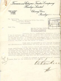
Document - HANRO COLLECTION: COLLECTION OF LETTERS - ESTATE OF CHARLES HANDSCHIN
... Estate of Charles Handschin. Letters are dated 24 February 1934 from Farmers and Citizens Trustees Company which mentions Shares, Dr Veit-Gysin, Mrs Handschin and heirs; 10 January 1934 from Allgemeine Treuhand A G Re Shares, Two letters dated 24 March 1933 from Alice Handschin Re Shares, Letter from Allgemeine Treuhand A G, dated15 January 1934 mentioning Shares; a copy of a letter from Mr E F Granger, a list of letters and Certificates; a letter from E F Granger, dated 27 January 1932 which mentions liquidation and shares; and a letter from Dr Veit Gysin, dated 22 March 1933 to The Manager of the Farmers and Citizens Trustees Co...History House 11 Mackenzie Street Bendigo goldfields HANRO Clothing Share Register Hanro Collection - Collection of Letters - Estate of Charles Handschin Farmers and Citizens Trustees Company R A Rankin Hanro (Aust) Knitting Mills Pty Ltd Alice Handschin Hanro Consortium Mr Tredinnick Allgemeine Treudand A Dr Veit-Gysin Mr E F Granger Dr A Veit-Gysin Dr Eugen Meier Dr Manfred Veit A collection of letters in reference of the Estate of Charles Handschin. ...A collection of letters in reference of the Estate of Charles Handschin. Letters are dated 24 February 1934 from Farmers and Citizens Trustees Company which mentions Shares, Dr Veit-Gysin, Mrs Handschin and heirs; 10 January 1934 from Allgemeine Treuhand A G Re Shares, Two letters dated 24 March 1933 from Alice Handschin Re Shares, Letter from Allgemeine Treuhand A G, dated15 January 1934 mentioning Shares; a copy of a letter from Mr E F Granger, a list of letters and Certificates; a letter from E F Granger, dated 27 January 1932 which mentions liquidation and shares; and a letter from Dr Veit Gysin, dated 22 March 1933 to The Manager of the Farmers and Citizens Trustees Cohanro, clothing, share register, hanro collection - collection of letters - estate of charles handschin, farmers and citizens trustees company, r a rankin, hanro (aust) knitting mills pty ltd, alice handschin, hanro consortium, mr tredinnick, allgemeine treudand a, dr veit-gysin, mr e f granger, dr a veit-gysin, dr eugen meier, dr manfred veit -
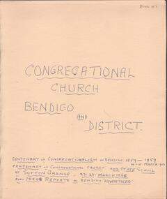 Bendigo Historical Society Inc.
Document - Lydia Chancellor collection: congregational church Bendigo and district
... grange Congregational Church was built in 1865. Original services were held in the home of Mr James Grey who served the church for 50 years. The Bendigo Congregational church originally operated out of the Mechanics Institue building before moving temporarily to the Church of England school room. In May 1858, a meeting was held to establish a permanent building and tenders were called in September 1858. Land was purchased in Forest Street from the estate...grange Congregational Church was built in 1865. Original services were held in the home of Mr James Grey who served the church for 50 years. The Bendigo Congregational church originally operated out of the Mechanics Institue building before moving temporarily to the Church of England school room. In May 1858, a meeting was held to establish a permanent building and tenders were called in September 1858. Land was purchased in Forest Street from the estate ...The Sutton grange Congregational Church was built in 1865. Original services were held in the home of Mr James Grey who served the church for 50 years. The Bendigo Congregational church originally operated out of the Mechanics Institue building before moving temporarily to the Church of England school room. In May 1858, a meeting was held to establish a permanent building and tenders were called in September 1858. Land was purchased in Forest Street from the estate of Mr WIlkinson and the new brick structure was opened 28/11/1858.Manilla folder titled: Congregational Church Bendigo and district. Centenary of congregationalism in Bendigo 1859 to 1959, 14-15 March 1959. Centenary of congregational church and state school at Sutton Grange, 27-28 March 1965. Also, press reports in the Bendigo Advertiser.sutton grange, congregational church, centenary -
Surrey Hills Historical Society Collection
Folder of real estate advertisements, Folders of real estate advertisements (Streets beginning with G), Various
... Surrey Hills Historical Society Collection 190A Canterbury Road Canterbury melbourne gawler court george street gilbert street gladstone street glendale street godfrey court goodwood street gordon street grace court graham street grange street griffin close grovedale road guildford road A4 folders with individual pockets for each property in streets beginning with G located in Surrey Hills and Mont Albert. Folders are ordered by street name and then chronologically by property number. Each property has its own pocket. This may include multiple real estate ...A4 folders with individual pockets for each property in streets beginning with G located in Surrey Hills and Mont Albert. Folders are ordered by street name and then chronologically by property number. Each property has its own pocket. This may include multiple real estate advertisements collected from sales over time. It may also include copies of any research undertaken by Alan Holt and / or members of the SHNCHC team. These are augmented by cards in the Alan Holt index file and by his property registers of Surrey Hills and Mont Albert.gawler court, george street, gilbert street, gladstone street, glendale street, godfrey court, goodwood street, gordon street, grace court, graham street, grange street, griffin close, grovedale road, guildford road -
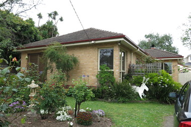 Surrey Hills Historical Society Collection
Photograph - 1 Grange Street, Mont Albert, The Street Where You Live Project
... These photos provide a snapshot of real estate in the suburbs of Mont Albert and Surrey Hills during a period of rapid change with many properties on large blocks demolished to create higher density residential development or renewal of single dwellings. At particular risk were properties not covered by heritage overlays, especially interwar housing and post 1950's housing. The Street Where You Live Project Photograph 1 Grange ...Photos documenting this address as part of a photographic series undertaken by volunteer photographers during 2013 and 2014 for The Street Where You Live Project. This was organised through the Surrey Hills Neighbourhood Centre and covered the postcode 3127 in the cities of Boroondara and Whitehorse.These photos provide a snapshot of real estate in the suburbs of Mont Albert and Surrey Hills during a period of rapid change with many properties on large blocks demolished to create higher density residential development or renewal of single dwellings. At particular risk were properties not covered by heritage overlays, especially interwar housing and post 1950's housing. -
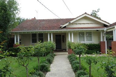 Surrey Hills Historical Society Collection
Photograph - 3 Grange Street, Mont Albert, The Street Where You Live Project
... These photos provide a snapshot of real estate in the suburbs of Mont Albert and Surrey Hills during a period of rapid change with many properties on large blocks demolished to create higher density residential development or renewal of single dwellings. At particular risk were properties not covered by heritage overlays, especially interwar housing and post 1950's housing. The Street Where You Live Project Photograph 3 Grange ...Photos documenting this address as part of a photographic series undertaken by volunteer photographers during 2013 and 2014 for The Street Where You Live Project. This was organised through the Surrey Hills Neighbourhood Centre and covered the postcode 3127 in the cities of Boroondara and Whitehorse.These photos provide a snapshot of real estate in the suburbs of Mont Albert and Surrey Hills during a period of rapid change with many properties on large blocks demolished to create higher density residential development or renewal of single dwellings. At particular risk were properties not covered by heritage overlays, especially interwar housing and post 1950's housing. -
 Surrey Hills Historical Society Collection
Photograph - 4 Grange Street, Mont Albert, The Street Where You Live Project
... These photos provide a snapshot of real estate in the suburbs of Mont Albert and Surrey Hills during a period of rapid change with many properties on large blocks demolished to create higher density residential development or renewal of single dwellings. At particular risk were properties not covered by heritage overlays, especially interwar housing and post 1950's housing. The Street Where You Live Project Photograph 4 Grange ...Photos documenting this address as part of a photographic series undertaken by volunteer photographers during 2013 and 2014 for The Street Where You Live Project. This was organised through the Surrey Hills Neighbourhood Centre and covered the postcode 3127 in the cities of Boroondara and Whitehorse.These photos provide a snapshot of real estate in the suburbs of Mont Albert and Surrey Hills during a period of rapid change with many properties on large blocks demolished to create higher density residential development or renewal of single dwellings. At particular risk were properties not covered by heritage overlays, especially interwar housing and post 1950's housing. -
 Surrey Hills Historical Society Collection
Photograph - 5 Grange Street, Mont Albert, The Street Where You Live Project
... These photos provide a snapshot of real estate in the suburbs of Mont Albert and Surrey Hills during a period of rapid change with many properties on large blocks demolished to create higher density residential development or renewal of single dwellings. At particular risk were properties not covered by heritage overlays, especially interwar housing and post 1950's housing. The Street Where You Live Project Photograph 5 Grange ...Photos documenting this address as part of a photographic series undertaken by volunteer photographers during 2013 and 2014 for The Street Where You Live Project. This was organised through the Surrey Hills Neighbourhood Centre and covered the postcode 3127 in the cities of Boroondara and Whitehorse.These photos provide a snapshot of real estate in the suburbs of Mont Albert and Surrey Hills during a period of rapid change with many properties on large blocks demolished to create higher density residential development or renewal of single dwellings. At particular risk were properties not covered by heritage overlays, especially interwar housing and post 1950's housing. -
 Surrey Hills Historical Society Collection
Photograph - 6 Grange Street, Mont Albert, The Street Where You Live Project
... These photos provide a snapshot of real estate in the suburbs of Mont Albert and Surrey Hills during a period of rapid change with many properties on large blocks demolished to create higher density residential development or renewal of single dwellings. At particular risk were properties not covered by heritage overlays, especially interwar housing and post 1950's housing. The Street Where You Live Project Photograph 6 Grange ...Photos documenting this address as part of a photographic series undertaken by volunteer photographers during 2013 and 2014 for The Street Where You Live Project. This was organised through the Surrey Hills Neighbourhood Centre and covered the postcode 3127 in the cities of Boroondara and Whitehorse.These photos provide a snapshot of real estate in the suburbs of Mont Albert and Surrey Hills during a period of rapid change with many properties on large blocks demolished to create higher density residential development or renewal of single dwellings. At particular risk were properties not covered by heritage overlays, especially interwar housing and post 1950's housing. -
 Surrey Hills Historical Society Collection
Photograph - 7 Grange Street, Mont Albert, The Street Where You Live Project
... These photos provide a snapshot of real estate in the suburbs of Mont Albert and Surrey Hills during a period of rapid change with many properties on large blocks demolished to create higher density residential development or renewal of single dwellings. At particular risk were properties not covered by heritage overlays, especially interwar housing and post 1950's housing. The Street Where You Live Project Photograph 7 Grange ...Photos documenting this address as part of a photographic series undertaken by volunteer photographers during 2013 and 2014 for The Street Where You Live Project. This was organised through the Surrey Hills Neighbourhood Centre and covered the postcode 3127 in the cities of Boroondara and Whitehorse.These photos provide a snapshot of real estate in the suburbs of Mont Albert and Surrey Hills during a period of rapid change with many properties on large blocks demolished to create higher density residential development or renewal of single dwellings. At particular risk were properties not covered by heritage overlays, especially interwar housing and post 1950's housing. -
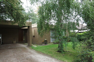 Surrey Hills Historical Society Collection
Photograph - 9 Grange Street, Mont Albert, The Street Where You Live Project
... These photos provide a snapshot of real estate in the suburbs of Mont Albert and Surrey Hills during a period of rapid change with many properties on large blocks demolished to create higher density residential development or renewal of single dwellings. At particular risk were properties not covered by heritage overlays, especially interwar housing and post 1950's housing. The Street Where You Live Project Photograph 9 Grange ...Photos documenting this address as part of a photographic series undertaken by volunteer photographers during 2013 and 2014 for The Street Where You Live Project. This was organised through the Surrey Hills Neighbourhood Centre and covered the postcode 3127 in the cities of Boroondara and Whitehorse.These photos provide a snapshot of real estate in the suburbs of Mont Albert and Surrey Hills during a period of rapid change with many properties on large blocks demolished to create higher density residential development or renewal of single dwellings. At particular risk were properties not covered by heritage overlays, especially interwar housing and post 1950's housing. -
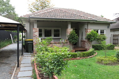 Surrey Hills Historical Society Collection
Photograph - 11 Grange Street, Mont Albert, The Street Where You Live Project
... These photos provide a snapshot of real estate in the suburbs of Mont Albert and Surrey Hills during a period of rapid change with many properties on large blocks demolished to create higher density residential development or renewal of single dwellings. At particular risk were properties not covered by heritage overlays, especially interwar housing and post 1950's housing. The Street Where You Live Project Photograph 11 Grange ...Photos documenting this address as part of a photographic series undertaken by volunteer photographers during 2013 and 2014 for The Street Where You Live Project. This was organised through the Surrey Hills Neighbourhood Centre and covered the postcode 3127 in the cities of Boroondara and Whitehorse.These photos provide a snapshot of real estate in the suburbs of Mont Albert and Surrey Hills during a period of rapid change with many properties on large blocks demolished to create higher density residential development or renewal of single dwellings. At particular risk were properties not covered by heritage overlays, especially interwar housing and post 1950's housing. -
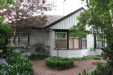 Surrey Hills Historical Society Collection
Photograph - 13 Grange Street, Mont Albert, The Street Where You Live Project
... These photos provide a snapshot of real estate in the suburbs of Mont Albert and Surrey Hills during a period of rapid change with many properties on large blocks demolished to create higher density residential development or renewal of single dwellings. At particular risk were properties not covered by heritage overlays, especially interwar housing and post 1950's housing. The Street Where You Live Project Photograph 13 Grange ...Photos documenting this address as part of a photographic series undertaken by volunteer photographers during 2013 and 2014 for The Street Where You Live Project. This was organised through the Surrey Hills Neighbourhood Centre and covered the postcode 3127 in the cities of Boroondara and Whitehorse.These photos provide a snapshot of real estate in the suburbs of Mont Albert and Surrey Hills during a period of rapid change with many properties on large blocks demolished to create higher density residential development or renewal of single dwellings. At particular risk were properties not covered by heritage overlays, especially interwar housing and post 1950's housing. -
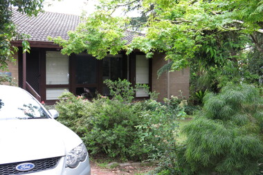 Surrey Hills Historical Society Collection
Photograph - 15 Grange Street, Mont Albert, The Street Where You Live Project
... These photos provide a snapshot of real estate in the suburbs of Mont Albert and Surrey Hills during a period of rapid change with many properties on large blocks demolished to create higher density residential development or renewal of single dwellings. At particular risk were properties not covered by heritage overlays, especially interwar housing and post 1950's housing. The Street Where You Live Project Photograph 15 Grange ...Photos documenting this address as part of a photographic series undertaken by volunteer photographers during 2013 and 2014 for The Street Where You Live Project. This was organised through the Surrey Hills Neighbourhood Centre and covered the postcode 3127 in the cities of Boroondara and Whitehorse.These photos provide a snapshot of real estate in the suburbs of Mont Albert and Surrey Hills during a period of rapid change with many properties on large blocks demolished to create higher density residential development or renewal of single dwellings. At particular risk were properties not covered by heritage overlays, especially interwar housing and post 1950's housing. -
 Surrey Hills Historical Society Collection
Photograph - 17 Grange Street, Mont Albert, The Street Where You Live Project
... These photos provide a snapshot of real estate in the suburbs of Mont Albert and Surrey Hills during a period of rapid change with many properties on large blocks demolished to create higher density residential development or renewal of single dwellings. At particular risk were properties not covered by heritage overlays, especially interwar housing and post 1950's housing. The Street Where You Live Project Photograph 17 Grange ...Photos documenting this address as part of a photographic series undertaken by volunteer photographers during 2013 and 2014 for The Street Where You Live Project. This was organised through the Surrey Hills Neighbourhood Centre and covered the postcode 3127 in the cities of Boroondara and Whitehorse.These photos provide a snapshot of real estate in the suburbs of Mont Albert and Surrey Hills during a period of rapid change with many properties on large blocks demolished to create higher density residential development or renewal of single dwellings. At particular risk were properties not covered by heritage overlays, especially interwar housing and post 1950's housing.