
Showing 187 items matching " land division"
-
 University of Melbourne, Burnley Campus Archives
Document - Report, Department of Conservation and National Parks and Public Land Division, Kooyoora State Park Proposed Management Plan, November 1991
... Produced by the Department of Conservation and Environment, Victoria, Bendigo Region and National Parks and Public Land Division...Department of Conservation and National Parks and Public Land Division....Produced by the Department of Conservation and Environment, Victoria, Bendigo Region and National Parks and Public Land Division Kooyoora State Park Proposed Management Plan Document Report Department of Conservation and National Parks and Public Land Division. ...kooyoora state park, management plan, department of conservation & environment, bendigo region -
Port Melbourne Historical & Preservation Society
Plan - Proposed land sub-division, west of railway, Sandridge, 19 Nov 1866
... Proposed land sub-division, west of railway, Sandridge...1866 plan of proposed sub-division of land at Sandridge, west of railway. Includes manure depot....Plan Proposed land sub-division, west of railway, Sandridge Department of Lands and Surveys ...1866 plan of proposed sub-division of land at Sandridge, west of railway. Includes manure depot.J. Noone (Photolithographer, Dept. of Lands and Survey) J. Hardy (Assistant Surveyor)town planning, town planning - proposals shelved, j noone, j hardy -
Port Melbourne Historical & Preservation Society
Plan - Land sub-division at 34 Crockford Street, MMBW, Melbourne and Metropolitan Board of Works, Apr 1958
... Land sub-division at 34 Crockford Street, MMBW...built environment - commercial percival edward mann sue pentland mmbw melbourne and metropolitan board of works MMBW plan to sub-divide land at 34 Crockford St. Plan Land sub-division at 34 Crockford Street, MMBW Melbourne and Metropolitan Board of Works ...MMBW plan to sub-divide land at 34 Crockford St.built environment - commercial, percival edward mann, sue pentland, mmbw, melbourne and metropolitan board of works -
 Ringwood and District Historical Society
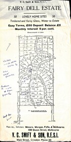
Flyer, Residential Land Sale Sub-division - Fairy Dell Estate, Warranwood, Vic. - circa 1950s
... Residential Land Sale Sub-division - Fairy Dell Estate, Warranwood, Vic. - circa 1950s...Land sale advertisement for 50 home sites with map of Sub-division showing layout of streets and allotments, summary of local features and services and terms of sale, and copy of sectional map of Crown Allotments 20 & 21B Parish of Warrandyte also showing layout of Sub-division....Residential Land Sale Sub-division - Fairy Dell Estate, Warranwood, Vic. - circa 1950s Flyer ...Land sale advertisement for 50 home sites with map of Sub-division showing layout of streets and allotments, summary of local features and services and terms of sale, and copy of sectional map of Crown Allotments 20 & 21B Parish of Warrandyte also showing layout of Sub-division.Subdivision includes Grandview Grove (later Bemboka Road), Merrill Crescent and Kerry Road, Warranwood. Estate Agents - V.C. Swift & Son R.E.S.I., Main Street, Croydon, Phone 20. Solicitors - Morgan, Fyffe & Mulkearns, 108 Queen Street, Melbourne. Handwritten 1970s real estate price notations for some blocks. -
 Ringwood and District Historical Society
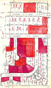
Plan, Residential Land Sale Sub-division
... Residential Land Sale Sub-division....Residential Land Sale Sub-division. Plan ...Subdivision map of 60 residential allotments for sale in North Ringwood, Vic., circa 1968, with handwritten asking price annotations. Subdivision includes Lockhart Road, Goldsmith Avenue, Albany Close and Park Hill Drive. -
Glen Eira Historical Society
Document - Sarsfield, Blanche Street, 19, Elsternwick
... ... Land Division...Bullock Hilary Landells Rosalind Hocking Stuart Real Estate Agents Glenhuntly Road Land Division Place Name House Names Document Sarsfield, Blanche Street, 19, Elsternwick ...Copy of typed document on this history and owners from 1851 to 1989 researched by Brighton Historical Society dated 09 March 1990. Handwritten notes reference to typed document regarding the owners of Sarsfield 19 Blanche Street Elsternwick.historical buildings, sarsfield, blanche street, elsternwick, holloway j.m., langdon henry j., beemery park, rose craddock, langdon blanche, bardwell everett, wynne edwin p., mcrorie william, mcrorie and co., healy j.d., healy eugene, holland ernest, holland e. w., coutts k.d., bullock hilary, landells rosalind, hocking stuart real estate agents, glenhuntly road, land division, place name, house names -
 Surrey Hills Historical Society Collection
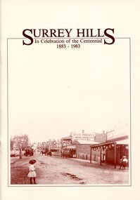
Book, Surrey Hills: in celebration of the centennial 1883-1983, 1983
... It includes early rural properties and diaries, the coming of the railway, land sub-division and early homes, schools, parks and recreation....It includes early rural properties and diaries, the coming of the railway, land sub-division and early homes, schools, parks and recreation....It includes early rural properties and diaries, the coming of the railway, land sub-division and early homes, schools, parks and recreation. ...A pictorial history of Surrey Hills based on information collected and based at the Surrey Hills Neighbourhood Centre. It includes early rural properties and diaries, the coming of the railway, land sub-division and early homes, schools, parks and recreation.A pictorial history of Surrey Hills based on information collected and based at the Surrey Hills Neighbourhood Centre. It includes early rural properties and diaries, the coming of the railway, land sub-division and early homes, schools, parks and recreation.surrey hills, railways, land use, migrants, spanish communities, transport, houses, wattle park, festivals and celebrations, churches, education, water supply, fire stations, hospitals, (mr) george klepper, ainger family, (mr) john woodhead, (mr) h. breedon, medical services, real estate agents, businesses, musical events and activities, entertainment, parks and reserves, scouts, guides -
 Surrey Hills Historical Society Collection
Book, Surrey Hills: in celebration of the centennial 1883-1983, Reprinted November 1992
... It includes information about early rural properties and dairies, the coming of the railway, land sub-division and early homes, doctors, schools, churches, parks and recreation facilities....It includes early rural properties and diaries, the coming of the railway, land sub-division and early homes, schools, parks and recreation....It includes early rural properties and diaries, the coming of the railway, land sub-division and early homes, schools, parks and recreation. ...A pictorial history of Surrey Hills and Mont Albert based on information collected by the history group at the Surrey Hills Neighbourhood Centre. It includes information about early rural properties and dairies, the coming of the railway, land sub-division and early homes, doctors, schools, churches, parks and recreation facilities.A pictorial history of Surrey Hills based on information collected and based at the Surrey Hills Neighbourhood Centre. It includes early rural properties and diaries, the coming of the railway, land sub-division and early homes, schools, parks and recreation.1992surrey hills, railways, land use, migrants, spanish communities, transport, houses, wattle park, festivals and celebrations, churches, education, water supply, fire stations, hospitals, (mr) george klepper, ainger family, (mr) john woodhead, (mr) h. breedon, medical services, real estate agents, businesses, musical events and activities, entertainment, parks and reserves, scouts, guides -
University of Melbourne, Burnley Campus Archives
Plan, Royal Botanic Gardens Melbourne, 1978
... Department of Crown Land and Survey Division of Survey and Mapping...jeremy j. wallace royal botanical gardens melbourne Department of Crown Land and Survey Division of Survey and Mapping ornamental lakes Plan of RBG with grid references. ...Plan of RBG with grid references. Produced by Dept. of Crown Lands and Survey, Victoria, Division of Survey and Mapping. Prepared in 1978 from surveys completed in 1976. (1) 2 copies plan. Main areas, buildings, etc., labelled, beds outlined. (2) Original coloured plan and reduced size photocopy. More labelling, particularly beds (handwritten). Labelled Jeremy J. Wallace with handwritten notes on reverse re a project. (3) Reduced size photocopy. Handwritten labelling of beds. (4 - 11) Enlarged photocopies of sections of (1) Handwritten notes and plant labelling. (1). Photgraphed copies by FRESCO 510131-TA. (12) Plan on a grid, coloured. "No Public Access," areas marked.jeremy j. wallace, royal botanical gardens melbourne, department of crown land and survey division of survey and mapping, ornamental lakes -
Canterbury History Group
Pamphlet - Camberwell Golf Links, c1932 original
... Brochure produced for Land Sub-division sale by auction of Camberwell Golf Links on Saturday 28 May c1932. ...Camberwell Fairmont Avenue Camberwell Road Christowell Street Trams Vintage Cars Brochure produced for Land Sub-division sale by auction of Camberwell Golf Links on Saturday 28 May c1932. ...Brochure produced for Land Sub-division sale by auction of Camberwell Golf Links on Saturday 28 May c1932. Reproduced from the original, includes Map and some historic photographscamberwell, fairmont avenue, camberwell road, christowell street, trams, vintage cars -
 Falls Creek Historical Society
Document - Site 4 - Design Of Extension Of Christie Street Completed
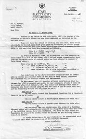
... Hymans' from the SEC outlining changes to be made to the land divisions in Christie Street. The intention was to create two separate sites - Site 4 and Site 4A. ...Hymans' from the SEC outlining changes to be made to the land divisions in Christie Street. The intention was to create two separate sites - Site 4 and Site 4A. ...Bob (Herman) Hymans (a former member of the Royal Netherlands Navy) was born in Bloemendaal, Holland on 30th September 1922. During World War II he fought against the Japanese in the Dutch East Indies (now Indonesia) and was imprisoned in Changi and on the Burma Railway. After gaining qualifications as a Ski Instructor, Bob arrived in Falls Creek in July 1950. Working as an Instructor and Supervisor at Bogong Lodge, Bob decided his future was in accommodation. He was successful in negotiating an indenture for land from the State Electricity Commission (SEC). It took Bob two years to build his Grand Coeur Chalet but, tragically, it was burned down in August 1961. Bob also built the first Chairlift in Australia. This was a single chairlift and the structure was built from wooden electricity poles. He was constantly full of new ideas and proposals for the village. Bob Hymans died on 7th July 2007. This Collection of documents and letters tells the story of Bob's endeavours to develop Falls Creek into the ski village it is today.This letter is significant because it reflects the relationship between Bob Hymans, the State Electricity Commission and the Management Committee.A letter to Mr. Hymans' from the SEC outlining changes to be made to the land divisions in Christie Street. The intention was to create two separate sites - Site 4 and Site 4A. SIte 4 was the location of Mr Hymans' existing accommodation. He had submitted a proposal for development of Site 4A. The dimensions of each site and the proposed rentals is included in this letter. His current lease would expire on the 31st October 1964, so Mr Hymans needed to indicate what future lease arrangement he desired to pursue.falls creek tourist area management committee, bob hymans, falls creek administration -
 Warrnambool and District Historical Society Inc.
Map - Soldier Settlement Map, Soldier Settlement Commission, Tarrone Estate Alex Boyd, 1940s
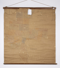
... This is a map of the Tarrone Soldier Settlement land divisions probably produced by the Soldier Settlement Commission. ...This is a map of the Tarrone Soldier Settlement land divisions probably produced by the Soldier Settlement Commission. ...This is a map of the Tarrone Soldier Settlement land divisions probably produced by the Soldier Settlement Commission. The map is incomplete with lots 48,49 and 50 missing. The Soldier Settlement Commission purchased 23,373 acres of Tarrone Station from the Boyd brothers in 1947 and the sub divided lots were occupied by soldier settlers commencing in 1949. Tarrone Station was established in 1840 by Doctors Kilgour and Bernard and the Boyd brothers secured the free hold in the 1890s and retained it until 1947. The map hung for many years in the Warrong school near Hawkesdale.This map is of considerable interest as an original item from the establishment of the Tarrone Soldier Settlement..The map is made of brown cloth and creased. The edges are tattered and there is a piece missing at the top. It is a map of allotments, hand drawn and with faded colours in red, blue and yellow. The names of localities and land holders are hand written in ink and chalk. The map is contained within two pieces of wood at the bottom and the top. There are two screws and a cord to hang on a wall. A scale of measurement is shown under the map. tarrone soldiers settlement, boyd brothers tarrone -
Warrnambool and District Historical Society Inc.
Document, signatures and a sketch map
... The sheet includes a sketch showing the proposed change to the land division. ...The sheet includes a sketch showing the proposed change to the land division. This item is of minor interest as a document from the 19th century dealing with a land transfer proposal by some prominent Warrnambool residents at the time Adam Bell Warrnambool Wiliam Ardlie This is a sheet of paper with handwriting, signatures and a sketch map, all in black ink. ...This document comes from the Ardlie collection. It is presumed that it is part of the material that belonged to William Ardlie, a prominent lawyer in Warrnambool in the 19th and 20th centuries. It is not clear if the document is a copy or an original. It is an 1886 document in which the purchasers of Allotments 127,128 and 129 in Coulstock Street, Warrnambool requested a change to the original land situation. They wished to eliminate a laneway shown on the original purchase document owned by Adam Bell and transfer the lane land to the new purchasers. The signatures on the document include Isabella Helpman, R.D. Burall, Adam Bell, Anthony Derrick and another signature not able to be deciphered. The sheet includes a sketch showing the proposed change to the land division. This item is of minor interest as a document from the 19th century dealing with a land transfer proposal by some prominent Warrnambool residents at the timeThis is a sheet of paper with handwriting, signatures and a sketch map, all in black ink. The page is a little yellowed with age. adam bell, warrnambool, wiliam ardlie -
 Federation University Historical Collection
Map - Documents, Documents relating to Land - Selection of Maps of subdivisions; Titles; Cemetery sections
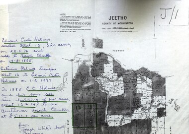
... Land maps showing block divisions and owners. Edward Carter Holmes J.P. selected land and called it Launchley - later called Wambalano....Maps indicate the land owned in various areas of Victoria - Mornington Peninsula, Ascot / Creswick area jeetho county of mornington edward carter holmes joseph clarke catherine holmes talbot william coghill pre-emptive right tourello pre-emptive right glendonald pre-emptive right clunes smeaton ascot counties of ripon and talbot certificate of title ballaarat general cemetery new cemetery Poowong Helen Coghill Land maps showing block divisions and owners. Edward Carter Holmes J.P. selected land and called it Launchley - later called Wambalano. ...Maps indicate the land owned in various areas of Victoria - Mornington Peninsula, Ascot / Creswick areaLand maps showing block divisions and owners. Edward Carter Holmes J.P. selected land and called it Launchley - later called Wambalano.jeetho, county of mornington, edward carter holmes, joseph clarke, catherine holmes, talbot, william coghill, pre-emptive right, tourello pre-emptive right, glendonald pre-emptive right, clunes, smeaton, ascot, counties of ripon and talbot, certificate of title, ballaarat general cemetery, new cemetery, poowong, helen coghill -
 Whitehorse Historical Society Inc.
Functional object - Snake Bite Kit, circa 1960's
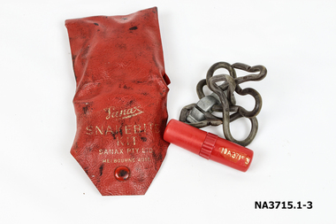
... They didn't experience a snake problem until the late 1950's when land sub division around their property forced snakes into the area. ...They didn't experience a snake problem until the late 1950's when land sub division around their property forced snakes into the area. ...The Gunning family owned 20 acres of orchard and farm land in High Street Lower Templestowe and kept one of these kits in each vehicle and tractor. They didn't experience a snake problem until the late 1950's when land sub division around their property forced snakes into the area. The family lost one dog to snake bite in the early 1960's.Consists of a Wallet, tourniquet and lancet . 1.Wallet - small red plastic wallet with one press stud to close. Printed in gold on front: 'Sanax Snakebite Kit Sanax Pty Ltd Melbourne Australia 2.Tourniquet - rubber tourniquet looped through a metal clip used to tighten tourniquet. ' Sanax ' embossed on flat of metal clip. 3.Lancet - a three chambered cylindrical container made of red plastic. One end removes to reveal a lancet/ blade, the other end acts as a handle for the blade. Container holds instructions on a small roll of paper. The centre of the container can be be unscrewed to access crystals of permanganate of potash to put on the woundmedicine, first aid -
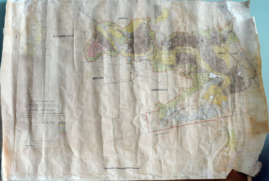 Orbost & District Historical Society
plan, before 1948
... A large plan of divisions of land for the purpose of levying the Snowy River Improvement District - Bete Bolong, Orbost, Waygara, Newmerella and Orbost East. ...Snowy-River-Improvement-Trust A large plan of divisions of land for the purpose of levying the Snowy River Improvement District - Bete Bolong, Orbost, Waygara, Newmerella and Orbost East. ...Drainage infrastructure was developed and maintained in this region by the Snowy River Improvement Trust. The Trust was administered by a local committee and its activities funded by a local rate charged on the farmers and land owners in the Trust’s designated district. The level of the rate charged by the Trust was designed to be proportionate to the benefit derived from the works undertaken. Financial assistance was provided by the State Government from time to time for specific projects such as post flood repairs but not for new capital works. The Trust undertook new drainage and river management works including tree planting, rock beach construction and servicing of the drains and flood gates. The Trust also provided a personal flood warning service to the farmers in its district. The Trust ceased to operate in 1997 with the advent of the East Gippsland Catchment Management Authority. The infrastructure developed by the Trust continues to provide a service to the farmers in the region. (ref. 4 East Gippsland CMA Submission to Inquiry into Flood Mitigation Infrastructure in Victoria) This plan is significant as a historical document. The Snowy River Improvement Trust was vital to the Orbost district because of its ability to apply local knowledge and to engage the local farming community.A large plan of divisions of land for the purpose of levying the Snowy River Improvement District - Bete Bolong, Orbost, Waygara, Newmerella and Orbost East. The properties are coloured according to levy amount. The scale is 1" - 20 chains. snowy-river-improvement-trust -
 Sunshine and District Historical Society Incorporated
Archive - St John's Deer Park Centenary 1891-1991: notice, St John's (Foostcray) Parochial Calendar, List of names street by street
... List of church people street by street. Map of land sub-division (Deer Park area). Financial statements for St John's Deer Park - with St Alban's, 1972, St John's Deer Park 1976-77....List of church people street by street. Map of land sub-division (Deer Park area). Financial statements for St John's Deer Park - with St Alban's, 1972, St John's Deer Park 1976-77. ...'Built 1891 Dedication' [on centenary notice] 'G.Mousley, 12 Victoria St, Sunshine'; 'Parish of St John's Footscray June 1891'; 'St Mark's (Sunshine) Braybrook consecrated July 1895 by the Bishop of Melbourne, the Right Reverend Field Flowers Goe.' [on photocopy of St John's (Footscray) Parochial Calendar] 'St John's after renovations in 1937 and till early 1960s' [on back of photo] '1926' [on map] Some updating of names in listing of streets.st. johns church, deer park, miles street, church -
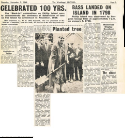 Phillip Island and District Historical Society Inc.
Newspaper Clipping, 100yrs Celebrations for Phillip Island, 7/11/1968
... Account of Back to Phillip Island 100yrs after first sub division of land at Phillip Island. Account of History of Phillip Island from discovery by Surgeon George Bass on January 5, 1979 to 1922. ...Account of Back to Phillip Island 100yrs after first sub division of land at Phillip Island. Account of History of Phillip Island from discovery by Surgeon George Bass on January 5, 1979 to 1922. ...Article from a collection of newspaper clippings from October 1968 to July 1971Article about the 100yrs celebrations at Phillip Island in November 1968. Account of Back to Phillip Island 100yrs after first sub division of land at Phillip Island. Account of History of Phillip Island from discovery by Surgeon George Bass on January 5, 1979 to 1922. Account of Historical Display in the Cowes Parish Hall.phillip island, back to phillip island celebrations, surgeon george bass -
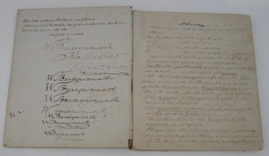 Federation University Historical Collection
Book - Exercise Book, Astronomy Notes by William Baragwanath, 1897
... Headings include: Astronomy refraction Correction for Semi diameter Determination of True Meridian Elongation Observation Latitude Determining the TIme Convergence of Meridian Barometric Measurement of Heights Formulae Latitude Observation On the Division of Land Calculations for Observations by a Single Altitude Computations Triginometrical Rations of Two Arcs...Headings include: Astronomy refraction Correction for Semi diameter Determination of True Meridian Elongation Observation Latitude Determining the TIme Convergence of Meridian Barometric Measurement of Heights Formulae Latitude Observation On the Division of Land Calculations for Observations by a Single Altitude Computations Triginometrical Rations of Two Arcs Astronomy Notes by William Baragwanath Book Exercise Book William Baragwanath ...William Baragwanath studied at the Ballarat School of Mines, obtained a Geology certificate in 1911. He was born on 01 August 1878 at Ballarat. He joined the Victorian Department of Mines in 1897 and was Chief Mining Surveyor from 1924 to 1943. Baragwanath died at Prahran on 20 September 1966. See Book 2 - Catalogue Number 4530Marbled card covered exercise book with brown tape spine containing handwritten notes by William Baragwanath on Astronomy and astronomical, geodetic, geights and distances, North Line Latitue, Lime, etc., problems . Headings include: Astronomy refraction Correction for Semi diameter Determination of True Meridian Elongation Observation Latitude Determining the TIme Convergence of Meridian Barometric Measurement of Heights Formulae Latitude Observation On the Division of Land Calculations for Observations by a Single Altitude Computations Triginometrical Rations of Two Arcsballarat school of mines, astronomy, william baragwanath -
 Bacchus Marsh & District Historical Society
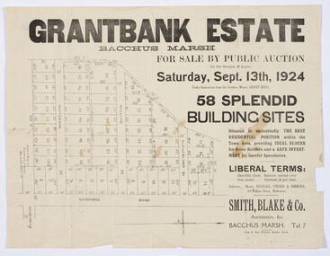
Map - Land Sales Plan, Grantbank Estate Bacchus Marsh, 1924
... land close to the centre of the shopping area of Bacchus Marsh which was sub-divided and offered for sale in 58 lots on the 13th September, 1924. It comprised an area of 15 acres, being a portion of the Millbank Estate which had been in the hands of the Grant family for 75 years. The lots had frontages to Gisborne Road, Patterson, William and Sutherland Streets. This was a significant sub-division...land close to the centre of the shopping area of Bacchus Marsh which was sub-divided and offered for sale in 58 lots on the 13th September, 1924. It comprised an area of 15 acres, being a portion of the Millbank Estate which had been in the hands of the Grant family for 75 years. The lots had frontages to Gisborne Road, Patterson, William and Sutherland Streets. This was a significant sub-division ...The Grantbank Estate was a parcel of land close to the centre of the shopping area of Bacchus Marsh which was sub-divided and offered for sale in 58 lots on the 13th September, 1924. It comprised an area of 15 acres, being a portion of the Millbank Estate which had been in the hands of the Grant family for 75 years. The lots had frontages to Gisborne Road, Patterson, William and Sutherland Streets. This was a significant sub-division of land and represented a major expansion of residential housing in Bacchus Marsh in the early 20th century.This land sale map is a typical example of housing estate land sales advertising maps produced by real estate agents in this era. The map is significant for the detailed information it provides about when and where land was sold for new housing estates in Bacchus Marsh in the early twentieth century.Printed paper mapland sales bacchus marsh, land subdivsion bacchus marsh, housing estates land sales bacchus marsh, grant family bacchus marsh -
Warrnambool and District Historical Society Inc.
Document (collection) - Legal papers 1885-1951 from William Ardlie and John Ardlie, Legal Documents Ardlie
... The collection contains invoices, wills, mortgage and assignment notices from 1888 until 1950 as well as handwritten letters regarding matters related to the division of land and assets.Among them are names of many well known Warrnambool families and early pioneers such as Cassady, Bowman,Beattie Murfitt, Carroll, McPhee, McGinness, O'Brien, Carey , Hunt, Cole Parker, Hetherington, McKenna, Clifford,Hocking, Begley, ...The collection contains invoices, wills, mortgage and assignment notices from 1888 until 1950 as well as handwritten letters regarding matters related to the division of land and assets.Among them are names of many well known Warrnambool families and early pioneers such as Cassady, Bowman,Beattie Murfitt, Carroll, McPhee, McGinness, O'Brien, Carey , Hunt, Cole Parker, Hetherington, McKenna, Clifford,Hocking, Begley, These papers are valuable for research in family history as well as property and social connections.They have strong provenance and are a valuable primary source of historical information. cassady hurst bower kearns molan ardlie briggs drought russell hose melican dallimore kerr fogarty harwood foley bowman beattie o'keeffe keys baudinette brennan clifford mcphee degraff carroll mcginness johnson murfitt carey o'brien walsh cole hunt parker hetherington dumsney whitton paech ernest ardlie hocking young There are a large number of signatories to the various letters and documents. ...John ArdlieTo record legal matters between clients , government departments and family entities.Legal paperscassady, hurst, bower, kearns, molan, ardlie, briggs, drought, russell, hose, melican, dallimore, kerr, fogarty, harwood, foley, bowman, beattie, o'keeffe, keys, baudinette, brennan, clifford, mcphee, degraff, carroll, mcginness, johnson, murfitt, carey, o'brien, walsh, cole, hunt, parker, hetherington, dumsney, whitton, paech, ernest ardlie, hocking, youngcassady, hurst, bower, kearns, molan, ardlie, briggs, drought, russell, hose, melican, dallimore, kerr, fogarty, harwood, foley, bowman, beattie, o'keeffe, keys, baudinette, brennan, clifford, mcphee, degraff, carroll, mcginness, johnson, murfitt, carey, o'brien, walsh, cole, hunt, parker, hetherington, dumsney, whitton, paech, ernest ardlie, hocking, young -
 Ballarat Tramway Museum
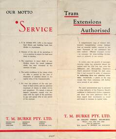
Pamphlet - Real Estate, T M Burke Pty Ltd, "Tram Extensions Authorised", 1936
... Issued by T M Burke Pty Ltd of 840 Collins St Melbourne, Real Estate agents, shows the extensive sub-divisions where land was available for purchase and notes the MMTB authorisation of new tram routes. ...Issued by T M Burke Pty Ltd of 840 Collins St Melbourne, Real Estate agents, shows the extensive sub-divisions where land was available for purchase and notes the MMTB authorisation of new tram routes. ...Wal Jack collected tramway and railway items for his collection. This pamphlet gives details of the Melbourne Public Transport system - rail, tram and bus in late 1936. Issued by T M Burke Pty Ltd of 840 Collins St Melbourne, Real Estate agents, shows the extensive sub-divisions where land was available for purchase and notes the MMTB authorisation of new tram routes. Gives details of the T M Burke services. Routes shown as authorised (16-7-1936) are: Keilor Road Essendon, High St North Balwyn and Hawthorn Road East Brighton. Demonstrates a Real Estate Sales pamphlet.Pamphlet - four colours printed on cream coloured bond paper, folded vertically originally.letter, wal jack, buninyong, railway lines -
Surrey Hills Historical Society Collection
Folder of information, Libby Cavenagh's 1990 building census of Wandsworth Road, Surrey Hills, 1990
... There are a number of appendices including s a map of the breakdown of styles and materials; date of construction and other information from the Camberwell Building registers 1890-1934; entries re owners from Sands & McDougall directories, 1897-1937; map from Land Titles Office showing sub-division information; land auction advertisements; information re W J Vine; list of builders; references....There are a number of appendices including s a map of the breakdown of styles and materials; date of construction and other information from the Camberwell Building registers 1890-1934; entries re owners from Sands & McDougall directories, 1897-1937; map from Land Titles Office showing sub-division information; land auction advertisements; information re W J Vine; list of builders; references. ...Libby Cavenagh was Secretary of the Surrey Hills Historical Society. She completed this study as part of a Diploma of Local History she was undertaking at the University of New England. At the time she lived in Wandsworth Road.This is a unique analysis of the housing stock of a complete street at one point in time. Many of the houses have been altered since the study was completed and quite a number have been demolished.Blue folder of A4 size. This contains an analysis of each house in Wandsworth Road in 1990 with details regarding building style, approximate age, materials used, fence design, presence or absence of a garage or carport and some comment on the garden elements. For most entries there is a coloured photo taken from the street. For some there are photocopies of real estate advertisements. There are a number of appendices including s a map of the breakdown of styles and materials; date of construction and other information from the Camberwell Building registers 1890-1934; entries re owners from Sands & McDougall directories, 1897-1937; map from Land Titles Office showing sub-division information; land auction advertisements; information re W J Vine; list of builders; references.wandsworth road, libby cavenagh -
![Map, Millbank Estate Bacchus Marsh Thursday 4th October 1888 [Land sales], 1924](/media/collectors/5e461d8021ea67224c82f2a1/items/67765662eb6d2cbd24e0797f/item-media/67765682eb6d2cbd24e07a41/item-fit-380x285.jpg?cb=6) Bacchus Marsh & District Historical Society
Bacchus Marsh & District Historical SocietyMap, Millbank Estate Bacchus Marsh Thursday 4th October 1888 [Land sales], 1924
... land close to the centre of the shopping area of Bacchus Marsh which was sub-divided and offered for sale in 62? lots on the 4th October 1888. The lots had frontages to Ballarat Road (Main Street), Maddingley Road (now Grant Street), Turner Street, Millbank Street, Clarinda Road (now Clarinda Street), and an unnamed street south of Turner Street (possibly known as Grant Street at this time) which connected to Maddingley Road through the vicinity of the present day Bacchus Marsh Hospital. This was a significant sub-division...land close to the centre of the shopping area of Bacchus Marsh which was sub-divided and offered for sale in 62? lots on the 4th October 1888. The lots had frontages to Ballarat Road (Main Street), Maddingley Road (now Grant Street), Turner Street, Millbank Street, Clarinda Road (now Clarinda Street), and an unnamed street south of Turner Street (possibly known as Grant Street at this time) which connected to Maddingley Road through the vicinity of the present day Bacchus Marsh Hospital. This was a significant sub-division ...The Millbank Estate was a parcel of land close to the centre of the shopping area of Bacchus Marsh which was sub-divided and offered for sale in 62? lots on the 4th October 1888. The lots had frontages to Ballarat Road (Main Street), Maddingley Road (now Grant Street), Turner Street, Millbank Street, Clarinda Road (now Clarinda Street), and an unnamed street south of Turner Street (possibly known as Grant Street at this time) which connected to Maddingley Road through the vicinity of the present day Bacchus Marsh Hospital. This was a significant sub-division of land and represented a major expansion of residential housing in Bacchus Marsh in the late 19th century. The map includes a wealth of detail about the time of the sale, where it will take place, who the selling agents were, the deposit terms for purchases and details of a special train from Melbourne to Bacchus Marsh on sale day. The location of the allotments in relation to the shopping and commercial area of Bacchus Marsh, Maddingley and the railway station are indicated on an inset map within the overall map and poster. The Millbank Estate area was an area which had once belonged to the Grant family who were prominent early citizens of Bacchus Marsh and lived in a house in this area known as 'Millbank'.This land sale map is a typical example of housing estate land sales advertising maps produced by real estate agents in this era. The map is significant for the detailed information it provides about when and where land was sold for new housing estates in Bacchus Marsh in the late nineteenth century.Single page map showing land allotments for sale at auction in Bacchus Marsh in October 1888. A significant portion of the map is missing from the bottom right side. land sales bacchus marsh, land subdivsion bacchus marsh, housing estates land sales bacchus marsh, grant family bacchus marsh, millbank estate land sales -
 Federation University Historical Collection
Document, History of the Ballarat Technology Park, Oakbank
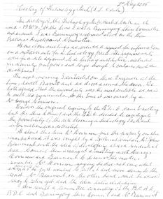
... It was previously zoned residential land and would seem to have been suitable for sub-division and residential development - its close proximity to the College being a major factor in its favour. ...It was previously zoned residential land and would seem to have been suitable for sub-division and residential development - its close proximity to the College being a major factor in its favour. ...The Ballarat Technology Park is associated with Federation University Australia. The first stage commenced on 03 August 1989 when the first sod was turned by Hon, David White, Minister for Industry, Technology and Resources. John Beaumont was the Director of the Ballarat Technology Research and Development Park in 1989.Twenty items relating to the History of the Ballarat Technology Park as collected by John Parkin. .1) Handwritten notes by John Parkin on the history of the Ballarat Technology Park .2) Letter from A.E. Helyar (Shire of Buninyong Secretary), 08 March 1988 .3) Shire of Buninyong Minutes 07 June 1988 .4) Development of High Technology Activity by Jack Barker .5) Definition of a Technology Park by Derek Woolley .6) Shire of Buninyong minutes 28 June 1988 .7) Shire of Buninyong minutes 19 July 1988 .8) Invitation to a reception to commemorate the inauguration of the Ballarat Technology Park (John Parkin) by Shire of Buninyong President Cr Judith Coull to be held on 03 August 1989. .9) Invitation to a reception to the Ballarat Technology Park (John Beaumont) .10) Ballarat Courier article 04 August 1989 .11) Draft letter to Professor Geoffrey Blainey from John Parkin .12) Letter to the Editor from John Parkin, 18 December 2000 .13) University of Ballarat Development Appeal, 04 November 1994 .14 & .15) Invitation to installment dinner to celebrate the installation of Professor Geoffrey Blainey as Chancellor of the University of Ballarat to be held in the Union Building (now Albert Coates Building), Mt Helen campus .16) Letter to the editor from John Parkin .17) Letter from John Beaumont, 25 November 1994 .18) Invitation to the opening of the ISSC Southern Region Data Centre to be held on 24 November 1995. .19) Letter from Barry Traynor, 13 December 1995 .20) Planning Scheme information relating to the LaTrobe Research and Development Zone. .1) 2nd May 2005 History of Technology Park (I.T. centre) The history of the Technology Park started back in the mid-1980s. At the time I was a Buninyong Shire Councilor and as such I was Buninyong's representative on the then Ballarat Development Committee. At one of our meetings we received a request for information on a suitable site for a technology park. The requirements were for a site adjacent to a tertiary institution, secluded for security purposes and large enough to contain such a development. The next morning I contacted our Shire Engineer at the time, Newell Barrett and we drove around the area we both agreed that the current site was the most suitable we saw to meet the requirements. At the time it was owned by George Morrison. however the original enquiry to the B.D.C. came to nothing but the Shire Council and the B.D.C. decided to investigate the possibility of the site becoming a technology Park and information was collected. At about this time Mr Morrison put the property on the market and it was bought by a Ballarat builder, Mr John Beaumont, with the idea of developing it as a residential area. Council then arranged a meeting with Messrs Morrison and Beaumont to discuss the matter. I remember Mr Morrison saying he did not care what was done with it he just wanted to sell it and move down to the coast. Mr Beaumont, on the other hand, said he wasn't ready to retire yet and the idea interested him. As a result a committee consisting of the B.C.A.E., B.D.C. and Buninyong Shire Council (and Mr Beaumont) was formed to plan the development and rezone the area to technology park. It was previously zoned residential land and would seem to have been suitable for sub-division and residential development - its close proximity to the College being a major factor in its favour. The point of this is if Mr Beaumont had insisted on pursuing his original plan and had opposed the rezoning, I am quite confident he would have won an appeal at the A.A.T . (Administrative Appeals Tribunal - forerunner of V.C.A.T.) and the I.T. centre would not have got off the ground and the area would be covered with houses. But Mr Beaumont did go into the project with enthusiasm and the first stage was commenced on the 3rd August 1989 when the first sod was turned by Hon. David White, the Minister for Industry, Technology and resources (See the Courier 4th August 1989) Mr Beaumont went overseas to study similar parks and look for tenants. Unfortunately government did not support the project as they have now and apparently Mr Beaumont was ahead of his time for the private sector so Mr Beaumont could not continue the development and the site eventually passed to the College. I personally think more could have been done ... The work done by the Buninyong Shire Council and Ballarat Development Committee seems to have been forgotten as according to the Courier December 21, 2000 we are told the Park opened in 1995 as a joint venture between the City and the University. As a former Councillor said to me on the day "What happened to the plaque David White unveiled in 1989!" If there is any other information you want, please contact me. You may use my file for reference. Kind regards John Parkin PS I always felt a bit guilty that I encouraged John Beaumont and he was left in the lurch. ballarat technology park, parkin, john parkin, helyar, barker, woolley, shire of buninyong, beaumont, blainey, geoffrey blainey, southern region data centre, greenhill enterprise centre, stan jeffrey, jeffrey, john beaumont, david white -
 Ballarat Clarendon College
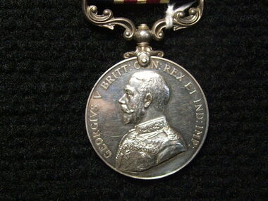
Medal, Military Medal GV, Instituted 25th March 1916
... During the First World War, it was also available to equivalent ranks in the Royal Naval Division and Royal Marines and it later became available to equivalent ranks in the RAF for acts of gallantry on land. ...During the First World War, it was also available to equivalent ranks in the Royal Naval Division and Royal Marines and it later became available to equivalent ranks in the RAF for acts of gallantry on land. ...Instituted in 1914, the Military Cross (MC) was issued for gallantry in presence of the enemy to warrant and junior officers of the Army who were ineligible (on account of their rank) for the Distinguished Service Order. During the First World War, it was also available to equivalent ranks in the Royal Naval Division and Royal Marines and it later became available to equivalent ranks in the RAF for acts of gallantry on land. The equivalent award for the other ranks for gallantry on land in presence of the enemy was the Military Medal (MM) which had been instituted in 1916 and, similarly to the MC, later became available to RAF other ranks serving on the ground. This medal was awared to Pte H. S Holgate for bravery in the field in 1917. Pte Holgate was killed in action at Zonnebeke 11 October 1917. Historical and social significance for schoolSilver medal with a swivelling suspension. features King George the V, uncrowned, in Field Marshal's uniform on the obverse. The medal reverse depicts the crowned royal cypher over the words "FOR BRAVERY IN THE FIELD" all within a laurel wreath. Impressed around edge are the recipient's details. The ribbon has a central stripe of thin red and white lines flanked by equally sized stripes of navy. Inscribed around obverse: 'GEORGIVS V BRITT: O[M]N: REX ET IND: IMP:' Inscribed in centre of reverse below royal insignia : 'FOR/BRAVERY/IN THE/FIELD' Impressed around OUTER edge of medal: '4303 PTE H. S. HOLGATE. 8/COY AUST. M.G.C.' Notation on original box A./Cpl H.S.Holgate 29Bn AIF 51531/Decd. 43031917, medals, military medal, world war i, w w 1, holgate, private h s holgate, zonnebeke, holgate medal -
 Lara RSL Sub Branch
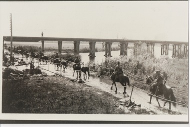
Photograph, Set 4 photographs. and others for Torquay Light Horse camp, 1940
... Division. The rows of horses, tents and huts near Blackgate Road were quite a sight. While the cavalrymen engaged in exercises on the land and on the beaches, many of the troops took over the Torquay School for special training of men and officers. ...Division. The rows of horses, tents and huts near Blackgate Road were quite a sight. While the cavalrymen engaged in exercises on the land and on the beaches, many of the troops took over the Torquay School for special training of men and officers. ...These images capture for all time Light Horsemen travelling through Geelong on their way to camp at Torquay for the last Group meeting in Australia . information following - details obtained from .........https://torquayhistory.com/light-horse-brigade/ On Australia Day, 1997, Sir John Young unveiled this plaque on Point Danger, Torquay. Torquay history, Light Horse Training Camp, WW2 Plaque at Pt. Danger Note----- (See images to view plaque) The plaque identifies a significant event in Torquay’s history and the sentiments of ‘change’ for the Light Horse Brigade – from horses to machines. In 1940 the four Light Horse Regiments (4th, 8th, 13th and 20th), some 5000 Light Horse and 2000 horses camped and trained at Torquay. Three other regiments, formerly mounted on horses, were also at Torquay ‘mounted’ on privately owned trucks and cars. Division troops included Artillery, Engineers, Signals, Field Ambulance and other branches of the Army necessary to enable a Division to function. It wasn’t just the sheer numbers of men coming to this little town that made the event significant, it was also the fact that the men of the Light Horse were dramatic, almost glamorous figures and it is easy to see their exploits as some splendid adventure. Horses have played a special role in the story of Australia. They were the only means of transport across this huge country, so it was necessary for everyone to have the ability to ride a horse. When war broke out in 1899 between Britain and the Boers of South Africa (“Boer” was Dutch for “farmer”) Australia sent troops to fight. At first Britain was wary of using untried, unprofessional colonial cavalrymen but soon saw that the slouch-hatted Australian “bushmen” were a match for the fast-moving and unconventional mounted commandos of the Boers. The Australians proved themselves to be expert rough-riding horsemen and good shots. Bush life had hardened them to go for long periods with little food and water. They also showed remarkable ability to find their way in a strange country and use its features for cover, in both attack and defence. By 1914, when Australia joined the war against Germany, there were 23 Light Horse regiments of militia volunteers. Many men from these units joined the Light Horse regiments of the Australian Imperial Force (AIF). Men were given remounts (if not using their own horses) – army horses bought by Commonwealth purchasing officers from graziers and breeders. These were called “walers” because they were a New South Wales stockhorse type – strong, great-hearted animals with the strains of the thoroughbred and semi-draught to give them speed, strength and stamina. On 1st November, 1914, Australia’s First Infantry Division and the first four Light Horse regiments sailed for England in a fleet of transport ships. The first of the Light Horse arrived at Gallipoli in May without their horses. Back with their horses after Gallipoli, they were formidable combatants across the Sinai and Palestine. Some British commanders observed that the light horseman moved with a “lazy, slouching gait, like that of a sleepy tiger” but described how the promise of battle “changes that careless gait, into a live athletic swing that takes him over the ground much quicker than other troops”. They had Light Horse, Torquay, training campdeveloped a reputation as formidable infantrymen. The Turks called them “the White Ghurkas” – a reference to their deadly skill with the bayonet. The Arabs called them “The Kings of the Feathers”. The plume had originally been a battle honour of the Queensland Mounted Infantry for their work in the shearer’s strike of 1891. During WW1 it was adopted by almost all the Light Horse Regiments. It was the proud badge of the light horseman. The most famous of their battles was the attack on Beersheba- the charge of the 4th Light Horse Brigade. Mounted infantrymen and their superb walers had carried out one of the most successful cavalry charges in history – against what seemed impossible odds. They surprised the Turks by charging cavalry-style, when they would normally have ridden close to an objective then dismounted to fight. The fall of Beersheba swung the battle tide against the Turks in Palestine; and changed the history of the Middle East. While 19 men from the Surf Coast Shire served with the 4th Light Horse over the course of WW1, only four were involved in the charge of Beersheba- John GAYLARD, Philip QUINN.(Winchelsea); Wallace FINDLAY (Anglesea); Harry TRIGG (Bambra). After the war, Light Horse units played a key role in the Australian Government’s compulsory military training programme. The Citizen Military Forces (C.M.F.) thrived on the glamour of the wartime Light Horse tradition, ignoring the possibility that motor vehicles would soon replace the horses. When training was no longer compulsory, the C.M.F. regiments declined and horses became more of a luxury during the 1930s depression years of poverty and unemployment. Some regiments were motorised. Then, in 1939, Australia joined Britain in another world war. Training was increased for the militia at both home bases and regional training camps. The camp at Torquay in 1940, commanded by Major General Rankin, was at Divisional strength. By the end of the camp some felt that the Division was ready for active service. Gradually, over the next four years, the Australian Light Horse units were mounted on wheels and tracks and the horses were retired. Six men enlisted at the Torquay camp and another 57 men and women enlisted at Torquay for service in WW2. Those who served in the Militia provided valuable Officers and NCOs and men for the armed services during the war. Each infantry division of the 2nd AIF had a Light Horse regiment attached to it. But the day of the Australian mounted soldier hadn’t quite passed. During World War II, Australia’s 6th Cavalry Regiment formed a mounted unit they called “The Kelly Gang” which did valuable scouting work. In New Guinea, a mounted Light Horse Troop did patrol duty and helped carry supplies. Some fully equipped walers were flown into Borneo for reconnaissance in rugged mountain country. But by the end of the war, in 1945, the horse had disappeared from the Australian Army. References: Australian Light Horse Association www.lighthorse.org.au National Australia Archives Australian War Memorial Surf Coast Shire WW1 memorials www.togethertheyserved.com The Light horse- a Cavalry under Canvas Light Horse, Training Camp, Torquay, WW2 Late in 1939 it was decided to set up a Lighthorse training camp in Torquay to train both men and horses for the battles of the Second World War. Horses, men and equipment came on special trains from all over Victoria and NSW, and as you would expect horseman came from areas such as Omeo and Sale, the Wimmera and the Western District. They arrived at the Geelong racecourse for watering in the Barwon River and then were ridden across the ford at the breakwater and began their 11 mile trek to Torquay. Light Horse, Training Camp, Torquay, WW2 Tent city By the end of January 1940 the camp at Torquay accommodated some 5000 men and 2500 horses of the Second Cavalry Division. The rows of horses, tents and huts near Blackgate Road were quite a sight. While the cavalrymen engaged in exercises on the land and on the beaches, many of the troops took over the Torquay School for special training of men and officers. Mr Bob Pettit local farmer and Councillor for the Barrabool Shire, wrote about the Light horse in the Surf Coast Community News in 1985 saying “They used to travel about the district riding four abreast in one long convoy. To my annoyance they went through my property and shut all the gates behind them. I had certain gates open to let stock in to the water holes and it would take me three -quarters of an hour to follow the horsemen up and put all the gates right again” he continued “the men from the Light Horse were here when the fire went through in March 1940. He recalled an incident when early one morning, as some one blew the bugle, a soldier putting a white sheet on the line frightened the horses. They panicked and ran off in all directions. Six went over the cliff near Bird Rock, five were never found, and the rest were gathered up after nearly a fortnight in the bush around Addiscott and Anglesea" Light Horse, Training Camp, Torquay, WW2, Geelong Parade Geelong parade The training camp culminated in a parade through the streets of Geelong on March 12th 1940. The salute was given at the Town Hall and the troops continued on a route to the You Yang’s for a training exercise. Note-----(see media section for photograph) The Camp was abandoned in mid 1940 as it was deemed unsuitable for training during winter and the cost of a permanent camp could not be justified if it could not be used all year. Historic.......Rare,,,Interpretive.Sepia photographs.set of four ....post card size ....Horses &LighthorsemenNo 1, Lighthorsemen Regiment Geelong 1940......No 2 Light Horse at Breakwater Geelong 1938 to 1940....No 3 Light Horse at Breakwater Geelong 1938 to 1940.....No 4 Light Horse crossing Breakwater camped at Geelong Showgrounds. These markings are on reverse of photographs.light horsemengeelong 1940., world war 2 -
 Federation University Historical Collection
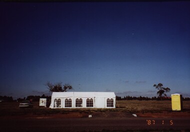
Photograph - Colour, Chatham-Holmes Collection: On the road to Burrumbeet, 1987, 1987
... Philip Chatham was responsible for the sub-division located on the road to Burrumbeat. Preparations for land sales....Philip Chatham was responsible for the sub-division located on the road to Burrumbeat. Preparations for land sales. chatham-holmes collection philip chatham burrumbeat land sales Chatham-Holmes Collection: On the road to Burrumbeet, 1987 Photograph - Colour ...Philip Chatham was responsible for the sub-division located on the road to Burrumbeat. Preparations for land sales.chatham-holmes collection, philip chatham, burrumbeat, land sales -
 Federation University Historical Collection
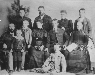
Photograph - Photograph and Documents, Anne Beggs Sunter, Latta/Downing Family, Mount Helen
... The land was purchased by the Ballarat School of Mines for their tertiary division from the Stapleton family....The land was purchased by the Ballarat School of Mines for their tertiary division from the Stapleton family. mount helen campus latta family greenhill e. latta m. fiscalini r. wynne r. nixon j.u. smith j. davis parish plan john latta elizabeth latta george downing elezabeth downing green hill pontresina abraham baxter g. dean market gardens jim downing bob thornton j. hateley martin fanning toll keeper anne beggs sunter Various items relating to the Federation University Mount Helen Campus, and the early settlers on the land, the Latta Family. .1) Parish Plan, including E. ...The Federation University Mt Helen Campus was once the farm of John Latta and his wife Elizabeth Ann Dean. The couple married in 1867 and had three children at the time of John Latta's death (Elizabeth Ann b.1870; Mary b.1873; John b.1875). Elizabeth later married George Downing, and had another six children. The house was situated in the vicinity of the current Administration and Caro Conference Centre buildings, surrounded by an orchard, and a well under the current Albert Coates Building (Union Building). The land was purchased by the Ballarat School of Mines for their tertiary division from the Stapleton family.Various items relating to the Federation University Mount Helen Campus, and the early settlers on the land, the Latta Family. .1) Parish Plan, including E. Latta, M. Fiscalini, R. Wynne, R. Nixon, J.U. Smith, J. Davis .2) Part of a 1930s ordinance map showing Ballarat, Buninyong and Greenhill .3) Contour Map with the first two Mt Helen Campus buildings included. .4) Drawing a a proposed campus plan .5) Latta Family negativemount helen campus, latta family, greenhill, e. latta, m. fiscalini, r. wynne, r. nixon, j.u. smith, j. davis, parish plan, john latta, elizabeth latta, george downing, elezabeth downing, green hill, pontresina, abraham baxter, g. dean, market gardens, jim downing, bob thornton, j. hateley, martin fanning, toll keeper, anne beggs sunter -
 Federation University Historical Collection
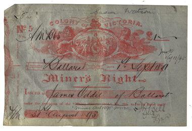
Document - Miner's Right, Colony of Victoria, Miner's Right for the Ballarat Observatory Land in Magpie Street, 1890-1899
... land at Dana Street with red writing over it regarding its transferal. The Observatory Registration in No 19578 with the situation of residence area being 'Magpie Street Mount Pleasant 209 feet x 52 feet" The District and Division is Central D Ballarat. ...land at Dana Street with red writing over it regarding its transferal. The Observatory Registration in No 19578 with the situation of residence area being 'Magpie Street Mount Pleasant 209 feet x 52 feet" The District and Division is Central D Ballarat. ...The Ballarat Observatory was established by James Oddie. It was later given to the Ballarat School of Mines, then the City of Ballarat.A number of Miners' Rights made out to James Oddie of Ballarat, for a block of land in Magpie Street, Mount Pleasant, used as the Ballarat Observatory. The red 1995 Miners' Right includes land at Dana Street with red writing over it regarding its transferal. The Observatory Registration in No 19578 with the situation of residence area being 'Magpie Street Mount Pleasant 209 feet x 52 feet" The District and Division is Central D Ballarat. The red Miners' Right includes the Magpie Ste Address and "Dana Street allot 3 Sec 52 40 feet and 140 feet in Ballarat Central D". In red ink over the address in written (Ressarell) transferred in favor of Susan Watson 7/1/95 C.H. Stevenson Asst M.R. miner's right, james oddie, ballarat observatory, magpie st, mount pleasant, f. bell, w.a. christy, dana street
