Showing 1668 items matching " land use"
-
 Sunshine and District Historical Society Incorporated
Document - Maribyrnong Valley Land Use (Brimbank Park to Canning Street Bridge), Maribyrnong Valley Land Use Committee February 1992, 1992
... Maribyrnong Valley Land Use (Brimbank Park to Canning Street Bridge)...Maribyrnong Valley Land Use (Brimbank Park to Canning Street Bridge)...Maribyrnong Valley Land Use Committee February 1992...Maribyrnong Valley Maribyrnong River Canning Street Bridge Maribyrnong Valley Land Use (Brimbank Park to Canning Street Bridge) Ring bounded A4 document Document Maribyrnong Valley Land Use (Brimbank Park to Canning Street Bridge) Maribyrnong Valley Land Use Committee February 1992 ...Maribyrnong Valley Land Use (Brimbank Park to Canning Street Bridge)maribyrnong valley, maribyrnong river, canning street, bridge -
 Bendigo Historical Society Inc.
Book - RURAL LAND USE IN THE LODDON-CAMPASPE REGION, 1976
... RURAL LAND USE IN THE LODDON-CAMPASPE REGION......land use...RURAL LAND USE IN THE LODDON-CAMPASPE REGION - a discussion paper on issues and options. 30 pages, with maps....History House 11 Mackenzie Street Bendigo goldfields BOOK Rural land use loddon campaspe rural land use agriculture Loddon-Campaspe regional planning authority RURAL LAND USE IN THE LODDON-CAMPASPE REGION - a discussion paper on issues and options. 30 pages, with maps. ...RURAL LAND USE IN THE LODDON-CAMPASPE REGION - a discussion paper on issues and options. 30 pages, with maps.Loddon-Campaspe regional planning authoritybook, rural, land use, loddon campaspe, rural, land use, agriculture -
 Whitehorse Historical Society Inc.
Pamphlet, City of Nunawading land use statement, 1994
... City of Nunawading land use statement...Land Use...A draft statement from City of Nunawading on land use strategy to establish directions & priorities for land use change and development within the municipality for the remainder of this decade and into the next. ...Whitehorse Historical Society Inc. 2-10 Deep Creek Road Mitcham melbourne 4p Land Use City of Nunawading A draft statement from City of Nunawading on land use strategy to establish directions & priorities for land use change and development within the municipality for the remainder of this decade and into the next. ...A draft statement from City of Nunawading on land use strategy to establish directions & priorities for land use change and development within the municipality for the remainder of this decade and into the next. Council seeking comments.land use, city of nunawading -
Tatura Irrigation & Wartime Camps Museum
Book, Soils and Land Use, 1963
... Soils and Land Use...soils and land use...Advice to land holders on how to use the Soil Survey Report. Soils and land use in the deakin Irrigation area, Vict, Technical Bulletin No. 16, Melb. ...Includes maps for Deakin Irrigation Area soils and land use tatura irrigation books technical rural industry Cream cover, black writing, Techical Bulletin No. 16 Soils and Land Use Book ...Advice to land holders on how to use the Soil Survey Report. Soils and land use in the deakin Irrigation area, Vict, Technical Bulletin No. 16, Melb. Includes maps for Deakin Irrigation AreaCream cover, black writing, Techical Bulletin No. 16soils and land use, tatura, irrigation, books, technical, rural, industry -
 Tatura Irrigation & Wartime Camps Museum
Book, Soils and Land Use. Deakin Irrigation Area Technical Bulletin No 16, 1963
... Soils and Land Use. Deakin Irrigation Area Technical Bulletin No 16...land use...Information in regard to land and soil use in Deakin irrigation area....Tatura Irrigation & Wartime Camps Museum 49 Hogan Street Tatura the-murray Information in regard to land and soil use in Deakin irrigation area. land use soil use Deakin irrigation area Mid sized soft cover book, black spine, off white front and back, black writing on back and front Soils and Land Use. ...Mid sized soft cover book, black spine, off white front and back, black writing on back and frontnon-fictionland use, soil use, deakin irrigation area -
Box Hill Historical Society
Book, City of Box Hill, Spring Street and Environs Study : Land Use Strategy, c. 1986
... Spring Street and Environs Study : Land Use Strategy....Land use...Box Hill Historical Society Box Hill Heritage Centre Suite 7 Town Hall Hub Box Hill melbourne Land use Spring Street Box Hill Town planning This report presents a broad strategic framework for the area to the north west of the Box Hill Business District. ...This report presents a broad strategic framework for the area to the north west of the Box Hill Business District. This report sets down guidelines and options for the development of the area in and around Spring Street, Box Hill.44pThis report presents a broad strategic framework for the area to the north west of the Box Hill Business District. This report sets down guidelines and options for the development of the area in and around Spring Street, Box Hill.land use, spring street, box hill, town planning -
Port Melbourne Historical & Preservation Society
Document - Port Melbourne Council re non-residential land use in residential zones, 1974 - 1978
... Port Melbourne Council re non-residential land use in residential zones...Miscellaneous Port Melbourne Council documents 1974-78 Schedule of non-residential land uses in residential zones...Port Melbourne Historical & Preservation Society Port Melbourne Town Hall 333 Bay Street Port Melbourne melbourne Retained by donor from his service on Port Melbourne Council 1973-78 local government - city of port melbourne town planning glen cosham Miscellaneous Port Melbourne Council documents 1974-78 Schedule of non-residential land uses in residential zones Document Port Melbourne Council re non-residential land use in residential zones ...Retained by donor from his service on Port Melbourne Council 1973-78Miscellaneous Port Melbourne Council documents 1974-78 Schedule of non-residential land uses in residential zoneslocal government - city of port melbourne, town planning, glen cosham -
 Bendigo Historical Society Inc.
Book - LAND USE STRATEGY PLAN FOR THE BENDIGO SUV-REGION 1990-2020, 1991
... LAND USE STRATEGY PLAN FOR THE BENDIGO SUV-REGION 1990-2020...Land Use Strategy Plan for the Bendigo Sub-Region, 1990 - 2020. ...Book LAND USE STRATEGY PLAN FOR THE BENDIGO SUV-REGION 1990-2020 ...Land Use Strategy Plan for the Bendigo Sub-Region, 1990 - 2020. Bendigo 2020 Strategy. Prepared by three consulting firms for the Loddon-Campaspe Regional Planning Authority Inside front cover are: 1 Cover sheet, 3 stapled reports covering Bendigo 2020 land use strategy plan, Issues Report, Environment, also a 5 page booklet planning for the future with information and maps.Loddon-Campaspe Regional Planning Authoritybendigo, planning, 2020 strategy. -
Lakes Entrance Historical Society
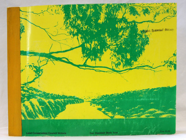
Book, Land Conservation Council Victoria, The Gippsland Lakes Land Use Strategy Plan 1978, 1985
... The Gippsland Lakes Land Use Strategy Plan 1978...A review of public land use in the East Gippsland area, including natural resources, flora and fauna, recreation. ...The Gippsland Lakes Land Use Strategy Plan 1978 Book Land Conservation Council Victoria ...A review of public land use in the East Gippsland area, including natural resources, flora and fauna, recreation. Contains photographs, maps statistics.conservation, aboriginals, primary industry -
 Bendigo Historical Society Inc.
Document - Kangaroo Flat Gold Mine Collection: Land Use Impact Study, Unknown
... Kangaroo Flat Gold Mine Collection: Land Use Impact Study...Four pages of information on the Birds/Carshalton Gold Mining poposed development by Bendigo Mining N.L.. 1. Summary of land use planning impact study, Birds/Carshalton Gold Mining Project. ...Document Kangaroo Flat Gold Mine Collection: Land Use Impact Study ...Four pages of information on the Birds/Carshalton Gold Mining poposed development by Bendigo Mining N.L.. 1. Summary of land use planning impact study, Birds/Carshalton Gold Mining Project. On top of page: ' KLM Planning Consultants, Summary Bendigo Mining NL - Birds/Carshalton Project. 2. South Birds/Carshalton Gold Mines, summary of environmental noise and vibration impacts. On top of page: Watson Moss Growcott Acoustics Pty Ltd. 3. Proposed Birds South/Carshalton Gold Mining Project, Summary of Social Impact Assessment. 4. Birds/Carshalton project - economic benefits, tourism benefits, public sector externalities, effect on property values and recommendation. bendigo mining n.l., bendigo, mining, gold, mining proposal, dust supression, carshalton mine, williams united mine, birds reef -
Clunes Museum
Education kit - DOCUMENT, SOIL CONSERVATION AUTHORITY, MCHUGH'S GULLY - A LAND USE AND MANAGEMENT TEACHING RESOURCE KIT, 1982
... MCHUGH'S GULLY - A LAND USE AND MANAGEMENT TEACHING RESOURCE KIT...Section A contains documents of land use and management teaching resource kit. ...Section A contains documents of land use and management teaching resource kit. ...ENVIRONMENTAL STUDY OF MCHUGH'S GULLY RECORDED IN THE EARLY 1980'SBUFF COLOURED LEVER ARCH FILE CONTAINING SECTIONS A TO I WITH A CARDBOARD INSERT OF FRONT COVER WITH SEPIA IMAGES OF RURAL SCENES AND TOWN SHIP PRINTED ON IT. Section A contains documents of land use and management teaching resource kit. Section I contains slides and transparenciesnon-fictionENVIRONMENTAL STUDY OF MCHUGH'S GULLY RECORDED IN THE EARLY 1980'Smchughs gully, land management, environmental impact report -
Whitehorse Historical Society Inc.
Document, Community participation with land use
... Community participation with land use...Community participation with land use - a Nunawading example. Edited version of a paper presented at 'Land for Leisure', annual conference of the Royal Australian Institute of Parks and Recreation, Burnie, 1978. ...Parks and Recreation Community participation with land use - a Nunawading example. Community participation with land use - a Nunawading example. ...Community participation with land use - a Nunawading example.Community participation with land use - a Nunawading example. Edited version of a paper presented at 'Land for Leisure', annual conference of the Royal Australian Institute of Parks and Recreation, Burnie, 1978. Includes introduction and colour thumbnail prints of slides which were part of the presentation. 3 Cds contain images NP2904-2906.Community participation with land use - a Nunawading example. community gardens, city of nunawading. parks and recreation -
 Greensborough Historical Society
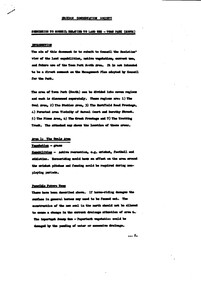
Booklet, Toward the municipal mapping of traditional aboriginal land use, by Jim Poulter, 2017c
... Toward the municipal mapping of traditional aboriginal land use, by Jim Poulter...Using Manningham as an example, aboriginal land use patterns are shown, together with interconnecting songlines....Greensborough Historical Society 34A Glenauburn Road Lower Plenty Lower Plenty melbourne Using Manningham as an example, aboriginal land use patterns are shown, together with interconnecting songlines. manningham songlines aborigines 10 p., typescript Toward the municipal mapping of traditional aboriginal land use, by Jim Poulter Booklet Jim Poulter ...Using Manningham as an example, aboriginal land use patterns are shown, together with interconnecting songlines.10 p., typescriptmanningham, songlines, aborigines -
 Wonga Park Community Cottage History Group
Booklet - 10-page booklet by Jim Poulter, “Toward the Municipal Mapping of Traditional Land Use”
... “Toward the Municipal Mapping of Traditional Land Use”...10-page booklet by Jim Poulter “Toward the Municipal Mapping of Traditional Land Use”...Wonga Park Community Cottage History Group Unit 1, 9 – 13 Old Yarra Road Wonga Park melbourne 10-page booklet by Jim Poulter “Toward the Municipal Mapping of Traditional Land Use” “Toward the Municipal Mapping of Traditional Land Use” Booklet 10-page booklet by Jim Poulter ...10-page booklet by Jim Poulter “Toward the Municipal Mapping of Traditional Land Use” -
 Croydon Conservation Society Inc.
Document, Town Park (South) - submission to Council re land use - date unknown
... Town Park (South) - submission to Council re land use - date unknown...CCS view of land capabilities, native vegetation and current use and future use of Town Park South area...Town Park (South) - submission to Council re land use - date unknown Document ...CCS view of land capabilities, native vegetation and current use and future use of Town Park South areaOne typed page of submission paper to Council. -
 Tatura Irrigation & Wartime Camps Museum
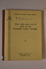
Book, Department of Agriculture Victori, Soil and Land Use in Part of the Goulburn Valley Victoria Technical Bulletin No 14, 1962
... Soil and Land Use in Part of the Goulburn Valley Victoria Technical Bulletin No 14...Tech Bulletin No 14. Soil and Land Use in Part of the Goulburn Valley Victoria Technical Bulletin No 14 Book Book Department of Agriculture Victori ...Mid sized book with soft cover, brown spine with off white cover. Black writing on back and front. Contains maps. Tech Bulletin No 14.non-fictiongoulburn valley, soil studies victoria, victorian maps -
Lakes Entrance Historical Society
Book, Town and Country Planning Board Melbourne, Gippsland Lakes Land Use Strategy Plan, 1978
... Gippsland Lakes Land Use Strategy Plan...Lakes Entrance Historical Society 4 Marine Parade Lakes Entrance gippsland Waterways Recreation Background report to the strategy plan to guide future development of the Gippsland Lakes Gippsland Lakes Land Use Strategy Plan Book Town and Country Planning Board Melbourne ...Background report to the strategy plan to guide future development of the Gippsland Lakeswaterways, recreation -
 Orbost & District Historical Society
book, Report on the East Gippsland Study Area, June 1974
... East-Gippsland-Study-Area conservation public-land-use...Land Conservation Act 1970. As one of its three functions, it makes recommendations to the Minister for Planning and Environment with respect to the use of public land, in order to provide for the balanced use of land in Victoria. ...It contains folded maps and information on public land use in East Gippsland....East-Gippsland-Study-Area conservation public-land-use inside - "With Compliments - Bruce Evans, M.P." ...In 1961 Bruce Evans was elected to the Victorian Legislative Assembly as the member for Gippsland East. He was the party's deputy leader from 1964 to 1970 and its whip from 1970 until his retirement in 1992. "The Land Conservation Council was established by the Land Conservation Act 1970. As one of its three functions, it makes recommendations to the Minister for Planning and Environment with respect to the use of public land, in order to provide for the balanced use of land in Victoria. This report contains the Council’s final recommendations concerning the use of public land in the East Gippsland study area, the boundaries of which correspond to those of the Shire of Orbost. The recommendations in the text are grouped under major headings, such as Parks, State Forest, and so on. " The Council met on seven occasions during the year, and also made visits of inspection to each study area. The Chairman visited Shire Councils in study areas to explain the role and the functions of the Land Conservation Council and to invite submissions on the use of public land in these areas. This is the fourth annual report by the council. This is a useful research tool.A large book 236 pp book with a yellow / gold cover with a green bush scene . The binding is orange. It contains folded maps and information on public land use in East Gippsland.inside - "With Compliments - Bruce Evans, M.P."east-gippsland-study-area conservation public-land-use -
 Whitehorse Historical Society Inc.
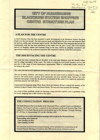
Pamphlet, City of Nunawading Blackburn Station Shopping Centre structure plan, 1990
... ...Land use...Map of land use precincts, draft structure plan including overall strategic goals of Blackburn Station Shopping Centre. ...Whitehorse Historical Society Inc. 2-10 Deep Creek Road Mitcham melbourne blackburn station shopping centre Land use Map of land use precincts, draft structure plan including overall strategic goals of Blackburn Station Shopping Centre. ...Map of land use precincts, draft structure plan including overall strategic goals of Blackburn Station Shopping Centre. Also traffic managementMap of land use precincts, draft structure plan including overall strategic goals of Blackburn Station Shopping Centre. Also traffic management.Map of land use precincts, draft structure plan including overall strategic goals of Blackburn Station Shopping Centre. Also traffic managementblackburn station shopping centre, land use -
Whitehorse Historical Society Inc.
Document, Lee Parade, 1/11/1960
... Land Use...Lee Parade/Barkly Terrace area land use study, City of Nunawading. Review and recommendations by Hassell Planning Consultants Pty. ...Whitehorse Historical Society Inc. 2-10 Deep Creek Road Mitcham melbourne Land Use Hassell Planning Consultants Lee Parade Mitcham Barkly Terrace Mitcham Whitehorse Road Mitcham Church Street Mitcham Lee Parade/Barkly Terrace area land use study, City of Nunawading. ...Lee Parade/Barkly Terrace area land use study, City of Nunawading. Review and recommendations by Hassell Planning Consultants Pty. Ltd., November 1960. In the folder correspondence, petitions and submissions from residents.land use, hassell planning consultants, lee parade, mitcham, barkly terrace, mitcham, whitehorse road, mitcham, church street, mitcham -
Port Melbourne Historical & Preservation Society
Letter - Lands & Survey Office re permission to use land for football ground, 13 May 1880
... Lands & Survey Office re permission to use land for football ground...Letter from Lands & Survey Office granting permission for use of land as per tracing sheet for football ground, 1880...Port Melbourne Historical & Preservation Society Port Melbourne Town Hall 333 Bay Street Port Melbourne melbourne Sport - Australian Rules Football Sport - Recreational Grounds Peter Gallienne GRUT Port Melbourne Football Club PMFC Letter from Lands & Survey Office granting permission for use of land as per tracing sheet for football ground, 1880 Letter Lands & Survey Office re permission to use land for football ground ...Letter from Lands & Survey Office granting permission for use of land as per tracing sheet for football ground, 1880sport - australian rules football, sport - recreational grounds, peter gallienne grut, port melbourne football club, pmfc -
 Greensborough Historical Society
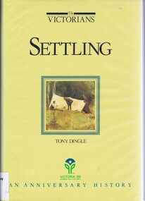
Book, Settling: The Victorians. By Tony Dingle, 1984_
... victoria land use...Part 2 of a 3-part series deals with land use from Aboriginal land use to European settlement....Greensborough Historical Society 34A Glenauburn Road Lower Plenty Lower Plenty melbourne Part 2 of a 3-part series deals with land use from Aboriginal land use to European settlement. ...Part 2 of a 3-part series deals with land use from Aboriginal land use to European settlement.Published to commemorate the 150th anniversary of European settlement in Victoria.Hard cover. 274 pages, illus., maps, end maps.victoria land use, victoria history, victoria social conditions, tony dingle -
Box Hill Historical Society
Book, City of Box Hill, Albion Road. Local Area Traffic Management Scheme, c.1986
... ...Land use...A traffic management study and scheme that was implemented during the 1980's as a result of concerns by local residents. It includes land use, traffic accidents, bus routes, trip tables and maps. ...It includes land use, traffic accidents, bus routes, trip tables and maps. ...A traffic management study and scheme that was implemented during the 1980's as a result of concerns by local residents. It includes land use, traffic accidents, bus routes, trip tables and maps. It covers the area bounded by Station Street, Canterbury Road, Middleborough Road and the railway line at Box Hill.traffic management, station street, canterbury road, middleborough road, railway line, box hill, land use, car parks, ellingworth parade, john street, albion road, rutland road, sweetland road, barkly street, william street, traffic accidents, bus services, town planning -
Box Hill Historical Society
Book, City of Box Hill, Prospect Street Development Plan - Draft, 1983
... Land use...It takes into consideration traffic flow - both pedestrian and vehicular; types of land use control, i.e. permitted uses, discretionary uses and prohibited uses; and buildings suitable for offices. ...It takes into consideration traffic flow - both pedestrian and vehicular; types of land use control, i.e. permitted uses, discretionary uses and prohibited uses; and buildings suitable for offices. ...This paper provides recommendations for the Prospect Street, Box Hill, area being developed as an "enterprise area" for larger office buildings. It takes into consideration traffic flow - both pedestrian and vehicular; types of land use control, i.e. permitted uses, discretionary uses and prohibited uses; and buildings suitable for offices. Maps.land use, town planning, prospect street, box hill, whitehorse road, nelson road, elgar road, traffic -
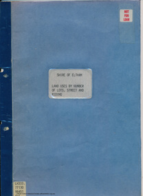 Eltham District Historical Society Inc
Document - Folder, Shire of Eltham, Land uses by number of lots, street and riding, 1984
... ...land use...The exercise was expanded to include other land uses. At the end of each Riding is given a summary of the number of the various major land uses and index to abbreviations used on the last page...The exercise was expanded to include other land uses. At the end of each Riding is given a summary of the number of the various major land uses and index to abbreviations used on the last page harry gilham collection land use streets ridings dwellings units 11 pages inside blue cover Land uses by number of lots, street and riding Document Folder Shire of Eltham ...In work undertaken by the Shire of Eltham in revising its residential multi-unit development policy, information was collated by street and number of units. The exercise was expanded to include other land uses. At the end of each Riding is given a summary of the number of the various major land uses and index to abbreviations used on the last page11 pages inside blue coverharry gilham collection, land use, streets, ridings, dwellings, units -
Broadmeadows Historical Society & Museum
Document - Planning correspondence, c.1966
... ...Land‑use regulation...The document provides evidence of municipal planning control and regulatory processes within the City of Broadmeadows during the 1960s, reflecting governance, land‑use planning and community facility assessment....Glenroy Town planning Municipal government Land‑use regulation Community facilities Typed official text including municipal letterhead, planning application references, addresses and signatures. ...The document provides evidence of municipal planning control and regulatory processes within the City of Broadmeadows during the 1960s, reflecting governance, land‑use planning and community facility assessment.This item is significant as a record of local government decision‑making and planning regulation, documenting the administration of the Melbourne Metropolitan Planning Scheme at a municipal level.Multi‑page printed paper document, including typed correspondence and official planning form.Typed official text including municipal letterhead, planning application references, addresses and signatures.broadmeadows (vic.), glenroy, town planning, municipal government, land‑use regulation, community facilities -
 Wooragee Landcare Group
Photograph, 5 September 2004
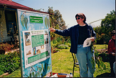
... ...land use...Wooragee Landcare was formed in 1989 to promote sustainable conservation and land-use practices in the North-East region of Victoria. ...The event was about looking at land use on small farms and as a social get-together for the Group. ...Wooragee Landcare was formed in 1989 to promote sustainable conservation and land-use practices in the North-East region of Victoria. The organisation's work has included public awareness and education campaigns to control invasive, introduced species and protect native wildlife, such as campaigns to replant native plant species to improve soil integrity and restore habitat for flora and fauna. The organisation has drawn on the work of a variety of Government and academic experts to ensure best practice approaches are utilised. This photograph was taken at Riverview Farm, Victoria on Sunday the 5th of September as part of a day trip by the Wooragee Landcare Group. The event was about looking at land use on small farms and as a social get-together for the Group. Wooragee was also researching how small landholders could run some enterprises around the time of the trip. This photograph is a great example of the type of events that Wooragee Landcare Group has organized, while educating the public about the importance of land use management.Landscape colour photograph printed on gloss paper. Reverse: WAN NA E0NA2N2. NNN+ 4 4240/ [PRINTED] (No. 24) / 377wooragee, wooragee landcare group, wooragee landcare's collection, land use, social, riverview farm, animals, pests, indigo shire, tatong, samaria, north-east victoria -
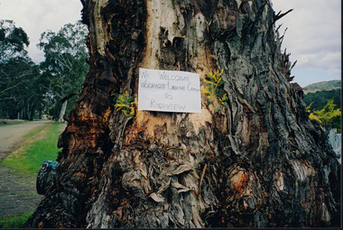
 Wooragee Landcare Group
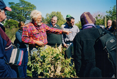
Photograph, 5 September 2004
... ...land use...The purpose of the excursion was to look at land use on small farms. As part of this, the excursion included a visit to Samaria Farm, run by Sue and Don Matheson. ...The purpose of the excursion was to look at land use on small farms. As part of this, the excursion included a visit to Samaria Farm, run by Sue and Don Matheson. ...This photograph was taken during a bus excursion to Tatong in North East Victoria, held by the Wooragee Landcare Group in September 2004. The purpose of the excursion was to look at land use on small farms. As part of this, the excursion included a visit to Samaria Farm, run by Sue and Don Matheson. In this photo, taken at Samaria Farm, Don Matheson is discussing the management of his commercial rose garden. Events like this meet Wooragee Landcare's organisational goals of promoting best land management practices, cooperating and engaging with landowners, and providing information on plant management and care. This object is significant as a record of Wooragee Landcare's activities and community involvement. Landscape colour photograph printed on gloss photographic material. Reverse: "WAN NA E0NA2N2 NNN+ 1 4240/ don matheson, sue matheson, matheson, tatong, excursion, bus trip, wooragee landcare, wooragee, landcare, wooragee landcare group, samaria farm, roses, commercial rose garden, rose growing, education, activity, 2004, rose, farm, small farms, land use -
 Wooragee Landcare Group
Photograph, 5 Sepember 2004
... ...land use...The event was about looking at land use on small farms and as a social get-together for the Group. ...The event was about looking at land use on small farms and as a social get-together for the Group. ...This photograph was taken at Riverview Farm, Victoria on Sunday the 5th of September as part of a day trip by the Wooragee Landcare Group. The event was about looking at land use on small farms and as a social get-together for the Group. Wooragee was also researching how small landholders could run some enterprises around the time of the trip. This photograph includes Julius Holt, Graeme Missen, Peter and Lesley Finedon, Sue Brunskill, Jacky Luisi, Bonnie Payne, Bob and Christine Stewart, Oliver Payne, and Gerri Boland. Wooragee Landcare Group was created in 1988. Its core mission is to work towards eradicating animals and pests from the land to protect the natural vegetation and promote revegetation projects.This photograph is a great example of the type of events that Wooragee Landcare Group has organized, while educating the public about the importance of land use management.Reverse: WAN NA E0NA2N2. NN1- 3 4556 / [PRINTED] (No. 9) / 188wooragee, wooragee landcare group, wooragee landcare's collection, land use, social, riverview farm, animals, pests -
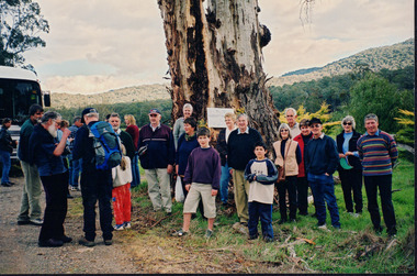
 Wooragee Landcare Group
Photograph, 5 September 2004
... ...land use...Wooragee Landcare Group took a bus trip Sunday 5th September to Samaria, Tatong area (near Benalla) to look at land use on small farms. Around this time, Wooragee Landcare were looking into how small land holders could run some enterprises. ...Wooragee Landcare Group 1001 Beechworth-Wodonga Rd, Wooragee Wooragee Landcare Group took a bus trip Sunday 5th September to Samaria, Tatong area (near Benalla) to look at land use on small farms. Around this time, Wooragee Landcare were looking into how small land holders could run some enterprises. ...Wooragee Landcare Group took a bus trip Sunday 5th September to Samaria, Tatong area (near Benalla) to look at land use on small farms. Around this time, Wooragee Landcare were looking into how small land holders could run some enterprises. This photo was taken at Tatong Tavern where the group had lunch. The Tatong Tavern is an old English style pub situated in the foothills of the Great Dividing Range the small community of Tatong 23km south-east of Benalla. The original weatherboard hotel was originally built in the 1880s by William Worrall who was listed as Hotel Keeper from 1886 to 1910. It was destroyed by fire in 1923 and replaced by the current building, which has undergone many changes over the past 100 years. The name has also changed from the Tatong Hotel or ‘Pub’ to the current name of Tatong Tavern.Tatong is a rural village in north-east Victoria, set in undulating country that rises southwards to the Tolmie ranges. The name is thought to derive from an Aboriginal expression, possibly referring to something unseen. The Tatong pastoral run was taken up in 1847 and farm selections began in the 1870s. A school opened in 1890 (closed in 2006). Dairy herds were grazed on the Tatong flats and a cooperative creamery operated from 1892 until 1918. In 1914 a branch railway line was opened from Benalla to Tatong that carried farm produce and timber to Tatong, which had two sawmills in the 1920s. There was also a general store, a police station, and a livestock trucking yard. St Albans Church of England was built in 1921. Most of those buildings have now disappeared. The Tatong Tavern along with the Hall built in 1904 are the only remaining buildings. The Tatong Tavern is a significant tangible and visual representation of the area’s cultural and social history over the past 100 years. Coloured rectangular photograph printed on paperReverse: WAN NA E0NA2N2. NNN- 14240/ (No. 20) 373/ tatong, tatong pub, tatong tavern, tolmie ranges, tatong flats, benalla, wooragee landcare, wooragee landcare group, bus trip, samaria, land use, william worrall, 1800s, 2004, mount samaria