Showing 34 items matching " m.m.b.w."
-
 Whitehorse Historical Society Inc.
Map, M.M.B.W - Schwerkolt Cottage, 30/04/1968
... M.M.B.W - Schwerkolt Cottage...Extract from M.M.B.W. map No 79 showing proposed main road, open space, residential zones C & D and location of Schwerkolt Cottage. ...Approved 40/04/1968. 2 copies M.M.B.W - Schwerkolt Cottage Map Map ...Extract from M.M.B.W. map No 79 showing proposed main road, open space, residential zones C & D and location of Schwerkolt Cottage. Approved 40/04/1968. 2 copiesschwerkolt cottage, melbourne and metropolitan board of works, eastern freeway -
 Eltham District Historical Society Inc
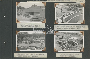
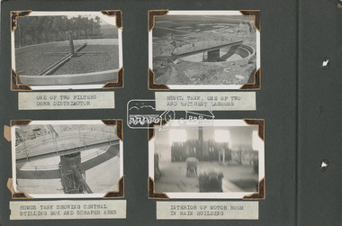
Album - Photograph Album, Alan Gardiner, M.M.B.W Braeside Sewage Treatment Plant Construction, 1939
... M.M.B.W Braeside Sewage Treatment Plant Construction...Bound with (faded) red cord (2 holes) M.M.B.W Braeside Sewage Treatment Plant Construction Album Photograph Album Alan Gardiner ...In April 1928 the MMBW had the land and the plans for what they were to construct but the timing of the actual building did not proceed as planned. Before the construction could commence the Great Depression of the 1930s intervened forcing the shelving of its plans. The new owners then offered the land for lease resulting in Frederick Werrett taking the opportunity to take up the land he formerly owned to continue his market gardening activities of growing potatoes, onions and other crops. The land and improvements made by Syme were leased in 1929 to Harry Telford a trainer from New South Wales. Phar Lap grazed there for a short time. [9] However the population of Melbourne continued to grow and the need for a sewerage treatment plant did not go away. In 1939 when the effects of the Depression had dissipated work on the Sewerage Effluent Treatment Plant commenced and the following year in October the Premier of the State, Albert Dunstan, officially commissioned it. The Sewerage Effluent Treatment Plant at Braeside served the communities of south-east Melbourne for thirty five years until 1975. In that year all the sewers that entered the Braeside plant were diverted to the South Eastern Trunk Sewer complex at Carrum.[10] In 1982 the chairman of the MMBW at that time, Alan Croxford, announced that a substantial part of the property at Braeside would be administered by the Parks and Gardens section of MMBW as a public park. Subsequently the responsibilities were transferred to Parks Victoria, the situation that exists today. It is known as “Braeside Park” now. [Source: Sewerage Treatment Plant at Braeside, Kingston Local History, https://localhistory.kingston.vic.gov.au/articles/407]alan gardiner collection, 1939, braeside sewage treatment plant, construction, melbourne metropolitan board of works, mmbw -
 Eltham District Historical Society Inc
Album - Photograph Album, Alan Gardiner, M.M.B.W Braeside Sewage Treatment Plant Construction, 1939
... M.M.B.W Braeside Sewage Treatment Plant Construction...Bound with (faded) red cord (2 holes) M.M.B.W Braeside Sewage Treatment Plant Construction Album Photograph Album Alan Gardiner ...In April 1928 the MMBW had the land and the plans for what they were to construct but the timing of the actual building did not proceed as planned. Before the construction could commence the Great Depression of the 1930s intervened forcing the shelving of its plans. The new owners then offered the land for lease resulting in Frederick Werrett taking the opportunity to take up the land he formerly owned to continue his market gardening activities of growing potatoes, onions and other crops. The land and improvements made by Syme were leased in 1929 to Harry Telford a trainer from New South Wales. Phar Lap grazed there for a short time. [9] However the population of Melbourne continued to grow and the need for a sewerage treatment plant did not go away. In 1939 when the effects of the Depression had dissipated work on the Sewerage Effluent Treatment Plant commenced and the following year in October the Premier of the State, Albert Dunstan, officially commissioned it. The Sewerage Effluent Treatment Plant at Braeside served the communities of south-east Melbourne for thirty five years until 1975. In that year all the sewers that entered the Braeside plant were diverted to the South Eastern Trunk Sewer complex at Carrum.[10] In 1982 the chairman of the MMBW at that time, Alan Croxford, announced that a substantial part of the property at Braeside would be administered by the Parks and Gardens section of MMBW as a public park. Subsequently the responsibilities were transferred to Parks Victoria, the situation that exists today. It is known as “Braeside Park” now. [Source: Sewerage Treatment Plant at Braeside, Kingston Local History, https://localhistory.kingston.vic.gov.au/articles/407]alan gardiner collection, 1939, braeside sewage treatment plant, construction, melbourne metropolitan board of works, mmbw -
 Port Melbourne Historical & Preservation Society
Booklet, Melbourne and Metropoltan Board of Works, Once Upon a Time ... An M.M.B.W. Picture Story, 1950
... Once Upon a Time ... An M.M.B.W. Picture Story...Describes history of Melbourne's sewerage system Once Upon a Time ... An M.M.B.W. Picture Story Booklet Melbourne and Metropoltan Board of Works The Argus & Australasian Ltd ..."Once Upon a Time ... An MMBW Picture Story" Small oblong booklet. Front cover red banner title and B&W photo of the All England Eleven Hotel. Describes history of Melbourne's sewerage systemutilities - sewerage, engineering - board of works, armed services - air force, built environment - commercial, business and traders - hotels, all england eleven hotel, mmbw, werribee metropolitan farm, pier hotel, melbourne and metropolitan board of works -
Whitehorse Historical Society Inc.
Map, M.M.B.W, c1962
... M.M.B.W....Prepared by Department of Lands and Survey and Melbourne and Metropolitan Board of Works from State aerial Survey, June 1957 and Cadastral Survey information, August 1960. Scale 1:4,800. M.M.B.W. Map Map ...Melbourne Metropolitan Area Base Map series sheet 235, covering part, Mitcham, Nunawading and Ringwood areas.Melbourne Metropolitan Area Base Map series sheet 235, covering part, Mitcham, Nunawading and Ringwood areas. Prepared by Department of Lands and Survey and Melbourne and Metropolitan Board of Works from State aerial Survey, June 1957 and Cadastral Survey information, August 1960. Scale 1:4,800.Melbourne Metropolitan Area Base Map series sheet 235, covering part, Mitcham, Nunawading and Ringwood areas. maps, mitcham, nunawading, ringwood, melbourne and metropolitan board of works, victoria. department of lands and survey -
 Bendigo Historical Society Inc.
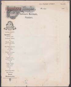
Document - CAMBRIDGE PRESS COLLECTION: LETTER PAPER - LANGLEY AND PLUMBE
... ... M.M.B.W....Down the left edge of the page is a logo, Certified M.M.B.W., and their specialities....Down the left edge of the page is a logo, Certified M.M.B.W., and their specialities. Document CAMBRIDGE PRESS COLLECTION: LETTER PAPER - LANGLEY AND PLUMBE ...Letter paper from Langley & Plumbe, Hardware Merchants, Plumbers, 172-4 Mundy Street, Bendigo. Date line ends 193-. Printed letterhead with the name, first name has three red lines through it. Picture of a bath below the name Langley. Down the left edge of the page is a logo, Certified M.M.B.W., and their specialities.business, printers, cambridge press, cambridge press collection, langley & plumbe, m.m.b.w. -
 Sunshine and District Historical Society Incorporated
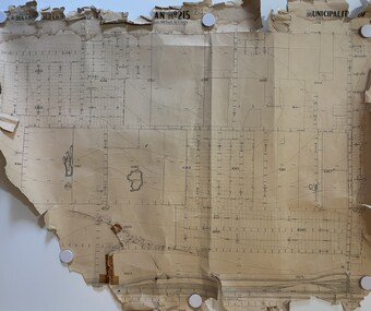
Map - M.M.B.W. Map (Plan No 215)
... M.M.B.W. Map (Plan No 215)...No 1 Stores and former quarry sites Map M.M.B.W. Map (Plan No 215) ...M.M.B.W. Map (Plan No 215)map -
 Whitehorse Historical Society Inc.
Photograph - Black & white photograph, Clearing Land for Mitcham Reservoir
... Black and white photo of Teams of Horses clearing Land for M.M.B.W. Reservoir at Mitcham....Whitehorse Historical Society Inc. 2-10 Deep Creek Road Mitcham melbourne meagher ray melbourne and metropolitan board of works mitcham reservoir Black and white photo of Teams of Horses clearing Land for M.M.B.W. Reservoir at Mitcham. Clearing Land for Mitcham Reservoir Photograph Black & white photograph ...Black and white photo of Teams of Horses clearing Land for M.M.B.W. Reservoir at Mitcham.meagher, ray, melbourne and metropolitan board of works, mitcham reservoir -
 Ringwood and District Historical Society
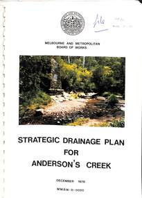
Book, Strategic Drainage Plan For Anderson's Creek, 1978
... Foreword by Alan H. Croxford, M.M.B.W. Chairman....Ringwood and District Historical Society 125A Warrandyte Road Ringwood North melbourne Foreword by Alan H. Croxford, M.M.B.W. Chairman. Melbourne and Metropolitan Board of Works 1988 report on physical characteristics of Anderson's Creek and development of management strategies formulated in consultation with Cities of Croydon, Doncaster & Templestowe, and Ringwood, in which the Anderson's Creek Basin is located. ...Melbourne and Metropolitan Board of Works 1988 report on physical characteristics of Anderson's Creek and development of management strategies formulated in consultation with Cities of Croydon, Doncaster & Templestowe, and Ringwood, in which the Anderson's Creek Basin is located. Foreword by Alan H. Croxford, M.M.B.W. Chairman. -
 Whitehorse Historical Society Inc.
Article, Lucky escape for chick, 23/10/1985 12:00:00 AM
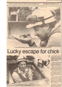
... Plover chick rescued after falling down manhole at Lucknow Street complex of M.M.B.W....Whitehorse Historical Society Inc. 2-10 Deep Creek Road Mitcham melbourne plovers birds melbourne and metropolitan board of works smith george lucknow street mitcham Plover chick rescued after falling down manhole at Lucknow Street complex of M.M.B.W. Lucky escape for chick Article Article ...Plover chick rescued after falling down manhole at Lucknow Street complex of M.M.B.W.plovers, birds, melbourne and metropolitan board of works, smith, george, lucknow street, mitcham -
Ringwood and District Historical Society
Envelope, Packet: Ringwood Town Planning, Incl Health Plan, Shops, Development, 1940-1992, 944-1946
... .; Costs, Future development; M.M.B.W.; Essays (Children); Includes health plan....; Costs, Future development; M.M.B.W.; Essays (Children); Includes health plan Packet: Ringwood Town Planning, Incl Health Plan, Shops, Development, 1940-1992 Envelope ...Town Planning - Ringwood (Packet 1 of 2); Shops, Plans, C.R.B.; Costs, Future development; M.M.B.W.; Essays (Children); Includes health plan -
![M.M.B.W. reticulation plan no. 731, Shire of Blackburn and Mitcham. Locality plan of bores [1933].](/media/collectors/56f368632162f118acbff12e/items/60d923316e5f99545134f002/item-media/636db48a3e324a979b36a333/item-fit-380x285.jpg?cb=6) Whitehorse Historical Society Inc.
Whitehorse Historical Society Inc.Document, Locality plan of bores, 1933
... M.M.B.W. reticulation plan no. 731, Shire of Blackburn and Mitcham. ...Whitehorse Historical Society Inc. 2-10 Deep Creek Road Mitcham melbourne whitehorse road blackburn surrey road clare street francis street pope road queen street albert street chapel street bores melbourne and metropolitan board of works M.M.B.W. reticulation plan no. 731, Shire of Blackburn and Mitcham. ...M.M.B.W. reticulation plan no. 731, Shire of Blackburn and Mitcham. Locality plan of bores [1933]. Scale 1' - 160'. Ref No. S 33/154.whitehorse road, blackburn, surrey road, clare street, francis street, pope road, queen street, albert street, chapel street, bores, melbourne and metropolitan board of works -
![Photograph - Braybrook Shire Council visit to Melbourne Metropolitan Board of Works catchment, [1930s]](/media/collectors/5164c1772162ef0c64d700f2/items/69dc57946a5a9c1cb356d996/item-media/69dc59536a5a9c1cb356ee82/item-fit-380x285.jpg?cb=6) Sunshine and District Historical Society Incorporated
Sunshine and District Historical Society IncorporatedPhotograph - Braybrook Shire Council visit to Melbourne Metropolitan Board of Works catchment, [1930s]
... ... M.M.B.W....Shire of Braybrook M.M.B.W. Photograph of members of Braybrook Shire Council visit to Melbourne Metropolitan Board of Works in the mid 1930s Various council workers were invited to a weekend at one of MMBW catchment areas for an inspection tour Back row- Unknown Unknown Unknown Unknown Unknown Arthur Dednick Henry Robinson Unknown Unknown Unknown Bob Grant In front Joe Parsons Clarrie Carlton|Photograph Braybrook Shire Council trip to board of works catchment area mid 1930s Braybrook Shire Council visit to Melbourne Metropolitan Board of Works catchment Photograph Braybrook Shire Council visit to Melbourne Metropolitan Board of Works catchment ...Photograph of members of Braybrook Shire Council visit to Melbourne Metropolitan Board of Works in the mid 1930s Various council workers were invited to a weekend at one of MMBW catchment areas for an inspection tour Back row- Unknown Unknown Unknown Unknown Unknown Arthur Dednick Henry Robinson Unknown Unknown Unknown Bob Grant In front Joe Parsons Clarrie Carlton|Photograph Braybrook Shire Council trip to board of works catchment area mid 1930sshire of braybrook, m.m.b.w. -
 Sunshine and District Historical Society Incorporated
Document - Social Dysfunction and Relative Poverty In Metropolitan Melbourne Report, F. M. Little, 27150
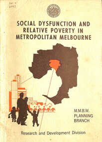
... Social Dysfunction and Relative Poverty In Metropolitan Melbourne Report M.M.B.W. Planning Branch Research and Development Division May 1974...Social Dysfunction and Relative Poverty In Metropolitan Melbourne Report M.M.B.W. Planning Branch Research and Development Division May 1974 Document Social Dysfunction and Relative Poverty In Metropolitan Melbourne Report F. ...Social Dysfunction and Relative Poverty In Metropolitan Melbourne Report M.M.B.W. Planning Branch Research and Development Division May 1974 -
 Port Melbourne Historical & Preservation Society
Photograph - Manufacturing MMBW Pontoon at Mytton's
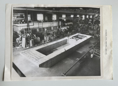
... Partly attached to a plain backing sheet with caption "STAINLESS STEEL PONTOON - M.M.B.W."....Partly attached to a plain backing sheet with caption "STAINLESS STEEL PONTOON - M.M.B.W.". Photograph Manufacturing MMBW Pontoon at Mytton's ...B&W photograph of stainless steel MMBW pontoon under construction at Mytton's Ltd, Fisherman's Bend. Partly attached to a plain backing sheet with caption "STAINLESS STEEL PONTOON - M.M.B.W.".On reverse of photograph "SS Pontoon / MMBW".myttons ltd, mmbw, engineering - melbourne metropolitan board of works -
 Whitehorse Historical Society Inc.
Document, Sewerage, 1933
... Plan of M.M.B.W. reticulation area no 708,Shire of Blackburn and Mitcham; sewer through council property. ...Plan of M.M.B.W. reticulation area no 708,Shire of Blackburn and Mitcham; sewer through council property. ...Plan of M.M.B.W. reticulation area no 708,Shire of Blackburn and Mitcham; sewer through council property.Plan of M.M.B.W. reticulation area no 708,Shire of Blackburn and Mitcham; sewer through council property. Scale 40' to 1' [1933?] with correspondence between MMBW and the Shire, March - April 1933.Plan of M.M.B.W. reticulation area no 708,Shire of Blackburn and Mitcham; sewer through council property.sewerage and sanitation, melbourne and metropolitan board of works, shire of blackburn and mitcham, pope road, blackburn, whitehorse road -
 Whitehorse Historical Society Inc.
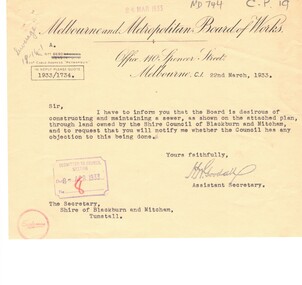
Pamphlet, Melbourne and Metropolitan Board of Works, 26/08/1931
... Notice of ordinary meeting of the M.M.B.W. at 3pm on 8 September 1931 in Board Room at the offices of the Board where respective rates for the financial year 1 July 1931 to 30 June 1932 will be levied....Notice of ordinary meeting of the M.M.B.W. at 3pm on 8 September 1931 in Board Room at the offices of the Board where respective rates for the financial year 1 July 1931 to 30 June 1932 will be levied. ...Notice of ordinary meeting of the M.M.B.W. at 3pm on 8 September 1931 in Board Room at the offices of the Board where respective rates for the financial year 1 July 1931 to 30 June 1932 will be levied.rates, melbourne and metropolitan board of works, king, f. l. -
 Ringwood and District Historical Society
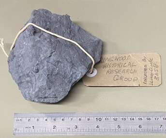
Geological specimen, Collected by J. Lundy-Clarke, Sample of Metamorphic Rock from Hubbard Park, Ringwood, Victoria, Found 1979
... Sample of metamorphic rock encountered by M.M.B.W. gang of tunnellers boring for a sewer drain through a geological fault-dyke along the southern boundary of Hubbard Park. ...Sample of metamorphic rock encountered by M.M.B.W. gang of tunnellers boring for a sewer drain through a geological fault-dyke along the southern boundary of Hubbard Park. ...Sample of metamorphic rock encountered by M.M.B.W. gang of tunnellers boring for a sewer drain through a geological fault-dyke along the southern boundary of Hubbard Park. The hole for 900 feet of 12.5 inch pipe took 6 months to bore from Oct-1979 to May-1980. Collected by J. Lundy-Clarke, Ringwood Historical Research Group. -
 Greensborough Historical Society
Newsletter, Greenhills and North Greensborough Progress Association, Community News: official journal of the Greenhills and Nth. Greensborough Progress Association.1st September, 1974. Edition No. 5/74, 01/09/1974
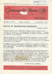
... This edition includes a report on the Progress Association's August 1974 meeting, Willis St. restrictive entrance, Farewell to Harry Nash, Marriage counselling in Greensborough, From the Council chamber, School and kinder news, Pentridge, Meet the natives, M.M.B.W. rates. Open Forum. A digital copy of this Newsletter is available from Greensborough Historical Society....Greensborough Historical Society 34A Glenauburn Road Lower Plenty Lower Plenty melbourne This edition includes a report on the Progress Association's August 1974 meeting, Willis St. restrictive entrance, Farewell to Harry Nash, Marriage counselling in Greensborough, From the Council chamber, School and kinder news, Pentridge, Meet the natives, M.M.B.W. rates. Open Forum. A digital copy of this Newsletter is available from Greensborough Historical Society. ...This edition includes a report on the Progress Association's August 1974 meeting, Willis St. restrictive entrance, Farewell to Harry Nash, Marriage counselling in Greensborough, From the Council chamber, School and kinder news, Pentridge, Meet the natives, M.M.B.W. rates. Open Forum. A digital copy of this Newsletter is available from Greensborough Historical Society.Newsletter, 20 p., illus.greenhills and north greensborough progress association, greenhills -
 Eltham District Historical Society Inc
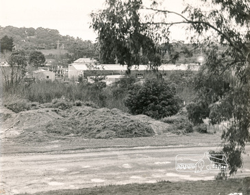
Photograph, N. J. Tillings Timber Factory, 15 June, 1975, 15/06/1975
... Trees in foreground will soon be lost due to making of the main drain by M.M.B.W.. Photograph shows topographical features of the valley and how sound travels upwards and outwards to residential zones surrounding." ...Trees in foreground will soon be lost due to making of the main drain by M.M.B.W.. Photograph shows topographical features of the valley and how sound travels upwards and outwards to residential zones surrounding." 1 black and white photograph printed with white border on three sides N. ...Piles of dirt alongside dirt road, part of the light industrial area including N. J. Tillings Timber Factory, Brougham Street, Eltham. This is one of 7 B/W 8x10 inch photos with notes on obverse by Dick Crichton. Accompanying letter from Florence Chrichton 2013 : "Originally sent to Shire of Eltham Engineer, Mr. McDonald. [These photographs were part of their campaign to the Shire of Eltham in 1975] claiming that the zoning regulations were being breached by the occupants of various factories in the nearby light industrial zone [Brougham Street, Eltham] - to the detriment of those living in adjoining residential zones, and that, despite .. earlier objections and complaints, nothing was done about it." 1 black and white photograph printed with white border on three sidesInscribed on back: "View from residential premises in Brougham Street. Trees in foreground will soon be lost due to making of the main drain by M.M.B.W.. Photograph shows topographical features of the valley and how sound travels upwards and outwards to residential zones surrounding." industrial estate, brougham street, eltham, 1975, bolton street, dick crichton, n.j. tillings, timber factory, shire of eltham -
Whitehorse Historical Society Inc.
Article, Board agrees to Mitcham plan, 1962
... This proposal first originated through Mitcham Chamber of Commerce, has already been before the State Government and the Education Department. The M.M.B.W. said it would not favour re-zoning to the east of Mitcham Road....This proposal first originated through Mitcham Chamber of Commerce, has already been before the State Government and the Education Department. The M.M.B.W. said it would not favour re-zoning to the east of Mitcham Road. ...The Board of Works has agreed to Mitcham's proposal that the whole Mitcham Junior School area eventually should become a shopping car park.The Board of Works has agreed to Mitcham's proposal that the whole Mitcham Junior School area eventually should become a shopping car park. Mitcham's long range plan is to get the Education Department to agree to move the school to another site. This proposal first originated through Mitcham Chamber of Commerce, has already been before the State Government and the Education Department. The M.M.B.W. said it would not favour re-zoning to the east of Mitcham Road.The Board of Works has agreed to Mitcham's proposal that the whole Mitcham Junior School area eventually should become a shopping car park.shopping centres, mitcham shopping centre, melbourne and metropolitan board of works, mitcham chamber of commerce -
University of Melbourne, Burnley Campus Archives
Plan, School of Primary Agriculture & Horticulture - Burnley, c. 1925-1926
... Accomodation Burnley School Part 1. Traced from M.M.B.W. Plan No. 42. Scale 160 ft=1 in. Level Datum L.M.N. ...Accomodation Burnley School Part 1. Traced from M.M.B.W. Plan No. 42. Scale 160 ft=1 in. Level Datum L.M.N. ...Copy of plan photographed at the Public Records Office Victoria. Central Administration Correspondence Files 1912-1939 ITEM. VPRS 10163/P0003/2. Accomodation Burnley School Part 1. Traced from M.M.B.W. Plan No. 42. Scale 160 ft=1 in. Level Datum L.M.N. Hobson's Bay. Traced by C.E.B.W. 16.02.1926. Additional matter in red and green inserted by F.E.T.C. 09.02.1926. Note by J.J. Rae (Principal). Lists W.C.s (toilets). Shows 1891 Flood Line. Possibly dates from 1925.prov, school of primary agriculture and horticulture, burnely, j.j. rae -
 Ringwood and District Historical Society
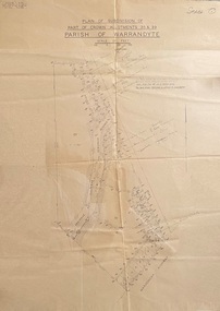
Map - Plans of Subdivision, Part of Crown Allotments 35 & 39, Parish of Warrandyte
... Levels shown are to M.M.B.W. Datum. The land shown hatched is subject to innundation....Levels shown are to M.M.B.W. Datum. The land shown hatched is subject to innundation. ...Survey maps of stages 1, 2 & 3 of residential allotments in Kalinda Road and Grayling Crescent, Ringwood, Victoria. (Undated, circa 1960). Some allotments are marked with real estate information and prices in pre decimal £s.Adshead & McGuire, Land Surveyors L.S. M.I.S. (Aust), 268 Albert Street East Melbourne (Ref 118/2a b &c) Tel 41-6960. The land colored blue is set apart for drainage & sewerage purposes. Reference Marks (R.M's) are Gal Iron Pipes 12"x1". Levels shown are to M.M.B.W. Datum. The land shown hatched is subject to innundation. -
 Eltham District Historical Society Inc
Photograph, Shire of Eltham Councillors visit to the Board of Works, Upper Thomson's Quarters, West Gipplsand, 3-5 December, 1971, 1971
... Clarke, Mr. H. Jackson (M.M.B.W.) Seated Front (L-R): Cr. G.C. Dreverman and Cr. ...Clarke, Mr. H. Jackson (M.M.B.W.) Seated Front (L-R): Cr. G.C. Dreverman and Cr. ...Original Title: Visit to Upper Thomson's Quarters, Board of Works, 3-5 December, 1971 Shire of Eltham Councilors and an ex councilor visiting the early works leading up to the construction of the Thomson Dam, located in West Gippsland, Victoria. Standing Back (L-R): Ex. Cr. H. Bartlett, Cr. P. Graham Middle Row (L to R): Cr. D. Ingersole, Cr. A. Glover (Shire President), seated - Cr. E.A. Hale, Cr. C.J. Bock (Shire Secretary/ Chief Administrative Officer), standing - Cr. J. White, Cr. L.E. Clarke, Mr. H. Jackson (M.M.B.W.) Seated Front (L-R): Cr. G.C. Dreverman and Cr. A.S. Knox Source: Shire of ElthamThis photo forms part of a collection of photographs gathered by the Shire of Eltham for their centenary project book,"Pioneers and Painters: 100 years of the Shire of Eltham" by Alan Marshall (1971). The collection of over 500 images is held in partnership between Eltham District Historical Society and Yarra Plenty Regional Library (Eltham Library) and is now formally known as the 'The Shire of Eltham Pioneers Photograph Collection.' It is significant in being the first community sourced collection representing the places and people of the Shire's first one hundred years.Digital imagealistair knox, cr. a. glover, colin j. bock, cr. ingersole, cr. e.a. hale, cr. g.c. dreverman, cr. j. white, les clarke, cr. p. graham, melbourne metropolitan board of works, mmbw, h jackson, shire of eltham pioneers photograph collection, thomson dam -
 Eltham District Historical Society Inc
Slide, Maroondah Aqueduct, Research, Victoria, 22 Mar. 1981
... The channel has remained largely intact (unlike sections at Greensborough and Bundoora where long lengths of the disused aqueduct have been demolished or filled in). The M.M.B.W. relinquished control of the disused aqueduct reserve which is crown land and the Shire of Eltham took control of this section of the reserve as a linear park. ...The channel has remained largely intact (unlike sections at Greensborough and Bundoora where long lengths of the disused aqueduct have been demolished or filled in). The M.M.B.W. relinquished control of the disused aqueduct reserve which is crown land and the Shire of Eltham took control of this section of the reserve as a linear park. ...An inspection tour of the Maroondah Aqueduct was undertaken by the Shire of Eltham Historical Society on Sunday, March 22nd, 1981, commening where the aqueduct crosses Main Rd., Research, just below Eltham College. The Maroondah Aqueduct was part of Melbourne’s water supply system. It carried water over the 66 km from the Maroondah Reservoir on the Watts River at Healesville to the Preston Reservoir. Of this length, 41 km were open channel, 10 km, tunnel through hills and 15 km in 14 inverted siphons across stream valleys. The route of the aqueduct is north of Tarrawarra and Yarra Glen, along the Yarra escarpment south of Christmas Hills and crossing Watsons Creek into the present Shire of Eltham near Henley Rd. The eastern part of the route lies entirely within the former boundaries of the shire. The aqueduct passes south of Kangaroo Ground to Research and crosses the Diamond Creek by siphon at Allendale Rd., Eltham North. It then extends to Reservoir via St. Helena, Greensborough North and Bundoora. Water first flowed through the aqueduct in February 1891 when it was fed by a diversion weir on the Watts River. Records of the building of the aqueduct indicate that it was a significant construction achievement. The present Maroondah Reservoir was completed in 1927 and the aqueduct was enlarged at that time to take increased flows. About 1971 the section of the aqueduct through and north of Research was replaced by a large pipe and that section of the channel is now unused. The channel has remained largely intact (unlike sections at Greensborough and Bundoora where long lengths of the disused aqueduct have been demolished or filled in). The M.M.B.W. relinquished control of the disused aqueduct reserve which is crown land and the Shire of Eltham took control of this section of the reserve as a linear park. The Maroondah Aqueduct is considered to be an important historic structure, not just to the local area but to the metropolitan area generally. It is considered important to preserve substantially intact long lengths of the disused aqueduct, together with its bridges and other associated structures. 35 mm colour positive transparency (1 of 5) Mount - Agfachrome Agfa CS System black 8 dotsactivities, heritage excursion, maroondah aqueduct, research (vic.), shire of eltham historical society -
 Sunshine and District Historical Society Incorporated
Administrative record - City of Sunshine - Commissioner Mr Alexander Alex George Gillon Collection 1976 - 1982 - Notice of ordinary meeting of the council 10th February 1981, City of Sunshine, 4th February 1981
... Albans Street Lighting Agreement with City of Footscray for Princess Highway between Tottenham Parade & Holmwood Road and Francis Street & McDonald Road M.M.B.W. Land abutting Collenso Street School Crossing Furlong Road between Austin Street and Browne Avenue St. ...Albans Street Lighting Agreement with City of Footscray for Princess Highway between Tottenham Parade & Holmwood Road and Francis Street & McDonald Road M.M.B.W. Land abutting Collenso Street School Crossing Furlong Road between Austin Street and Browne Avenue St. ...Olympic Games The Catholic Family Welfare Bureau emergency family accommodation 10 Dodd Street Braybrook Land Transfer Part of Omega Street Discontinued Proposed Land Transfer Former Right of Way off Station Road between Poole Street and Tulloch Street Proposed Land Transfer George Street Maidstone Proposed to Discontinue part of Charlotte Street South of Hall Street Kiosk Sunshine Swimming Pool Demise of Land Howard Kingham Lodge Industrial Tipping Agreements City of South Melbourne Proposed Technical School Keilor More Park Committee of Management Proposed Pavilion Larissa Reserve Cherry Crescent Pre-School / Child Care Centre Maribyrnong Senior Citizens' Club Randall Street Removal of Dwelling from 18 Bennett Street Sunshine West to 32 Dale Avenie Pascoe Vale Health Act Registrations Aycliffe Drive Infant Welfare Centre Billingham Road Bridge over Kororoit Creek Maribyrnong River Valley Flooding Planning Permit Application Radio Mast Beaver Street St. Albans Planning Permit Application Hairdressing Salon 62 Station Place Sunshine Planning Permit Application Service Premises Alterations and extensions 123 Rosamond Road Maidstone Planning Permit Application Detached House Lot 284 Orama Street Deer Park Planning Permit Application Erection of iron fence Lot 664 West Street Sunshine West Planning Permit Application Extension to existing building Lots 44 & 45 and Nos 3 & 5 Richards Street Maidstone Land Use Permit Apartment house and caretaker's residence 16 Ridley Street Albion Planning Permit Application Transport and storage depot 16 Carrington Drive Albion Planning Permit Application Hot Bread Kitchen 9 Commercial Street Maidstone Planning Permit Application Laundrette Lot 1 Main Road West St. Albans Planning Permit Application Warehouse (Cold Store) Lot 2 Emu Road Maidstone Planning Permit Application Extension to garden shop Highpoint West Rosamond Road Maribyrnong Planning Permit Application Access widening Ashley Street Footscray West Planning Permit Application Office alternations Sperry Vickers 169 Rosamond Road Maribyrnong Planning Permit Application Factory renovations Somerville Road South West corner of Tottenham Parade Brooklyn Planning Permit Application Factory Lot 12 McIntyre Road Sunshine North Planning Permit Application Retail plant nursery corner of McIntyre Road and Main Road East and Sunshine Avenue Proposed Telecom Western Radio Telephone Terminal Commonwealth Land Hampstead Road Maidstone Plan of Transfer and Consolidation A. T. Stead Frederick Road and Justin Road Plan of Transfer Lysaght Durham Chemical Company Somerville Road Tottenham Plan of Subdivision ETA Cranwell Street and Lacy Street Braybrook Consolidation of Title Railway Parade Sunshine Traffic Signals Furlong Road and St. Albans Road St. Albans Street Lighting Agreement with City of Footscray for Princess Highway between Tottenham Parade & Holmwood Road and Francis Street & McDonald Road M.M.B.W. Land abutting Collenso Street School Crossing Furlong Road between Austin Street and Browne Avenue St. Albans Trees in Duke Street Sunshine North Closure of Omar Street to through traffic Pennell Reserve roof replacement Building over Easement 6 Busch Street Sunshine North Location of Building Lot 335 Maxweld Street Ardeer Verandah installation Lot 479 Kardina Drive St. Albans Location of Building 26 Harrison Street Deer Park Permission to Erect Building Lot 138 Keynes Court Deer Park Location of Building 9 Dinnell Street Sunshine West Location of Building 9 Walker Place Braybrook Building over Easement 9 Larool Crescent Sunshine West Location of Building Lot 990 Mulhall Drive St. Albans Fire Separation within a Building 22 St. Albans Road Sunshine Fence Lot 20 Riverview Court Maribyrnong Above ground water tank Lots 2 & 5 Frederick Street Building over Council Property Ravenhall Street Braybrookolympic games, catholic family welfare bureau, dodd street, braybrook, omega street, sunshine, station road, poole street, tulloch street, deer park, george street, maidstone, charlotte street, hall street, sunshine west, sunshine swimming pool, kennedy street, howard kingham lodge, darnley street, more park committee of management, more park, esmond street, ardeer, st. albans, cherry crescent, maribyrnong senior citizens' club, randall street, maribyrnong, bennett street, aycliffe drive, billingham road, kororoit creek, maribyrnong river valley, maribyrnong river, beaver street, station place, rosamond road, orama street, west street, richards street, ridley street, albion, carrington drive, commercial street, main road west, emu road, highpoint west, ashley street, footscray west, perry vickers, somerville road, tottenham parade, mcintyre road, sunshine north, main road east, sunshine avenue, hampstead road, frederick road, justin road, tottenham, lysaght durham chemical company, eta, cranwell street, lacy street, railway parade, furlong road, st. albans road, princess highway, collenso street, austin street, browne avenue, duke street, omar street, pennell reserve, burke street, busch street, maxweld street, kardina drive, harrison street, keynes court, dinnell street, walker place, larool crescent, mulhall drive, riverview court, ravenhall street, larissa reserve -
 Sunshine and District Historical Society Incorporated
Administrative record - City of Sunshine - Commissioner Mr Alexander Alex George Gillon Collection 1976 - 1982 - Notice of ordinary meeting of the council 10th February 1981, City of Sunshine, 4th February 1981
... Albans Street Lighting Agreement with City of Footscray for Princess Highway between Tottenham Parade & Holmwood Road and Francis Street & McDonald Road M.M.B.W. Land abutting Collenso Street School Crossing Furlong Road between Austin Street and Browne Avenue St. ...Albans Street Lighting Agreement with City of Footscray for Princess Highway between Tottenham Parade & Holmwood Road and Francis Street & McDonald Road M.M.B.W. Land abutting Collenso Street School Crossing Furlong Road between Austin Street and Browne Avenue St. ...Olympic Games The Catholic Family Welfare Bureau emergency family accommodation 10 Dodd Street Braybrook Land Transfer Part of Omega Street Discontinued proposed Land Transfer Former Right of Way off Station Road between Poole Street and Tulloch Street Proposed Land Transfer George Street Maidstone Proposed to Discontinue part of Charlotte Street South of Hall Street Kiosk Sunshine Swimming Pool Demise of Land Howard Kingham Lodge Industrial Tipping Agreements City of South Melbourne Proposed Technical School Keilor More Park Committee of Management Proposed Pavilion Larissa Reserve Cherry Crescent Pre-School / Child Care Centre Maribyrnong Senior Citizens' Club Randall Street Removal of Dwelling from 18 Bennett Street Sunshine West to 32 Dale Avenie Pascoe Vale Health Act Registrations Aycliffe Drive Infant Welfare Centre Billingham Road Bridge over Kororoit Creek Maribyrnong River Valley Flooding Planning Permit Application Radio Mast Beaver Street St. Albans Planning Permit Application Hairdressing Salon 62 Station Place Sunshine Planning Permit Application Service Premises Alterations and extensions 123 Rosamond Road Maidstone Planning Permit Application Detached House Lot 284 Orama Street Deer Park Planning Permit Application Erection of iron fence Lot 664 West Street Sunshine West Planning Permit Application Extension to existing building Lots 44 & 45 and Nos 3 & 5 Richards Street Maidstone Land Use Permit Apartment house and caretaker's residence 16 Ridley Street Albion Planning Permit Application Transport and storage depot 16 Carrington Drive Albion Planning Permit Application Hot Bread Kitchen 9 Commercial Street Maidstone Planning Permit Application Laundrette Lot 1 Main Road West St. Albans Planning Permit Application Warehouse (Cold Store) Lot 2 Emu Road Maidstone Planning Permit Application Extension to garden shop Highpoint West Rosamond Road Maribyrnong Planning Permit Application Access widening Ashley Street Footscray West Planning Permit Application Office alternations Sperry Vickers 169 Rosamond Road Maribyrnong Planning Permit Application Factory renovations Somerville Road South West corner of Tottenham Parade Brooklyn Planning Permit Application Factory Lot 12 McIntyre Road Sunshine North Planning Permit Application Retail plant nursery corner of McIntyre Road and Main Road East and Sunshine Avenue Proposed Telecom Western Radio Telephone Terminal Commonwealth Land Hampstead Road Maidstone Plan of Transfer and Consolidation A. T. Stead Frederick Road and Justin Road Plan of Transfer Lysaght Durham Chemical Company Somerville Road Tottenham Plan of Subdivision ETA Cranwell Street and Lacy Street Braybrook Consolidation of Title Railway Parade Sunshine Traffic Signals Furlong Road and St. Albans Road St. Albans Street Lighting Agreement with City of Footscray for Princess Highway between Tottenham Parade & Holmwood Road and Francis Street & McDonald Road M.M.B.W. Land abutting Collenso Street School Crossing Furlong Road between Austin Street and Browne Avenue St. Albans Trees in Duke Street Sunshine North Closure of Omar Street to through traffic Pennell Reserve roof replacement Building over Easement 6 Busch Street Sunshine North Location of Building Lot 335 Maxweld Street Ardeer Verandah installation Lot 479 Kardina Drive St. Albans Location of Building 26 Harrison Street Deer Park Permission to Erect Building Lot 138 Keynes Court Deer Park Location of Building 9 Dinnell Street Sunshine West Location of Building 9 Walker Place Braybrook Building over Easement 9 Larool Crescent Sunshine West Location of Building Lot 990 Mulhall Drive St. Albans Fire Separation within a Building 22 St. Albans Road Sunshine Fence Lot 20 Riverview Court Maribyrnong Above ground water tank Lots 2 & 5 Frederick Street Building over Council Property Ravenhall Street Braybrookolympic games, catholic family welfare bureau, dodd street, braybrook, omega street, sunshine, station road, poole street, tulloch street, deer park, george street, maidstone, charlotte street, hall street, sunshine west, sunshine swimming pool, kennedy street, howard kingham lodge, darnley street, more park committee of management, more park, esmond street, ardeer, st. albans, cherry crescent, maribyrnong senior citizens' club, randall street, maribyrnong, bennett street, aycliffe drive, billingham road, kororoit creek, maribyrnong river valley, maribyrnong river, beaver street, station place, rosamond road, orama street, west street, richards street, ridley street, albion, carrington drive, commercial street, main road west, emu road, highpoint west, ashley street, footscray west, perry vickers, somerville road, tottenham parade, mcintyre road, sunshine north, main road east, sunshine avenue, hampstead road, frederick road, justin road, tottenham, lysaght durham chemical company, eta, cranwell street, lacy street, railway parade, furlong road, st. albans road, princess highway, collenso street, austin street, browne avenue, duke street, omar street, pennell reserve, burke street, busch street, maxweld street, kardina drive, harrison street, keynes court, dinnell street, walker place, larool crescent, mulhall drive, riverview court, ravenhall street, larissa reserve