
Showing 43 items matching " natural resources and environment"
-
 University of Melbourne, Burnley Campus Archives
Legal record, Environment and Natural Resources Committee et al, Inquiry Into Pest Plants in Victoria, 1996
... ...environment and natural resources committee...Parliamentary Submission to the Environment and Natural Resources Committee (includes Terms of Reference Background Paper, July 1996. 1. ...Environment and Natural Resources Committee...pest plants victoria environment and natural resources committee dr gregory moore Dors Berry Kate McCormick noxious weeds pesticides Parliamentary Submission to the Environment and Natural Resources Committee (includes Terms of Reference Background Paper, July 1996. 1. ...pest plants, victoria, environment and natural resources committee, dr gregory moore, dors berry, kate mccormick, noxious weeds, pesticides -
Save the Dandenongs League Inc.
Archive (item), Save the Dandenongs League Incorporated, For the Attention of Mr. Garrique Pergl - Parliament of Victoria - Environment and Natural Resources Committee
... Garrique Pergl - Parliament of Victoria - Environment and Natural Resources Committee...Garrique Pergl - Parliament of Victoria - Environment and Natural Resources Committee Archive Save the Dandenongs League Incorporated ... -
 Marysville & District Historical Society
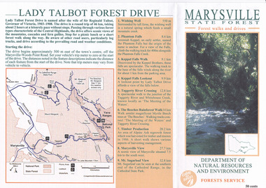
Flyer (item) - Brochure, Department of Natural Resources and Environment-Forest Service, Marysville State Forest-Forest walks and drives-Lady Talbot Forest Drive, Pre 2009
... Department of Natural Resources and Environment-Forest Service...Marysville State Forest-Forest walks and drives-Lady Talbot Forest Drive Flyer Brochure Department of Natural Resources and Environment-Forest Service ...A brochure that was produced as a guide to Lady Talbot Forest Drive in Marysville in Victoria.A brochure that was produced as a guide to Lady Talbot Forest Drive in Marysville in Victoria. Lady Talbot Drive a 24 kilometer scenic rainforest car journey which passes a number of walks and waterfalls in the Yarra Ranges National Park. Lady Talbot Drive is named after Lady Sarah Elizabeth, the wife of Sir Reginald Talbot, who was the Governor of Victoria from 25th April, 1904 to 6th July 1908.50 cents Bob McNamara/ Real Estate Agent/ Tourism Info Centre Co-Ordinatorlady talbot forest drive, lady talbot drive, sir reginald talbot, lady sarah elizabeth talbot, marysville, wishing well, phantom falls, keppel falls walk, keppel falls lookout, taggerty river, beeches rainforest walk, logging, mount sugarloaf, victoria -
 Greensborough Historical Society
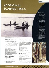
Poster, Victoria. Department of Natural Resources and Environment, Site identification mini poster (#1-2, 4-6, 8-10, 13-14), 2002
... Department of Natural Resources and Environment...Department of Natural Resources and Environment Aboriginal Affairs Victoria ...This set produced by the Victorian Department of Natural Resources and Environ met and Aboriginal Affairs Victoria. Mini poster 1: Aboriginal scarred trees; 2 Aboriginal mounds; [3 missing]; 4 Aboriginal flaked stone tools; 5 Aboriginal burials; 6 Aboriginal surface scatters; [7 missing]; 8 Aboriginal ground-edge axes; 9 Aboriginal grinding stones; 10 Aboriginal stone arrangements; [11 missing]; 12 Aboriginal axe-grinding grooves; 13 Aboriginal coastal shell middens; 14 Aboriginal rock art.11 parts of incomplete set, each two sided, text and photographsaborigines - victoria, aboriginal affairs victoria -
 Victorian Aboriginal Corporation for Languages
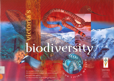
Book, Department of Natural Resources and Environment, Victoria's biodiversity : our living wealth, 1997
... Department of Natural Resources and Environment...Victoria's biodiversity : our living wealth Book Department of Natural Resources and Environment ...Lush colour photographs of the particular environments, including flora, fauna, birds etc and maps locating area.Colour illustrations, colour photographsconservation, sustainability, biodiversity, victorian alps, mallee -
 Victorian Aboriginal Corporation for Languages
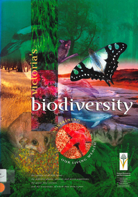
Book, Department of Natural Resources and Environment, Victoria's biodiversity : sustaining our living wealth, 1997
... Department of Natural Resources and Environment...Victoria's biodiversity : sustaining our living wealth Book Department of Natural Resources and Environment ...Investigates ways of sustaining Victoria's biodiversity.Colour illustrations, colour photographsbiodiversity, sustainability, conservation -
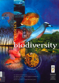 Victorian Aboriginal Corporation for Languages
Book, Department of Natural Resources and Environment, Victoria's biodiversity : directions in management, 1997
... Department of Natural Resources and Environment...biodiversity sustainability conservation Maps (including two large maps) charts, graphs, colour photographs, Looking at Victoria in each region and examining the biodiversity of the environment, for management purposes. Victoria's biodiversity : directions in management Book Department of Natural Resources and Environment ...Looking at Victoria in each region and examining the biodiversity of the environment, for management purposes.Maps (including two large maps) charts, graphs, colour photographs,biodiversity, sustainability, conservation -
Tatura Irrigation & Wartime Camps Museum
Book, Natural Resources and Environment Committee of Cabinet, Salt Action, 1987
... Natural Resources and Environment Committee of Cabinet...Salt Action Book Natural Resources and Environment Committee of Cabinet F. ...Soft cover. Off white background. Dead grey trees, dark green writing, 56 pages.On cover "Government of Victoria / Salt action / Victoria's strategy for managing the / salinity of land and water resources / salt force / draft / February 1987" -
Lakes Entrance Historical Society
Book, Ecological Vegetation Class Mapping 1:2500 Gippsland, 2002
... Department of Natural Resources and Environment, State of Victoria, 2002...310 printed pages, spiral plastic bound cover, inside rear cover has DVD DOCUMENTS Reports Clear plastic front cover, cardboard front page containing five colour photos superimposed over each other, cardboard rear cover Ecological Vegetation Class Mapping 1:2500 Gippsland Book Department of Natural Resources and Environment, State of Victoria, 2002 ...310 printed pages, spiral plastic bound cover, inside rear cover has DVDClear plastic front cover, cardboard front page containing five colour photos superimposed over each other, cardboard rear coverdocuments, reports -
Lakes Entrance Historical Society
Book, Dept of Natural Resources and Environment Victoria Publisher, Heritage Rivers and Natural Catchment Areas Vol 3, 1997
... Dept of Natural Resources and Environment Victoria Publisher...Gippsland catchments are significant for the essential undisturbed condition Heritage Rivers and Natural Catchment Areas Vol 3 Book Dept of Natural Resources and Environment Victoria Publisher ...Draft Management Plans prepared under the Heritage Rivers Act set out the proposed basis for future management of Heritage Rivers and Natural Catchment Areas. Gippsland catchments are significant for the essential undisturbed conditionISBN 0730667936environment, waterways -
Lakes Entrance Historical Society
Book, Department of Natural Resources and Environment, Request for Tender - Recreation Earthworks in Colquhoun Forest, 2002
... Department of Natural Resources and Environment...Contains a location map Request for Tender - Recreation Earthworks in Colquhoun Forest Book Department of Natural Resources and Environment ...Tender request for recreation building works in the Colquhoun Forest, especially bridges. Contains a location maprecreation, government -
Lakes Entrance Historical Society
Book, Department of Natural Resources and Environment, Request for Tender- Recreation Earthworks in the Colquhoun Forest, 2002
... Department of Natural Resources and Environment...Request for Tender- Recreation Earthworks in the Colquhoun Forest Book Department of Natural Resources and Environment ...Tender specifications for recreation earthworks in the Colquhoun Foret, including pathways and drainage. Contains location map.government, recreation -
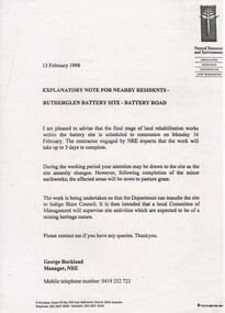 Rutherglen Historical Society
Document, 13/02/1998
... Department of Natural Resources and Environment...Document Department of Natural Resources and Environment ...When operational, the Gold Battery used cyanide in its processing processes. The land surrounding it required remediation before it could be handed over to Indigo Shire for public use. The land has since been planted with pasture and native plants. The Gold Battery has been restored to working condition, and can be viewed by collecting a ticket from the Rutherglen Wine Experience and Visitor Information Centre.Photocopy of letter relating to remediation works on the Gold Battery site.gold battery, gold processing, land remediation -
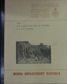 Wodonga & District Historical Society Inc
Booklet - The Tasman fold belt system in Victoria : geology and mineralisation of proterozoic to carboniferous rocks, A.H.M. Vanden Berg, 1976
... ...Dept. of Natural Resources and Environment Victoria...Vanden Berg Geological Survey of Victoria Dept. of Natural Resources and Environment Victoria ...A scientific analysis of the development of the sequence of geological events and processes which contributed to the building of southeastern Australia landforms as part of the Tasman Fold Belt System.non-fictionA scientific analysis of the development of the sequence of geological events and processes which contributed to the building of southeastern Australia landforms as part of the Tasman Fold Belt System.geology victoria, landforms victoria, tasman fold belt -
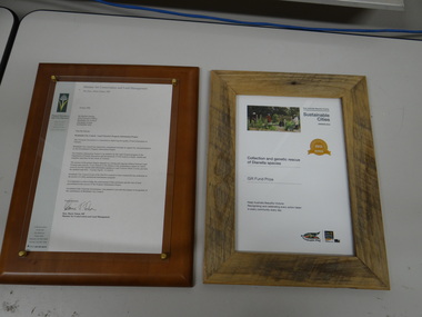 Brimbank City Council
Environmental certificates x 2
... Environmental certificates x 2, Sustainable Cities + Natural Resources and Environment...Environmental certificates x 2, Sustainable Cities + Natural Resources and Environment Environmental certificates x 2 Environmental certificates x 2 ...Environmental certificates x 2, Sustainable Cities + Natural Resources and Environment -
 Whitehorse Historical Society Inc.
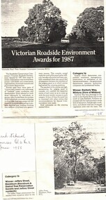
Article, Victorian Roadside Environment Awards for 1987, 1/06/1988 12:00:00 AM
... Article from 'Trees and Natural Resources' v.30 No2 (June 1988) on Jeffrey Street, Blackburn, winner of Roadsides Conservation Committee's Victorian Roadside Environment Award for 1987....jeffery street blackburn roads and streets Article from 'Trees and Natural Resources' v.30 No2 (June 1988) on Jeffrey Street, Blackburn, winner of Roadsides Conservation Committee's Victorian Roadside Environment Award for 1987. ...Article from 'Trees and Natural Resources' v.30 No2 (June 1988) on Jeffrey Street, Blackburn, winner of Roadsides Conservation Committee's Victorian Roadside Environment Award for 1987.jeffery street, blackburn, roads and streets -
Lakes Entrance Historical Society
Book, Parks Victoria Compiler, MacLeod Morass & Jones Bay Draft Management Plan 2003, 2003
... Environment...Environment...Environment Fauna Natural Resources Restoration Vegetation A draft plan for the startegies to manage the Macleod Morass and Jones Bay Wildlife reserves MacLeod Morass & Jones Bay Draft Management Plan 2003 Book Parks Victoria Compiler ...A draft plan for the startegies to manage the Macleod Morass and Jones Bay Wildlife reservesenvironment, fauna, natural resources, restoration, vegetation -
Glen Eira Historical Society
Newspaper - CAULFIELD ENVIRONMENT PROTECTION SOCIETY
... ... Caulfield Environment Protection Society...C.E.P.S News Caulfield Environment Protection Society Local government Caulfield Council Glenhuntly Glen Huntly Caulfield Glenhuntly Railway Station Hawthorn Road Glenhuntly Road Caulfield South Pollution Conservation Recycling Waste disposal Living organisms Pesticides Environment Flann Robert Child Joan Gwythr Alan Pilley Erica Flann Elizabeth Bennett June Lees Harry Goldhar Jeffry Hutchinson Colin McNamara Beryl Martin John Davies Patricia Composting Conservation of Natural Resources Alexander John C Arden Councillor Leschen Councillor Fox Max Community groups Parliamentary representatives Public Interest Research Group P.I.R.G. ...The file contains one item for this organisation. 1/Original copy of document titled C.E.P.S NEWS, no.4, June 1973. This newsletter covered subjects including banning the spraying of pesticides such as Dieldrin, waste disposal, recycling, compost making, and the beautification plans for Glenhuntly Railway Station.c.e.p.s news, caulfield environment protection society, local government, caulfield council, glenhuntly, glen huntly, caulfield, glenhuntly railway station, hawthorn road, glenhuntly road, caulfield south, pollution, conservation, recycling, waste disposal, living organisms, pesticides, environment, flann robert, child joan, gwythr alan, pilley erica, flann elizabeth, bennett june, lees harry, goldhar jeffry, hutchinson colin, mcnamara beryl, martin john, davies patricia, composting, conservation of natural resources, alexander john c, arden councillor, leschen councillor, fox max, community groups, parliamentary representatives, public interest research group, p.i.r.g., garbage, parr-smith geoff, caulfield historical society, filbert street -
 Lakes Entrance Historical Society
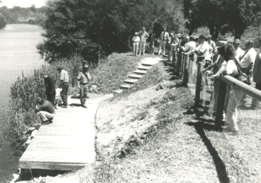
Photograph, fishing platform , Tambo River Victoria, 1/11/1994 12:00:00 AM
... Black and white photograph showing crowd gathered at launch of the fishing platform installed by Tambo Nicholson Management Group and Department of Natural Resources and Environment on the bank of the Tambo River Victoria. ...Birds Fishing Jetties Black and white photograph showing crowd gathered at launch of the fishing platform installed by Tambo Nicholson Management Group and Department of Natural Resources and Environment on the bank of the Tambo River Victoria. ...Black and white photograph showing crowd gathered at launch of the fishing platform installed by Tambo Nicholson Management Group and Department of Natural Resources and Environment on the bank of the Tambo River Victoria. Also three other black and white photographs showing the TAFE students under LEAP program building the fishing platform. birds, fishing, jetties -
 Buninyong Visitor Information Centre
Document (item) - Typescript, A Study of Historic Sawmills and Tramway Sites
... The report was prepared by Peter Evans, Historic Places, Department of Natural Resources and Environment, Victoria in 1999. ...The report was prepared by Peter Evans, Historic Places, Department of Natural Resources and Environment, Victoria in 1999. ...The report was prepared by Peter Evans, Historic Places, Department of Natural Resources and Environment, Victoria in 1999. The pages copied relate to Mount Buninyong.tramways, sawmilling, forests, forestry, environment -
 Bendigo Historical Society Inc.
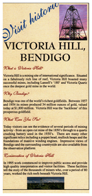
Pamphlet - Victoria Hill, Bendigo Touris Brochure, Early 2000s
... Produced by the City of Greater Bendigo and the Department of Natural Resources and Environment 11217.58b Rear of brochure with map...Produced by the City of Greater Bendigo and the Department of Natural Resources and Environment 11217.58b Rear of brochure with map Pamphlet Victoria Hill, Bendigo Touris Brochure ...Victoria Hill is a mining site of international significance. It is situated on a fabulously rich line of reef, Victoria Hill boasted many successful mines, including Lansell's '180' and 'Victoria Quartz' once the deepest mine in the world.Victoria Hill, Bendigo Touris Brochure This item contains the following document: 11217.58a Brochure, describes "What is Victoria Hill, "Why Bendigo, What you can see" and the "Conservation of the hill". On the rear is a map and opening hours. Produced by the City of Greater Bendigo and the Department of Natural Resources and Environment 11217.58b Rear of brochure with mapnon-fictionbendigo, fortuna, victoria hill, lansell's 180, victoria quartz mine -
 University of Melbourne, Burnley Campus Archives
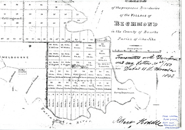
Plan - Photocopy, Sketch of the Proposed Boundaries of the Village of Richmond, 1843
... Survey Department." original in Central Plan Office, Department of Natural Resources and Environment...Survey Department." original in Central Plan Office, Department of Natural Resources and Environment Sketch of the Proposed Boundaries of the Village of Richmond Plan Photocopy ...Sketch of the proposed boundaries of the village of Richmond in the County of Bourke Parish of Jika-Jika. Handwritten on original: "Transmitted with Description and my letter No 43/150 Dated 11th November 1843 Robert Hoddle." Shows Burnley Gardens site as "Reserve. Survey Department." original in Central Plan Office, Department of Natural Resources and EnvironmentIn ink: From Central Plan Office Dept. Nat. Resources & Environmentrichmond, jika-jika, survey department, yarra river, robert hoddle -
 Eltham District Historical Society Inc
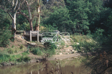
Slide - Photograph, Viewing platform near the confluence of Diamond Creek and Yarra River, c.Nov. 2001
... It was a joint project involving Nillumbik Shire Council, Skill Seekers Inc., Department of Natural resources and Environment and Department of Employment, Education, Training and Youth Affairs. ...It was a joint project involving Nillumbik Shire Council, Skill Seekers Inc., Department of Natural resources and Environment and Department of Employment, Education, Training and Youth Affairs. ...In October 1996 the viewing platform was opened. It is situated near Lenister Farm on the Diamond Creek trail. It was a joint project involving Nillumbik Shire Council, Skill Seekers Inc., Department of Natural resources and Environment and Department of Employment, Education, Training and Youth Affairs. The platform was officially opened by Don Cordell Chairman of Commissioners. Part of a slide show presentation "A Trip Down the Diamond Creek" by Russell Yeoman to the Eltham District Historical Society meeting of 14 Nov. 200135mm colour positive transparency Mount - Black and Whiteconfluence, diamond creek, yarra river, viewing platform -
 Eltham District Historical Society Inc
Folder, Victorian Goldfields Project: Historic gold mining sites in St Andrews mining division, 1999
... Heritage site report and gazetteer by David Bannear, head consultant for archealogy for the Department of Natural Resources and Environment. Includes information on the Warrandyte Goldfield and the Caledonia Goldfield, Queenstown (now known as St Andrews), One Tree Hill, Kingston (now known as Panton Hill), Kangaroo Grounds, You You Hill, Kingstown, South Morang, Nillumbik, (now known as Diamond Creek), Steele's Creek, Yarrambet and Kinglake. ...Heritage site report and gazetteer by David Bannear, head consultant for archealogy for the Department of Natural Resources and Environment. Includes information on the Warrandyte Goldfield and the Caledonia Goldfield, Queenstown (now known as St Andrews), One Tree Hill, Kingston (now known as Panton Hill), Kangaroo Grounds, You You Hill, Kingstown, South Morang, Nillumbik, (now known as Diamond Creek), Steele's Creek, Yarrambet and Kinglake. ...Heritage site report and gazetteer by David Bannear, head consultant for archealogy for the Department of Natural Resources and Environment. Includes information on the Warrandyte Goldfield and the Caledonia Goldfield, Queenstown (now known as St Andrews), One Tree Hill, Kingston (now known as Panton Hill), Kangaroo Grounds, You You Hill, Kingstown, South Morang, Nillumbik, (now known as Diamond Creek), Steele's Creek, Yarrambet and Kinglake. Photocopy of map headed: Location of mines and reefs from Geological survey of Victoria, Yan Yean with the Diamond Creek prominant on the map. no date35 page report with map and print out of cover letter (email form) from donorcaledonian gold fields, caledonina gold field, david bannear, gold mining, harry gilham collection, queenstown, st andrews, warrandyte goldfield -
Unions Ballarat
Photograph: Norm Borchers and Geoff Howard, November 1997
... Howard has served as Parliamentary Secretary for Natural Resources and the Environment and Parliamentary Secretary for Agriculture. ...Howard has served as Parliamentary Secretary for Natural Resources and the Environment and Parliamentary Secretary for Agriculture. ...Photograph: Norm Borchers and Geoff Howard at Waubra. Geoff Howard is the current state member for Buninyong. He has been in parliament since 2009. Howard has also served as a councillor and mayor on Ballarat City Council. Howard has served as Parliamentary Secretary for Natural Resources and the Environment and Parliamentary Secretary for Agriculture. Norm Borchers passed away in 2008. Borchers was a Club President of the Sebastopol Lions Club (1975-76). He worked for the railways as an engineering employee and was long-term trade unionist (Amalgamated Engineering Union and the Australian Railways Union) and ALP member; he lived and worked in the Ballarat area. Norm was active in workplace disputes during the ALP split in 1955. He was a long time supporter of Ballarat Trades Hall. It is assumed that this picture was taken at an ALP barbeque - see pictures 0374 and 0375.Photograph.btlc, ballarat trades hall, ballarat trades and labour council, howard, geoff, politicians, borchers, norm, australian labor party, alp -
 Bendigo Historical Society Inc.
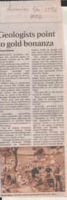
Newspaper - Kangaroo Flat Gold Mine Collection:, Department of Conservation and Environment, May 25/26 2002
... The project will involve 12 earth science agencies including the Victorian Department of Natural Resources and Environment, Geoscience Australia, the Cooperative Research Centre for Landscape, Environments and Mineral Exploration and the CSIRO. ...The project will involve 12 earth science agencies including the Victorian Department of Natural Resources and Environment, Geoscience Australia, the Cooperative Research Centre for Landscape, Environments and Mineral Exploration and the CSIRO. ...Victoria will be sliced in half during the next two years by earth scientists who expect to reveal hidden mineral wealth and better understand land degradation caused by salinity. By using instruments that send vibrations into the earth, geologists will peel back the surface layers to expose a hidden landscape of buried hills, valleys and fossil streams, undiscovered gold and mineral wealth, and giant extinct volcanos. The $3 million project, called the Victorian Geotraverse, will attempt to expose the processes that shaped the state and helped form its mineral wealth. The project will be discussed at a conference, Victoria Undercover, in Benalla this week. Project leader Neil Phillips, chief of CSIRO Exploration and Mining, said the project would attempt to discover where the rest of Victoria's gold deposits might be found and where the next salinity disaster might strike. Using this process they will cut a 500-kilometre swathe through the Grampians, Bendigo, Benalla and Wodonga, curving down to Mallacoota on the far east coast. The project will involve 12 earth science agencies including the Victorian Department of Natural Resources and Environment, Geoscience Australia, the Cooperative Research Centre for Landscape, Environments and Mineral Exploration and the CSIRO. ('Age' newspaper, 28th April, 2002. https://www.theage.com.au/national/going-to-ground-for-state-secrets-20020428-gdu5tz.html Scientists will send shocks through the Victorian earth which will be reflected back and recorded on instruments that will reveal the density of the rocks below.'Australian' newspaper article, 25/26th May, 2002, 'Geologists point to gold bonanza'. Article describes the $5 million Geotraverse research in Victoria, undertaken by CSIRO geologists, that 'estimate the northern plains of Victoria conceal up to 5000 tonnes of gold'. Image on bottom of article, possibly S.T. Gill watercolour, titled 'Victorian miners pan for gold in the mid-1800's'.bendigo mining n.l., bendigo, mining, gold, csiro, geologist, geology, victorian geotraverse project -
 Victorian Aboriginal Corporation for Languages
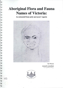
Book, Sue Wesson et al, Aboriginal flora and fauna names of Victoria : as extracted from early surveyors' reports, 2001
... The researcher has examined material from the archives of the Department of Natural Resources and Environment (NRE), the State Library of Victoria, the Victorian Public Records Office and the Australian Archives Office. ...The researcher has examined material from the archives of the Department of Natural Resources and Environment (NRE), the State Library of Victoria, the Victorian Public Records Office and the Australian Archives Office. ...The Flora and Fauna Names Project is an initiative of the Victorian Aboriginal Corporation for Languages and the Victorian Biodiversity Strategy. The researcher has examined material from the archives of the Department of Natural Resources and Environment (NRE), the State Library of Victoria, the Victorian Public Records Office and the Australian Archives Office. This first stage of the project focussed on the NRE archives, in particular the field notebooks of the earliest surveyors and their maps although other NRE resources, libraries and public records were accessed. A total of 3028 words were found of which a significant proportion have previously been unknown to linguists. It appears that the place names and word lists in early surveyors notebooks, the 1858 surveyors responses to the Surveyor General and an extensive Wiradjuri wordlist by James Baylis have not yet been widely used or published. Fifteen percent of these 3028 words describe flora and fauna and six percent describe habitat. Of particular interest is the evidence provided by these lists of the existence of fauna in the mid nineteenth century in regions where it is now extinct. For example, magpie geese, eastern quolls, bustards and pademelons were assigned names in the Jardwadjali language area of the upper Glenelg and Wimmera Rivers. The outcomes of this project may help to assist in ascertaining the distribution of flora and fauna assets in Victoria.maps, b&w photographs, colour photographs, illustrations, word listswiradjuri, jardwadjali, glenelg river, wimmera river -
Federation University Historical Collection
Book, Toni Woolley et al, Port Fairy Community and Organisational Plan, 1999
... department of natural resources and environment...University of Ballarat Students' Project. port fairy toni woolley tamara lang janelle gilbert ben balshaw grant caromody executive summary introduction background to port fairy methodology limitations appraisal of tourism planning and development to date assessment of local community issues, attitudes and involvement in tourism roles of local and regional tourism associations effectiveness of local & regional tourism associations analysis of services and service quality moyne shire council friends of port fairy tourism victoria country victoria tourism great ocean road marketing shipwreck coast tourism port fairy tourism association inc moyne shire department of natural resources and environment the western coastal board tourism accreditation board of victoria george borg craig delahoy michael hearn jodie honan judith kershaw andrea lowenthal neil martin john ploenges james purcell peter strickland mark thompson libby wilson michael pearlman battle of the moyne tourism planning great ocean road White bound book of 35 pages plus 6 appendices. ...Port Fairy Community and Organisational Plan. University of Ballarat Students' Project.White bound book of 35 pages plus 6 appendices.port fairy, toni woolley, tamara lang, janelle gilbert, ben balshaw, grant caromody, executive summary, introduction, background to port fairy, methodology, limitations, appraisal of tourism planning and development to date, assessment of local community issues, attitudes and involvement in tourism, roles of local and regional tourism associations, effectiveness of local & regional tourism associations, analysis of services and service quality, moyne shire council, friends of port fairy, tourism victoria, country victoria tourism, great ocean road marketing, shipwreck coast tourism, port fairy tourism association inc, moyne shire, department of natural resources and environment, the western coastal board, tourism accreditation board of victoria, george borg, craig delahoy, michael hearn, jodie honan, judith kershaw, andrea lowenthal, neil martin, john ploenges, james purcell, peter strickland, mark thompson, libby wilson, michael pearlman, battle of the moyne, tourism planning, great ocean road -
 Eltham District Historical Society Inc
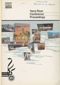
Book, Melbourne Metropolitan Board of Works, Yarra River Conference Proceedings, 1991
... Yarra River Melbourne Conference staged by the Board of Works to present a range of papers examining the river's environment, recreational uses, natural resources, development, commerce and land use. ...Conference staged by the Board of Works to present a range of papers examining the river's environment, recreational uses, natural resources, development, commerce and land use. Conference delegates included representatives from Eltham Shire Council and was held in April 1991. Session 1 Heritage and Environment: Flora and fauna / Paul Gullan. -- Geology and topography / Brian Finlayson. -- Aboriginal culture / Margaret Gardiner. Session 2 History. Session 3: Management plans and policies : overview of responsibilities / Dr Colin Leigh. --Role of the media / Peter Cole-Adams. -- Urban development / Paul Jerome. -- Port of Melbourne area / Leigh McKay. -- Recreation / Ken Marriott. Session 4: Perspectives - the current view. Session 5: Issues, challenges, potential solutions.non-fictionConference staged by the Board of Works to present a range of papers examining the river's environment, recreational uses, natural resources, development, commerce and land use. Conference delegates included representatives from Eltham Shire Council and was held in April 1991. Session 1 Heritage and Environment: Flora and fauna / Paul Gullan. -- Geology and topography / Brian Finlayson. -- Aboriginal culture / Margaret Gardiner. Session 2 History. Session 3: Management plans and policies : overview of responsibilities / Dr Colin Leigh. --Role of the media / Peter Cole-Adams. -- Urban development / Paul Jerome. -- Port of Melbourne area / Leigh McKay. -- Recreation / Ken Marriott. Session 4: Perspectives - the current view. Session 5: Issues, challenges, potential solutions.yarra river, melbourne -
 Eltham District Historical Society Inc
Book, Land Conservation Council, Report on the Melbourne Study Area, December 1973
... This report sets out to describe and assess the natural resources of the public lands in the Melbourne area and provides a factual basis on which members of the community may base submissions to the [Land Conservation] Council" - Foreword. land use Kinglake Thomson Valley conservation public lands This report is one of a series describings the physical nature of the land and its environment, examines the likely forms of land use, and assesses the hazards associated with these uses. ...This report is one of a series describings the physical nature of the land and its environment, examines the likely forms of land use, and assesses the hazards associated with these uses. It is divided into four main sections: Introduction, Characteristics of environment, main forms of land use and description of 24 specific blocks in the study area which include Torquay, Brisbane Ranges, Werribee, Wombat, Loddon, Romsey, Puckapunyal, Strathbogie, Eildon, Disappointment, Break O'Day, Black Range, Cerberean, Upper Goulburn, Kinglake, Donna Buang, Upper Yarra, Thomson, Dandenongs, Bunyip-Latrobe, Shady Creek, Tyers, Westernport and Strzelecki. The Land Conservation Act 1970 established the Land Conservation Council whose functions is to "carry out investigations and make recommendations to the Minister with respect to the use of public land in order to provide for the balanced use of land in Victoria. This report sets out to describe and assess the natural resources of the public lands in the Melbourne area and provides a factual basis on which members of the community may base submissions to the [Land Conservation] Council of Victoria.444 pagesnon-fictionThis report is one of a series describings the physical nature of the land and its environment, examines the likely forms of land use, and assesses the hazards associated with these uses. It is divided into four main sections: Introduction, Characteristics of environment, main forms of land use and description of 24 specific blocks in the study area which include Torquay, Brisbane Ranges, Werribee, Wombat, Loddon, Romsey, Puckapunyal, Strathbogie, Eildon, Disappointment, Break O'Day, Black Range, Cerberean, Upper Goulburn, Kinglake, Donna Buang, Upper Yarra, Thomson, Dandenongs, Bunyip-Latrobe, Shady Creek, Tyers, Westernport and Strzelecki. The Land Conservation Act 1970 established the Land Conservation Council whose functions is to "carry out investigations and make recommendations to the Minister with respect to the use of public land in order to provide for the balanced use of land in Victoria. This report sets out to describe and assess the natural resources of the public lands in the Melbourne area and provides a factual basis on which members of the community may base submissions to the [Land Conservation] Council of Victoria.land use, kinglake, thomson valley, conservation, public lands
