Showing 55 items matching " shale"
-
 The Beechworth Burke Museum
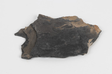
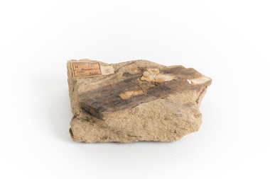
Geological specimen - Oil shale
... ...shale...Newnes's Torbanite oil shale rock contained around 350 litres of oil shale per tonne. ...Piece of dark gray oil bearing shale with shades of light brown and fossilised leaves...Existing label: OIL BEARING SHALE with / FOSSILISED LEAVES / Locality: Wongan Valley, NSW / Donor: Miss M. ...Newnes's Torbanite oil shale rock contained around 350 litres of oil shale per tonne. ...This particular specimen is found in Wolgan Valley, New South Wales. It could be linked to the abandoned oil shale mining sites in Wolgan Valley such as Newnes. Newnes was an industrial complex operational in the early 20th century is now partly surrounded by Wollemi National Park. It produced motor spirit, kerosene, and gas oil. Newnes's Torbanite oil shale rock contained around 350 litres of oil shale per tonne. The Torbanite was mined by the Commonwealth Oil Corporation Ltd. Oil shale is a sedimentary rock and also a form of fossil fuel. It is often formed millions of years ago and usually contain fossilised remains of plants and/or animals. Oil shale is rich in kerogen that releases hydrocarbon when heated. These hydrocarbon can be used as an alternative petroleum or natural gas. The oil-shale rock was converted into oil by "destructive distillation"; the rock being heated until it broke down to form an oily vapour and an ash residue. Oil bearing shale is one of Australia's national assets. There are many oil companies established in Australia. It reflects Australia's rich natural resources as well as connection to the Australia's engineering and oil industry. The booming oil shale extraction businesses can be traced as far back as 1920s. This specimen is part of a larger collection of geological and mineral specimens collected from around Australia (and some parts of the world) and donated to the Burke Museum between 1868-1880. A large percentage of these specimens were collected in Victoria as part of the Geological Survey of Victoria that begun in 1852 (in response to the Gold Rush) to study and map the geology of Victoria. Collecting geological specimens was an important part of mapping and understanding the scientific makeup of the earth. Many of these specimens were sent to research and collecting organisations across Australia, including the Burke Museum, to educate and encourage further study.Piece of dark gray oil bearing shale with shades of light brown and fossilised leavesExisting label: OIL BEARING SHALE with / FOSSILISED LEAVES / Locality: Wongan Valley, NSW / Donor: Miss M. Cambell geological specimen, geology, geology collection, burke museum, beechworth, oil shale, shale, fossil fuels, alfred selwyn, wolgen valley, 1868 geological survey of victoria, rocks, sedimentary rocks, newnes, torbanite, commonwealth oil corporation ltd -
 Federation University Historical Collection
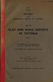
Book, Memoirs of the Geological Survey of Victoria; No 18, Clay and Shale Deposits of Victoria, 1952
... Memoirs of the Geological Survey of Victoria; No 18, Clay and Shale Deposits of Victoria...The 76 pages clay deposits, composition of Victorian clays, clay localities, granitic clays, Residual Clays, Clay-Shales, Jurassic clay shales....The 76 pages clay deposits, composition of Victorian clays, clay localities, granitic clays, Residual Clays, Clay-Shales, Jurassic clay shales. Memoirs of the Geological Survey of Victoria; No 18, Clay and Shale Deposits of Victoria Book ...Grey soft covered book with red tape spine. The 76 pages clay deposits, composition of Victorian clays, clay localities, granitic clays, Residual Clays, Clay-Shales, Jurassic clay shales.r a keble, senior field geologist, j c watson, chief chemist, d e watson, chief government geologist, g c moss, minister of mines, mallee plains, avoca valley, loddon valley, campaspe valley, goulburn valley, kiewa, mitta, glenelg valley, pitfield valley, otway area, moorabool valley, darley fireclay, campbellfield clay, latrobe river valley, hendley, ball clays, felspars, pegmatities, quartz, pakenham fireclay, bulla china clay, kaolin, terracotta, stoneware, ballan dyke-belt, egerton, gordon, ballan, llandeilo, colbrook, elaine, lal lal, maryborough, ballarat, ringwood, siliceous clay, stawell, dromana, ptways, bulla, pyalong china clay, linton china clay, wedderburn clays, lal lal china clays, ballan dyke belt, reginald callister, knight's koalin pottery, china clay, ferdinand krause, clarendon, bittern, frichot, hunt's dam, vaughan, rosenow, hickey, malone, claypits, ballarat dyke belt, stawell dyke belt, maryborough dyke belt, guildford, daylesford, ovens valley -
 Victorian Railway History Library
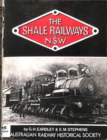
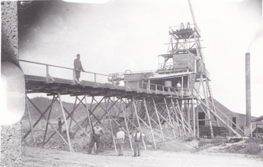
Book, Gifford H. Eardley et al, The Shale Railways of NSW, 1974
... The Shale Railways of NSW...The Shale Railways of NSW Book Gifford H. Eardley Stephens, Eric M. ...A history of the shale railway in the Wolgin Valley near Lithgow New South Wales.index, ill, maps. p.243.non-fictionA history of the shale railway in the Wolgin Valley near Lithgow New South Wales.industrial railroads - australia - history, railroad operations - new south wales - history -
 Hand Tool Preservation Association of Australia Inc
Hammer
... hammer, shale...Hand Tool Preservation Association of Australia Inc No physical address melbourne This item is part of the Thomas Caine Tool Collection, owned by The National Trust of Australia (Victoria) and curated by the Hand Tools Preservation Association of Australia. hammer, shale Hammer ...This item is part of the Thomas Caine Tool Collection, owned by The National Trust of Australia (Victoria) and curated by the Hand Tools Preservation Association of Australia.hammer, shale -
Hand Tool Preservation Association of Australia Inc
Hammer
... hammer, shale...Hand Tool Preservation Association of Australia Inc No physical address melbourne This item is part of the Thomas Caine Tool Collection, owned by The National Trust of Australia (Victoria) and curated by the Hand Tools Preservation Association of Australia. hammer, shale Hammer ...This item is part of the Thomas Caine Tool Collection, owned by The National Trust of Australia (Victoria) and curated by the Hand Tools Preservation Association of Australia.hammer, shale -
 Federation University Historical Collection
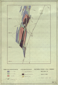
Plan, Southern Prince Lyell Orebody 115 Sublevel, 1991, 01/1991
... The planes of the orebody at South Prince Lyell, including felsic volcanics, silicified One, shale lenses and owen conglomerate....Barker Library (top floor) Mount Helen goldfields mount lyell tasmania southern prince lyell orebody volcanics hale lenses owen conglomerate magnetite alteration The planes of the orebody at South Prince Lyell, including felsic volcanics, silicified One, shale lenses and owen conglomerate. Southern Prince Lyell Orebody 115 Sublevel, 1991 Plan Plan ...The planes of the orebody at South Prince Lyell, including felsic volcanics, silicified One, shale lenses and owen conglomerate.mount lyell, tasmania, southern prince lyell, orebody, volcanics, hale lenses, owen conglomerate, magnetite alteration -
Tatura Irrigation & Wartime Camps Museum
Domestic object - Suitcase, 1940's
... Given to Mr. J R Shale. Made by an Italian officer....Tatura Irrigation & Wartime Camps Museum 49 Hogan Street Tatura the-murray Given to Mr. J R Shale. Made by an Italian officer. suitcase metal shale jr patterson mr & mrs n camp 3 ww2 camp 3 Italian internee Galvanised iron suitcase Domestic object Suitcase ...Given to Mr. J R Shale. Made by an Italian officer.Galvanised iron suitcasesuitcase, metal, shale jr, patterson mr & mrs n, camp 3, ww2 camp 3, italian internee -
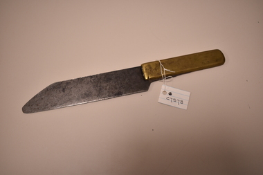
Tatura Irrigation & Wartime Camps Museum
Knife, Italian POW officers, 1940's
... Given to Mr JR Shale who then donated it to Mrs Noel Patterson...Tatura Irrigation & Wartime Camps Museum 49 Hogan Street Tatura the-murray Given to Mr JR Shale who then donated it to Mrs Noel Patterson Myrtleford knife, brass handle and steel blade. ...Given to Mr JR Shale who then donated it to Mrs Noel Pattersonknife, brass handle and steel blade. Made by an Italian officer in Myrtleford.myrtleford -
 Tatura Irrigation & Wartime Camps Museum
Knife - carving, 1940's
... Handmade by Italian Officer in Myrtleford POW Camp and given to Mr J. R. Shale....Tatura Irrigation & Wartime Camps Museum 49 Hogan Street Tatura the-murray Handmade by Italian Officer in Myrtleford POW Camp and given to Mr J. R. Shale. mr j. r. shale myrtleford pow camp carving knives Handmade carving knife, brass handle, long, wide steel blade. ...Handmade by Italian Officer in Myrtleford POW Camp and given to Mr J. R. Shale.Handmade carving knife, brass handle, long, wide steel blade.mr j. r. shale, myrtleford pow camp, carving knives -
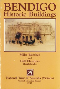 Bendigo Historical Society Inc.
Book - BENDIGO HISTORIC BUILDINGS, c1987
... Inscriptions: L Slate? Shale? S Lake 12/1/89 from Hilary. 180 pages....Inscriptions: L Slate? Shale? S Lake 12/1/89 from Hilary. 180 pages. ...Bendigo Historic Buildings. Publisher: National Trust of Australia. ISBN:0 9097 10 67 8. Photographs, illustrations & maps. Inscriptions: L Slate? Shale? S Lake 12/1/89 from Hilary. 180 pages.Mike Butcher & Gill Flandersbook, bendigo, buildings, historic, bendigo history, architecture -
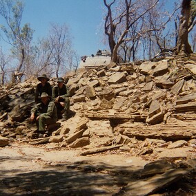 8th/13th Victorian Mounted Rifles Regimental Collection
Photograph
... The patrol decided the Armoured Personnel carrier could descend the shale bank but not climb out again....The patrol decided the Armoured Personnel carrier could descend the shale bank but not climb out again. Photograph ...In 1988, as part of a Defence of Mainland Australian policy, defence of facilities of strategic importance in northern Australia were allocated to Army Reserve units. ‘A’ Squadron was allocated the defence of Tindal Air Force base located 15 KM outside Katherine in Northern Territory. Consequently the Squadron deployed on Exercise ‘Northern Explorer’ to gain first-hand knowledge of operating conditions for mounted and dismounted patrolling in the area.Colour photograph of vehicle patrol of ' A " Squadron 8/13 VMR accessing the viability of a crossing point of Ferguson River during Exercise ' Northern Explorer. The patrol decided the Armoured Personnel carrier could descend the shale bank but not climb out again. -
 The Beechworth Burke Museum
Geological specimen - Yellow Sandstone
... Sandstone is the second most common sedimentary rock after shale. Sandstones consist of sand-sized grains principally quartz, feldspar and rock fragments. ...Sandstone is the second most common sedimentary rock after shale. Sandstones consist of sand-sized grains principally quartz, feldspar and rock fragments. ...This specimen is from Barefoot Hills, Victoria. Sandstones are economically important as major reservoirs for both petroleum and water, as building materials, and as valuable sources of metallic ores. Most significantly, they are the single most useful sedimentary rock type for deciphering Earth history. This specimen is part of a larger collection of geological and mineral specimens collected from around Australia (and some parts of the world) and donated to the Burke Museum between 1868-1880. A large percentage of these specimens were collected in Victoria as part of the Geological Survey of Victoria that begun in 1852 (in response to the Gold Rush) to study and map the geology of Victoria. Collecting geological specimens was an important part of mapping and understanding the scientific makeup of the earth. Many of these specimens were sent to research and collecting organisations across Australia, including the Burke Museum, to educate and encourage further study.A sedimentary rock composed mostly of quartz sand. Sandstone is the second most common sedimentary rock after shale. Sandstones consist of sand-sized grains principally quartz, feldspar and rock fragments. The two major classes of sandstone are arenite and wacke. the colour of sandstone varies from grey, yellow, red and white reflecting the variation in mineral content and cement and is gritty to touch (like sandpaper).Geological survey / R.... S 61 / Loc Bareboot Hills / Sheet / 24SE / 94 /burke museum, beechworth, indigo shire, beechworth museum, geological, geological specimen, mineralogy, sandstone, yellow sandstone, victoria, barefoot hills -
Glenelg Shire Council Cultural Collection
Souvenir - Envelope - First Day Cover, Jun-04
... ... shale...Glenelg Shire Council Cultural Collection History House Cliff Street Portland great-ocean-road first day cover stationery souvenir shale Portland Envelope, 1st Day Cover, first use of the whale post mark in 2004. ...Envelope, 1st Day Cover, first use of the whale post mark in 2004. Photo of whale breaching, on left, 50 cent stamp cancelled 16 June 2004, at Portland. Glenelg Shire logo, bottom right.first day cover, stationery, souvenir, shale, portland -
 Bendigo Historical Society Inc.
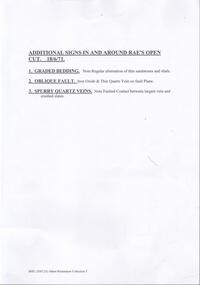
Document - VICTORIA HILL - ADDITIONAL SIGNS IN & AROUND RAE'S OPEN-CUT
... (1) Graded Bedding - Note regular alternation of thin sandstones and shale. (2) Oblique Fault - Iron Oxide & thin quartz vein on fault plane...Notes read: Additional Signs In and Around Rae's Open-Cut 18/6/71. (1) Graded Bedding - Note regular alternation of thin sandstones and shale. (2) Oblique Fault - Iron Oxide & thin quartz vein on fault plane. (3) Spurry Quartz Veins - note faulted contact between largest vein and crushed slates. ...Carbon copy and typed notes for signs at Victoria Hill. Notes read: Additional Signs In and Around Rae's Open-Cut 18/6/71. (1) Graded Bedding - Note regular alternation of thin sandstones and shale. (2) Oblique Fault - Iron Oxide & thin quartz vein on fault plane. (3) Spurry Quartz Veins - note faulted contact between largest vein and crushed slates. Notes prepared by Albert Richardson.document, victoria hill, victoria hill - additional signs in and around rae's open-cut, graded bedding, oblique fault, spurry quartz veins -
 The Beechworth Burke Museum
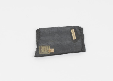
Geological specimen - Slate (Metamorphic), Unknown
... Slate is a fine-grained, low-grade metamorphic rock that is formed by the transformation of mudstone, shale or sometimes volcanic ash under low pressure and temperatures. ...Slate is a fine-grained, low-grade metamorphic rock that is formed by the transformation of mudstone, shale or sometimes volcanic ash under low pressure and temperatures. ...This particular specimen was found in the Moorabool Slate quarries in Victoria. The Moorabool Slate quarries was established in the 1860’s by a company of Welshmen with a crew of six who purchased land by the riverside to mine for slate. Under the promise of adding to existing recourses the crew mined the slate which was used for paving and roofing. Slate is a fine-grained, low-grade metamorphic rock that is formed by the transformation of mudstone, shale or sometimes volcanic ash under low pressure and temperatures. It dark colour is due to carbonaceous material or to finely divided iron sulphide. It is believed that Evan Rowlands and Theophilus Williams of Ballarat were the first to discover the slate veins. Slate is a one of the most common natural stones in general use. Being used as paving, flooring, roofing and more. However, its history of being mined in Australia is not common as it is considered that the best places to mine slate is Spain and parts of the United Kingdom. This specimen is part of a larger collection of geological and mineral specimens collected from around Australia (and some parts of the world) and donated to the Burke Museum between 1868-1880. A large percentage of these specimens were collected in Victoria as part of the Geological Survey of Victoria that begun in 1852 (in response to the Gold Rush) to study and map the geology of Victoria. Collecting geological specimens was an important part of mapping and understanding the scientific makeup of the earth. Many of these specimens were sent to research and collecting organisations across Australia, including the Burke Museum, to educate and encourage further study.A somewhat rectangular foliated metamorphic rock composed of quartz, sericite and minerals from the chlorite group that make up the compounds of slate. The rock is dark grey almost black.Geological survey / R S / Loc Moorabool /Slate quarries / 1/4 sheet | 78 | Roofing Slate /burke museum, beechworth, geological, slate, metamorphic, slate (metamorphic), geological specimen, slate specimen, indigo shire -
 Bendigo Historical Society Inc.
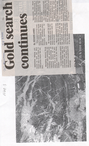
Newspaper - Kangaroo Flat Gold Mine Collection: Gold search continues, 2.9.2000
... The geology of the Bendigo Field consists of a series of tightly folded, interbedded sandstone and shale sediments. Within the sediments the gold mineralisation is hosted in quartz reefs or ribbons closely associated with anticline axes and reverse faulting. ...The geology of the Bendigo Field consists of a series of tightly folded, interbedded sandstone and shale sediments. Within the sediments the gold mineralisation is hosted in quartz reefs or ribbons closely associated with anticline axes and reverse faulting. ...New Bendigo Gold Project The Bendigo goldfield is centred on the urban area of Bendigo (population approximately 60 000) in central Victoria, 130 km north west of Melbourne, Australia. Gold was discovered at Bendigo in 1851 and production continued through to 1954. The Bendigo goldfield is the second largest goldfield in total gold produced in Australia, after Kalgoorlie's Golden Mile with a total production of 22 million oz. The geology of the Bendigo Field consists of a series of tightly folded, interbedded sandstone and shale sediments. Within the sediments the gold mineralisation is hosted in quartz reefs or ribbons closely associated with anticline axes and reverse faulting. The gold within the quartz reefs is typically both coarse grained and erratically distributed.Bendigo Advertiser article attached to a photocopy of an underground rock formation. Photocopy date stamped 21.8.2000. Headline on newspaper article: 'Gold search continues'. Content describes exploration on the New Chum line of reef 'down to 1500 metres below the surface'. Doug Buerger is quoted discussing the 10 million ounce potential of the New Bendigo gold project. The Garden Gully line of reef is being tested for unmined ribbons on the reefline. bendigo mining n.l., bendigo, mining, gold, kangaroo flat, doug buerger, garden gully reef, new chum reef -
 Bendigo Historical Society Inc.
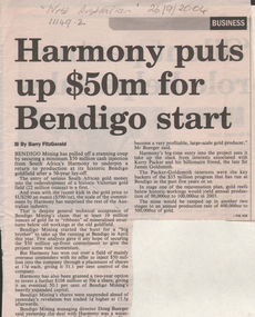
Newspaper - Kangaroo Flat Gold Mine Collection: New Bendigo Gold Project
... The geology of the Bendigo Field consists of a series of tightly folded, interbedded sandstone and shale sediments. Within the sediments the gold mineralisation is hosted in quartz reefs or ribbons closely associated with anticline axes and reverse faulting. ...The geology of the Bendigo Field consists of a series of tightly folded, interbedded sandstone and shale sediments. Within the sediments the gold mineralisation is hosted in quartz reefs or ribbons closely associated with anticline axes and reverse faulting. ...New Bendigo Gold Project The Bendigo goldfield is centred on the urban area of Bendigo (population approximately 60 000) in central Victoria, 130 km north west of Melbourne, Australia. Gold was discovered at Bendigo in 1851 and production continued through to 1954. The Bendigo goldfield is the second largest goldfield in total gold produced in Australia, after Kalgoorlie's Golden Mile with a total production of 22 million oz. The geology of the Bendigo Field consists of a series of tightly folded, interbedded sandstone and shale sediments. Within the sediments the gold mineralisation is hosted in quartz reefs or ribbons closely associated with anticline axes and reverse faulting. The gold within the quartz reefs is typically both coarse grained and erratically distributed.'Harmony puts up $50m for Bendigo start'. Newspaper article details the 'stunning coup' that Bendigo Mining has organised to secure a minimum $50m cash injection from South Africa's Harmony to 'return to production at its historic Bendigo goldfield after a 50 year lay-off'. Mr. Doug Buerger, managing Director of Bendigo Mining, stated that the New Bendigo project has 'the potential to become a very profitable, large-scale gold producer'. 'The Age' attributed at end of article. In pencil on top of article: 'West Australian 26/9/2004'bendigo mining n.l., bendigo, mining, gold, kangaroo flat, harmony, south africa, mining shares, doug buerger -
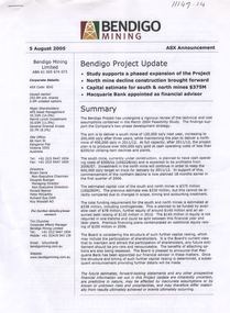
 Bendigo Historical Society Inc.
Document - Kangaroo Flat Gold Mine Collection: New Bendigo Gold Project, 2.9.2000
... The geology of the Bendigo Field consists of a series of tightly folded, interbedded sandstone and shale sediments. Within the sediments the gold mineralisation is hosted in quartz reefs or ribbons closely associated with anticline axes and reverse faulting. ...The geology of the Bendigo Field consists of a series of tightly folded, interbedded sandstone and shale sediments. Within the sediments the gold mineralisation is hosted in quartz reefs or ribbons closely associated with anticline axes and reverse faulting. ...New Bendigo Gold Project The Bendigo goldfield is centred on the urban area of Bendigo (population approximately 60 000) in central Victoria, 130 km north west of Melbourne, Australia. Gold was discovered at Bendigo in 1851 and production continued through to 1954. The Bendigo goldfield is the second largest goldfield in total gold produced in Australia, after Kalgoorlie's Golden Mile with a total production of 22 million oz. The geology of the Bendigo Field consists of a series of tightly folded, interbedded sandstone and shale sediments. Within the sediments the gold mineralisation is hosted in quartz reefs or ribbons closely associated with anticline axes and reverse faulting. The gold within the quartz reefs is typically both coarse grained and erratically distributed.Two page document produced by Bendigo Mining N.L. on the occasion of their 2002 Open Day. Front page 'Welcome to the New Bendigo Giold Project' outlines the procedure involved in signing in and safety issues whilst on site. A site plan is provided. Second page is an information sheet, and provides facts and figures on the project to date. bendigo mining n.l., bendigo, mining, gold, kangaroo flat, 2002, new bendigo gold project, open day -
 Bendigo Historical Society Inc.
Document - Kangaroo Flat Gold Mine Collection: Bendigo Project Update ASX announcement, Bendigo Mining NL, 5 August 2005
... The geology of the Bendigo Field consists of a series of tightly folded, interbedded sandstone and shale sediments. Within the sediments the gold mineralisation is hosted in quartz reefs or ribbons closely associated with anticline axes and reverse faulting. ...The geology of the Bendigo Field consists of a series of tightly folded, interbedded sandstone and shale sediments. Within the sediments the gold mineralisation is hosted in quartz reefs or ribbons closely associated with anticline axes and reverse faulting. ...New Bendigo Gold Project The Bendigo goldfield is centred on the urban area of Bendigo (population approximately 60 000) in central Victoria, 130 km north west of Melbourne, Australia. Gold was discovered at Bendigo in 1851 and production continued through to 1954. The Bendigo goldfield is the second largest goldfield in total gold produced in Australia, after Kalgoorlie's Golden Mile with a total production of 22 million oz. The geology of the Bendigo Field consists of a series of tightly folded, interbedded sandstone and shale sediments. Within the sediments the gold mineralisation is hosted in quartz reefs or ribbons closely associated with anticline axes and reverse faulting. The gold within the quartz reefs is typically both coarse grained and erratically distributed. Source: https://www.ausimm.com/publications/conference-proceedings/eighth-underground-operators-conference-2002/new-bendigo-gold-project/Three page, double sided project update for the Bendigo project. On top of front page 'Bendigo Mining, 5 August 2005, ASX Announcement'. Content includes: summary of the project with the aim defined 'to deliver a south mine of 120,000 oz/y next year, increasing to 200,000 oz/y in 2011/12. At full capacity, after 2001/12, the project plan is to produce over 600,000 oz/y gold at cash operating costs of less than $200/0z utilising twin declines and plants'. Development strategy, funding, recent expenditures, key project details, production, processing, operating costs, development capital, maintenance capital are discussed in the project update. bendigo mining n.l., bendigo, mining, gold, kangaroo flat, swan decline, development strategy, funding, recent expenditures, key project details, production, processing, oeprating costs, development capital, maintenance capital, stock exchange, project update -
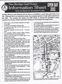
 Bendigo Historical Society Inc.
Document - Kangaroo Flat Gold Mine Collection: Bendigo Gold Project Newsletters, Bendigo Mining NL, November 2001, August 2002, October 2002, July 2005, February 2006 and May 2006
... The geology of the Bendigo Field consists of a series of tightly folded, interbedded sandstone and shale sediments. Within the sediments the gold mineralisation is hosted in quartz reefs or ribbons closely associated with anticline axes and reverse faulting. ...The geology of the Bendigo Field consists of a series of tightly folded, interbedded sandstone and shale sediments. Within the sediments the gold mineralisation is hosted in quartz reefs or ribbons closely associated with anticline axes and reverse faulting. ...New Bendigo Gold Project The Bendigo goldfield is centred on the urban area of Bendigo (population approximately 60 000) in central Victoria, 130 km north west of Melbourne, Australia. Gold was discovered at Bendigo in 1851 and production continued through to 1954. The Bendigo goldfield is the second largest goldfield in total gold produced in Australia, after Kalgoorlie's Golden Mile with a total production of 22 million oz. The geology of the Bendigo Field consists of a series of tightly folded, interbedded sandstone and shale sediments. Within the sediments the gold mineralisation is hosted in quartz reefs or ribbons closely associated with anticline axes and reverse faulting. The gold within the quartz reefs is typically both coarse grained and erratically distributed. Source: https://www.ausimm.com/publications/conference-proceedings/eighth-underground-operators-conference-2002/new-bendigo-gold-project/Six newsletters, "New Bendigo Gold Project", dated November 2001, August 2002, October 2002, July 2005, February 2006 and May 2006. Newsletters highlight development of gold project; a map of the decline development, underground workings and personnel news is featured on most newsletters. bendigo mining n.l., bendigo, mining, gold, kangaroo flat, decline, swan decline, south decline, new moon plant eaglehawk, ventilation shaft, drilling, blasting, ground support, sandra burns, james lerk, underground development, rehabilitation, greg miller, alexandria reef -
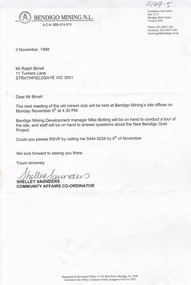 Bendigo Historical Society Inc.
Letter - Kangaroo Flat Gold Mine Collection: Ralph Birrell, 3rd November, 1998
... The geology of the Bendigo Field consists of a series of tightly folded, interbedded sandstone and shale sediments. Within the sediments the gold mineralisation is hosted in quartz reefs or ribbons closely associated with anticline axes and reverse faulting. ...The geology of the Bendigo Field consists of a series of tightly folded, interbedded sandstone and shale sediments. Within the sediments the gold mineralisation is hosted in quartz reefs or ribbons closely associated with anticline axes and reverse faulting. ...Dr Ralph Birrell (20/3/1927 - 7/6/2014) was a lecturer at the Bendigo School of mines and the author of numerous books about mining in Victoria, particularly Bendigo, and books on various elements of Bendigo history. New Bendigo Gold Project The Bendigo goldfield is centred on the urban area of Bendigo (population approximately 60 000) in central Victoria, 130 km north west of Melbourne, Australia. Gold was discovered at Bendigo in 1851 and production continued through to 1954. The Bendigo goldfield is the second largest goldfield in total gold produced in Australia, after Kalgoorlie's Golden Mile with a total production of 22 million oz. The geology of the Bendigo Field consists of a series of tightly folded, interbedded sandstone and shale sediments. Within the sediments the gold mineralisation is hosted in quartz reefs or ribbons closely associated with anticline axes and reverse faulting. The gold within the quartz reefs is typically both coarse grained and erratically distributed.Three letters from Bendigo Mining N.L. 14th May 1998, 3 November 1998, and 22nd. April 1999, to Mr. Ralph Birrell from Bendigo Mining N.L. regarding the next meeting of the old miners club to be held at Bendigo mining's site offices. Signed by Shelley Saunders, Community Affairs Co-ordinator. On bottom of page: Registered and Secretarial Office, 61-65 Bull Street, Bendigo Vic 3550. Carshalton Site Office, Coonooer Street, Kangaroo Flat, Vic 3555.bendigo mining n.l., bendigo, mining, gold, kangaroo flat, ralph birrell, old miners group -
 The Beechworth Burke Museum
Photograph, 1857
... Spring Creek is a contact zone for granite pluton and siltstones, shales and standstones; which has, over time, encouraged natural springs to form. ...Spring Creek is a contact zone for granite pluton and siltstones, shales and standstones; which has, over time, encouraged natural springs to form. ...This photograph is of old mine workings on the site of the Spring Creek diggings. Spring Creek is a contact zone for granite pluton and siltstones, shales and standstones; which has, over time, encouraged natural springs to form. Enriched with gold washed out of the surrounding granite, these alluvial deposits achieved fame from 1852 onwards as the Spring Creek Diggings sprang to life (not realised as geographically important until 1871). In Spring Creek that runs behind the main street of Beechworth, near the foot of Newtown Hill a pint pot of gold was discovered on one of these expeditions in 1852 by prospectors Baker and Strickland and the gold rush town of Spring Creek was formed. Australian gold rushes have always created a sense of independence and freedom; as do-it-yourself, off-grid, low-tech adventures. People of all backgrounds were drawn to the gold fields by the prospect of riches and adventure, but they also learned self-sufficiency and found freedom of expression. Industry boomed, new practices were adopted and social norms were upended. This image is of historical significance as it informs on the history of Australian gold mining. It represents the innovation that accompanied the mining industry and the importance of gold mining in town building and regional histories. Black and white rectangular photograph on unmounted board.gold mining, spring creek, mining, geography, geology -
 Eltham District Historical Society Inc
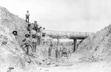
Negative - Photograph, Construction of Railway Line, Greensborough to Eltham, 1901
... Some hold picks, a couple of horses and carts are lined up probably for carting the broken rock away, dirt, rocks and shale lay at the bottom. A pair of small wooden buckets are evident, most likley to provide drinking water. ...Some hold picks, a couple of horses and carts are lined up probably for carting the broken rock away, dirt, rocks and shale lay at the bottom. A pair of small wooden buckets are evident, most likley to provide drinking water. ...The Silver Street Bridge, 1901 Butty Gang workers excavate a rock cutting near the Silver Street bridge prior to laying of track. The Butty Gang system versus the Contract System was subject to public debate regarding cost benefits at the time of the Eltham line construction. Butty gang workers were a group of men who take a contract for a part of a work, as in the construction of railroads, etc., the proceeds being equally divided between them, with something extra to the foreman. Some hold picks, a couple of horses and carts are lined up probably for carting the broken rock away, dirt, rocks and shale lay at the bottom. A pair of small wooden buckets are evident, most likley to provide drinking water. The timber Silver Street bridge crosses the cutting in the background. The opening of the railway line from Heidelberg to Eltham took place on the 6th June 1902. Similiar to 810. Source: Mrs. Dandy, Montmorency and Miss McColl, 8 Anderson St., HeidelbergThis photo forms part of a collection of photographs gathered by the Shire of Eltham for their centenary project book,"Pioneers and Painters: 100 years of the Shire of Eltham" by Alan Marshall (1971). The collection of over 500 images is held in partnership between Eltham District Historical Society and Yarra Plenty Regional Library (Eltham Library) and is now formally known as the 'The Shire of Eltham Pioneers Photograph Collection.' It is significant in being the first community sourced collection representing the places and people of the Shire's first one hundred years.Digital image 120 format B&W negativeshire of eltham pioneers photograph collection, eltham, railway workers, 1901, butty gang, overpass, railway construction, railway line construction, silver street bridge -
 Wodonga & District Historical Society Inc
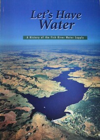
Book - Let's Have Water - A history of the Fish River Water Supply, Robin McLachlan, Denis Barrett, Jack Domis, Nick Welling, 1997
... Engineered by the NSW Public Works Department this scheme commenced in October 1943 to supply water to the Glen Davis shale oil works, with Stage 1 being constructed by the Civil Constructional Corps during World War 2. ...Engineered by the NSW Public Works Department this scheme commenced in October 1943 to supply water to the Glen Davis shale oil works, with Stage 1 being constructed by the Civil Constructional Corps during World War 2. ...A history of the development of the management of the Fish River Water Supply Scheme in Central NSW. The scheme extends across the local government areas of the Shire of Oberon, the City of Lithgow and the City of the Blue Mountains.non-fictionA history of the development of the management of the Fish River Water Supply Scheme in Central NSW. The scheme extends across the local government areas of the Shire of Oberon, the City of Lithgow and the City of the Blue Mountains.water nsw, fish river region nsw, oberon dam, water resources development nsw australia -
 Bendigo Historical Society Inc.
Slide - Dunn's Rock Eppalock, 2012
... Rocks mainly are sandstone, mudstone, black shale and quartz conglomerates. Marine fossils can be found in the area. ...Rocks mainly are sandstone, mudstone, black shale and quartz conglomerates. Marine fossils can be found in the area. ...The low rolling hills of the Kimbolton countryside consist of ancient, hard and fractured Ordovician rock up to 65 million years old, which was originally deposited deep under the sea. Rocks mainly are sandstone, mudstone, black shale and quartz conglomerates. Marine fossils can be found in the area. Around seven million years ago a basalt flow buried the original bedrock along the along the Campaspe River. Ongoing weathering, wind and water movement over the following years has produced younger clay, sand, silt and gravel deposits throughout the area. Patches of White Hills Gravel are also found in the area. Another unique geological feature of this area is the Permian Glacial Pavement rocks north and south of Eppalock and glacial sediments (such as “Dunn’s Rock” and “Kellams Rock”). During the ice age (up to 280 million years ago) large glaciers moving over the countryside, scoured out sediments, pulverized bedrock, polished and cut grooves into bedrock in the direction of ice movement. When the ice melted boulders etc where left behind in areas of entirely different rock types, such as a 100 Tonne granite block known as ‘The Stranger’ near Derrinal. Dunn's Rock (Glaciated Pavement) Eppalock - Photos of the rock and a field group collecting data with Lake Eppalock (Knowsley) in the backgroundhistory, bendigo, dunn's rock eppalock, kimbolton forest, lake eppalock, gately collection -
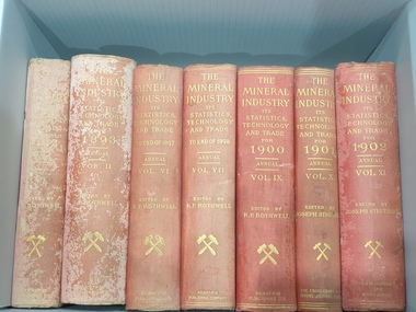 Federation University Historical Collection
Book, The MIneral Industry its Statistics, Technology and Trade in the United States and Other Countries 1893
... ...shale...Barker Library (top floor) Mount Helen goldfields Used at the Ballarat School of Mines Mining statistics technology trades metal industry minerals united states canada china france germany italy japan russia south america spain sweden united kingdom ireland coins Cuba blast furnaces Gold Lead production Manganese opals silver + alumite antinomy cobalt coke copper ore iron lead limestone flux managanese shale silver-lead tin zinc This volume includes Australasia, and lists each state seperately , as well as New Zealand, It also lists Bismoth, Chome iron ore, coal, copper, gold, lead, mineral industry growth, alumite, antinomy, cobalt, coke, copper ore, gold, iron, lead, limestone flux, managanese, shale, silver, silver-lead, tin and zinc Lead production Manganese opals Red hard cloth covered book of 115 pages. ...This volume includes Australasia, and lists each state seperately , as well as New Zealand, It also lists Bismoth, Chome iron ore, coal, copper, gold, lead, mineral industry growth, alumite, antinomy, cobalt, coke, copper ore, gold, iron, lead, limestone flux, managanese, shale, silver, silver-lead, tin and zinc Lead production Manganese opalsRed hard cloth covered book of 115 pages. INcludes contentsnon-fictionThis volume includes Australasia, and lists each state seperately , as well as New Zealand, It also lists Bismoth, Chome iron ore, coal, copper, gold, lead, mineral industry growth, alumite, antinomy, cobalt, coke, copper ore, gold, iron, lead, limestone flux, managanese, shale, silver, silver-lead, tin and zinc Lead production Manganese opals mining, statistics, technology, trades, metal industry, minerals, united states, canada, china, france, germany, italy, japan, russia, south america, spain, sweden, united kingdom, ireland, coins, cuba, blast furnaces, gold, lead production, manganese, opals, silver, +, alumite, antinomy, cobalt, coke, copper ore, iron, lead, limestone flux, managanese, shale, silver-lead, tin, zinc -
Federation University Historical Collection
Book, The MIneral Industry its Statistics, Technology and Trade in the United States and Other Countries 1898
... ...shale...Barker Library (top floor) Mount Helen goldfields Used at the Ballarat School of Mines Mining statistics technology trades metal industry minerals united states canada china france germany italy japan russia south america spain sweden united kingdom ireland coins Cuba blast furnaces Gold Lead production Manganese opals silver + alumite antinomy cobalt coke copper ore iron lead limestone flux managanese shale silver-lead tin zinc abrasives chemical industry gems precious stones This volume includes Australasia, and lists each state seperately , as well as New Zealand, It also lists Bismoth, Chome iron ore, coal, copper, gold, lead, mineral industry growth, alumite, antinomy, cobalt, coke, copper ore, gold, iron, lead, limestone flux, managanese, shale, silver, silver-lead, tin and zinc Lead production Manganese opals Red hard cloth covered book of 984 pages. ...This volume includes Australasia, and lists each state seperately , as well as New Zealand, It also lists Bismoth, Chome iron ore, coal, copper, gold, lead, mineral industry growth, alumite, antinomy, cobalt, coke, copper ore, gold, iron, lead, limestone flux, managanese, shale, silver, silver-lead, tin and zinc Lead production Manganese opalsRed hard cloth covered book of 984 pages. Includes contents and index.non-fictionThis volume includes Australasia, and lists each state seperately , as well as New Zealand, It also lists Bismoth, Chome iron ore, coal, copper, gold, lead, mineral industry growth, alumite, antinomy, cobalt, coke, copper ore, gold, iron, lead, limestone flux, managanese, shale, silver, silver-lead, tin and zinc Lead production Manganese opals mining, statistics, technology, trades, metal industry, minerals, united states, canada, china, france, germany, italy, japan, russia, south america, spain, sweden, united kingdom, ireland, coins, cuba, blast furnaces, gold, lead production, manganese, opals, silver, +, alumite, antinomy, cobalt, coke, copper ore, iron, lead, limestone flux, managanese, shale, silver-lead, tin, zinc, abrasives, chemical industry, gems, precious stones -
Federation University Historical Collection
Book, The MIneral Industry its Statistics, Technology and Trade in the United States and Other Countries 1899
... ...shale...Barker Library (top floor) Mount Helen goldfields Used at the Ballarat School of Mines Mining statistics technology trades metal industry minerals united states canada china france germany italy japan russia south america spain sweden united kingdom ireland coins Cuba blast furnaces Gold Lead production Manganese opals silver + alumite antinomy cobalt coke copper ore iron lead limestone flux managanese shale silver-lead tin zinc abrasives chemical industry gems precious stones This volume includes Australasia, and lists each state seperately , as well as New Zealand, It also lists Bismoth, Chome iron ore, coal, copper, gold, lead, mineral industry growth, alumite, antinomy, cobalt, coke, copper ore, gold, iron, lead, limestone flux, managanese, shale, silver, silver-lead, tin and zinc Red hard cloth covered book of 982 pages. ...This volume includes Australasia, and lists each state seperately , as well as New Zealand, It also lists Bismoth, Chome iron ore, coal, copper, gold, lead, mineral industry growth, alumite, antinomy, cobalt, coke, copper ore, gold, iron, lead, limestone flux, managanese, shale, silver, silver-lead, tin and zincRed hard cloth covered book of 982 pages. Includes contents and index.non-fictionThis volume includes Australasia, and lists each state seperately , as well as New Zealand, It also lists Bismoth, Chome iron ore, coal, copper, gold, lead, mineral industry growth, alumite, antinomy, cobalt, coke, copper ore, gold, iron, lead, limestone flux, managanese, shale, silver, silver-lead, tin and zinc mining, statistics, technology, trades, metal industry, minerals, united states, canada, china, france, germany, italy, japan, russia, south america, spain, sweden, united kingdom, ireland, coins, cuba, blast furnaces, gold, lead production, manganese, opals, silver, +, alumite, antinomy, cobalt, coke, copper ore, iron, lead, limestone flux, managanese, shale, silver-lead, tin, zinc, abrasives, chemical industry, gems, precious stones