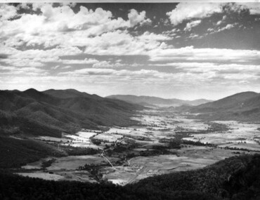
Showing 360 items matching " view hill house"
-
 Bendigo Historical Society Inc.
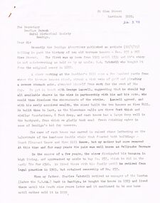
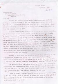
Document - CORRESPONDENCE: VIEW ST PROPERTY OWNED BY CHARLES TATCHELL, 24th March, 1973
... ... View Hill House...View St) bought in 1923 by Charles Tatchell. Sold by family in 1939 Description in the letter from Tatchell's daughter about the history of the houses - the pair were called for many years ''Bellyache Terrace''. Known originally as Mount Pleasant House and View Hill...Known originally as Mount Pleasant House and View Hill House (later removed by Mrs Tatchell). ...1973 correspondence to BHS re the two View St properties (257 and 267 View St) bought in 1923 by Charles Tatchell. Sold by family in 1939 Description in the letter from Tatchell's daughter about the history of the houses - the pair were called for many years ''Bellyache Terrace''. Known originally as Mount Pleasant House and View Hill House (later removed by Mrs Tatchell).Nancy Macpherson Smithperson, individual, charles tatchell, george lansell, view street, view hill house, mount plesant house, bellyache terrace, charles tatchell, london bank bendigo -
 Bendigo Historical Society Inc.
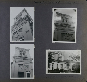
Document - 257 & 267 View Street Two Terrace house
... A miner from the Hustler's Hill mine struck a rich vein of gold and suggested George Lansell should buy all available share and enter into a partnership with him. The resulting fortune allowed the miner to build these substantial cottages of bluestone and named them Mt Pleasant House and View Hill House. ...History House 11 Mackenzie Street Bendigo goldfields A miner from the Hustler's Hill mine struck a rich vein of gold and suggested George Lansell should buy all available share and enter into a partnership with him. The resulting fortune allowed the miner to build these substantial cottages of bluestone and named them Mt Pleasant House and View Hill House. ...A miner from the Hustler's Hill mine struck a rich vein of gold and suggested George Lansell should buy all available share and enter into a partnership with him. The resulting fortune allowed the miner to build these substantial cottages of bluestone and named them Mt Pleasant House and View Hill House. They were later known as Bellyache Terrace. No 267 was eventually sold to G H Tatchell, solicitor. It was then bought by his son Charles Tatchell and remained in the family until 1939.A paper detailing the history of the two terrace house at 257 & 267 View Street. 1 Page. view street, house, goldfield -
 Lakes Entrance Historical Society
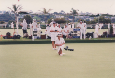
Photograph - Lakes Entrance Bowls Club, Lake Post Newspaper, 2002
... Colour photograph Bowls Club Invitation Day view of the greens with bowlers waiting their turn, a lady Morwell player bowling, view of houses on hill behind. Lakes Entrance Victoria...Lakes Entrance Historical Society 4 Marine Parade Lakes Entrance gippsland number in album 03574.01 Bowls Club Sports Colour photograph Bowls Club Invitation Day view of the greens with bowlers waiting their turn, a lady Morwell player bowling, view of houses on hill behind. Lakes Entrance Victoria Photograph Lakes Entrance Bowls Club Lake Post Newspaper ...number in album 03574.01Colour photograph Bowls Club Invitation Day view of the greens with bowlers waiting their turn, a lady Morwell player bowling, view of houses on hill behind. Lakes Entrance Victoriabowls club, sports -
 Eltham District Historical Society Inc
Photograph, Nicholes Photographers, Bird family, c.1905
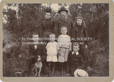
... The View Hill house was occupied by the Johanssons in the 1930s and was later damaged by fire. ...The View Hill house was occupied by the Johanssons in the 1930s and was later damaged by fire. ...Bird family, c.1905 Back row, L-R: Janet Bird (nee Kilpatrick), George Bird, Ellen May (Nell) Bird Front row L-R: George Hugh Bird, Ernest Reginald Bird, Arthur Andrew Bird, Edwin John Bird Nicholes Photographer, Alphington According to the Sands McDougall Melbourne Directory, George. Nicholes, Photographer was first listed on the north side of Heidelberg Road, Alphington in 1904 and again in 1905. By 1906 he was still listed but with no profession. From 1907 on he was listed as a bicycle agent. On July 23, 1878, George Bird married Janet Kilpatrick (born Ayrshire) at Northcote by Presbyterian minister, Duncan Fraser. The witnesses were daughters of the minister. George gave his profession as farmer. Around 1880 or possibly earlier he acquired the property known as View Hill at the top of Pitt Street, Eltham between Pitt Street and Mount Pleasant Road and what is now Eucalyptus Road. George and Janet developed an orchard and farm around the View Hill home and had 10 children, three of whom died young. George Bird is listed in the 1977 history of the Eltham Methodist Church as Steward and trustee in the early years. In the 1950 history he is mentioned as Sunday School Superintendent. In the early 1900s, Janet regularly went to the church by horse and jinker. Janet died September 2, 1915, age 60 of endocarditis and bronchial pneumonia. At about this time, three children had married (Sarah, George and Ada) and four were living at home. However, Edwin joined the AIF in August 1915 and Ellen married in 1916 leaving two sons, Arthur and Reg, to look after their father and the property although some of the married children may have lived at View Hill for some time. From Edwin's letters, Hilda Pepper, a cousin on their mother's side) stayed with the family for some time to help. In later years, George developed glaucoma and became blind. He died December 6, 1920, aged 75 years, of diabetes mellites. Both Janet and George are buried at Eltham Cemetery, but the gravestone incorrectly gives 1921 for the death of George. The estate was divided into equal portions and distributed to the surviving members with Arthur and Ted Pepper being Executors. Ada Janet Lowe received a portion above what is now Rockliffe Street and Sis Pepper (Sarah Ann nee Bird) the portion below Rockliffe Street. Ernest Pepper built in the 1930s on the Pepper block at the Pitt Street end. George's share was along Wattle Grove and Arthur received the portion at the eastern end. Presumably the other two received portions including the top of the hill and slopes down to Pitt Street, Mount Pleasant Road and Wattle Grove. Read's (at the corner of Pitt Street and View Hill Crescent) was the first additional house brought in on wheels by a Mr Walkenden. The View Hill house was occupied by the Johanssons in the 1930s and was later damaged by fire. Source: Info provided to Marg Ball by Neil and Lyn Pepper (both deceased) abt. 2018. PANEL 1875-1920 Panels began to be produced around 1875, and were particularly suited, because of their larger size, for capturing family, or even larger, groups. They measured 8.5 by 6.5 inches (22 cm x 16.5 cm). - Frost, Lenore; Dating Family Photos 1850-1920; Valiant Press Pty. Ltd., Berwick, Victoria 1991marg ball collection, 1905, arthur andrew bird, bird family, edwin john bird, ellen may (nell) bird, ernest reginald bird, george bird (1845-1921), george hugh bird, janet bird (nee kilpatrick), nicholes photographer alphington, straw boater -
 Kew Historical Society Inc
Album, Eva Grant, Historic Buildings in Victoria & New South Wales, 1919-c.1962
... Sites include: Abbotsford (Vic) - Abbotsford Convent, Mayfield (c.1962), prefabricated house - Church street Armadale (Vic) - church (c.1959) - Thomson & Wattletree Roads Arthur’s Seat (Vic) - McCrae homestead Ballarat (Vic) - Memorial plaque on site of Bentley’s Hotel, Memorial on site of Eureka Stockade, Early municipal buildings - East Ballarat, Adam Lindsay Gordon’s cottage - Botanical Gardens, View from Sovereign Hill, Shell house Broken Hill (NSW) - panorama (1963), Flying Doctor’s base (?...Sites include: Abbotsford (Vic) - Abbotsford Convent, Mayfield (c.1962), prefabricated house - Church street Armadale (Vic) - church (c.1959) - Thomson & Wattletree Roads Arthur’s Seat (Vic) - McCrae homestead Ballarat (Vic) - Memorial plaque on site of Bentley’s Hotel, Memorial on site of Eureka Stockade, Early municipal buildings - East Ballarat, Adam Lindsay Gordon’s cottage - Botanical Gardens, View from Sovereign Hill, Shell house Broken Hill (NSW) - panorama (1963), Flying Doctor’s base (? ...One of three scrapbooks created by Eva Grant, a past member of the Kew Historical Society which were donated by her niece, Julie Thomson, in 2013. The scrapbook includes photographs and descriptions of the following sites. (Many of these are now demolished and so the photographs and descriptions may be rare records of a site.) Sites include: Abbotsford (Vic) - Abbotsford Convent, Mayfield (c.1962), prefabricated house - Church street Armadale (Vic) - church (c.1959) - Thomson & Wattletree Roads Arthur’s Seat (Vic) - McCrae homestead Ballarat (Vic) - Memorial plaque on site of Bentley’s Hotel, Memorial on site of Eureka Stockade, Early municipal buildings - East Ballarat, Adam Lindsay Gordon’s cottage - Botanical Gardens, View from Sovereign Hill, Shell house Broken Hill (NSW) - panorama (1963), Flying Doctor’s base (?1963) Eltham (Vic) - Hassell’s outdoor art gallery Essendon (Vic) - Niddrie Homestead and stables (1963) Geelong (Vic) - first Bishopscourt Hawthorn (Vic) - Convent (1930), The Hawthorns, Keilor plains (Vic) - pioneer homes, pioneer cemetery Kew (Vic) - Roseneath (1951), Tarring - Ruyton, Turinville, house - Foley street (c.1960). Malvern (Vic) - church Mount Ridley (Vic) - Summerhill Melbourne (Vic) - Old Brewery - Custom’s House Lane (1960), Customs House, Scott’s Hotel (1962), Western market (c.1960) Phillip Island (Vic) - Grave Toorak (Vic) - Mandeville Hall, Merna (sic) - Arthur Streeton’s house, Toorak House Wentworth (NSW) - Harvey’s Hotel, Sturt Memorial, Sturt’s Tree, Wentworth Gaol Williamstown (Vic) - Williamstown Dairy Yan Yean (Vic) - Bear’s Castle (c.1947) Beveridge/Big Hill (Vic) - Kelly’s cottageImportant photograph record (and notes) about historic buildings in Victoria.38-page scrapbook with additional text created by Eva Grant, a past member of the Kew Historical Society. In addition to the 68 photographs, there are two postcards and a number of publications/handouts.collected by Eva on her trips to heritage sites in Victoria and New South Wales. The pages of the album can be viewed in the image carousel above. Most of the photographs of heritage buildings were taken in the early 1960s.See imagesheritage sites - victoria - australia, eva grant, scrapbooks - 20th century -
 Warrnambool and District Historical Society Inc.
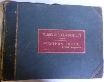
Album, Warrnambool and District 1886 Western Hotel, 1886
... views of the town from Manse Hill and Booval Hill and the Botanic Gardens. Buildings included are Cramond and Dickson, St Joseph’s Church, the saleyards. The book itself would have been used by patrons of the Western Hotel when J Fox was licensee, from 1880 until 1887. The hotel had been operating since 1870 when William O’Brien applied for a publican’s license for the house...views of the town from Manse Hill and Booval Hill and the Botanic Gardens. Buildings included are Cramond and Dickson, St Joseph’s Church, the saleyards. The book itself would have been used by patrons of the Western Hotel when J Fox was licensee, from 1880 until 1887. The hotel had been operating since 1870 when William O’Brien applied for a publican’s license for the house ...This album contains a number of local coastal and seascapes including Thunder Point, views of local streets such as Liebig and Fairy streets, panorama views of the town from Manse Hill and Booval Hill and the Botanic Gardens. Buildings included are Cramond and Dickson, St Joseph’s Church, the saleyards. The book itself would have been used by patrons of the Western Hotel when J Fox was licensee, from 1880 until 1887. The hotel had been operating since 1870 when William O’Brien applied for a publican’s license for the house on the corner of Timor and Kepler Streets with five sitting rooms and eight bedrooms. The stone building was designed by Andrew Kerr and built by Williams & Co. The Western Hotel was also the booking office for Cobb and Co Coaches which operated until the railway came to town in 1890. This album has historical significance on different levels. Firstly the photographs provide a view of Warrnambool in the late 19th century. The photos are aesthetically and artistically significant. Many of the buildings in the streetscapes are still recognizable. Secondly the Western Hotel has occupied a prominent site within the CBD for nearly 150 years. It has links to Cobb & Co, an important part of early Australian transport. Large hard covered album. Dark green cover with title in red rectangle on front cover. Text in gold lettering. A variety of photographs mounted on card.Chuck Photo Ballarat on front cover. Small cutting pasted inside front cover, reads as follows,” Will and Estates. Joseph Fox, late of Grosvenor Street, Balaclava who died on 29th July by his will of 11th August 1915 left 3737pounds real estate and 2342 pounds personality to relatives. warrnambool, warrnambool history, warrnambool photographs of the past, western hotel photographs -
 Kiewa Valley Historical Society
Photograph - Mount Beauty from Bogong Hill, 1950
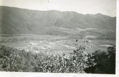
... houses up to Nelse street were erected from 1946 onward and then the township was extended beyond Nelse Street in 1950. The workmen's camp was enlarged in 1950 to the extent of providing accommodation for a total of 1,200. Shows early construction of the town of Mt. Beauty surrounded by farmland taken in 1950 during the early stages of construction of the Kiewa Hydro electric System Mt Beauty Bogong Hill SECV Handwritten on back of photograph in black ink - Mt Beauty from Bogong Hill 1950 Printed on rear Volox 2428 Black and white photograph - aerial view of Mt Beauty taken from Bogong Hill. ...The new State Electricity Commission construction camp at the head of the Kiewa Valley was for workmen on the second power station in the project expected to be the most modern and best equipped in Australia… In contrast to the early Kiewa days of horses and canvas tents, the new camp, with its modern amenities, compared favourably with any country town. Administration of the Kiewa Scheme was moved from Tawonga to Mount Beauty in 1946. The first house in Mount Beauty, in Hollonds Street, was occupied by the co-op store manager from November 1946. The new Mess Hall at Mt Beauty was opened with much ceremony in early November 1946. The houses up to Nelse street were erected from 1946 onward and then the township was extended beyond Nelse Street in 1950. The workmen's camp was enlarged in 1950 to the extent of providing accommodation for a total of 1,200.Shows early construction of the town of Mt. Beauty surrounded by farmland taken in 1950 during the early stages of construction of the Kiewa Hydro electric SystemBlack and white photograph - aerial view of Mt Beauty taken from Bogong Hill. Photograph framed by 6mm white boarder.Handwritten on back of photograph in black ink - Mt Beauty from Bogong Hill 1950 Printed on rear Volox 2428mt beauty, bogong hill, secv -
 Kiewa Valley Historical Society
Papers - "Yurnga: - Mount Beauty High School Magazine. 1963 x2, "Yurnga" Mt Beauty High School Magazine
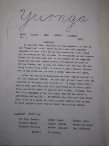
... view among the hills". Mt Beauty is surrounded by mountains. The names in the newsletter are important for the history of the school. Yurnga Mt Beauty High School education 2 typed pages with the headings 'Editorial', 'Magazine Committee' and 'Investiture of Prefects, House Captains and Form Captains'. 1963 Vol. 1 "Yurnga" Mt Beauty High School Magazine Papers - "Yurnga: - Mount Beauty High School Magazine. 1963 x2 ...The Mt Beauty Higher Elementary School was proclaimed on 25th May 1958 then in 1963 it was proclaimed the Mount Beauty High School with an enrolment of 213 pupils, 12 staff members and D.B.Bennett as Principal. The school began to publish its magazine.Yurnga is the aboriginal word for "view among the hills". Mt Beauty is surrounded by mountains. The names in the newsletter are important for the history of the school.2 typed pages with the headings 'Editorial', 'Magazine Committee' and 'Investiture of Prefects, House Captains and Form Captains'. 1963 Vol. 1yurnga, mt beauty high school, education -
 Kiewa Valley Historical Society
Photograph of Kiewa Valley Panorama, Kiewa Valley from No. 5 Road, Before 1945
... houses under construction. The No. 5 Road, from where the photograph was taken, is the road to West Kiewa Power Station and Big Hill Scenic Lookout. Is an excellent view ...In 1943 a camp for workmen was erected and a commencement made with the erection of plant storage and workshop buildings in the new township of Mt. Beauty. The photograph was probably taken after the completion of these buildings. There is no sign of construction of the town itself. In the latter part of 1945 work was commenced on the Mt. Beauty township area with a medical centre, general trading store and some houses under construction. The No. 5 Road, from where the photograph was taken, is the road to West Kiewa Power Station and Big Hill Scenic Lookout.Is an excellent view of the Kiewa Valley before there was little work undertaken to establish the town of Mt. Beauty. Farming was well established with the evidence of huge areas of cleared land. The junction of the East and West Kiewa Rivers can be clearly seen. The first Workmen's camp is near the river and some workshop buildings can also be seen. Black and white photograph of the Kiewa Valley, looking North.Handwritten on the back of photograph "Kiewa Valley from No. 5 Road".kiewa valley, camp, buildings, mt. beauty -
 Federation University Historical Collection
Photograph, Marilyn Jeffs, Hotels of Ballarat, 2019
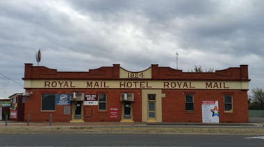
... hill hotel...canberra hotel...carboni...carboni's italian kitchen...eureka stockade hotel...carriers arms hotel...eastern station hotel...centenary hotel...craig's hotel...eastern railway hotel...freight bar...athletic club hotel...grapes hotel...munster arms hotel...golden city hotel...golf house hotel...irish murphy's...camp hotel...lake view...Barker Library (top floor) Mount Helen goldfields hotels ballarat royal mail hotel peter lalor hotel the george hotel x on albert hotel cattleyards inn market hotel bunch of grapes hotel argyle hotel atlantic hotel ballarat hotel black hill hotel blue bell hotel bluebell hotel brown hill hotel canberra hotel carboni carboni's italian kitchen eureka stockade hotel carriers arms hotel eastern station hotel centenary hotel craig's hotel eastern railway hotel freight bar athletic club hotel grapes hotel munster arms hotel golden city hotel golf house hotel irish murphy's camp hotel lake view hotel la porchetta southern cross hotel the mallow hotel meaghers hotel millers arms miners tavern hotel miner's tavern hotel provincial hotel north britain hotel north star hotel oscar's hotel criterian hotel park hotel prince regent house prince regent hotel sport globe sporting globe jacksons hotel railway hotel pwtn pater lalor hotel royal highlander hotel queen's head hotel red lion hotel robin hood hotel military arms hotel royal oak hotel western hotel imperial hotel unicorn hotel union hotel Numerous photographs take by Marilyn Jeffs for use on the Ballarat and District Industrial Heritage Wiki Hotels of Ballarat Photograph Marilyn Jeffs ...Numerous photographs take by Marilyn Jeffs for use on the Ballarat and District Industrial Heritage Wikihotels, ballarat, royal mail hotel, peter lalor hotel, the george hotel, x on albert hotel, cattleyards inn, market hotel, bunch of grapes hotel, argyle hotel, atlantic hotel, ballarat hotel, black hill hotel, blue bell hotel, bluebell hotel, brown hill hotel, canberra hotel, carboni, carboni's italian kitchen, eureka stockade hotel, carriers arms hotel, eastern station hotel, centenary hotel, craig's hotel, eastern railway hotel, freight bar, athletic club hotel, grapes hotel, munster arms hotel, golden city hotel, golf house hotel, irish murphy's, camp hotel, lake view hotel, la porchetta, southern cross hotel, the mallow hotel, meaghers hotel, millers arms, miners tavern hotel, miner's tavern hotel, provincial hotel, north britain hotel, north star hotel, oscar's hotel, criterian hotel, park hotel, prince regent house, prince regent hotel, sport globe, sporting globe, jacksons hotel, railway hotel, pwtn, pater lalor hotel, royal highlander hotel, queen's head hotel, red lion hotel, robin hood hotel, military arms hotel, royal oak hotel, western hotel, imperial hotel, unicorn hotel, union hotel -
 Eltham District Historical Society Inc
Film - Video (VHS), Nillumbik Shire Council, The Nillumbik Story, 1996
... CREDITS Music by John Greenfield from the CD Sweet Rain “The Snow Tree”, Uncle Music UNC 2001 Cameras - David Mirabella and Peter Farragher Editor – Olwyn Jones Written and Produced by Jason Cameron A Jason Cameron Proction for Nillumbik Shire Provides a record of the relatively newly created Shire of Nillumbik at the time and the features and attactions of the shire in its people arts, culture and environment video recording Arthurs Creek Arthurs Creek Landcare group Artists artists in residence Arts Arts Festival Authors BlackBerry Brock family Bulldozer Bulleen bushland sanctuary Caledonian gold rush Charles Reddington Clifton Pugh cottlesbridge Cypress rows developer Diamond Creek Diamond Creek Mine Diamond Reef Diamond Valley miniature railway Doncaster dunmoochin Education program EEPS Eltham Eltham East Primary School Eltham East Primary School Band Eltham Library Community Gallery Eltham Lower Park Environment fishing flour mill fruit growing fruiterer Garden Hill Gold mining Green Wedge Greensborough Heritage Trail Hurstbridge Railway Line jazz festival Jock Ryan Kangaroo Ground kangaroo ground tower Kinglake Maroondah Aqueduct Matcham Skipper Memorial Park Ming Mackay (1918-2009) Montsalvat Mudbrick houses Music musicians nesting area Nillumbik Historical Society Nillumbik Shire North Warrandyte Old timer Orchards Peter Brock Plenty River poets Population Recreation recreational activities revegetation Robert Hoddle Sandy Brock Shillinglaw Cottage Shire of Eltham War Memorial Sigmund Jorgensen St Andrews Hotel St Andrews Market Sugarloaf Reservoir Templestowe The Hill tourism Viewing platform Warrandyte water catchment area Watsons Creek Wedgetail eagle Whittlesea Wiregrass Gallery Wurundjeri Yarra River Jack Powell VHS Cassette (five copies) DVD (one copy) Converted to MP4 file format 0:22:00, 1.60GB The Nillumbik Story Film Video (VHS) Nillumbik Shire Council Jason Cameron David Mirabella Peter Farragher Olwyn Jones ...PART 1 – NILLUMBIK (00:00-07:17) Opening features various scenes around Nillumbik Shire. For 40,000 years Nillumbik was the home of the Wurundjeri people. Robert Hoddle gave the district its name. Jock Ryan, then president of Nillumbik Historical Society discusses the names Nillumbik and Diamond Creek. In the late 1830s white occupation began with gold found in Warrandyte in 1851 and 12 years later at Diamond Creek -the Diamond Reef which led to the Caledonian gold rush. Jock Ryan discusses the Diamond Creek mine, which was thriving until it burnt out in 1915. Large numbers of workmen moved into area in late 1870s to construct the Maroondah Aqueduct. With growing population of Melbourne, the nearby Yan Yean system had severely disrupted the flow of the Plenty River, forcing the closure of three flour mills there. The aqueduct came to the rescue carrying water 66km from Healesville to Preston. When the Diamond Creek gold mine burnt down the local economy suffered but fruit growing industry had already been established and Diamond Creek became a thriving fruit growing centre. Interview with Jack Powell, a long-time fruiterer at St Andrews market, his family had lived in the area for a hundred years, 3 to 4 generations, “a lot of hard work”. By the time the railway arrived fruit growing was no longer competitive. The railway brought the city closer and day trippers. The Green Wedge separates the shire from the more densely developed neighbours such as Whittlesea, Doncaster, Templestowe, Bulleen and Greensborough. Population at the time (1996) was 19,000 but links to the past remain strong. Mudbrick houses along the Heritage Trail The saving of Shillinglaw Cottage from demolition in 1963 and relocation brick by brick. PART 2 – ENVIRONMENT (07:18-14:44) Peter Brock (with Bev Brock in background) at St Andrews market discusses his childhood growing up in the district and the environment and the values it instilled upon him and his own family. The Brocks have been in the district since the 1860s. Nillumbik Shire responsible for managing three catchment areas; Diamond Creek, Arthurs Creek and Watsons Creek. Follows the course of the Diamond Creek commencing in Kinglake through the district to its confluence with the Yarra River at Eltham at Eltham Lower Park. Highlights Eltham Lower Park community revegetation program and the newly constructed (1996) viewing platform built of new and recycled timbers at the confluence of the Diamond Creek and Yarra River. Also featured are outdoor recreation on the river and at Eltham Lower Park including the Diamond Valley miniature railway. Sugarloaf reservoir and recreational activities and fishing. Aerial view of Memorial Park and Shire of Eltham War Memorial tower at Garden Hill, Kangaroo Ground. Significant tourism opportunities for the shire with 3 million potential day-trippers in metropolitan Melbourne. Council and community working together to find a way to promote the shires natural and artistic assets. At Arthurs Creek, the Brock family and neighbours working together to take care of their waterway. Peter Brock’s uncle, Sandy Brock talks about environmental management and the Arthurs Creek Landcare group and actions to eradicate blackberry problem. Having previously planted Cypress rows they are replacing them with indigenous species to improve the water supply, keeping cattle out of the creek bed to improve the quality downstream flowing into the Yarra. Eltham East Primary School Band playing “All things bright and beautiful” merges into scenes of the bushland sanctuary set aside by the school in 1980 with unidentified teacher discusses the sanctuary and their education program and school children’s comments. Plight of a family of Wedgetail eagles nesting in the path of a developer’s bulldozer at North Warrandyte and actions to save their nesting areas. PART 3 – ARTS (14:45-22:00) Arts and Jazz festival at Montsalvat featuring interviews with Sigmund Jorgensen discussing Montsalvat and its principles. Also Matcham Skipper. Clifton Pugh’s funeral at Montsalvat and his legacy at Dunmoochin near Cottlesbridge with artists in residence, at the time, Chicago artist Charles Reddington who discusses the benefits of the experience. An unidentified female artist also talks about the program and why people are drawn to the area. Unidentified man on street talking about the amount of talent in the area, artists, poets, musicians, authors. Artist Ming Mackay (1918-2009) interviewed talking about the people she mixes with on “the Hill”. Works of local artists are displayed Eltham Library Community Gallery and Wiregrass gallery with a new coffee shop at the Wiregrass making it an even more popular destination. Music at St Andrews Hotel (may be a little bit country) and the Saturday market where likely to hear anything. Sellers and patrons at the market asked about what attracts them to the market and where they came from. Scenes of poets/authors giving readings. CREDITS Music by John Greenfield from the CD Sweet Rain “The Snow Tree”, Uncle Music UNC 2001 Cameras - David Mirabella and Peter Farragher Editor – Olwyn Jones Written and Produced by Jason Cameron A Jason Cameron Proction for Nillumbik ShireProvides a record of the relatively newly created Shire of Nillumbik at the time and the features and attactions of the shire in its people arts, culture and environmentVHS Cassette (five copies) DVD (one copy) Converted to MP4 file format 0:22:00, 1.60GBvideo recording, arthurs creek, arthurs creek landcare group, artists, artists in residence, arts, arts festival, authors, blackberry, brock family, bulldozer, bulleen, bushland sanctuary, caledonian gold rush, charles reddington, clifton pugh, cottlesbridge, cypress rows, developer, diamond creek, diamond creek mine, diamond reef, diamond valley miniature railway, doncaster, dunmoochin, education program, eeps, eltham, eltham east primary school, eltham east primary school band, eltham library community gallery, eltham lower park, environment, fishing, flour mill, fruit growing, fruiterer, garden hill, gold mining, green wedge, greensborough, heritage trail, hurstbridge railway line, jazz festival, jock ryan, kangaroo ground, kangaroo ground tower, kinglake, maroondah aqueduct, matcham skipper, memorial park, ming mackay (1918-2009), montsalvat, mudbrick houses, music, musicians, nesting area, nillumbik historical society, nillumbik shire, north warrandyte, old timer, orchards, peter brock, plenty river, poets, population, recreation, recreational activities, revegetation, robert hoddle, sandy brock, shillinglaw cottage, shire of eltham war memorial, sigmund jorgensen, st andrews hotel, st andrews market, sugarloaf reservoir, templestowe, the hill, tourism, viewing platform, warrandyte, water catchment area, watsons creek, wedgetail eagle, whittlesea, wiregrass gallery, wurundjeri, yarra river, jack powell -
 Eltham District Historical Society Inc
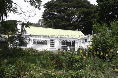
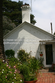
Photograph - Digital Photograph, Alan King, Garden Hill, Eltham-Yarra Glen Road, Kangaroo Ground, 3 February 2008
... The original house was built around 1850 was one of Kangaroo Ground's earliest homes, part of which remains today. Built by Scottish farmer Andrew Harkness who acquired the property in 1849 at the top of the hill with magnificent panoramic views as far as Kinglake, the same year he married Sarah Oswin. ...Eltham District Historical Society Inc 728 Main Rd Eltham melbourne The original house was built around 1850 was one of Kangaroo Ground's earliest homes, part of which remains today. Built by Scottish farmer Andrew Harkness who acquired the property in 1849 at the top of the hill with magnificent panoramic views as far as Kinglake, the same year he married Sarah Oswin. ...The original house was built around 1850 was one of Kangaroo Ground's earliest homes, part of which remains today. Built by Scottish farmer Andrew Harkness who acquired the property in 1849 at the top of the hill with magnificent panoramic views as far as Kinglake, the same year he married Sarah Oswin. The property was known as Garden Hill from at least 1865. Andrew and Sarah had four sons and five daughters. Harkness was a founder of the Kangaroo Ground School and one of the first to suggest establishing the Eltham District Road Board (1858-71) of which he was a member, the pre-cursor to the Shire of Eltham (1871-1994). He was also a Trustee of the Kangaroo Ground Cemetery. His daughter Fanny married farmer Alexander White who purchased the property in 1893. Alexander White died in 1906 and ownership transferred to Fanny White. Son, Robert White was a Councillor of the Shire of Eltham at the time the Shire acquired two acres of land on the adjacent property from the Mess brothers for the creation of the Shire of Eltham Memorial Park (1921) in which the Shire of Eltham War Memoirial tower was erected (1926). Fanny White donated a small section of land from the Garden Hill property to facilitate entry access to the park. The White family sold the property to Sir Herbert Gepp in 1925. Covered under Heritage Overlay, Nillumbik Planning Scheme. Published: Nillumbik Now and Then / Marguerite Marshall 2008; photographs Alan King with Marguerite Marshall.; p29 Garden Hill, on Yarra Glen Road, Kangaroo Ground, near the War Memorial is well named. The old house and gardens overlook a magnificent panorama extending to Kinglake. The original house, built around 1850, was one of Kangaroo Ground’s earliest, and part of it remains in today’s timber house. The house was built by the early and prominent settler Andrew Harkness. Later it was occupied for a long time by Sir Herbert Gepp, renowned Australia wide.1 Harkness and Gepp are buried in the Kangaroo Ground Cemetery. Scottish farmer Harkness, who was born in 1817, acquired this property in 18492 and he and his family occupied it until the early 1920s. Harkness cleared its 152 acres (61.4 ha), fenced it and grazed sheep and cattle. Harkness proved a valuable community member. When only ten families lived in the district, he and other settlers set up a school in 1852, with Andrew Ross as the first teacher. Harkness was also one of the first to suggest establishing the Eltham District Road Board, of which he was a member for around 15 years. He was also a trustee of the Kangaroo Ground Cemetery. Harkness married in 1854 and had four sons and five daughters. The first part of the timber house he built included a kitchen-living room and a parlor. The living room’s large fireplace was bricked-in and modernised in 1940. Beside it is the old baker’s oven with its original iron door replaced by a wooden one. It is thought two wattle-and-daub huts, used for a bedroom and bathroom, were built to the west. Harkness’ son-in-law, farmer Alexander White, who had seven sons, bought the property in 1893. Harkness’ grand-daughter Flora married Ewen Cameron who became Minister for Health and was later knighted; he was not related to Ewen Hugh Cameron, a Member of the Legislative Assembly. In 1923 the White family sold the property, called Kilby Park, to Sir Herbert Gepp, who renamed it Garden Hill. Gepp used the property, which was still on the original New South Wales title, as a hobby farm. Robert White stayed on to manage the farm for a while, living in a house on the property. Gepp was born in 1877 and at 16 years began working as a junior chemist with the Australian Explosives and Chemical Company at Deer Park near Melbourne. Gepp was a pioneer in applying enlightened labour policies in industry. He initiated the Broken Hill Progress Association, to improve living conditions. It laid the ground work for the welfare schemes pursued by companies after World War One. During the mid 20th century Gepp was the most prominent liberal thinker associated with conservative politics. As a friend of Prime Minister John Curtin, he contributed to post-war reconstruction. Gepp returned to private industry and retired in 1950. Gepp made significant contributions to the solution of the great metallurgical problems of the mining industry. He was an advocate of the role of science in industry, government and the economy and helped to establish several organizations including the CSIR and the Institute of Public Affairs.3 After Sir Herbert died in 1954 his son Orwell continued to farm the property part-time. When Lady Gepp died in 1963, the land was divided among the five children, although Orwell continued to farm it as a hobby. In 1966, a daughter, Mardi Gething, now married, settled in the house. Another daughter, Kathleen, built her house close by on the property. After the Board of Works designated the property as part of a reserve for a possible reservoir, the family sold all, except the minimum 20 acres allowed, to the Board in the 1970s. Orwell then leased what was the family property from the Board to continue grazing. The two sisters and brother continued to live on the property.This collection of almost 130 photos about places and people within the Shire of Nillumbik, an urban and rural municipality in Melbourne's north, contributes to an understanding of the history of the Shire. Published in 2008 immediately prior to the Black Saturday bushfires of February 7, 2009, it documents sites that were impacted, and in some cases destroyed by the fires. It includes photographs taken especially for the publication, creating a unique time capsule representing the Shire in the early 21st century. It remains the most recent comprehenesive publication devoted to the Shire's history connecting local residents to the past. nillumbik now and then (marshall-king) collection, kangaroo ground -
 Eltham District Historical Society Inc
Journal, Peter Doughtery, ArtStreams: Arts & Culture in Banyule, Darebin, Manningham, Nillumbik and Whittlesea; Vol. 5, No. 1, Mar-Apr 2000, 2000
... ." - Eltham District Historical Society Newsletter No. 161, March 2005 art streams carly young plenty views golf park dynamic vegies dandenong ranges folk festival felicity gordon sounds of global harmony banyule festival Rosanna Fire Station Community House bulleen art & garden centre were street cafe Were Street hill climb bahnhof cafe Walkers Wheels Peter Glass Eltham Wiregrass Gallery Boroondara Writers Festival Warrandyte Festival Diamond Creek Town Fair Templestowe Village Festival Willy Wonkas ice cream, gourmet food Ciaro to Cracow Fleur de Feliss Florist Mia Mia Gallery festival of kites bi-wize quality paints Kinglake Gallery Andy Cowan Wild Dog Hill Studio montsalvalt Ian Collard geoff achison Bridget Allen Thompsons Pharmacy Volumes Colour front and back cover with feature articles and literary pieces with photographs and advertisements printed in black and white. 36 pages, 30 cm. ...Vol. 5, No. 1, Mar-Apr 2000 CONTENTS ON THE ROAD The Car at Heide 3 ON TOP OF THE WORLD Dandenong Ranges Folk Festival 5 INTERVIEW Felicity Gordon 7 SOUNDS OF HARMONY Gyuto Monks in Eltham 10 BANYULE FESTIVAL 13 WERE ST HILL CLIMB 15 BOROONDARA WRITERS' FESTIVAL 16 WARRANDYTE VILLAGE FESTIVAL 18 DIAMOND CREEK TOWN FAIR 19 TEMPLESTOWE VILLAGE FESTIVAL 20 RECIPES From leading Chefs 21 CAIRO TO CRACOW Middle Eastern Music at Montsalvat 22 POETRY 23 FESTIVAL OF KITES 24 BOOK REVIEW By Michele Lonsdale 25 CD REVIEWS 27 ARTIN ABOUT 28 WINING & DINING 30 ARTISTS SERVICES 32 "Peter Dougherty has been involved in the local art scene for many years. As publisher and editor of the arts magazine Artstreams, his comments on the various branches of the arts are widely respected. His "The Arts" column in the Diamond Valley Leader presents a brief summary for a much wider cross section of the local community. Peter also operates his own gallery and the Artstreams Cafe at the St Andrews market. Peter has a wealth of knowledge about present day and historical aspects of local art and artists." - Eltham District Historical Society Newsletter No. 161, March 2005Colour front and back cover with feature articles and literary pieces with photographs and advertisements printed in black and white. 36 pages, 30 cm. Vol. 1, no. 1 (Nov. 1996) - Vol. 10, no. 5 (summer ed. 2005/06) art streams, carly young, plenty views golf park, dynamic vegies, dandenong ranges folk festival, felicity gordon, sounds of global harmony, banyule festival, rosanna fire station community house, bulleen art & garden centre, were street cafe, were street hill climb, bahnhof cafe, walkers wheels, peter glass, eltham wiregrass gallery, boroondara writers festival, warrandyte festival, diamond creek town fair, templestowe village festival, willy wonkas ice cream, gourmet food, ciaro to cracow, fleur de feliss florist, mia mia gallery, festival of kites, bi-wize quality paints, kinglake gallery, andy cowan, wild dog hill studio, montsalvalt, ian collard, geoff achison, bridget allen, thompsons pharmacy, volumes -
 Eltham District Historical Society Inc
Colour Print, David Taylor, Falkiner's Cottage, Ely Street, Eltham, c.1976
... viewed. By 1981 the estate was well established with all houses built. Falkiner Cottage, also known as Maynard's Cottage. Falkiner was the original owner and Maynard the last owner. The cottage was located on the north side of Ely Street where present day #19 is situated. The cottage ran in a north-south orientation with an easterly aspect down the hill...viewed. By 1981 the estate was well established with all houses built. Falkiner Cottage, also known as Maynard's Cottage. Falkiner was the original owner and Maynard the last owner. The cottage was located on the north side of Ely Street where present day #19 is situated. The cottage ran in a north-south orientation with an easterly aspect down the hill ...Viewed from the western boundary at the rear of Eltham High School looking southwest across part of what would be become the Cronus Court housing development. Aerial photos for 1976 reflect the undeveloped landscape as viewed. By 1981 the estate was well established with all houses built. Falkiner Cottage, also known as Maynard's Cottage. Falkiner was the original owner and Maynard the last owner. The cottage was located on the north side of Ely Street where present day #19 is situated. The cottage ran in a north-south orientation with an easterly aspect down the hill.david taylor collection, eltham, eltham high school, cronus court, ely street, falkiner cottage -
 Eltham District Historical Society Inc
Document - Folder, Squire family
... House Greensborough...Avery sisters...Diamond Valley Community Hospital...Briar Hill Hardware...25-31 Sherbourne Road Briar Hill...Eltham Cottage Hospital...Eltham Methodist Hall...Dr Edward Cordner...Dr Bradbury...Dr Sinclair...Albert Charles Henry Price...Andrew Griffith...Irvine Hewitt...Honorary Justices Association...Eltham Court...William Brinkotter...Were Street Montmorency...Sherbourne Road...Eltham Police Station...Eltham District Play Centre Montmorency branch...Montmorency park...Lower Plenty park...Fitzsimmons Lane bridge...Kangaroo Ground...Max McMahon...Martin McMahon...Clive Tingate...Eltham Clay Bird Shooting Club...Greensborough Masonic Lodge...Mountain View...Frederick Vincent Squire Hazel Squire Lorraine Squire Briar Hill Primary School Eltham Shire Councill Sir Dallas Brooks Eltham Country Womens Association Dean Lacey Eltham Community Festival Edward Hughes Hazel Rose Squire nee Hughes Deirdre Squire James Squire Genista House Greensborough Avery sisters Diamond Valley Community Hospital Briar Hill Hardware 25-31 Sherbourne Road Briar Hill Eltham Cottage Hospital Eltham Methodist Hall Dr Edward Cordner Dr Bradbury Dr Sinclair Albert Charles Henry Price Andrew Griffith Irvine Hewitt Honorary Justices Association Eltham Court William Brinkotter Were Street Montmorency Sherbourne Road Eltham Police Station Eltham District Play Centre Montmorency branch Montmorency park Lower Plenty park Fitzsimmons Lane bridge Kangaroo Ground Max McMahon Martin McMahon Clive Tingate Eltham Clay Bird Shooting Club Greensborough Masonic Lodge Mountain View Road Briar Hill Briar Hill Hall H R Squire Family Reserve Hazel Rose Court Montmorency Briar Hill Swimming Pool Centre Briar Hill Timber and Hardware Stan Nedwell Montmorency Football Club Sylvia Davey Briar Hill Girl Guide Group Montmorency Girl Guides Eltham Pony Club Rederick Nedwell Robert Manuell Sutherland Homes Committee Red Cross Eltham Rurl Group Lower Plenty Neighbourhood House Eltham/Diamond Valley Citizens AdviceBureau Cape Otway ratio-operated lighthouse Heidelberg Town Hall Ouyen High School J B Were St Helena Briar Hill Timber and Trading Pty Ltd St Margaret's Church Eltham D V Darwin A W Brinkkotter D C O'Beirne Newspaper clippings, A4 photocopies, etc Squire family Document Folder ...Frederick Vincent Squire established a building business in Briar Hill, later becoming an Eltham Shire Councillor and responsible for many local advances; he was later Shire President. He and wife Hazel with involved with numerous community activities. Their children continued local involvement. Contents Letter Shire Secretary to F V Squite, 2 October 1981. Items of Council business of interest to F V Squire. Letter F V Squire to Shire Seretary, 3 October 1963. Accepting and declining social invitation. Newspaper article: "Wife of former councillor dies", Diamond Valley News, 7 October 1986. Death of Hazel Squire. Another article: "Young Eltham man recovering after horse-riding accident". Diamond Valley News, 7 October 1986. Dean Lacey seriously injured in horse riding accident. Another article: "Everyone loves a community parade.". Diamond Valley News, 7 October 1986. Eltham Community festival will be held again. Typed notes, no author:"Squire Family History", 18 December 1989. Newspaper article: "Briar Hill building recalls early days", Diamond Valley News, 12 November 1991. Biography of Fred Squite. Handwritten note, 30 January 1998: Names and telephone numbers.Newspaper clippings, A4 photocopies, etcfrederick vincent squire, hazel squire, lorraine squire, briar hill primary school, eltham shire councill, sir dallas brooks, eltham country womens association, dean lacey, eltham community festival, edward hughes, hazel rose squire nee hughes, deirdre squire, james squire, genista house greensborough, avery sisters, diamond valley community hospital, briar hill hardware, 25-31 sherbourne road briar hill, eltham cottage hospital, eltham methodist hall, dr edward cordner, dr bradbury, dr sinclair, albert charles henry price, andrew griffith, irvine hewitt, honorary justices association, eltham court, william brinkotter, were street montmorency, sherbourne road, eltham police station, eltham district play centre montmorency branch, montmorency park, lower plenty park, fitzsimmons lane bridge, kangaroo ground, max mcmahon, martin mcmahon, clive tingate, eltham clay bird shooting club, greensborough masonic lodge, mountain view road briar hill, briar hill hall, h r squire family reserve, hazel rose court montmorency, briar hill swimming pool centre, briar hill timber and hardware, stan nedwell, montmorency football club, sylvia davey, briar hill girl guide group, montmorency girl guides, eltham pony club, rederick nedwell, robert manuell, sutherland homes committee, red cross, eltham rurl group, lower plenty neighbourhood house, eltham/diamond valley citizens advicebureau, cape otway ratio-operated lighthouse, heidelberg town hall, ouyen high school, j b were, st helena, briar hill timber and trading pty ltd, st margaret's church eltham, d v darwin, a w brinkkotter, d c o'beirne -
 Eltham District Historical Society Inc
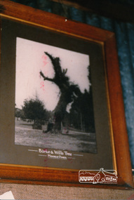
Photograph, Peter Bassett-Smith, Display of Society collection at 'Ness' House, 1987, 1987
... Eltham District Historical Society Inc 728 Main Rd Eltham melbourne r.b ness historical displays burke and wills view hill Colour photograph of a photograph of Burke and Wills tree, part of display at Ness house Kangaroo Ground 1987 Display of Society collection at 'Ness' House, 1987 Photograph Peter Bassett-Smith ...Colour photograph of a photograph of Burke and Wills tree, part of display at Ness house Kangaroo Ground 1987r.b ness, historical displays, burke and wills, view hill -
 Eltham District Historical Society Inc
Photograph - Digital Photograph, Alan King, Garden Hill, Eltham-Yarra Glen Road, Kangaroo Ground, 3 February 2008
... The original house was built around 1850 was one of Kangaroo Ground's earliest homes, part of which remains today. Built by Scottish farmer Andrew Harkness who acquired the property in 1849 at the top of the hill with magnificent panoramic views as far as Kinglake, the same year he married Sarah Oswin. ...Eltham District Historical Society Inc 728 Main Rd Eltham melbourne The original house was built around 1850 was one of Kangaroo Ground's earliest homes, part of which remains today. Built by Scottish farmer Andrew Harkness who acquired the property in 1849 at the top of the hill with magnificent panoramic views as far as Kinglake, the same year he married Sarah Oswin. ...The original house was built around 1850 was one of Kangaroo Ground's earliest homes, part of which remains today. Built by Scottish farmer Andrew Harkness who acquired the property in 1849 at the top of the hill with magnificent panoramic views as far as Kinglake, the same year he married Sarah Oswin. The property was known as Garden Hill from at least 1865. Andrew and Sarah had four sons and five daughters. Harkness was a founder of the Kangaroo Ground School and one of the first to suggest establishing the Eltham District Road Board (1858-71) of which he was a member, the pre-cursor to the Shire of Eltham (1871-1994). He was also a Trustee of the Kangaroo Ground Cemetery. His daughter Fanny married farmer Alexander White who purchased the property in 1893. Alexander White died in 1906 and ownership transferred to Fanny White. Son, Robert White was a Councillor of the Shire of Eltham at the time the Shire acquired two acres of land on the adjacent property from the Mess brothers for the creation of the Shire of Eltham Memorial Park (1921) in which the Shire of Eltham War Memoirial tower was erected (1926). Fanny White donated a small section of land from the Garden Hill property to facilitate entry access to the park. The White family sold the property to Sir Herbert Gepp in 1925. Covered under Heritage Overlay, Nillumbik Planning Scheme. Published: Nillumbik Now and Then / Marguerite Marshall 2008; photographs Alan King with Marguerite Marshall.; p29This collection of almost 130 photos about places and people within the Shire of Nillumbik, an urban and rural municipality in Melbourne's north, contributes to an understanding of the history of the Shire. Published in 2008 immediately prior to the Black Saturday bushfires of February 7, 2009, it documents sites that were impacted, and in some cases destroyed by the fires. It includes photographs taken especially for the publication, creating a unique time capsule representing the Shire in the early 21st century. It remains the most recent comprehenesive publication devoted to the Shire's history connecting local residents to the past. nillumbik now and then (marshall-king) collection, kangaroo ground -
 Eltham District Historical Society Inc
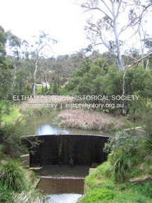
Photograph - Digital Photograph, Marguerite Marshall, Smith Dam, Karingal Drive, Eltham, 19 September 2006
... Upon completion of the dam a pump-house was constructed beside the creek but before the water could be pumped up the hill they had to dig a trench and lay 500m of 100mm water main to an elevated holding tank. The Smiths made the pump-house their home for several years until they constructed their home at the top of the hill overlooking Eltham and views extending to Kinglake. ...Upon completion of the dam a pump-house was constructed beside the creek but before the water could be pumped up the hill they had to dig a trench and lay 500m of 100mm water main to an elevated holding tank. The Smiths made the pump-house their home for several years until they constructed their home at the top of the hill overlooking Eltham and views extending to Kinglake. ...The dam at the entrance to the Nerreman Gateway in Eltham was built according to an internationally acclaimed theory developed by the builder's father. In 1920, Victorian engineer B.A. Smith was awarded the American Society of Civil Engineers J. James R. Cross Gold Medal for his Technical Paper titled 'Arched Dams'. It was the first time this medal had been awarded outside the United States. The concrete arched dam across the Eltham West Drain was built in 1940 by B.A. Smith's son and engineer, D. B. (Bernie) Smith to water the 24 acre (9.75 ha) hobby farm owned by himself and new wife, Isa Smith. Upon completion of the dam a pump-house was constructed beside the creek but before the water could be pumped up the hill they had to dig a trench and lay 500m of 100mm water main to an elevated holding tank. The Smiths made the pump-house their home for several years until they constructed their home at the top of the hill overlooking Eltham and views extending to Kinglake. Following Bernie's death in 1983, Nerreman Park was subdivided between 1993 and 1995. Gordon Ford designed the landscaping and the pump-house was demolished. Covered under Heritage Overlay, Nillumbik Planning Scheme. Published: Nillumbik Now and Then / Marguerite Marshall 2008; photographs Alan King with Marguerite Marshall.; p137 The dam at the entrance to the Nerreman Gateway in Eltham, was built according to an internationally acclaimed theory developed by the builder’s father. In 1920, Victorian engineer B A Smith was awarded the American Society of Civil Engineers J. James R. Croes Gold Medal, for his Technical Paper titled Arched Dams. It was the first time this medal had been awarded outside America. An international example of the application of Smith’s work can be found in the design of the Hoover Dam on the Colorado River, Nevada, USA. Built between 1930 and 1936, it is recognised by the ASCE as one of ‘America’s Seven Modern Civil Engineering Wonders’.1 The concrete arched dam across the Eltham West Drain was built by B A Smith’s son and engineer, D B (Bernie) Smith. Bernie’s dam followed his father’s theory, having a curvature that takes maximum advantage of concrete’s great strength in compression. The water load is carried into the abutments because of this curvature, which permits a wall thickness of only 225 millimetres thick at its crest, despite the dam’s capacity of more than 4.5 megalitres. The Eltham dam was designed to water the 24 acre (9.75 ha) hobby farm belonging to newly married couple Bernie and Isa Smith. Bernie, from Armadale, and Isa, from a farm at Tyntynder near Swan Hill, were attracted to the hilly topography and the creek running through the property. It extended from Ryans Road, Eltham, to Karingal Drive, Montmorency and was adjacent to Meruka Park. The Smiths named it Nerreman Park using the Aboriginal word Nerreman meaning ‘River Bend’ as their creek had a pronounced bend.2 In 1940 the first thing Bernie did was to build a dam, and with Isa’s help, a pump-house, to secure a water supply for their cattle, pigs, chickens, orchard and vegetable gardens. It was also available for the fire-plugs, which they placed all over the property in case of bushfire. The couple built the pump-house beside the creek and installed a Tange three-plunger pump, which had originally supplied the City of Wodonga with water. But before the Smiths could pump water up the hill from the dam they had to dig a trench and lay about 550 yards (500m) of a four-inch (100mm) water main up to an elevated holding tank. The trench was dug with a single furrow plough drawn by an old draught horse. Living in rough conditions did not deter the Smiths, who made the pump-house their home, where they still lived when their first child was born in 1944. They later built their home at the top of their property overlooking Eltham, with magnificent views to Kinglake, the Dandenong Ranges and Melbourne. From 1946 it took them almost 20 years to complete the 36-square house with its 12-foot (3.6m) high ceilings. Material for the concrete roof and walls faced with sandstone, was ripped out of the ground on their property by plough pulled by tandem Clydesdale horses. Isa was a strong woman – two days before their second child was born – she set three huge sandstone boulders in place in the bottom wall of the garage. She also mixed all the cement for the house. A collapsed kitchen wall did not discourage her from rebuilding it in a week, while her husband was away working in the country. She later recalled: ‘We stood back to admire this beautiful wall we’d built and while we were looking at it, it came tumbling down’.3 Following Bernie’s death in 1983, Nerreman Park was subdivided, between 1993 and 1995. Local Gordon Ford designed the landscaping and the pump-house was pulled down. But the dam remains as a reminder of exceptional engineering4 – and of a remarkable couple.This collection of almost 130 photos about places and people within the Shire of Nillumbik, an urban and rural municipality in Melbourne's north, contributes to an understanding of the history of the Shire. Published in 2008 immediately prior to the Black Saturday bushfires of February 7, 2009, it documents sites that were impacted, and in some cases destroyed by the fires. It includes photographs taken especially for the publication, creating a unique time capsule representing the Shire in the early 21st century. It remains the most recent comprehenesive publication devoted to the Shire's history connecting local residents to the past. nillumbik now and then (marshall-king) collection, eltham, karingal drive, smiths dam, bernie smith, gordon ford, isa smith, nerreman gateway, nerreman park estate, dams -
 Glen Eira Historical Society
Album - Album page, Nithsdale now Five Way Hill, Kambrook Road, Circa 1972
... Page 102 of Photograph Album with four photographs (three landscape and one portrait) of Nithsdale, now known as Five Way Hill. Three views of the tower and one of the house....Names used besides Nithsdale have been Bundoora and Five Way Hill. trevor hart north caulfield victorian mid victorian late victorian tower j.s. crouchin 1850's 1880's italianate rendered five way hill nithsdale slate roof plaster arches ornamental columns triangular pediment ornamental parapet cast iron balconies kambrook road glen eira road t crouch j s crouchin mansions j s chambers bluestone foundations land subdivision adolph f brockhoff bundoora house names Handwritten: "Nithsdale" now "Five Way Hill" Kambrook road [top right] / CNR KAMBROOK AND GLENEIRA ROADS [under bottom right photo] / 102 [bottom right] Page 102 of Photograph Album with four photographs (three landscape and one portrait) of Nithsdale, now known as Five Way Hill. Three views ...This photograph is part of the Caulfield Historical Album 1972. This album was created in approximately 1972 as part of a project by the Caulfield Historical Society to assist in identifying buildings worthy of preservation. The album is related to a Survey the Caulfield Historical Society developed in collaboration with the National Trust of Australia (Victoria) and Caulfield City Council to identify historic buildings within the City of Caulfield that warranted the protection of a National Trust Classification. Principal photographer thought to be Trevor Hart, member of Caulfield Historical Society. Most photographs were taken between 1966-1972 with a small number of photographs being older and from unknown sources. All photographs are black and white except where stated, with 386 photographs over 198 pages. Glen Eira Heritage Management Plan (1996) by Andrew Ward and Associates - Vol 3 "Nithsdale", built for J.S. Crouchin 1858 and extended in 1885 with a tower and associated rooms, survives as testimony to the nineteenth century occupation of the vicinity of the Kambrook/Glen Eira Road intersection. Caulfield's Building Heritage by Dr Geulah Solomon, Vol 1 p49 records it as a small Victorian mansion home on bluestone foundations of Italianate style with a tower. Built for J S Chambers circa 1860, it was built in stages and then the land subdivided in the 1920s. Other owners include Adolph F Brockhoff (of Brockhoff Biscuits company). Names used besides Nithsdale have been Bundoora and Five Way Hill. Page 102 of Photograph Album with four photographs (three landscape and one portrait) of Nithsdale, now known as Five Way Hill. Three views of the tower and one of the house.Handwritten: "Nithsdale" now "Five Way Hill" Kambrook road [top right] / CNR KAMBROOK AND GLENEIRA ROADS [under bottom right photo] / 102 [bottom right]trevor hart, north caulfield, victorian, mid victorian, late victorian, tower, j.s. crouchin, 1850's, 1880's, italianate, rendered, five way hill, nithsdale, slate roof, plaster arches, ornamental columns, triangular pediment, ornamental parapet, cast iron balconies, kambrook road, glen eira road, t crouch, j s crouchin, mansions, j s chambers, bluestone foundations, land subdivision, adolph f brockhoff, bundoora, house names -
 Bendigo Historical Society Inc.
Photograph - HOUSE IN LANDSCAPE VIEW, 1960's ?
... House is small cottage, set in front of pine forest rising on hill to rear. Large eucalypts on right with road just evident on extreme right of photo. Photograph HOUSE IN LANDSCAPE VIEW ...Hand tinted photo: photo of house in rural setting with autumn toned trees. Photo appears to have been taken at Daylesford or Hepburn Springs. House is small cottage, set in front of pine forest rising on hill to rear. Large eucalypts on right with road just evident on extreme right of photo.F. T. Kennedyplace, building, rural cottage -
 Bendigo Historical Society Inc.
Photograph - VIEW OF LAUNCESTON FROM CATARACT GORGE, c.early 1900's
... Sepia photo on grey mount of elevated view of river with single span bridge, with boats moored. Swimming baths in centre to right. Town with church spires and houses and hills in background. ...History House 11 Mackenzie Street Bendigo goldfields PLACE Landscape view launceston tasmania W Vincent Kelly, Mitchell St., Bendigo Sepia photo on grey mount of elevated view of river with single span bridge, with boats moored. Swimming baths in centre to right. Town with church spires and houses and hills ...Sepia photo on grey mount of elevated view of river with single span bridge, with boats moored. Swimming baths in centre to right. Town with church spires and houses and hills in background. Inscriptions 'Christmas Greetings' gold ink underneath photo. On back - written in pencil 'City of Launceston, Tasmania from Cataract Gorge'.W Vincent Kelly, Mitchell St., Bendigoplace, landscape view, launceston, tasmania -
 Bendigo Historical Society Inc.
Photograph - NEW CHUM LINE OF REEF, FROM OLD CHUM HILL
... History House 11 Mackenzie Street Bendigo goldfields PLACE Landscape view new chum line of reef Black and white photo (copy?) of view of Old Chum Line of Reef from Old Chum Hill. ...Black and white photo (copy?) of view of Old Chum Line of Reef from Old Chum Hill. Lansell's '222 Mine' tallest poppet legs on the Bendigo Field. Golden Square in the distance. Corner of 'grounds at right (Geo. Lansell's mansion)place, landscape view, new chum line of reef -
Bendigo Historical Society Inc.
Photograph - STEREOSCOPE SANDHURST, c. 1860s
... History House 11 Mackenzie Street Bendigo goldfields PLACE Landscape view sandhurst Sepia stereoscope photographs of Sandhurst, looking West from where Gravel Hill School now stands. ...Sepia stereoscope photographs of Sandhurst, looking West from where Gravel Hill School now stands. History of photograph: Printed on reverse 'Royal Historical Society of Victoria, Bendigo Branch' purple circular stamp. In blue pen in centre of stamp '1959' and '36'.place, landscape view, sandhurst -
 Bendigo Historical Society Inc.
Postcard - CHARING CROSS, VALENTINE POSTCARD,1910
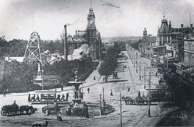
... History House 11 Mackenzie Street Bendigo goldfields PLACE Bendigo view over alexandra fountain B+W photo of Charing cross from a 'Valentine' postcard photograph c1910 (details J. Lerk) streetscape from elevated position looking from Charing Cross down Pall Mall towards White Hills. ...B+W photo of Charing cross from a 'Valentine' postcard photograph c1910 (details J. Lerk) streetscape from elevated position looking from Charing Cross down Pall Mall towards White Hills. Depicts: Alexandra fountain; electric tram; horse drawn wagon, dray, vehicles; Hustlers Royal reserve No2 mine, poppet heads, chimney; post office; tram power poles; buildings fronting Pall Mall; Pedestrians; trees; Queen Victoria statue; Colonial bank. Inscription: Lower right '53464 JV'.place, bendigo, view over alexandra fountain -
 Bendigo Historical Society Inc.
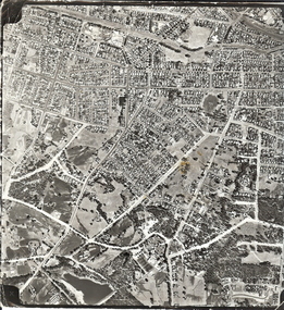
Photograph - AERIAL SURVEY BENDIGO BASE MAP - RUN 12
... History House 11 Mackenzie Street Bendigo goldfields PLACE Aerial view of bendigo Black and white photograph which is an aerial survey Bendigo base map - run 12. Inscriptions: Vic 1583. State Aerial Survey Bendigo Base Map Project - Run 12. 16/3/1967, 5600ASL on front. The photograph shows areas of Kennington and Flora Hill ...Black and white photograph which is an aerial survey Bendigo base map - run 12. Inscriptions: Vic 1583. State Aerial Survey Bendigo Base Map Project - Run 12. 16/3/1967, 5600ASL on front. The photograph shows areas of Kennington and Flora Hill. Title of map to be held at right hand side. Streets identifiable from 'Five Ways' intersection.place, aerial view of bendigo -
 Bendigo Historical Society Inc.
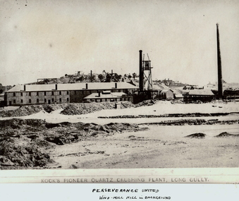
Photograph - KOCK'S PIONEER QUARTZ CRUSHING PLANT
... History House 11 Mackenzie Street Bendigo goldfields MINING Crushing & milling kock's pioneer quartz crushing plant Bendigo mines and mining mines mine mining crushing plant landscape mining landscape quartz perserverance united windmill Black and white photograph. View of large mining plant and associated chimneys. Open (waste) area in foreground. Low hill ...Black and white photograph. View of large mining plant and associated chimneys. Open (waste) area in foreground. Low hill in background. Inscriptions: on front 'Kock's Pioneer Quartz Crushing Plant, Long Gully', Perserverance United Windmill Hill in background'. On back - 'A Richardson, 29 Harrison St, Bendigo'.mining, crushing & milling, kock's pioneer quartz crushing plant, bendigo, mines and mining, mines, mine, mining, crushing plant, landscape, mining landscape, quartz, perserverance united windmill -
 Bendigo Historical Society Inc.
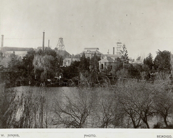
Photograph - FORTUNA COLLECTION: VIEW OF FORTUNA
... History House 11 Mackenzie Street Bendigo goldfields BUILDINGS Residential fortuna villa Bendigo mines and mining mine mines mining poppet head Old Chum mine landscape mining landscape Black and white photograph of Fortuna with lake in foreground. Poppet head and chimneys in background. Inscriptions: on front - 'W Ninnis' Photo Bendigo. Inscription on back: 'Old Chum Mine - New Chum Hill. Taken from rear, Lansell's Fortuna lake.' A. Richardson, 29 Harrison St., Bendigo. Photograph FORTUNA COLLECTION: VIEW ...Black and white photograph of Fortuna with lake in foreground. Poppet head and chimneys in background. Inscriptions: on front - 'W Ninnis' Photo Bendigo. Inscription on back: 'Old Chum Mine - New Chum Hill. Taken from rear, Lansell's Fortuna lake.' A. Richardson, 29 Harrison St., Bendigo.buildings, residential, fortuna villa, bendigo, mines and mining, mine, mines, mining, poppet head, old chum mine, landscape, mining landscape -
 Bendigo Historical Society Inc.
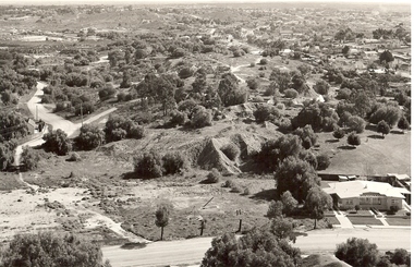
Photograph - VIEW OF MINING AREA - VICTORIA HILL
... View overlooking north from Victoria Hill, mullock heaps, houses - some mid to late 20th century and some miner's cottages, formed road, children's playground centre foreground. ...History House 11 Mackenzie Street Bendigo goldfields PLACE Mining site victoria hill Bendigo mines and mining landscape mining landscape mullock heaps Robert Wallace Black and white photograph. View ...Black and white photograph. View overlooking north from Victoria Hill, mullock heaps, houses - some mid to late 20th century and some miner's cottages, formed road, children's playground centre foreground. Inscriptions: on back - purple rubber stamp 'Robert Wallace Studios, 6 Ruth Street, Golden Square, Phone Bgo 37565.Robert Wallaceplace, mining site, victoria hill, bendigo, mines and mining, landscape, mining landscape, mullock heaps -
 Bendigo Historical Society Inc.
Photograph - BENDIGO POST OFFICE, c1920
... History House 11 Mackenzie Street Bendigo goldfields BUILDINGS Government bendigo post office W Vincent Kelly Black and white Photograph: Former Bendigo Post Office currently the Bendigo Visitor Information Centre. View of entrant into Rosalind Park from Williamson Street. Camp Hill ...Black and white Photograph: Former Bendigo Post Office currently the Bendigo Visitor Information Centre. View of entrant into Rosalind Park from Williamson Street. Camp Hill Primary School also visable in background. Prior to Public toilets being built in Williamson St and prior to the urns being removed from the Post Office. Physical description: Cardboard mounted. Inscriptions: 'W Vincent kelly, Bendigo' photographic studio.W Vincent Kellybuildings, government, bendigo post office -
 Bendigo Historical Society Inc.
Photograph - NEW CHUM GULLY C 1875, C 1875
... History House 11 Mackenzie Street Bendigo goldfields PLACE Landscape view new chum gully Bendigo cityscape Sandhurst panorama mining town Caire Back and white photograph: panorama showing timber and brick residences, hotel, church ? Mines with poppet heads and chimneys in background. An image on building at centre ' Cleary's Honeysuckle Hotel' Ken Arnold captions this image ' New Chum Gully from Specimen Hill ...Back and white photograph: panorama showing timber and brick residences, hotel, church ? Mines with poppet heads and chimneys in background. An image on building at centre ' Cleary's Honeysuckle Hotel' Ken Arnold captions this image ' New Chum Gully from Specimen Hill C 1875, photographer Caire 'Caireplace, landscape view, new chum gully, bendigo, cityscape, sandhurst, panorama, mining town