Showing 639 items matching " west creek"
-
 Ringwood and District Historical Society
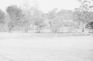
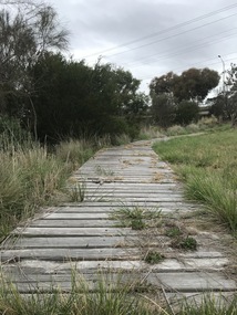
Photograph, Old baths site looking north west over creek to Ringwood Street, Late 1980
... Old baths site looking north west over creek to Ringwood Street, Late 1980...Old baths site looking north west over creek to Ringwood Street."...Old baths site looking north west over creek to Ringwood Street." Old baths site looking north west over creek to Ringwood Street, Late 1980 Photograph ...Written on back of photograph, "Late '80. Old baths site looking north west over creek to Ringwood Street." -
 Ringwood and District Historical Society
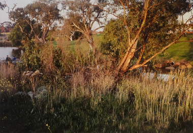
Photograph, Mullum Creek west of Ringwood Street, Ringwood 1974
... Mullum Creek west of Ringwood Street, Ringwood 1974...Written on back of photograph, "Mullum Creek west of Ringwood Street, August, 1974"....Mullum Creek west of Ringwood Street, Ringwood 1974 Photograph ...Written on back of photograph, "Mullum Creek west of Ringwood Street, August, 1974". -
 Ringwood and District Historical Society
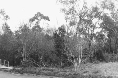
Photograph, Mullum Mullum Creek. West side of Warrandyte Road Bridge. Ringwood 1986
... Mullum Mullum Creek. West side of Warrandyte Road Bridge. Ringwood 1986...Mullum Mullum Creek. West side of Warrandyte Road Bridge."...Ringwood. Mullum Mullum Creek. West side of Warrandyte Road Bridge." Mullum Mullum Creek. ...Written on back of photograph, "3.8.86. Ringwood. Mullum Mullum Creek. West side of Warrandyte Road Bridge." -
 Brimbank City Council Art Collection
Photograph, Robert Pointon, West Bank of Kororoit Creek, 1988
... West Bank of Kororoit Creek...West Bank of Kororoit Creek - AR0033...Brimbank City Council Art Collection The Hunt Club Community Arts Centre 775 Ballarat Road Deer Park melbourne Local Scene West Bank of Kororoit Creek - AR0033 West Bank of Kororoit Creek Photograph Robert Pointon ...Local SceneWest Bank of Kororoit Creek - AR0033 -
 Eltham District Historical Society Inc
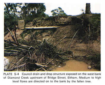
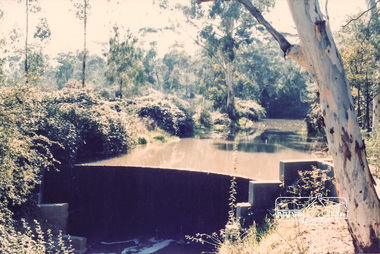
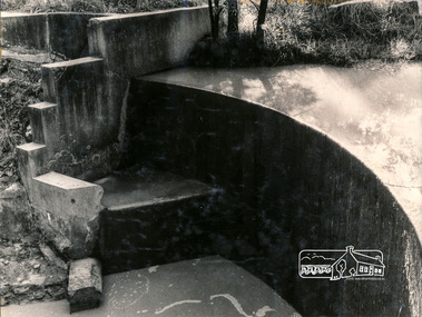
Work on paper (Sub-Item) - Photograph, Council drain and drop structure exposed on the west bank of Diamond Creek upstream of Bridge Street, Eltham
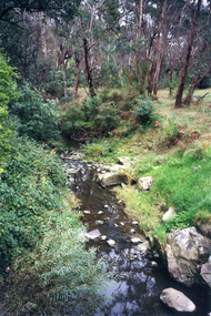
... Council drain and drop structure exposed on the west bank of Diamond Creek upstream of Bridge Street, Eltham...Colour photograph of a muddy creek (probably after a downpour) showing council drain and drop structure exposed on the west bank of Diamond Creek upstream of Bridge Street, Eltham. ...Eltham District Historical Society Inc 728 Main Rd Eltham melbourne Colour photograph of a muddy creek (probably after a downpour) showing council drain and drop structure exposed on the west bank of Diamond Creek upstream of Bridge Street, Eltham. ...Colour photograph of a muddy creek (probably after a downpour) showing council drain and drop structure exposed on the west bank of Diamond Creek upstream of Bridge Street, Eltham. Mediun to high level water flows are directed on to the bank by the fallen tree.eltham, creek, diamond creek, bridge street, drainage, waterflow, vegetation -
 Sunshine and District Historical Society Incorporated
Photograph - The Walan-walan 'Bug Rug' Sculptor Kororoit Creek Sunshine West, Bajada C, Melchior, 16th August 2022
... The Walan-walan 'Bug Rug' Sculptor Kororoit Creek Sunshine West...Creek... Sunshine West...After the completion of the carvings of these 6 large Basalt Blue stone Boulders they placed in a permanent position on the Kororoit Creek Trail on the west side of the creek approximately halfway between Derby Road and Wright Street. ...After the completion of the carvings of these 6 large Basalt Blue stone Boulders they placed in a permanent position on the Kororoit Creek Trail on the west side of the creek approximately halfway between Derby Road and Wright Street. ...After the completion of the carvings of these 6 large Basalt Blue stone Boulders they placed in a permanent position on the Kororoit Creek Trail on the west side of the creek approximately halfway between Derby Road and Wright Street. |What is Walan-walan? Walan-walan is a sculpture project at The Bug Rug by Fiona Clarke & Kenneth McKean Walan-walan means circle /round in Wurundjeri Woi Wurrung language. The circle has more than one meaning in First Nations cultures. In this case it represents the annual cycle of the year. Other important meanings include as a symbol for a meeting place or a body of water. The sculptures forming the circle are based on animal elemental signs of nature from local Aboriginal seasons. Wumangurruditj - Wombat, Ilk - Eel, Common Brown Butterfly, Gurrborra - Koala, Pied Currawong, Goanna and Buliyong - Bat. Many First Nations stories handed down over thousands of years often included mention of stars. Fiona and Ken have added glow in the dark resin to the artworks. This will gently illuminate them at night giving them a constellatory effect. The circle is relatable in many cultures. Walan-walan is a place where people come to sit and learn or simply to talk and rest in nature. It has many uses but will firstly honour the original First Nations Custodians past, present and future, who took extremely good care of this land for 60k + years. Ref: Friends of the Kororoit Creek3008.01 - The Walan-walan 'Bug Rug' Sculptor - Artists (L-R) Kenneth McKean & Fiona Clarke 3008.02 - The Walan-walan 'Bug Rug' Sculptor - Artists engraving a rock 3008.03 - The Walan-walan 'Bug Rug' Sculptor - Artists examining an engraved rock 3008.04 - The Walan-walan 'Bug Rug' Sculptor - Artists washing an engraved rock 3008.05 - The Walan-walan 'Bug Rug' Sculptor - Artist Fiona Clarke washing an engraved rock 3008.06 - The Walan-walan 'Bug Rug' Sculptor - Engraved rock 3008.07 - The Walan-walan 'Bug Rug' Sculptor - Engraved rock 3008.08 - The Walan-walan 'Bug Rug' Sculptor - Engraved rock 3008.09 - The Walan-walan 'Bug Rug' Sculptor - Rocks on palents prior to engraving 3008.10 - The Walan-walan 'Bug Rug' Sculptor - Collection of miscelleous photographsaboriginal, aborigine, first nation, kororoit creek, sunshine west -
 Surrey Hills Historical Society Collection
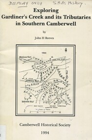
Book, Exploring Gardiner's Creek and its tributaries in southern Camberwell, 1994
... ...west creek...Surrey Hills Historical Society Collection 190A Canterbury Road Canterbury melbourne This book describes geographical landmarks and especially waterways that of the City of Camberwell (now City of Boroondara). gardiner's creek (mr) john gardiner koonung creek back creek glass's creek w creek west creek ashburton creek delaney's creek walking trails rivers This book describes geographical landmarks and especially waterways that of the City of Camberwell (now City of Boroondara). ...This book describes geographical landmarks and especially waterways that of the City of Camberwell (now City of Boroondara).This book describes geographical landmarks and especially waterways that of the City of Camberwell (now City of Boroondara).gardiner's creek, (mr) john gardiner, koonung creek, back creek, glass's creek, w creek, west creek, ashburton creek, delaney's creek, walking trails, rivers -
 Surrey Hills Historical Society Collection
Book, Alan Judge Holt (deceased), Pre-Suburban Surrey Hills 1839-1883, 1989
... ...west creek...(mr) henry jamieson (mr) ken hall (ms) edna holt (mr) frank bamford (mr) harrison buchanan scouts grange hill wattle park round hill bona vista mount albert barton street (mr) john raeburn (mr) edmund holt (mr) james dunn butter merchant mont albert road elgar road view hill new street surry mont delany's hill reservoir hill riversdale road middlesex road surrey hills (mr) aldo massora aborigines damper creek back creek west creek kooyongkoot creek (mr) john gardiner (mr) chas mullins (mr) henry elgar (mr) robert campbell (mr) alexander dyce (mr) robert brooks t budds payne (mr) hugh glass (mr) patrick trainer w virtue (mr) t fulton (mr) john crimp (mr) w dempsey (mr) w e stanbridge (mr) james atkinson j porter j collings w edde (mr) orlando fenwick (dr)(mr) l l smith (mr) j h knipe (mr) george cockcroft (sr) (mr) john martin kleinert w morton d delaney a moeller (mr) william smith (mr) e.p.s.sturt (mr) thomas blood (mr) patrick mornane (mr) henry de carle w craig j hill w oliver j keogh a laing vineyards toll gates (mr) david staig (mr) phillip kleeper (mr) goyder usher (mr) james lawler (mr) w.e. stanbridge (mr) gideon rutherford c a f mater j gadsby w h wrixon e h lamont i ainger (mr) james henty (mr) henry henty w freemantle w palmer beckett park, maranoa gardens Unpublished manuscript / notes written by Alan Holt about settlers in and around Surrey Hills bound in-house. ...Author: Alan Judge Holt amassed a significant collection of historical material related to the Surrey Hills area. Born in Moonee Ponds in 1912 to Edmund Holt and Ellen Ruby Sutton, he married Edna Jean Pallot in 1937. They lived at 62 Broughton Road, Surrey hills, had 3 sons and were strongly associated with the Surrey Hills Methodist Church. Alan was Secretary of the Victorian Lands Department and in his spare time recorded the occupancy of every property in Surrey Hills and Mont Albert at the beginning of each decade from 1890 to 1980. His collection of files and individual cards covers people, places, churches, clubs, businesses and other organisations in the area. Alan used this information to give talks and tours of the area and gifted his material to the local history collection through Jocelyn Hall.Unpublished manuscript / notes written by Alan Holt about settlers in and around Surrey Hills bound in-house. It is supported by maps showing landowners over various years from about 1840-1885(mr) henry jamieson, (mr) ken hall, (ms) edna holt, (mr) frank bamford, (mr) harrison buchanan, scouts, grange hill, wattle park, round hill, bona vista, mount albert, barton street, (mr) john raeburn, (mr) edmund holt, (mr) james dunn, butter merchant, mont albert road, elgar road, view hill, new street, surry mont, delany's hill, reservoir hill, riversdale road, middlesex road, surrey hills, (mr) aldo massora, aborigines, damper creek, back creek, west creek, kooyongkoot creek, (mr) john gardiner, (mr) chas mullins, (mr) henry elgar, (mr) robert campbell, (mr) alexander dyce, (mr) robert brooks, t budds payne, (mr) hugh glass, (mr) patrick trainer, w virtue, (mr) t fulton, (mr) john crimp, (mr) w dempsey, (mr) w e stanbridge, (mr) james atkinson, j porter, j collings, w edde, (mr) orlando fenwick, (dr)(mr) l l smith, (mr) j h knipe, (mr) george cockcroft, (sr) (mr) john martin kleinert, w morton, d delaney, a moeller, (mr) william smith, (mr) e.p.s.sturt, (mr) thomas blood, (mr) patrick mornane, (mr) henry de carle, w craig, j hill, w oliver, j keogh, a laing, vineyards, toll gates, (mr) david staig, (mr) phillip kleeper, (mr) goyder usher, (mr) james lawler, (mr) w.e. stanbridge, (mr) gideon rutherford, c a f mater, j gadsby, w h wrixon, e h lamont, i ainger, (mr) james henty, (mr) henry henty, w freemantle, w palmer, beckett park, maranoa gardens -
 Surrey Hills Historical Society Collection
Book, Exploring Gardiner's Creek and its tributaries in southern Camberwell, 1994
... ...west creek...Surrey Hills Historical Society Collection 190A Canterbury Road Canterbury melbourne This book describes geographical landmarks, in particular the waterways, that make up the City of Camberwell (now City of Boroondara). gardiner's creek (mr) john gardiner koonung creek back creek glass's creek w creek west creek ashburton creek delaney's creek walking trails rivers creeks glass creek This book describes geographical landmarks, in particular the waterways, that make up the City of Camberwell (now City of Boroondara). ...This book describes geographical landmarks, in particular the waterways, that make up the City of Camberwell (now City of Boroondara).This book describes geographical landmarks, in particular the waterways, that make up the City of Camberwell (now City of Boroondara).gardiner's creek, (mr) john gardiner, koonung creek, back creek, glass's creek, w creek, west creek, ashburton creek, delaney's creek, walking trails, rivers, creeks, glass creek -
 Eltham District Historical Society Inc
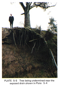
Work on paper (Sub-Item) - Photograph, Tree being undermined near an exposed drain on the west bank of Diamond Creek upstream of Bridge Street, Eltham
... Tree being undermined near an exposed drain on the west bank of Diamond Creek upstream of Bridge Street, Eltham...The tree has been undermined with roots exposed near a council drain. eltham diamond creek bridge street drainage roots tree Image printed on A4 page from 04997 Diamond Creek Basin Study, 1980 Tree being undermined near an exposed drain on the west bank of Diamond Creek upstream of Bridge Street, Eltham Work on paper Photograph ...Colour photograph of tree on the side of the Diamond Creek upstream at Bridge Street, Eltham. The tree has been undermined with roots exposed near a council drain.eltham, diamond creek, bridge street, drainage, roots, tree -
 Eltham District Historical Society Inc
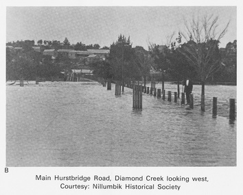
Work on paper (Sub-Item) - Photograph, Main Hurstbridge Road, Diamond Creek looking west
... Main Hurstbridge Road, Diamond Creek looking west...Undated black and white photograph of Main Hurstbridge Road, Diamond Creek in flood looking west. Nillumbik Historical Society collection...Eltham District Historical Society Inc 728 Main Rd Eltham melbourne Undated black and white photograph of Main Hurstbridge Road, Diamond Creek in flood looking west. Nillumbik Historical Society collection flood diamond creek Nillumbik Historical Society Image printed on A4 page from 04997 Diamond Creek Basin Study, 1980 Main Hurstbridge Road, Diamond Creek looking west Work on paper Photograph ...Undated black and white photograph of Main Hurstbridge Road, Diamond Creek in flood looking west. Nillumbik Historical Society collectionflood, diamond creek, nillumbik historical society -
 Canterbury History Group
Article, Cochrane, Al, Logan's run of good luck, 29/05/2007 12:00:00 AM
... ... West Creek...Canterbury History Group 190A Canterbury Road Canterbury melbourne Canterbury Logan Street Logan> Michael West Creek Boroondara Roads Board Roads and Streets Article from the Progress Leader, 29 May 2007 on Michael Logan and Logan Street Canterbury Logan's run of good luck Article Cochrane, Al ...Article from the Progress Leader, 29 May 2007 on Michael Logan and Logan Street Canterburycanterbury, logan street, logan> michael, west creek, boroondara roads board, roads and streets -
 Eltham District Historical Society Inc
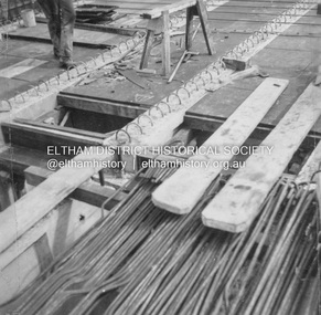
Album - Photograph, J.A. McDonald, General; Albion Street and Eltham-Yarra Glen Road, Oct. 1955
... West...Moonee Ponds Creek...General – Country Roads Board Albion Street bridge over Moonee Ponds Creek, Brunswick West Deck Forms October 1955...Infrastructure Road construction shire of eltham 1955-10 Albion Street bridge construction Country Roads Board Benchmark studies Brunswick West Moonee Ponds Creek Black and white photo print (location of negative unknown) Adhered to a page in an album of 78 foolscap pages containing a sequence of photos, adhered via glue or sticky tape, with typed or handwritten headings and captions in pencil. ...General – Country Roads Board Albion Street bridge over Moonee Ponds Creek, Brunswick West Deck Forms October 1955Record of various Shire of Eltham infrastructure works undertaken during the period of 1952-1962 involving bridge and road reconstruction projects, sometimes with Eltham Shire Council Project Reference numbers quoted. It was during this period that a number of significant improvements were made to roads and new bridges constructed within the shire that remain in place as of present day (2022). In many situations, the photos provide a tangible visible record of infrastructure that existed throughout the early days of the Shire. The album was put together by or under the direction of the Shire Engineer, J.A. McDonald.infrastructure, road construction, shire of eltham, 1955-10, albion street, bridge construction, country roads board, benchmark studies, brunswick west, moonee ponds creek -
 Eltham District Historical Society Inc
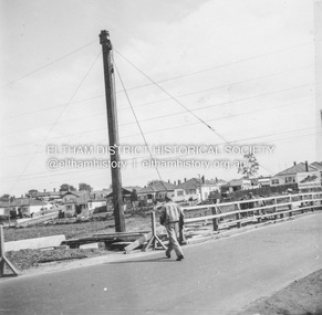
Album - Photograph, J.A. McDonald, General; Albion Street and Eltham-Yarra Glen Road, Oct. 1955
... West...Moonee Ponds Creek...General – Country Roads Board Albion Street bridge over Moonee Ponds Creek, Brunswick West Derrick for launching beams October 1955...Infrastructure Road construction shire of eltham 1955-10 Albion Street bridge construction Country Roads Board Benchmark studies Brunswick West Moonee Ponds Creek Black and white photo print (location of negative unknown) Adhered to a page in an album of 78 foolscap pages containing a sequence of photos, adhered via glue or sticky tape, with typed or handwritten headings and captions in pencil. ...General – Country Roads Board Albion Street bridge over Moonee Ponds Creek, Brunswick West Derrick for launching beams October 1955Record of various Shire of Eltham infrastructure works undertaken during the period of 1952-1962 involving bridge and road reconstruction projects, sometimes with Eltham Shire Council Project Reference numbers quoted. It was during this period that a number of significant improvements were made to roads and new bridges constructed within the shire that remain in place as of present day (2022). In many situations, the photos provide a tangible visible record of infrastructure that existed throughout the early days of the Shire. The album was put together by or under the direction of the Shire Engineer, J.A. McDonald.infrastructure, road construction, shire of eltham, 1955-10, albion street, bridge construction, country roads board, benchmark studies, brunswick west, moonee ponds creek -
Federation University Historical Collection
Reports, Big Cats Sightings and Stock Kills 2000-2011, 2000-2011
... West...wallaby creek...The folder was collected for research being conducted by David Waldron. australian mythical animals collection david waldron Department of Primary Industries rangers peter walsh Warragul creek Binginwarri Coongulla Straford Licola Blanket Hill Darramin Blanket Hill Woodside BEach heyfield puma panther cowwarr glenmaggie bolands bluff darrimen bolands bluff binginnwarri dawson the springs mt taylor black range driffield west Snowy plains airstrip glenmaggie north jack smith lake munro briagaling dutson downs connors plain giffard west darriment Joyces Road Junction Giffard West wallaby creek south Gippsland Highway avon river orbost four mile creek Folder of reports of Big Cat by rangers. ...The folder or correspondence is the result of a Freedom of Informaition request made to the Department of Primary Industries in 2011. The folder was collected for research being conducted by David Waldron.Folder of reports of Big Cat by rangers. australian mythical animals collection, david waldron, department of primary industries, rangers, peter walsh, warragul creek, binginwarri, coongulla, straford, licola, blanket hill, darramin, blanket hill, woodside beach, heyfield, puma, panther, cowwarr, glenmaggie, bolands bluff, darrimen, bolands bluff, binginnwarri, dawson, the springs, mt taylor, black range, driffield west, snowy plains airstrip, glenmaggie north, jack smith lake, munro, briagaling, dutson downs, connors plain, giffard west, darriment, joyces road junction, giffard west, wallaby creek, south gippsland highway, avon river, orbost, four mile creek -
 Sunshine and District Historical Society Incorporated
Administrative record - City of Sunshine - Commissioner Mr Alexander Alex George Gillon Collection 1976 - 1982 - Report of committee meetings 25th November 1980, City of Sunshine, 25th November 1980
... West...Kororoit Creek...Sassella Park ICI Oval Deer Park Primary School cleanup Traffic Lights Main Road West and Station Road intersection Damage to property by golf balls 5 Boa Court Sunshine West Proposed purchase of former part of discontinued road Bridge of Kororoit Creek at Billingham Road Shops at Hampshire Road footpath Rear access to Service Station corner Ballarat Road and Alford Street Selwyn Park Deer Park Cricket Club Kinder Smith Reserve Road Works Rowe Street Community Hall Housing Commission Coleman Street, Greenham Street and Gilder Street Maidstone School Hall St. ...Sassella Park Station Road Main Road West Deer Park Primary School Ballarat Road Deer Park Boa Court Sunshine West Kororoit Creek Billingham Road Alford Street Sunshine North Selwyn Park Selwyn Street Albion Deer Park Cricket Club Kinder Smith Reserve Braybrook Tallintyre Reserve Kermeen Street St. ...Sassella Park ICI Oval Deer Park Primary School cleanup Traffic Lights Main Road West and Station Road intersection Damage to property by golf balls 5 Boa Court Sunshine West Proposed purchase of former part of discontinued road Bridge of Kororoit Creek at Billingham Road Shops at Hampshire Road footpath Rear access to Service Station corner Ballarat Road and Alford Street Selwyn Park Deer Park Cricket Club Kinder Smith Reserve Road Works Rowe Street Community Hall Housing Commission Coleman Street, Greenham Street and Gilder Street Maidstone School Hall St. Albans Heights Primary School Playground Equipment Tallintyre Reserve Sunshine United Cricket Club Selwyn Park Sunshine Park Tennis Club Errington Reserve sassella park, station road, main road west, deer park primary school, ballarat road, deer park, boa court, sunshine west, kororoit creek, billingham road, alford street, sunshine north, selwyn park, selwyn street, albion, deer park cricket club, kinder smith reserve, braybrook, tallintyre reserve, kermeen street, st. albans heights primary school, norwich street, st. albans, sunshine united cricket club, sunshine park tennis club, parsons reserve, stanford street, sunshine, errington reserve, main road east -
 Whitehorse Historical Society Inc.
Photograph, Deep Creek Road, 1/04/2001 12:00:00 AM
... Coloured photograph looking West from Deep Creek Road Bridge....Whitehorse Historical Society Inc. 2-10 Deep Creek Road Mitcham melbourne deep creek road mitcham Coloured photograph looking West from Deep Creek Road Bridge. ...Coloured photograph looking West from Deep Creek Road Bridge.deep creek road, mitcham -
Eltham District Historical Society Inc
Document - Folder, Smith, Isa Bernhard
... ...Nerreman Creek...West...Isa Bernhard Smith Ryans Road Eltham Karringal Drive Eltham Nerreman Creek West Main Drain Eltham War Memorial Trust Eltham St Margaret's Church Eltham Eltham Pony Club Whelan the Wrecker Prahran Technical College Melbourne Grammar School Newspaper clippings, A4 photocopies, etc Smith, Isa Bernhard Document Folder ...Isa grew up near Tyntynder, Swan Hill. After she married the couple lived at Nerreman Park, eventually building their own house. Contents Newspaper article: "Isa's hard work pays off", Diamond Valley News, 17 December 1985. Biography of Isa Bernhard Smith. Newspaper clippings, A4 photocopies, etcisa bernhard smith, ryans road eltham, karringal drive eltham, nerreman creek, west main drain eltham, war memorial trust eltham, st margaret's church eltham, eltham pony club, whelan the wrecker, prahran technical college, melbourne grammar school -
 Eltham District Historical Society Inc
Photograph, Smiths Dam, Karingal Drive, Eltham
... west drain...karingal creek...Eltham District Historical Society Inc 728 Main Rd Eltham melbourne dams karingal drive eltham d.b smith eltham west drain karingal creek Colour photograph Smiths Dam, Karingal Drive, Eltham Photograph ...Colour photographdams, karingal drive, eltham, d.b smith, eltham west drain, karingal creek -
 Eltham District Historical Society Inc
Photograph, George W. Bell, Smiths Dam, Eltham, 1961, 1961
... west drain...karingal creek...Eltham District Historical Society Inc 728 Main Rd Eltham melbourne karingal drive st helena road d.b smith eltham west drain karingal creek st helena creek dams george w bell collection Black and white photograph of concrete dam on Smith property Karingal Drive Eltham 1961 Smiths Dam, Eltham, 1961 Photograph George W. ...Black and white photograph of concrete dam on Smith property Karingal Drive Eltham 1961karingal drive, st helena road, d.b smith, eltham west drain, karingal creek, st helena creek, dams, george w bell collection -
 Victorian Aboriginal Corporation for Languages
Book, Bruce Pascoe et al, Wathaurong : the people who said no, 2003
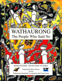
... ...South West Victoria...Battle Creek...Victorian Aboriginal Corporation for Languages 33 Saxon Street Brunswick melbourne Wathaurong Wadtharung Port Philllip Bay Western Port Bay Lorne South West Victoria Battle Creek Aire River Werribee Ballarat Wathaurong Aboriginal Cooperative Coast Action Koori studies John Batman William Buckley Aboriginal studies policy secondary school education hissing swan Victorian history maps, colour illustrations, b&w illustrations, colour photographs, word lists The Wathaurong people of South Western Victoria said no to European invasion. ...The Wathaurong people of South Western Victoria said no to European invasion. Learn about this heroic resistance to the occupation of their lands. Can white and black live together or must we be always at war? The answer can only be given by young Australians. Includes a comprehensive historical timeline.maps, colour illustrations, b&w illustrations, colour photographs, word listswathaurong, wadtharung, port philllip bay, western port bay, lorne, south west victoria, battle creek, aire river, werribee, ballarat, wathaurong aboriginal cooperative, coast action, koori studies, john batman, william buckley, aboriginal studies policy, secondary school education, hissing swan, victorian history -
 Greensborough Historical Society
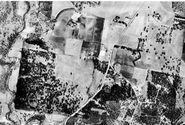
Aerial Photograph, Flintoff land - View from above, 1945_
... "Flintoff land to west of Diamond Creek Rd" written in pencil on back...Section of the 1945 Greensborough aerial survey, focusing on the land belonging to the Flintoff family flintoff family aerial photograph aerial 1945 "Flintoff land to west of Diamond Creek Rd" written in pencil on back Photocopy of section of 1945 aerial survey of Greensborough area Flintoff land - View from above Aerial Photograph ...Section of the 1945 Greensborough aerial survey, focusing on the land belonging to the Flintoff familyPhotocopy of section of 1945 aerial survey of Greensborough area"Flintoff land to west of Diamond Creek Rd" written in pencil on backflintoff family, aerial photograph, aerial 1945 -
 Sunshine and District Historical Society Incorporated
Photograph - Lions Club Reserve Kororoit Creek Deer Park Photographs, John Alchin, 2021
... Situated on the west bank of the Kororoit Creek, it lies directly opposite the Deer Park Hotel, where a swimming hole once enjoyed popularity among the early residents of Deer Park. ...5651.01 - Lions Club Reserve Kororoit Creek West Bank Deer Park 2021 Photo 23.JPG 5651.02 - Lions Club Reserve Kororoit Creek West Bank Deer Park 2021 Photo 17.JPG 5651.03 - Lions Club Reserve Kororoit Creek West Bank Deer Park 2021 Photo 19.JPG 5651.04 - Lions Club Reserve Kororoit Creek West Bank Deer Park 2021 Photo 20.JPG 5651.05 - Lions Club Reserve Kororoit Creek West Bank Deer Park 2021 Photo 21.JPG ...Ballarat Road Deer Park Kororoit Creek Deer Park Lions Club 5651.01 - Lions Club Reserve Kororoit Creek West Bank Deer Park 2021 Photo 23.JPG 5651.02 - Lions Club Reserve Kororoit Creek West Bank Deer Park 2021 Photo 17.JPG 5651.03 - Lions Club Reserve Kororoit Creek West Bank Deer Park 2021 Photo 19.JPG 5651.04 - Lions Club Reserve Kororoit Creek West Bank Deer Park 2021 Photo 20.JPG 5651.05 - Lions Club Reserve Kororoit Creek West Bank Deer Park 2021 Photo 21.JPG Digital Photographs Photograph Lions Club Reserve Kororoit Creek Deer Park Photographs John Alchin ...No formal name has been assigned to this reserve. From research, which is still to be confirmed, it is believed the Deer Park Lions Club installed the infrastructure in the area, which includes the wooden path, table and bench seat, therefore for convenience we will refer to it as the Lions Club Reserve. Situated on the west bank of the Kororoit Creek, it lies directly opposite the Deer Park Hotel, where a swimming hole once enjoyed popularity among the early residents of Deer Park. Unfortunately, as the surrounding areas were developed for residential and industrial requirements, along came pollution that made these holes unsafe to swim in. The use of these holes were discouraged in the mid 1900's and subsequently the local Councils of the district started to provide man made swimming pools such as the ones located in Sunshine and St. Albans. Today, now an almost forgotten location in Deer Park, the water hole provides a tranquil location for visitors to relax and watch the creek slowly flowing past and the birdlife that frequent the area.Water holes along the Kororoit Creek and Maribyrnong River were once used for providing drinking water, relaxation, recreation sport and spots to cool off on the long summer days.5651.01 - Lions Club Reserve Kororoit Creek West Bank Deer Park 2021 Photo 23.JPG 5651.02 - Lions Club Reserve Kororoit Creek West Bank Deer Park 2021 Photo 17.JPG 5651.03 - Lions Club Reserve Kororoit Creek West Bank Deer Park 2021 Photo 19.JPG 5651.04 - Lions Club Reserve Kororoit Creek West Bank Deer Park 2021 Photo 20.JPG 5651.05 - Lions Club Reserve Kororoit Creek West Bank Deer Park 2021 Photo 21.JPG ballarat road, deer park, kororoit creek, deer park lions club -
 Brimbank City Council Art Collection
Photograph, Kororoit Creek, Opposite Deer Park Hotel, 1994
... Opposite Deer Park Hotel, West Side Kororoit Creek looking East AR0108...Brimbank City Council Art Collection The Hunt Club Community Arts Centre 775 Ballarat Road Deer Park melbourne Local Landscape photograph landscape Opposite Deer Park Hotel, West Side Kororoit Creek looking East AR0108 Kororoit Creek, Opposite Deer Park Hotel Photograph Robert Pointon ...Local LandscapeOpposite Deer Park Hotel, West Side Kororoit Creek looking East AR0108photograph, landscape -
Port Melbourne Historical & Preservation Society
Map - Footscray, Public Lands Office, 19 Oct 1857
... Map of Footscray, west of Saltwater Creek; south of Hopkins Street, east of Railway and north southern boundary of Botanical Garden reserve....Port Melbourne Historical & Preservation Society Port Melbourne Town Hall 333 Bay Street Port Melbourne melbourne footscray The Township of Footscray, Parish of Cut-Paw-Paw Map of Footscray, west of Saltwater Creek; south of Hopkins Street, east of Railway and north southern boundary of Botanical Garden reserve. ...Map of Footscray, west of Saltwater Creek; south of Hopkins Street, east of Railway and north southern boundary of Botanical Garden reserve.The Township of Footscray, Parish of Cut-Paw-Pawfootscray -
Whitehorse Historical Society Inc.
Document, Land along Mullum Mullum Creek, 1994
... Nunawading City Council minute on land along Mullum Mullum Creek west of Schwerkolt Cottage. 40/11/006 BPS/BN/DWT...Whitehorse Historical Society Inc. 2-10 Deep Creek Road Mitcham melbourne Local government City of Nunawading Parks and Reserves Schwerkolt Cottage Yarran Dheran Mullum Mullum Creek Nunawading City Council minute on land along Mullum Mullum Creek west of Schwerkolt Cottage. 40/11/006 BPS/BN/DWT Nunawading City Council minute on land along Mullum Mullum Creek west of Schwerkolt Cottage. 40/11/006 BPS/BN/DWT Land along Mullum Mullum Creek Document Document ...Nunawading City Council minute on land along Mullum Mullum Creek west of Schwerkolt Cottage. 40/11/006 BPS/BN/DWTNunawading City Council minute on land along Mullum Mullum Creek west of Schwerkolt Cottage. 40/11/006 BPS/BN/DWTNunawading City Council minute on land along Mullum Mullum Creek west of Schwerkolt Cottage. 40/11/006 BPS/BN/DWTlocal government, city of nunawading, parks and reserves, schwerkolt cottage, yarran dheran, mullum mullum creek -
 Ballarat Tramway Museum
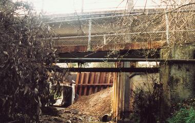
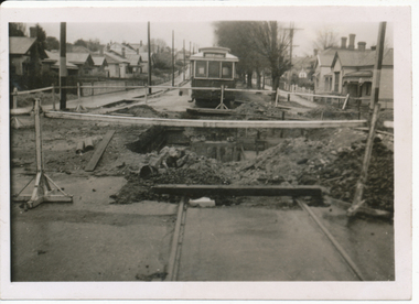
Negative - SECV Ballarat No. 32 at Canadian Creek bridge in Barkly St, Wal Jack, 12/06/1955
... On rear in ink "SEC Ballarat No. 32 in Barkly St west of creek - old bridge pulled down 12-6-55." ...Trams tramways Mt Pleasant Canadian Creek Barkly St tram 32 On rear in ink "SEC Ballarat No. 32 in Barkly St west of creek - old bridge pulled down 12-6-55." ...Photograph of No. 32 at Canadian Creek bridge in Barkly St, Mt Pleasant during the reconstruction of the bridge. Photo dated 12-6-55 and shows the reconstruction work in progress. Tram was isolated to enable the service in Barkly St during the reconstruction of the Canadian Creek bridge during June-July 1955, see Reg Item 5155, 5157 as well and 5301, 5302 and 5305. See image i2 for rear of photograph. See image i3 for hi res scan of print. See image i4 for hi res scan of negativeYields information the reconstruction of the Canadian Creek Bridge in 1955.Negative and Digital image from the Wal Jack Ballarat Album with notes on the rear of the print.On rear in ink "SEC Ballarat No. 32 in Barkly St west of creek - old bridge pulled down 12-6-55." In top right hand corner is Wal Jack stamp with number T177 written in.trams, tramways, mt pleasant, canadian creek, barkly st, tram 32 -
 Brimbank City Council Art Collection
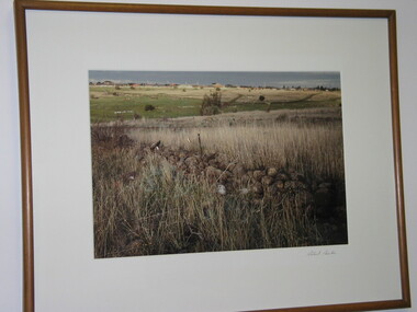
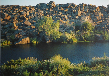
Photograph, Robert Pointon, River Rocks, 1988
... West bank Kororoit Creek looking east. Looking directly across the creek. ...Part of the 1989 Hunt Club Exhibition. photograph kororoit creek robert pointon West bank Kororoit Creek looking east. ...Local Significance. Part of the 1989 Hunt Club Exhibition.West bank Kororoit Creek looking east. Looking directly across the creek. Foliage in the immediate foreground. Creek in the midground, Stone embankment across the river. - AR0038photograph, kororoit creek, robert, pointon -
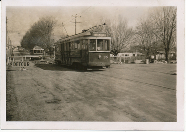 Ballarat Tramway Museum
Photograph - SECV trams 35 & 32 - Canadian Creek Bridge works, Wal Jack, 12/06/1955
... On rear in ink "SEC Ballarat No. 35 east of creek, No. 32 west of creek in Barkly St at Steinfeld St. ...Trams tramways Mt Pleasant Canadian Creek Barkly St tram 32 On rear in ink "SEC Ballarat No. 35 east of creek, No. 32 west of creek in Barkly St at Steinfeld St. ...Photo of trams 35 and 32 at Canadian Creek bridge in Barkly St, Mt Pleasant during the reconstruction of the bridge. Photo dated 12-6-55 and shows the reconstruction work in progress. Tram was isolated to enable the service in Barkly St during the reconstruction of the Canadian Creek bridge during June-July 1955, see Reg Item 5155, 5157 as well and 5301, 5302 and 5305. No. 35 was the service car, shows the detour sign as well. See image i2 for rear of photograph.Yields information the reconstruction of the Canadian Creek Bridge in 1955.Digital image from the Wal Jack Ballarat Album.On rear in ink "SEC Ballarat No. 35 east of creek, No. 32 west of creek in Barkly St at Steinfeld St. Bridge under repairs. 13-6-55." In top right hand corner is Wal Jack stamp with number T178 written in.trams, tramways, mt pleasant, canadian creek, barkly st, tram 32