
Showing 43 items matching " wheatly road"
-
 Glen Eira Historical Society
Document - National Trust Register
... ... Wheatly Road...Georges Road Willow Street Grange Road Station Place Railway Parade Alexandra Street Wood Crescent Elizabeth Street Halstead Street Mavho Street Tucker Road McKinnon Road Nepean Highway Wheatly Road Uniting Church Carnegie Athole St Stephen's Uniting Church Caulfield St Aloysius' Catholic Church Halstead St Mary's Anglican Church Caulfield Caulfield Town Hall Anseln The Glen Woolamai Caulfield House Caulfield Hospital Lirrewa Labassa Fairfield Hall Bellecourt Bagatelle Myoora Rosecraddock Adam and Eve - Karl Duldig The Family - Karl Duldig Caulfield Primary School Septimus Miller Memorial Chapel Brighton Cemetery Hopetoun Gardens State Savings Bank Elsternwick Anderson Organ Hopetoun Private Hospital (Melrose) Rippon Lea Ripponlea Burreel O'Neill College Lisbon House Elsternwick Club Merkin-Schutze Organ Presentation Convent Duldig Mural - Kadimah Cultural Centre Glenmoore Craigellachie St James the Great Glenfern Grimwade House Dacre Trinity Congregational Uniting Church Glenhuntly Alnwick Holmwood New Alexandra Joscelyne Organ Smith Organ Fincham Organ St George's Bentleigh McKinnon Progress Hall Wurlitzer Organ Moorabbin Town Hall Christ Anglican Church St Mary's Jubilee School St Stephen's Presbyterian Church Elsternwick Congregational Church St Mary's Church of England Former Metropolitan Fire Brigade Station No. 31 St Mary's Jubilee Church Belle Court Trinity Congregational Church Heatherbrae Carnegie Caulfield Caulfield North Caulfield South Elsternwick Glen Huntly Glenhuntly Murrumbeena St Kilda East Bentleigh McKinnon Moorabbin Ormond National Trust of Australia National Trust Register Houses Churches Schools Organs Vallati Gladys Mansions Document National Trust Register ...This file contains two items relating to historic buildings in Glen Eira listed on the National Trust Registry: 1/A fax, sent to Gladys Vallati on 02/03/1995 from the National Trust of Australia listing buildings on the Trust’s registry in the Glen Eira area, as well as their addresses and status on the register (5 pages). (Additional photocopy taken for preservation purposes). 2/A typed list of buildings in the Glen Eira area (mainly Caulfield) which are on the National Trust list, including address, approximate date of construction and status on the register. Date of production of the list is unknown. (6 pages).neerim road, poplar grove, avoca grove, balaclava road, orrong road, bambra road, glen eira road, hood crescent, hawthorn road, glenferri street, glenhuntly road, glen huntly road, kambrook road, kooyong road, lirrewa grove, manor grove, north road, pearson avenue, seymour road, alma road, craddock avenue, dandenong road, lyndoch avenue, orrong crescent, hotham street, nagle avenue, inkerman street, iknerman road, sandham street, selwyn street, st. georges road, willow street, grange road, station place, railway parade, alexandra street, wood crescent, elizabeth street, halstead street, mavho street, tucker road, mckinnon road, nepean highway, wheatly road, uniting church carnegie, athole, st stephen's uniting church caulfield, st aloysius' catholic church, halstead, st mary's anglican church caulfield, caulfield town hall, anseln, the glen, woolamai, caulfield house, caulfield hospital, lirrewa, labassa, fairfield hall, bellecourt, bagatelle, myoora, rosecraddock, adam and eve - karl duldig, the family - karl duldig, caulfield primary school, septimus miller memorial chapel, brighton cemetery, hopetoun gardens, state savings bank elsternwick, anderson organ, hopetoun private hospital (melrose), rippon lea, ripponlea, burreel, o'neill college, lisbon house, elsternwick club, merkin-schutze organ, presentation convent, duldig mural - kadimah cultural centre, glenmoore, craigellachie, st james the great, glenfern, grimwade house, dacre, trinity congregational uniting church glenhuntly, alnwick, holmwood, new alexandra, joscelyne organ, smith organ, fincham organ, st george's bentleigh, mckinnon progress hall, wurlitzer organ, moorabbin town hall, christ anglican church, st mary's jubilee school, st stephen's presbyterian church, elsternwick congregational church, st mary's church of england, former metropolitan fire brigade station no. 31, st mary's jubilee church, belle court, trinity congregational church, heatherbrae, carnegie, caulfield, caulfield north, caulfield south, elsternwick, glen huntly, glenhuntly, murrumbeena, st kilda east, bentleigh, mckinnon, moorabbin, ormond, national trust of australia, national trust register, houses, churches, schools, organs, vallati gladys, mansions -
 Flagstaff Hill Maritime Museum and Village
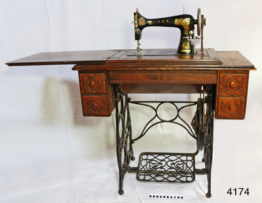
Domestic object - Sewing Machine, Early 20th century
... An item fabricated in Australia from a majority of imported parts from either Germany, America or England giving a snapshot into the early manufacturing industries that were operating at the time of Federation. flagstaff hill warrnambool shipwrecked coast flagstaff hill maritime museum maritime museum shipwreck coast flagstaff hill maritime village great ocean road ward bros. australian sewing machine co. a.n.a. treadle sewing machine rocket shuttle sewing machine home industry clothing wardana australian sewing machine company all native australian dressmaking clothing manufacturer Decal coat of arms on right front of machine: kangaroo on left, man with broad-brim hat, holding pick-axe on right, in centre, top “SEWING MACHINE / THE / A. N. A.” then below it, the rising sun, then below that is state of Victoria shield with the Southern Cross constellation. Wheat ...Ward Brothers (George and Samuel) registered a company (Australian Sewing Machines Limited Pty Ltd) with the head office address in Errol St, North Melbourne, and Prahan. The earliest newspaper advertisement for this company was in 1897. Around this time the Ward Brothers first imported sewing machines from England and Wertheim placed their decal on them and mounted them in their own Australian made cabinets. David Ward later imported machines from Beisolt & Locke in Germany and registered name A.N.A. (All Native Australian), his shop was in Collingwood Melbourne. Some of these machines had Ward Brothers decals on them as well. The three brothers sold under the same name as Ward Brothers. The early Ward Brothers logo had a map of Australia with a picture of all three brothers on it. In 1911 all three of the Ward Brothers decided to share a stall in the yearly Melbourne exhibition. The A.N.A was the machine that got rave reviews. It was at this time that the Australian Sewing Machine Company Pty Ltd decided to add the A.N.A logo to their logo to cash in on the new found celebrity status that the A.N.A has gained. To cut a long story short. David Ward took his brothers to court to prevent this from happening. This was a long drawn out affair that took quite a few years. The settlement was decided out of court and nothing was disclosed of the deal that was made. David seemed to have left the scene, then the remaining Ward Brothers and A.N.A. combined and then became “Wardana”. There are many Ward Brothers sewing machines in displays, they originated from Japan, England, America, and Germany. It seems that where ever they got the best deal for sewing machines or parts is the direction they went. This is where the Bendigo sewing machine company came into the picture. All imported sewing machines into Australia drew a government tax. Bendigo Cording's Traction Company was given proposed two-pound tariff protection that gave the company a significant price advantage for its machines. As a result, the Ward Brothers purchased a huge number of Bendigo shares to get cheaper machines for their sewing machine cabinets. Ward Brothers then placed one of their company officials on the Board of “Bendigo Sewing Machines Limited” and the rest is history. Ward Brothers had shops Australian wide and in most of the major country towns. History for “Bendigo Sewing Machines Limited” Cordings Traction Company owners (H. Keck MLC, W. Wallace, and W. Ewing) operated their business out of the former W. Webb & Co. building in Queen St. Bendigo. Around 1923-1924 they decided to switch from traction engines to manufacturing sewing machines. The actual date is not known but that year's financial report made note of both Cordings and Bendigo Sewing Machines Limited. The switch was made with the government of the day agreeing to a tariff of two pounds per head for every machine head made completely in Australia. The change from traction engines to sewing machines went well. Government representatives visited the factory in Bendigo to inspect and ensure that the sewing machines were Australian made as a result they agreed on granting the two-pound tariff to the company. After the first 12 months, they built 30, the following 12 months the company had produced 1500 machines probably due to the involvement of the Ward brothers. However, the government proposed a new condition to the tariff agreement which was that the company must produce 20% of Australia's requirements for sewing machines. In 1924 after having had produced 1500 machines resulting in reaching their financial limit for tariff support. According to the government, the requirement was 15,000 machines for the next year had to be produced to qualify for the tariff. The company had already reached its production limit and unfortunately folded. There were several attempts to regain government assistance to save this new industry but it was to no avail. Even a promise to open another factory in Sydney was offered but unfortunately wasn't accepted. An item fabricated in Australia from a majority of imported parts from either Germany, America or England giving a snapshot into the early manufacturing industries that were operating at the time of Federation. Sewing machine, treadle, in timber cabinet. Branded Ward Bros, A.N.A., Australian Sewing Machine Coy. Decorative carved timber cabinet, hinged, fold-out laminated timber top and five drawers; two small on each side with handles and one long, shallow, between side drawers without handle. Thread is on bobbin in a rocket shuttle (both in good condition) plus spare empty shuttle (rusty). Brass ‘Half Yard’ ruler inlaid across front, measuring scale in inches and centimetres. Two metal shuttle cover plates (or throat plate / slide plate); front one is impressed with a gauge for needle and thread. Gold trim and decals on flatbed and machine front and back, serial number under shuttle cover, brand on decals and on round metal plate on back of machine. Front right of machine has a bobbin winder. Treadle belt shows signs of wear and laminate on timber machine cover is peeling slightly.Decal coat of arms on right front of machine: kangaroo on left, man with broad-brim hat, holding pick-axe on right, in centre, top “SEWING MACHINE / THE / A. N. A.” then below it, the rising sun, then below that is state of Victoria shield with the Southern Cross constellation. Wheat sheaves around edge on left and flowering plant on right. Gold ribbon banner at bottom with script “WARD BROS.“ Decal of map of Australia on flatbed of machine. States and capital cities are marked and named (no northern territory), portrait of two men. In centre of map are interwoven letters “A. N. A.” and written in script “WARD BROS.” Decal across front of machine body has large, decorated gold lettering “A. N. A.” Decal across the top of machine “THE AUSTRALIAN SEWING MACHINE COY. PTY. Ltd.” Steel shuttle cover at front has an impressed gage listing cotton and needle sizes and number of stitches. Brass disc on back of machine “A. N. A.” in centre. Brass ruler across front of machine has carved or pressed words in the timber. In centre “INCHES” above ruler and “CENTIMETRES” below ruler, and on right above ruler is “HALF YARD” Decal across back of machine’s body “A.N. A. / MADE IN U.S.A.” Stamped into metal under shuttle cover is “219415” (2 and 5 are partially there, first 1 could instead be a 7) flagstaff hill, warrnambool, shipwrecked coast, flagstaff hill maritime museum, maritime museum, shipwreck coast, flagstaff hill maritime village, great ocean road, ward bros., australian sewing machine co., a.n.a., treadle sewing machine, rocket shuttle sewing machine, home industry, clothing, wardana, australian sewing machine company, all native australian, dressmaking, clothing manufacturer -
 Federation University Historical Collection
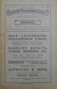
Booklets, Coventry Engineering Society Journal, 1926, 1926
... road springs...c.e. cary...testing engines...g.h. walker...disposal of a town's refuse...h.l. bunting...roadcasting...j.a. cooper...thermionic repeaters...long distance telephony...h.c. hannam-clark...automobile design...w. ferrier brown...floodlighting...h.c. wheat...Road Springs by C.E. Cary .3) Vol. 7. No. 2, February 1926. Includes * Some methods of Testing Engines by G.H. Walker Vol. 7. No. 3, March 1926. Includes * Notes on the Disposal of a Town's Refuse by H.L. Bunting * How roadcasting is Done by J.A. Cooper Vol. 7. No. 4, April, 1926. Includes * The Applicaton of Thermionic Repeaters to Long Distance Telephony by H.C. Hannam-Clark Vol. 7. No. 5, May 1926. Includes * Automobile Design by W. Ferrier Brown * Floodlighting and its Possibilities by H.C. Wheat...coventry engineering coventry engineering society peterborough cathedral cast iron h. beeny pulverised coal j. pickin (junior) road springs c.e. cary testing engines g.h. walker disposal of a town's refuse h.l. bunting roadcasting j.a. cooper thermionic repeaters long distance telephony h.c. hannam-clark automobile design w. ferrier brown floodlighting h.c. wheat machines for testing materials h.n. cox ground gears h.f.l. orcutt instruments for recording minute oscillations iron ores a.j. aiers Six grey soft covered Coventry Engineering Society Journals. .1) Vol. 6 No. 3, March 1925. ...Six grey soft covered Coventry Engineering Society Journals. .1) Vol. 6 No. 3, March 1925. Includes * The Influences of Rates of Colling upon Cast Iron by H. Beeny * Pulverised Coal by J. Pickin (Junior) .2) Vol. 7. No. 1, January 1926. Includes * Coventry Engineering Society Annual Report * Road Springs by C.E. Cary .3) Vol. 7. No. 2, February 1926. Includes * Some methods of Testing Engines by G.H. Walker Vol. 7. No. 3, March 1926. Includes * Notes on the Disposal of a Town's Refuse by H.L. Bunting * How roadcasting is Done by J.A. Cooper Vol. 7. No. 4, April, 1926. Includes * The Applicaton of Thermionic Repeaters to Long Distance Telephony by H.C. Hannam-Clark Vol. 7. No. 5, May 1926. Includes * Automobile Design by W. Ferrier Brown * Floodlighting and its Possibilities by H.C. Wheat Vol. 7. No. 6, June 1926. Includes * Machines for Testing Materials by H.N. Cox * Characteristics and uses of Ground Gears by H.F.L. Orcutt * Instruments for Recording Minute Oscillations * Characteristics of Iron Ores by A.J. Aierscoventry, engineering, coventry engineering society, peterborough cathedral, cast iron, h. beeny, pulverised coal, j. pickin (junior), road springs, c.e. cary, testing engines, g.h. walker, disposal of a town's refuse, h.l. bunting, roadcasting, j.a. cooper, thermionic repeaters, long distance telephony, h.c. hannam-clark, automobile design, w. ferrier brown, floodlighting, h.c. wheat, machines for testing materials, h.n. cox, ground gears, h.f.l. orcutt, instruments for recording minute oscillations, iron ores, a.j. aiers -
 Flagstaff Hill Maritime Museum and Village
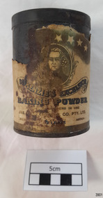
Container - Tin, McKenzies Foods, circa 1930s
... road tin cooking ingredient baking powder mckenqie Text includes “JAS. F. McKENZIE & CO. PTY. LTD. / AUSTRALIA“ “McKENZIE’S EXCELSIOR / BAKING POWDER”. Motif: man’s portrait within oval frame with wheat ...This tin once contained McKenzie’s baking powder, a cooking ingredient. It was donated with other similar tins that were used by the donor’s mother who was married in 1932. It those times in Australia all manner of household items, including food and drink, were sold by hawkers (salesmen) who travelled from door to door in both suburban and rural areas. The donor remembered the bicarb soda tin on her mother’s pantry shelf. The McKenzie’s Baking Powder label adds the information that the ingredients were “Prepared with Aerophos, Regd. Trade Mark, the finest raising ingredient. A product of Albright & Wilson, Australia Pty. Ltd.” It also says that it “Excels all others in use”. The Australian family business, McKenzie’s Foods, began in Melbourne in 1852 and continues today, now run be the fifth generation of descendants from the original owners. Its baking and cookery products are well recognised by Australians. This tin originates in the early 1900s from an Australian company that is now managed by fifth generation descendants of the original family after its inception in 1852. The tin increases in significance for its use as a recognised object found in many Australian kitchens since early days. It gives a snapshot into domestic life and social norms of the pre and post war period in Melbourne The tin is significant for its association with a local family in the 1930s for the preparation of family meals. Tin container, cylindrical, with cream paper label with gold highlights, motif and text. Used for selling McKenzie’s Excelsior baking powder. Container has push-on lid. Quantity of 1/2 LB. NETT. Made in Australia by Jas. F. McKenzie & Co. Pty Ltd. Text includes “JAS. F. McKENZIE & CO. PTY. LTD. / AUSTRALIA“ “McKENZIE’S EXCELSIOR / BAKING POWDER”. Motif: man’s portrait within oval frame with wheat sheaf border, placed below figures of sun, moon and stars. Information and instructions. flagstaff hill asset, baking powder tin, container, flagstaff hill museum, kitchen item, cookery, baking, grocery, mckenzie, rising agent, food container, flagstaff hill, warrnambool, shipwrecked coast, flagstaff hill maritime museum, maritime museum, shipwreck coast, flagstaff hill maritime village, great ocean road, tin, cooking ingredient, baking powder, mckenqie -
 Flagstaff Hill Maritime Museum and Village
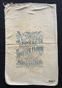
Textile - Flour bag - W.C.Thomas, Warracknabeal
... wheat belt, with the Warracknabeal Mill operating from 1884 to 1964. After their use for flour storage, flour bags were able to be reused for bulk storage of other dry goods or sewn into domestic objects such as tea towels, pillowcases or waggas. This is a good example of a flour bag from a prominent Victorian flourmill, operating from the late 19th century to the mid-20th century. Flagstaff Hill Maritime Museum and Village Great Ocean Road ...This flour bag came from the W.C. Thomas Flour Mill at Warracknabeal, Victoria. W.C. Thomas ran a number of flour mills throughout the Victorian wheat belt, with the Warracknabeal Mill operating from 1884 to 1964. After their use for flour storage, flour bags were able to be reused for bulk storage of other dry goods or sewn into domestic objects such as tea towels, pillowcases or waggas.This is a good example of a flour bag from a prominent Victorian flourmill, operating from the late 19th century to the mid-20th century.Calico flour bag for 'Roller Flour' from the flour mill of W.C. Thomas in Warracknabeal, a large wheat growing area in Victoria. The stencil on the front of the bag includes an image of wheat overlaid with the written information in scroll format.W.C. Thomas, Finest, Patent, Roller Flour, Warracknabeal, Victoria, Australia. Wheat image.flagstaff hill maritime museum and village, great ocean road, shipwreck coast, flour bags, calico, domestic object, textile, food storage, w.c. thomas, warracknabeal, flour mill -
 Flagstaff Hill Maritime Museum and Village
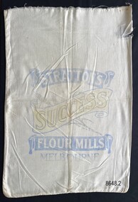
Textile - Flour bag - Stratton's, Melbourne
... Flagstaff Hill Maritime Museum and Village Great Ocean Road Shipwreck Coast calico domestic object textile food storage Stratton's flour bag Stratton's, Success, Flour Mills, Melbourne Calico flour bag for 'Success Flour' from Stratton’s flour mill in Melbourne. The stencil on the front of the bag includes the image of a wheat ...Flour bags were used when purchasing flour from the late 19th century to the mid 20th century. They were able to be reused for bulk storage of dry goods or sewn into domestic objects such as tea towels, pillowcases or waggas.The flour bag provides an example of a useful domestic packaging product, from the early 20th century.Calico flour bag for 'Success Flour' from Stratton’s flour mill in Melbourne. The stencil on the front of the bag includes the image of a wheat stalk overlaid with the written information in scroll format.Stratton's, Success, Flour Mills, Melbourneflagstaff hill maritime museum and village, great ocean road, shipwreck coast, calico, domestic object, textile, food storage, stratton's, flour bag -
 Flagstaff Hill Maritime Museum and Village
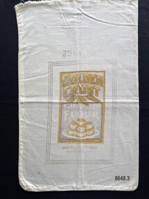
Textile - Flour bag - Golden Crust
... Flagstaff Hill Maritime Museum and Village Great Ocean Road Shipwreck Coast calico domestic object textile food storage flour bag Golden Crust 25lbs, Golden Crust, Self-raising Flour, Blended with Phosphate Aerator, Hancock’s Golden Crust Pty.Ltd. South Yarra, Vic Calico flour bag for Golden Crust Self-raising flour, 25lb. The stencil on the bag includes the manufacturer’s address and images of heads of wheat ...Flour bags were used when purchasing flour from the late 19th century to the mid 20th century. They were able to be reused for bulk storage of dry goods or sewn into domestic objects such as tea towels, pillowcases or waggas.The flour bag provides an example of a useful domestic packaging product, from the early 20th century.Calico flour bag for Golden Crust Self-raising flour, 25lb. The stencil on the bag includes the manufacturer’s address and images of heads of wheat and a plate of scones. 25lbs, Golden Crust, Self-raising Flour, Blended with Phosphate Aerator, Hancock’s Golden Crust Pty.Ltd. South Yarra, Vicflagstaff hill maritime museum and village, great ocean road, shipwreck coast, calico, domestic object, textile, food storage, flour bag, golden crust -
 Flagstaff Hill Maritime Museum and Village
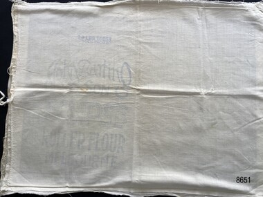
Textile - Flour Bag Pillowcase
... Flagstaff Hill Maritime Museum and Village Great Ocean Road Shipwreck Coast Warrnambool Calico Domestic object textile food storage John Darling & Son Eclipse Roller Flour O-SO-LITE Flour pillowcase flour bag Side 1 25LBS GROSS WHEN PACKED, John Darling & Son, ECLIPSE, ROLLER FLOUR, MELBOURNE Side 2 O-SO-LITE, Self-raising, FLOUR, Creamy & Delicious, O-SO-LITE PRODUCTS, 412 COLLINS ST MELBOURNE, C.I. Decoration of wheat ...Flour bags were a useful source of material to be repurposed into domestic objects in the early 20th century. This object, fashioned from two well-known brands of flour bag, was most likely used as a pillowcase.The pillowcase provides an example of how flour bags were recycled and repurposed into useful domestic objects in the early 20th century.Two flour bags opened out and sewn together to create a possible pillowcase. The open end has a tie sewn to each side to enable the pillowcase to be closed. The bags have been sewn with the inscriptions on the inside of the pillowcase.Side 1 25LBS GROSS WHEN PACKED, John Darling & Son, ECLIPSE, ROLLER FLOUR, MELBOURNE Side 2 O-SO-LITE, Self-raising, FLOUR, Creamy & Delicious, O-SO-LITE PRODUCTS, 412 COLLINS ST MELBOURNE, C.I. Decoration of wheat stalks surround the inscription.flagstaff hill maritime museum and village, great ocean road, shipwreck coast, warrnambool, calico, domestic object, textile, food storage, john darling & son, eclipse roller flour, o-so-lite flour, pillowcase, flour bag -
 Flagstaff Hill Maritime Museum and Village
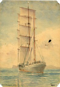
Painting - Watercolour Painting, Beni Carr Glyn Burnett, The Winterhude, 1933
... wheat for Europe. This painting (one of a set of three small artworks) is significant as an example of shipping (particularly the use of sailing ships) that were still being used as late as the 1930's in Australia. It is also important because its creator (B. C. G. Burnett) went on to become a well-known public figure in the Northern Territory in the late 1930's due to his innovative approach to designing homes for the tropical climate. Flagstaff Hill Maritime Museum and Village Warrnambool Great Ocean Road ...Beni Carr Glyn Burnett (also known as B. C. G. Burnett or Beni Burnett) was born in 1889 to missionary parents in Mongolia. When he was 15 years old he began training as an architect with a firm in Shanghai. He worked in Singapore, Japan and China before moving to Australia around 1933. In 1937 he was appointed as the Commonwealth principal architect in the Northern Territory. He went on to design a series of houses for senior public servants and military personnel which became very popular as they were specifically designed for the tropics - incorporating louvres, high ceilings and good ventilation. When Darwin was bombed in February 1942, he was evacuated to Alice Springs where he continued to work as an architect. He also became a Magistrate and Coroner in Alice Springs. In later life he was well known for sketching clientele in public bars. He died in 1955. Beni Burnett was living in Sydney in 1933 when he produced these three artworks. There were several photography firms operating in Sydney at this time who specialised in photographing ships and the shipping trade (e.g. Samuel J. Hood and William James Hall) and whose photographs were used by artists to produce ship portraits. Both of these photographers took photographs of the two ships in B. C. G. Burnett's watercolours. The "Winterhude" (originally called "Mabel Rickmers) was a three masted Finnish barque built in 1898 by Rickers - Werft Bremerhaven for use on the East India rice trade and later the South American nitrate trade. After WW1 it came under French control as war compensation. It was also sold several times and at one stage was called "Selma Hemsoth" but in 1925 it was bought by Gustaf Erikson who restored the name "Winterhude" and the vessel became a regular transport in the Australian wheat trade. In 1944 it was sold to the German navy before being taken over by the British at the end of WW2. It was photographed in Sydney by William James Hall in1931 on its way to Port Lincoln, South Australia to load wheat for Europe.This painting (one of a set of three small artworks) is significant as an example of shipping (particularly the use of sailing ships) that were still being used as late as the 1930's in Australia. It is also important because its creator (B. C. G. Burnett) went on to become a well-known public figure in the Northern Territory in the late 1930's due to his innovative approach to designing homes for the tropical climate.A watercolour painting of a sailing ship called "Winterhude". It shows a 3 masted barque with a blue and red steel hull in full sail heading away from the viewer. A small figure can be seen at the wheel at the rear of the ship. The painter's name (B. C. G. Burnett) and date (1933) are written on the bottom left-hand corner of the painting. The name of the ship is written in faded pencil on the back of the painting.front - "B. C. G. BURNETT. 1933" back - in faded pencil - "the Winterhude"flagstaff hill maritime museum and village, warrnambool, great ocean road, sailing ships, ships, barque, winterhude, beni carr glyn burnett, b. c. g. burnett, beni burnett, painting, watercolour painting, sketch, ink sketch, sydney harbour, architect, darwin, burnett house, photography, samuel j. hood, william james hall, mabel rickmers -
 Flagstaff Hill Maritime Museum and Village
Photograph - Vessel "Strathgryfe", late 19th or early 20th century
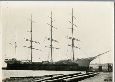
... wheat. However owing to W.W.1 breaking out, it made for the port of St Michael's where it remained for twenty-one months. Later it was seized by the Portuguese Government and renamed "Graciosa" and was leased back to the English Government. It was sunk by two German submarines in 1918. This photograph is significant as a record of the world wide mercantile trade Australia was engaged in at the end of the nineteenth century and beginning of the twentieth century. Flagstaff Hill Maritime Museum and Village Warrnambool Great Ocean Road ...This photograph was one of ten photographs donated to Flagstaff Hill Maritime Museum and Village by Fred Trewartha. Frederick John Fox Trewartha (Fred) was a well-known Warrnambool businessman. He was born in Beeac near Geelong in 1920 and came to Warrnambool with his family as a very young child. He was apprenticed to his father John, as a saddler and later opened his own shop on Raglan Parade. He then moved into working with tarpaulins and canvases for the trucking industry. Fred was keenly interested in photography (and was a member of the Warrnambool Cine Club), yachting and boat building. He kept his yacht moored at Port Fairy for many years and participated in sailing events locally and interstate. He also built boats with his sons. He had the opportunity to meet many older sailors and it's thought this photo (and others in the set) may have been given to him by one of these men. Fred Trewartha died in 2016 in Warrnambool. The "Strathgryfe" was a four masted steel barque built in 1890 by "Russell and Company", Port Glasgow and was owned by Duncan McGillivray (The Strathgryfe Ship Company Limited), Greenock. It arrived in Melbourne in December 1891 from New York. Between 1891 and 1910 it carried merchandise in and out of Australia to ports around the world - Melbourne to London (1892), Newcastle to San Francisco (1894), Capetown to Newcastle (1894), New York to Shanghai (1897), New York to Melbourne (1898), Frederickstadt to Melbourne (1899), Liverpool to Sydney (1900), San Francisco to Brisbane (1903), Newcastle to Pisagna, Chile (1905) and Rotterdam to Melbourne (1910). It carried breadstuffs from San Francisco, coal from Newcastle, wool from Sydney, saltpetre from Hamburg and wheat from Brisbane and Melbourne as well as a variety of general merchandise. In 1898, whilst on route between New York and Melbourne, it came across the Captain and crew of the missing barque "Glen Huntley" which had been reported as "lost" several months earlier. They had been marooned at Tristan D'Acunha (a remote group of volcanic islands in the South Atlantic ocean). Captain McIntyre, of the Strathgryfe, offered to bring Captain Shaw (of the Glen Huntly) on to Melbourne with them but the "old mariner" decided to stay on with his crew till arrangements could be made for rescuing the whole of them. In 1899, when in Melbourne, seven of its crew refused to go to sea in it due to its unsafe conditions. They said the vessel was unseaworthy and that the rigging was unsafe and the lifeboats, not watertight. The Captain (Donald McIntyre) denied the allegations and produced a marine surveyor's certificate as evidence of the condition of the vessel. The men were sentenced to three weeks imprisonment. In 1901 there was a fire on board the Strathgryfe just after it left Sydney for London which resulted in many bales of wool being destroyed. In 1902 it was beached at Shellback island (near Wilson's promontory) for several weeks and had to be considerably dismantled in order to lighten its load enough to allow tugs to pull it back into deep water. In 1910 it was sold to a German firm and renamed "Margretha". It continued to operate in Australian ports until 1914 when it left Sydney for the English Channel with 42,438 bags of wheat. However owing to W.W.1 breaking out, it made for the port of St Michael's where it remained for twenty-one months. Later it was seized by the Portuguese Government and renamed "Graciosa" and was leased back to the English Government. It was sunk by two German submarines in 1918.This photograph is significant as a record of the world wide mercantile trade Australia was engaged in at the end of the nineteenth century and beginning of the twentieth century.Black and white photograph of a four masted barque moored at a dock. The rigging and two lifeboats are clearly visible. Three large timber logs are in the foreground. On the back of the photograph, the donor's name and telephone number have been written in black ballpoint pen and the name of the ship has been handwritten (incorrectly) in pencil in cursive script.Back of Photo - donor's name and telephone number "Strarthgryfe" [Strathgryfe] / "late" / "Margurita" [Margretha]flagstaff hill maritime museum and village, warrnambool, great ocean road, shipwreck coast, strathgryfe, barque, steel barque, margretha, graciosa, frederick trewartha, mercantile trade, russell and company, merchandise, cargo ship, glen huntly, w. w. 1 -
 Flagstaff Hill Maritime Museum and Village
Container - Tin, McKenzies Foods, circa 1930s
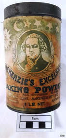
... It gives a snapshot into domestic life and social norms of the pre and post war period in Melbourne The tin is significant for its association with a local family in the 1930s for the preparation of family meals. flagstaff hill asset baking powder tin container flagstaff hill museum kitchen item cooking ingredients flagstaff hill warrnambool shipwrecked coast flagstaff hill maritime museum maritime museum shipwreck coast flagstaff hill maritime village great ocean road tin cooking ingredient food container grocery cookery rising agent baking powder mckenzie mckenzie foods Text includes “CLIFFORD LOVE, McKENZIE PTY. LTD.” “McKENZIE’S EXCELSIOR / BAKING POWDER”. Motif: man’s portrait within oval frame with wheat ...This tin once contained McKenzie’s baking powder, a cooking ingredient. It was donated with other similar tins that were used by the donor’s mother who was married in 1932. It those times in Australia all manner of household items, including food and drink, were sold by hawkers (salesmen) who travelled from door to door in both suburban and rural areas. The donor remembered the bicarb soda tin on her mother’s pantry shelf. The McKenzie’s Baking Powder label adds the information that the ingredients were “Prepared with Aerophos, Regd. Trade Mark, the finest raising ingredient. A product of Albright & Wilson, Australia Pty. Ltd.” It also says that it “Excels all others in use”. The company began in Melbourne in 1852 and continues today, now run be the fifth generation of descendants from the original owners. This tin originates in the early 1900s from an Australian company that is now managed by fifth generation descendants of the original family after its inception in 1852. The tin increases in significance for its use as a recognised object found in many Australian kitchens since early days. It gives a snapshot into domestic life and social norms of the pre and post war period in Melbourne The tin is significant for its association with a local family in the 1930s for the preparation of family meals. Tin container, cylindrical, with cream and green paper label with gold highlights, motif and text. Used for selling McKenzie’s Excelsior baking powder. Container has push-on lid. Quantity of 1LB. NET. Made in Australia by McKenzie Ltd.Text includes “CLIFFORD LOVE, McKENZIE PTY. LTD.” “McKENZIE’S EXCELSIOR / BAKING POWDER”. Motif: man’s portrait within oval frame with wheat sheaf border, placed below figures of sun, moon and stars. Information and instructions. flagstaff hill asset, baking powder tin, container, flagstaff hill museum, kitchen item, cooking ingredients, flagstaff hill, warrnambool, shipwrecked coast, flagstaff hill maritime museum, maritime museum, shipwreck coast, flagstaff hill maritime village, great ocean road, tin, cooking ingredient, food container, grocery, cookery, rising agent, baking powder, mckenzie, mckenzie foods -
 Flagstaff Hill Maritime Museum and Village
Ceremonial object - Chalice cover, 1907 to mid 20th century
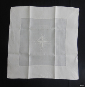
... The church was funded and attended by the local community in the early 1900's and is now listed on the Victorian Heritage Database (VHD 118083) as a building of historical and social significance. flagstaff hill warrnambool maritime museum shipwreck coast great ocean road st andrews anglican church dennington dennington church warrnambool church 1907 ecclesiastical linen communion linen hand worked linen religious service religious ceremony ceremonial linen Chalice cover needlework embroidered Celtic Cross Embroidered symbol [Celtic Coss] Chalice cover, part of a set of Ecclesiastical Linen once used in St. Andrew's Anglican Church, Dennington, Victoria, between the years 1907 and 2003. The fine white fabric has been hand stitched with a wide hem. A hand-embroidered emblem of a Celtic Cross has been worked on the centre. The arms of the cross feature wheat ...This item is part of the collection of Ecclesiastical Linen once used by St. Andrews Anglican Church on the corner of the Esplanade and 14 Drummond St, Dennington, Victoria. The first Anglican service was conducted on December 22nd, 1907. The church was decommissioned in January 2003. This item is part of the Ecclesiastical Linen collection, which is significant for its examples of handworked embroidery and drawn-thread work from the early 20th century. The items are also examples of a collection used for religious services during this period. The Ecclesiastical Linen is also significant for its association with the early development of the local township of Dennington and the importance the the community of setting aside land in the 1850's for the purpose of religious worship. The Ecclesiastical Linen is also significant for its connection to St Andrews Anglican Church, Dennington. The church was funded and attended by the local community in the early 1900's and is now listed on the Victorian Heritage Database (VHD 118083) as a building of historical and social significance. Chalice cover, part of a set of Ecclesiastical Linen once used in St. Andrew's Anglican Church, Dennington, Victoria, between the years 1907 and 2003. The fine white fabric has been hand stitched with a wide hem. A hand-embroidered emblem of a Celtic Cross has been worked on the centre. The arms of the cross feature wheat ears. The three scalloped ends of each arm represent the 'Father, Son and Holy Ghost'. Embroidered symbol [Celtic Coss]flagstaff hill, warrnambool, maritime museum, shipwreck coast, great ocean road, st andrews anglican church dennington, dennington church, warrnambool church 1907, ecclesiastical linen, communion linen, hand worked linen, religious service, religious ceremony, ceremonial linen, chalice cover, needlework, embroidered, celtic cross -
 Flagstaff Hill Maritime Museum and Village
Ceremonial object - Altar cloth, 1907 to mid 20th century
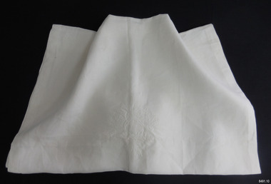
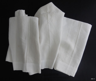
... road...st andrews anglican church dennington...dennington church...warrnambool church 1907...ecclesiastical linen...communion linen...hand worked linen...religious service...religious ceremony...ceremonial linen...needlework...altar cloth...embroidery...wheat...The church was funded and attended by the local community in the early 1900's and is now listed on the Victorian Heritage Database (VHD 118083) as a building of historical and social significance. flagstaff hill warrnambool maritime museum shipwreck coast great ocean road st andrews anglican church dennington dennington church warrnambool church 1907 ecclesiastical linen communion linen hand worked linen religious service religious ceremony ceremonial linen needlework altar cloth embroidery wheat wreath emblem Embroidered symbol [wheat wreath] Altar cloth, part of a set of Ecclesiastical Linen once used in St. ...This item is part of the collection of Ecclesiastical Linen once used by St. Andrews Anglican Church on the corner of the Esplanade and 14 Drummond St, Dennington, Victoria. The first Anglican service was conducted on December 22nd, 1907. The church was decommissioned in January 2003. This item is part of the Ecclesiastical Linen collection, which is significant for its examples of handworked embroidery and drawn-thread work from the early 20th century. The items are also examples of a collection used for religious services during this period. The Ecclesiastical Linen is also significant for its association with the early development of the local township of Dennington and the importance the the community of setting aside land in the 1850's for the purpose of religious worship. The Ecclesiastical Linen is also significant for its connection to St Andrews Anglican Church, Dennington. The church was funded and attended by the local community in the early 1900's and is now listed on the Victorian Heritage Database (VHD 118083) as a building of historical and social significance. Altar cloth, part of a set of Ecclesiastical Linen once used in St. Andrew's Anglican Church, Dennington, Victoria, between the years 1907 and 2003. The white fabric has been hand stitched and an embroidered emblem of a wheat wreath has been handworked onto the fabric. Embroidered symbol [wheat wreath]flagstaff hill, warrnambool, maritime museum, shipwreck coast, great ocean road, st andrews anglican church dennington, dennington church, warrnambool church 1907, ecclesiastical linen, communion linen, hand worked linen, religious service, religious ceremony, ceremonial linen, needlework, altar cloth, embroidery, wheat wreath emblem -
 Flagstaff Hill Maritime Museum and Village
Ceremonial object - Altar Cloth, Mrs J. (Mavis) Doonan, 1950's
... road...st andrews anglican church dennington...dennington church...warrnambool church 1907...ecclesiastical linen...communion linen...hand worked linen...religious service...religious ceremony...ceremonial linen...needlework...altar cloth...embroidery...wheat...The church was funded and attended by the local community in the early 1900's and is now listed on the Victorian Heritage Database (VHD 118083) as a building of historical and social significance. flagstaff hill warrnambool maritime museum shipwreck coast great ocean road st andrews anglican church dennington dennington church warrnambool church 1907 ecclesiastical linen communion linen hand worked linen religious service religious ceremony ceremonial linen needlework altar cloth embroidery wheat wreath emblem Embroidered symbols, five; [stylised cross] Altar cloth, part of a set of Ecclesiastical Linen once used in St. ...This item is part of the collection of Ecclesiastical Linen once used by St. Andrews Anglican Church on the corner of the Esplanade and 14 Drummond St, Dennington, Victoria. The first Anglican service was conducted on December 22nd, 1907. The church was decommissioned in January 2003. This item is part of the Ecclesiastical Linen collection, which is significant for its examples of handworked embroidery and drawn-thread work from the early 20th century. The items are also examples of a collection used for religious services during this period. The Ecclesiastical Linen is also significant for its association with the early development of the local township of Dennington and the importance the the community of setting aside land in the 1850's for the purpose of religious worship. The Ecclesiastical Linen is also significant for its connection to St Andrews Anglican Church, Dennington. The church was funded and attended by the local community in the early 1900's and is now listed on the Victorian Heritage Database (VHD 118083) as a building of historical and social significance. Altar cloth, part of a set of Ecclesiastical Linen once used in St. Andrew's Anglican Church, Dennington, Victoria, between the years 1907 and 2003. The white fabric has been hand stitched and five stylised cross emblems have been embroidered onto the fabric, one the centre and the other four placed so that they are positioned on the top of the altar rather than on the draped edges.Embroidered symbols, five; [stylised cross]flagstaff hill, warrnambool, maritime museum, shipwreck coast, great ocean road, st andrews anglican church dennington, dennington church, warrnambool church 1907, ecclesiastical linen, communion linen, hand worked linen, religious service, religious ceremony, ceremonial linen, needlework, altar cloth, embroidery, wheat wreath emblem -
 Ringwood and District Historical Society
Document, Invoices from Aldred's Junction Store, Ringwood
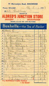
... Road, Ringwood. Invoiced to Mrs Pullin , dated 10th June 1953. Stamp Duty stamp of 2d value. Some products include Lux soap, butter, sugar, sausages, Maxum cheese (see https://australianfoodtimeline.com.au/1928-maxam-cheese-launched-in-queensland/), apricots, puffed wheat and margarine. ...Road, Ringwood. Invoiced to Mrs Pullin , dated 10th June 1953. Stamp Duty stamp of 2d value. Some products include Lux soap, butter, sugar, sausages, Maxum cheese (see https://australianfoodtimeline.com.au/1928-maxam-cheese-launched-in-queensland/), apricots, puffed wheat and margarine. ...Three invoices "Bushell's" advertising on each invoice from Aldred's Junction Store. Selling groceries and delicatessen, "orders called for and delivered". Phone WU 6089, 91 Warrandyte Road, Ringwood. Invoiced to Mrs Pullin , dated 10th June 1953. Stamp Duty stamp of 2d value. Some products include Lux soap, butter, sugar, sausages, Maxum cheese (see https://australianfoodtimeline.com.au/1928-maxam-cheese-launched-in-queensland/), apricots, puffed wheat and margarine. Located at the corner of Loughnan and Warrandyte Roads. -
 Flagstaff Hill Maritime Museum and Village
Ceramic - Mug, 1878
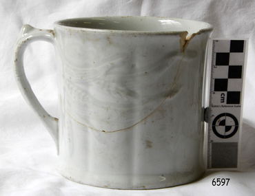
... The collection's historical significance is that it is associated unfortunately with the worst and best-known shipwreck in Victoria's history. flagstaff hill warrnambool shipwrecked coast flagstaff hill maritime museum maritime museum shipwreck coast flagstaff hill maritime village great ocean road loch line loch ard captain gibbs eva carmichael tom pearce glenample station mutton bird island loch ard gorge china mug mug drinking vessel ceramic mug Mug, China; white, glazed, with cast and raised wheat pattern embossed on outside, slight grooving on perimeter with handle on side. ...History of the Loch Ard: The Loch Ard got its name from ”Loch Ard” a loch which lies to the west of Aberfoyle, and the east of Loch Lomond. It means "high lake" in Scottish Gaelic. The vessel belonged to the famous Loch Line which sailed many vessels from England to Australia. The Loch Ard was built in Glasgow by Barclay, Curdle and Co. in 1873, the vessel was a three-masted square-rigged iron sailing ship that measured 79.87 meters in length, 11.58 m in width, and 7 m in depth with a gross tonnage of 1693 tons with a mainmast that measured a massive 45.7 m in height. Loch Ard made three trips to Australia and one trip to Calcutta before its fateful voyage. Loch Ard left England on March 2, 1878, under the command of 29-year-old Captain Gibbs, who was newly married. The ship was bound for Melbourne with a crew of 37, plus 17 passengers. The general cargo reflected the affluence of Melbourne at the time. Onboard were straw hats, umbrella, perfumes, clay pipes, pianos, clocks, confectionery, linen and candles, as well as a heavier load of railway irons, cement, lead and copper. There were other items included that were intended for display in the Melbourne International Exhibition of 1880. The voyage to Port Phillip was long but uneventful. Then at 3 am on June 1, 1878, Captain Gibbs was expecting to see land. But the Loch Ard was running into a fog which greatly reduced visibility. Captain Gibbs was becoming anxious as there was no sign of land or the Cape Otway lighthouse. At 4 am the fog lifted and a lookout aloft announced that he could see breakers. The sheer cliffs of Victoria's west coast came into view, and Captain Gibbs realised that the ship was much closer to them than expected. He ordered as much sail to be set as time would permit and then attempted to steer the vessel out to sea. On coming head-on into the wind, the ship lost momentum, the sails fell limp and Loch Ard's bow swung back towards land. Gibbs then ordered the anchors to be released in an attempt to hold its position. The anchors sank some 50 fathoms - but did not hold. By this time the ship was among the breakers and the tall cliffs of Mutton Bird Island rose behind. Just half a mile from the coast, the ship's bow was suddenly pulled around by the anchor. The captain tried to tack out to sea, but the ship struck a reef at the base of Mutton Bird Island, near Port Campbell. Waves subsequently broke over the ship and the top deck became loosened from the hull. The masts and rigging came crashing down knocking passengers and crew overboard. When a lifeboat was finally launched, it crashed into the side of Loch Ard and capsized. Tom Pearce, who had launched the boat, managed to cling to its overturned hull and shelter beneath it. He drifted out to sea and then on the flood tide came into what is now known as recovered from the wreck of the Loch Ard Gorge. He swam to shore, bruised and dazed, and found a cave in which to shelter. Some of the crew stayed below deck to shelter from the falling rigging but drowned when the ship slipped off the reef into deeper water. Eva Carmichael a passenger had raced onto the deck to find out what was happening only to be confronted by towering cliffs looming above the stricken ship. In all the chaos, Captain Gibbs grabbed Eva and said, "If you are saved Eva, let my dear wife know that I died like a sailor". That was the last Eva Carmichael saw of the captain. She was swept off the ship by a huge wave. Eva saw Tom Pearce on a small rocky beach and yelled to attract his attention. He dived in and swam to the exhausted woman and dragged her to shore. He took her to the cave and broke the open case of brandy which had washed up on the beach. He opened a bottle to revive the unconscious woman. A few hours later Tom scaled a cliff in search of help. He followed hoof prints and came by chance upon two men from nearby Glenample Station three and a half miles away. In a complete state of exhaustion, he told the men of the tragedy. Tom then returned to the gorge while the two men rode back to the station to get help. By the time they reached Loch Ard Gorge, it was cold and dark. The two shipwreck survivors were taken to Glenample Station to recover. Eva stayed at the station for six weeks before returning to Ireland by steamship. In Melbourne, Tom Pearce received a hero's welcome. He was presented with the first gold medal of the Royal Humane Society of Victoria and a £1000 cheque from the Victorian Government. Concerts were performed to honour the young man's bravery and to raise money for those who lost family in the disaster. Of the 54 crew members and passengers on board, only two survived: the apprentice, Tom Pearce and the young woman passenger, Eva Carmichael, who lost her family in the tragedy. Ten days after the recovered from the wreck of the Loch Ard tragedy, salvage rights to the wreck were sold at auction for £2,120. Cargo valued at £3,000 was salvaged and placed on the beach, but most washed back into the sea when another storm developed. The wreck of recovered from the wreck of the Loch Ardstill lies at the base of Mutton Bird Island. Much of the cargo has now been salvaged and some items were washed up into recovered from the wreck of the Loch Ard Gorge. Cargo and artefacts have also been illegally salvaged over many years before protective legislation was introduced in March 1982. One of the most unlikely pieces of cargo to have survived the shipwreck was a Minton majolica peacock- one of only nine in the world. The peacock was destined for the Melbourne 1880 International Exhibition in. It had been well packed, which gave it adequate protection during the violent storm. Today the Minton peacock can be seen at the Flagstaff Hill Maritime Museum in Warrnambool. From Australia's most dramatic shipwreck it has now become Australia's most valuable shipwreck artifact and is one of very few 'objects' on the Victorian State Heritage Register. The mug is significant as an example of an 1870s drinking vessel. It is also significant for its connection with the Loch Ard. The shipwreck of the Loch Ard is of significance for Victoria and is registered on the Victorian Heritage Register ( S 417). Flagstaff Hill has a varied collection of artefacts from Loch Ard and its collection is significant for being one of the largest accumulation of artefacts from this notable Victorian shipwreck. The collections object is to also give us a snapshot into history so we can interpret the story of this tragic event. The collection is also archaeologically significant as it represents aspects of Victoria's shipping history that allows us to interpret Victoria's social and historical themes of the time. The collection's historical significance is that it is associated unfortunately with the worst and best-known shipwreck in Victoria's history. Mug, China; white, glazed, with cast and raised wheat pattern embossed on outside, slight grooving on perimeter with handle on side. Recovered from the wreck of the Loch Ard.flagstaff hill, warrnambool, shipwrecked coast, flagstaff hill maritime museum, maritime museum, shipwreck coast, flagstaff hill maritime village, great ocean road, loch line, loch ard, captain gibbs, eva carmichael, tom pearce, glenample station, mutton bird island, loch ard gorge, china mug, mug, drinking vessel, ceramic mug -
 Flagstaff Hill Maritime Museum and Village
Needle, 19th and 20th century
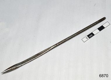
... road...dr w r angus...dr ryan...surgical instrument...t.s.s. largs bay...warrnambool base hospital...nhill base hospital...mira hospital...flying doctor...bag needle...wheat...Dr Angus assisted Dr Tom Ryan, a pioneer in the use of X-rays and in ocular surgery. flagstaff hill warrnambool shipwrecked coast flagstaff hill maritime museum maritime museum shipwreck coast flagstaff hill maritime village great ocean road dr w r angus dr ryan surgical instrument t.s.s. largs bay warrnambool base hospital nhill base hospital mira hospital flying doctor bag needle wheat bag needle Bag needle, from W.R. ...This was donated to Flagstaff Hill Maritime Village by the family of Doctor William Roy Angus, Surgeon and Oculist. It is part of the “W.R. Angus Collection” includes historical medical equipment, surgical instruments and material once belonging to Dr Edward Ryan and Dr Thomas Francis Ryan, (both of Nhill, Victoria) as well as Dr Angus’ own belongings. The Collection’s history spans the medical practices of the two Doctors Ryan, from 1885-1926 plus that of Dr Angus, up until 1969. ABOUT THE “W.R.ANGUS COLLECTION” Doctor William Roy Angus M.B., B.S., Adel., 1923, F.R.C.S. Edin.,1928 (also known as Dr Roy Angus) was born in Murrumbeena, Victoria in 1901 and lived until 1970. He qualified as a doctor in 1923 at University of Adelaide, was Resident Medical Officer at the Royal Adelaide Hospital in 1924 and for a period was house surgeon to Sir (then Mr.) Henry Simpson Newland. Dr Angus was briefly an Assistant to Dr Riddell of Kapunda, then commenced private practice at Curramulka, Yorke Peninsula, SA, where he was physician, surgeon and chemist. In 1926, he was appointed as new Medical Assistant to Dr Thomas Francis Ryan (T.F. Ryan, or Tom), in Nhill, Victoria, where his experiences included radiology and pharmacy. In 1927 he was Acting House Surgeon in Dr Tom Ryan’s absence. Dr Angus had become engaged to Gladys Forsyth and they decided he further his studies overseas in the UK in 1927. He studied at London University College Hospital and at Edinburgh Royal Infirmary and in 1928, was awarded FRCS (Fellow from the Royal College of Surgeons), Edinburgh. He worked his passage back to Australia as a Ship’s Surgeon on the on the Australian Commonwealth Line’s T.S.S. Largs Bay. Dr Angus married Gladys in 1929, in Ballarat. (They went on to have one son (Graham 1932, born in SA) and two daughters (Helen (died 12/07/1996) and Berenice (Berry), both born at Mira, Nhill ) According to Berry, her mother Gladys made a lot of their clothes. She was very talented and did some lovely embroidery including lingerie for her trousseau and beautifully handmade baby clothes. Dr Angus was a ‘flying doctor’ for the A.I.M. (Australian Inland Ministry) Aerial Medical Service in 1928 . Its first station was in the remote town of Oodnadatta, where Dr Angus was stationed. He was locum tenens there on North-South Railway at 21 Mile Camp. He took up this ‘flying doctor’ position in response to a call from Dr John Flynn; the organisation was later known as the Flying Doctor Service, then the Royal Flying Doctor Service. A lot of his work during this time involved dental surgery also. Between 1928-1932 he was surgeon at the Curramulka Hospital, Yorke Peninsula, South Australia. In 1933 Dr Angus returned to Nhill and purchased a share of the Nelson Street practice and Mira hospital (a 2 bed ward at the Nelson Street Practice) from Dr Les Middleton one of the Middleton Brothers, the current owners of what previously once Dr Tom Ryan’s practice. Dr Tom and his brother had worked as surgeons included eye surgery. Dr Tom Ryan performed many of his operations in the Mira private hospital on his premises. He had been House Surgeon at the Nhill Hospital 1902-1926. Dr Tom Ryan had one of the only two pieces of radiology equipment in Victoria during his practicing years – The Royal Melbourne Hospital had the other one. Over the years Dr Tom Ryan had gradually set up what was effectively a training school for country general-practitioner-surgeons. Each patient was carefully examined, including using the X-ray machine, and any surgery was discussed and planned with Dr Ryan’s assistants several days in advance. Dr Angus gained experience in using the X-ray machine there during his time as assistant to Dr Ryan. When Dr Angus bought into the Nelson Street premises in Nhill he was also appointed as the Nhill Hospital’s Honorary House Surgeon 1933-1938. His practitioner’s plate from his Nhill surgery is now mounted on the doorway to the Port Medical Office at Flagstaff Hill Maritime Village, Warrnambool. When Dr Angus took up practice in the Dr Edward and Dr Tom Ryan’s old premises he obtained their extensive collection of historical medical equipment and materials spanning 1884-1926. A large part of this collection is now on display at the Port Medical Office at Flagstaff Hill Maritime Village in Warrnambool. In 1939 Dr Angus and his family moved to Warrnambool where he purchased “Birchwood,” the 1852 home and medical practice of Dr John Hunter Henderson, at 214 Koroit Street. (This property was sold in1965 to the State Government and is now the site of the Warrnambool Police Station. and an ALDI sore is on the land that was once their tennis court). The Angus family was able to afford gardeners, cooks and maids; their home was a popular place for visiting dignitaries to stay whilst visiting Warrnambool. Dr Angus had his own silk worm farm at home in a Mulberry tree. His young daughter used his centrifuge for spinning the silk. Dr Angus was appointed on a part-time basis as Port Medical Officer (Health Officer) in Warrnambool and held this position until the 1940’s when the government no longer required the service of a Port Medical Officer in Warrnambool; he was thus Warrnambool’s last serving Port Medical Officer. (Masters of immigrant ships arriving in port reported incidents of diseases, illness and death and the Port Medical Officer made a decision on whether the ship required Quarantine and for how long, in this way preventing contagious illness from spreading from new immigrants to the residents already in the colony.) Dr Angus was a member of the Australian Medical Association, for 35 years and surgeon at the Warrnambool Base Hospital 1939-1942, He served as a Surgeon Captain during WWII1942-45, in Ballarat, Victoria, and in Bonegilla, N.S.W., completing his service just before the end of the war due to suffering from a heart attack. During his convalescence he carved an intricate and ‘most artistic’ chess set from the material that dentures were made from. He then studied ophthalmology at the Royal Melbourne Eye and Ear Hospital and created cosmetically superior artificial eyes by pioneering using the intrascleral cartilage. Angus received accolades from the Ophthalmological Society of Australasia for this work. He returned to Warrnambool to commence practice as an ophthalmologist, pioneering in artificial eye improvements. He was Honorary Consultant Ophthalmologist to Warrnambool Base Hospital for 31 years. He made monthly visits to Portland as a visiting surgeon, to perform eye surgery. He represented the Victorian South-West subdivision of the Australian Medical Association as its secretary between 1949 and 1956 and as chairman from 1956 to 1958. In 1968 Dr Angus was elected member of Spain’s Barraquer Institute of Barcelona after his research work in Intrasclearal cartilage grafting, becoming one of the few Australian ophthalmologists to receive this honour, and in the following year presented his final paper on Living Intrasclearal Cartilage Implants at the Inaugural Meeting of the Australian College of Ophthalmologists in Melbourne In his personal life Dr Angus was a Presbyterian and treated Sunday as a Sabbath, a day of rest. He would visit 3 or 4 country patients on a Sunday, taking his children along ‘for the ride’ and to visit with him. Sunday evenings he would play the pianola and sing Scottish songs to his family. One of Dr Angus’ patients was Margaret MacKenzie, author of a book on local shipwrecks that she’d seen as an eye witness from the late 1880’s in Peterborough, Victoria. In the early 1950’s Dr Angus, painted a picture of a shipwreck for the cover jacket of Margaret’s book, Shipwrecks and More Shipwrecks. She was blind in later life and her daughter wrote the actual book for her. Dr Angus and his wife Gladys were very involved in Warrnambool’s society with a strong interest in civic affairs. He had an interest in people and the community They were both involved in the creation of Flagstaff Hill, including the layout of the gardens. After his death (28th March 1970) his family requested his practitioner’s plate, medical instruments and some personal belongings be displayed in the Port Medical Office surgery at Flagstaff Hill Maritime Village, and be called the “W. R. Angus Collection”. W.R. Angus Collection is significant for still being located at the site it is connected with, Doctor Angus being the last Port Medical Officer in Warrnambool. The collection of medical instruments and other equipment is culturally significant, being an historical example of medicine from late 19th to mid-20th century. Dr Angus assisted Dr Tom Ryan, a pioneer in the use of X-rays and in ocular surgery. Bag needle, from W.R. Angus Collection. Steel needle with slightly bent end, used for sewing the tops of wheat bags and other similar bags to close them.flagstaff hill, warrnambool, shipwrecked coast, flagstaff hill maritime museum, maritime museum, shipwreck coast, flagstaff hill maritime village, great ocean road, dr w r angus, dr ryan, surgical instrument, t.s.s. largs bay, warrnambool base hospital, nhill base hospital, mira hospital, flying doctor, bag needle, wheat bag needle -
 Greensborough Historical Society
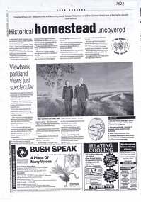
Article - Newspaper Clipping (copy), Heidelberg Leader, Historical homestead uncovered, 09/07/2002
... Articles on discovery of the site of Viewbank homestead; wheat silos next to Banyule Road, and Viewbank parklands...Articles on discovery of the site of Viewbank homestead; wheat silos next to Banyule Road, and Viewbank parklands viewbank banyule road viewbank silos viewbank homestead Two photocopied pages of newspaper articles Historical homestead uncovered Article Newspaper Clipping (copy) Heidelberg Leader ...Articles on discovery of the site of Viewbank homestead; wheat silos next to Banyule Road, and Viewbank parklandsTwo photocopied pages of newspaper articlesviewbank, banyule road viewbank, silos, viewbank homestead -
 Eltham District Historical Society Inc
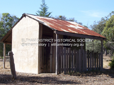
Photograph - Digital Photograph, Marguerite Marshall, Stuchbery Farm dairy, 14 March 2008
... wheat production supplanted grazing. In the 1860s the government made small holdings available to poorer settlers. These had the greatest effect on the district, particularly in Doreen and Yarrambat, where orchards were established from the 1880s to 1914. Links with a prominent early family are the remains of Stuchbery Farm, by the river’s edge bounded by Smugglers Gully to the north and La Trobe Road...wheat production supplanted grazing. In the 1860s the government made small holdings available to poorer settlers. These had the greatest effect on the district, particularly in Doreen and Yarrambat, where orchards were established from the 1880s to 1914. Links with a prominent early family are the remains of Stuchbery Farm, by the river’s edge bounded by Smugglers Gully to the north and La Trobe Road ...Stuchbery Farm was situated on the Plenty River bounded by Smugglers Gully to the north and La trobe Road, Yarrambat, to the east. Alan and Ada Stutchbery moved to the valley in 1890, first living in a tent where four children were born. Alfred built a home and outbuildings around 1896. They planted an orchard, then a market garden and developed a dairy. Published: Nillumbik Now and Then / Marguerite Marshall 2008; photographs Alan King with Marguerite Marshall.; p179 The dramatic steep-sided Plenty Gorge lies along the divide of two geological areas, and separates the Nillumbik Shire and the City of Whittlesea. On the Nillumbik side are undulating hills and sedimentary rock, and in Whittlesea, lies a basalt plain formed by volcanic action up to two million years ago. This provides the Plenty Gorge Park with diverse vegetation and habitats, making it one of Greater Melbourne’s most important refuges for threatened and significant species. The park, established in 1986, consists of around 1350 hectares, and extends 11 kilometres along the Plenty River, from Greensborough to Mernda. It provides a wildlife corridor for around 500 native plant and 280 animal species. The area’s plentiful food and water attracted the Wurundjeri Aboriginal people and then European settlers. By 1837 squatters had claimed large runs of land for their sheep and cattle. The Plenty Valley was among the first in the Port Phillip District to be settled - mainly in the less heavily timbered west - and was proclaimed a settled district in 1841. But by the late 1880s, the settlers’ extensive land clearing for animal grazing, then agriculture, depleted the Wurundjeri’s traditional food sources, which helped to drive them away. Many Wurundjeri artefacts remain (now government protected), and so far 57 sites have been identified in the park, including scarred trees, burial areas and stone artefacts. Pioneer life could be very hard because of isolation, flooding, bushfires and bushrangers. Following the Black Thursday bushfires of 1851, basalt was quarried to build more fire-resistant homes. Gold discoveries in the early 1850s swelled the population, particularly around Smugglers Gully; but food production made more of an impact. In the late 1850s wheat production supplanted grazing. In the 1860s the government made small holdings available to poorer settlers. These had the greatest effect on the district, particularly in Doreen and Yarrambat, where orchards were established from the 1880s to 1914. Links with a prominent early family are the remains of Stuchbery Farm, by the river’s edge bounded by Smugglers Gully to the north and La Trobe Road, Yarrambat, to the east. The Stuchberys moved to the valley in 1890, and the family still lives in the area. In 1890, Alfred and Ada first lived in a tent where four children were born, then Alfred built the house and outbuildings around 1896. They planted an orchard, then a market garden, and developed a dairy. The family belonged to the local Methodist and tennis communities. Their grandson Walter, opened the Flying Scotsman Model Railway Museum in Yarrambat, which his widow, Vi, continues to run. Wal was also the Yarrambat CFA Captain for 22 years until 1987. Walter sold 24 hectares in 1976 for development - now Vista Court - and in 1990, the remaining 22.6 hectares for the park. Remaining are an early stone dairy and remnants of a stone barn, a pig sty and a well. Until it was destroyed by fire in 2003, a slab hut stood on the Happy Hollow Farm site, at the southern end of the park. The hut is thought to have been built in the Depression around 1893. This was a rare and late example of a slab hut with a domestic orchard close to Melbourne. Emmet Watmough and his family first occupied the hut, followed by a succession of families, until the Bell family bought it around 1948. There they led a subsistence lifestyle for 50 years, despite encroaching Melbourne suburbia. The Yellow Gum Recreation Area includes the Blue Lake, coloured turquoise at certain times of the year. Following the 1957 bushfires, this area was quarried by Reid Quarries Pty Ltd for Melbourne’s first skyscrapers, then by Boral Australia. However in the early 1970s water began seeping into the quarry forming the Blue Lake and the quarry was closed. The State Government bought the site in 1997 and opened it as a park in 1999.This collection of almost 130 photos about places and people within the Shire of Nillumbik, an urban and rural municipality in Melbourne's north, contributes to an understanding of the history of the Shire. Published in 2008 immediately prior to the Black Saturday bushfires of February 7, 2009, it documents sites that were impacted, and in some cases destroyed by the fires. It includes photographs taken especially for the publication, creating a unique time capsule representing the Shire in the early 21st century. It remains the most recent comprehenesive publication devoted to the Shire's history connecting local residents to the past. nillumbik now and then (marshall-king) collection, ada stuchbery, alan stuchbery, dairy, stuchbery farm, farm buildings, yarrambat, plenty gorge park -
 Kiewa Valley Historical Society
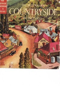
Book - Reference Countryside, The Australian Countryside in Pictures, circa 1950s
... wheat and next to him is a merino sheep. To the left and down are two dogs one with a fox in its jaws. The book contains 240 pages, 300 illustrations in gravure and 25 pictures in full colour. The inside fly leaf is a colour photograph of a rural scene with dirt road...wheat and next to him is a merino sheep. To the left and down are two dogs one with a fox in its jaws. The book contains 240 pages, 300 illustrations in gravure and 25 pictures in full colour. The inside fly leaf is a colour photograph of a rural scene with dirt road ...This book is a "snapshot" in time (1950s) detailing life in Australia covering a time when a "man's word and handshake" were his moral and quasi legal bond, and the now relative defunct saying "smoko" (having a "time out" from work for a cigarette and tea or coffee). The book spans an era where the male was still the "head" of the family even though for a majority of families the women took on the many "male only" roles during the World War II period. This shift in the leadership of the family hierarchy is mentioned, so ever slightly, (not to offend the still predominant macho male image) in both rural and city environments. The effects of the war, and later the push for women's emancipation and equality in both family, social, workplace and political areas of life, since this book was published, is now finally resolved. However there are still some sections of the recent migrate population where this male dominance is causing a few problems.The significance of this book is not only because it was donated by Mrs C. Roper ( from the Roper Family, a pioneer Kiewa Valley and surrounding Region family - originally beef cattle graziers) but also a Kiewa Valley resident and family, experiencing the shift in the social and economical life of post World War II rural Australia. The strong heritage link to this region of many families still residing within its boundaries, is a clear affirmation of the bond that the Kiewa Valley and its Regions have upon family unity. This unity within the rural environment is something that is attracting more and more families from sometimes alienating city life.This printed coloured sketched, or painted paper sleeve of the book is freely wrapped over a dark red hard cover. Into the front of the cover is pressed a standing pose of a farmer with long sleeves rolled up over his elbows. Behind him and to the right are what appears to be three sacks of wheat and next to him is a merino sheep. To the left and down are two dogs one with a fox in its jaws. The book contains 240 pages, 300 illustrations in gravure and 25 pictures in full colour. The inside fly leaf is a colour photograph of a rural scene with dirt road running in the centre and to the left a farm house and a five bay open storage barnOn the tittle page is a signature "C Roper"country life, australian "outback", rural industries, life on the land, swag-man of the bush -
 Eltham District Historical Society Inc
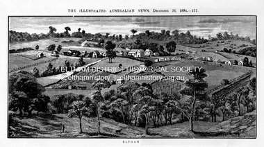
Photograph, Samuel Calvert, Eltham, The Illustrated Australian News, December 26, p212, 1884
... road, about 14 miles east north east of Melbourne, from which place there is communication by way of Heidelberg. It has a population of nearly 400 inhabitants, but in addition it is the centre of a large district extending over about 203 square miles, having a population of 2344. The land in the district is mostly used for grazing purposes, although as a rule the small farms grow a good deal of wheat...road, about 14 miles east north east of Melbourne, from which place there is communication by way of Heidelberg. It has a population of nearly 400 inhabitants, but in addition it is the centre of a large district extending over about 203 square miles, having a population of 2344. The land in the district is mostly used for grazing purposes, although as a rule the small farms grow a good deal of wheat ...A description in the newspaper near the illustration (page 210) reads as follows: "Eltham is a pretty little township on the Yarra Flats road, about 14 miles east north east of Melbourne, from which place there is communication by way of Heidelberg. It has a population of nearly 400 inhabitants, but in addition it is the centre of a large district extending over about 203 square miles, having a population of 2344. The land in the district is mostly used for grazing purposes, although as a rule the small farms grow a good deal of wheat, oats and other agricultural produce. A large quantity of fruit, especially raspberries and strawberries, is also produced, the rich alluvial flats along the creek upon which the township is situated being very well adapted for that purpose. Gold has also been found in the vicinity of the township, but not in remunerative quantities". This photo forms part of a collection of photographs gathered by the Shire of Eltham for their centenary project book,"Pioneers and Painters: 100 years of the Shire of Eltham" by Alan Marshall (1971). The collection of over 500 images is held in partnership between Eltham District Historical Society and Yarra Plenty Regional Library (Eltham Library) and is now formally known as 'The Shire of Eltham Pioneers Photograph Collection.' It is significant in being the first community sourced collection representing the places and people of the Shire's first one hundred years.Digital imageshire of eltham pioneers photograph collection, eltham, illustrated australian news -
 Bendigo Historical Society Inc.
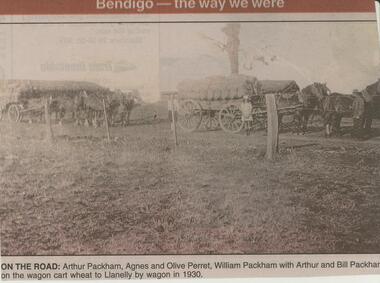
Newspaper - JENNY FOLEY COLLECTION: ON THE ROAD
... On the road: Arthur Packham, Agnes and Olive Perret, William Packham with Arthur and Bill Packham on the wagon cart wheat to Llanelly by wagon in 1930. ...On the road: Arthur Packham, Agnes and Olive Perret, William Packham with Arthur and Bill Packham on the wagon cart wheat to Llanelly by wagon in 1930. ...BHS CollectionBendigo Advertiser ''The way we were'' from Monday, May 27, 2002. On the road: Arthur Packham, Agnes and Olive Perret, William Packham with Arthur and Bill Packham on the wagon cart wheat to Llanelly by wagon in 1930. The clip is in a folder.newspaper, bendigo advertiser, the way we were -
 Bendigo Historical Society Inc.
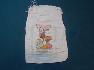
Textile - FLOUR BAG COLLECTION: WATSON MILLING, 1900-1950
... Road, East Malvern, Se5 Phone UL3131''. Centre front is a picture of an African-American lady holding a cake. Picture has a border of wheat...Road, East Malvern, Se5 Phone UL3131''. Centre front is a picture of an African-American lady holding a cake. Picture has a border of wheat ...Textiles.Calico flour bag with the following printed on one side; ''Mammy'' oven puff, creamed self raising flour large bags, 25 lb net weight. When packed. Contains Vita-phos. The only creamed flour. Prepared with phosphate aerator. Manufactured by WATSON Milling Co. Pty. Ltd. 1097 Dandenong Road, East Malvern, Se5 Phone UL3131''. Centre front is a picture of an African-American lady holding a cake. Picture has a border of wheat sheaves. The boy has remnants of stitching used to close the top of the bag. Collection holds two other uncatalogued samples. 7lb bag has picture of three scones on one side.textiles, domestic, watson milling flour bag -
 Bendigo Historical Society Inc.
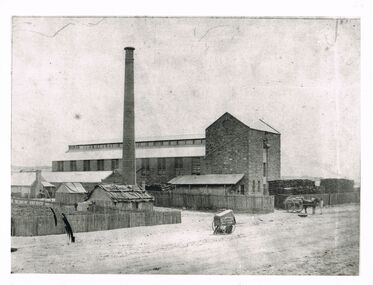
Photograph - WES HARRY COLLECTION: STONE INDUSTRIAL BUILDING, CHIMNEY
... wheat ? ) On LH side of image, picket fence surrounds large amount of cut wood - cut to equal length. Slab and bark roof hut on road adjoining large building , various smaller buildings to back of hut. ...wheat ? ) On LH side of image, picket fence surrounds large amount of cut wood - cut to equal length. Slab and bark roof hut on road adjoining large building , various smaller buildings to back of hut. ...Black and white photo, image: large stone industrial building, brick chimney, stacks of wood. Man standing on top floor operating winch. Horse and wagon beneath, loaded with bags of ( could be wheat ? ) On LH side of image, picket fence surrounds large amount of cut wood - cut to equal length. Slab and bark roof hut on road adjoining large building , various smaller buildings to back of hut. Batchelder carriage in centre of image. Batchelderindustrial stone building, batchelder -
 Eltham District Historical Society Inc
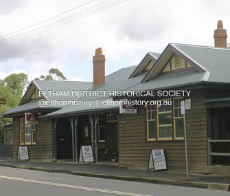
Photograph - Digital Photograph, Alan King, Panton Hill Hotel, 27 March 2008
... road dates from early last century, and has changed considerably. While most people searched for gold, the more enterprising ones established farms to feed the diggers. Farmers grew wheat...road dates from early last century, and has changed considerably. While most people searched for gold, the more enterprising ones established farms to feed the diggers. Farmers grew wheat ...Today’s Panton Hill Hotel was built around 1920. Published: Nillumbik Now and Then / Marguerite Marshall 2008; photographs Alan King with Marguerite Marshall.; p61 Panton Hill was originally known as Kingstown, and consisted of only one hotel when the Orams Reef was discovered in 1859. Kingstown was a quartz mining centre and many old mine shafts remain in the area. Orams Reef was one of the first reefs with a rich find of gold in the area. The Hotel Francais, which had been operating in 1861, was well situated on the way to Queenstown (later St Andrews). So was Herr Hirt’s Hotel and store at Smiths Gully. The Kingstown hotel, known as the Frenchman’s and in 1864 as the Hotel de France, was run by a Monsieur Emile Hude and his wife Jeanne, and known for its good food. They hosted social events, business conventions and debates, attracting patrons from as far as Melbourne. The hotel’s name was changed to Panton Hill Hotel in 1905. In 1883 Charles Caudwell built another hotel nearby, possibly in Long Gully Road,3 which it is thought, was burnt down early last century. Today’s Panton Hill Hotel, built around 1920, is the only one of the cluster of buildings in the main road, not to date from around the turn of last century. It was severely damaged by fire in 2003, then underwent extensive alterations. It is the township’s only hotel and is an example of a modest hotel building exterior, constructed early last century. In its early days the hotel also housed the first post office, newsagency and store. Orams Reef yielded a total of £100,000, and fossikers also found alluvial gold in the creeks and gullies, but there is no record of the total value of their finds. Gold greatly increased the Panton Hill population, which peaked between 1865 and 1885. On holidays large sports meetings were held with wood chopping contests and foot races and the day would end with a ball. Miners came from various countries to seek their fortune, including many from China. The Chinese became unpopular however, and gradually left the district, although some stayed and grew and sold vegetables.5 Panton Hill was named after Joseph Panton, who in 1862 was appointed Police Magistrate for the Woods Point, Heidelberg and Yarra districts. Panton was an outstanding man, who in 1852, was Commissioner of Crown Lands and Assistant Commissioner of Goldfields at Bendigo. In 1874 he was promoted to Chief Magistrate for the Melbourne Police. Panton was also an artist, becoming president of the Victorian Arts Society in 1888, and in 1913, president of the Royal Geographical Society. Despite Panton Hill’s prosperity, it still lacked many services as poor roads made access to Melbourne difficult. A horse-drawn mail coach travelled to Melbourne until 1890, when the railway came to Heidelberg. The nearest doctor was at Yarra Glen or Heidelberg, and the Indian hawker Singh’s annual visit was very welcome. A miner’s shack opposite the school was used as a post office. Today’s general store and post office in the main road dates from early last century, and has changed considerably. While most people searched for gold, the more enterprising ones established farms to feed the diggers. Farmers grew wheat, barley and oats, and sent animal skins to the Eltham tannery, to make furs in Melbourne. As gold became scarce from around 1880, miners took up farming on 19 to 20 acre (8ha) allotments. The first settlers in Cherry Tree Road included Purcell, Smith, Owens, Hughes and Shillinglaw. By 1900 all the land had been taken up around Panton Hill and Hurstbridge. The orchards in Panton Hill and the wider district, particularly of apple and pear, were very successful, and made Panton Hill a cohesive and successful community. About 1914 the Moores built the first cool-store and refrigeration plant at their orchard in Cherry Tree Road. Many settlers planted vineyards and made high quality wine, but in 1922 the blight destroyed them.This collection of almost 130 photos about places and people within the Shire of Nillumbik, an urban and rural municipality in Melbourne's north, contributes to an understanding of the history of the Shire. Published in 2008 immediately prior to the Black Saturday bushfires of February 7, 2009, it documents sites that were impacted, and in some cases destroyed by the fires. It includes photographs taken especially for the publication, creating a unique time capsule representing the Shire in the early 21st century. It remains the most recent comprehenesive publication devoted to the Shire's history connecting local residents to the past. nillumbik now and then (marshall-king) collection, panton hill hotel -
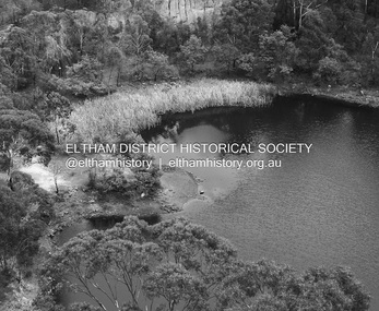 Eltham District Historical Society Inc
Photograph - Digital Photograph, Alan King, Blue Lake, Plenty Gorge Park, 2008
... wheat production supplanted grazing. In the 1860s the government made small holdings available to poorer settlers. These had the greatest effect on the district, particularly in Doreen and Yarrambat, where orchards were established from the 1880s to 1914. Links with a prominent early family are the remains of Stuchbery Farm, by the river’s edge bounded by Smugglers Gully to the north and La Trobe Road...wheat production supplanted grazing. In the 1860s the government made small holdings available to poorer settlers. These had the greatest effect on the district, particularly in Doreen and Yarrambat, where orchards were established from the 1880s to 1914. Links with a prominent early family are the remains of Stuchbery Farm, by the river’s edge bounded by Smugglers Gully to the north and La Trobe Road ...A quarry was transformed into the Blue Lake. Published: Nillumbik Now and Then / Marguerite Marshall 2008; photographs Alan King with Marguerite Marshall.; p179 The dramatic steep-sided Plenty Gorge lies along the divide of two geological areas, and separates the Nillumbik Shire and the City of Whittlesea. On the Nillumbik side are undulating hills and sedimentary rock, and in Whittlesea, lies a basalt plain formed by volcanic action up to two million years ago. This provides the Plenty Gorge Park with diverse vegetation and habitats, making it one of Greater Melbourne’s most important refuges for threatened and significant species. The park, established in 1986, consists of around 1350 hectares, and extends 11 kilometres along the Plenty River, from Greensborough to Mernda. It provides a wildlife corridor for around 500 native plant and 280 animal species. The area’s plentiful food and water attracted the Wurundjeri Aboriginal people and then European settlers. By 1837 squatters had claimed large runs of land for their sheep and cattle. The Plenty Valley was among the first in the Port Phillip District to be settled - mainly in the less heavily timbered west - and was proclaimed a settled district in 1841.But by the late 1880s, the settlers’ extensive land clearing for animal grazing, then agriculture, depleted the Wurundjeri’s traditional food sources, which helped to drive them away. Many Wurundjeri artefacts remain (now government protected), and so far 57 sites have been identified in the park, including scarred trees, burial areas and stone artefacts. Pioneer life could be very hard because of isolation, flooding, bushfires and bushrangers. Following the Black Thursday bushfires of 1851, basalt was quarried to build more fire-resistant homes. Gold discoveries in the early 1850s swelled the population, particularly around Smugglers Gully; but food production made more of an impact. In the late 1850s wheat production supplanted grazing. In the 1860s the government made small holdings available to poorer settlers. These had the greatest effect on the district, particularly in Doreen and Yarrambat, where orchards were established from the 1880s to 1914. Links with a prominent early family are the remains of Stuchbery Farm, by the river’s edge bounded by Smugglers Gully to the north and La Trobe Road, Yarrambat, to the east. The Stuchberys moved to the valley in 1890, and the family still lives in the area. In 1890, Alfred and Ada first lived in a tent where four children were born, then Alfred built the house and outbuildings around 1896. They planted an orchard, then a market garden, and developed a dairy. The family belonged to the local Methodist and tennis communities. Their grandson Walter, opened the Flying Scotsman Model Railway Museum in Yarrambat, which his widow, Vi, continues to run. Wal was also the Yarrambat CFA Captain for 22 years until 1987. Walter sold 24 hectares in 1976 for development - now Vista Court - and in 1990, the remaining 22.6 hectares for the park. Remaining are an early stone dairy and remnants of a stone barn, a pig sty and a well. Until it was destroyed by fire in 2003, a slab hut stood on the Happy Hollow Farm site, at the southern end of the park. The hut is thought to have been built in the Depression around 1893. This was a rare and late example of a slab hut with a domestic orchard close to Melbourne. Emmet Watmough and his family first occupied the hut, followed by a succession of families, until the Bell family bought it around 1948. There they led a subsistence lifestyle for 50 years, despite encroaching Melbourne suburbia. The Yellow Gum Recreation Area includes the Blue Lake, coloured turquoise at certain times of the year. Following the 1957 bushfires, this area was quarried by Reid Quarries Pty Ltd for Melbourne’s first skyscrapers, then by Boral Australia. However in the early 1970s water began seeping into the quarry forming the Blue Lake and the quarry was closed. The State Government bought the site in 1997 and opened it as a park in 1999.This collection of almost 130 photos about places and people within the Shire of Nillumbik, an urban and rural municipality in Melbourne's north, contributes to an understanding of the history of the Shire. Published in 2008 immediately prior to the Black Saturday bushfires of February 7, 2009, it documents sites that were impacted, and in some cases destroyed by the fires. It includes photographs taken especially for the publication, creating a unique time capsule representing the Shire in the early 21st century. It remains the most recent comprehenesive publication devoted to the Shire's history connecting local residents to the past. nillumbik now and then (marshall-king) collection, blue lake, plenty gorge park -
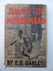 Warrnambool and District Historical Society Inc.
Book, Jimmy of Murrumbar by E D Oakley, 1938
... Road area today). Edward Oakley first worked at Saltau’s shipping office in Warrnambool then ran a dairy farm, Halifax, near Cudgee. He later had wheat...Road area today). Edward Oakley first worked at Saltau’s shipping office in Warrnambool then ran a dairy farm, Halifax, near Cudgee. He later had wheat ...This book subtitled, ‘A Story of the Amazing Ability and Fidelity of an Australian Black Tracker’, has been written in the late 1930s by Edward Daniel Oakley (1877-1962). He was the fourth child of Thomas and Eliza Oakley who had the farm, Oakbank, near the mouth of the Hopkins River, Warrnambool (Otway Road area today). Edward Oakley first worked at Saltau’s shipping office in Warrnambool then ran a dairy farm, Halifax, near Cudgee. He later had wheat farms in the Grampians area and at Willaura before returning to Warrnambool in 1923. He built a row of shops in Liebig Street and opened a boot and shoe store. He was instrumental in persuading Fletcher Jones to open a shop in Warrnambool. After he retired he researched and wrote the story of Jimmy of Murrumbar. This book is of high significance because: 1. It was written by a local Warrnambool businessman, Edward Oakley. He and other members of his family were prominent residents of the city in the late 19th and early to mid 20th centuries 2. It was written in the late 1930s and tells of the story of a young aboriginal boy, one of the early writings appreciating the talents and worth of young aborigines. This is a hard cover book of 181 pages. A buff-coloured dust cover has been pasted over the hard cover and it has a black, grey and white illustration of a young aboriginal boy being chased. This illustration is repeated in black and white on the second page. The titling on the cover is in red and black printing. The front cover has become almost detached from the pages. An inscription on the inside cover is handwritten in black ink. The book has a foreword, an appreciation, a contents page and 23 chapters. ‘Best Wishes for a Happy Birthday from Graeme Dorman Dec 8th 1942’ edward oakley, history of warrnambool, aboriginal literature, jimmy of murrumbar, thomas and eliza oakley -
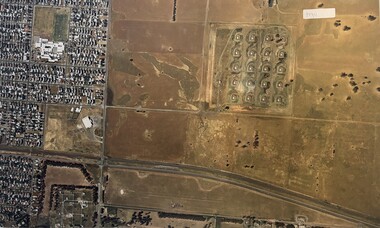 Sunshine and District Historical Society Incorporated
Photograph - Aerial Photographs Of Melbourne Metropolitan Area 1989, Qascophoto, 17th November 1989 & 28th November 1989
... Little Boundary Road (West) Points of Interest: Jones Road and Old Geelong Road Quarries, Brooklyn Go Kart Track, Sims Metal Foundry, Ralphs, Guiding Star Hotel, Gas & Fuel Substation 953.13 - Aerial Photographs Of Melbourne Metropolitan Area 1989.JPG Suburb(s): Sunshine, Sunshine West Area bounded by: Parsons Street (North), South of Fourth Avenue (South), Alfred Street (East), West of Kororoit Creek (West) Points of Interest: Parsons Reserve, Wheat Silos, H.V. ...Little Boundary Road (West) Points of Interest: Jones Road and Old Geelong Road Quarries, Brooklyn Go Kart Track, Sims Metal Foundry, Ralphs, Guiding Star Hotel, Gas & Fuel Substation 953.13 - Aerial Photographs Of Melbourne Metropolitan Area 1989.JPG Suburb(s): Sunshine, Sunshine West Area bounded by: Parsons Street (North), South of Fourth Avenue (South), Alfred Street (East), West of Kororoit Creek (West) Points of Interest: Parsons Reserve, Wheat Silos, H.V. ...953.01 - Aerial Photographs Of Melbourne Metropolitan Area 1989.JPG Suburb(s): Ardeer, Deer Park (Now Derrimut), Sunshine West Area bounded by: Railway Parade (North), Paramount Bouvard (South), Allison Street (East), Approx Station Road (West) Points of Interest: IVI Explosive Bunkers, Railway Siding into ICI off Forrest Street, Former Railway Station Tilburn Road, Sunshine Technical School Annex, Croatian Catholic Centre Sunshine Fitzgerald Road 953.02 - Aerial Photographs Of Melbourne Metropolitan Area 1989.JPG Suburb(s): Brooklyn, Yarraville Area bounded by: South of Somerville Road (North), Westgate Freeway (South), Urwin Street (East). West of McDonald Road (West) Points of Interest: State Electricity Commission of Victoria (SECV) Stores, Brooklyn Wool Stores, Brooklyn Primary School, Half Moon Caravan Park, Footscray Cemetery, Rheems, James Hardy 953.03 - Aerial Photographs Of Melbourne Metropolitan Area 1989.JPG Suburb(s): Ascot Vale, Maribyrnong Area bounded by: Raleigh Road (North), River Street and James Street (South), Holdsworth Street (East), West of Van Ness Avenue (West) Points of Interest: Highpoint City, Fairbairn Park, Hume Pipes, Riverside Golf Course, ICI Laboratories 953.04 - Aerial Photographs Of Melbourne Metropolitan Area 1989.JPG Suburb(s): Albion, Ardeer, Sunshine, Sunshine West Area bounded by: Dubbo Street (North), South of Glengala Road (South), West of Sydney Street (East), Vernon Crescent (West) Points of Interest: Ainsworth Reserve, Selwyn Park, St. Paul Church, Marian College, Ardeer Primary School, Glengala Road Shopping Centre, 953.05 - Aerial Photographs Of Melbourne Metropolitan Area 1989.JPG Suburb(s): Deer Park Area bounded by: Station Road (East), Marcellin Court (West), Irvine Street (North), Deer Street (South) Points of Interest: Deer Park Primary School, Deer Park Play Kindergaten, Deer Park Shopping Centre, St. Peter Chanel Church & School 953.06 - Aerial Photographs Of Melbourne Metropolitan Area 1989.JPG Suburb(s): Derrimut Area bounded by: Future Ring Road (North), South of Boundary Road (South), East of Andersons Swamp (East), West of Fitzgerald Road (West) Points of Interest: Andersons Swamp 953.07 - Aerial Photographs Of Melbourne Metropolitan Area 1989.JPG Suburb(s): Sunshine West Area bounded by: East of Fairbairn Road (East), East of Fitzgerald Road (West), North of Mailey Street (North), South of Talintyre Road (South) Points of Interest: Sunshine West High School, Sunshine Heights Primary School, Castley Reserve, Talintyre Reserve, Talintyre Road Shops, St. Peters School, Sunshine Golf Course, Ralph Reserve, Glengala Primary School 953.08 - Aerial Photographs Of Melbourne Metropolitan Area 1989.JPG Suburb(s): Derrimut, Ravenhall Area bounded by: East of Station Road, now Derrimut Road (East), West of Robinsons Road (West), South of Railway Line (North), North of Future Deer Park Bypass Points of Interest: Old Farms and Quarries 953.09 - Aerial Photographs Of Melbourne Metropolitan Area 1989.JPG Suburb(s): Sydenham, Taylors Lakes, Taylors Hill Area bounded by: Taylors Creek (North), Future Hume Drive (South), West of Future Parmelia Drive (East), Future Hawthorn Grove (West) Points of Interest: Sydenham Reservoir, Sydenham Railway Station, Sydenham Memorial Hall, Sydenham Primary School, Sydenham Recreation Reserve, Catholic Regional College Sydenham, Kingdom Hall of Jehovah's Witnesses 953.10 - Aerial Photographs Of Melbourne Metropolitan Area 1989.JPG Suburb(s): Brooklyn, Tottenham Area bounded by: Stony Creek (North), South of Somerville Road (South), Holmwood Road (East), West of McDonald Road (West) Points of Interest: Monsanto, Dalgety's, Wool Stores, Sims Metals, Farmer & Graziers, Olex Cables, Redbrook Carpets, May & Baker, Cargil Oil, Smorgans 953.11 - Aerial Photographs Of Melbourne Metropolitan Area 1989.JPG Suburb(s): Brooklyn Area bounded by: South of Fourth Avenue (North), South of Bunting Road (South), West of McDonald Road, East of Fitzgerald Road (West) Points of Interest: Market Road, Bunting & Jones Road Quarries, Monsanto, ANI, Market Timber 953.12 - Aerial Photographs Of Melbourne Metropolitan Area 1989.JPG Suburb(s): Brooklyn, Laverton North Area bounded by: South of Bunting Road (North), Buchanan Road (South), Cypress Avenue (East). Little Boundary Road (West) Points of Interest: Jones Road and Old Geelong Road Quarries, Brooklyn Go Kart Track, Sims Metal Foundry, Ralphs, Guiding Star Hotel, Gas & Fuel Substation 953.13 - Aerial Photographs Of Melbourne Metropolitan Area 1989.JPG Suburb(s): Sunshine, Sunshine West Area bounded by: Parsons Street (North), South of Fourth Avenue (South), Alfred Street (East), West of Kororoit Creek (West) Points of Interest: Parsons Reserve, Wheat Silos, H.V. McKay Trade Wing, Tottenham Hotel, Sunshine Carvan Park 953.14 - Aerial Photographs Of Melbourne Metropolitan Area 1989.JPG Suburb(s): Derrimut, Mt. Derrimut, Sunshine West, Area bounded by: East of Allison Street (East), Mt. Derrimut (West), Hilma Street (North), South of old Sunshine Golf Course (South) Points of Interest: Mt. Derrimut, Sunshine Golf Course 953.15 - Aerial Photographs Of Melbourne Metropolitan Area 1989.jpeg Suburb(s): Avondale Height, Braybrook, Sunshine North Area bounded by: Canning Street (North), North of Cranwell Street (South), Medway Golf Course (East), Nottingham Street (West) Points of Interest: Duke Street Quarries, Cranwell Park, Pennell Reserve 953.16 - Aerial Photographs Of Melbourne Metropolitan Area 1989.jpeg Suburb(s): All of City of Sunshine Area bounded by: Maribyrnong River (North), Westgate Freeway (South), Nicholson Street (East), Robinsons Road (West) Points of Interest: General overall of the City of Sunshine 953.17 - Aerial Photographs Of Melbourne Metropolitan Area 1989.jpeg Map is missing 953.18 - Aerial Photographs Of Melbourne Metropolitan Area 1989.jpeg Suburb(s): Braybrook, Maidstone, Sunshine Area bounded by: Ballarat Road (North), North of South Road (South), East of Ashley Street (East), West of Duke Street (West) Points of Interest: Skinner Reserve, Kinder Smith Reserve, Churchill Avenue Shops, St. John College, Industrial Engineering, Invita Carpets, Tottenham Technical School, Carolone Chisholm College, Christ The King Primary School, Sunshine East Primary School, Dyecraft 953.19 - Aerial Photographs Of Melbourne Metropolitan Area 1989.JPG Suburb(s): Laverton North, Sunshine West Area bounded by: North of Boundary Road (North), Sewer Out Fall (South), East of Little Boundary Road (East), East of Future Ring Road (West). Points of Interest: Factories in Laverton Northmelbourne, aerial photograph -
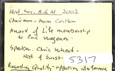 Sunshine and District Historical Society Incorporated
Audio - Sunshine And District Historical Society Annual General Meeting 2002 Audio Tape, Guest speaker Chris Wheat, History of Sunshine Technical School. Life membership award to Eric Wegener
... Road (former Sunshine North Technical) campuses. Sunshine Technical School Eric Wegener Audio tape This audio tape has been digitised. This audio tape has been transcribed. No editing of the recording has taken place, except where the speaker(s) can be identified. Guest speaker Chris Wheat ...On the 7th July 1913, the Sunshine Technical School opened as a wooden administration building with six classrooms and a large, galvanised iron workshop for the trade apprentices. Over the next few years, the school expanded its subjects to teaching commercial and science subjects. In 1915 the school was opened for girls to attend to learn shorthand and typewriting. To separate the boys from the girls the science lab was partitioned off. By 1992 and with amalgamation and restructure of six schools, the Sunshine Technical School was renamed as the Sunshine College and operated four campuses, three junior campuses for years 7-10 in Ardeer, North Sunshine and West Sunshine and the senior campus in Graham St caters for Victorian Certificate of Education (VCE) for years 11 & 12. The College also runs the Harvester Technical College in North Sunshine (opened 2014) which brings the purpose of the school a full circle back to H.V. McKay's original vision of a technical school. in 2020 the site was closed, and the students were relocated to the College's Lachlan Road (former Sunshine West High) and Northumberland Road (former Sunshine North Technical) campuses.Audio tape This audio tape has been digitised. This audio tape has been transcribed. No editing of the recording has taken place, except where the speaker(s) can be identified.sunshine technical school, eric wegener -
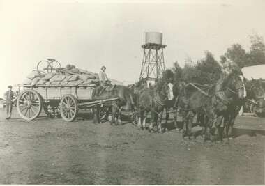 Lake Bolac & District Historical Society
Black and white photograph, Carting wheat on "Bellevue", c.1910
... On the road in front of "Bellevue", Lake Bolac, circa 1910. A load of wheat is ready for the trip to the railhead at Willaura. ...On the road in front of "Bellevue", Lake Bolac, circa 1910. A load of wheat is ready for the trip to the railhead at Willaura. ...On the road in front of "Bellevue", Lake Bolac, circa 1910. A load of wheat is ready for the trip to the railhead at Willaura. Seated on the wagon is Bert Moreton and standing at the rear is Harry Hewitt. Note the home-made gig perched on top of the load.lake bolac, bellevue, moreton, hewitt, wheat, willaura,
