
Showing 7 items matching "18th century map"
-
 Flagstaff Hill Maritime Museum and Village
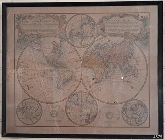
Map - World Map, Mappe Monde [Medieval Map of the World], 1910
... ...18th century map...This map from the mid-18th century doesn't include the finer details of land and sea masses that we know today. ...Map behind glass in dark brown wooden frame on beige paper. The Coloured hand drawn line drawings show different hemispheres of the known world in the mid-18th century. ...Flagstaff Hill Warrnambool Flagstaff Hill Maritime Museum Flagstaff Hill Maritime Village Flagstaff Hill Maritime Museum and Village Shipwreck Coast World Map French map 18th century map Leisure Arts Ltd cartography early exploration cartographer Johann Homann (1663-1724) exploration naviagtion 1746 Planiglobil Terrestris "PLANIGLOBIL TERRESTRIS" "MDCCXXXXVI" [1746] "MAPPE_MONDE" [Medieval Map of the World] "LEISURE ARTS LTD" "Printed in England" Map behind glass in dark brown wooden frame on beige paper. ...This map from the mid-18th century doesn't include the finer details of land and sea masses that we know today. The map was produced by German cartographer and publisher, Johann Baptist Homann (1663-1724) and published in 1746, after his death. Earlier versions were published, such as 1707 and 1716. The date can be calculated from the Roman numerals on the top left text area. This print of a map is significant for its connection with early world explorers. A comparison of maps over the centuries shows the progression of navigational technology, the countries who claimed the land they explored. The naming of even some Australian locations shows who had already made their mark on Australia in the early 18th century. The print shows the fine details included by the cartographer and the beauty included that makes it attractive and interesting even today. The map is also significant for its connection with German cartographer, Johann Baptist Homann, whose Homann publishing company was renewed in Germany for producing high quality maps and atlases. Map behind glass in dark brown wooden frame on beige paper. The Coloured hand drawn line drawings show different hemispheres of the known world in the mid-18th century. Beautifully drawn figures and decorative embellishments enhance the map. The text on the top right has an explanation of the Figures I, II, III, and IV. This print of the 1746 map was produced in England by Leisure Arts Ltd. "PLANIGLOBIL TERRESTRIS" "MDCCXXXXVI" [1746] "MAPPE_MONDE" [Medieval Map of the World] "LEISURE ARTS LTD" "Printed in England"flagstaff hill, warrnambool, flagstaff hill maritime museum, flagstaff hill maritime village, flagstaff hill maritime museum and village, shipwreck coast, world map, french map, 18th century map, leisure arts ltd, cartography, early exploration, cartographer, johann homann (1663-1724), exploration, naviagtion, 1746 planiglobil terrestris -
 Flagstaff Hill Maritime Museum and Village
Book - Reference Travel/History/Cartography, Mr Salmon (Thomas Salmon) et al, Modern History or, the Present State of All Nations. Vol III, 1746
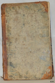
... 18th-century British public’s understanding of the global world. The illustrator for this volume was the cartographer Herman Moll (1654–1732). He was a Dutch engraver and cartographer who moved to London around 1678 and became one of the most celebrated mapmakers in Britain. Known for his crisp line work, distinctive decorative vignettes, and high detail, Moll moved in prominent intellectual circles, often frequenting coffee houses with Daniel Defoe, Jonathan Swift, and pirate-explorer William Dampier. Maps...This work is highly significant as it represents the 18th-century shift toward systematic, empirical geographical recording, rather than relying on mythical or outdated medieval lore. The inclusion of Herman Moll’s maps ...This 1746 3rd Edition of Thomas Salmon’s Modern History is a fantastic slice of Enlightenment era geography and publishing history. It sits at a fascinating intersection of early modern travel literature, top tier cartography, and the rise of one of London's most famous publishing houses. Thomas Salmon’s Modern History: or, the Present State of All Nations was an ambitious encyclopedic project. Rather than focusing strictly on dynastic timelines, Salmon took a modern geographical and ethnographic approach. For each region covered, he detailed its geography and climate, along with its natural resources, plants, animals, and minerals. Culture and society were covered by focusing on local habits, dress, religious rites, laws, customs, and architecture. Economy and trade were also detailed, including the arts, sciences, husbandry, and commercial manufactures.Hard cover book,Modern History: or, the Present State of All Nations Vol III Author: Mr Salmon (Thomas Salmon) Illustrator: Herman Moll Publisher: T Longman and T Shewell, London. Date: 1746 (MDCCXLVI), 3rd Edition Further Information: Set of Three Volumes. Hard covered book has reinforcing on the spine and corners. The cover is very well worn and has remnants of a coloured design. The fly page is printed in red and black ink and has a long description of the contents. Inside the cover is printed a Coat of Arms, there is a stocker on the inside cover. non-fictionThis 1746 3rd Edition of Thomas Salmon’s Modern History is a fantastic slice of Enlightenment era geography and publishing history. It sits at a fascinating intersection of early modern travel literature, top tier cartography, and the rise of one of London's most famous publishing houses. Thomas Salmon’s Modern History: or, the Present State of All Nations was an ambitious encyclopedic project. Rather than focusing strictly on dynastic timelines, Salmon took a modern geographical and ethnographic approach. For each region covered, he detailed its geography and climate, along with its natural resources, plants, animals, and minerals. Culture and society were covered by focusing on local habits, dress, religious rites, laws, customs, and architecture. Economy and trade were also detailed, including the arts, sciences, husbandry, and commercial manufactures.flagstaff hill, flagstaff hill maritime museum and village, warrnambool, maritime museum, maritime village, great ocean road, shipwreck coast, pattison collection, ralph eric pattison, warrnambool mechanics’ institute, mechanics’ institute library, warrnambool library, free library, corangamite regional library service, mr salmon, thomas salmon, 18th century, 1746, history, geography, social studies, culture, maps, modern history, present state of all nations vol iii, herman moll, t longman and t shewell, social history, cartography -
 Bendigo Military Museum
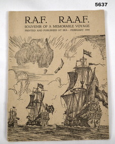
Booklet, Printed at sea and published at sea February 1944, RAF RAAF Souvenir of a Memorable Voyage, Feb 1944
... A sketched image of the maps of Australia and New Zealand. Also drawings of 3 18th century sailing ships afloat. ...A sketched image of the maps of Australia and New Zealand. Also drawings of 3 18th century sailing ships afloat. ...Booklet has a cardboard cover, printed in black ink. A sketched image of the maps of Australia and New Zealand. Also drawings of 3 18th century sailing ships afloat. Under front cover “cabin 408 A Deck” followed by 8 signatures rear cover written in ink Mrs F.H. Weaver, Morgan Sth Aust, Australia “ Grenferry Cruise III Bon voyage and happy landings” ww2, raaf, raf -
 Dutch Australian Heritage Centre Victoria
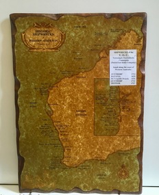
Wooden Plaque
... 18th centuries. Because the coast was so unattractive the Dutch did not try to settle the country. An insert reads: "Historic Shipwrecks of Western Australia (Protected as of 1983). Coastal cities are marked with their names and dots along the coastline indicate wreck sites. Most are named and dated; others marked as unidentified. An inset map ...The VOC sent its trading ships to the (then) Dutch East Indies to collect spices and other goods. In the 17th century accurate navigation was not always possible and ships might end up on the wild, unchartered West Australian coastline. Item recalls the fact that the WA coast was unintentionally visited by Dutch ships during the 17th and 18th centuries. Because the coast was so unattractive the Dutch did not try to settle the country.Large rectangular timber plaque with scalloped edges depicting historic shipwrecks of Western Australia.An insert reads: "Historic Shipwrecks of Western Australia (Protected as of 1983). Coastal cities are marked with their names and dots along the coastline indicate wreck sites. Most are named and dated; others marked as unidentified. An inset map deals with the area around Fremantle and shows a large number of wrecks. A separate typed notice attached to the map identifies the five known Dutch wrecks - all ships of the VOC - Vereennigde East Indian Compagnie (Dutch East India Company). Further than that there are a distance scale and a compass. -
 Embroiderers Guild, Victoria
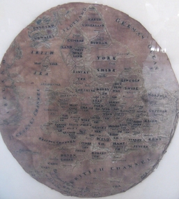
Textile - Map Sampler 1758, Margaret Hoetherington, 1758
... English map sampler worked by a child of 10 years. Conserved and remounted. Embroidery Samplers 18th Century England Silk Embroidery European Margaret Margaret Hoetherington ? ...English map sampler worked by a child of 10 years. Conserved and remounted.Oval map of Britain, excluding Scotland, naming all the counties. Silk material over linen and probably worked in silk.Margaret Margaret Hoetherington ? School August 20thembroidery, samplers, 18th century, england, silk embroidery, european -
 The Celtic Club
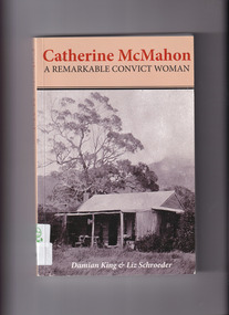
Book, Damien King et al, Catherine McMahon: A remarkable convict woman, 2012
... Irish - Australia -Biography Social history of the 18th and 19th century Ireland, England, Van Diemen's Land, Norfolk Island, Victoria and Western Australia via the life story of a woman convict, later free settler of the above named colonies. Index, bib, maps ...Social history of the 18th and 19th century Ireland, England, Van Diemen's Land, Norfolk Island, Victoria and Western Australia via the life story of a woman convict, later free settler of the above named colonies.Index, bib, maps, plates, ill., p.320.non-fictionSocial history of the 18th and 19th century Ireland, England, Van Diemen's Land, Norfolk Island, Victoria and Western Australia via the life story of a woman convict, later free settler of the above named colonies.women convicts - australia -biography., irish - australia -biography -
 Mrs Aeneas Gunn Memorial Library
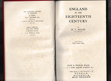
Book, A. & C. Black, England in the eighteenth century, 1949
... England - History England - History - 18th century An examination of the chief events in England history in the eighteenth century. Index, maps ...An examination of the chief events in England history in the eighteenth century.Index, maps, p.383.non-fictionAn examination of the chief events in England history in the eighteenth century.england - history, england - history - 18th century
