Showing 194 items matching atlas
-
 Ballarat Clarendon College
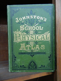
Book, School atlas of physical geography
Robert Mitchell attended Ballarat College 1879The book was printed in 1878 year, The place of publication of the book is W & A K Johnston, Edinburgh and London, 1878. A School Atlas of Physical Geography. Book in English language. Book has cover wear and fading, modest foxing to plates. Some plates are missingHandwritten on flyleaf: R. A Mitchell July 1878 / Ballarat / RAM -
 Victorian Aboriginal Corporation for Languages
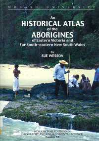
Book, Sue Wesson, An historical atlas of the Aborigines of Eastern Victoria and Far South-eastern New South Wales, 2000
An extremely detailed atlas of tribes, clans, and languages in eastern Victoria and south-eastern New South Wales. Includes maps, census information about the numbers and makeup of these clans in historical records, meanings and comparative spellings of all known named tribes and clans.maps, b&w photographs, colour photographs, tables -
 Glenelg Shire Council Cultural Collection
Book, Illustrated Bible Geography and Atlas, n.d
religion; atlas; geography; Bible; Judah; Israel;Book, 'Illustrated Bible Geography and Atlas'. red card covers, white banner with red print. Map of Judah and Israel in white on front cover. 32 pages on geography of the Bible; 16 pages of coloured maps, most in biblical times; 8 black and white photos of Jerusalem.religion; atlas; geography; Bible; Judah; Israel; -
 Flagstaff Hill Maritime Museum and Village
Book, Coltons General Atlas
Colton's General Atlas Date: 1866 Register of Authorised Copies of the Standard Weights and Measures Issued The Centre page of the Book has the heading of "Register of Authorised Copies of The Standard Weights and Measures Issued 1866." All front half pages are stapled together. All back half pages are stapled together. No Markingsflagstaff hill, warrnambool, maritime village, maritime museum, shipwreck coast, great ocean road, coltons general atlas, weights and measures -
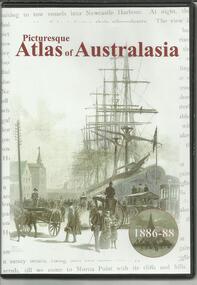
 Marysville & District Historical Society
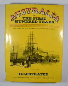
Book, IPC Books Pty Limited, Australia-The First Hundred Years-Being a facsimile of Volumes I & II of the Picturesque Atlas of Australia-1888, 1886
The Picturesque Atlas was designed to give a graphic and summarised conception of Australasian history and life from the days of the earliest Portuguese, Spanish, Dutch, English and French navigators to the 1880's, embracing such salient events as the landing of Captain Cook in 1770. the discoveries of voyagers, explorers an pioneer missionaries; the founding of the different colonies; the establishment of representative government and the marvellous political, commercial and social development which characterises the people of Australia.Dust cover has an illustration depicting Circular Quay, West Side in the early days of Australia.non-fictionThe Picturesque Atlas was designed to give a graphic and summarised conception of Australasian history and life from the days of the earliest Portuguese, Spanish, Dutch, English and French navigators to the 1880's, embracing such salient events as the landing of Captain Cook in 1770. the discoveries of voyagers, explorers an pioneer missionaries; the founding of the different colonies; the establishment of representative government and the marvellous political, commercial and social development which characterises the people of Australia.history, australia, explorers, voyagers, missionaries, politics, commercial development, social development -
 Whitehorse Historical Society Inc.
Book
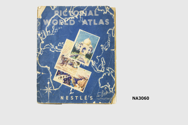
Nestles had a small chocolate bar dispenser on railway station from which for one penny inserted in the dispenser you received a chocolate bar with a coloured card. Card could be inserted in album in a space reserved for that card in the country it referred to.|Album was given to Dianne Warren, daughter of donor, by her cousin whose father had a sweet shop in Glenferrie.Pictorial World Atlas - a Nestles collectors album of cards of various country's of the world. See History.Nestles Pictorial World Atlasbooks, collections -
 Wangaratta High School
WHS Textbook, 1887
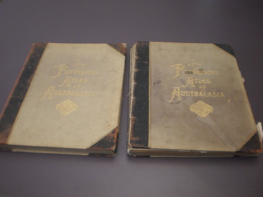
Two hardcover felt lined atlases with black reinforced spines and corners. Gold writing and symbol in the centre of the cover reads The PICTURESQUE ATLAS of AUSTRALASIA. Volumes 1 and 3 are in the school's collection. each book has some degree or wear, with torn pages and peeling paper in some areas, and one has a large water mark on the cover.The PICTURESQUE ATLAS of AUSTRALASIA -
Friends of St Brigids Association
Book - An Atlas of Irish History, Edwards, Ruth Dudley. 1989. An Atlas of Irish History. London ; New York : Methuen, 1981 1 atlas (286 p.) : maps ; 24 cm
-
 Bendigo Military Museum
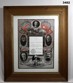
Certificate - CERTIFICATE WW1, FRAMED, Post WW1
Item relates to John Stanley HOWLETT No 2676 AIF. Refer Cat No 41 for his service history.Certificate of Appreciation by the Citizens of the Shire of Tullaroop to Pte John S Howlett No 2676 59th Battalion AIF 1914-5-6. Black & white certificate with red and white flags at top. 6 x dignitaries of the day are pictured. White border mounted, glass front, timber frame with gold inner border & ply backing.certificates, framed, shire -
 Stawell Historical Society Inc
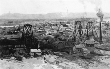
Photograph, Working Mines with Stawell in background
Stawell Mining Scene "The Picturesque Atlas of Australasia" edited by the Hon Andrew Garran MLC B/W photograph an an engraving on wood. One of the mines is Scothman's United. Copied from "The Picturesque Atlas Of Australasia" stawell -
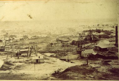 Stawell Historical Society Inc
Photograph, Working Mines with Stawell in background
Stawell Mining Scene "The Picturesque Atlas of Australasia" edited by the Hon Andrew Garran MLC B/W photograph an an engraving on wood. One of the mines is Scothman's United. Copied from "The Picturesque Atlas Of Australasia" stawell -
Phillip Island and District Historical Society Inc.
Book, FARRELL, David, Atlas of first aid, 1940
Stamped 'McGill's Agency etc.'. Inscribed 'Ita Gallagher, 1 Launder St., Hawthorn'. -
Phillip Island and District Historical Society Inc.
Book, WEBSTER, D.L, Encyclopedia of useful information and world's atlas, 1889
Stamped 'Phillip Island & District Historical Society'. -
Phillip Island and District Historical Society Inc.
Book, William Collins, library atlas : consisting of one hundred and ten maps of modern, historical, and classical geography, &c., with descriptive letterpress of Modern geography by James Bryce, Historical geography by William F. Collier, Classical geography by Leonard Schmitz; with copious indices, 1876?
Inscribed: Hazel Fair, 37 Laura St., E. Bruns. N. 10. Stamped: J.R. Mann, Bookseller, Victoria Market ; Phillip Island & District Historical Society -
Phillip Island and District Historical Society Inc.
Book, W. & A.K. Johnston, world-wide atlas of modern geography, political and physical, containing one hundred and twenty-eight plates and complete index with an introduction by J. Scott Keltie, 1906
-
Phillip Island and District Historical Society Inc.
Book, BARTHOLOMEW, John, Black's general atlas of the world, 1860
Book from the Cleeland Bequest - a comprehensive collection of books relating to the History of England, Civil & Military, Religious, Intellectual & Social. Labelled 'Cowes Free Public Library', 'Phillip Island Historical Society, Cleeland Bequest'. Inscribed 'Jno Cleeland'.cleeland bequest -
Phillip Island and District Historical Society Inc.
Book, F.E. Hiscocks &? Co, F.E. Hiscocks &? Co.'s new Victorian counties atlas, 1874 [cartographic material] : together with map of Victoria, indicating roads, distances, relative position of counties, &?c, 1874
Labelled 'Cowes Free Public Library', 'Phillip Island Historical Society, Cleeland Bequest'.victoria, maps -
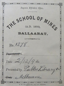 Federation University Historical Collection
Book, John Ferres, Government Printer, Eucalyptographia : a Descriptive Atlas of the Eucalypts of Australia and Adjoining Islands, 1883-4, 1883 and 1884
Ferdinand Von Mueller was the Government Botanist for the Colony of Victoria. He was an early examiner in Botany at the Ballarat School of Mines. The book was donated to the Ballarat School of Mines by the Melbourne Public Library. The Bookplate in the front states the book is number 1278 in the Ballarat School of Mines Library and was presented on 02/12/1892.Two books (ninth and tenth decade) with soft cover and blue tape spine. Includes text and black and white images relating to Eucalypts .1) includes a bookplatebotany, ferdinand von mueller, ballarat school of mines, eucalypts, botanist, bookplate, melbourne public library, state library of victoria -
Federation University Historical Collection
Book, Department of Infrastructure, Regional Matters: An Atlas of Regional Victoria, C2003
Green soft covered book including chapers on population, jobs and industry, housing, road and rail transport, health services, education, and water resourcesvictoria, regional victoria, population, migration flow, jobs, industry, export, food production, housing, rail, roads, health, education, qualifications, water, irrigation -
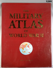 Bendigo Military Museum
Book, Chris Bishop, The Military Atlas of World War II, c.2005
Red, hard cover with red loose paper jacket, map of world on front (circular, in colours mainly white), gold & white print, black print on inside cover. Colour illustrations & photographs throughout, 176 pages.books, military history -
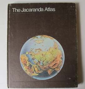 Robin Boyd Foundation
Book, Jacaranda Press, The Jacaranda Atlas, 1969
Hardcover"Suzy Boyd" Inside front cover, Newspaper clippings from The Age, 7th September 1993 re Casino development inserted insidegeography, walsh st library -
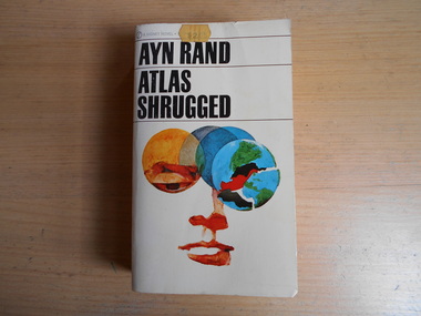 Robin Boyd Foundation
Book, Ayn Rand, Atlas Shrugged, 1957
Softcoverwalsh st library -
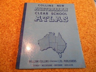 Robin Boyd Foundation
Book, Edgar Ford, Collins New Australian Clear School Atlas, 1965
Softcovergeography, walsh st library -
 The Adam Lindsay Gordon Commemorative Committee Inc.
DVD, Picturesque Atlas of Australasia- 1886-1880
-
 Beechworth Honey Archive
Publication, James Halliday's wine atlas of Australia. (Halliday, James). Melbourne, 2008
311 pages, illustrated. -
Stawell Historical Society Inc
Book - Military Atlas, First World War Atlas, 1970
History of first war through Maps, Intro by Field Marshal Viscount Montgomery OG Alamein, KG Cartography by Arthur Banks Text by Martin Gilbertpaperback, covered in clear contact, white wig green square and red circle with gridDonated to Stawell Biarri group for genealogy inc 4/3/2009 by John Wynd Galen Champgnat Colege Library Wangarattafirst world war cartography history -
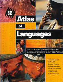 Victorian Aboriginal Corporation for Languages
Book, Bernard Comrie, SBS SBS atlas of languages : the origin and development of languages throughout the world, 2003
Over 30 full-colour maps, over 40 of the world?s major languages, language family trees, over 100 stunning full-colour photographs. A full glossary of linguistic terms.Maps, colour illustrations, colour photographslinguistics, maps, atlases -
 Victorian Aboriginal Corporation for Languages
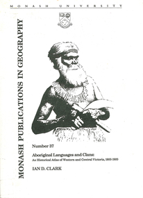
Book, Ian D Clark, Aboriginal languages and clans : an historical atlas of Western and Central Victoria, 1800-1900, 1990
Comprehensive coverage of language in the Western and Central Victorian areas, 1800-1900. Includes detailed language structures and historical details, Aboriginal Protectors and their work are included.maps, b&w illustrations, b&w photographsaboriginal clans, spatial and social organization, dhauwurd wurrung, gundijimara, djab wurrung, dja dja wurrung, djargurd wurrung, gadubanud, girai wurrung, gulidjan, jardwadjali, wada wurrung, wergaia -
 Victorian Aboriginal Corporation for Languages
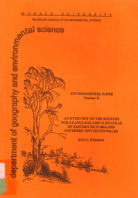
Book, Sue C Wesson, An overview of the sources for a language and clan atlas of Eastern Victoria and Southern New South Wales, 1994
This monograph concerns Eastern Victoria and Southern New South Wales and reviews the ethnographic record available for the study area. A test case is made of one tribe within the study area which requires further research. Overall, the literature review and the case study demonstrate that the ability to undertake detailed reconstructions, as Clark and Barwick have done for the other regions, can be undertaken in Eastern Victoria and Southern New South Wales, and this model will form the basis of future research.maps, b&w illustrations, b&w photographs, document reproductions, tableswoiworung, bunurong, taungurong, ngurai-illam-wurung, bidawal, maap, norman tindale, diane barwick, aldo massola, eve fesl, ian david clark, george augustus robinson, reverend john bulmer, robert brough smyth, alfred william howitt, moieties, clan names -
 Victorian Aboriginal Corporation for Languages
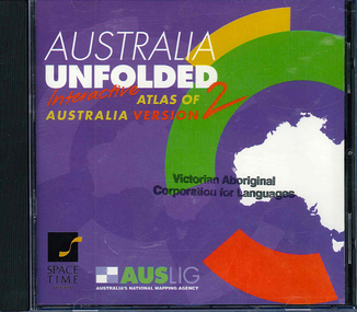
CD-ROM, Australian Surveying and Land Information Group, Australia unfolded : interactive atlas of Australia, 1996
Systems requirements: Macintosh version: Mac Plus (68030 or higher recommended), 5 MB hard disk space, 2 MB RAM (4 MB RAM recommended), CD-ROM drive, mouse, System 7 or above. "9314231106006"--CD-ROM. System requirements: Windows version: IBM compatible 386 or higher, 5MB hard disk space, 4MB RAM (8MB RAM recommended), VGA monitor, CD-ROM drive, mouse, Windows 3.1 or above. In box (19 x 27 x 5 cm.).CD-ROMtopographic maps, australian maps, surveying