
Showing 89 items matching "australia's victorian goldfields"
-
 Clunes Museum
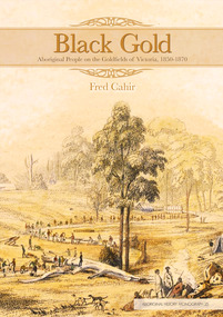
Book, Fred Cahir, BLACK GOLD - ABORIGINAL PEOPLE ON THE GOLD FIELDS OF VICTORIA 1850-1870, 2012
... ...AUSTRALIA'S VICTORIAN GOLDFIELDS...Fred Cahir tells the story about the magnitude of Aboriginal involvement on the Victorian goldfields in the middle of the nineteenth century FIRST NATIONS HISTORY AUSTRALIA'S VICTORIAN GOLDFIELDS Fred Cahir tells the story about the magnitude of Aboriginal involvement on the Victorian goldfields in the middle of the nineteenth century. ...Fred Cahir tells the story about the magnitude of Aboriginal involvement on the Victorian goldfields in the middle of the nineteenth century. The first history of Aboriginal–white interaction on the Victorian goldfields, Black Gold offers new insights on one of the great epochs in Australian and world history—the gold story. In vivid detail it describes how Aboriginal people often figured significantly in the search for gold and documents the devastating social impact of gold mining on Victorian Aboriginal communities. It reveals the complexity of their involvement from passive presence, to active discovery, to shunning the goldfields. This detailed examination of Aboriginal people on the goldfields of Victoria provides striking evidence which demonstrates that Aboriginal people participated in gold mining and interacted with non-Aboriginal people in a range of hitherto neglected ways. Running through this book are themes of Aboriginal empowerment, identity, integration, resistance, social disruption and communication. For more information on Aboriginal History Inc. please visit aboriginalhistory.org.au.BOUND FOLDER, BLACK CARDBOARD COVER 152 PAGESnon-fictionFred Cahir tells the story about the magnitude of Aboriginal involvement on the Victorian goldfields in the middle of the nineteenth century. The first history of Aboriginal–white interaction on the Victorian goldfields, Black Gold offers new insights on one of the great epochs in Australian and world history—the gold story. In vivid detail it describes how Aboriginal people often figured significantly in the search for gold and documents the devastating social impact of gold mining on Victorian Aboriginal communities. It reveals the complexity of their involvement from passive presence, to active discovery, to shunning the goldfields. This detailed examination of Aboriginal people on the goldfields of Victoria provides striking evidence which demonstrates that Aboriginal people participated in gold mining and interacted with non-Aboriginal people in a range of hitherto neglected ways. Running through this book are themes of Aboriginal empowerment, identity, integration, resistance, social disruption and communication. For more information on Aboriginal History Inc. please visit aboriginalhistory.org.au.first nations history, australia's victorian goldfields -
 Flagstaff Hill Maritime Museum and Village
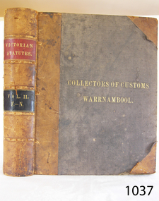
Book - Reference/Legal Acts, John Ferres, Government Printer, The Victorian Statutes Vol 2 Collectors of Customs, 1866
... Victorian Statutes) superseded it. John Ferres was a major figure in early Australian printing history. He managed the Government Printing Office from 1851 to 1887, overseeing the publication of everything from the colony's first postage stamps to its goldfield regulations and parliamentary records. ...Victorian Statutes) superseded it. John Ferres was a major figure in early Australian printing history. He managed the Government Printing Office from 1851 to 1887, overseeing the publication of everything from the colony's first postage stamps to its goldfield regulations and parliamentary records. ...Because the subject item is a book of law, it would not traditionally have a singular author, but rather a corporate author, specifically the Colony of Victoria and, more precisely, the Parliament of Victoria. The Victorian Statutes of 1866 is an official compilation of the statute law of the Colony of Victoria, Australia, 'Published by Authority', and printed by John Ferres, who was the Victorian Government Printer at the time. Ferres was the printer/publisher, not an author or editor in the usual sense, as this is a government publication rather than an individually authored work.Hard cover book, The Victorian Statutes Vol 2 Author: Corporate Author “The Colony of Victoria” Publisher: John Ferres Government Printer Melbourne. Date: 1866 Three quarter leather, Olive Front Cover, Brown Spine with Gold embossed Title on spine & front cover "Collector of Customs Warrnambool"non-fictionBecause the subject item is a book of law, it would not traditionally have a singular author, but rather a corporate author, specifically the Colony of Victoria and, more precisely, the Parliament of Victoria. The Victorian Statutes of 1866 is an official compilation of the statute law of the Colony of Victoria, Australia, 'Published by Authority', and printed by John Ferres, who was the Victorian Government Printer at the time. Ferres was the printer/publisher, not an author or editor in the usual sense, as this is a government publication rather than an individually authored work.flagstaff hill, warrnambool, shipwrecked-coast, flagstaff-hill, flagstaff-hill-maritime-museum, maritime-museum, shipwreck-coast, flagstaff-hill-maritime-village, the victorian statutes vol 2 collectors of customs, book -
 Federation University Historical Collection
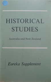
Book, Eureka - Historical Studies Eureka Supplement, 1965
... Contents include Agitations of the Victorian Goldfields (Bruce Kent), Eureka Documents, Causes of Eureka (Geoffrey Serle), Americans and other Foreigners at Eureka (L.G. Churchward), Eureka and the Creative Writer (Hume Dow), Significance of Eureka in Australian History (R.D. ...This book was withdrawn from the Ballarat High School Library. ballarat bendigo eureka ovens charles hotham forest creek australian democracy Green soft covered book of 158 pages. Contents include Agitations of the Victorian Goldfields (Bruce Kent), Eureka Documents, Causes of Eureka (Geoffrey Serle), Americans and other Foreigners at Eureka (L.G. ...This book was withdrawn from the Ballarat High School Library.Green soft covered book of 158 pages. Contents include Agitations of the Victorian Goldfields (Bruce Kent), Eureka Documents, Causes of Eureka (Geoffrey Serle), Americans and other Foreigners at Eureka (L.G. Churchward), Eureka and the Creative Writer (Hume Dow), Significance of Eureka in Australian History (R.D. Walshe), Bibliography of Eureka (R.D. Walshe).ballarat, bendigo, eureka, ovens, charles hotham, forest creek, australian democracy -
 Federation University Historical Collection
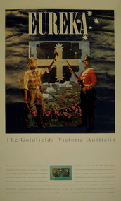
Poster, Eureka: The Goldfields of Victoria Australia, c1990s
... The poster is an advertisement for the Victorian Goldfield towns such as Ballarat , Bendigo, St Arnaud, Ararat, Stawell, Daylesford and Hepburn Springs. Eureka: The Goldfields of Victoria Australia Poster Poster ...Large white poster with blue image depicting a gold digger burning a gold license and a member of the military in from of the Eureka Flag and a painting of the Eureka battle. The poster is an advertisement for the Victorian Goldfield towns such as Ballarat , Bendigo, St Arnaud, Ararat, Stawell, Daylesford and Hepburn Springs. eureka stockade, poster, digger, redcoat -
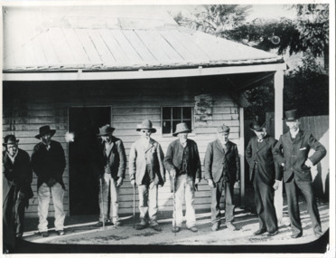 The Beechworth Burke Museum
Photograph, c1900
... Australia as part of the 1850s gold rush. This photograph is also of social significance for its association with the history of the Chinese community in Beechworth, and the adversity faced by Chinese immigrants during the gold rush as part of a system of Chinese protectorates and segregated camps enforced by the Victorian Government in response to the hostility and violence directed at the Chinese during this period. Beechworth Chinese Camp Beechworth Chinese Camps 1900s Beechworth Ovens Goldfield ...This black and white photograph taken c1900 at a camp in Beechworth, depicts the last six survivors of the Beechworth Chinese mining community. The two men standing on the far right are believed to be local Beechworth men. The man second-from-right is believed to be George Young, a Chinese Presbyterian catechist whose task was to fulfil the Church's remit to evangelise the Chinese population. Beechworth became home to one of the largest Chinese communities in Australia after the 1857 Buckland Riots pushed Chinese miners from their claims and they were forced to relocate their camps. Under the Protectorate system, the Chinese were required to live in camps on the outskirts of town and were subject to many additional controls and regulations. Chinese miners continued to form a large part of the Beechworth population, and surrounds, until gold ran out at the turn of the century.This photograph is historically significant for its association with the development of Victoria through the discovery of gold and the first wave of free Chinese immigration to Australia as part of the 1850s gold rush. This photograph is also of social significance for its association with the history of the Chinese community in Beechworth, and the adversity faced by Chinese immigrants during the gold rush as part of a system of Chinese protectorates and segregated camps enforced by the Victorian Government in response to the hostility and violence directed at the Chinese during this period. Black and white rectangular photograph (copy) on matte photographic paper unmountedReverse: Chinese / BMM2676 / 84-79-1 / 1998.00059 / 'UNITED SHIRE OF BEECHWORTH / SHIRE SECRETARY'beechworth, chinese camp, beechworth chinese camps, 1900s beechworth, ovens goldfield, chinese mining community, beechworth presbyterian church -
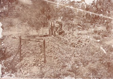 The Beechworth Burke Museum
Photograph
... Victorian Goldfields are filled with ruins and remnants of the area's rich mining history, ranging from small alluvial diggings to the remains of huge mining companies. Site names often changed several times throughout the nineteenth and twentieth centuries. Some sites were abandoned and forgotten, others were worked continuously over many decades. The names of mines were often repeated at different locations throughout the Victorian Goldfields. For example, there is a Mopoke Gully heritage mine near Fryers Creek, Victoria. 'Mopoke' is a common onomatopoeic name for Morepork and Australian...Victorian Goldfields are filled with ruins and remnants of the area's rich mining history, ranging from small alluvial diggings to the remains of huge mining companies. Site names often changed several times throughout the nineteenth and twentieth centuries. Some sites were abandoned and forgotten, others were worked continuously over many decades. The names of mines were often repeated at different locations throughout the Victorian Goldfields. For example, there is a Mopoke Gully heritage mine near Fryers Creek, Victoria. 'Mopoke' is a common onomatopoeic name for Morepork and Australian ...This image is a reproduction of an 1899 original depicting the 'Williams Good Luck Mine' on the Mopoke Reef (also called 'Morepork Gully') in the Dingle Ranges, approximately three miles from Beechworth. A large opening to a mine can be seen behind the men in the photograph, with a wheeled cart on a track leading to the men's position, where the soil and rocks have been hauled away. This photograph interestingly contains dogs alongside the miners. While dogs have been recorded as deterrents to thieves in the Victorian goldfields, these dogs appear as companions to these men. Following the discovery of gold at Beechworth in 1852, rushes quickly followed at surrounding creeks and gullies in the district. In the late nineteenth and early twentieth centuries, small syndicates of miners continued to work old or abandoned quartz reefs, often persisting without the assistance of heavy machinery to remove the large amounts of rock, in order to obtain yields at ever greater depths. The group of miners in this photograph are Mr. Roger Williams and Sons, who revived operations at the ‘Old Good Luck’ mine on the Mopoke Reef in the Dingle Range near Beechworth around 1892, working the site for more than two decades. An emigrant from Cornwall with experience in the tin mining industry, 19 year old Roger Williams senior sailed to New Zealand in 1840, then to Australia where he spent time in the Bendigo Gold Fields before settling in Beechworth in the early 1860s. Mr Williams senior worked on various mining activities in the district, including the Rocky Mountain Tunnel project. Conversant with the character of gold-bearing reefs in the area, the syndicate dug an eight hundred foot tunnel, digging down as far down as two hundred feet with little capital save their labour, to connect and provide better working access to the mass of reefs and veins in the vicinity. Progress was hampered by poor air quality charged with fumes from dynamite and large quantities of rock had to be crushed to obtain payable yields. The Victorian Goldfields are filled with ruins and remnants of the area's rich mining history, ranging from small alluvial diggings to the remains of huge mining companies. Site names often changed several times throughout the nineteenth and twentieth centuries. Some sites were abandoned and forgotten, others were worked continuously over many decades. The names of mines were often repeated at different locations throughout the Victorian Goldfields. For example, there is a Mopoke Gully heritage mine near Fryers Creek, Victoria. 'Mopoke' is a common onomatopoeic name for Morepork and Australian Boobook owls.This image has historical, social and research significance for patterns of emigration during of the Victorian Gold Rush, and the historical, social and environmental impacts of mining at Beechworth at the turn of the nineteenth and twentieth centuries. As gold became scarce and government support and large company investment waned, poor hard-working miners laboured intensively to make a living through periods of high unemployment. This image can be compared and studied alongside other historical mining photographs and objects in the Burke Museum Collection. It has potential to improve our understanding of miners working conditions and the shifting character of mining in the Beechworth district.Sepia coloured rectangular photograph printed on gloss photographic paper mounted on card. Obverse: Williams/ Good/ Luck Reverse: A02498/ 1997. 2498/ Good Luck/ Mine/ 1899/ Mopoke. burke museum, beechworth museum, beechworth, gold fields, gold rush, victorian gold rush, gold ming history, colonial australia, australian gold rushes, mining technology, beechworth historic district, indigo gold trail, migration, indigo shire, good luck gold mine, victorian goldfields, mining syndicates, gold fever, quartz-mining, small-scale mining, old good luck mine, mopoke gully, quartz reefs beechworth -
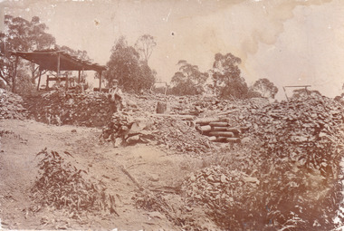 The Beechworth Burke Museum
Photograph
... Victorian Goldfields are filled with ruins and remnants of the area's rich mining history, ranging from small alluvial diggings to the remains of huge mining companies. Site names often changed several times throughout the nineteenth and twentieth centuries. Some sites were abandoned and forgotten, others were worked continuously over many decades. The names of mines were often repeated at different locations throughout the Victorian Goldfields. For example, there is a Mopoke Gully heritage mine near Fryers Creek, Victoria. 'Mopoke' is a common onomatopoeic name for Morepork and Australian...Victorian Goldfields are filled with ruins and remnants of the area's rich mining history, ranging from small alluvial diggings to the remains of huge mining companies. Site names often changed several times throughout the nineteenth and twentieth centuries. Some sites were abandoned and forgotten, others were worked continuously over many decades. The names of mines were often repeated at different locations throughout the Victorian Goldfields. For example, there is a Mopoke Gully heritage mine near Fryers Creek, Victoria. 'Mopoke' is a common onomatopoeic name for Morepork and Australian ...This image is a reproduction of an 1899 original depicting the 'Williams Good Luck Mine' on the Mopoke Reef (also called 'Morepork Gully') in the Dingle Ranges, approximately three miles from Beechworth. The foreground of the image is littered with piles of smashed rock and detritus, known as ‘mullock’, beside a reinforced mine shaft, a vertical access passageway allowing miners to enter the mine and haul ore out using lifting technology such as a poppet heads, whims or windlasses. A group of miners and a dog appear close to an open-sided miner’s hut. Following the discovery of gold at Beechworth in 1852, rushes quickly followed at surrounding creeks and gullies in the district. In the late nineteenth and early twentieth centuries, small syndicates of miners continued to work old or abandoned quartz reefs, often persisting without the assistance of heavy machinery to remove the large amounts of rock, in order to obtain yields at ever greater depths. The group of miners in this photograph are Mr. Roger Williams and Sons, who revived operations at the ‘Old Good Luck’ mine on the Mopoke Reef in the Dingle Range near Beechworth around 1892, working the site for more than two decades. An emigrant from Cornwall with experience in the tin mining industry, 19 year old Roger Williams senior sailed to New Zealand in 1840, then to Australia where he spent time in the Bendigo Gold Fields before settling in Beechworth in the early 1860s. Mr Williams senior worked on various mining activities in the district, including the Rocky Mountain Tunnel project. Conversant with the character of gold-bearing reefs in the area, the syndicate dug an eight hundred foot tunnel, digging down as far down as two hundred feet with little capital save their labour, to connect and provide better working access to the mass of reefs and veins in the vicinity. Progress was hampered by poor air quality charged with fumes from dynamite and large quantities of rock had to be crushed to obtain payable yields. The Victorian Goldfields are filled with ruins and remnants of the area's rich mining history, ranging from small alluvial diggings to the remains of huge mining companies. Site names often changed several times throughout the nineteenth and twentieth centuries. Some sites were abandoned and forgotten, others were worked continuously over many decades. The names of mines were often repeated at different locations throughout the Victorian Goldfields. For example, there is a Mopoke Gully heritage mine near Fryers Creek, Victoria. 'Mopoke' is a common onomatopoeic name for Morepork and Australian Boobook owls.This image has historical, social and research significance for patterns of emigration during of the Victorian Gold Rush, and the historical, social and environmental impacts of mining at Beechworth at the turn of the nineteenth and twentieth centuries. As gold became scarce and government support and large company investment waned, poor hard-working miners laboured intensively to make a living through periods of high unemployment. This image can be compared and studied alongside other historical mining photographs and objects in the Burke Museum Collection. It has potential to improve our understanding of miners working conditions and the shifting character of mining in the Beechworth district.Sepia coloured rectangular photograph printed on gloss photographic paper mounted on card.Obverse: Reverse: A02497/ 1997.2497/ 'Good/ Luck/ Mine'/ Morepork/ Gully/ Mrs Joyce/ Bright/ Tunnel/ 800 ft/ 1899. burke museum, beechworth museum, beechworth, gold fields, gold rush, victorian gold rush, gold ming history, colonial australia, australian gold rushes, mining technology, beechworth historic district, indigo gold trail, migration, indigo shire, good luck gold mine, victorian goldfields, mining syndicates, gold fever, quartz-mining, small-scale mining, old good luck mine, mopoke gully, quartz reefs beechworth -
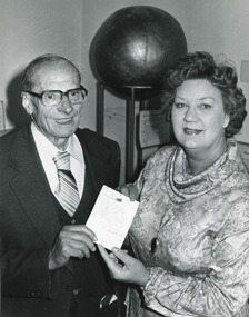 The Beechworth Burke Museum
Photograph, Border Morning Mail newspaper, 14/5/2979
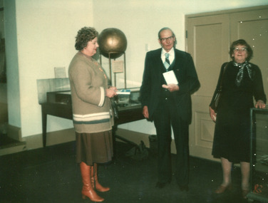
... The tie pin artefact being donated in this photo is entered into the Victorian Collections database as follows: 'This nugget was found on the Beechworth Goldfield in the late 1800s by Mr Fred McIntosh (Alan & Edward Dunlop's Uncle by marriage, husband of Elizabeth (Bessie) Dunlop), who had made it into a tie pin and presented it to the Dunlop family'. Furthermore, Val Mason was the first female president of the former Beechworth Shire for two terms and a councillor for nine years. This photograph is of historic significance as it depicts known individuals who have connections to key Australian ...This photograph is recorded as depicting the presentation by Mr Alan Dunlop to Cr Val Mason, Shire President, of a 2.86-gram solid gold nugget found in the area more than 100 years ago, at the Burke Museum. The gold is reported as attached to a small amount of milk quartz mounted onto a tie pin. The photo and an article about the donation appeared in the Border Morning Mail on Friday 14th May, 1979. Alan Dunlop, pictured, was Sir Edward 'Weary' Dunlop's older brother. The tie pin artefact being donated in this photo is entered into the Victorian Collections database as follows: 'This nugget was found on the Beechworth Goldfield in the late 1800s by Mr Fred McIntosh (Alan & Edward Dunlop's Uncle by marriage, husband of Elizabeth (Bessie) Dunlop), who had made it into a tie pin and presented it to the Dunlop family'. Furthermore, Val Mason was the first female president of the former Beechworth Shire for two terms and a councillor for nine years. This photograph is of historic significance as it depicts known individuals who have connections to key Australian figures. Alan Dunlop is the brother of famous war doctor Edward 'Weary' Dunlop, and both men are Beechworth locals. The object Alan holds is a tie pin made from gold found by the Dunlops' uncle. It's also significant as it documents visually the origin of the tie pin artefact in the Burke Museum collection, via donation by Alan Dunlop. In addition, it depicts Val Mason, the first female president of the former Beechworth Shire for two terms and a councillor for nine years. It is of social significance as it depicts two well-known and respected Beechworth locals handling a key artefact of significance to the Beechworth Goldfields, and therefore Beechworth local history. It also shows the Burke Museum in 1979, providing research potential for those interested in the history of the development of the museum's collection.Black and white, rectangular photograph printed on paper.Obverse: (lllegible) Reverse: A02653weary dunlop, gold, beechworth, val mason, tie pin, jewellery, goldfield, beechworth goldfield, fred mcintosh, bessie dunlop, elizabeth dunlop, dunlop, border morning mail, victorian collections, donation, burke museum -
 The Beechworth Burke Museum
Photograph, 14/05/1979
... Victorian Collections, and records that the nugget was found in the Beechworth Goldfields by Mr Fred McIntosh, in the last 1800s. Fred McIntosh, the husband of Elizabeth (Bessie) Dunlop (the sister of Alan & Edward's father, John) had the nugget made into tie pin and presented it to the Dunlop Family. Furthermore, Valerie 'Val' Mason was the first female president of the former Beechworth Shire for two terms and a councillor for nine years. This photograph is of historic significance as it depicts known individuals who have connections to key Australian ...Taken on 14 May 1979, this photo depicts Mr Alan J. Dunlop and his wife presenting a 2.86-gram solid gold nugget found in the Beechworth area more than 100 years ago, to the Shire President, Councillor Mrs Valerie Mason. The gold is reported as attached to a small amount of milk quartz mounted onto a tie pin, and was donated to the Burke Museum by the Dunlop family. Alan Dunlop, pictured, was Sir Edward 'Weary' Dunlop's older brother. The tie pin artefact being donated in this photograph is entered into the Victorian Collections, and records that the nugget was found in the Beechworth Goldfields by Mr Fred McIntosh, in the last 1800s. Fred McIntosh, the husband of Elizabeth (Bessie) Dunlop (the sister of Alan & Edward's father, John) had the nugget made into tie pin and presented it to the Dunlop Family. Furthermore, Valerie 'Val' Mason was the first female president of the former Beechworth Shire for two terms and a councillor for nine years. This photograph is of historic significance as it depicts known individuals who have connections to key Australian figures. Alan Dunlop is the brother of famous war doctor Edward 'Weary' Dunlop, and both men are Beechworth locals. The object Alan holds is a tie pin made from gold found by the Dunlops' uncle, and the provenance of the item – from goldfield to family collection to museum collection – provides a recent context with which to interpret the significance of gold-mining on present and future generations, as well as strong research potential on minerals known to be sourced in the area. In conjunction with other photographs in the collection, this photograph visually documents the donation and acquisition of the tie pin artefact into the Burke Museum Collection. In addition, it depicts Valerie ‘Val’ Mason, in her role as the president of the former Beechworth Shire. Val was the first female in this role, which she held for two terms, and was a councillor in the Shire for nine years. This photograph is of social significance as it depicts two well-known and respected Beechworth locals handling a key artefact of significance to the Beechworth Goldfields. It also shows the Burke Museum in 1979, providing research potential for those interested in the history of the development of the museum's collection. Colour rectangular photograph printed on matte photographic paper.Reverse: Polacolor (Registered Trademark symbol) Type 108 / LR / Mrs Valerie Mason / Mr Dunlop (Weary's brother) / Mrs Vivian Payne (erased) / 14-5-1979 A.J. Dunlop & wife with Cr. Mason /L85052P gold, nugget, tie pin, pin, beechworth, burke museum, goldrush, goldfield, dunlop, edward dunlop, weary dunlop, alan dunlop, valerie mason, fred mcintosh, gold mining, donation, museum, collection, president, councillor, shire, female -
 Federation University Historical Collection
Document, Dianne Campbell, Ballarat Lawyers 1853-1895 Research Folders, c2000-2021
... Ballarat Lawyers Ballarat Dianne Campbell Goldfields Lawyers Collection Folders of research notes on Ballarat Lawyers, including newspaper clippings, website information, etc. .1) Ballarat Lawyers - A (Australian Law Firm histories, Jamaican in Australia, History of the Court System, University of Melbourne Law Students c1870s, Melanie Senior, Cinque Oakley Senior Lawyers, 19th Century Castlemaine Police Courts, New Victorian County Court, Scots and the Law in Scotland, Solicitor online encyclopedia, Alfred Akehurst, Artur Akehurst, J.T. ...Folders of research notes on Ballarat Lawyers, including newspaper clippings, website information, etc. .1) Ballarat Lawyers - A (Australian Law Firm histories, Jamaican in Australia, History of the Court System, University of Melbourne Law Students c1870s, Melanie Senior, Cinque Oakley Senior Lawyers, 19th Century Castlemaine Police Courts, New Victorian County Court, Scots and the Law in Scotland, Solicitor online encyclopedia, Alfred Akehurst, Artur Akehurst, J.T. Ansdell, Butler Cole Aspinall, Alfred James Bailey, Henry Stephen Bailey, Matthew Baird, Hugh Sutherland Barrett, William Field Barrett, Redmond Barry, George Elliott Barton, George Frederick Bartrop, John Bell, Thomas Bellas, George Booker) .2) Ballarat Lawyers B (Hugh Sunderland Barrett, Peter Beckford, William Beckford, John T.F. Bowker, William Box, George Boyd, William Boykett, B. Browne, Richard Archer Burton, Alfred Butler) .3) Ballarat Lawyers C-E (Thomas B.S. Carwithen, J.B. Cathcart, John Alfred Chalk, David Clarke, John Collins, Matthew Combe, Thomas Spemcer Cope, Richard. Crouch, Charles Curwan-Walker, Frank H. Cole, John Rowland Davies, Charles J. Dawson, Christopher John Dease, J.E. Dixon, Robert Willian Dobson, Roy Dobson, Edward Doward, Charles R. Doward, Edgar R. Doward,) .4) Ballarat Lawyers F-G (Charles B. Finlayson, Peter T. Finn, John Findlay, John Fitzgerald, John Olsen Foss, Alexander Fraser, J.A. Doane, Andrew Garran, George Garrard, David Gaunson, William Gaunt, MAry Gaunt, F.T. Gell) .5) Ballarat Lawyers H-J: (Frederick Ham, Jeremy Harper, John H. Harris, solicitors, Amelia Harris, J. Henry Harris, Peter Blake, Henry Plomer, Arthur Plomer, Ballarat Chamber of Commerce, Freemasons, White Flat Drainage and Mining Company, Henry R. Nicholls, Francis Ham, Richard T. Harvey, Edward Heady, Peter Heinz, T.t. Hollway. Thomas tuke hollway, William Higgins, James V.M. Hitchins, frederick Hitchins, James Hitchins, Edward Hockley, Robert W. Holmes, Catherine Kain, JOhn Ireland, Richard D. Ireland, Peter Jacobs) .6) T.C. Williams, John Kidahl, Arthur W. King, Pendrell family, M.A. Lazarus, Edward Lewis, W.H. McCormick, Soho Foundry, Henry S, Ochiltree, James V. McCormick, McDonnell, Townsend MacDermott, Morgan McDOnnell, Percy McDonnell, Cyprian McDonnell, John McFarland, Samuel W, McGowan, Bill McGregor, David Madden, Charles Holthouse, J. Madden, Samuel Mann, Samuel F. Mann, Tobias Furneaux, Samuel Mann, Agar Wynne, thomas Mann, Henry MacDermott, Archibald Midnie, Arthur Nevett, Arthur H. Nevett, Alfred Mitchell, William Mitchell, H.W. Morrow, William Mitchell, Norman P. Must, George F. Oakley.) .7) Ballarat Lawyer Q-R (Henry S. Ochiltree, W.B. Ochiltree, Edward G. Ochiltree, J.J.P. O'Dee, Bernard O'Dowd, John Ogier, Cornish Lawyers in Central Victoria Q-R, John Bateman Paynter, J.B. Pearson, Mondle Emmanuel Phillips, Robert King Piers, Robert King Piers, Pinkerton, Frank Pinkerton, Martha Pinkerton, Charles Purcell, R.H. Ramsay, Henry Randall, James Randall, Thomas Randall, John Warrington Rogers, John M. S. Rodd, George Rutler) .8) Lawyers in Central Victoria S-W (Charles Salter, H. Holmes, George Staveley, Charles Salter, George T. Boyd, Edward Sandford, Henry G. Shaw, Thomas W. Snape, Thomas S. Standish, Charles Snape, Frederick C. Standish, Edith Snape, James Snape, Thomas Snape, Philip Snape, George Staveley, John G. Stoker, William Stone, Henry Sturt, Matthew W. Taylor, Bread and Cheese Club, R.D. Thompson, Roger D. Thompson, R.H. Ramsay, R.G. Turner, F.H. Tuthill, W.M.K. Vale, William Vale, May Vale, William L. Vardy, Gordon Vardy, William S. Vardy, Charles Von Ende) .9) Lawyers in Central Victoria W-Z (Henry Walker, Andrew Wallace, John Wellesley, Brereton Watson, C.G.M. Watson, James Watson, George Armytage, Thomas Watson, Patricius Welsh, John Westmore, Theodore Whipham, Arthur Whipham, Thomas H. Whipham, Frances Whipham, Thomas Bellas, James L. Willoughby, John Noble Williams, James Wisewould, Horace Wright, H.M. Wright, William Wright, Henry J. Wrixon, Agar Wynne, Samuel Young) . ballarat lawyers, ballarat, dianne campbell goldfields lawyers collection -
Marysville & District Historical Society
Article (item) - Book Extract, Aboriginal History, Unknown
... The extract also covers current (1991) status of Aboriginal affairs and European settlement of the area. kulin nation woiworung taungurong bunurong watherong jajowrong wurrundjeri-willam waring-ilam-balluk goulburn valley acheron valley upper goulburn district eildon-thornton eildon homestead o'rourke thornton assistant protector thomas yarra valley kilmore mount william jt gellibrand william buckley major mitchell port phillip murray river yorta yorta yowung-illam-balluk waring-illam-balluk ngurai-illam-wurrung kurnai nation protectorate system victoria george robinson chief protector willam thomas james dredge edward parker charles sievewright central board for the protection of aborigines presbyterian mission anglican mission moravian mission wonga munnarin beaning murrin murrin parugean baruppin koo-gurrin acheron river little river acheron run peter snodgrass stephen jones barak dividing range black spur watts river badger creek healesville coranderrk victorian christmas bush aboriginal and torres strait islander heritage protection act 1984 archaelological and aboriginal relics preservation act 1972 camp jungai rubicon warrawa college victorian archaeological survey hume and hovell molesworth broadford william hamilton alexandra mansfield avenel tallarook worrough john cotton trawool valley seymour pyalong gold mining central victoria strath creek reedy creek yea jamieson marysville jordan goldfields comet mine wandong melbourne-albury railway rabbit plague narbethong lord kitchener puckapunyal military camp 1944 decentralisation policy eildon weir hume freeway bypass timber industry australian paper manufacturers mill An extract from a book regarding a brief history of the Kulin nation of the North Central district of Victoria. ...An extract from a book regarding a brief history of the Kulin nation of the North Central district of Victoria.An extract from a book regarding a brief history of the Kulin nation of the North Central district of Victoria. This history covered is both prior to European history and post-European history. The extract also covers current (1991) status of Aboriginal affairs and European settlement of the area.kulin nation, woiworung, taungurong, bunurong, watherong, jajowrong, wurrundjeri-willam, waring-ilam-balluk, goulburn valley, acheron valley, upper goulburn district, eildon-thornton, eildon homestead, o'rourke, thornton, assistant protector thomas, yarra valley, kilmore, mount william, jt gellibrand, william buckley, major mitchell, port phillip, murray river, yorta yorta, yowung-illam-balluk, waring-illam-balluk, ngurai-illam-wurrung, kurnai nation, protectorate system, victoria, george robinson, chief protector, willam thomas, james dredge, edward parker, charles sievewright, central board for the protection of aborigines, presbyterian mission, anglican mission, moravian mission, wonga, munnarin, beaning, murrin murrin, parugean, baruppin, koo-gurrin, acheron river, little river, acheron run, peter snodgrass, stephen jones, barak, dividing range, black spur, watts river, badger creek, healesville, coranderrk, victorian christmas bush, aboriginal and torres strait islander heritage protection act 1984, archaelological and aboriginal relics preservation act 1972, camp jungai, rubicon, warrawa college, victorian archaeological survey, hume and hovell, molesworth, broadford, william hamilton, alexandra, mansfield, avenel, tallarook, worrough, john cotton, trawool valley, seymour, pyalong, gold mining, central victoria, strath creek, reedy creek, yea, jamieson, marysville, jordan goldfields, comet mine, wandong, melbourne-albury railway, rabbit plague, narbethong, lord kitchener, puckapunyal military camp, 1944 decentralisation policy, eildon weir, hume freeway bypass, timber industry, australian paper manufacturers mill -
 Marysville & District Historical Society
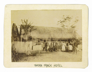
Photograph (Item) - Black and white photograph, Yarra Track Hotel, c1900
... Goldfields, in Victoria, Australia. A direct route via the Yarra River and the Great Divide was discovered by Rieck in September 1862 and became known as the Yarra Track. Early in 1863, the Victorian ...An early black and white photograph of a hotel along the Yarra Track.An early black and white photograph of a hotel along the Yarra Track. The Yarra Track is the former name of the gold fields road from Healesville to the Woods Point and Jordan Goldfields, in Victoria, Australia. A direct route via the Yarra River and the Great Divide was discovered by Rieck in September 1862 and became known as the Yarra Track. Early in 1863, the Victorian Government decided to construct a 193-kilometre (120 mile) road along the route. Its original width varied between 4 and 6 metres (12 and 20 feet), and was designed to accommodate horse-drawn vehicles. The Track involved the climbing of the Black Spur, descent into the Acheron Valley, and then through Marysville to the Cumberland where it followed the existing route. Unable to ascertain both the location and name of hotel.ARMSTRONG COLLECTION 42 STATION STREET/ SANDRINGHAM 3191/ TEL. (03) 9521 5442/ IAN M.L. ARMSTRONG OAMyarra track, healesville, wood's point, jordan goldfields, victoria, yarra river, great divide, reick, black spur, acheron valley, marysville, cumberland creek -
 Marysville & District Historical Society
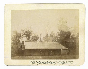
Photograph (Item) - Black and white photograph, The "Scandinavians' - (Deserted), c1900
... Goldfields, in Victoria, Australia. A direct route via the Yarra River and the Great Divide was discovered by Rieck in September 1862 and became known as the Yarra Track. Early in 1863, the Victorian ...An early black and white photograph of The Scandinavian's Hotel and Boarding House along the Yarra Track.An early black and white photograph of The Scandinavian's Hotel and Boarding House along the Yarra Track. The Yarra Track is the former name of the gold fields road from Healesville to the Woods Point and Jordan Goldfields, in Victoria, Australia. A direct route via the Yarra River and the Great Divide was discovered by Rieck in September 1862 and became known as the Yarra Track. Early in 1863, the Victorian Government decided to construct a 193-kilometre (120 mile) road along the route. Its original width varied between 4 and 6 metres (12 and 20 feet), and was designed to accommodate horse-drawn vehicles. The Track involved the climbing of the Black Spur, descent into the Acheron Valley, and then through Marysville to the Cumberland where it followed the existing route.ARMSTRONG COLLECTION 42 STATION STREET/ SANDRINGHAM 3191/ TEL. (03) 9521 5442/ IAN M.L. ARMSTRONG OAMthe scandinavians', yarra track, healesville, wood's point, jordan goldfields, victoria, yarra river, great divide, reick, black spur, acheron valley, marysville, cumberland creek -
 Marysville & District Historical Society
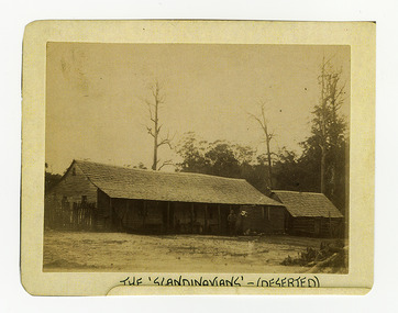
Photograph (Item) - Black and white photograph, The "Scandinavians' - (Deserted), c1900
... Goldfields, in Victoria, Australia. A direct route via the Yarra River and the Great Divide was discovered by Rieck in September 1862 and became known as the Yarra Track. Early in 1863, the Victorian ...An early black and white photograph of The Scandinavian's Hotel and Boarding House along the Yarra Track.An early black and white photograph of The Scandinavian's Hotel and Boarding House along the Yarra Track. The Yarra Track is the former name of the gold fields road from Healesville to the Woods Point and Jordan Goldfields, in Victoria, Australia. A direct route via the Yarra River and the Great Divide was discovered by Rieck in September 1862 and became known as the Yarra Track. Early in 1863, the Victorian Government decided to construct a 193-kilometre (120 mile) road along the route. Its original width varied between 4 and 6 metres (12 and 20 feet), and was designed to accommodate horse-drawn vehicles. The Track involved the climbing of the Black Spur, descent into the Acheron Valley, and then through Marysville to the Cumberland where it followed the existing route.ARMSTRONG COLLECTION 42 STATION STREET/ SANDRINGHAM 3191/ TEL. (03) 9521 5442/ IAN M.L. ARMSTRONG OAMthe scandinavians', yarra track, healesville, wood's point, jordan goldfields, victoria, yarra river, great divide, reick, black spur, acheron valley, marysville, cumberland creek -
 Marysville & District Historical Society
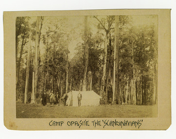
Photograph (Item) - Black and white photograph, Camp Opposite The "Scandinavians', c1900
... Goldfields, in Victoria, Australia. A direct route via the Yarra River and the Great Divide was discovered by Rieck in September 1862 and became known as the Yarra Track. Early in 1863, the Victorian ...An early black and white photograph of a camp which was opposite The Scandinavian's Hotel and Boarding House along the Yarra Track.An early black and white photograph of a camp which was opposite The Scandinavian's Hotel and Boarding House along the Yarra Track. The Yarra Track is the former name of the gold fields road from Healesville to the Woods Point and Jordan Goldfields, in Victoria, Australia. A direct route via the Yarra River and the Great Divide was discovered by Rieck in September 1862 and became known as the Yarra Track. Early in 1863, the Victorian Government decided to construct a 193-kilometre (120 mile) road along the route. Its original width varied between 4 and 6 metres (12 and 20 feet), and was designed to accommodate horse-drawn vehicles. The Track involved the climbing of the Black Spur, descent into the Acheron Valley, and then through Marysville to the Cumberland where it followed the existing route.ARMSTRONG COLLECTION 42 STATION STREET/ SANDRINGHAM 3191/ TEL. (03) 9521 5442/ IAN M.L. ARMSTRONG OAMthe scandinavians', yarra track, healesville, wood's point, jordan goldfields, victoria, yarra river, great divide, reick, black spur, acheron valley, marysville, cumberland creek -
Marysville & District Historical Society
Document (Item) - Research Document, Judith Vimpani, William Cavanagh Farrell (1844-1901), 04-2020
... Goldfields, in Victoria, Australia. A direct route via the Yarra River and the Great Divide was discovered by Reick in September 1862 and became known as the Yarra Track. Early in 1863, the Victorian ...An account of the life of William Cavanagh Farrell.An account of the life of William Cavanagh Farrell who was important to Marysville as his review in 1863 of the routes to Wood's Point led to the Yarra Track ascending the Black Spur and going on to what became the resort town of Marysville on the Steavenson River. The Yarra Track is the former name of the gold fields road from Healesville to the Woods Point and Jordan Goldfields, in Victoria, Australia. A direct route via the Yarra River and the Great Divide was discovered by Reick in September 1862 and became known as the Yarra Track. Early in 1863, the Victorian Government decided to construct a 193-kilometre (120 mile) road along the route. Its original width varied between 4 and 6 metres (12 and 20 feet), and was designed to accommodate horse-drawn vehicles. The Track involved the climbing of the Black Spur, descent into the Acheron Valley, and then through Marysville to the Cumberland where it followed the existing route.willaim cavanagh farrell, marysville, victoria, wood's point, yarra track, black spur, steavenson's creek, steavenson river, george theodore rieck -
Marysville & District Historical Society
Document (Item) - Research Document, Judith Vimpani, George Theodore Rieck (1833-pos 1884), 04-2020
... Goldfields, in Victoria, Australia. A direct route via the Yarra River and the Great Divide was discovered by Rieck in September 1862 and became known as the Yarra Track. Early in 1863, the Victorian ...An account of the life of George Theodore Rieck.An account of the life of George Theodore Rieck. The Yarra Track is the former name of the gold fields road from Healesville to the Woods Point and Jordan Goldfields, in Victoria, Australia. A direct route via the Yarra River and the Great Divide was discovered by Rieck in September 1862 and became known as the Yarra Track. Early in 1863, the Victorian Government decided to construct a 193 kilometre (120 mile) road along the route. Its original width varied between 4 and 6 metres (12 and 20 feet), and was designed to accommodate horse-drawn vehicles. The Track involved the climbing of the Black Spur, descent into the Acheron Valley, and then through Marysville to the Cumberland where it followed the existing route.george theordore rieck, marysville, victoria, james murphy, new chum creek, wood's point, gold mining, matlock, walhalla, yarra track -
Marysville & District Historical Society
Booklet (Item) - Information booklet, Artworkz Tourism, The Big Culvert, Unknown
... Goldfields, in Victoria, Australia. A direct route via the Yarra River and the Great Divide was discovered by Rieck in September 1862 and became known as the Yarra Track. Early in 1863, the Victorian ...An information booklet that was produced as a guide to The Big Culvert.An information booklet that was produced as a guide to The Big Culvert. The Big Culvert is a historic granite and bluestone arch along the Yarra Track, a major route to Melbourne through the 1800s. Built in 1870 and a major piece of infrastructure for its time, the heritage listed culvert allowed water to flow under often-flooded the road. The Yarra Track is the former name of the gold fields road from Healesville to the Woods Point and Jordan Goldfields, in Victoria, Australia. A direct route via the Yarra River and the Great Divide was discovered by Rieck in September 1862 and became known as the Yarra Track. Early in 1863, the Victorian Government decided to construct a 193-kilometre (120 mile) road along the route. Its original width varied between 4 and 6 metres (12 and 20 feet), and was designed to accommodate horse-drawn vehicles. The Track involved the climbing of the Black Spur, descent into the Acheron Valley, and then through Marysville to the Cumberland where it followed the existing route.the big culvert, yarra track, victoria, healesville, wood's point goldfields, jordan goldfields, black spur, acheron valley, cumberland valley -
Marysville & District Historical Society
Flyer (Item) - Information flyer, Artworkz Tourism, The Big Culvert, 26-03-2016
... Goldfields, in Victoria, Australia. A direct route via the Yarra River and the Great Divide was discovered by Rieck in September 1862 and became known as the Yarra Track. Early in 1863, the Victorian ...An information flyer that was produced as a guide to The Big Culvert.An information flyer that was produced as a guide to The Big Culvert. The Big Culvert is a historic granite and bluestone arch along the Yarra Track, a major route to Melbourne through the 1800s. Built in 1870 and a major piece of infrastructure for its time, the heritage listed culvert allowed water to flow under often-flooded the road. The Yarra Track is the former name of the gold fields road from Healesville to the Woods Point and Jordan Goldfields, in Victoria, Australia. A direct route via the Yarra River and the Great Divide was discovered by Rieck in September 1862 and became known as the Yarra Track. Early in 1863, the Victorian Government decided to construct a 193-kilometre (120 mile) road along the route. Its original width varied between 4 and 6 metres (12 and 20 feet), and was designed to accommodate horse-drawn vehicles. The Track involved the climbing of the Black Spur, descent into the Acheron Valley, and then through Marysville to the Cumberland where it followed the existing route.the big culvert, yarra track, victoria, healesville, wood's point goldfields, jordan goldfields, black spur, acheron valley, cumberland valley -
 Marysville & District Historical Society
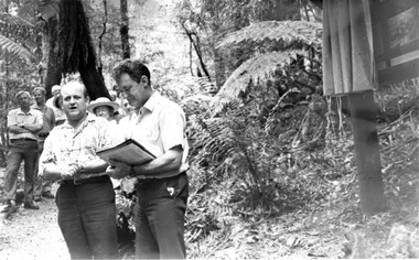
Photograph (Item) - Black and white photograph, Unknown
... Goldfields, in Victoria, Australia. A direct route via the Yarra River and the Great Divide was discovered by Rieck in September 1862 and became known as the Yarra Track. Early in 1863, the Victorian ...A black and white photograph taken at the unveiling of the sign placed at The Big Culvert.A black and white photograph taken at the unveiling of the sign placed at The Big Culvert. The Big Culvert is a historic granite and bluestone arch along the Yarra Track, a major route to Melbourne through the 1800s. Built in 1870 and a major piece of infrastructure for its time, the heritage listed culvert allowed water to flow under often-flooded the road. The Yarra Track is the former name of the gold fields road from Healesville to the Woods Point and Jordan Goldfields, in Victoria, Australia. A direct route via the Yarra River and the Great Divide was discovered by Rieck in September 1862 and became known as the Yarra Track. Early in 1863, the Victorian Government decided to construct a 193-kilometre (120 mile) road along the route. Its original width varied between 4 and 6 metres (12 and 20 feet), and was designed to accommodate horse-drawn vehicles. The Track involved the climbing of the Black Spur, descent into the Acheron Valley, and then through Marysville to the Cumberland where it followed the existing route.Unveiling of sign/ at "Big Culvert" In front Max Cockerrell and - Rear: second back Geoff Pope R.H.S. rear: Nancy "/ Anne "the big culvert, yarra track, victoria, healesville, wood's point goldfields, jordan goldfields, black spur, acheron valley, cumberland valley -
 Marysville & District Historical Society
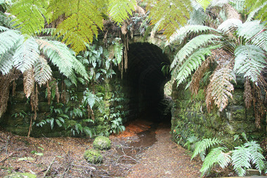
Photograph (Item) - Colour photograph, 20-09-2008
... Goldfields, in Victoria, Australia. A direct route via the Yarra River and the Great Divide was discovered by Rieck in September 1862 and became known as the Yarra Track. Early in 1863, the Victorian ...A colour photograph of the entrance to The Big Culvert.A colour photograph of the entrance to The Big Culvert. The Big Culvert is a historic granite and bluestone arch along the Yarra Track, a major route to Melbourne through the 1800s. Built in 1870 and a major piece of infrastructure for its time, the heritage listed culvert allowed water to flow under often-flooded the road. The Yarra Track is the former name of the gold fields road from Healesville to the Woods Point and Jordan Goldfields, in Victoria, Australia. A direct route via the Yarra River and the Great Divide was discovered by Rieck in September 1862 and became known as the Yarra Track. Early in 1863, the Victorian Government decided to construct a 193-kilometre (120 mile) road along the route. Its original width varied between 4 and 6 metres (12 and 20 feet), and was designed to accommodate horse-drawn vehicles. The Track involved the climbing of the Black Spur, descent into the Acheron Valley, and then through Marysville to the Cumberland where it followed the existing route.the big culvert, yarra track, victoria, healesville, wood's point goldfields, jordan goldfields, black spur, acheron valley, cumberland valley -
Federation University Historical Collection
Document, Zelda Martin, Confirmation of Candidature - Central Victorian Towns - Boom or Bust, c1996
... Victorian goldfield towns...bendigo...castlemaine...ballarat...Maldon...Stawell...Ararat...maryborough...Creswick...Avoca...Heathcote...Banks...Bank of Australasia...Union bank of Australia...Zelda is the author of a book titled " Australia's Relations with the Third World in the context of negotiations for a new international commodity order in the 1970's: continuity or change?" Pub. [Parkville, Victoria]: University of Melbourne, 1982. Zelda Martin Victorian goldfield ...Zelda Martin was a PhD candidate at the University of Melbourne. Zelda had a Bachelor of Commerce (majoring in Economic History and Economic Geography), an Master of Arts (in Politics) and a Diploma of Education; all from the University of Melbourne. Zelda is the author of a book titled " Australia's Relations with the Third World in the context of negotiations for a new international commodity order in the 1970's: continuity or change?" Pub. [Parkville, Victoria]: University of Melbourne, 1982.Eleven page article on Victorian goldfields town. The article was written during the author's PhD study. zelda martin, victorian goldfield towns, bendigo, castlemaine, ballarat, maldon, stawell, ararat, maryborough, creswick, avoca, heathcote, banks, bank of australasia, union bank of australia, government camp, sandhurst, water supply, tarnagulla, talbot, back creek, mountain creek, police court, carisbrook, dunolly, thompson's foundry -
Federation University Historical Collection
Document, Zelda Martin, Central Victorian Goldmining towns - Boom Towns or Ghost Towns?, c1996
... Victorian goldfield towns...bendigo...castlemaine...ballarat...Maldon...Stawell...Ararat...maryborough...Creswick...Avoca...Heathcote...Banks...Bank of Australasia...Union bank of Australia...Zelda Martin Victorian goldfield towns bendigo castlemaine ballarat Maldon Stawell Ararat maryborough Creswick Avoca Heathcote Banks Bank of Australasia Union bank of Australia government camp Sandhurst water supply Tarnagulla Talbot back creek Mountain Creek Police court Carisbrook dunolly thompson's foundry Charles Clacy Anthony Trollope Robert Cecil Mount Alexander urbanisation national schools education govenrment industry railway transport settlement land settlement in central Victoria Steiglitz Joseph Brady The New Australian Mine Berry Deep Leads William Guthrie Spence Creswick State Forest Arthur Worsley Worsley Cottage The Welcome Stranger Moliagul Moonambel Redbank St Arnaud Sebastapol Brown's Scarsdale Clunes Chewton Daylesford Bushfires Inkerman Inglewood Kingower Lintons Happy Valley Piggoreet McIvor Majorca Tarrangower Taradale The Coliban System The Syphon Sandy Creek Wedderburn Koorong Arnold Jones Creek Waanyarra The Golden Triangle Census 1857 Blackwood Buninyong Durham Lead Magpie Carngham Snake Valley Alma Amherst Daisy Hill Amphitheatre Mountain Hut Beaufort Fiery Creek Counties population gold fields commission of enquiry1854 William Westgarth Gold license Fee lieutenant Colonel Valiant administration of the victorian gold fields Commission to Enquire into Sludge 1859 E.S. ...Zelda Martin was a PhD candidate at the University of Melbourne.[.1] 4th item in light blue display book titled Research Approach/Overview of Chapters/Confirmation of Canditure/Chapters1,2,3&4 of proposed thesis. *Twenty-seven page article on Victorian goldfields towns titled: Central Victorian Goldmining Towns - Boom Towns or Ghost Towns. The article was written during the author's PhD study. It outlines the context methodology, and resources and the chapters of the proposed thesis: (1) Central Victorian Goldmining Towns - The Context (2) Contemporary Views of the Factors Necessary for Town Growth (3) Outward Manifestations of Town Growth (4) The Trappings of Government (5-9) The Main Towns and Their Hinterland. [.2] 5th item in Light Blue display book as above item. *Chapter 1 of proposed thesis titled 'Pick, Shovel and Tin Dish Mining.' Covers in Section A: Central Victoria - Pre 1851: Aborigines in Central Victoria, Squatters, and Government. Section B: The years 1851-1854: The Early Gold Rushes, Government Reaction, Township Surveys, Legislation, Town Development, Local Government and Early Settlement. [.3] 6th item in Light Blue display book as above item. *2A of proposed thesis titled 'Contemporary Views of the Factors Necessary for Town Growth'. Similar information to Chapter 1 plus extra re towns and maps. Sections: Introduction, Context of Place - Geographical Towns Listed, The Context of Time - Pre1851 Aborigines, Governance of Port Phillip, The Squatters, The Villages of Central Victorian Highlands, Conclusion, Condensed Version of Chapter2B. [.4] 7th item in Light Blue display book as above item. *Chapter2B of proposed thesis. Sections: Area of Research, Schools, Banks, Newspapers, Progress Association, Town Development - Sandhurst (Bendigo), Ballarat, Castlemaine,, Maryborough, Ararat and Stawell. [.5] 8th item in Light Blue display book as above item. *Chapter 3 of proposed thesis titled 'Outward Manifestations of Town Growth'. Sections: Introduction, Contemporary Writing, Educationalists, The Bankers, The Townsfolk, Current Theory, General Theories of Urban Development, and Conclusion. [.6] 9th item in Light Blue display book as above item. *Chapter 4 of proposed thesis titled 'Trappings of Government' Sections: Introduction, Early Government Attitudes to Mining and Town Development, Law and Order, Township Surveys, Legislation, Local Government, Transport and Communication, The People and Lobbyists. [.7] 10th item in Light Blue display book as above item. *'The Rise and Fall of Central Victorian Goldmining Towns'. Includes a map showing main Goldfields, a table showing towns and villages at two points in time - 1857 and 1871; a Bibliography of Primary and Secondary Sources. [.8] Resource No1. Black display book titled Local Towns 1 : Alma: *Brief history *Directory *Maps Amphitheatre / Mountain Hut: *Brief History Post Office Directory Ararat: *Brief History *Post Office Directory 1869 - Alphabetical Listing by Occupation *Ararat - Prominent Citizens of 1858 *Langi-Morgala Museum Avoca: *Brief History *Excerpts from 'Avoca The Early Years', Margery and Betty Beavis; pg1 - Beginnings; pg11 - The Midas Touch; pg25 - Local Gold Escorts; pg27 - A Town is Born; pg51- The Administration of Justice; pg53 - The Ways of the Law; pg61 - News of the Day; pg65 - A Time to Play; pg72 - Land Ownership *Post Office Directory (Bailliere's) 1869 *Tourism Map and Information of area *Historic Avoca - A 5.5km Tour *Avoca & the Pyrenees Region - information pamphlet Ballarat: *Early History of Ballarat - Ballarat Historical Society, Publication No.1: origin of the name; Ballaarat - the Beginning; Fabulous Yields from the Ballaarat Goldfield; *Streetscape Lydiard Street. *Hand drawn map showing Leigh River, Old Portland Bay Road, plaque on road to Colac; etc. *Newspaper article re 'The Theatre Royal' ( which stood in the vicinity of the current Owen Williams store) - 'The News'15/04/1998 *Article - 'Ballarat's Mechanics' Institute Lives On' Ballarat Courier, 14/09/1985 *Article - Standing the Test of Time' The News 17/11/1993 re The Mechanics Institute & picture of the Reading Room *'Ballarat a Study of a City, Phyllis Reichl, pub. Nelson, 1968; no.3 place, time and people field studies series *Investigator Vol.33 No.2, 1998 Geelong Historical Society. Article on pg75 describes Ballarat in 1861 *Folded poster - 'Ballarat 100' a history of telegraph communication, pub. Telecom. Beaufort (Fiery Creek): *Brief history *Post Office Directory [.9] Resource No.2 Black Folder Titled Towns cont.No2 Bendigo (Sandhurst): *'Family & Local History at the Bendigo Library - 1851-2001 150 years of gold'. *Bendigo Government Camp in 1853 illustration; key to sketch and names of Government officers stationed there *Excerpts from 'Bendigo and Vicinity' Adolph Haman *The Bendigo Goldfield Registry - pgs 1-7 Introduction *Excerpt: 'Breaking the Grip' *Excerpt: The Most Go-Ahead Place *Excerpts from 'History of Bendigo' - anti license agitation; laying out of town; proposed railway; gold calls and dividends; the Sandhurst Municipality; journalism *Bibliography Blackwood: *Excerpts from 'Aspects of Early Blackwood - The Goldfield, the Landmarks, the Pioneers' Alan J Buckingham and Margaret F Hitchcock, JG Publishing,1980 Buninyong: *A Brief History *Investigator Vol1 No.2 Feb 1966 Geelong Historical Society. Pg3 - Article re gold escort route - Mt Alexander to Adelaide - (see a simple monument on the Western Highway a few miles out of Horsham. Pg 15 - Ballarat Excursion - re the finding of gold. *Three articles published by Buninyong and District Historical Society Inc: (Magpie Exploration; Finding Gold In The Green Hills; Magpie Exploration; Burnt Bridge to Cargarie to Mt Mercer) *Copies of newspaper articles/items *Buninyong Street Directory Carisbrook: *In the Beginning There Was Carisbrook *The History of the Carisbrook Racecourse Carngham / Snake Valley: *Brief History *Directory Castlemaine: *Directory 1865-1866 - Alphabetical and Street *Poster - Castlemaine A Contemporary Guide "The Great Centre" 1866 - A Contemporary Guide to the Fascinating Past *Pamphlet - Castlemaine District Community Hospital *Map - Castlemaine, Maldon & Surrounding Districts *Map and Information - The Dry Diggings Track - a 55kl walk among historic goldfields relics ( Castlemaine Fryerstown Vaughan Mt Franklin Hepburn Daylesford) *Postcard - Former Court House *Directory 1867 - Alphabetical, Trade [.10] Resource No.3 Grey folder Titled Towns 3 Creswick to Maryborough Creswick: *Brief History *Booklet - "Creswick Cemetery Walk" *Booklet - The Buried Rivers of Gold Heritage Trail Creswick *Creswick Historical Museum Information Sheet *Chronological History of Creswick *Alphabetical Directory of the Borough of Creswick *Creswick's Creek Directory 1856 *Historic Creswick Walking Tour *A Brief Account of the Schools of Creswick - Past and Present *100 Years of Railway Travel in Creswick *The Berry Deep Leads *The Spence Home at Jackass Gully in the Creswick State Forest ( William Guthrie Spence - Pioneer) *The New Australian Mine and the 1882 Disaster *Creswick District News, Issue 7, July August 1999 *The Creswick Miners Walk - Information and Map *Maps Chewton: *Brief History *Directory Clunes: *Brief History *Clunes Street Directory Daylesford: *Brief History *Notable Bushfires in Daylesford District Over More Than a Century - "Black Thursday" 1851; 1862; 1899; the Disastrous Hepburn Fire of 1906; 1939; 1944; 1969. *Post Office Directory -Daylesford and Hepburn Dunolly / Inkerman: *Brief History *Directory *Pamphlet - Goldfields Historical Museum *Pamphlet - Historic Dunolly - Victoria's Best Kept Secret *Map of Gold Workings at Dunolly Area - showing where the main gold rushes occurred *Brief History - Inglewood *Directory - Inglewood - Name Occupation, Dwelling Kingower: *Brief History *Directory - Name / Ocupation / Dwelling Linton / Happy Valley / Piggoreet: *Brief History *Directory - Lintons McIvor: *"A History of the Shire and the Township of Heathcote" by J.O. Randell Majorca: *Brief History *Official Post Office Directory 1869 - Name / Occupation/ Address Maldon (Tarrangower): *Brief History Part 1 *Brief History Part 2 *Post Office Directory *List - Alphabetical Order by Names plus Business and Trade (Tarrangower Times Oct/1858) *List - Alphabetical Order by Trade plus Name and Business *Directory - Name / Occupation / Dwelling Maryborough: *Worsley Cottage - built by Arthur Worsley, a contractor in stonework in 1894 [.11] Resource No. 4 Blue Display Book titled Towns 4 Moliagul to Stawell Moliagul: *Brief History *Moligul Legislative Assembly (Voting?) List - Names and Occupations *Moliagul Victorian Post Office Directory 1868 - Name / Ocupation / Address / Comments *"The Welcome Stranger" gold nugget *The Sunday School *The Welcome Stranger Discovery Walk - information and map Moonambel (Mountain Creek) Redbank *Brief History *List of names extracted from advertisments of the Pioneer and Mountain Creek Advertiser 16/02/1861. *Bailliere's Directory 1869 - Alphabetical List of Name / Occupation / Place St Arnaud: *Brief History Sebastapol: *Brief History *Directory 1869 - Alphabetical by Name; plus occupation and address. Browns and Scarsdale: *Brief History *Browns Street Directory - Name and Occupation Smythesdale: *Brief Description *Smythesdale Street Directory -Name and Occupation Stawell (Pleasant Creek) *Brief History *Victorian Official Post Office Directory - Name /Occupation / Dwelling *Chronology - 1841-1920 *Production of gold statistics - 1879 - 1900 *Big Hill *Extracts from "The Golden Years of Stawell". Chapt 1 - Stawell's Coming Out. Capt. 2 - The Gold Rush. Caapt.3 - Cradle of Democracy. Chapt.4 - The Reefs Becomes Stawell. Chapt. 5 - Rushing In. Chapt.6 - The Pioneers. Chapt 7 - The Decade of Optimism. [.12] Resource No. 5: Blue Display Book titled 'Towns Steiglitz to the The Golden Triangle. Steiglitz: Brief History Victorian Post Office Directory 1869 *Map of Steiglitz *List of maps relevant to Steiglitz history *Information 6 tables of data from "Reports of Mining Surveyors Talbot (Back Creek) Brief History Taradale: Post office Directory 1869 - Name/Occupation/Street. Also list in alphabetical order by Occupation Taradale *Chronological Reference to Taradale Mines *Water - The Coliban System of Waterworks *Joseph Brady *The Syphon Tarnagulla (Sandy Creek) *Brief History *Tarnagulla Businessmen Cameos to give depth to advertisments in 'The Tarnagulla Courier' various issues 1864-1871 *Directory - Name/Occupation /Address *List - Name/Business/Trade Wedderburn (Koorong) *Brief History *List - Name/Occupation The Golden Triangle: *The Early Rushes - Wedderburn / Moliagul / Sandy Creek - Tarnagulla / Jones Creek - Waanyarra / Kingower / Dunolly - Goldsborough / Inglweood *Census of 1857 - Population / Occupations *1858-1871 - A Time of Consolidation- Wedderburn / Moliagul / Sandy Creek- Tarnagulla / Arnold *Census 1871 - Population *Information gleaned from the census data - Demographics / Population / Occupations / marital / Birthplace / Religion / Literacy/ Occupation and Housing Cameos *Graphs - Birthplace of settlers /Male-Female Ratio / Married males / Children under 15 as Percentage of Population / Religion *Census 1857 - Statistical data *Maps *Bibliography [.13] Resource No. 6 - Black Display Book Information and Research in Central Victoria including: *Banking - Research from ANZ Bank Archives *Institutions - also includes articles listed from the Ballarat Times Newspaper *Australian mining History Association - A.M.H.A. Bibliography *Australia's Mining History * Bibliography - Land Surveys Victoria - *1853 Administration (Statistics and Other) includes: schools / ministers of religion / police / military / local administration / licences for sale of spirits / distances between various Victorian gold fields. * Victoria Government Gazette (Copy) - N0. 116, 12/12/1854 includes: Gold Felds Commission of Enquiry & No. 85, 15/09/1854 - Addresses presented to the Lieutenant Governor (Sir Charles Hotham) during his tour through the Gold Fields of Victoria,1854. Addresses on behalf of : the people of Bendigo; Members of the Church of England, Bendigo; Members of the Wesleyan Church on the Bendigo Gold Fields; Bendigo Gold District General Hospital; the Bendigo Prospecting Association; Committee of the Bendigo Local Exhibition; Bendigo District Medical Association; Coloured Americans Resident at Bendigo; German Inhabitants of Bendigo; Landowners, Inhabitants, and Miners of Castlemaine; Inhabitants of Forest Creek; Inhabitants of Heathcote and Gold Miners of McIvor; Residents and landholders of the District of Bacchus Marsh; Inhabitants of Kilmore and Vicinity. *Gold Fields Correspondence 1853: letter from Lieutenant Colonel Valiant, (Officer commanding the Troops in Victoria) to the Lieutenant Governor re threatened disturbance at Sandhurst (Bendigo) regarding the Gold License Fee. * Extracts from a book "Victoria" re Gold Fields Commission of Enquiry involving mainly Ballarat and Castlemaine and a chapter titled 'A Tour to the Victorian Gold-Fields' *Lists of central Victorian newspapers - listed by date published 1851to 1874; by first date available to State Library. *A list of cities and towns showing County, population in 1861 &1871, and municipal status. [.14] Resource no.7. Black display book. *Reference: Papers presented to Parliament Victoria - 1859-1860 4 volumes - relevant sections copied. Contains information on Branches of Government. General / Finance / Gold / Gazette / Commission and Warrant / Statistic. *Gold Fields Act. In accordance with the Act the gold fields are divided into six districts - Ballaarat, Castlemaine , Sandhurst, Avoca, Ararat, and Beechworth.. Official staff in each gold district consists of a Resident Warden, Wardens, Wardens' Clerks, Bailiffs, Chinese Protectors, Chinese Interpreters, and Mining Surveyors. *Gold Receiver *Gaols *Police magistrates and Clerks of Petty Sessions, etc. *Field Branch *Immigration and Emigration Overland - Chinese - 1859 *Population on the Goldfields *The Geological Survey - The Government Geologist is assisited by staff from four branches - the office Branch; the Publishing Branch; the Field Branch and the Museum Branch. *Commission to Enquire Into Sludge dated 10/02/1859 (Some sections copied) - Report to the Honorable Chief Commissioner of Public Works, Melbourne re the mode of carrying the sludge from the puddling mills in Sandhurst without interfering with the drainage of the town and the roads in the neighbourhood. [.15] Resource No.8: Camel display book titled Resource No. 8. Aborigines *Lists of book titles - +"Readings in Victorian prehistory" +"The Aborigines of Port Phillip" +Aboriginal languages and clans" +"A History of the Port Phillip District" +"Langi Ghiran 1: Aboriginal Rock...." +"Koorie History: sources for aboriginal studies in the State Library of Victoria", ed. Tom Griffiths, Melb. Friends of the State Library, 1989 +"The Public Lands of Australia Felix"; settlement and land appraisal in Victoria1834-91 with special reference to the Western Plains", J.M.Powell, Melb. Oxford University Press 1970 +*Bibliography of the Victorian Aborigines' from the earliest manuscripts to 31st December 1970, Massoa, Aldo, Melb. Hawthorn Press, 1971 +"Aborigines in Colonial Victoria, 1836-1886", M.F. Christie, Sydney University Press, 1979 +"Urban and Industrial Australia: readings in Human Geography" ed J.M. Powell, Melb. Sorrett Pub. 1974 *Extracts: -Processes of Pioneer Settlement - The Squatting Occupation of Victoria, 1834-60. J.M. Powell -Areal Variations in the Class Structure of the Central-Place Hierarchy. P. Scott - Volume1 and Volume 2: Notes Relating to the Habits of the Natives of Other Parts of Australia and Tasmania. Compiled from various sources for the Government of Victoria by R Brough Smyth. John Curry, O'Neil, Melb. 1st pub. Melb. 1876. p31-45 - Numbers and Distribution of the Aborigines in Victoria -Victorian Aborigines 1835-1901 - A Resource Guide to the Holdings of the Public Record Office, Victoria; published by the Government Information Centre 1984. *History of the Aboriginal Artefacts Displayed in the Daylesford Museum. F. G. Powell (4 page pamphlet) *Letter to Zelda Martin from Peter Lovett, Cultural Officer, Ballarat & District Aboriginal Co- Operative, 05/02/1997 *Map: Ian Clarke Victorian Tribunal Boundary Map - Clans of Central Victoria. *Victorian Rock Art and Mythology - Article about Mount Langhi Ghiran and myths of the Tjapwarong people. *Two Aboriginal myths relating to the Grampians - 'The Monster Emu' / 'The Aquisition of Fire', by the Aborigines in the Grampians Areas *Article titled (chapter 8) Ballarat - information re camping sites in the region. Lake Wendouree / Lake Burrumbeet (includes a myth) / Mt Bunninyong / Lal Lal / Pitfield / Mount Elephant / Mount Egerton / Meredith / Lake Goldsmith / Lake Learmonth / Ercildoune *Notes on the Aborigines of the Wider Ballarat Region plus European names=Aboriginal names. John Morris 26/07/1995 *Role of Aborigines in Town Development in Central Victoria. Mentions Native Police Force est. in Port Phillip 1842 and Central Board for Aborigines est. 1860 *The Grave of King Billy. (Frank Wilson) Pamphlet. *Camping Places in Central and Northern Victoria. Article re Lake Burrumbeet site. *Programme for the Unveiling of Memorial Cairn for Edward Stone Parker 1802-1865. Note portrait not accurate. Accurate portrait is available in the book "A Successful Failure A Trilogy The Aborigines and Early Settlers", Edgar Morrison, Graffiti Publications, 2002. * Large envelope addressed to Mr G Netherway containing newspaper cuttings regarding the life of Edward Stone Parker, the unveiling of the Memorial Cairn as mentioned above, articles titled 'Episodes from Our Early Days' (Edgar Morrison, Yandoit)- The Black's School, A School At Last and The Final years. Also a typed page titled 'Historical Background to E.S.Parker's Career. Includes an interesting tale titled 'When the cat lay doggo' re laying power leads for the unveiling ceremony at the memorial site. [.16] green display folder titled 'Research Aids' *List of references to Commissioners' & W'ardens' Reports (formerly held at La Trobe Library Archives, now at Public Records Office [PRO]). Indicates town referred to / date of report / name of camp if different to town. * Archive information re Anglican Records *Movement around the Goldfields - Miners and Storekeepers - usefulness of newspapers in providing information - areas covered - Castlemaine, Maldon, Ararat, Stawell, Tarnagulla, Dunolly. *Port Phillip /Victoria Directories 1839/1867 - Chronological list of Directories included in this series. *"Notes on the History of Local Government in Victoria" A.W. Greig Melb. University Press 1925 - Photo-copied extract p5-p40. (Source - Deakin University Library) - Introduction by W.Harrison Moore. Section 1 - Development in New South Wales Before Separation. Section 2 - Development in Victoria After Its Separation from New South Wales. Hand written notations: 'roads, markets, and local government 1855 on' ;'opportunity of squatters in parliament' and 'opportunities of matters in parliament p33' * Notes on the Establishment of Surveyor General's Department 1851and Commissioner of Crown Lands and Survey. * Newspaper articles from The Argus, 1849, re the discovery of gold in the Pyrenees region. * Excerpt - a report on schools - A.B.Orlebar, Inspector; re the need for permanent school buildings rather than tents. *Excerpt from - 'Approaches to Urban History', Sean Glynn: The Case for Caution * Except from - 'The Urban Sprinkle', Weston Bate: Country Towns and Australian Regional History *Reference- 'The History of Land Tenure in the Colony of Victoria', John Quick. References the Haines Land Bill, land tenure and Land Leagues. [.17] Light blue envelope folder titled 'Birtchnell's Ballarat, etc. Directory 1862 *Contains various directories for Smythesdale, Buninyong, Clunes, Brown's and Creswick. [.18] Red envelope folder no.2 titled Victorian Gazetteer *Selected pages from 1869 Victorian Gazetteer on A4 paper (with a handwritten note questioning if some pages are from 1868 Victorian Gazetteer as appears to be different sizes - A3 pages.) Information includes locations and descriptions of towns, hotels, banks, communications and populations. (Does not include names, residences and occupations) [.19] Red Envelope folder titled Bailliere's Official Post Office Directory 1868 (or1869 or a mixture of both?) *Preface *Contains a selection of pages of towns highlighted in yellow in the the index *Work on this directory was commenced in 1867. *Information includes: Municipalities - mayors and councilors; lists of towns naming male inhabitants and their occupations. [.20]Yellow manila folder titled Post Grad Seminar Presentation 1996 *Gives some background to Zelda Martin's proposed thesis and why she chose the topic Gold Mining Towns Boom or Bust [.21] A3 display book - No. 1A * A list of 'Relevant Newspapers collected: The Tarrangower Times and Maldon Advertiser (first published 1858) Includes dates 1858-1867. The Mount Alexander Mail. Includes dates 1854-1866 The Tarnagulla Courier. Includes dates from1864-1871 Dunolly and Burnt Creek Express. Includes dates from 1862-1871 * Selection of newspaper pages from The Mount Alexander Mail 1854 to 1856, mostly showing advertisements for businesses and services provided to that community. [.22] A3 display book - No. 1B * Selection of newspaper pages from The Mount Alexander Mail 1857 to 1866, mostly showing advertisements for businesses and services provided to that community. [.23] A3 display book -No. 2 * Selection of newspaper pages from The Tarnagulla Courier 1864 to 1871, mostly showing advertisements for businesses and services provided to that community. [.24] A3 display book - No. 3 *Selection of newspaper pages from The Tarrangower Times (and Maldon and Newstead) Advertiser 1858 to1867, mostly showing advertisements for businesses and services provided to that community. [.25] A3 display book - No.4 * Selection of newspaper pages from The Dunolly and Burnt Creek Express; and The Dunolly and Betbetshire Express 1862 to 1871, mostly showing advertisements for businesses and services provided for that community. [.26] A3 display book - No.5 Includes: * Bryce Ross's Diggings Directory. Includes instructions for using this directory. This directory was used by "all persons having connexion or desiring to communicate with 'working parties, private friends, or Stores at the Diggings." As a directory for each area wwas completed it was published in each month's issue of Bonwick's "Digger's Magazine." Years c1852/1853. This Directory commences first at the head of Forest Creek. Includes a directory for Bendigo and Ballarat. Of interest at the end of the Bendigo and Ballarat directory is a list of the number of storekeepers, butchers, doctors, smiths, eating houses, lemonade sellers and chapels. * The Castlemaine Directory and Book of General Information Comprehending Glass's Model Calendar for the Two Years 1862 and1863. "zelda martin, victorian goldfield towns, bendigo, castlemaine, ballarat, maldon, stawell, ararat, maryborough, creswick, avoca, heathcote, banks, bank of australasia, union bank of australia, government camp, sandhurst, water supply, tarnagulla, talbot, back creek, mountain creek, police court, carisbrook, dunolly, thompson's foundry, charles clacy, anthony trollope, robert cecil, mount alexander, urbanisation, national schools, education, govenrment, industry, railway, transport, settlement, land settlement in central victoria, steiglitz, joseph brady, the new australian mine, berry deep leads, william guthrie spence, creswick state forest, arthur worsley, worsley cottage, the welcome stranger, moliagul, moonambel, redbank, st arnaud, sebastapol, brown's, scarsdale, clunes, chewton, daylesford, bushfires, inkerman, inglewood, kingower, lintons, happy valley, piggoreet, mcivor, majorca, tarrangower, taradale, the coliban system, the syphon, sandy creek, wedderburn, koorong, arnold, jones creek, waanyarra, the golden triangle, census 1857, blackwood, buninyong, durham lead, magpie, carngham, snake valley, alma, amherst, daisy hill, amphitheatre, mountain hut, beaufort, fiery creek, counties, population, gold fields commission of enquiry1854, william westgarth, gold license fee, lieutenant colonel valiant, administration of the victorian gold fields, commission to enquire into sludge 1859, e.s. parker, edward stone parker, edgar morrison, mount franklin protectorate, dja dja wurrung, memorial cairn, franklinford, mt franklin memorial cairn, jajowurrong, dja dja wurung, tjaowarong, wothowurong, assistant protectors, daylesford museum, buluk, rock art - grampians, aboriginal mythology - grampians, aborigines, first nations people, mount franklin, aboriginal artifacts, lake burrumbeet, native police force, central board of aborigines, yandoit, commissioners' reports, wardens' reports, port phillip/victoria directories 1839-1867, local government - victoria 1853/1854, surveyor general's department - 1850's, victorian schools 1850's, a.b.orlebar, haines land bill, william charles haines, wilson gray, land tenure, land leagues, victorian gazetteer, the tarrangower times and maldon advertiser - 1858-1867, the mount alexander mail 1854-1866, the tarnagulla courier 1864, dunolly and burnt creek express 1862-1871, bryce rose's diggings directory, the castlemaine directory 1862-1863 -
 Federation University Historical Collection
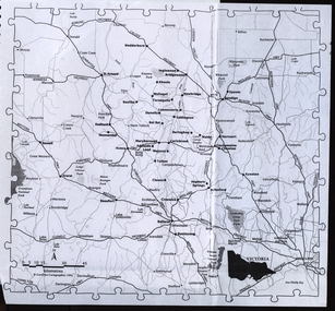
Document - Report, Township of Maldon Tourism Development Strategy, 1992, 18/06/1992
... victorian tourisim industry tourism victorian goldfields maldon built heritage national trust Report compiled by four students of Tourism at Ballarat University College (later Federation University Australia) Township of Maldon Tourism Development Strategy, 1992 Document Report Michelle Connolly Peter Leersen Lisa Louey Alicia Pickering ...Report compiled by four students of Tourism at Ballarat University College (later Federation University Australia)victorian tourisim industry, tourism, victorian goldfields, maldon, built heritage, national trust -
 Federation University Historical Collection
Photograph - Black and White, Chatham-Holmes Collection: Philip Chatham with his mother Imogene Furness
... Victorian Goldfields during the 1850s and early 1860s, before selecting a 240 acre property at Illabarook which they named “The Wattles”. [ https://www.facebook.com/GreatIrishFamineMemorial/photos/a.319845464760508/504144869663899/?type=3&mibextid=WC7FNe&rdid=g7RgSaaGEYbHPsAb&share_url=https%3A%2F%2Fwww.facebook.com%2Fshare%2F16nh8HnJ71%2F%3Fmibextid%3DWC7FNe sited 22 May 2025] Several of the children were born at Port Campbell, Vic. Jessie Imogene Chatham ( nee Furniss) was born at Illabarook, Golden Plains Shire, Victoria, Australia...Victorian Goldfields during the 1850s and early 1860s, before selecting a 240 acre property at Illabarook which they named “The Wattles”. [ https://www.facebook.com/GreatIrishFamineMemorial/photos/a.319845464760508/504144869663899/?type=3&mibextid=WC7FNe&rdid=g7RgSaaGEYbHPsAb&share_url=https%3A%2F%2Fwww.facebook.com%2Fshare%2F16nh8HnJ71%2F%3Fmibextid%3DWC7FNe sited 22 May 2025] Several of the children were born at Port Campbell, Vic. Jessie Imogene Chatham ( nee Furniss) was born at Illabarook, Golden Plains Shire, Victoria, Australia ...Jessie Imogene [Gene] Chatham ( nee Furness 1901 - 1980) was the grand-daughter of Rosanna McFadden and Alexander Poynton, the 13th child of their eldest daughter Mary Jane Poynton. Philip Chatham was her second eldest child. Rosanna married Liverpool-born Alexander Poynton in the Free Church of Victoria in 1852. According to family legend, Alexander was attracted to Rosanna’s beautiful singing voice, however his proposal was conditional: he would marry her provided the first twelve children were raised as Protestants. Rosanna and Alexander had 14 children. The thirteenth and last surviving child was brought up Catholic. Alexander is reported to have been involved in the Eureka Rebellion, placing Rosanna at Ballarat in late 1854. The family moved about the Victorian Goldfields during the 1850s and early 1860s, before selecting a 240 acre property at Illabarook which they named “The Wattles”. [ https://www.facebook.com/GreatIrishFamineMemorial/photos/a.319845464760508/504144869663899/?type=3&mibextid=WC7FNe&rdid=g7RgSaaGEYbHPsAb&share_url=https%3A%2F%2Fwww.facebook.com%2Fshare%2F16nh8HnJ71%2F%3Fmibextid%3DWC7FNe sited 22 May 2025] Several of the children were born at Port Campbell, Vic. Jessie Imogene Chatham ( nee Furniss) was born at Illabarook, Golden Plains Shire, Victoria, Australia. [Jane Dyer ( nee Chatham) 2025] Rosanna’s first child Alexander, was a State and Federal Politican, holding the role of Treasurer in Billy Hughes government. He was awarded an OBE in 1920 for his work on WW1 repatriation issues. Fifth child Rosanna, married the Mayor of Brunswick and their son Sir Alexander George Wales was Lord Mayor of Melbourne between 1934 – 37. Finally, eleventh son John Joseph was Lord Mayor of Perth. Alexander died in 1896 at the age of 64, while Rosanna lived on to the age of 87, dying on March 9th, 1920. philip chatham, imogene furness, surfers paradise, chatham-holmes collection, queensland holiday -
 Flagstaff Hill Maritime Museum and Village
Book, The Miners Right
... The Warrnambool Mechanics' Institute’s publication collection is of both local and state significance. warrnambool shipwrecked-coast flagstaff-hill flagstaff-hill-maritime-museum maritime-museum shipwreck-coast flagstaff-hill-maritime-village shipwrecked-artefact book pattison collection warrnambool library warrnambool mechanics’ institute ralph eric pattison corangamite regional library service warrnambool city librarian mechanics’ institute library victorian library board warrnambool books and records warrnambool children’s library great ocean road The Miners Right Australian Goldfields Australian Rush Rolf Boldrewood Gold Rush Label on spine cover with typed text R.A. 823.91 BOL Pastedown front endpaper has sticker from Warrnambool Public Library The Miners Right A tale of the Australian Goldfields Author: Rolf Boldrewood Publisher: Macmillan And Co Date: 1922 The Miners Right Book ...This item is from the ‘Pattison Collection’, a collection of books and records that was originally owned by the Warrnambool Mechanics’ Institute, which was founded in Warrnambool in 1853. By 1886 the Warrnambool Mechanics’ Institute (WMI) had grown to have a Library, Museum and Fine Arts Gallery, with a collection of “… choice productions of art, and valuable specimens in almost every branch and many wonderful national curiosities are now to be seen there, including historic relics of the town and district.” It later included a School of Design. Although it was very well patronised, the lack of financial support led the WMI in 1911 to ask the City Council to take it over. In 1935 Ralph Pattison was appointed as City Librarian to establish and organise the Warrnambool Library as it was then called. When the WMI building was pulled down in 1963 a new civic building was erected on the site and the new Warrnambool Library, on behalf of the City Council, took over all the holdings of the WMI. At this time some of the items were separated and identified as the ‘Pattison Collection’, named after Ralph Pattison. Eventually the components of the WMI were distributed from the Warrnambool Library to various places, including the Art Gallery, Historical Society and Flagstaff Hill. Later some were even distributed to other regional branches of Corangamite Regional Library and passed to and fro. It is difficult now to trace just where all of the items have ended up. The books at Flagstaff Hill Maritime Village generally display stamps and markings from Pattison as well as a variety of other institutions including the Mechanics’ Institute itself. RALPH ERIC PATTISON Ralph Eric Pattison was born in Rockhampton, Queensland, in 1891. He married Maude Swan from Warrnambool in 1920 and they set up home in Warrnambool. In 1935 Pattison accepted a position as City Librarian for the Warrnambool City Council. His huge challenge was to make a functional library within two rooms of the Mechanics’ Institute. He tirelessly cleaned, cleared and sorted a disarrayed collection of old books, jars of preserved specimens and other items reserved for exhibition in the city’s museum. He developed and updated the library with a wide variety of books for all tastes, including reference books for students; a difficult task to fulfil during the years following the Depression. He converted all of the lower area of the building into a library, reference room and reading room for members and the public. The books were sorted and stored using a cataloguing and card index system that he had developed himself. He also prepared the upper floor of the building and established the Art Gallery and later the Museum, a place to exhibit the many old relics that had been stored for years for this purpose. One of the treasures he found was a beautiful ancient clock, which he repaired, restored and enjoyed using in his office during the years of his service there. Ralph Pattison was described as “a meticulous gentleman whose punctuality, floorless courtesy and distinctive neat dress were hallmarks of his character, and ‘his’ clock controlled his daily routine, and his opening and closing of the library’s large heavy doors to the minute.” Pattison took leave during 1942 to 1945 to serve in the Royal Australian Navy, Volunteer Reserve as Lieutenant. A few years later he converted one of the Museum’s rooms into a Children’s Library, stocking it with suitable books for the younger generation. This was an instant success. In the 1950’s he had the honour of being appointed to the Victorian Library Board and received more inspiration from the monthly conferences in Melbourne. He was sadly retired in 1959 after over 23 years of service, due to the fact that he had gone over the working age of council officers. However he continued to take a very keen interest in the continual development of the Library until his death in 1969. WARRNAMBOOL PUBLIC LIBRARY The Warrnambool Mechanics’ Institute (WMI) was formed by a voluntary community group in 1863, within six years of Warrnambool’s beginnings, and its Reading Room opened in 1854. The WMI operated until 1963, at which time it was one of the oldest Mechanics’ Institutes in Victoria. Mechanics’ Institutes offered important services to the public including libraries, reading rooms and places to display and store collections of all sorts such as curiosities and local historical relics. In 1886 a Museum and Fine Arts Gallery were added to the WMI and by the beginning of the 20th century there was also a billiards room and a School of Art. By this time all Mechanics’ Institutes in country Victoria had museums attached. Over the years the Warrnambool Mechanics’ Institute Library was also known as the Warrnambool Public Library the Warrnambool Library and the Free Library. Early funding from the government was for the “Free Library”. The inscription in a book “Science of Man” was for the “Warrnambool Public Library”, donated by Joseph Archibald in 1899. Another inscription in the book “Catalogue of Plants Under Cultivation in the Melbourne Botanic Gardens 1 & 2, 1883” was presented to the “Warrnambool Library” and signed by the author W.R. Guilfoyle. In 1903 the Warrnambool Public Library decided to add a Juvenile Department to library and stock it with hundreds of books suitable for youth. In 1905 the Public Library committee decided to update the collection of books and added 100 new novels plus arrangements for the latest novels to be included as soon as they were available in Victoria. In July 1911 the Warrnambool Council took over the management of the Public Library, Art Gallery, Museum and Mechanics’ Institute and planned to double the size of the then-current building. In 1953, when Mr. R. Pattison was Public Librarian, the Warrnambool Public Library’s senior section 10,000 of the 13,000 books were fiction. The children’s section offered an additional 3,400 books. The library had the equivalent of one book per head of population and served around 33 percent of the reading population. The collection of books was made up of around 60 percent reference and 40 percent fiction. The library was lending 400 books per day. In 1963 the Warrnambool City Council allocated the site of the Mechanics’ Institute building, which included the Public Library, Museum and Art Gallery, for the new Municipal Offices and the Collections were dispersed until 1971. The Warrnambool Library took over the Mechanics’ Institute Library’s holdings on behalf of the Warrnambool City Council. Since the closure of the Warrnambool Mechanics’ Institute the exact location and composition of the original WMI books and items has become unclear. Other materials have been added to the collection, including items from Terang MI, Warrnambool Court House and Customs House. Many of the books have been identified as the Pattison Collection, named after the Librarian who catalogued and numbered the books during his time as Warrnambool Public Librarian in the time before the Mechanics’ Institute closed. It seems that when Warrnambool became part of the Corangamite Regional Library some of the books and materials went to its head office in Colac and then back to Warrnambool where they were stored at the Art Gallery for quite some time. Some then went to the Warrnambool Historical Society, some stayed at the Art Gallery and some were moved to Flagstaff Hill Maritime Village. The various stamps and labels on the books held at Flagstaff Hill show the variety of the collection’s distribution and origin. The books in the collection at Flagstaff Hill Maritime Village date from the 1850’s to the late 1950’s and include rare and valuable volumes. Many of the books are part of the “Pattison Collection” after the Warrnambool’s Public Librarian, Mr. R. Pattison. Rolf Boldrewood (1826-1915) ‘Rolf Boldrewood’ is the pen-name used by Thomas Alexander Browne as a writer. Browne was the eldest child of Captain Sylvester John Brown and Elizabeth Angell nee Alexander. He was born in London on 6th August 1826 and arrived in Australia with his parents and siblings when he was 5 years old and grew up in Sydney. In the 1860’s Browne added the ‘e’ to his surname. As a 17 year old Browne took up land in the Western District of Victoria between Portland and Port Fairy on a property named “Squattlesea Mere”. He remained there until 1858, enjoying the squatters’ life on his 32,000 acre property, growing potatoes and running cattle and horses. He sold in 1858 and purchased a sheep station on the Murray River near Swan Hill. He later sold this and bought another sheep station near Narrandera until bad seasons and severe droughts eventually caused him to change his career after 25 years as a squatter. Over the next 25 years Browne held the position of Police Magistrate and as a gold commissioner in various locations. His third career as an author lasted approximately 40 years. In 1865 he wrote two articles on pastoral life while he was recovering from a riding accident. In the 1870’s his writing was bringing in the income to support his family, changing his focus to the writing of novels. A series of these was written for the Australian market and published in The Sydney Mail and the Centennial Magazine. His later novels were aimed at the overseas markets. His best known novel “Robbery Under Arms” was written from 1882 to 1883 and has been serialised on radio in Australia and Britain. The novel was filmed in 1907, 1920 and 1957, and in 1985 it was made into a television series. It is now an Australian Classic. He also wrote short stories, several nonfiction graziers’ guides, and an autobiography named “Old Melbourne Memories” in 1884. [This information has been taken from Wikipedia; Australian Authors-Perry Meddlemiss; Australian Dictionary of Biography, Browne, Thomas Alexander (1826-1915)] The Pattison Collection, along with other items at Flagstaff Hill Maritime Village, was originally part of the Warrnambool Mechanics' Institute’s collection. The Warrnambool Mechanics’ Institute Collection is primarily significant in its totality, rather than for the individual objects it contains. Its contents are highly representative of the development of Mechanics' Institute libraries across Australia, particularly Victoria. A diversity of publications and themes has been amassed, and these provide clues to our understanding of the nature of and changes in the reading habits of Victorians from the 1850s to the middle of the 20th century. The collection also highlights the Warrnambool community’s commitment to the Mechanics’ Institute, reading, literacy and learning in the regions, and proves that access to knowledge was not impeded by distance. These items help to provide a more complete picture of our community’s ideals and aspirations. The Warrnambool Mechanics Institute book collection has historical and social significance for its strong association with the Mechanics Institute movement and the important role it played in the intellectual, cultural and social development of people throughout the latter part of the nineteenth century and the early twentieth century. The collection of books is a rare example of an early lending library and its significance is enhanced by the survival of an original collection of many volumes. The Warrnambool Mechanics' Institute’s publication collection is of both local and state significance. The Miners Right A tale of the Australian Goldfields Author: Rolf Boldrewood Publisher: Macmillan And Co Date: 1922Label on spine cover with typed text R.A. 823.91 BOL Pastedown front endpaper has sticker from Warrnambool Public Library warrnambool, shipwrecked-coast, flagstaff-hill, flagstaff-hill-maritime-museum, maritime-museum, shipwreck-coast, flagstaff-hill-maritime-village, shipwrecked-artefact, book, pattison collection, warrnambool library, warrnambool mechanics’ institute, ralph eric pattison, corangamite regional library service, warrnambool city librarian, mechanics’ institute library, victorian library board, warrnambool books and records, warrnambool children’s library, great ocean road, the miners right, australian goldfields, australian rush, rolf boldrewood, gold rush -
 Flagstaff Hill Maritime Museum and Village
Book - Fictional Novel, Macmillan & Co. et al, Nevermore, 1892
... Victorian England and the 1850s Australian gold rush. The story follows Launcelot 'Lance' Trevanion, a proud and rebellious young Englishman who quarrels with his father and leaves for the Victorian goldfields of Ballarat to seek his fortune. ...Nevermore was serialized between 1889 and 1890, and was then published as a book in 1892. The novel is a dramatic tale set against the backdrop of Victorian England and the 1850s Australian gold rush. The story follows Launcelot 'Lance' Trevanion, a proud and rebellious young Englishman who quarrels with his father and leaves for the Victorian goldfields of Ballarat to seek his fortune. Lance's impulsive nature and poor judgment lead him into a web of misfortune. He is falsely accused of horse-stealing by a corrupt police magistrate, wrongfully imprisoned, and subjected to the brutal realities of the colonial penal system. The title Nevermore reflects the tragic, Edgar Allan Poe-esque downward spiral of the protagonist, exploring themes of family pride, mistaken identity, colonial injustice, and the impossibility of reclaiming lost innocence.Hard cover book, Nevermore Author: Pen Name Rolf Boldrewood For (Thomas Alexander Browne) Publisher: Macmillan And Co Printer: Robert Clark Date: 1892 Blue cloth hardcover and spine with spine lettering in black texter. The spine has a Library label with inscription.fictionNevermore was serialized between 1889 and 1890, and was then published as a book in 1892. The novel is a dramatic tale set against the backdrop of Victorian England and the 1850s Australian gold rush. The story follows Launcelot 'Lance' Trevanion, a proud and rebellious young Englishman who quarrels with his father and leaves for the Victorian goldfields of Ballarat to seek his fortune. Lance's impulsive nature and poor judgment lead him into a web of misfortune. He is falsely accused of horse-stealing by a corrupt police magistrate, wrongfully imprisoned, and subjected to the brutal realities of the colonial penal system. The title Nevermore reflects the tragic, Edgar Allan Poe-esque downward spiral of the protagonist, exploring themes of family pride, mistaken identity, colonial injustice, and the impossibility of reclaiming lost innocence.flagstaff hill, warrnambool, shipwrecked coast, flagstaff hill maritime museum, maritime museum, shipwreck coast, flagstaff hill maritime village, great ocean road, book, pattison collection, warrnambool library, warrnambool mechanics’ institute, ralph eric pattison, corangamite regional library service, warrnambool city librarian, mechanics’ institute library, victorian library board, warrnambool books and records, warrnambool children’s library, nevermore, rolf boldrewood, thomas alexander browne, robbery under arms, the miner's right. -
 City of Moorabbin Historical Society (Operating the Box Cottage Museum)
Document, Photocopy Letter Thomas Charman to Michael Charman UK 1878, 1878
... Australia 1842 with his brother Stephen and moved to Sydney where he obtained a large dray and bullock team. He delivered supplies to the Goldfields and realized this was more secure than chancing to find gold by digging. Thomas returned to Melbourne when the Victorian ...Thomas Charman came to Australia with his brother Stephen and went to Sydney. Thomas came to Melbourne c 1853 with a large dray and bullock team and with his son took supplies to the Victorian Gold digging sites. Quite profitably. Stephen Charman, aged 21years, arrived in Melbourne in 1842 as one of Henry Dendy's Emigrants. 1852 he purchased 160 acres for £328 bounded by Charman Rd and Balcome Rd. 'The Spring' was an important water source for the local Aboriginal people and then for the early settlers. Charman's first wife Harriet and their infant child died and in 1850 he married a widow with 5 children, Mary Gettens. Their first home was made of wattle and daub and they had 7 more children. Later a weatherboard cottage was built c 1855 Together they developed a market garden and specialized in marigolds which were sold for medicinal purposes to the Melbourne Chemists - Martin & Pleasance Thomas Charman arrived in Australia 1842 with his brother Stephen and moved to Sydney where he obtained a large dray and bullock team. He delivered supplies to the Goldfields and realized this was more secure than chancing to find gold by digging. Thomas returned to Melbourne when the Victorian Mines became more numerous than NSW and profitably delivered to the Victorian gold fields .Letter, handwritten from Thomas Charman to his brother Michael in UK 1878 x 3 pagesHandwritten -
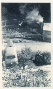 The Beechworth Burke Museum
Photograph, Unknown
... victorian gold rush...mining tunnels...gold ming history...colonial australia...australian gold rushes...mining technology...beechworth historic district...indigo gold trail...indigo shire...upper goulburn shire...jamieson...woods point-walhalla goldfield...The photograph contributes to our understanding of the A1 Gold Mine's impact on the landscape and the social, environmental impacts of mining on communities and may be compared with others in the Burke Museum's extensive collection of mining photographs to deepen our understanding of mining in the Jamieson area. burke museum beechworth museum beechworth gold fields gold rush victorian gold rush mining tunnels gold ming history colonial australia australian gold rushes mining technology beechworth historic district indigo gold trail indigo shire upper goulburn shire jamieson woods point-walhalla goldfield a1 gold mine victorian high country modern mining methods orogenic gold province gold mineralisation devonian dykes Reverse: 5577 / A1 Mine / Near Jamieson / Vic. / Black and white rectangular photograph printed on photographic paper Photograph Photograph ...The A1 Gold Mine is located north of Woods Point, near Jamieson, in the Upper Goulburn region of Victoria. Gold was discovered at the A1 site in 1861 and mining operations began in 1864. The A1 Mine Settlement refers to a small township known variously as Castle Reef, Castle Point, and Raspberry Creek, which developed in the 1860s around mining industry centred on a crushing machine that worked the three gold reefs in the area. Historically, the name "A1"referred to the high quality of gold found in the quartz reefs at depths of at least two thousand feet. Along with the Morning Star mine at Woods Point, the A1 gold mine produced almost sixty percent of Victoria's gold output in the 1950s to 1970s and continued operating until 1992 when it went into administration. Operations at the site were revived in 2016 and the A1 Mine is now considered one of Victoria's premier gold mines. The A1 mine is part of the extensive and prospective Lachlan Fold Belt, a north-west trending belt of tightly folded Early Devonian sedimentary rocks extending from New South Wales to Victoria. Mineralisation is hosted within or immediately adjacent to diorite dykes. Contemporary development of the 'Queens Lode' at the A1 mine signals a move from high-grade, narrow vein airleg mining into larger scale, mechanical mining designed to increase ore production volume. This original, undated photograph of the A1 Mine appears to depict an area or phase of disuse or abandonment. The aged and humble appearance of the cottage suggests association with the historical A1 Mine Settlement, therefore the image may have been taken prior to the 1950s-1970s revival period in which the A1 mine is known to have produced high gold yields. The photograph contributes to our understanding of the A1 Gold Mine's impact on the landscape and the social, environmental impacts of mining on communities and may be compared with others in the Burke Museum's extensive collection of mining photographs to deepen our understanding of mining in the Jamieson area.Black and white rectangular photograph printed on photographic paperReverse: 5577 / A1 Mine / Near Jamieson / Vic. /burke museum, beechworth museum, beechworth, gold fields, gold rush, victorian gold rush, mining tunnels, gold ming history, colonial australia, australian gold rushes, mining technology, beechworth historic district, indigo gold trail, indigo shire, upper goulburn shire, jamieson, woods point-walhalla goldfield, a1 gold mine, victorian high country, modern mining methods, orogenic gold province, gold mineralisation, devonian, dykes -
 Ringwood and District Historical Society
Mixed media - Video, RDHS Guest Speaker Presentation - "Fluctuating Fortunes on the Upper Goulburn Goldfields 1870s-1880s" - Dr. Louise Blake
... Australia and New Zealand. Inspired by her family connection to the gold mining settlement of Woods Point, Louise completed a PhD on Women and Community on the Upper Goulburn Goldfields in north-east Victoria in 2019. In this talk Louise will share her research on Lawrence and Esther Chubb, who lived and worked at Gaffneys Creek on the Upper Goulburn Goldfields in the 1870s and 80s. In a series of letters Lawrence wrote to his family in England, and now held by the State Library of Victoria, Lawrence shared his early struggles as an independent miner on the central Victorian...Australia and New Zealand. Inspired by her family connection to the gold mining settlement of Woods Point, Louise completed a PhD on Women and Community on the Upper Goulburn Goldfields in north-east Victoria in 2019. In this talk Louise will share her research on Lawrence and Esther Chubb, who lived and worked at Gaffneys Creek on the Upper Goulburn Goldfields in the 1870s and 80s. In a series of letters Lawrence wrote to his family in England, and now held by the State Library of Victoria, Lawrence shared his early struggles as an independent miner on the central Victorian ...Digitised video (2.66GB) Duration: 51 minutes. Recorded August, 2022 (Video is available for viewing at Ringwood & District Historical Society Archives by appointment)Presenter: Louise Blake is a writer and historian with an interest in the stories of women, families, and communities on the nineteenth-century goldfields in Australia and New Zealand. Inspired by her family connection to the gold mining settlement of Woods Point, Louise completed a PhD on Women and Community on the Upper Goulburn Goldfields in north-east Victoria in 2019. In this talk Louise will share her research on Lawrence and Esther Chubb, who lived and worked at Gaffneys Creek on the Upper Goulburn Goldfields in the 1870s and 80s. In a series of letters Lawrence wrote to his family in England, and now held by the State Library of Victoria, Lawrence shared his early struggles as an independent miner on the central Victorian goldfields, his protracted courtship with Esther, the ordinary intimacies of their life at Gaffneys Creek, the work that Esther did to support the family in this remote mining region, as well as the material and emotional support provided by and to family, friends and neighbours. A rare and revealing source, these letters help to expand our understanding of the lived experience of mining families, particularly the work that women did to sustain families and communities, in this period of waged labour and tribute mining in Victoria.
