
Showing 46 items matching "broadbent's maps"
-
 Emerald Museum & Nobelius Heritage Park
Map - Melbourne and surrounds map, Broadbent's Maps et al, Fifty Miles Round Melbourne, 1929
... ...Broadbent's maps...Broadbent's Maps...Emerald Victoria Australia tourism guest houses Broadbent's maps Royal Automobile Club of Victoria The Falls Guest House Nottingham House J.B. ...Road map of Melbourne and surrounds showing main tourist areas. Booklet contains information on each area, including Dandenong Ranges. See p. 46 for advertisaements for 'The Falls' guest house (with photograph), owned by Mr and Mrs J.B. Holman, and Nottingham house, owned by M. Slee, both on Emerald-Beaconsfield Road. The map is of interest for showing main roads into Emerald in the 1920s and 1930s, well before construction of Cardinia Reservoir.Folded road map contained in soft cover booklet. 1929-1930 Edition. Includes photographsemerald, victoria, australia, tourism, guest houses, broadbent's maps, royal automobile club of victoria, the falls guest house, nottingham house, j.b. holman, m. slee -
Whitehorse Historical Society Inc.
Document, F. S. Baker/ Yarra Hill country map, 1950s
... Real Estate Agent c. 1950s, backed by Broadbent's Map no. 280, Yarra Hill Country....Pleasant Road Nunawading, Real Estate Agent c. 1950s, backed by Broadbent's Map no. 280, Yarra Hill Country...Real Estate Agent c. 1950s, backed by Broadbent's Map no. 280, Yarra Hill Country. Broadbents Baker F. ...Advertising leaflet for F. S. Baker, Mt. Pleasant Road Nunawading,Advertising leaflet for F. S. Baker, Mt. Pleasant Road Nunawading, Real Estate Agent c. 1950s, backed by Broadbent's Map no. 280, Yarra Hill CountryAdvertising leaflet for F. S. Baker, Mt. Pleasant Road Nunawading, broadbents, baker, f. s., mount pleasant road, nunawading, no. 20 -
 Emerald Museum & Nobelius Heritage Park
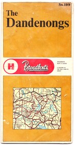
Map - Map of the Dandenongs, The Paul Hamlyn Group, c. 1970s
... George Broadbent was a Geelong-born cyclist record-holder, who produced from 1896 the most comprehensive and detailed maps of Victoria until his death in October 1947. ...Front of fold-out map titled 'The Dandenongs No. 199', produced by Broadbents. Folded out, one side is a street map of the Dandenongs. ...On front: ' No. 199 / The / Dandenongs / Broadbents / Broadbents / Maps & Guides / A DIVISION OF / THE PAUL HAMLYN / GROUP'... Dandenongs 1970s tourist sites walking tracks On front: ' No. 199 / The / Dandenongs / Broadbents / Broadbents / Maps & Guides / A DIVISION OF / THE PAUL HAMLYN / GROUP' Front of fold-out map titled 'The Dandenongs No. 199', produced by Broadbents. ...George Broadbent was a Geelong-born cyclist record-holder, who produced from 1896 the most comprehensive and detailed maps of Victoria until his death in October 1947. His son had taken over map production in 1945. This map of the Dandenongs c 1970s details tourist sites and walking tracks. This map shows streets and walking tracks and tourist sites significant in the Dandenongs c. 1970s.Front of fold-out map titled 'The Dandenongs No. 199', produced by Broadbents. Folded out, one side is a street map of the Dandenongs. The other side includes a street index, a list of tourist sites, a list of walking tracks, a map of Sherbrooke Forest, and a map of key approaches from the city to the Dandenongs.On front: ' No. 199 / The / Dandenongs / Broadbents / Broadbents / Maps & Guides / A DIVISION OF / THE PAUL HAMLYN / GROUP'broadbents, dandenongs, 1970s, tourist sites, walking tracks -
 Peterborough History Group
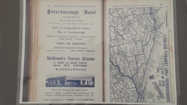
Book - Broadbents Map Warrnambool - Port Campbell district
... A4 copy of a Broadbent Map which includes an advertisement for the Peterborough Hotel. ...Approx 1950-1960. Book Broadbents Map Warrnambool - Port Campbell district ...Advertisement for the significant local building of the time for the Peterborough Hotel. Also contains detailed map of the local roads.The Peterborough Hotel was a significant local building until it burned down in the 1960's.A4 copy of a Broadbent Map which includes an advertisement for the Peterborough Hotel. Approx 1950-1960.peterborough hotel, broadbents guide, peterborough hotel advertisment, john wiber, james irvine -
 Marysville & District Historical Society
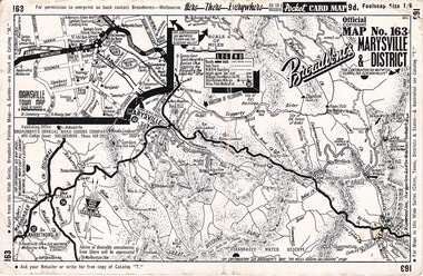
Ephemera (Item) - Pocket card map, Broadbent's Official Road Guides Company, Broadbent's Map No. 163 Marysville & District, 1950s
... maps...broadbent's...Has a legend, scale and a town map of Marysville. Gives an address for Broadbent's Publishing Office of 475 Collins St Melbourne and a Melbourne telephone number - MR 2021. ...Reverse has advertisements for Barton's Store and Marylands in Marysville. Broadbent's Map No. 163 Marysville & District Ephemera Pocket card map Broadbent's Official Road Guides Company. ...A pocket card map of Marysville and the district. Drawn map of Marysville and the district. Has a legend, scale and a town map of Marysville. Gives an address for Broadbent's Publishing Office of 475 Collins St Melbourne and a Melbourne telephone number - MR 2021. Reverse has advertisements for Barton's Store and Marylands Guest House in Marysville.A pocket card map of Marysville and the district. Gives information about Marysville and the district. Broadbent's was a prolific publisher of maps. marysville, victoria, maps, broadbent's, barton's store, marylands guest house -
 Marysville & District Historical Society
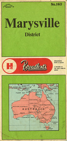
Ephemera (Item) - Tourist map, The Paul Hamlyn Group, Marysville District No. 163, 1950s
... maps...broadbent's...A tourist map of Marysville and the district which was produced by Broadbent's, a division of The Paul Hamlyn Group. ...A tourist map of Marysville and the district which was produced by Broadbent's, a division of The Paul Hamlyn Group....A tourist map of Marysville and the district which was produced by Broadbent's, a division of The Paul Hamlyn Group. marysville victoria maps broadbent's the paul hamlyn group A tourist map of Marysville and the district which was produced by Broadbent's, a division of The Paul Hamlyn Group. ...A tourist map of Marysville and the district which was produced by Broadbent's, a division of The Paul Hamlyn Group. Drawn map of Marysville and the district. Has a legend, scale and a town map of Marysville. Has an index of locations and their grid details. Gives details of addresses in New South Wales and Victoria for The Paul Hamlyn Group.A tourist map of Marysville and the district which was produced by Broadbent's, a division of The Paul Hamlyn Group.marysville, victoria, maps, broadbent's, the paul hamlyn group -
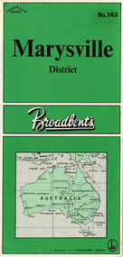 Marysville & District Historical Society
Ephemera (Item) - Tourist map, Lansdowne Press, Marysville District No. 163, Unknown
... maps...broadbent's...A tourist map of Marysville and the district which was produced by Broadbent's, a division of Lansdowne Press. ...A tourist map of Marysville and the district which was produced by Broadbent's, a division of Lansdowne Press....Shows a list of other maps in the Robinson's and Broadbent's range. A tourist map of Marysville and the district which was produced by Broadbent's, a division of Lansdowne Press. marysville victoria maps broadbent's lansdowne press A tourist map of Marysville and the district which was produced by Broadbent's, a division of Lansdowne Press. ...A tourist map of Marysville and the district which was produced by Broadbent's, a division of Lansdowne Press. Drawn map of Marysville and the district. Has a legend, scale, and a town map of Marysville. Has an index of locations and their grid details. Shows a list of other maps in the Robinson's and Broadbent's range.A tourist map of Marysville and the district which was produced by Broadbent's, a division of Lansdowne Press.marysville, victoria, maps, broadbent's, lansdowne press -
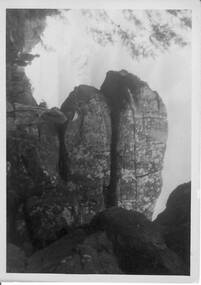 Halls Gap & Grampians Historical Society
Photograph - B/W, C 1940s -- 50s
... Rock formation is called " The Woolpacks " and was located on the Wonderland Track at the top of Silent Street -- however on a Broadbent map of the Grampians no.205 this formation was called the " Wool Sacks " ; and the "Woolpacks" was shown on the map close to Venus Bath....Rock formation is called " The Woolpacks " and was located on the Wonderland Track at the top of Silent Street -- however on a Broadbent map of the Grampians no.205 this formation was called the " Wool Sacks " ; and the "Woolpacks" was shown on the map close to Venus Bath. ...Rock formation is called " The Woolpacks " and was located on the Wonderland Track at the top of Silent Street -- however on a Broadbent map of the Grampians no.205 this formation was called the " Wool Sacks " ; and the "Woolpacks" was shown on the map close to Venus Bath.Photo shows distinct slabs of rock balancing on each other. Three people appear in the photo -- a man with a boy and a woman. All three are wearing hats. A large rock outcrop can be seen on right of photos -- trees can be seen on left.The Wool Packs F5030scenery, wonderland range -
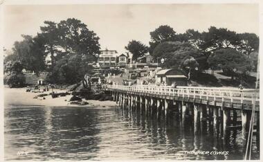 Phillip Island and District Historical Society Inc.
Photographs-Postcards, Valentine Publishing Co. Pty. Ltd. et al, 1940's
... Shows camel rides on the beach. 357-09: Bayview Guest House on The Esplanade, Cowes. 357-10: A koala and young on tree. 357-11: Penguins coming in at dusk at the Penguin Parade. 357-12: Broadbent's Official Map of Phillip Island....Phillip Island. 357-12: Broadbent's Official Map. Phillip Island....map of phillip island 357-08: The Pier, Cowes. No. 9. 357-09: Photo Shop Series. Bayview Guest House. Cowes. 357-10: Native Bears (Koala) at Cowes No. 55B. 357-11: Photo Shop Series. Parade of the Penguins. Phillip Island. 357-12: Broadbent's ...Five of a collection of 12 photographs and postcards donated by Jill Palmer.Five black & white postcards taken around Phillip Island. 357-08: Looking from the Cowes Pier towards the Isle of Wight Hotel. Shows camel rides on the beach. 357-09: Bayview Guest House on The Esplanade, Cowes. 357-10: A koala and young on tree. 357-11: Penguins coming in at dusk at the Penguin Parade. 357-12: Broadbent's Official Map of Phillip Island.357-08: The Pier, Cowes. No. 9. 357-09: Photo Shop Series. Bayview Guest House. Cowes. 357-10: Native Bears (Koala) at Cowes No. 55B. 357-11: Photo Shop Series. Parade of the Penguins. Phillip Island. 357-12: Broadbent's Official Map. Phillip Island.cowes pier, cowes beach, wildlife - koalas, wildlife - penguins, bayview guest house cowes phillip island, map of phillip island -
![Booklet, Souvenir of Phillip Island [Cowes, Rhyll, Newhaven etc] and San Remo, Late 1920s. Post 1926](/media/collectors/4f729f5b97f83e0308601629/items/6462d05d551955aaca8bbecf/item-media/6462d125551955aaca8c0867/item-fit-380x285.jpg?cb=6) Phillip Island and District Historical Society Inc.
Phillip Island and District Historical Society Inc.Booklet, Souvenir of Phillip Island [Cowes, Rhyll, Newhaven etc] and San Remo, Late 1920s. Post 1926
... In 1963, it changed its name to Broadbent's Road Maps Pty. Ltd. Broadbent's company produced many maps, road and tourism guides of Australia....In 1963, it changed its name to Broadbent's Road Maps Pty. Ltd. Broadbent's company produced many maps, road and tourism guides of Australia. ...Broadbent's Official Road Guides Company took over George R. Broadbent's business in 1935. In 1963, it changed its name to Broadbent's Road Maps Pty. Ltd. Broadbent's company produced many maps, road and tourism guides of Australia.HistoricalSmall, beige coloured booklet with blue print and round photo of S.S.Alvina at Cowes jetty on cover. Advertisement for Westernport Steamer Service on rear page. Contains descriptions of main towns and places of interest. Also advertisements for guesthouses, businesses and tourist guides.Broadbent's Holiday Guide to Phillip Island and San Remo. [alternative title]tourist brochure, souvenir, broadbent's guides, phillip island accommodation, ferries, maps, guesthouses, hotels, shops -
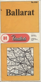 Ballarat Tramway Museum
Map, Broadbent's, "Broadbent's Map 616 Ballarat", c1960
... Printed street map titled "Broadbent's Map 1616 Ballarat" printed in colour on one side only of a folded (10) sheet. ...Large Res scan made 28/1/2011. "Broadbent's Map 616 Ballarat" Map Broadbent's ...Yields information about the extent of Ballarat in the early to mid 1960's shows the tram lines and other rail lines in the district.Printed street map titled "Broadbent's Map 1616 Ballarat" printed in colour on one side only of a folded (10) sheet. Shows the suburbs of Ballarat, tram lines, has a scale in miles, Ballarat District map and an index to streets. Also points interest and historical interest. also shows railways lines. Map used as the base for the tram line map in the display area in the depot. Large Res scan made 28/1/2011."50c" in pencil on front cover.trams, tramways, map, ballarat, broadbent's, railways -
 Bendigo Historical Society Inc.
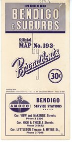
Map - Three Road Maps of Bendigo, 1962
... George Robert Broadbent (1863-1947), cyclist and map publisher, was born on 3 November 1863 at Ashby near Geelong, Victoria, son of George Adam Broadbent, Lancashire-born draper, and his wife Elizabeth, née Ruffhead. ...Two fold out maps printed in colour and produced by Broadbent's Road Maps Pty. ...Two fold out maps printed in colour and produced by Broadbent's Road Maps Pty. ...George Robert Broadbent (1863-1947), cyclist and map publisher, was born on 3 November 1863 at Ashby near Geelong, Victoria, son of George Adam Broadbent, Lancashire-born draper, and his wife Elizabeth, née Ruffhead. When the family moved to North Melbourne Broadbent attended the Errol Street school, followed his father's trade, and became an early cycling and cycle-racing enthusiast. At various times Broadbent held most Victorian and Australian road records, and two of his performances on solid tyres—203 miles (327 km) in 24 hours on a penny farthing, and 100 miles (161 km) in 6 hours 20 minutes on a 'safety' bicycle—were never bettered. He established records for all distances between 130 and 220 miles (209 and 354 km), and for all times between 8 and 12 hours, at the Exhibition Grounds track in May 1894, and road records for 50 and 100 miles (80 and 161 km) in October 1896. The Australian Cyclist acknowledged him 'the finest road rider that Australia has ever produced'. A foundation councillor of the League of Victorian Wheelmen in October 1893, Broadbent contested the first Warrnambool-Melbourne race in 1895, and was active in the Good Roads Movement. Next year he issued a road map of Victoria, 'prepared … after some sixteen years riding and touring in all parts of the Colony', which indicated general topography, distances, and roads classified as 'good', 'fair' or 'ridden with difficulty'. It was to become Victoria's standard map, and the basis of a continuous publishing programme by Broadbent's Official Road Guides Co.Three Road Maps of Bendigo, Bendigo and Suburbs, Bendigo and Eaglehawk. Two fold out maps printed in colour and produced by Broadbent's Road Maps Pty. Ltd. 475 Collins Street Melbourne. One map printed by Bolton's Bendigo.history, bolton's, bendio broadbent maps -
 Phillip Island and District Historical Society Inc.
Booklet, Broadbent's Official Road Guide incorporating Central Victoria 55th Edition, About 1951
... In 1963, it changed its name to Broadbent's Road Maps Pty. Ltd. Each Victorian guide contains maps, plans of routes, a detailed description of roads, mileage, hotels, garages, guesthouses, shops etc....In 1963, it changed its name to Broadbent's Road Maps Pty. Ltd. Each Victorian guide contains maps, plans of routes, a detailed description of roads, mileage, hotels, garages, guesthouses, shops etc. ...These are only the pages relevant to Phillip Island from the guide. Broadbent's Official Road Guides Company took over George R. Broadbent's business in 1935. In 1963, it changed its name to Broadbent's Road Maps Pty. Ltd. Each Victorian guide contains maps, plans of routes, a detailed description of roads, mileage, hotels, garages, guesthouses, shops etc.HistoricalFoolscap sized, black and white photocopied pages stapled into booklet.broadbent's guides, guesthouses, shops, hotels, rothsay guesthouse, cowes main garage, co-operative society, hislop's newsagency, wagner's butchery, the nobbies tea rooms -
 Ballarat Tramway Museum
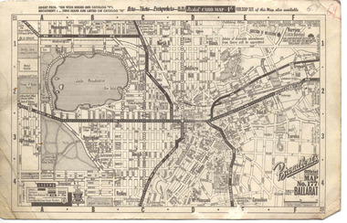
Map, Broadbent's, "Broadbent's Official Map 177 Ballarat", c1960
... Printed street map titled "Broadbent's Official Map 177 Ballarat" on a medium weight (200gsm?) ...Printed street map titled "Broadbent's Official Map 177 Ballarat" on a medium weight (200gsm?) ...Printed street map titled "Broadbent's Official Map 177 Ballarat" on a medium weight (200gsm?) card. Shows the suburbs of Ballarat, but not Sebastopol, rail lines and tram routes, schools, some churches, hospitals, parks and some features. Does not show the full length of the Lydiard St or Sebastopol tram lines. Has scale, national route numbers and distance from Ballarat PO marked on the map. In bottom left hand corner, has Broadbent's north point logo and notes that it is the 66th year of publication of road maps. Gives telephone number as MB 2021 in top right hand corner.Initials "GY" in pencil and red ink in top right hand corner.trams, tramways, map, ballarat, broadbent's, railways -
 Kiewa Valley Historical Society
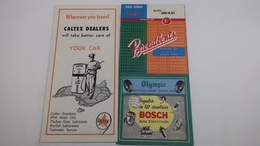
Maps, Unknown
... There are 2 maps: 1. Broadbent's Makers of Maps since 1896, No. 323 Across the Alps/Official Copyright Map./ The cover is blue, green and orange with advertising for Ólympic' and 'Bosch' and there is further advertising on the fold out covers/ 2/-. 2. ...maps tourism Kiewa Hydro Electric Scheme Victorian Alps skiing There are 2 maps: 1. Broadbent's Makers of Maps since 1896, No. 323 Across the Alps/Official Copyright Map./ The cover is blue, green and orange with advertising for Ólympic' and 'Bosch' and there is further advertising on the fold out covers/ 2/-. 2. ...There are 2 maps: 1. Broadbent's Makers of Maps since 1896, No. 323 Across the Alps/Official Copyright Map./ The cover is blue, green and orange with advertising for Ólympic' and 'Bosch' and there is further advertising on the fold out covers/ 2/-. 2. Robinson's Kiewa Hydro-Electric Scheme & Hotham Heights Map No. 613, with Insets of: Bright, Mt Beauty, Falls Creek Ski Village, Hotham Heights Ski Village/ the cover is blue, green and orange with image of skier, hydro tower and locality map./Other fold out sides have advertising and information for tourists./ 4/-.maps, tourism, kiewa hydro electric scheme, victorian alps, skiing -
 Orbost & District Historical Society
book, Broadbent's Melbourne - Sydney Guide Book, 1936
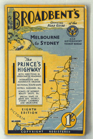
... In 1963, it changed its name to Broadbent's Road Maps Pty. Ltd. George Robert Broadbent (1863-1947), cyclist and map publisher, was born on 3 November 1863 at Ashby near Geelong, Victoria. ...A 160 pp road guide book titled Broadbent's Official Road Guide Melbourne - Sydney. The front cover has a yellow background with a map of the coastline from Sydney to Melbourne, the Prince's Highway route marked. ...In 1963, it changed its name to Broadbent's Road Maps Pty. Ltd. George Robert Broadbent (1863-1947), cyclist and map publisher, was born on 3 November 1863 at Ashby near Geelong, Victoria. ...Broadbent's Official Road Guides Company took over George R. Broadbent's business in 1935. In 1963, it changed its name to Broadbent's Road Maps Pty. Ltd. George Robert Broadbent (1863-1947), cyclist and map publisher, was born on 3 November 1863 at Ashby near Geelong, Victoria. At various times Broadbent held most Victorian and Australian road cycling records. Broadbent became an active vice-president of the Good Roads Association of Victoria in November 1912 and was consulted regularly during the preparation of the country roads bill. That year he took over the Argus motoring column, wrote tirelessly on road improvements and maintenance, and became manager of the Automobile Club's new touring department in 1914.A 160 pp road guide book titled Broadbent's Official Road Guide Melbourne - Sydney. The front cover has a yellow background with a map of the coastline from Sydney to Melbourne, the Prince's Highway route marked. This is inset in a drawing of a car driving along the coastal road.The book contains speedometer readings, route maps, advertisements and photos of points of interest. In the top right is the logo of the Royal Automobile Club of Victoria and at the bottom right is the price 1/-.traavel road-guides broadbent-george car-touring -
 Eltham District Historical Society Inc
Document - Folder, Survey Maps and Technical Drawings
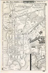
... Pocket Card Map: Broadbent’s Official Map No. 326 Darwin 2. Contour Map: Mt Bride Area, Zone 7, No. 850, 1 mile to 1 inch; Australian Boy Scouts Association, Victorian Branch, 1963 3. ...Pocket Card Map: Broadbent’s Official Map No. 326 Darwin 2. Contour Map: Mt Bride Area, Zone 7, No. 850, 1 mile to 1 inch; Australian Boy Scouts Association, Victorian Branch, 1963 3. ...alan gardiner collection, maps -
 Gippsland Vehicle Collection
Book, Darge, Victoria's Leaders in the Motor Car World, 1911 (estimated); Based on make & models of vehicles, maps, and articles
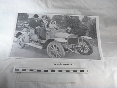
... ...broadbent...road map...melbourne melba dame nellie melba gippsland cars darge broadbent road map advertisements touring james flood hudson berliet "The property of Bramwell" "thanks Fred" "Fred Armylope\19/7/68" Book of "Darge" photographs c.1911. ...Book of "Darge" photographs c.1911. Algenon Darge was a noted photographer in Melbourne around the commencement of the 20th century. 124 pages"The property of Bramwell" "thanks Fred" "Fred Armylope\19/7/68"melbourne, melba, dame nellie melba, gippsland, cars, darge, broadbent, road map, advertisements, touring, james flood, hudson, berliet -
 Greensborough Historical Society
Map, Broadbent's, Greensborough, 1953_
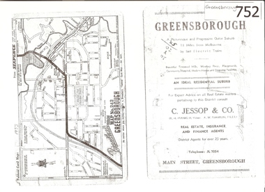
... This road map was a part of a Broadbent's Melbourne suburban directory from 1953....Greensborough Map Broadbent's ...This road map was a part of a Broadbent's Melbourne suburban directory from 1953.It shows the lay out of Greensborough's streets in 1953.It also shows some different street names to those used today. It also features a C Jessop & Co. Real estate advertisementA 1 page photocopy of a road map of Greensborough from 1953.Nilgreensborough, c jessop, broadbents, map no 242, road maps, 1953 -
Glenelg Shire Council Cultural Collection
Map - Map - Western Victoria, n.d
... Map Map - Western Victoria BROADBENT'S Wilke and Co. Pty Ltd Printers 19-47 Jeffcott St. ...Fold-out map of the western section of Victoria- Melbourne to Mt. Gambier and north to NSW border. Has been detached from its cover and glued to brown paper.map, western victoria, melbourne, mount gambier, victoria, south australia -
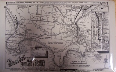 Glenelg Shire Council Cultural Collection
Map - Map - "Broadbent's Map of Portland and District, no. 28", n.d
... Unknown Map Map - "Broadbent's Map of Portland and District, no. 28" ...Unknown -
Phillip Island and District Historical Society Inc.
Book, Broadbent's Official Road Guides Company, Broadbent's official guide : Gippsland and south-east corner of N.S.W. incorporating large scale maps, 1950
... Anderson, 97 Salmon St., Hastings' Broadbent's official guide : Gippsland and south-east corner of N.S.W. incorporating large scale maps. ...J.P. Anderson, 97 Salmon St., Hastings'victoria, guidebooks -
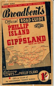 Phillip Island and District Historical Society Inc.
Booklet, Broadbent's Official Roadguide Phillip Island and Gippsland 45, c. 1945
... Broadbent's Year of Issue 45. Small orange, black and red booklet with black type containing maps and information of accommodation, businesses and tourist venues. ...Broadbent's was the official guide of the Government Tourist Bureau. Mr Roy Bain owned a secondhand shop on corner of Thompson Ave and Chapel Street, Cowes, currently a Japanese restaurant.HistoricalSmall orange, black and red booklet with black type containing maps and information of accommodation, businesses and tourist venues.Broadbent's Official Road Guide Phillip Island and Gippsland South and Central. Broadbent's Year of Issue 45.guesthouses, broadbent's guides, hislop newsagency, underdown strawberry farm, osterlund fishing trips, parry's butcher, athenia cafe, roy bain, broadway bakery, cowes camping ground, cowes main garage, beach park camp -
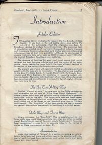 Phillip Island and District Historical Society Inc.
Book, Broadbent's Road Guide- Central Victoria Jubilee Edition, 1946
... Historical Broadbent's Guides Guesthouses tourism Shops San remo koala cafe cowes Phillip Island A5 bound book, missing cover, broken binding, contains maps, photos, advertisements and information on tourist areas. ...Broadbents began in 1935 and produced many travel guides. The Jubilee edition [ 50th] was probably printed in 1946.HistoricalA5 bound book, missing cover, broken binding, contains maps, photos, advertisements and information on tourist areas.broadbent's guides, guesthouses, tourism, shops, san remo, koala cafe cowes, phillip island -
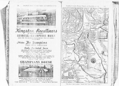 Halls Gap & Grampians Historical Society
Magazine - Photocopy
... Matthews MEDIA Advertisements Grampian House Advertisement in Broadbents, Guide of western Victoria, and South-East of S.A. Advertisement for Kingston Roadliners, Grampians House and Map of the Grampians Magazine Photocopy ...Kingston Roadliners (F. Kingston, Proprietor) STAWELL - GRAMPIANS DAILY Coach for the Grampians meets mid day train at Stawell Return Daily Make the Grampians your next vacation Daily Conducted Tours, from Hotels and Guesthouses in Stawell and Hall's Gap to WONDERLAND - MCKENZIE FALLS - LAKE WARTOOK - MT. VICTORY - MT ROSEA - WANNON VALLEY conducted Hiking Trips Arranged Stawell booking office: 75 Main Street - Phone: Stawell 214, Hall's Gap booking office: Main Road - Phone: Hall's Gap 35, Bookings also from Vitorian Government Tourist Bureau, Cars for hire GRAMPIANS HOUSE The Most Conveniently Situated Tourist House in the Grampians. Ballroom, electric light, large garage, hot water service, hot water in all rooms, internal sewerage. Tennis, fishing, shooting, Alongside is the Bowling Green, where visitors are welcome to play. Phone: Hall's Gap 28. Tariff on application. Manageress: Mrs, E. MatthewsAdvertisement for Kingston Roadliners, Grampians House and Map of the GrampiansAdvertisement in Broadbents, Guide of western Victoria, and South-East of S.A.media, advertisements, grampian house -
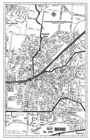 Ringwood and District Historical Society
Map, Broadbent Map No. 226 of Ringwood, East Ringwood, Park Orchards, Ringwood North and Heathmont circa 1960
... Broadbent Map No. 226 of Ringwood, East Ringwood, Park Orchards, Ringwood North and Heathmont circa 1960. ...Head Office 221-23 George St, Sydney Broadbent Map No. 226 of Ringwood, East Ringwood, Park Orchards, Ringwood North and Heathmont circa 1960. ...Published by Broadbent's, a unit of Robinson's (HEC Robinson P/L), 167 Elizabeth Street, Melbourne. Head Office 221-23 George St, Sydney -
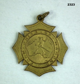 Bendigo Military Museum
Memorabilia - MEDALLION, SHIRE OF MARONG WW1, Est 1917
... Refer 2322.2 for service history also 2567P. badges presentation shire On rear, "Presented to A Broadbent who enlisted for the Great War that commenced 4.8.1914" Badge, metal, centre has map of Australia with a soldier centre, around the outside is "From Shire of Marong" Memorabilia MEDALLION, SHIRE OF MARONG WW1 ...Thomas Alan Broadbent No 15887 46th Batt, KIA 20.9.18. Refer 2322.2 for service history also 2567P.Badge, metal, centre has map of Australia with a soldier centre, around the outside is "From Shire of Marong"On rear, "Presented to A Broadbent who enlisted for the Great War that commenced 4.8.1914"badges, presentation, shire -
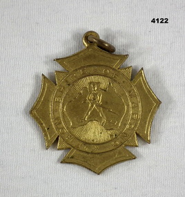 Bendigo Military Museum
Memorabilia - MEDALLION, SHIRE OF MARONG WW1
... BROADBENT”. The “Wil” has 3 engraved lines through. Medal, brass, star shaped with a central circle, inside circle is a map of Australia with a soldier and rifle, a small ring at the top, on the rear engraving and raised writing. ...There are two Brothers “Ray and Wilson BROADBENT” The correct spelling for Rae not Ray. Rae enlisted No 31395 on 12.9.1916 in 8th F.A.B reinforcement No 7, embarked for England 23.12.1916, embark for France 19.6.1917, transfers to 5th F.A.B, WIA 1.8.1917 GSW to right hand, discharged from the AIF 21.3.1918 medically unfit. Wilson Lyle BROADBENT enlisted No 3034 in 10th reinforcements 5th Bn on 13.7.1915, embark for Egypt 29.9.1915, embark for France 25.3.1916, WIA 25.7.1916 GSW to face severe, discharged from the AIF 13.3.1918.Medal, brass, star shaped with a central circle, inside circle is a map of Australia with a soldier and rifle, a small ring at the top, on the rear engraving and raised writing.On the front,”From the Shire of Marong”, On the rear in raised form, “Presented to .... who enlisted for the Great War that commenced on 4.8.1914”, Engraved on rear, “Ray - Wil BROADBENT”. The “Wil” has 3 engraved lines through.marong shire, medals -
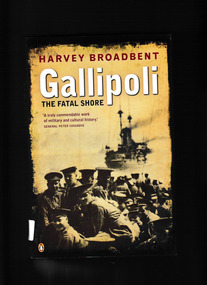 Monbulk RSL Sub Branch
Book, Penguin, Gallipoli : the fatal shore, 2005
... maps, p.363. Gallipoli : the fatal shore Book Penguin Harvey Broadbent. ...This book situates the story of Gallipoli within its multinational context. It is illustrated with over 200 photographs and artworks from collections in Australia, Britain, New Zealand and Turkey.Index, bib, ill, maps, p.363.non-fictionThis book situates the story of Gallipoli within its multinational context. It is illustrated with over 200 photographs and artworks from collections in Australia, Britain, New Zealand and Turkey. world war 1914-1918 - campaigns - gallipoli, gallipoli campaign - history -
 Narre Warren and District Family History Group
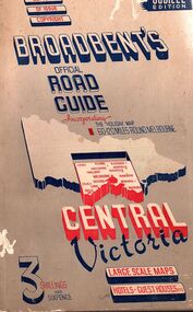
Book, Broadbent's Official Road Guides Company, Broadbent's Official Road Guide for Central Victoria, abt 1946
... An early example of Australian motoring and tourism maps Victoria Jubilee edition of road guide with large fold out map, advertisments for services and accomadation Broadbent's Official Road Guide for Central Victoria Book Broadbent's Official Road Guides Company ...Jubilee edition of road guide with large fold out map, advertisments for services and accomadationnon-fictionJubilee edition of road guide with large fold out map, advertisments for services and accomadationmaps, victoria
