Showing 2426 items matching "cape-otway"
-
 Otway Districts Historical Society
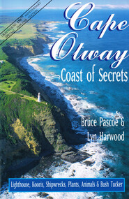
Book, Pascoe Publishing, Cape Otway: Cape of Secrets. Bruce Pascoe. Lyn Harwood, 1999
... Cape Otway: Cape of Secrets. Bruce Pascoe. ...Cape Otway is a story of sailing ships, race wars, shipwrecks, bushfires, murder and betrayal, love and revenge, births and deaths, and of the oldest lighthouse in Australia....Cape Otway: Cape of secrets. Bruce Pascoe. ...Otway Districts Historical Society Cliff Young Drive Beech Forest great-ocean-road Cape Otway is a story of sailing ships, race wars, shipwrecks, bushfires, murder and betrayal, love and revenge, births and deaths, and of the oldest lighthouse in Australia. cape otway; bruce pascoe; lyn harwood; kooris; aboriginals; birds; plants; palaeontology; bush tucker; Cape Otway: Cape of secrets. ...Cape Otway is a story of sailing ships, race wars, shipwrecks, bushfires, murder and betrayal, love and revenge, births and deaths, and of the oldest lighthouse in Australia.Cape Otway: Cape of secrets. Bruce Pascoe. Lyn Harwood. 1st ed., rev. Pascoe Publishing; Apollo Bay (Vic); 1999. 96 p.; illus, map. Soft cover. ISBN 0-947087-33-8cape otway; bruce pascoe; lyn harwood; kooris; aboriginals; birds; plants; palaeontology; bush tucker; -
 Seaworks Maritime Museum
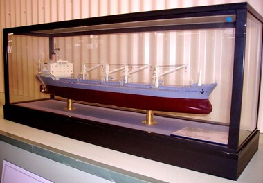
Shipbuilders model, Cape Otway
... Cape Otway...The Department stated that "state provision of ETVs does not represent a correct use of taxpayers money and that ship salvage should be a commercial matter between a ship's operator and the salvor".Two days after the announcement that the fleet was to be disbanded, Anglian Prince was sent to the aid of the UK's newest and largest nuclear submarine HMS Astute, which ran aground off the Isle of Skye in Scotland during sea trials. 1977 owners became Cape Otway Ltd, same managers 1978 Owners became Otway Shipping Co LTD, same managers August 1981 Returned to owners and bareboat chartered to the Australian National Line 1987: Sold, k/s Hansa Bulk 2. ...Ship builder's model of the bulk carrier Cape Otway IMO 7520229 built by Misui Engineering & Shipping Co. ...SPEED: 17.50 KTS 9AT = 17,870 KT, M.C.O.)/ DELIVERED : DECEMBER, 1976/ SCALE: 1/200" On model: "CAPE OTWAY/GLASGOW" ...SPEED: 17.50 KTS 9AT = 17,870 KT, M.C.O.)/ DELIVERED : DECEMBER, 1976/ SCALE: 1/200" On model: "CAPE OTWAY/GLASGOW" Ship builder's model of the bulk carrier Cape Otway IMO 7520229 built by Misui Engineering & Shipping Co. ...In 2010, the Government announced that the ETV fleet would be no longer be funded by the MCA from September 2011, saving £32.5m over the Spending Review period. The Department stated that "state provision of ETVs does not represent a correct use of taxpayers money and that ship salvage should be a commercial matter between a ship's operator and the salvor".Two days after the announcement that the fleet was to be disbanded, Anglian Prince was sent to the aid of the UK's newest and largest nuclear submarine HMS Astute, which ran aground off the Isle of Skye in Scotland during sea trials. 1977 owners became Cape Otway Ltd, same managers 1978 Owners became Otway Shipping Co LTD, same managers August 1981 Returned to owners and bareboat chartered to the Australian National Line 1987: Sold, k/s Hansa Bulk 2. Barber International A/S managers. Renamed HANSA MARINER. Norway flag 1988 Sold K/S Stamariner. Helmer Staubo and Co Managers, renamed Stamariner. Norway (NIS flag) 1993: Sold Shipping Enterprise, renamed Tamarine, Malta flag 1998: sold renamed Andromechi 1998: Sold, Golden Union Shipping Co S.A Panama flag, renamed Flag Braveheart 2000: sold, Flag Sofia Shipping Company Ltd. renamed Flag Sofia. Malta flag. November 15th reported as being on fire at St Petersburg. Damage to the Officer's dining room, laundry and alleyways 2002: Sold Emirates Shipping Corporation Ltd. Emirates Trading Agency LLC, managers. Renamed PEARL OF ASMAN then amended PEALR OF AJMAN. Malta Flag 2003: March sold for scrap to ship breakers in BangladeshShip builder's model of the bulk carrier Cape Otway IMO 7520229 built by Misui Engineering & Shipping Co. The burgundy and grey hull beneath a deck with detailed fittings and superstructure, presented within a glazed display case. On base of case: " M.V CAPE OTWAY/ OWNER : LYLE SHIPPING CO., LTD/ BUILDER : MITSUI ENGINEERING & SHIPBUILDING CO., LTD CHIBA WORKS/ BUILDER'S NO.: 1093/ CLASS: LLOYD'S REGISTER OF SHIPPING/ DEADWEIGHT...32,504KT/ LENGTH (OVERALL)... 179.000M/ LENGTH (P.p) 170.000M/ BREADTH (MLD)... 14.800M/ FULL LOAD DRAFT (EXT)... 10.677M/ MAIN ENGINE: MITSUI B&W 7K 74EF X 1 SET/ M.C.O.: 13,100 BHP X 124 RPM/ C.S.O: 11,900 BHP X 120 RPM/ TRIAL MAX. SPEED: 17.50 KTS 9AT = 17,870 KT, M.C.O.)/ DELIVERED : DECEMBER, 1976/ SCALE: 1/200" On model: "CAPE OTWAY/GLASGOW" -
 Federation University Art Collection
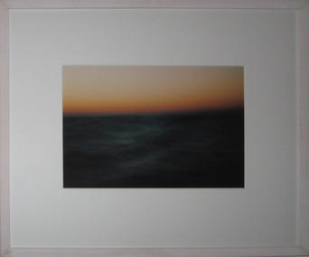
Photograph - colour, Robert Allan, 'South of Cape Otway' by Robert Allan, 2003
... 'South of Cape Otway' by Robert Allan...Cape Otway, Victoria, Australia...The Art Collection features over 1000 works and was listed as a 'Ballarat Treasure' in 2007. art artwork bob allan photo robert allan sea cape otway available ballarat university college federation university australia staff seascape photograph Framed photograph of the sea and a red coloured sky 'South of Cape Otway' by Robert Allan Photograph - colour Robert Allan ...Robert ALLAN Born Hopetoun, Victoria Bob Allan graduated from Melbourne Teachers' College in 1967. He obtained an Associateship Diploma in 1973, and a Fellowship Diploma of Art (pottery) in 1976 from the Royal Melbourne Institute of Technology. Since 1968 he taught art and pottery at various Victorian secondary schools, and joined the staff of the Ballarat University College (now Federation University Australia) in 1976. This item is part of the Federation University Art Collection. The Art Collection features over 1000 works and was listed as a 'Ballarat Treasure' in 2007.Framed photograph of the sea and a red coloured skyart, artwork, bob allan, photo, robert allan, sea, cape otway, available, ballarat university college, federation university australia staff, seascape, photograph -
 Parks Victoria - Gabo Island Lightstation
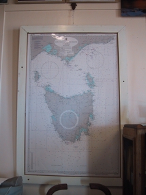
Chart, nautical, "Cape Otway to Gabo Island including Tasmania", April 1071
... "Cape Otway to Gabo Island including Tasmania"...This mounted chart, dated 21 August 1971 is under glass in a wooden frame and covers Bass Strait between Cape Otway and Gabo Island, showing southern and eastern Victoria and the whole of Tasmania. ...Blue / grey & white nautical chart of Cape Otway to Gabo Island . It is under glass and in a white painted wooden frame. ...Blue / grey & white nautical chart of Cape Otway to Gabo Island . It is under glass and in a white painted wooden frame. ...This mounted chart, dated 21 August 1971 is under glass in a wooden frame and covers Bass Strait between Cape Otway and Gabo Island, showing southern and eastern Victoria and the whole of Tasmania. The frame was possibly handmade locally. The charts are specific to the Gabo Island Lightstation and have second level contributory significance for their historic value and provenance to the lightstation.Blue / grey & white nautical chart of Cape Otway to Gabo Island . It is under glass and in a white painted wooden frame. The frame has three holes at the top left and the base.Top left-hand," AUS 422 DEPTHS IN FATHOMS......." -
 Otway Districts Historical Society
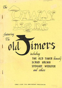
Book, Otway Light Editorial Board, The Otway Light, 1989
... The Otway Light....A collection of stories from the Otways that were collected for the Otway Light 10th Anniversary publication....Lavers Hill (Vic); Otway Light Editorial Board; 1989. 98 p.; illus. ...Otway Light Editorial Board...Otway Districts Historical Society Cliff Young Drive Beech Forest great-ocean-road A collection of stories from the Otways that were collected for the Otway Light 10th Anniversary publication. otways; stories; sketches; history; Melba Gully (21st March 1975) The Otway Light featuring the Old Timers, including the Old Timer himself, Scrub Urchin, Stewart Webster, and others. ...A collection of stories from the Otways that were collected for the Otway Light 10th Anniversary publication.The Otway Light featuring the Old Timers, including the Old Timer himself, Scrub Urchin, Stewart Webster, and others. Helen Grant (ed.). Robert Montgomery, Ellise Angel, Claire McCaffie (illus.). Lavers Hill (Vic); Otway Light Editorial Board; 1989. 98 p.; illus. Soft cover.Melba Gully (21st March 1975)otways; stories; sketches; history; -
 Otway Districts Historical Society
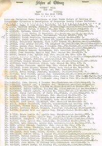
Voters, Shire of Otway, Shire of Otway, Voters' Rolls, 1963, 23 July 1963
... Shire of Otway, Voters' Rolls, 1963....It included both local residents and residents from other municipalities who owned allotments in the Shire of Otway entitled to vote in Shire of Otway elections....Typescript. Shire of Otway, Voters' Roll for the East (a), Central (b), West (c) and Apollo Bay [comprising a portion of the Parish of Krambruk] (d) Ridings, made in the year 1963. ...Shire of Otway...Tann, Chairman of Revision Court, 23rd July, 1963. Shire of Otway, Voters' Rolls, 1963. Voters Shire of Otway ...After going to a Revision Court where the voters' rolls had been revised and certified correct every voter on the Shire of Otway register was listed with his or her surname, christian names, residence or post town, nature of calling or occupation, situation and description of property, the yearly value, and the number of votes to which the incumbent was entitled. It included both local residents and residents from other municipalities who owned allotments in the Shire of Otway entitled to vote in Shire of Otway elections.Typescript. Shire of Otway, Voters' Roll for the East (a), Central (b), West (c) and Apollo Bay [comprising a portion of the Parish of Krambruk] (d) Ridings, made in the year 1963. Certified for each riding that it "has been revised and is correct", signed by W.H. Tann, Chairman of Revision Court, 23rd July, 1963.Variously underlined, marked, and written on the verso.shire; otway; voter roll; -
![Crystal Brook, in the Cape Otway Ranges / [by] Nicholas Caire, circa 1876](/media/collectors/550653872162f11fb04854aa/items/578338b0d0cdd1176c64c320/item-media/57833931d0cdd1176c64fa91/item-fit-380x285.jpg?cb=6) Kew Historical Society Inc
Kew Historical Society IncPhotograph, Anglo-Australasian Photographic Company, Crystal Brook, in the Cape Otway Ranges, c. 1876
... Crystal Brook, in the Cape Otway Ranges...‘Crystal Brook, in the Cape Otway Ranges’ : Views of Victoria (General Series) No.53 : Albumen silver photograph | Photo on card with Title and Description on reverse | Mounted 24 x 30 cm; Photo 12 x 17 cm....On Reverse: 'The subject of the present illustration was discovered by one of our operators exploring the Cape in search of scenery. It is situated about four miles from the coast, and is surrounded by dense foliage on the one side, and rocky boulders on the other. ...Crystal Brook, in the Cape Otway Ranges Photograph Photograph Anglo-Australasian Photographic Company ...Nicholas Caire was born on Guernsey in the Channel Islands in 1837. He arrived in Adelaide with his parents in about 1860. In 1867, following photographic journeys in Gippsland, he opened a studio in Adelaide. From 1870 to 1876 he lived and worked in Talbot in Central Victoria. In 1876 he purchased T. F. Chuck's studios in the Royal Arcade Melbourne. In 1885, following the introduction of dry plate photography, he began a series of landscape series, which were commercially successful. As a photographer, he travelled extensively through Victoria, photographing places few of his contemporaries had previously seen. He died in 1918. Reference: Jack Cato, 'Caire, Nicholas John (1837–1918)', Australian Dictionary of Biography.An original, rare photograph from the series 'Views of Victoria: General Series' by the photographer, Nicholas Caire (1837-1918). The 60 photographs that comprise the series were issued c. 1876 and reinforced a neo-Romantic view of the Australian landscape to which a growing nationalist movement would respond. Nicholas Caire was active as a photographer in Australia from 1858 until his death in 1918. His vision of the Australian bush and pioneer life had a counterpart in the works of Henry Lawson and other nationalist poets, authors and painters.‘Crystal Brook, in the Cape Otway Ranges’ : Views of Victoria (General Series) No.53 : Albumen silver photograph | Photo on card with Title and Description on reverse | Mounted 24 x 30 cm; Photo 12 x 17 cm.On Reverse: 'The subject of the present illustration was discovered by one of our operators exploring the Cape in search of scenery. It is situated about four miles from the coast, and is surrounded by dense foliage on the one side, and rocky boulders on the other. This spot being unknown to the settlers, the title we have given to it is highly suggestive of such a romantic and secluded spot.'nicholas caire (1837-1918), landscape photography -
 Glenelg Shire Council Cultural Collection
Painting, S.S. Casino Off Cape Otway 1932, 1932
... S.S. Casino Off Cape Otway 1932...Front: SS CASINO OFF CAPE OTWAY 1932 (lower left, paint) A.V. GREGORY 1932 (lower right, paint)...Framed in wooden frame with gold edging. S.S. Casino Off Cape Otway 1932 Painting Painting GREGORY, ARTHUR ...Depiction of a ship in heavy swells, tilting towards viewer. Ocean is deep blue green with white crests. Ship has a black and red hull, white cabin, white and black smokestack and red mast. Flags from mast and at rear of ship are flapping in strong wind. Sky is cloudy and grey, with lighter areas in cream and pale grey, darker areas in slate grey and blue. Framed in wooden frame with gold edging.Front: SS CASINO OFF CAPE OTWAY 1932 (lower left, paint) A.V. GREGORY 1932 (lower right, paint) -
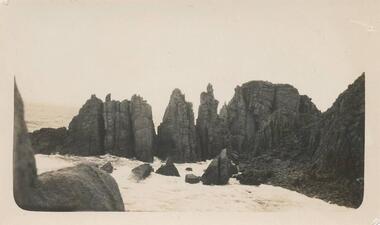
 Phillip Island and District Historical Society Inc.
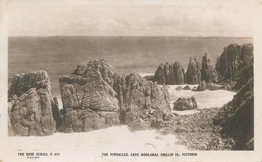
Photograph, Rose Series, The Pinnacles, Cape Woolamai, c.1923
... The Pinnacles, Cape Woolamai...Pinnacles, Cape Woolamai Phillip Island. Beautiful coastal area. ...View of The Pinnacles - coastal rocks projecting into sea at Cape Woolamai...The Rose Series P 677. The Pinnacles, Cape Woolamai, Phillip Is., Victoria....Cape Woolamai, Phillip Island , Victoria, Australia...The Pinnacles, Cape Woolamai, Phillip Is., Victoria. View of The Pinnacles - coastal rocks projecting into sea at Cape Woolamai The Pinnacles, Cape Woolamai Photograph Photograph Rose Series ...Pinnacles, Cape Woolamai Phillip Island. Beautiful coastal area. Part of the Jessie Smith Collection.View of The Pinnacles - coastal rocks projecting into sea at Cape WoolamaiThe Rose Series P 677. The Pinnacles, Cape Woolamai, Phillip Is., Victoria.local history, photographs, cape woolamai, phillip island, black & white photograph, coastal geography, jessie smith collection, stan mcfee -
 Otway Districts Historical Society
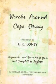
Book, J.K. Loney, Wrecks around Cape Otway
... Wrecks around Cape Otway...Wrecks around Cape Otway. Shipwrecks and strandings from Port Campbell to Anglesea. ...Soft cover. Wrecks around Cape Otway Book J.K. Loney ...History of shipwrecks and strandings from Port Campbell to Anglesea, with photographs, locations and gravesites, and some mention of areas either side of the main wrecks.Wrecks around Cape Otway. Shipwrecks and strandings from Port Campbell to Anglesea. J.K. Loney. 1st ed. Apollo Bay (Vic); J.K. Loney; nd. iv, 50 p.; illus. Soft cover.cape otway; shipwrecks; strandings; port campbell; anglesea; apollo bay; lorne; j.k. loney; -
![Straus’ Falls, Cape Otway Ranges / [by] Nicholas Caire, circa 1876](/media/collectors/550653872162f11fb04854aa/items/57833e2ad0cdd1176c6791eb/item-media/57833ea7d0cdd1176c67b9d8/item-fit-380x285.jpg?cb=6) Kew Historical Society Inc
Kew Historical Society IncPhotograph, Anglo-Australasian Photographic Company, Straus’ Falls, Cape Otway Ranges, c. 1876
... Straus’ Falls, Cape Otway Ranges...‘Straus’ Falls, Cape Otway Ranges’ : Views of Victoria (General Series) No.55 : Albumen silver photograph | Photo on card with Title and Description on reverse | Mounted 24 x 30 cm; Photo 12 x 17 cm....Straus’ Falls, Cape Otway Ranges Photograph Photograph Anglo-Australasian Photographic Company ...Nicholas Caire was born on Guernsey in the Channel Islands in 1837. He arrived in Adelaide with his parents in about 1860. In 1867, following photographic journeys in Gippsland, he opened a studio in Adelaide. From 1870 to 1876 he lived and worked in Talbot in Central Victoria. In 1876 he purchased T. F. Chuck's studios in the Royal Arcade Melbourne. In 1885, following the introduction of dry plate photography, he began a series of landscape series, which were commercially successful. As a photographer, he travelled extensively through Victoria, photographing places few of his contemporaries had previously seen. He died in 1918. Reference: Jack Cato, 'Caire, Nicholas John (1837–1918)', Australian Dictionary of Biography.An original, rare photograph from the series 'Views of Victoria: General Series' by the photographer, Nicholas Caire (1837-1918). The 60 photographs that comprise the series were issued c. 1876 and reinforced a neo-Romantic view of the Australian landscape to which a growing nationalist movement would respond. Nicholas Caire was active as a photographer in Australia from 1858 until his death in 1918. His vision of the Australian bush and pioneer life had a counterpart in the works of Henry Lawson and other nationalist poets, authors and painters.‘Straus’ Falls, Cape Otway Ranges’ : Views of Victoria (General Series) No.55 : Albumen silver photograph | Photo on card with Title and Description on reverse | Mounted 24 x 30 cm; Photo 12 x 17 cm.On Reverse: ‘These Falls were discovered some time since by a gentleman named Straus, and were so named in memory of him. They comprise a succession of falls, rapids, and cataracts varying from 10 feet to 60 feet, making a total of 250 feet from the fall to the bed of the stream. These waters probably form a tributary to one of the adjacent rivers.’nicholas caire (1837-1918), landscape photography -
 Ballarat Tramway Museum
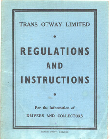
Booklet, Trans Otway, "Trans Otway Ltd Regulations & Instructions', Feb. 1956
... "Trans Otway Ltd Regulations & Instructions'...Trans Otway Limited took over a number of the Geelong tram routes in 1956 (see item 6812) and produced this booklet for the information of crews, including "collectors" of their responsibilities with regard to their vehicles, passengers and behaviour. ...Trans Otway...Booklet - blue card covers, with 20 pages (not all used) centre stapled. "Trans Otway Ltd Regulations & Instructions' Booklet Trans Otway Mercer Print ...Trans Otway Limited took over a number of the Geelong tram routes in 1956 (see item 6812) and produced this booklet for the information of crews, including "collectors" of their responsibilities with regard to their vehicles, passengers and behaviour. Yields information about the procedures, rules instructions for Trans Otway bus crews.Booklet - blue card covers, with 20 pages (not all used) centre stapled.on rear cover has a telephone number in ink.geelong, buses, trans otway, closure, rules, regulations -
 Ringwood and District Historical Society
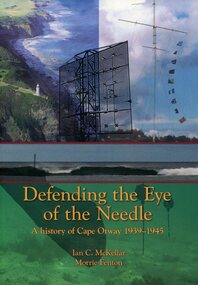
Book, Defending the Eye of the Needle - A History of Cape Otway 1939-1945 - Ian C. McKellar, Morrie Fenton, 2007
... Defending the Eye of the Needle - A History of Cape Otway 1939-1945 - Ian C. McKellar, Morrie Fenton...Foreword extract: "In 1848 the vital beam of the nobly proportioned Cape Otway lighthouse first shone out over the perilous, previously unlit, waters of Bass Strait. ...Defending the Eye of the Needle - A History of Cape Otway 1939-1945 - Ian C. McKellar, Morrie Fenton Book ...Soft covered 195-page book with sketches, photographs and charts.Foreword extract: "In 1848 the vital beam of the nobly proportioned Cape Otway lighthouse first shone out over the perilous, previously unlit, waters of Bass Strait. It has now maintained that watch over its narrow western entrance, the aptly named 'Eye of the Needle', for over a century and a half. During that time ships of all shapes and sizes passed below Cape Otway's high cliffs - clipper ships with a hectare of canvas aloft, their masters determined to achieve the fastest passage out to the goldfields, four-masted grain ships and, by the turn of the century, the punctual, comfortable, Orient liners. They were followed by the battleships of the American White fleet in 1908 and, from time to time, cruiser squadrons of the Royal Navy, showing the flag at the furthest corner of the Empire. The lighthouse and its associated signal station made no distinction between merchant vessel and warship. In this book Ian McKellar examines a little known aspect of the history of Cape Otway - its role in war, more particularly the Second World War between 1939 and 1945. It takes the reader back to a time when Australia was ill-prepared for another war so soon after the conclusion of the Great War." -
 Phillip Island and District Historical Society Inc.
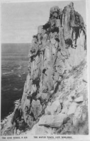
Photograph, The Watch Tower, Cape Woolamai
... The Watch Tower, Cape Woolamai...Part of the rock formation on Cape Woolamai. Known as The Watch Tower....Rose Series P679. The Watch Tower, Cape Woolamai....Cape Woolamai, Phillip Island, Victoria, Australia...The Watch Tower, Cape Woolamai. Black & White Postcard. Part of the rock formation on Cape Woolamai. ...Part of a collection of 'Rose & Valentine' series of Post Cards. Copied by John Jansson 1984Black & White Postcard. Part of the rock formation on Cape Woolamai. Known as The Watch Tower.Rose Series P679. The Watch Tower, Cape Woolamai.local history, photography, photographs, postcards, cape woolamai, phillip island, black & white postcard copy, the watch tower, rock formation -
 Phillip Island and District Historical Society Inc.
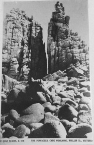
Photograph, The Pinnacles, Cape Woolamai
... The Pinnacles, Cape Woolamai...Rock formation known as The Pinnacles at Cape Woolamai....Rose Series P678. The Pinnacles, Cape Woolamai, Phillip Island, Victoria....Cape Woolamai, Phillip Island, Victoria, Australia...Rock formation known as The Pinnacles at Cape Woolamai. The Pinnacles, Cape Woolamai Photograph ...Part of a collection of 'Rose & Valentine' series of Post Cards. Copied by John Jansson 1984Black & White Postcard. Rock formation known as The Pinnacles at Cape Woolamai.Rose Series P678. The Pinnacles, Cape Woolamai, Phillip Island, Victoria.local history, photography, photographs, postcards, phillip island, black & white postcard copy, the pinnacles, cape woolamai -
 Phillip Island and District Historical Society Inc.
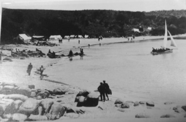
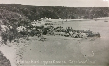
Photograph, Mutton Bird Eggers' Camp Cape Woolamai
... Mutton Bird Eggers' Camp Cape Woolamai...View on Cape Woolamai of Mutton Birders' Camps and their boats anchored in the bay. ...Mutton bird eggers camps Cape Woolamai...Cape Woolamai, Phillip Island, Victoria, Australia...Mutton Bird Eggers' Camp Cape Woolamai Photograph ...Part of a collection of Rose & Valentine series Post Cards. Copied by John JanssonView on Cape Woolamai of Mutton Birders' Camps and their boats anchored in the bay. Figures on beach and sitting around their tents.Mutton bird eggers camps Cape Woolamailocal history, photography, photographs, postcards, black & white photograph, phillip island, mutton bird eggers camp, cape woolamai -
 Phillip Island and District Historical Society Inc.
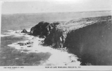
Photograph, View at Cape Woolamai
... View at Cape Woolamai...Black & White Postcard. View at Cape Woolamai. Faint background of Phillip Island including The Nobbies....The Rose Series P3425. view at Cape Woolamai, Phillip Island....Cape Woolamai, Phillip Island, Victoria, Australia...View at Cape Woolamai Photograph ...Part of a collection of 'Rose & Valentine' series of Post Cards. Copied by John Jansson 1984Black & White Postcard. View at Cape Woolamai. Faint background of Phillip Island including The Nobbies.The Rose Series P3425. view at Cape Woolamai, Phillip Island.local history, photography, photographs, postcards, cape woolamai, phillip island, black & white postcard copy -
 Phillip Island and District Historical Society Inc.
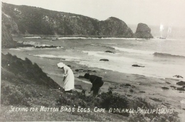
Photograph, Seeking mutton bird eggs. Cape Woolamai
... Seeking mutton bird eggs. Cape Woolamai...Male & female looking for Mutton bird eggs on Cape Woolamai - western side - looking towards the "Pinnacles"....Seeking for Mutton Bird eggs Cape Woolamai Phillip Island...Cape Woolamai, Phillip Island, Victoria, Australia...Seeking mutton bird eggs. Cape Woolamai Photograph ...Part of a collection of 'Rose & Valentine' series of Post Cards. Copied by John Jansson 1984Male & female looking for Mutton bird eggs on Cape Woolamai - western side - looking towards the "Pinnacles".Seeking for Mutton Bird eggs Cape Woolamai Phillip Islandlocal history, photography, photographs, postcards, black & white photograph, phillip island, cape woolamai, the pinnacles -
 Ballarat Heritage Services
Photograph - Photograph - Colour, Clare Gervasoni, Cape Schank, 2011, 30/08/2017
... Cape Schank, 2011...Perched atop dramatic cliffs, the Cape Schanck Lighthouse has ensured the safe passage of ships since 1859. ...Colour photographs of Cape Schank and the Cape Schank Lighthouse....Cape Schank, Victoria, Australia...The buildings were constructed from 1859 and are an excellent example of the architecture of the day. Cape Schank Cape Schank Lighthouse sea Colour photographs of Cape Schank and the Cape Schank Lighthouse. ...Perched atop dramatic cliffs, the Cape Schanck Lighthouse has ensured the safe passage of ships since 1859. In 2025 it was still possible to climb the Lighthouse sandstone steps up to the still functioning lamp room for spectacular views over the Southern Peninsula and Bass Strait. Cape Schanck Lighthouse precinct includes the heritage listed lighthouse, museum and former lighthouse keeper's residence. The buildings were constructed from 1859 and are an excellent example of the architecture of the day.Colour photographs of Cape Schank and the Cape Schank Lighthouse.cape schank, cape schank lighthouse, sea -
 Otway Districts Historical Society
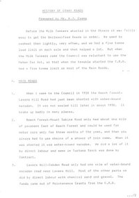
Document, W.J. Evans, History of Otway Roads. W.J. Evans, June 1981
... History of Otway Roads. W.J. Evans....Document. History of Otway Roads. W.J. Evans. 1st ed. W.J. Evans; Beech Forest (Vic); 1981. 13 p. ...Beech Forest, Otway, Victoria, Australia...Otway Districts Historical Society Cliff Young Drive Beech Forest great-ocean-road otways; roads; history; Document. ...Document. History of Otway Roads. W.J. Evans. 1st ed. W.J. Evans; Beech Forest (Vic); 1981. 13 p. Soft cover.otways; roads; history; -
 Phillip Island and District Historical Society Inc.
Photograph, Mutton Bird Eggers' Camps, Cape Woolamai
... Mutton Bird Eggers' Camps, Cape Woolamai...Mutton Bird eggers camps Cape Woolamai showing tent sites, boats in bay. ...Mutton Bird eggers' camps Cape Woolamai....Cape Woolamai, Phillip Island, Victoria, Australia...Copied by John Jansson 1984 local history photography photographs postcards phillip island mutton bird eggers camp cape woolamai Mutton Bird eggers' camps Cape Woolamai. ...Part of a collection of 'Rose & Valentine' series of Post Cards. Copied by John Jansson 1984Mutton Bird eggers camps Cape Woolamai showing tent sites, boats in bay. Several figures standing on the old stone jetty built from red Woolamai granite. Part of the Granite Quarry.Mutton Bird eggers' camps Cape Woolamai.local history, photography, photographs, postcards, phillip island, mutton bird eggers camp, cape woolamai -
 Ballarat Heritage Services
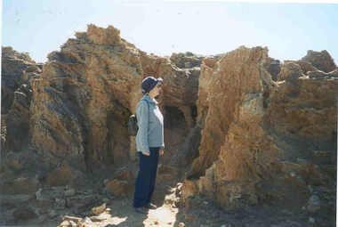
Photograph - Digital photograph, Lisa Gervasoni, Cape Bridgewater, Victoria, c2015
... Cape Bridgewater, Victoria...Cape Bridgewater was once a volcanic island. ...Photograph of a person at Cape Bridgewater, Victoria....Cape Bridgewater, Victoria, Australia...It is a 20 minute drive from Portland. cape bridgewater geology ocean coastal landscape seascape petrified forest Photograph of a person at Cape Bridgewater, Victoria. ...Cape Bridgewater was once a volcanic island. It is a 20 minute drive from Portland. Photograph of a person at Cape Bridgewater, Victoria.cape bridgewater, geology, ocean, coastal, landscape, seascape, petrified forest -
 Phillip Island and District Historical Society Inc.
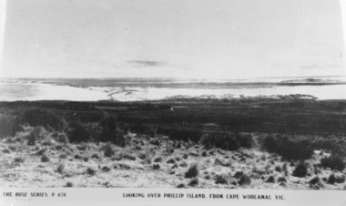
Photograph, Looking over Phillip island from Cape Woolamai
... Looking over Phillip island from Cape Woolamai...View of Philip Island from high up on Cape Woolamai - Churchill Island can be seen on right hand side of photograph....Looking over Phillip Island from Cape Woolamai Victoria...Cape Woolamai, Phillip Island, Victoria, Australia...Looking over Phillip island from Cape Woolamai Photograph ...Part of a collection of 'Rose & Valentine' series of Post Cards. Copied by John Jansson 1984Black & White Postcard. View of Philip Island from high up on Cape Woolamai - Churchill Island can be seen on right hand side of photograph.The Rose Series P676. Looking over Phillip Island from Cape Woolamai Victorialocal history, photography, photographs, postcards, black & white postcard copy, cape woolamai. phillip island, churchill island, phillip island -
 Phillip Island and District Historical Society Inc.
Photograph, The Pinnacles, Cape Woolamai
... The Pinnacles, Cape Woolamai...Pinnacles south side of Philip Island, Cape Woolamai. Part of the Jessie Smith Collection....Coastal view of The Pinnacles, Cape Woolamai - rocks at coast edge....Cape Woolamai, Phillip Island , Victoria, Australia...The Pinnacles, Cape Woolamai Photograph Photograph ...Pinnacles south side of Philip Island, Cape Woolamai. Part of the Jessie Smith Collection.Coastal view of The Pinnacles, Cape Woolamai - rocks at coast edge.local history, photographs, the pinnacles, cape woolamai, phillip island, coastal geography, jessie smith collection, stan mcfee -
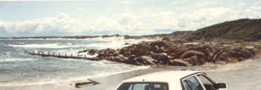
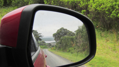 Ballarat Heritage Services
Photograph - Digital photograph, Lisa Gervasoni, Cape Bridgewater, Victoria, c2015
... Cape Bridgewater, Victoria... Cape Bridgewaters is located on the western shore of Bridgewater Bay about 21 kilometres south-west of Portland and about 383 kilometres west of Melbourne, Victoria. ...Colour photograph of Cape Bridgewater taken in the side mirror of a car....Cape Bridgewater, Victoria, Australia...Cape Bridgewater includes the Discovery Bay Coastal Park and the Mount Richmond National Park within its boundaries, a protected areas cape bridgewater geology ocean coastal landscape seascape birds waves Colour photograph of Cape Bridgewater taken in the side mirror of a car. ...Cape Bridgewaters is located on the western shore of Bridgewater Bay about 21 kilometres south-west of Portland and about 383 kilometres west of Melbourne, Victoria. The area was settled in the 1860s by the Henty family who had settled nearby Portland, and a post office opened in 1863 (closed 1968) though it was known as Bridgewater Lower for some years. Both Cape Bridgewater and Bridgewater Bay were named after the Duke of Bridgewater (1756-1829), by Lieutenant James Grant sailing on the Lady Nelson on 4 December 1800. Cape Bridgewater includes the Discovery Bay Coastal Park and the Mount Richmond National Park within its boundaries, a protected areas Colour photograph of Cape Bridgewater taken in the side mirror of a car.cape bridgewater, geology, ocean, coastal, landscape, seascape, birds, waves -
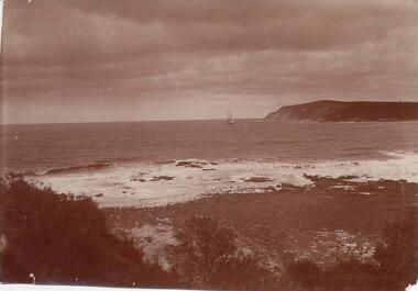 Phillip Island and District Historical Society Inc.
Photograph, Cape Woolamai from San Remo
... Cape Woolamai from San Remo...View of Cape Woolamai with fishing boat. Part of the Jessie Smith Collection....View of Cape Woolamai from San Remo with 3 masted boat in background, right....Cape Woolamai, Phillip Island , Victoria, Australia...Cape Woolamai from San Remo Photograph Photograph ...View of Cape Woolamai with fishing boat. Part of the Jessie Smith Collection.View of Cape Woolamai from San Remo with 3 masted boat in background, right.local history, photographs, cape woolamai, phillip island, sepia photograph, coastal geography, jessie smith collection, stan mcfee -
Lakes Entrance Historical Society
Book, Shepherd Wendy, Cray Coff, Joiners Channel West Cape, Cape Conran, 2003
... Cray Coff, Joiners Channel West Cape, Cape Conran...Research interpretation and management recommendations for the cray coff, Joiner Channel, West Cape, Cape Conran, East Gippsland victoria by Forestec Student....Cape Conran, Victoria, Australia...Cray Coff, Joiners Channel West Cape, Cape Conran Book Shepherd Wendy ...Research interpretation and management recommendations for the cray coff, Joiner Channel, West Cape, Cape Conran, East Gippsland victoria by Forestec Student.fishing industry -
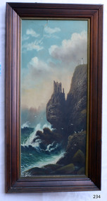 Flagstaff Hill Maritime Museum and Village
Painting - Oil painting, W. Langley-Taylor, Cape Schank [Schanck], Late 19th to early 20th century
... Cape Schank [Schanck]...It includes the Cape Schanck Lighthouse and its Flagstaff. ...Painted on front “W.LANGLEY-TAYLOR.” and “CAPE SCHANK, VIC.” [NOTE: correct spelling is Schanck] Handwritten on back “Mrs. ...Cape Schanck, Victoria, Australia...It includes the Cape Schanck Lighthouse and its Flagstaff. ...This painting is one of a pair of large paintings by W. Langley-Taylor in our collection. Currently, no further information has been found about the artist but research is ongoing. The subjects of these paintings are seascapes of notable areas of the coast on each side of Port Phillip Bay, south of Melbourne, Victoria. The subject of this painting is Cape Schanck, Victoria, which is on the east side of Port Phillip Bay. It includes the Cape Schanck Lighthouse and its Flagstaff. The Cape Schanck Lighthouse was built in 1859 and is the second of Victoria’s coastal lights. It is 21 metres tall and made from limestone. Unusually, its stairway is made from stone rather than wrought iron. Gilded tours are available to explain its use and significance to visitors. The lighthouse keepers at Cape Schanck kept records of the ships that sailed past them along Bass Strait; ship’s names, direction, time and date and so on. The details would also be passed on to shipping agencies, Harbour Masters and newspapers, which published Arrivals and Departures into and out of shipping ports such as Port Phillip Bay and the Port of Melbourne. INSCRIPTIONS “Mrs M Irby” (and on the Eagle Rock, Warrnambool, painting “980/Regency”) The inscription “Mrs M Irby” is on the back of both paintings but the significance of the inscription has not yet been discovered. Perhaps she was connected with the ship or shipping company “Irby”. A ship named “Irby”, built in Merseyside, Liverpool in 1881 by R & J Evans, Birkenhead. It was a four-masted iron ship built for the White Star Line. Henry Wilson Hewitt bought her in 1882, then later she was owned by Chadwick & Pritchard. In 1888 she was registered under the Irby Ship Co. Ltd. (trading as J. Joyce) in Liverpool. In 1912 Galgate Co. Ltd owned her. She traded between London, England and Australia, and is recorded as being in Melbourne and Hobart. In 1919 the Irby was destroyed by a mine when on her way to England. Or perhaps her name and the inscription in pencil “980/Regency” on the Eagle Rock Warrnambool, painting could be a delivery address for the paintings, perhaps an apartment in a hotel. NOTE: The artist’s spelling of the title “Cape Schank, Vic.” is incorrect. The location in this painting is named Cape Schanck. This painting is geographically significant for its depiction of Victoria’s coastal scenery. It is also significant as one of a pair of seascapes depicting sites on either side of Port Phillip Bay. Historically, the painting is significant as an example of the late nineteenth- and early twentieth-century methods and materials used in frame construction.Oil on board, in a dark-stained wooden frame, portrait format. The composition depicts a seascape with cliffs, a lighthouse and a flagstaff, birds in flight, waves breaking against rocks, and a blue sky with clouds. The title is painted at the lower left. The work is signed at lower right by the Victorian artist W. Langley-Taylor. A handwritten inscription in red crayon or heavy red pencil appears on the reverse. The board is fixed within the timber frame by small dark metal tacks. Metal eyes secure the hanging wire to the frame. Small round nail heads are visible around the frame, and both the board and the wood exhibit colour change. The handwritten inscription runs vertically along the lower left edge of the board. The wire hangs in a shallow curve, and the mitred corners are reinforced with staples. The board shows some damage. The discolouration visible on both the board and frame may indicate the former presence of a backing paper, once attached to the reverse with tape and tacks.Painted on front “W.LANGLEY-TAYLOR.” and “CAPE SCHANK, VIC.” [NOTE: correct spelling is Schanck] Handwritten on back “Mrs. M. Irby” flagstaff hill, warrnambool, shipwrecked coast, flagstaff hill maritime museum, maritime museum, shipwreck coast, flagstaff hill maritime village, great ocean road, painting, oil painting, cape schanck painting, w. langley-taylor, wall decoration, seascape of victoria's coast, art, mrs m irby, victoria's coast, pair of paintings -
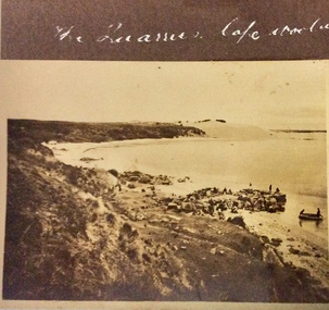 Phillip Island and District Historical Society Inc.
Photograph, The Quarries, Cape Woolamai, 1925-1926
... The Quarries, Cape Woolamai...The Quarries Cape Woolamai...Cape Woolamai, Victoria...Phillip Island and District Historical Society Inc. phillip-island-and-the-bass-coast cape woolamai photographs granite quarry cape woolamai The Quarries Cape Woolamai Sepia photograph of the coastline, people at the waters edge and standing on large granite blocks. ...Sepia photograph of the coastline, people at the waters edge and standing on large granite blocks. Two people in a small dingy near the edge.The Quarries Cape Woolamaicape woolamai, photographs, granite quarry cape woolamai -
 Lakes Entrance Historical Society
Photograph - Cape Conran Boat Ramp, M Fish, Cape Conran Victoria, 2000 c
... Cape Conran Victoria...Colour photograph of Cape Conran boat ramp looking west, Cape Conran Victoria.. ...Cape Conran, Victoria, Australia...Also a second colour photograph taken from Cape Conran boat ramp looking east Cape Conran Victoria Photograph Cape Conran Boat Ramp M Fish ...Colour photograph of Cape Conran boat ramp looking west, Cape Conran Victoria.. Also a second colour photograph taken from Cape Conran boat ramp looking east waterways, boat ramp, ocean, rivers