
Showing 16 items matching "character of area and shopping"
-
 Eltham District Historical Society Inc
Document - Report, Dimity Reed et al, Advisory Commlttee Hearing on Permit Applications 96/0376, and 96/0377, and on Planning Appeals 96/40724 and 96/40812 re a proposed convenience centre at 895 Main Road, Eltham, June 1997
... The cafe and take away food premises are as of right uses and are therefore allowable, but that shop and petrol station are unacceptable uses. ...The cafe and take away food premises are as of right uses and are therefore allowable, but that shop and petrol station are unacceptable uses. ...On 15 December 1994 the former Shire of Eltham ceased to exist following the Liberal Kennett Government local council amalgamations. A new Nillumbik Shire Council was established with unelected commissioners appointed. That Council sold the former Eltham Shire Council Offices and land at 89S Main Road Eltham to Dallas Price Homes Pty. Ltd. the sale being conditional upon the granting of a planning permit for a petrol station/convenience store, fast food and video outlet. The sale was conditional that if the permit was not granted by 30 August. 1997, the contract could be avoided by either the purchaser or the vendor. The proposed development consisted of a petrol station with undercover fuelling facilities, convenience shopping, a drive through service facility for fast food, an 80 seat cafe, automated banking, a children's play area and retail space. In addition, the proposal included a 200 square metre community facility for Council use, provision of on site carparking over 2 levels for 83 vehicles, and advertising signage. The Advisory Committee was appointed under Section 151 of the Planning and Environment Act 1987 to hear submissions on the proposal to develop the land at 895 Main Road Eltham, the site of the former Eltham Shire Offices. In September 1996, two applications were made by Contour Consultants Australia Pty Ltd on behalf of Dallas Price Homes Ply Ltd, to Nillumbik Shire Council. After extensive notification, the Council received 213 objections and a petition of over 1400 signatures. On October 9, 1996, Nillumbik Shire Council issued Notices of Decision to Grant Permit on Applications number 96/03376 and 96/0377 for the use and development of the land as a convenience Centre consisting of a petrol station, convenience store, cafe/takeaway food premises, a retail facility and a community facility, with associated advertising signs. Objectors to the proposals lodged Planning Appeals number 96/40724 and 96/40812 with the Administrative Appeals Tribunal on November 1, 1996. The grounds of appeal can be summarised as: inappropriate development, insufficient carparking, traffic and access issues, unsatisfactory design, inadequate permit conditions, the proposal being out of character with the area. and being contrary to the purpose and orderly development of the Eltham Town Centre, excessive noise, lack of consultation and unsuitable signage. On November 13, 1996, the Minister for Planning and Local Government directed the Registrar of the Administrative Appeals Tribunal. under Section 41 (1) (a) of the Planning Act 1980, to refer the Appeals to the Governor in Council for determination without a hearing or recommendation by the Tribunal. The Minister for Planning and Local Government called in the Appeals as he considered that they raised major issues of policy relating to the facilitation of development in accordance with the objectives set out in Section 4 of the Planning and Environment Act 1987, and that determination of the Appeals could have a substantial effect on the achievement of these planning objectives. The Minister required the Advisory Committee to consider the planning merits of the proposed use and development, and to address the issues raised in the objections. The Advisory Committee was required to produce a report providing: • The Committee's response to the matters detailed; • Relevant supporting information for the Advisory Committee's recommendation; and • A description of the proceedings conducted by the Advisory Committee and a list of those consulted or heard by the Committee. In March 1997, elections were held in the Shire of Nillumbik and the view of the new Council to this proposal differed from the view held by the earlier Council Hence the Submission made to the Committee by the Shire was against the decision by the Shire of Nillumbik to issue the Notices of Decision to Grant a Permit. The Recommendations of the Advisory Committee were: i. The cafe and take away food premises are as of right uses and are therefore allowable, but that shop and petrol station are unacceptable uses. A community facility is a discretionary use and is acceptable. ii. A development of the type and scale proposed is totally inappropriate for this land and that the Applications number 96/03376 and 96/0377 for the use and development of the land as a convenience Centre consisting of a petrol station, convenience store, café/takeaway food premises, a retail facility and a community facility, with associated advertising signs, be refused. iii. The land should be rezoned for public purposes and should remain in the community's ownership for community use. 895 main road, advisory committee, dallas price homes, eltham, eltham shire office, nillumbik shire council, planning application, administrative appeals tribunal -
 Eltham District Historical Society Inc
Document - Report, Paul Jerome, Advisory Committee on a Proposed Convenience Centre and an Alternative Shire Proposal - Eltham Gateway Community Precinct Concept Plan - 895 Main Road Eltham, October 1997
... The cafe and take away food premises are as of right uses and are therefore allowable, but that shop and petrol station are unacceptable uses. ...The cafe and take away food premises are as of right uses and are therefore allowable, but that shop and petrol station are unacceptable uses. ...On 15 December 1994 the former Shire of Eltham ceased to exist following the Liberal Kennett Government local council amalgamations. A new Nillumbik Shire Council was established with unelected commissioners appointed. That Council sold the former Eltham Shire Council Offices and land at 89S Main Road Eltham to Dallas Price Homes Pty. Ltd. the sale being conditional upon the granting of a planning permit for a petrol station/convenience store, fast food and video outlet. The sale was conditional that if the permit was not granted by 30 August. 1997, the contract could be avoided by either the purchaser or the vendor. The proposed development consisted of a petrol station with undercover fuelling facilities, convenience shopping, a drive through service facility for fast food, an 80 seat cafe, automated banking, a children's play area and retail space. In addition, the proposal included a 200 square metre community facility for Council use, provision of on site carparking over 2 levels for 83 vehicles, and advertising signage. An Advisory Committee consisting of Dimitry Reed and Margaret Pitt was appointed under Section 151 of the Planning and Environment Act 1987 to hear submissions on the proposal to develop the land at 895 Main Road Eltham, the site of the former Eltham Shire Offices. In September 1996, two applications were made by Contour Consultants Australia Pty Ltd on behalf of Dallas Price Homes Ply Ltd, to Nillumbik Shire Council. After extensive notification, the Council received 213 objections and a petition of over 1400 signatures. On October 9, 1996, Nillumbik Shire Council issued Notices of Decision to Grant Permit on Applications number 96/03376 and 96/0377 for the use and development of the land as a convenience Centre consisting of a petrol station, convenience store, cafe/takeaway food premises, a retail facility and a community facility, with associated advertising signs. Objectors to the proposals lodged Planning Appeals number 96/40724 and 96/40812 with the Administrative Appeals Tribunal on November 1, 1996. The grounds of appeal can be summarised as: inappropriate development, insufficient carparking, traffic and access issues, unsatisfactory design, inadequate permit conditions, the proposal being out of character with the area. and being contrary to the purpose and orderly development of the Eltham Town Centre, excessive noise, lack of consultation and unsuitable signage. On November 13, 1996, the Minister for Planning and Local Government directed the Registrar of the Administrative Appeals Tribunal. under Section 41 (1) (a) of the Planning Act 1980, to refer the Appeals to the Governor in Council for determination without a hearing or recommendation by the Tribunal. The Minister for Planning and Local Government called in the Appeals as he considered that they raised major issues of policy relating to the facilitation of development in accordance with the objectives set out in Section 4 of the Planning and Environment Act 1987, and that determination of the Appeals could have a substantial effect on the achievement of these planning objectives. The Minister required the Advisory Committee to consider the planning merits of the proposed use and development, and to address the issues raised in the objections. The Advisory Committee was required to produce a report providing: • The Committee's response to the matters detailed; • Relevant supporting information for the Advisory Committee's recommendation; and • A description of the proceedings conducted by the Advisory Committee and a list of those consulted or heard by the Committee. In March 1997, elections were held in the Shire of Nillumbik and the view of the new Council to this proposal differed from the view held by the earlier Council Hence the Submission made to the Committee by the Shire was against the decision by the Shire of Nillumbik to issue the Notices of Decision to Grant a Permit. The Recommendations of the Advisory Committee were: i. The cafe and take away food premises are as of right uses and are therefore allowable, but that shop and petrol station are unacceptable uses. A community facility is a discretionary use and is acceptable. ii. A development of the type and scale proposed is totally inappropriate for this land and that the Applications number 96/03376 and 96/0377 for the use and development of the land as a convenience Centre consisting of a petrol station, convenience store, café/takeaway food premises, a retail facility and a community facility, with associated advertising signs, be refused. iii. The land should be rezoned for public purposes and should remain in the community's ownership for community use. Following this, the Minister for Planning and Local Government, the Hon. Robert Maclellan, appointed Mr. Paul Jerome as an Advisory Committee under section 151 of the Planning and Environment Act 1987 to consider a Convenience Centre and an alternative proposal by Iha Shire of Nillumbik being the Eltham Gateway Community Precinct Concept Plan for the site of the former Shire of Eltham municipal offices at 895 Main Road, Eltham. In summary, the terms of reference for the Advisory Committee required it to: • consider the merits of the Council proposal • examine the merits of both proposals in terms of net community benefit • address the report of the previous Advisory Committee on the Convenience Centre proposal The Advisory Committee inspected the site and considered all the material before It including submissions made by all parties to the previous Advisory Committee and correspondence received by the Department of Infrastructure both before and after that Committee submltted its report. The Advisory Committee also held discussions with the following people: • Cr. Robert Marshall • Cr. Margaret Jennings • Cr. Lex de Man • Mr. Dallas Howgate of Dallas Price Properties, also Dallas Price Homes • Mr. Barry Rochford, CEO, Shire of Nillumbik • Ms. Yvonne Rust, Planning Officer, Shire of Nillumbik • Mr. Gregory Burgess, Architect of the Eltham Library and of Council’s Community Precinct Concept Plan • Mr. Jim Connor representing Mrs Thelma Barkway of the Eltham Senior Citizens Club Having considered all the material before it, the Committee arrived at two basic conclusions. First, the DPP proposal should be rejected because, on its merits, It does not sufficiently satisfy the requirements of the planning scheme which is a statutory document. The planning scheme requires that, before making a decision on the permit applications for the DPP proposal, a range of matters must be considered. It follows that consideration of these matters should Influence the decision. These matters include local policies relating to character and amenity. In particular, these policies seek • to conserve and enhance the bushland/country atmosphere, artistic heritage and strong sense of community of the Eltham Town Centre by ensuring that the design and height of any new development is sympathetic to existing buildings • to achieve a pleasing physical environment within the Eltham Town Centre by encouraging a high standard of architecture and urban design • to encourage Improvement to pedestrian amenity through such facilities as open and shattered rest areas and meeting places, crossing facilities, pedestrian arcades, pedestrian links to car parks and pedestrian weather protection • to reduce conflict between vehicular traffic and pedestrian flows, and • to encourage pedestrian thoroughfares It is submitted, as set out In the main body of this report, that the DPP proposal fails substantially to meet these policies and In so doing does not merit the exercise of discretion In Its favour with the Issuing of a permit. This finding is not offset by the investment and employment attributes of the proposal. They do not override the need to comply with the planning scheme. Second, the Council proposal, on Its own merits, substantially meets all statutory requirements applicable to this site with a possible reservation about car parking and traffic management which need further definition and assessment as the concept is refined. The Council proposal, however, has a serious weakness in that Its financial viability has not been adequately tested. The Committee refers to 'financial' rather than 'commercial' viability in recognition that Council owns the land and may enter into a range of agreements and partnerships to realise its concept some of which may be truly commercial and some of which may involve an element of subsidy arising from Council's involvement as a public body acting on behalf of its community. The Committee concludes that Council should be given the opportunity, within a reasonable timeframe to establish the financial feasibility of its concept and should develop a strategy for the future of Its land asset at 895 Main Road in the event that Its concept for the site cannot be realised. 895 main road, advisory committee, dallas price homes, eltham, eltham shire office, nillumbik shire council, planning application, administrative appeals tribunal -
 Eltham District Historical Society Inc
Document, Russell Yeoman, Tour of Historic Buildings and Locations, 1978
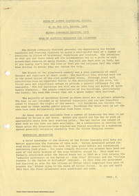
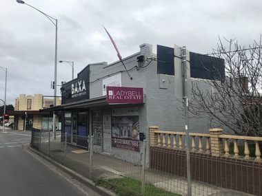
... OLD BAKERY On the southern corner of York Street and Main Road is an old house with a shop front which was for many years the local baker's shop. ...OLD BAKERY On the southern corner of York Street and Main Road is an old house with a shop front which was for many years the local baker's shop. ...Self guided heritage tour information produced by the Shire of Eltham Historical Society for 1978 Eltham Community Festival of 36 locations each numbered on accompanying map. Locations and detail provided current to 1978: 1. ELTHAM SHOPPING CENTRE Whilst very little remains in the centre of historical importance, this area has interest as the "village" which developed over many years following the opening of the railway from Melbourne in 1902. Previously the shopping centre had been spread out over a long length of Main Road to the south. Shops have been continuously demolished or remodelled and the majority of buildings date from the 1950's or later. The recently erected Post Office replaced the "old" Post Office opened on the same site only in 1958. 2. WOOLWORTHS ELTHAM VILLAGE Part of the site of this modern shopping development was occupied by the former Eltham Shire Offices and Hall. The hall was paid for by public subscription whilst the Council raised a loan for the offices. The combined building was opened in 1941. It served as office and Council meeting place until 1965 and as the hall until its demolition in 1970. 3. ELTHAM WAR MEMORIAL The complex of buildings adjoining the present Shire Offices were financed by public subscription as a Memorial following World War II. Their construction and for many years their operation was organised by the now disbanded Eltham War Memorial Committee. The original buildings were the; Infant Welfare Centre, Children’s Library (now War Memorial Hall and Dental Clinic) and Kindergarten. In later years the Elderly Citizens Club was built at the rear. 4. ELTHAM SHIRE OFFICES These offices were opened in 1965 and extended in 1971 to provide additional office accommodation and the Eltham Library. They represent the last of a long line of offices and meeting places of the Eltham Shire Council and its predecessor the Eltham District Road Board. The building occupies the former site of Shillinglaw Cottage. The three tall cypress trees which stood in front of the Cottage have been retained as a feature of the office surrounds. 5. OUR LADY'S CHURCH AND SCHOOL The Catholic Church and School complex opposite the Shires Offices shows a number of stages in the development of Eltham township. The recently constructed church adjoins its predecessor (now the parish centre). Many years ago the Catholic Church was located opposite Wingrove Park and the present central site follows the northerly drift of the township. 6. SHILLINGLAW COTTAGE The Cottage was built in 1859 by George Stebbing, a local builder who was responsible for a number of other prominent buildings in the area. Its removal from the site of the Shire Offices and re-erection on the present site was financed by public subscription. It is built of handmade bricks laid in Flemish Bond with an unusual design featuring burnt "leader" bricks over the whole facade. The Cottage is occupied by Eltham Fleececrafts and will be open during the Festival and at other times during weekends. It is classified by the National Trust. 7. RAILWAY BRIDGE The timber trestle bridge over the Diamond Creek was built in 1901. Whilst all of its timbers have been replaced at various times over the years the only change to its character has been the addition of pylons and wiring for electric trains in 1923. It is one of very few similar bridges remaining in the metropolitan area. In 1976 a proposal to replace the bridge with an earth embankment and large culvert pipes was abandoned following community protests. The bridge, however, remains under threat because of the necessity for future deuplication of the railway line. 8. ELTHAM CENTPAL PARK The area between the railway and the creek has for many years been used as a park which included Eltham' s main football oval. The access road, Panther Place is named after Eltham's team playing in the Diamond Valley League. In recent years a large area extending to Bridge Street and locally known as the Town Park has been landscaped and added to the area. The excellent blending of the park with the natural landscape of the creek valley has earned a National Trust Landscape Classification. 9. OLD BAKERY On the southern corner of York Street and Main Road is an old house with a shop front which was for many years the local baker's shop. The brick bakery at the rear is of somewhat later vintage than the house. 10. BRIDGE STREET CUTTING Before reconstruction of Main Road this intersection had deep cutting embankments on all four corners, forming a distinctive feature of the entrance to Eltham. Roadworks and private development have levelled the land on the low side of the road. A memorial to the Eltham soldiers of World War I which was located at the north-western corner is now situated at the Eltham R.S.L. 11. HILLTOP MILK BAR For many years this was the site of the Eltham Post Office under the control of the Hunniford family and later their descendants the Burgoynes. It was transferred to this site in 1855, although at that time the building apparently fronted Bridge Str e et. The site contained Eltham's first telephone exchange. The post office was relocated in 1954 but the shop was operated until recently by the Burgoyne family who still own the surrounding land. 12. UNITING CHURCH and former C.B.A. BANK The former Methodist Church was built in 1880 by George Stebbing. The Sunday School extension was built in 1929 and there have been more recent extensions. The adjoining opportunity shop was built as a bank in 1874 and purchased by the Methodist Church in 1954. 13. R.S.L. HALL, TELEPHONE EXCHANGE These relatively recent buildings occupy the site of a row of shops forming part of the early ribbon of business development along Main Road. In front of the R.S.L. building is the World War I Memorial relocated from the corner of Bridge Street and Main Road. 14. ELTHAM COMMUNITY CENTRE Australia's first mudbrick "community building" was opened in April this year. Part of the site of the building was purchased in 1856 by Henry Dendy (of Brighton fame). At the rear of the land near the creek was a steam flour mill whilst Dendy's house was at the Main Road frontage of the land. His purchase totalled about 2 Ha (5 acres) and included land on the opposite side of Maria Street (Main Road). Dendy became a prominent member of the Eltham community and served one term as President of the Eltham District Road Board. In 1867 Dendy sold his land and business to William Ford of Malmsbury and shifted to Walhalla. The avenue of trees leading past the Community Centre to the creek may well have bordered the track to the mill. 15. ELTHAM HOTEL The original part of this hotel was built in 1927 following the burning of the former Watson's Eltham Hotel on the same site. The car park on the opposite side of Main Road was also the site of a hotel variously known over the years as; the Fountain of Friendship, the Fountain and the Evelyn Arms. As the Fountain of Friendship it was the first meeting place of the Eltham District Road Board in 1856. 16. ST. MARGARET'S CHURCH, PITT STREET In 1860 Henry Dendy was appointed Chairman of a committee to establish a church of England in Eltham. He donated part of his land in Pitt Street and in 1861 the church was opened. It was built by George Stebbing and remains in a well preserved state today. Th adjoining old vicarage is now named Dendy Hou se. A new mudbrick church hall is under construction on the site. The church and Dendy House are now listed on the Register of Historic Buildings. 17. NO. 86 PITT STREET Cottage built by George Stebbing and believed to be his home for some years in the 1850s. 18. LIVING AND LEARNING CENTRE The house was built in the 1850s with the kitchen at the front being added about 40 years later. By the creek below the house a number of early Eltham industries were located. These included a tannery and a brewery. 19. ELTHAM COURT HOUSE A Court of Petty Sessions was established in Eltham in 1858 and the present building dates from 1860. It is the oldest public building remaining in Eltham. In its early days the building was used as the meeting place and office of the Eltham District Road Board and as an overflow classroom for the local school. The Court House has been classified by the National Trust. The citation states that it is an example of the simple form of early brick Court House with gabled roof and porch. 20. LANDS DEPARTMENT OFFICE This building is the former police station and is probably of about the same age as the Court House. The lockup at the rear has been demolished but the old stables remain as garages. A licence was first granted for a police station at Eltham in 1856. 21. JARROLD COTTAGE The old Cottage opposite Dalton Street was formerly owned by the Jarrold family. Early records indicate that this was the building leased from the Jarrolds as a temporary police station prior to construction of the building on the corner of Brougham Street. The small building on the corner of the property was used as a boot repairer's shop. The elevated studio at the rear is a more recent construction by the present owners. 22. STATE SCHOOL RESIDENCE Erected in 1891 23. WINGROVE COTTAGE This building fills an important place in the history of Eltham and is now used as a medical clinic. It was built in 1858 for Charles S. Wingrove who was Secretary to the Eltham District Road Board and Shire Council from 1858 to 1904. During part of this period he was also Shire Engineer and was Secretary to the Heidelberg Road Board. The house was used as the office of the Board and Council for many years. Wingrove is buried in the cemetery at St. Helena. 24. WINGROVE PARK The parkland opposite Wingrove Cottage has been named after Charles Wingrove. The old Manna Gums are an outstanding feature of the park. 25. ELTHAM FRI.MARY SCHOOL NO. 209 The school first opened in the slab building in 1855 and operated from the present site since 1857. The oldest part of the present school is the stone building erected in 1876. The first school teacher, David Clark remained at the school until 1888. This school is the government township and has always been known as the Eltham School. An earlier school (no.371) known as Little Eltham School operated in Swan Street from 1853 to 1872. 26. "SHOESTRING" This house was built for school teacher David Clark. It has been extensively extended in recent years but the extensions do not detract from the character of the older part of the building. 27. ELTHAM CEMETERY The cemetery contains the graves of many of the district's pioneers . 28. MONTSALVAT This unique complex of buildings was commenced in 1935 by the late Justus Jorgensen and its development has extended over many years. Montsalvat has exerted a significant impact on Eltham The earth and stone construction of many of the buildings has influenced local architecture to a great extent and it has served as a "nerve centre" of the local artistic community. Montsalvat is open to the public for a small charge. 29. MAIN ROAD BRIDGE This location has been the main crossing of Diamond Creek since the earliest days of settlement. The present concrete bridge was erected in 1925 .and was preceded by a number of timber bridges. 30. ELTHAM LOWER PARK This park, being an unusually large flat area for Eltham, was originally the local racecourse. Horse races were held here from 1855 and the area was gazetted as a reserve for a racecourse and recreation reserve in 1857. The park is well known as a venue for school "bird days" and more recently as the site of the Diamond Valley Railway. This miniature railway features scale models of modern and old locomotives and rolling stock and has operated on this site since 1961 . Before that the railway operated at Chelsworth Park, Ivanhoe. 31. FALKINER HOUSE Frederick Falkiner was one of the earliest settlers in the Eltham township area and occupied a substantial leasehold prior to the first land sales. Early records show that Falkiner was the subject of a number of complaints from his neighbours but he has nevertheless been considered a prominent enough citizen to have a street named for him. This house was the home of Evelyn (Ely) Falkiner a member of Frederick's family. 32. WEST HOUSE Behind the large house on the hill is an early house built by the West family. This was relocated from a site near the front of the land by the present owner Mr. Fabbro. 33. FALKINER HOUSE This very old house is believed to have been the home of Frederick and may have been Eltham's first post office. Falkiner was the first post master for a short period. in 1854/55. 34. WITHERS HOUSE This house was the home of famous artist Walter Withers who shifted here from Heidelberg in 1903. 35. ELTHAM HIGH SCHOOL This school celebrated its jubilee this year, having commenced as the Eltham Higher Elementary School 50 years ago. 36. DIAMOND CREEK FOOTWAY If returning from the High School to the town centre the footpath by the bank of the Diamond Creek provides a pleasant route to finish your walk. The creek is a major tributary of the Yarra River. Together with its own major tributaries Arthurs Creek and Running Creek it commences on the southern slopes of the Dividing Range at Kinglake. It gives the name Diamond Valley to an area extending well beyond its actual drainage catchment.Recognition of the significance of various landmarks to the history of the Eltham community as of 1978‘shoestring’, 1978, bridge street cutting, burgoyne store, c.b.a. bank, diamond creek trail, eltham cemetery, eltham central park, eltham community centre, eltham community festival, eltham court house, eltham festival, eltham high school, eltham hotel, eltham lower park, eltham primary school, eltham railway trestle bridge, eltham shire offices, eltham shopping centre, eltham state school no. 209, eltham village, eltham war memorial, falkiner house, heritage trail, hilltop milk bar, jarrold cottage, lands department office, living, living and learning centre, main road bridge, montsalvat, old bakery, our eltham artistic recollections, our lady help of christian’s church, our lady help of christian’s primary school, pitt street, post office, r.s.l. hall, shillinglaw cottage, st margaret’s church, state school residence, stebbing cottage, telephone exchange, uniting church, west house, wingrove cottage, wingrove park, withers house, woolworths -
 Eltham District Historical Society Inc
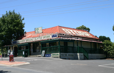
Photograph - Digital Photograph, Alan King, Kangaroo Ground General Store, Eltham-Yarra Glen Road, 28 December 2007
... Joy Ness, who belonged to an early Kangaroo Ground family, moved here in 1940 and recalled her impressions of the store at that time: ‘It was a very dark shop stained in a dark colour and on the walls just below the ceiling hung hurricane lamps, ropes, kitchen utensils and other goods for sale. ...Joy Ness, who belonged to an early Kangaroo Ground family, moved here in 1940 and recalled her impressions of the store at that time: ‘It was a very dark shop stained in a dark colour and on the walls just below the ceiling hung hurricane lamps, ropes, kitchen utensils and other goods for sale. ...The present store was built circa 1900 to replace another which had been destroyed by fire in 1898, which had replaced a predecessor on the opposite side of the road in 1865. The store was also used as a post office until early 2000s. The general store is historically significant because it has a long association with Kangaroo Ground and has been an important centre of community life for more than 120 years - Council meetings used to be conducted in the front room of the store at a time when Kangaroo Ground rivalled Eltham as the major centre of the Shire. The general store is historically and aesthetically significant as one of a group of three well preserved public buildings in the Kangaroo Ground hamlet and as a major heritage component of Kangaroo Ground which was one of the earliest settled areas of the Shire and which has the character of an English village rather than an Australian settlement. Covered under Heritage Overlay, Nillumbik Planning Scheme. Published: Nillumbik Now and Then / Marguerite Marshall 2008; photographs Alan King with Marguerite Marshall.; p77 Today the general store is an uncommon form of trade but the one at Kangaroo Ground continues a long tradition of friendliness and service. For more than 100 years it has been a centre of community life. In the settlement’s early days a previous general store, on the same site, was the meeting place for the Eltham District Road Board, precursor to the Eltham Shire Council. For years Kangaroo Ground rivalled Eltham as the shire’s major centre. It developed very differently from the rest of the shire as its rich soil attracted prosperous Presbyterian Scots who had large agricultural properties.1 The present store was built to replace another one, which had burnt down in 1898, after replacing a predecessor on the other side of the road in 1865. The store retains its outward character and its cellar, although inside it has changed considerably. It now includes a café and offers local produce, milk bar products, grocery items, gas and other fuel. Until early this century the store was also used as a post office. Kangaroo Ground’s first postmaster was Andrew Ross, who first operated from the school opposite, then from his hotel next to the present tennis court site. The first postmaster at this store was Edward Weller, followed in 1868 by James Anderson. At that time a mail coach ran three times a week between Eltham and Woods Point through Kangaroo Ground, Yarra Flats, Healesville, Fernshaw, Marysville and Matlock. Some early postmasters were Rodger, McLaughlin, Greenway and Burns.2 Burns was the only postmaster operating from the store. The others operated from Andrew Ross’s hotel. The mail service improved in 1892 when coaches ran from Melbourne to Queenstown (now known as St Andrews) and changed horses at Kangaroo Ground twice daily. The only telegraph office in the district at that time was at the Kangaroo Ground Post Office. Telegrams to outlying areas such as Queenstown and Kinglake had to be sent by hand. A local resident in the early 1900s often rode his pony to deliver telegrams and was paid one shilling a mile porterage. The store has also contributed to the lighter side of Kangaroo Ground life. During the years that Con Wraight owned the store, between 1906 and 1946, a new piano was needed for the Kangaroo Ground Hall, so monthly dances were held to raise money. When the piano was bought, a grand ball was held in the Kangaroo Ground Hall to celebrate the occasion and supper followed at Mr Wraight’s barn, cleaned especially for the occasion. Every New Year’s Eve, a Scottish piper would set off from between the store and the schoolhouse, playing his pipes, and march to Cameron’s Pigeon Bank homestead on the Kangaroo Ground-Warrandyte Road. Between 1914 and 1922, the store was a station for the Kangaroo Ground Bush Fire Brigade’s tanker. It consisted of a wooden barrel on a cart, fitted with a hand-pump, and stood on the side of the road outside the store. Joy Ness, who belonged to an early Kangaroo Ground family, moved here in 1940 and recalled her impressions of the store at that time: ‘It was a very dark shop stained in a dark colour and on the walls just below the ceiling hung hurricane lamps, ropes, kitchen utensils and other goods for sale. ‘Goods were weighed on a brass scale with weights, on which mothers also weighed their babies, because the nearest Infant Welfare Centre was at Greensborough. The bacon was cut with a hand slicer and later a pot-bellied stove warmed the store. Farmers and other locals used to gossip around it as they collected their daily mail. In those days the butter and cheese were kept in the cellar as no ice was delivered for cooling.’This collection of almost 130 photos about places and people within the Shire of Nillumbik, an urban and rural municipality in Melbourne's north, contributes to an understanding of the history of the Shire. Published in 2008 immediately prior to the Black Saturday bushfires of February 7, 2009, it documents sites that were impacted, and in some cases destroyed by the fires. It includes photographs taken especially for the publication, creating a unique time capsule representing the Shire in the early 21st century. It remains the most recent comprehenesive publication devoted to the Shire's history connecting local residents to the past. nillumbik now and then (marshall-king) collection, eltham-yarra glen road, kangaroo ground general store -
 Bendigo Historical Society Inc.
Newspaper - Bendigo Advertiser Collection: Small Town With Big Hearts Article on Maiden Gully, October 27 1993
... Maiden Gully offers a modern school with over 200 pupils, a central shopping area with essential services (general store, post office, take-away, bottle shop, service station), a conservation-focused public hall, and a leafy caravan park.Natural Setting. ...Maiden Gully offers a modern school with over 200 pupils, a central shopping area with essential services (general store, post office, take-away, bottle shop, service station), a conservation-focused public hall, and a leafy caravan park.Natural Setting. ...Maiden Gully is a distinctive community located on the western edge of Bendigo, known for its spacious living and strong local identity. Properties are typically no smaller than one acre, with most homes situated on even larger plots, offering residents ample space and privacy. The area features a variety of architectural designs, including neo-Colonial, neo-Victorian, neo-Federation, neo-Edwardian, and modern ranch-style homes, reflecting a blend of historical and contemporary influences. Residents strongly identify Maiden Gully as a separate community rather than a suburb of Bendigo, valuing its blend of country lifestyle and urban conveniences. The community includes heritage sites such as Pratty's Patch, a stone cottage over 130 years old, and a name rooted in the area's gold rush history. Maiden Gully offers a modern school with over 200 pupils, a central shopping area with essential services (general store, post office, take-away, bottle shop, service station), a conservation-focused public hall, and a leafy caravan park.Natural Setting. The community is set among rolling hills and ironbark forests, providing a scenic and tranquil environment.Maiden Gully combines the best aspects of rural and urban living, making it a unique and self-sufficient district on Bendigo's outskirts. Maiden Gully is described as a peaceful, close-knit community with a strong sense of identity, distinct from nearby Bendigo. Residents value the area's spaciousness, natural beauty, and welcoming atmosphere. The town's center is defined by its school and a central shop, with additional businesses like transport services and a modern sports complex. Leon and Kim Holt, who run the postal agency, note the demanding nature of their business but appreciate the supportive community. While the postal agency serves about 300 people, the actual population is believed to be much higher, stretching from West Bendigo stadium to Marong. The area has seen growth, with new housing developments and an expanding community. Residents like Lyn and Lorna Wilkinson have deep family ties to Maiden Gully, appreciating both its history and its evolving character. Gerard and Carol Kelly, owners of a historic stone cottage restaurant, share their positive experiences and ongoing investment in the community, including renovations and a new tavern-style license. Many residents express a strong sense of belonging and attachment to Maiden Gully, often contrasting it with previous places they've lived. Overall, the document paints Maiden Gully as a growing yet tight-knit suburb where community, history, and personal connections are highly valued.Small Towns With Big Hearts Maiden Gully. Series of photos and information about Maiden Gully. Pictures by Bill Hawking. Written by Wayne Gregson. This item contains the following documents: 8091.601k Part of Page 36, the Bendigo Advertiser Wednesday October 27 1993 8091.601l Part of Page 36, the Bendigo Advertiser Wednesday October 27 1993 8091.601a Black and White photo of the General Store, Post Office and Takeaway taken from the playground opposite. Contact BHS for Details 8091.601b Black and White photo of Left to Right: Hayley Wilkinson (2 Years), Lorna Wilkinson and Lyn Pearce; all next to the Post Box. Contact BHS for Details 8091.601c Black and White photo of Front: Hayley Wilkinson (2 Years), Karina Wilkinson (4.5 years) and Right: Devin Pearce (4 years). Contact BHS for Details 8091.601d Black and White photo of Carol and Gerard Kelly owners of Pratty's Patch Restaurant. Contact BHS for Details 8091.601e Black and White photo of typical house and street scene. Contact BHS for Details 8091.601f Black and White photo of Carol and Gerard Kelly owners of Pratty's Patch Restaurant with stone workers. Contact BHS for Details 8091.601g Black and White photo of the Calder Highway. Contact BHS for Details 8091.601h Black and White photo of the playground opposite the General Store. Contact BHS for Details 8091.601i Black and White photo of Leon and Kim Holt, owners of the Maiden Gully shops. Contact BHS for Details 8091.601j Black and White photo of the Maiden Gully Primary School. Contact BHS for Detailsnewspaper, bendigo advertiser, maiden gully -
 Kiewa Valley Historical Society
Photographs – Kiewa Cres Mt Beauty. Circa 1993. Set of 12 colour photographs, circa 1993
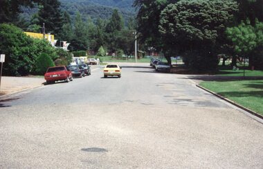
... It also demonstrates the attention paid by Alpine Shire towards providing accessible recreational green space around the town centre. kiewa crescent mt beauty; shopping centre; No markings Set of 12 colour photographs Kiewa Cres Mt Beauty. ...Established in 1946, during the construction of the Kiewa Hydro Electric Scheme, the township of Mt Beauty was developed by the State Electricity Commission of Victoria to provide additional accommodation for the thousands of workers during the construction of the country’s second largest hydro-electricity scheme. Although these towns were built as temporary accommodation for the workers and their families, many stayed after the scheme finished. Combined with the influx of European migrants, with their rich cultural backgrounds, all played a major part in shaping the future character of the Mount Beauty, the Kiewa Valley and Falls Creek. The Bright Council, now the Alpine Shire took over the control of the township in 1960. This relatively young town of Mount Beauty, along with the surrounding townships of Falls Creek, Bogong, Tawonga South and Tawonga, are all part of a prospering tourist area with excellent services, accommodation, food and a wide range of recreational activities available for all ages. According to Shire records, the population of Mt Beauty has grown from 1,500 in 1981 to 1,800 in 2016 with a projected increase to 2,000 in 2013The photographs taken around 1993 show a prosperous commercial centre catering for both locals and the needs of visitors. It provides a pictorial history of the changes which have occurred in the retail/commercial district of Mt Beauty over the years. It also demonstrates the attention paid by Alpine Shire towards providing accessible recreational green space around the town centre.Set of 12 colour photographs Kiewa Cres Mt Beauty. Circa 1993 showing retail services and streetscape of the time. No markingskiewa crescent mt beauty; shopping centre; -
 Sunshine and District Historical Society Incorporated
Photograph - Braybrook Photographs 2020, John Alchin, 2020
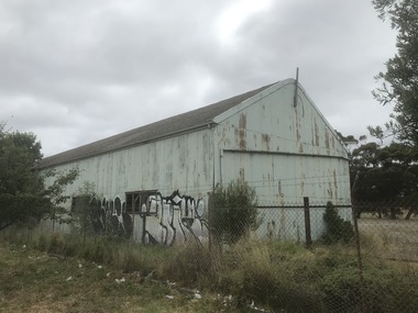
... area. To capture the essence of Braybrook in 2020, a series of photographs were taken. These images document a range of buildings, street scenes, and other notable points of interest throughout the suburb, providing a visual record of its unique character. ...Braybrook was originally part of the former Shire of Braybrook and later the City of Sunshine. However, in 1994, Victoria underwent council amalgamations, which resulted in Braybrook being incorporated into the City of Maribyrnong. The suburb of Braybrook continues to attract considerable attention from the residents of City of Brimbank, particularly its historical features, the old buildings and distinctive streetscapes that characterise the area.To capture the essence of Braybrook in 2020, a series of photographs were taken. These images document a range of buildings, street scenes, and other notable points of interest throughout the suburb, providing a visual record of its unique character.5579.01- Ashley St Braybrook - Former 3LO - AWA Frequency Changing Building.JPG 5579.02- Ballarat Rd 353 Braybrook - Braybrook Hotel Photo 01.JPG 5579.03- Ballarat Rd 353 Braybrook - Braybrook Hotel Photo 02.JPG 5579.04- Ballarat Rd 353 Braybrook - Braybrook Hotel Photo 03.JPG 5579.05- Cranwell St Braybrook - Cranwell Park 4th March 2020 Photo 01.JPG 5579.06- Cranwell St Braybrook - Cranwell Park 4th March 2020 Photo 02.JPG 5579.07- Cranwell St Braybrook - Wimble Printer Supplers - Cranwell St 4th March 2020.JPG 5579.08 - Duke St Braybrook - Unit Devlopment 4th March 2020 Photo 01.JPG 5579.09 - Duke St Braybrook - Unit Devlopment 4th March 2020 Photo 02.JPG 5579.10 - Duke St Braybrook - Unit Devlopment 4th March 2020 Photo 03.JPG 5579.11 - Duke St Braybrook - Unit Devlopment 4th March 2020 Photo 04.JPG 5579.12 - Maribyrnong River Braybrook 4th March 2020 Photo 01.JPG 5579.13 - Market Place 1 - 17 Place Braybrook.JPG 5579.14 - Salvation Army Hall 40 Myalla St Braybrook 16th Jan 2020.JPG 5579.15 - Churchill Ave Shops 2021 Photo 01.JPG 5579.16 - Churchill Ave Shops 2021 Photo 02.JPG 5579.17 - Churchill Ave Shops 2021 Photo 04.JPG 5579.18 - Cranwell Park 2021 Photo 05.JPG 5579.19 - Cranwell Park 2021 Photo 06.JPG 5579.20 - Cranwell Park 2021 Photo 02.JPG 5579.21 - Pennell Reserve 2021 Photo 03.JPG 5579.22 - Pennell Reserve 2021 Photo 01.JPG 5579.23 - Pennell Reserve 2021 Photo 07.JPG 5579.24 - Pennell Reserve 2021 Photo 08.JPG 5579.25 - Pennell Reserve 2021 Photo 09.JPG 5579.26 - Pennell Reserve 2021 Photo 13.JPG 5579.27 - Pennell Reserve 2021 Photo 05.JPG 5579.28 - Skinner Rerserve Pavilion 2021 Photo 01.JPG 5579.29 - Skinner Reserve 2021 Photo 05.JPG 5579.30 - Skinner Reserve 2021 Photo 06.JPG 5579.31 - Skinner Reserve 2021 Photo 07.JPG 5579.32 - Skinner Reserve 2021 Photo 13.JPG 5579.33 - Skinner Reserve 2021 Photo 20.JPG 5579.34 - Skinner Reserve 2021 Photo 25.JPG 5579.35 - Lance Reschstein 'Aeroplane' Playground Sign Skinner Reserve 2021 Photo 01.JPG 5579.36 - South Rd 131 - 137 Braybrook 2020.JPG 5579.37 - South Rd 103 - 125 Braybrook 2020.JPG 5579.38 - South Rd 125 - 131 Braybrook 2020.JPG 5579.39 - Myalla St 40 Braybrook - Salvation Army Hall 16th Jan 2020.JPG" ballarat road, ashley street, cranwell street, duke street, market place, braybrook, 3lo radio transmitter, braybrook hotel, cranwell park, wimble, salvation army hall, myalla street, churchill avenue, pennell reserve, braybrook football club, southern cross archery club, skinner reserve, lance reschstein 'aeroplane' playground, braybrook sporting club -
 Sunshine and District Historical Society Incorporated
Photograph - Braybrook Photographs 2021, John Alchin, 2021
... area. To capture the essence of Braybrook in 2021, a series of photographs were taken. These images document a range of buildings, street scenes, and other notable points of interest throughout the suburb, providing a visual record of its unique character. ...Braybrook was originally part of the former Shire of Braybrook and later the City of Sunshine. However, in 1994, Victoria underwent council amalgamations, which resulted in Braybrook being incorporated into the City of Maribyrnong. The suburb of Braybrook continues to attract considerable attention from the residents of City of Brimbank, particularly its historical features, the old buildings and distinctive streetscapes that characterise the area.To capture the essence of Braybrook in 2021, a series of photographs were taken. These images document a range of buildings, street scenes, and other notable points of interest throughout the suburb, providing a visual record of its unique character.5580.01 - Ashley St - Former 3LO - AWA Frequency changing building 2021 Photo 01.JPG 5580.02 - Ashley St 65- 67 Braybrook - Central West Shopping Centre 2021 Photo 02.JPG 5580.03 - Ashley St 185 - 195 Braybrook - Former National Springs 2021 Photo 01.JPG 5580.04 - Ballarat Rd 226 Braybrook - Ashley Hotel Ballarat Rd 2021 Photo 01.JPG 5580.05 - Ballarat Rd 234 Braybrook 2021 Photo 01.JPG 5580.06 - Ballarat Rd 234 Braybrook 2021 Photo 02.JPG 5580.07 - Ballarat Rd 244 - 246 Braybrook 2021 Photo 01.JPG 5580.08 - Ballarat Rd 256 Braybrook - ETA Factory Facade 2021 Photo 02.JPG 5580.09 - Ballarat Rd 256 Braybrook - ETA Factory Facade 2021 Photo 04.JPG 5580.10 - Ballarat Rd 261 Braybrook - La Porchetta 2021 Photo 01.JPG 5580.11 - Ballarat Rd 272 Braybrook - Former Holden Car Dealership 2021 Photo 01.JPG 5580.12 - Ballarat Rd 282 Braybrook 2021 Photo 02.JPG 5580.13 - Ballarat Rd 286 - 288 Braybrook 2021 Photo 01.JPG 5580.14 - Ballarat Rd 288 - 290 Braybrook 2021 Photo 01.JPG 5580.15 - Ballarat Rd 290 - 292 Braybrook 2021 Photo 01.JPG 5580.16 - Ballarat Rd 306 - 308 Braybrook 2021 Photo 01.JPG 5580.17 - Ballarat Rd 353 Braybrook - Braybrook Hotel 2021 Photo 01.JPG 5580.18 - Ballarat Rd 353 Braybrook - Braybrook Hotel 2021 Photo 02.JPG 5580.19 - Ballarat Rd 353 Braybrook - Braybrook Hotel 2021 Photo 03.JPG 5580.20 - Ballarat Rd 353 Braybrook - Braybrook Hotel Blue Stone Bar Sign 2021 Photo 01.JPG 5580.21 - Beachley St 23 - 33 Braybrook - Shops 2021 Photo 01.JPG 5580.22 - Beachley St 23 - 33 Braybrook - Shops 2021 Photo 02.JPG 5580.23 - Braybrook Commons Community Gardens Skinner Reserve 2021 Photo 01.JPG 5580.24 - Cranwell St 40 Braybrook - Klipspringer 2021 Photo 02.JPG 5580.25 - Darnley St 83 Braybrook 2021 Photo 01.JPG 5580.26 - Duke St 144 Braybrook 2021 Photo 01.JPG 5580.27 - Evans St 1 Braybrook - Harkrome Quality Electroplaters 2021 Photo 01.JPG 5580.28 - Evans St 9 Braybrook 2021 Photo 01.JPG 5580.29 - Gilbert St 8 Braybrrok - Steeden Engineering Co Pty Ltd 2021 Photo 01.JPG 5580.30 - Hampden St Factory Demolishment 2021 Photo 01.JPG 5580.31 - Kent St Braybrook - Sunshine VRI Bowling Club 2021 Photo 01.JPG 5580.32 - Kent St Braybrook - Sunshine VRI Bowling Club 2021 Photo 02.JPG 5580.33 - Kent St Braybrook - Sunshine VRI Bowling Club 2021 Photo 03.JPG 5580.34 - Lily st Braybrook - RecWest 2021 Photo 01.JPG 5580.35 - Maribyrnong River Temple to Temple Trail Sign 2021 Photo 01.JPG 5580.36 - Maribyrnong River Braybrook 2021 Photo 01.JPG 5580.37 - Marj Laffin Scoreboard Kinder Smith Reserve Lily St Braybrook 2021 Photo 01.JPG 5580.38 - Myalla St 40 Braybrook - Salvation Army Hall 2021 Photo 01.JPG 5580.39 - Myalla St 40 Braybrook - Salvation Army Hall 2021 Photo 02.JPG 5580.40 - Quang Minh Buddhist Temple Burke St Braybrook 2021 Photo 01.JPG 5580.41 - Quang Minh Buddhist Temple Gardens Braybrook 2021 Photo 04.JPG 5580.42 - Ramon Vila Pavilion Kinder Smith Reserve Lily St Braybrook 2021 Photo 01.JPG 5580.43 - Solomon Ford Maribyrnong River 2021 Photo 01.JPG 5580.44 - South Rd 204 Braybrook - Caroline Chisholm College Braybrook 2021 Photo 01.JPG 5580.45 - South Rd 204 Braybrook - Caroline Chisholm College Quinn Auditorium Braybrook 2021 Photo 01.JPG 5580.46 - William Barak Sign Duke St Reserve Braybrook 2021 Photo 01.JPG ballarat road, ashley street, beachkey street, cranwell street, darnley street, duke street, evans street, gilbert street, hampden street, kent street, lily street, maribyrnong river, myalla street, south road, 3lo radio transmitter, central west shopping centre, national springs, ashley hotel, eta factory, la porchetta, braybrook hotel, klipspringer, harkrome, steeden engineering, sunshine vri bowling club, recwest, kinder smith reserve, marj laffin, salvation army hall, quang minh buddhist temple, burke street, ramon vila pavilion, solomon ford, caroline chisholm college, william barak, aboriginal, aborigine, first nation, braybrook -
 Sunshine and District Historical Society Incorporated
Photograph - Maribyrnong Photographs 2022, John Alchin, 2022
... area. To capture the essence of Maribyrnong in 2022, a series of photographs were taken. These images document a range of buildings, street scenes, and other notable points of interest throughout the suburb, providing a visual record of its unique character. ...Maribyrnong was originally part of the former Shire of Braybrook and later the City of Sunshine. However, in 1994, Victoria underwent council amalgamations, which resulted in Braybrook being incorporated into the City of Maribyrnong. The suburb of Maribyrnong continues to attract considerable attention from the residents of City of Brimbank, particularly its historical features, the old buildings and distinctive streetscapes that characterise the area.To capture the essence of Maribyrnong in 2022, a series of photographs were taken. These images document a range of buildings, street scenes, and other notable points of interest throughout the suburb, providing a visual record of its unique character.5601.01 - Anglers Tavern - Repairs After Flood 2022 Photo 01.JPG 5601.02 - Anglers Tavern - Repairs After Flood 2022 Photo 02.JPG 5601.03 - Anglers Tavern - Repairs After Flood 2022 Photo 03.JPG 5601.04 - Highpoint City Quarry West Face 2022 Photo 01.JPG 5601.05 - Jack's Magazine Maribyrnong 2022 Photo 01.JPG 5601.06 - Jack's Magazine Maribyrnong 2022 Photo 03.JPG 5601.07 - Jack's Magazine Maribyrnong 2022 Photo 04.JPG 5601.08 - Maribyrnong Explosive Factory 2022 Photo 01.JPG 5601.09 - Maribyrnong Explosive Factory 2022 Photo 02.JPG 5601.10 - Maribyrnong Explosive Factory 2022 Photo 03.JPG 5601.11 - Maribyrnong Explosive Factory 2022 Photo 04.JPG 5601.12 - Maribyrnong Explosive Factory 2022 Photo 06.JPG 5601.13 - Maribyrnong Explosive Factory 2022 Photo 09.JPG 5601.14 - Maribyrnong Explosive Factory 2022 Photo 10.JPG 5601.15 - Maribyrnong Explosive Factory 2022 Photo 17.JPG 5601.16 - Maribyrnong Permacite & Clay Potteries Wharf 2022 Photo 01.JPG 5601.17 - Maribyrnong Reserve Grandstand 2022 Photo 01.JPG 5601.18 - Maribyrnong Reserve Grandstand 2022 Photo 03.JPG 5601.19 - Raleigh Rd 42 - 45 - Shops 2022 Photo 01.JPG 5601.20 - Raleigh Rd 83 - Former Maribyrnong Police Station 2022 Photo 01.JPG 5601.21 - Raleigh Rd 85 - Former Shop & Post Office Site 2022 Photo 01.JPG 5601.22 - Raleigh Rd 85 - Former Shop & Post Office Site 2022 Photo 02.JPG raleigh road, maribyrnong, anglers tavern, jacks magazine, maribyrnong explosive factory, maribyrnong permacite and clay potteries wharf, maribyrnong reserve grandstand, maribyrnong police station -
 Sunshine and District Historical Society Incorporated
Photograph - Maidstone 2021 Photographs Part 3, John Alchin, 2021
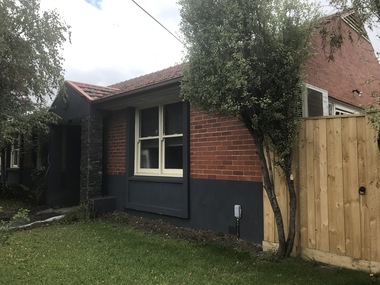
... area. To capture the essence of Maidstone in 2021, a series of photographs were taken. These images document a range of buildings, street scenes, and other notable points of interest throughout the suburb, providing a visual record of its unique character. ...Maidstone was originally part of the former Shire of Braybrook and later the City of Sunshine. However, in 1994, Victoria underwent council amalgamations, which resulted in Braybrook being incorporated into the City of Maribyrnong. The suburb of Maidstone continues to attract considerable attention from the residents of City of Brimbank, particularly its historical features, the old buildings and distinctive streetscapes that characterise the area.To capture the essence of Maidstone in 2021, a series of photographs were taken. These images document a range of buildings, street scenes, and other notable points of interest throughout the suburb, providing a visual record of its unique character.5594.01 - Short St 8 Maidstone - Former Police Station 2021 Photo 01.JPG 5594.02 - Short St 8 Maidstone - Former Police Station 2021 Photo 02.JPG 5594.03 - Short St 8 Maidstone - Former Police Station 2021 Photo 04.JPG 5594.04 - Studley St 24 Maidstone - Former Shop 2021 Photo 01.JPG 5594.05 - Studley St 34 - 36 Maidstone - Former Salvation Army Church 2021 Photo 03.JPG 5594.06 - Thomson St 28 Maidstone - Former Shop Site 2021 Photo 01.JPG 5594.07 - Thomson St Maidstone - Maidstone Tennis Club 2021 Photo 01.JPG 5594.08 - Thomson St Maidstone - Maidstone Tennis Club 2021 Photo 02.JPG 5594.09 - Thomson St Outside 7 Maidstone - Albert Facey Information Board Photo 01.JPG 5594.10 - Yardley St 21 Maidstone - Maidstone Community Centre 2021 Photo 03.JPG 5594.11 - Hampstead Rd - Midway Migrant Hostel Hampstead Rd 2021 Photo 01.JPG 5594.12 - Hampstead Rd - Midway Migrant Hostel 2021 Photo 03.JPG 5594.13 - Williamson Road Rd - Midway Migrant Hostel 2021 Photo 05.JPG 5594.14 - Williamson Rd - Midway Migrant Hostel 2021 Photo 09.JPG 5594.15 - Williamson Rd - Midway Migrant Hostel 2021 Photo 12.JPG 5594.16 - Williamson Rd - Midway Migrant Hostel 2021 Photo 14.JPG 5594.17 - Williamson Rd - Midway Migrant Hostel 2021 Photo 10.JPG 5594.18 - Williamson Rd - Midway Migrant Hostel 2021 Photo 01.JPG 5594.19 - Williamson Rd - Midway Migrant Hostel 2021 Photo 15.JPG 5594.20 - Williamson Rd - Midway Migrant Hostel 2021 Photo 16.JPG 5594.21 - Williamson Rd - Midway Migrant Hostel 2021 Photo 17.JPG 5594.22 - Williamson Rd - Philip Migrant Hostel 2021 Photo 01.JPG 5594.23 - Williamson Rd - Philip Migrant Hostel 2021 Photo 04.JPG short street, studley street, thomson street, yardley street, hampstead road, williamson road, maidstone, maidstone police station, salvation army church, albert facey, maidstone tennis club, maidstone community centre, midway migrant hostel, philip migrant hostel, student village -
 Sunshine and District Historical Society Incorporated
Photograph - Maidstone Photographs 2022, John Alchin, 2021
... area. To capture the essence of Maidstone in 2022, a series of photographs were taken. These images document a range of buildings, street scenes, and other notable points of interest throughout the suburb, providing a visual record of its unique character. ...Maidstone was originally part of the former Shire of Braybrook and later the City of Sunshine. However, in 1994, Victoria underwent council amalgamations, which resulted in Braybrook being incorporated into the City of Maribyrnong. The suburb of Maidstone continues to attract considerable attention from the residents of City of Brimbank, particularly its historical features, the old buildings and distinctive streetscapes that characterise the area.To capture the essence of Maidstone in 2022, a series of photographs were taken. These images document a range of buildings, street scenes, and other notable points of interest throughout the suburb, providing a visual record of its unique character.5595.01 - Ballarat Rd 97 Maidstone 2022 Photo 01.JPG 5595.02 - Ballarat Rd 97 Maidstone 2022 Photo 02.JPG 5595.03 - Ballarat Rd 129 - 131 Maidstone 2022 Photo 02.JPG 5595.04 - Ballarat Rd 129 - 131 Maidstone 2022 Photo 03.JPG 5595.05 - Ballarat Rd 154 Maidstone - Former Shop 2022 Photo 01.JPG ballarat road, maidstone -
 Sunshine and District Historical Society Incorporated
Photograph - Maidstone Photographs 2023, John Alchin, 2023
... area. To capture the essence of Maidstone in 2023, a series of photographs were taken. These images document a range of buildings, street scenes, and other notable points of interest throughout the suburb, providing a visual record of its unique character. ...Maidstone was originally part of the former Shire of Braybrook and later the City of Sunshine. However, in 1994, Victoria underwent council amalgamations, which resulted in Braybrook being incorporated into the City of Maribyrnong. The suburb of Maidstone continues to attract considerable attention from the residents of City of Brimbank, particularly its historical features, the old buildings and distinctive streetscapes that characterise the area.To capture the essence of Maidstone in 2023, a series of photographs were taken. These images document a range of buildings, street scenes, and other notable points of interest throughout the suburb, providing a visual record of its unique character.5596.01 - Ashley St 143 Maidstone 2023 Photo 01.JPG 5596.02 - Ashley St 143 Maidstone 2023 Photo 02.JPG 5596.03 - Ashley St 143 Maidstone 2023 Photo 03.JPG 5596.04 - Ashley St 143 Maidstone 2023 Photo 04.JPG 5596.05 - Ballarat Rd 131 Maidstone 2023 Photo 01.jpg 5596.06 - Rosamond Rd 109 2023 Photo 01.JPG 5596.07 - Rosamond Rd 121 - 123 Shops 2023 Photo 01.JPG 5596.08 - Rosamond Rd 121 - 123 Shops 2023 Photo 02.JPG ashley street, ballarat road, rosamond road, maidstone, stan cash -
 Sunshine and District Historical Society Incorporated
Photograph - Maidstone 2021 Photographs Part 2, John Alchin, 2021
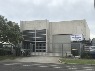
... area. To capture the essence of Maidstone in 2021, a series of photographs were taken. These images document a range of buildings, street scenes, and other notable points of interest throughout the suburb, providing a visual record of its unique character. ...Maidstone was originally part of the former Shire of Braybrook and later the City of Sunshine. However, in 1994, Victoria underwent council amalgamations, which resulted in Braybrook being incorporated into the City of Maribyrnong. The suburb of Maidstone continues to attract considerable attention from the residents of City of Brimbank, particularly its historical features, the old buildings and distinctive streetscapes that characterise the area.To capture the essence of Maidstone in 2021, a series of photographs were taken. These images document a range of buildings, street scenes, and other notable points of interest throughout the suburb, providing a visual record of its unique character.5593.01 - Mitchell St 118 Maidstone 2021 Photo 01.JPG 5593.02 - Mitchell St 120 Maidstone 2021 Photo 01.JPG 5593.03 - Mitchell St 122 Maidstone 2021 Photo 01.JPG 5593.04 - Mitchell St 124 - 132 Maidstone 2021 Photo 01.JPG 5593.05 - Mitchell St 124 - 132 Maidstone 2021 Photo 02.JPG 5593.06 - Mitchell St 124 - 138 Maidstone 2021 Photo 01.JPG 5593.07 - Mitchell St 124 - 138 Maidstone 2021 Photo 02.JPG 5593.08 - Mitchell St 126 - 132 Maidstone 2021 Photo 01.JPG 5593.09 - Mitchell St 128 - 130 Maidstone 2021 Photo 01.JPG 5593.10 - Mitchell St 132 - 128 Maidstone 2021 Photo 01.JPG 5593.11 - Mitchell St 1962 Maidstone - Former Ice Works.JPG 5593.12 - Mitchell St Maidstone - Consolidated Bearing Co 2021 Photo 01.JPG 5593.13 - Omar St 58 Maidstone 2021 Photo 01.JPG 5593.14 - Omar St 58 Maidstone 2021 Photo 02.JPG 5593.15 - Omar St Maidstone - Medway Golf Course 2021 Photo 02.JPG 5593.16 - Richards St Maidstone 2021 Photo 01.JPG 5593.17 - Richelieu St 66 Maidstone - Maidstone Church of Christ 2021 Photo 01.JPG 5593.18 - Richelieu St 66 Maidstone - Maidstone Church of Christ 2021 Photo 04.JPG 5593.19 - Rogers Reserve Maidstone 2021 Photo 01.JPG 5593.20 - Rosamond Rd 1 Maidstone - The Palms Bingo and Club 2021 Photo 01.JPG 5593.21 - Rosamond Rd 1 Maidstone - The Palms Bingo and Club 2021 Photo 02.JPG 5593.22 - Rosamond Rd 31 - Former Shop 2021 Photo 01.JPG 5593.23 - Rosamond Rd 69 Maidstone - Car Yard 2021 Photo 01.JPG 5593.24 - Rosamond Rd 75 Maidstone - Telstra Exchange 2021 Photo 01.JPG 5593.25 - Rosamond Rd 77 - 81 Maidstone Shops 2021 Photo 01.JPG 5593.26 - Rosamond Rd 93 Maidstone - Shop 2021 Photo 01.JPG 5593.27 - Rosamond Rd 93 Maidstone - Shop 2021 Photo 02.JPG 5593.28 - Rosamond Rd 95 Maidstone - Service Station 2021 Photo 02.JPG 5593.29 - Rosamond Rd 95A - Shop 2021 Photo 01.JPG 5593.30 - Rosamond Rd 97 - 103 Maidstone - Shops 2021 Photo 01.JPG 5593.31 - Rosamond Rd 97 - 103 Maidstone - Shops 2021 Photo 02.JPG 5593.32 - Rosamond Rd 103 Maidstone - Shop 2021 Photo 01.JPG 5593.33 - Rosamond Rd Maidstone - Rosamond School Annexe 2021 Photo 02.JPG 5593.34 - Rosamond Rd Maidstone - Rosamond School Annexe 2021 Photo 03.JPG 5593.35 - Rosamond Rd Maidstone 77 - 81 - Shops 2021 Photo 02.JPG 5593.36 - Rowe St 1 Maidstone - Former Shops 2021 Photo 01.JPG 5593.37 - Scovell Reserve Maidstone 2021 Photo 02.JPG 5593.38 - Scovell Reserve Maidstone 2021 Photo 04.JPG 5593.39 - Scovell Reserve Maidstone 2021 Photo 05.JPG 5593.40 - Shepherd Gardens Maidstone 2021 Photo 06.JPG mitchell street, omar street, richards street, richelieu street, rogers street, rosamond road, rowe street, maidstone, ice works, consolidated bearing, medway golf course, maidstone church of christ, the palms bingo and club, maidstone telephone exchange, rosamond school annexe, scovell reserve, shepherd gardens -
 Sunshine and District Historical Society Incorporated
Photograph - Maidstone 2021 Photographs Part 1, John Alchin, 2021
... area. To capture the essence of Maidstone in 2021, a series of photographs were taken. These images document a range of buildings, street scenes, and other notable points of interest throughout the suburb, providing a visual record of its unique character. ...Maidstone was originally part of the former Shire of Braybrook and later the City of Sunshine. However, in 1994, Victoria underwent council amalgamations, which resulted in Braybrook being incorporated into the City of Maribyrnong. The suburb of Maidstone continues to attract considerable attention from the residents of City of Brimbank, particularly its historical features, the old buildings and distinctive streetscapes that characterise the area.To capture the essence of Maidstone in 2021, a series of photographs were taken. These images document a range of buildings, street scenes, and other notable points of interest throughout the suburb, providing a visual record of its unique character.5592.01 - Ballarat Rd 3 - 5 Maidstone 2021 Photo 01.JPG 5592.02 - Ballarat Rd 17a Maidstone 2021 Photo 02.JPG 5592.03 - Ballarat Rd 27 - 29 Maidstone - Former Email Meters Factory 2021 Photo 01.JPG 5592.04 - Ballarat Rd 45 - Former Shop 2021 Photo 01.JPG 5592.05 - Ballarat Rd 49 - 57 Maidstone 2021 Photo 01.JPG 5592.06 - Ballarat Rd 63 - 65 Maidstone - Former Shop 2021 Photo 01.JPG 5592.07 - Ballarat Rd 81 Maidstone - Former Shop 2021 Photo 01.JPG 5592.08 - Ballarat Rd 101 Maidstone 2021 Photo 01.JPG 5592.09 - Ballarat Rd 115 Maidstone 2021 Photo 01.JPG 5592.10 - Ballarat Rd 127 - 131 Maidstone 2021 Photo 01.JPG 5592.11 - Ballarat Rd 46 Maidstone - Catholic Archdiocese of Melbourne 2021 Photo 01.JPG 5592.12 - Ballarat Rd 115 Maidstone 2021 Photo 02.JPG 5592.13 - Ballarat Rd 154 Maidstone - Former Shop 2021 Photo 01.JPG 5592.14 - Ballarat Rd 154 Maidstone - Former Shop 2021 Photo 02.JPG 5592.15 - Ballarat Rd 154 Maidstone - Former Shop 2021 Photo 03.JPG 5592.16 - Ballarat Rd 154 Maidstone - Former Shop 2021 Photo 04.JPG 5592.17 - Commercial St 1 - 11 Maidstone - Shops.JPG 5592.18 - Curtin St Maidstone - Fish And Chip Shop 2021 Photo 01.JPG 5592.19 - Dobson Kindergarten Rogers Reserve Maidstone 2021 Photo 01.JPG 5592.20 - Dobson Reserve 2021 Photo 05.JPG 5592.21 - Dobson Reserve 2021 Photo 06.JPG 5592.22 - Drey Park Maidstone 2021 Photo 01.JPG 5592.23 - Emu Rd 35 - 37 Maidstone 2021 Photo 01.JPG 5592.24 - Emu Rd 52 - 64 Maidstone 2021 Photo 01.JPG 5592.25 - Gilda St 10 - 12 Maidstone - MacKillop Education Maidstone Campus 2021 Photo 02.JPG 5592.26 - Hampstead Rd 2 - 8 Maidstone 2021 Photo 02.JPG 5592.27 - Hampstead Rd 2 Maidstone - Supermarket 2021 Photo 01.JPG 5592.28 - Hampstead Rd 5 Maidstone - New Apostolic Church 2021 Photo 01.JPG 5592.29 - Hampstead Rd 40 - Iglesia Ni Cristo - Locale of Melbourne 2021 Photo 01.JPG 5592.30 - Lyon St Maidstone - Our Lady's Parish Hall 2021 Photo 01.JPG 5592.31 - Maidstone Child And Family Centre Rogers Reserve Maidstone 2021 Photo 01.JPG 5592.32 - Mitchell St - Jemena Zone Substation BY 2021 Photo 01.JPG 5592.33 - Mitchell St 54 Maidstone - Worldwide Missionary Movement Melbourne 2021 Photo 01.JPG 5592.34 - Mitchell St 86 - 88 Maidstone 2021 Photo 01.JPG 5592.35 - Mitchell St 90 Maidstone - Hillsong Melbourne West 2021 Photo 01.JPG 5592.36 - Mitchell St 108 Maidstone - Warren And Brown 2021 Photo 01.JPG 5592.37 - Mitchell St 110 - 112 Maidstone 2021 Photo 01.JPG 5592.38 - Mitchell St 112 Maidstone 2021 Photo 01.JPG 5592.39 - Mitchell St 114 - 116 Maidstone 2021 Photo 01.JPG 5592.40 - Mitchell St 116 Maidstone 2021 Photo 01.JPG ballarat road, commercial street, curtin street, emu road, glida street, hampstead road, lyon street, mitchell street, maidstone, catholic archdiocese of melbourne, dobson kindergarten, rogers reserve, dobson reserve, drey park, mackillop education maidstone campus, new apostolic church, ernie's supermarket, iglesia ni cristo - locale of melbourne, our lady's parish hall, maidstone child and family centre, jemena zone substation, worldwide missionary movement melbourne, hillsong melbourne west, warren and brown -
 Kew Historical Society Inc
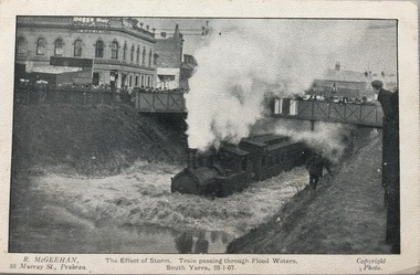
Postcard, R McGeehan, The Effect of Storm. Train Passing Through Flood Waters, South Yarra, 25-1-07, 1907
... The depression at the intersection of Toorak-road and Darling-street speedily filled to the dimensions of a small lake. Several shops were inundated, while the water from the higher levels rushed down like a mountain torrent, and in several in-stances swept through the rear of houses and shops, carrying furniture in a floating mass against the further walls. ...The depression at the intersection of Toorak-road and Darling-street speedily filled to the dimensions of a small lake. Several shops were inundated, while the water from the higher levels rushed down like a mountain torrent, and in several in-stances swept through the rear of houses and shops, carrying furniture in a floating mass against the further walls. ...SHARP DOWNPOUR. ONE INCH IN 45 MINUTES. SOUTHERN SUBURBS DELUGED. TRAIN STOPPED AT SOUTH YARRA. One of the sudden downpours of rain which occasionally fall in Melbourne occurred yesterday afternoon, when nearly an inch of rain fell in the course of three quarters of an hour, and caused a flood for an hour or two in certain localities. During the early part of the day, the sky had been clouded over, but there was nothing to indicate a storm of such intensity as that which followed. At about half-past 1 o'clock residents of South Yarra, South Melbourne, Prahran, and St. Kilda noticed a few drops of rain. Still, it appeared unlikely that there would be anything exceptional, until with startling suddenness at about 10 minutes to 1 o'clock, one of the heaviest downpours within the memory of residents burst upon those suburbs. A strange feature of the storm was that it was practically confined to an area of about three miles square. The city was but little affected, though at a spot as close as the Observatory 86 points of rain were recorded in three-quarters of an hour. Thunder and lightning accompanied the downpour, which was cyclonic in character, the rain driving heavily from all points of the compass as the cyclone passed. It was in South Yarra and Prahran that the rain fell heaviest. Within a few minutes after it commenced, the low-lying portions of Toorak-road and practically the whole length of Chapel-street were under water. The depression at the intersection of Toorak-road and Darling-street speedily filled to the dimensions of a small lake. Several shops were inundated, while the water from the higher levels rushed down like a mountain torrent, and in several in-stances swept through the rear of houses and shops, carrying furniture in a floating mass against the further walls. In one case a footbridge was carried bodily away and dashed to pieces. Darling-street itself Great Davis-street, and other low-lying and flat thoroughfares in the vicinity became flooded from kerb to kerb, while on the other side of the railway-bridge the valley between Kensington-road and River-street became filled for some minutes to a depth of several feet. Meanwhile the waters from South Yarra hill, seeking a lower level, found it in the railway cutting, and the excavations from South Yarra station to Prahran on the one line, and to the Chapel-street bridge on the other, were converted into a couple of canals. At the platforms at South Yarra the water was two feet deep on the permanent way, and towards Hawksburn, at the sudden depression under Chapel-street bridge, it was at one time deep enough to cover a tall man's head. Into this swirling mass of water the 1:50 p.m. train from Oakleigh plunged on its way to Melbourne. The impact caused a mighty fountain of water to rise to a height of about 20 feet above the level of Chapel-street and send clouds of spray in all directions. Under the belief that a terrible explosion had occurred residents braved the rain and rushed to the spot, only to find that the train had been brought to a stand-still in the middle of what seemed to be a river. The water was so high that it had entered the fire-box from below, extinguishing the fires and cutting off the steam supply. In the meantime the officials at the South Yarra station had been preparing for emergencies. Inspectors were on duty at intervals along the line, and the moment the alarm was given an extra engine was backed carefully down and continued on to connect with the stranded train without losing its own power. There was a delay of about ten minutes in the service for an hour or two, but by 5 o'clock all the trains were running on time again, and the water had run off all but the spot beneath the Chapel-street bridge. Here the water remained about four feet deep until nightfall, and throughout the afternoon several hundreds of people including biograph operators and photographers, were gathered around watching each train pass through. Even with the water two feet lower, this was a work attended with considerable difficulty. Each train had to absolutely force its way through the weight of water, almost enveloped by the spray thrown up, and it was only just able to negotiate the "ford" by using every ounce of steam. ... The Argus, 26 January 1907, p19.The item forms part of the Laurie Bennett collection of thirty-six postcards and photographs of Kew and early Melbourne, donated to the Kew Historical Society in 1980. The postcards in the Bennett collection, like other images in the Society's holdings date from the 1890s to the present and comprehensively indicate points-of-view or scenes considered historically, aesthetically or socially significant in the period in which they were produced.Postcard depicting a flood at South Yarra Station in 1907. The title and photographer's name are identified on the front of the postcard. Donated by L. Bennett, 1980flood - south yarra, trains - melbourne, postcards, r mcgeehan - prahran -
Canterbury History Group
Ephemera - Have a say about your Centre's future, Camberwell City Council, 1978
... ...Character of area and shopping...Town Planning Canterbury shop Character of area and shopping Camberwell Council Black and white and green text writing in size A3 - double sided plus 7 black and white photos and 2 maps. ...Black and white and green text writing in size A3 - double sided plus 7 black and white photos and 2 maps.town planning, canterbury shop, character of area and shopping, camberwell council
